Regional overview
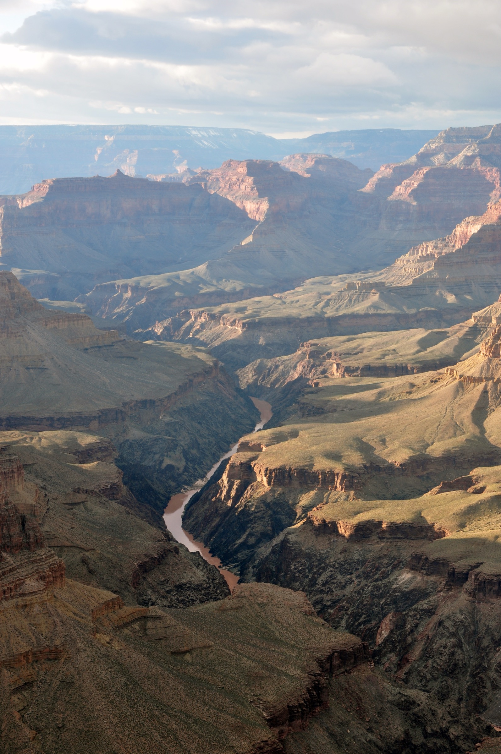
The Grand Canyon is the erosional signature of the western Colorado Plateau — 446 km long, up to 29 km wide and more than 1,600 m deep along the middle Colorado River in northern Arizona. The canyon separates two very different plateau surfaces: the drier, lower South Rim at roughly 2,090–2,260 m (6,860–7,400 ft), open year-round from the town of Tusayan and Grand Canyon Village, and the higher, cooler, forested North Rim on the Kaibab Plateau at 2,440–2,680 m (8,000–8,800 ft). The Kaibab is a broad, asymmetric uplift more than 300 m higher than the South Rim: its southerly tilt sends surface drainage into the canyon, keeps the rim cooler and wetter, and supports dense mixed conifer, aspen and open sub-alpine meadow country distinct from anything on the South Rim. The plateau is also the entire range of the endemic Kaibab squirrel (Sciurus aberti kaibabensis), an isolated ponderosa-pine specialist protected by a 200,000-acre National Natural Landmark designated in 1965.
Geology from rim to river runs through nearly two billion years of exposed rock. The uppermost Kaibab Limestone and Toroweap Formation cap both rims. Below the caprock the Coconino Sandstone, Hermit Shale, Supai Group and Redwall Limestone form the classic banded upper cliff-and-slope architecture; the Muav, Bright Angel and Tapeats units make up the Tonto Platform above the Inner Gorge; and the Vishnu Basement Rocks — schist and granite around 1.7–1.8 billion years old — appear only in the Inner Gorge above the Colorado River near Phantom Ranch. The river itself established its present course roughly 5–6 million years ago and continues to cut. Because the canyon compresses five of North America’s seven life zones between the river at ~760 m and the rim above 2,500 m, a descent from either rim is often described as “the ecological equivalent of a walk from Mexico to Canada.”
The two rims are effectively two different trips. The South Rim — administered by the National Park Service with free in-park shuttles running all year — carries about ninety per cent of the park’s five-million-plus annual visitors and is open year-round. The North Rim — accessed only by State Route 67 from Jacob Lake, closed for winter from 1 December to 15 May each year — historically operates from mid-May to mid-October and has no in-park shuttle. Between the two rims, the walking distance is 34 km on the classic Rim-to-Rim corridor of Bright Angel, the River Trail and North Kaibab; the driving distance is 346 km.
The 2025 Dragon Bravo Fire burned about 145,500 acres (58,900 ha) of the Kaibab Plateau above the North Rim and destroyed 113 structures, including the historic Grand Canyon Lodge. The park has confirmed an adaptive reopening on 15 May 2026 with major operational restrictions: no potable water anywhere on the North Rim in 2026, all overnight lodging closed, the North Kaibab Trail open to foot traffic only (stock use suspended), and the popular rim trails Bright Angel Point, Widforss, Transept, Uncle Jim and Ken Patrick (west of Cape Royal Road) closed for the season. Cape Royal Road, Point Imperial Road, and the Cape Royal, Cape Final, Roosevelt Point and Cliff Springs viewpoint trails are the North Rim’s practical day-hike menu for 2026. Any North Rim visit should confirm current conditions the day before departure and carry all drinking water in from Jacob Lake.
Corridor-trail policy shapes the South Rim day-hike menu. NPS designates Bright Angel, South Kaibab and North Kaibab as its three “corridor trails” — maintained, patrolled, with (seasonal) potable water and emergency phones — and explicitly warns against any attempt to hike from the rim to the river and back in one day. More than three hundred people are rescued from the canyon each year. Water and heat are the two dominant hazards below the rim: mid-summer temperatures on the river corridor routinely exceed 45 °C (115 °F), while the Bright Angel pipeline has broken repeatedly in recent years and the North Kaibab pipeline runs through the 2025 burn zone. Trail taps should never be assumed live.
The typical hiking season on the South Rim is March to May and September to early November, with winter viable on the upper trails carrying traction. On the North Rim only the summer window is available at all, and even then the 2026 fire recovery brings closures and no-water conditions that reshape the trip. The Yaki Point Road (South Kaibab trailhead access) is closed to private vehicles year-round — shuttle only — and Hermit Road is closed to private vehicles from March through November, also shuttle only.
For neighbouring Colorado Plateau day-hiking country, this article’s natural sibling on the north-west edge of the plateau is Zion National Park; on the Arizona sky-island side, the Huachuca Mountains, Chiricahua Mountains and Pinaleño Mountains guides cover the Madrean sky-island alternatives 400–500 km to the south.
See also: Grand Canyon and Kaibab Plateau, Arizona · Zion and Kolob Canyons day-hikes.
Selection rationale
The five day-hikes below cover both rims and both experiences the canyon offers — the top-down corridor descent into the geology, and the rim traverse across the plateau surface. Three are South Rim descents (two on maintained corridor trails, one on the historic pre-park Grandview Trail) sized as day-hike turnarounds well short of the river. Two are North Rim trips chosen for realism in the 2026 fire-recovery season: the North Kaibab Trail as far as Supai Tunnel — the only North Rim descent hike that survives the current closures — and the gentle Cape Final walk to a Walhalla Plateau viewpoint that stands in for the closed Widforss and Uncle Jim trails as the flagship rim walk. Rim-to-river and Rim-to-Rim itineraries are noted as excluded because NPS is explicit that these belong to a backpack, not a day-hike.
Routes excluded as out of scope are discussed at the end of the article.
Summary
| # | Hike | Trailhead | Route type | Distance | Gain | Max elevation | Difficulty |
|---|---|---|---|---|---|---|---|
| 1 | Bright Angel Trail to Havasupai Gardens | Bright Angel TH, Grand Canyon Village (South Rim) | Out-and-back | 14.5 km | ~940 m | 2,090 m | Strenuous |
| 2 | South Kaibab Trail to Skeleton Point | South Kaibab TH, Yaki Point Road (South Rim) | Out-and-back | 9.7 km | ~610 m | 2,195 m | Strenuous |
| 3 | Grandview Trail to Horseshoe Mesa | Grandview Point, Desert View Drive (South Rim) | Out-and-back | 10.3 km | ~760 m | 2,255 m | Strenuous |
| 4 | North Kaibab Trail to Supai Tunnel | North Kaibab TH, SR 67 (North Rim) | Out-and-back | 5.5 km | ~385 m | 2,512 m | Strenuous |
| 5 | Cape Final Trail | Cape Royal Road, Walhalla Plateau (North Rim) | Out-and-back | 6.8 km | ~140 m | 2,413 m | Easy–moderate |
1. Bright Angel Trail to Havasupai Gardens
Snapshot
Itinerary
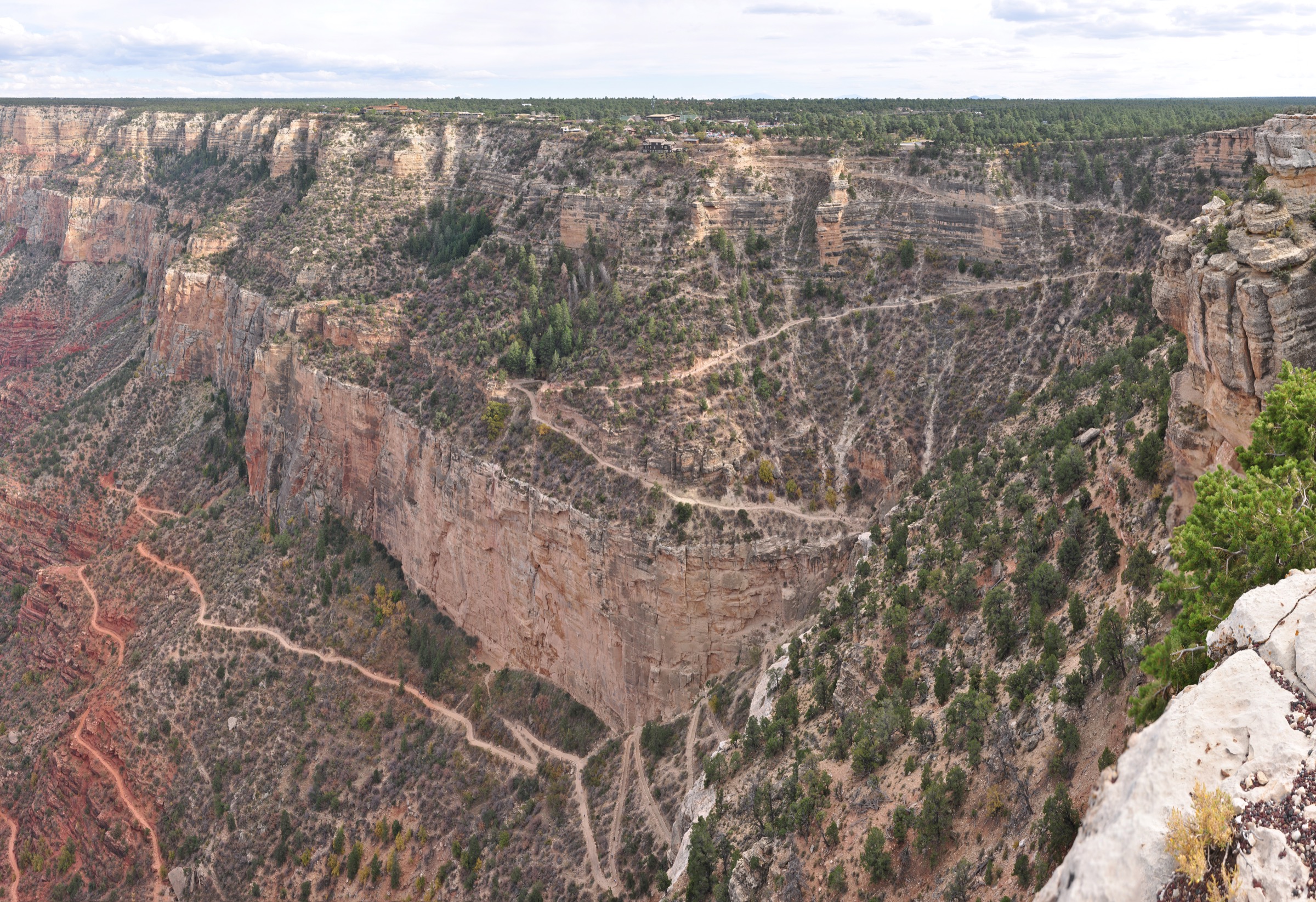
The trail leaves the rim at the west end of Grand Canyon Village, immediately below Kolb Studio, and drops sharply through two short tunnels blasted in the Kaibab Limestone. Switchbacks descend the Coconino Sandstone and Hermit Shale to Mile-and-a-Half Resthouse (2.4 km / 1.5 mi), historically a seasonal water tap and rest station. The trail continues down the Supai Group to Three-Mile Resthouse (4.8 km / 3.0 mi), then drops Jacob’s Ladder — the steepest section on the Redwall Limestone — into the shaded oasis of Havasupai Gardens at 7.2 km (4.5 mi), the cottonwood grove renamed from Indian Garden in 2023 in recognition of the Havasupai’s long presence in the canyon. The Bright Angel Trail continues to the river, but a rim-to-river day is not an option; Havasupai Gardens is the natural turnaround.
Parties starting well before first light and moving strongly may extend the day by adding the Plateau Point spur — a level 4.8 km round-trip from Havasupai Gardens onto the Tonto Platform for an overlook of the Colorado River in the Inner Gorge. This roughly doubles the day and pushes it toward the limits of NPS day-hike guidance; turning around at Havasupai Gardens is the sensible option in warm months. Descent reverses the route and typically takes twice as long as the descent.
Why it is essential
Bright Angel is the signature descent of the Grand Canyon — the corridor trail that threads every major geologic formation between the rim and the Tonto Platform, with seasonal water at three resthouses, mule-team traffic on a route the Havasupai used for centuries, and a shaded destination oasis. It is the single best introduction to inner-canyon hiking, and the most forgiving of the three corridor trails on a hot day.
Equipment
- Sturdy mountain hiking boots and trekking poles for the sustained descent and return
- Minimum 3 L water; assume all seasonal taps are dry unless NPS conditions confirm otherwise
- Salt/electrolytes and calorie-dense food for the return climb
- Wide-brim sun hat and high-SPF sun protection
- Warm layer for the rim in winter and early spring
- Microspikes for the upper switchbacks from November through March
- Offline map, GPS and headtorch for slow returns
Hazards and notes
- Rim-to-river-and-back in a single day is explicitly discouraged by NPS; every year more than 300 hikers are rescued from the canyon.
- Heat on the lower trail can exceed 45 °C (115 °F) in summer; day-hikers should target Havasupai Gardens by 10:00 and be back on the rim before mid-afternoon.
- The transcanyon pipeline breaks frequently — verify current tap status at the Backcountry Information Center or nps.gov before setting off.
- Mules have right of way; step to the uphill side of the trail and stand quietly until the string passes.
- Winter ice on the upper switchbacks makes the first mile the most technical section of the day.
- Dogs are not allowed below the rim.
- Day hikers do not need a backcountry permit; overnight travel does.
2. South Kaibab Trail to Skeleton Point
Snapshot
Itinerary
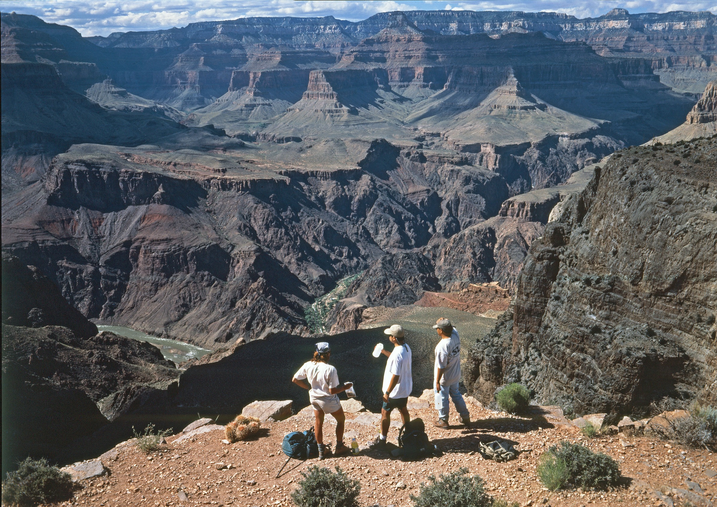
The trail plunges off the rim by a steep first pitch known as the Chimney and reaches Ooh Aah Point at 1.4 km, the first sweeping panorama of the eastern canyon. It continues along a broad ridge of Kaibab Limestone to Cedar Ridge at 2.4 km (4.8 km RT) — a mule hitching post at 1,860 m with pit toilets and views to O’Neill Butte — the natural short-day turnaround for most parties. Beyond Cedar Ridge the trail traverses the Supai Group flank of O’Neill Butte and then descends steeply through the Redwall Limestone to Skeleton Point at 4.8 km (9.7 km RT / 1,590 m), where the Colorado River appears for the first time and switchbacks vanish into the Inner Gorge. Skeleton Point is the classic day-hike turnaround.
Beyond Skeleton Point the trail commits to the Tonto Platform at the Tipoff (7.1 km) and continues to the Colorado River and Bright Angel Campground. NPS is explicit that continuing past Skeleton Point commits the party to a route with no water and no shade in either direction and is not a day-hike; day-parties turn back here and reverse the route to the rim.
Why it is essential
If Bright Angel is the corridor’s drainage descent, South Kaibab is its ridge line — the entire route rides an exposed sandstone spine, giving 360-degree views the whole way and the best hike-length view of the eastern canyon and the Inner Gorge from the South Rim. Skeleton Point is the classic “river in view” turnaround. The trail is short, dramatic and geologically legible in a way even a first-time canyon walker can read.
Equipment
- Sturdy mountain hiking boots and trekking poles
- Minimum 3 L water — nothing on the trail; the trailhead tap is seasonal
- Wide-brim sun hat and high-SPF sun protection
- Warm layer for the rim in cool seasons
- Microspikes for the upper trail from November through March
- Offline map, GPS and headtorch
- Salt/electrolytes and calorie-dense food
Hazards and notes
- No water, no shade anywhere on the trail — the highest-risk corridor route in heat.
- The South Kaibab is the primary mule descent route for Phantom Ranch; expect heavy stock traffic and yield uphill.
- Rim-to-river-and-back in a single day is not permitted as guidance from NPS; day-parties turn at Skeleton Point.
- Yaki Point Road is closed to private vehicles year-round — access is by NPS shuttle only.
- Lightning risk on the exposed ridge during monsoon afternoons (July–early September); start early and be off the ridge by noon.
- Winter ice can extend from the trailhead to below Cedar Ridge.
- Dogs are not allowed below the rim.
3. Grandview Trail to Horseshoe Mesa
Snapshot
Itinerary
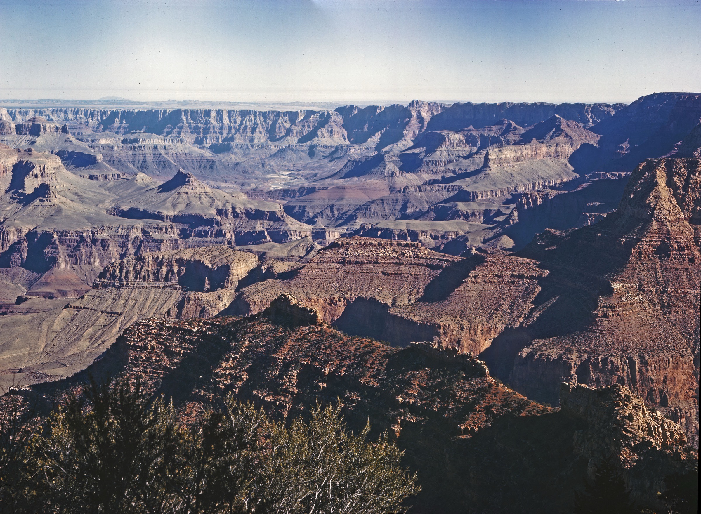
Built in 1893 by copper miners to serve the Last Chance Mine, the trail leaves the east side of Grandview Point and plunges off the rim on engineered cobblestone switchbacks and log-cribbed staircases — the visible remnants of one of the earliest constructed hiking routes in the canyon. The first 1.8 km descend the Kaibab Limestone and Coconino Sandstone to Coconino Saddle at ~2,015 m, a common short-day turnaround with wide views into Cottonwood and Grapevine Creek drainages.
Below the saddle the trail traverses the Hermit Shale slope and descends the Supai Group, alternating between narrow ledges and steep pitches until it gains the flat, tri-lobed Horseshoe Mesa — a broad Redwall Limestone bench at ~1,495 m and 5.1 km from the trailhead. The mesa hosts the stone-cabin ruin of the Last Chance mining camp, old ore piles, and the open shafts and adits of the copper workings. Historic side spurs lead across the mesa to the Cave of the Domes, to viewpoints above Page Spring and Miner’s Spring, and to the Tonto Trail contact on the mesa’s east and west arms. Return by the same route: the steep cobblestone regain to Coconino Saddle is the crux of the day, and much slower than the descent.
Why it is essential
Grandview is the historic pre-Park mining route into the canyon — the trail that turn-of-the-century tourists actually walked, complete with masterful cobblestone engineering that still holds a century later. It delivers a much quieter, more geological and more intimate canyon experience than the two corridor trails, and terminates on a genuine inner-canyon mesa with visible mining archaeology. The route also carries a sober warning: it is the standard example of what an “unmaintained” trail in the Grand Canyon really means.
Equipment
- Sturdy mountain hiking boots — the cobblestone is punishing on soft soles
- Trekking poles are effectively essential on the descent and return
- Minimum 3 L water — nothing on the trail; the trailhead has no tap
- Warm layer and windproof for the rim, wide-brim sun hat for the exposed lower trail
- Microspikes from November through March; the upper switchbacks freeze solid on shaded aspects
- Offline map, GPS, headtorch and a whistle
- Salt/electrolytes and calorie-dense food
Hazards and notes
- The trail is officially unmaintained; steep cobblestone-and-cribbing tread is loose and slippery in both wet and dry conditions.
- Ice on the upper trail from November through March is the most common cause of falls; carry traction.
- Horseshoe Mesa carries open mine shafts and adits; fatal falls have occurred. Stay outside barriers and do not enter workings.
- No reliable water on route; Miner’s Spring below the mesa requires a side-trail and treatment.
- Rockfall and post-storm debris flows can obscure the tread.
- Day hikers do not need a permit; camping on Horseshoe Mesa requires a backcountry permit from the BIC.
- Dogs are not allowed below the rim.
4. North Kaibab Trail to Supai Tunnel
Snapshot
Itinerary
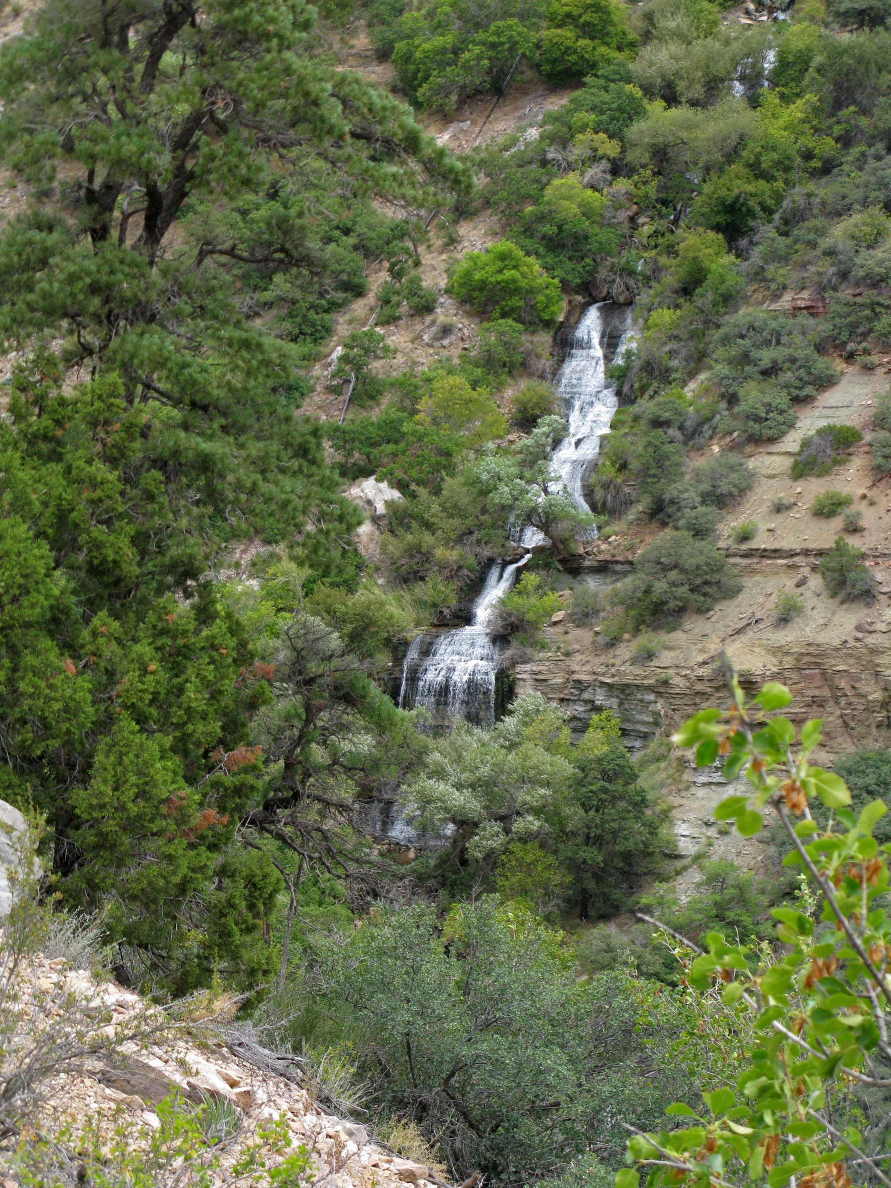
The trail leaves the trailhead through mixed spruce-fir-aspen forest at 2,512 m and drops immediately into steep open switchbacks that break out of the Kaibab Limestone. Coconino Overlook at 1.1 km delivers the first panorama across Bright Angel Canyon and toward the Redwall. The switchbacks continue through the Coconino Sandstone to Supai Tunnel at 2.7 km — a short blasted tunnel in the Supai Group at 2,073 m, with pit toilets and historically the seasonal water tap. Supai Tunnel is a strong turnaround for a half-day trip and is the trip described here.
Strong parties may continue beyond Supai Tunnel across the Redwall Bridge and out onto the exposed Eye of the Needle traverse into the sheer-walled Roaring Springs Canyon, reaching Roaring Springs at 7.6 km (15.1 km RT / ~1,590 m) — a burst of clear water from the base of the Muav Limestone that historically fed the transcanyon pipeline supplying both rims. Roaring Springs is the honest maximum North-Rim day-hike turnaround; NPS strongly discourages continuing on to Cottonwood Campground, Ribbon Falls or Phantom Ranch as a day-hike.
Why it is essential
With Widforss, Uncle Jim, Transept and Bright Angel Point closed for the 2026 season, the North Kaibab Trail is the only remaining North-Rim descent hike — and even in normal years it is the single trail that displays the full top-to-bottom Kaibab Plateau geology and the cool spruce-fir-to-cottonwood biology in one uninterrupted descent. Supai Tunnel is a realistic, geologically satisfying half-day turnaround; Roaring Springs is the full-day commit.
Equipment
- Sturdy mountain hiking boots and trekking poles
- Minimum 3 L water for Supai Tunnel, 4 L for Roaring Springs — carry all drinking water in the 2026 season, and do not assume any tap will be running
- Warm layer for the trailhead in early season
- Wide-brim sun hat and high-SPF sun protection below the tunnel
- Offline map, GPS and headtorch
- Salt/electrolytes and calorie-dense food
Hazards and notes
- The 2025 Dragon Bravo Fire destroyed 113 structures on the North Rim and burned across the plateau; expect standing dead trees, deadfall, temporary rehabilitation closures and post-fire hazards along the upper trail through the 2026 season.
- No potable water anywhere on the North Rim in 2026 — bring everything you will drink from Jacob Lake or Kanab.
- Stock use is suspended for the 2026 season on the North Kaibab Trail (no mule traffic).
- Mid-day thunderstorms and lightning are the standard summer risk once monsoon begins.
- SR 67 is closed from 1 December to 15 May annually; there is no access to the trailhead in winter.
- The trailhead vehicle-length limit is 22 ft; larger vehicles must use the overflow parking near the former lodge site.
- Dogs are not allowed below the rim.
5. Cape Final Trail
Snapshot
Itinerary
The trail leaves a small dirt pullout on the east side of Cape Royal Road, about 4 km north of the Cape Royal parking area, and slips quietly into open ponderosa pine, aspen and Gambel oak across the Walhalla Plateau. The tread is a gentle old fire-road grade that rolls through open forest with the Dragon Bravo burn edge visible in places along the middle section. The trail dips into a shallow saddle at about 2 km, then rises slightly to the exposed limestone brink at Cape Final.
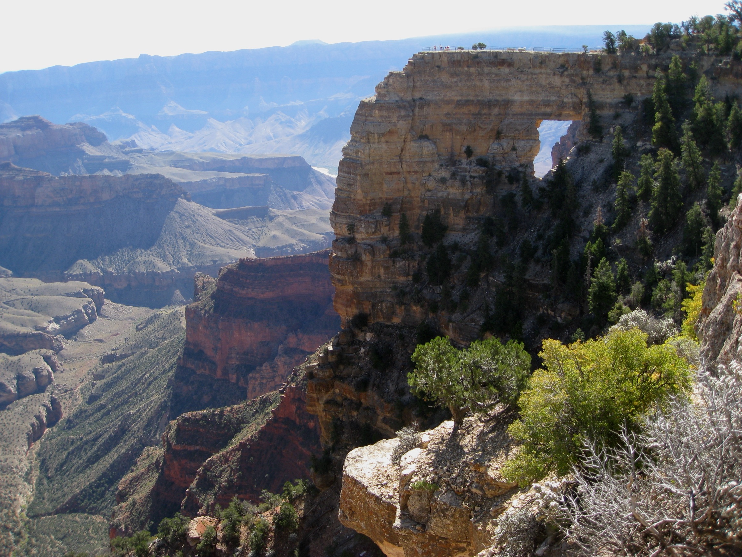
The viewpoint delivers a 180-degree panorama over the eastern Grand Canyon: the Unkar Delta (with visible Ancestral Puebloan sites) directly below, Wotan’s Throne and Vishnu Temple in the middle distance, the ordered fins of the Palisades of the Desert to the east, the Painted Desert beyond, and — on clear days — the outline of the San Francisco Peaks rising above Flagstaff on the far horizon. Return by the same route.
Why it is essential
With Widforss, Uncle Jim, Bright Angel Point and Transept closed for the 2026 season, Cape Final is the flagship gentle North-Rim walk left standing — a forested approach on the highest and quietest rim in the park, to one of the canyon’s most cinematic east-facing overlooks. It is also the best trail on the North Rim for parties that want the plateau experience without a serious descent, and stands in naturally with the short Cape Royal viewpoint walks for a full day on the Walhalla Plateau.
Equipment
- Sturdy trail shoes; poles are useful but not essential
- Warm layer for the trailhead in early season
- 2 L water minimum; no potable water on the North Rim in 2026, so include what you need for the drive
- Sun protection and a wide-brim hat
- Offline map and GPS
- Rain shell for monsoon afternoons
Hazards and notes
- Post-fire deadfall and standing dead trees are the leading hazard on the middle section of trail; avoid the trail in strong wind and give burned zones a wide berth.
- No potable water on the North Rim in 2026 — plan accordingly for the entire visit.
- Rapid mid-day thunderstorms are the standard summer risk on exposed viewpoints; leave the rim by mid-afternoon in monsoon season.
- SR 67 and Cape Royal Road are closed from 1 December to 15 May annually.
- Dogs are not allowed on this trail.
- Cell coverage on the Walhalla Plateau is effectively absent; leave an itinerary with someone before setting out.
Routes excluded as out of scope
The following sit inside or adjacent to the Grand Canyon and Kaibab Plateau but fall outside a day-hike entry, are closed for the 2026 season, or are better understood as overnight trips.
- Rim-to-river and Rim-to-Rim itineraries. Bright Angel to the Colorado River, South Kaibab to Phantom Ranch, North Kaibab to Cottonwood/Phantom Ranch and any Rim-to-Rim traverse are explicitly discouraged by NPS as day-hikes and belong to a backcountry-permit backpack. Included above only as points along the corridor descents.
- Widforss Trail (North Rim). Historically the flagship easy North Rim day-hike; closed for the entire 2026 season following the Dragon Bravo Fire.
- Uncle Jim Trail (North Rim). Closed for the 2026 season.
- Bright Angel Point, Transept and Ken Patrick (west of Cape Royal Road) trails. Closed for the 2026 season.
- Hermit Trail (South Rim). A superb non-corridor descent, but access requires the Hermits Rest shuttle (in season) and the route is unmaintained below Santa Maria Spring; better suited to a longer overnight or a dedicated second visit.
- Tonto Trail traverses. The Tonto Platform east–west traverses (e.g., Hermit to Bright Angel; Grandview to South Kaibab) are multi-day backpacks with limited water sources and are out of scope for a day-hike catalogue.
- Arizona Trail Passages 39–41 (Kaibab Plateau). Fine forest-country walking on the Kaibab NF side of the North Rim, but built as through-hike passages rather than as day-hikes; the East Rim Trail #7 short spurs into the Dragon Bravo burn zone and current conditions should be verified with the Kaibab NF before a visit.
Further reading
| Source | URL |
|---|---|
| NPS Grand Canyon — Day Hiking | nps.gov |
| NPS Grand Canyon — Trail Distances (backcountry) | nps.gov |
| NPS Grand Canyon — 2026 North Rim Summer Season Access | nps.gov |
| NPS Grand Canyon — Road closures | nps.gov |
| NPS Grand Canyon — Bright Angel Trail | nps.gov |
| NPS Grand Canyon — South Kaibab Trail | nps.gov |
| NPS Grand Canyon — North Kaibab Trail | nps.gov |
| NPS Grand Canyon — Cape Final Trail | nps.gov |
| NPS Grand Canyon — Cape Royal | nps.gov |
| Grand Canyon Conservancy — North Rim FAQ 2026 | grandcanyon.org |
| Arizona Trail Association — Passage 40 Kaibab Plateau South | aztrail.org |
| Arizona Trail Association — Passage 41 Kaibab Plateau Central | aztrail.org |
| USFS Kaibab National Forest — Trails | fs.usda.gov |
| Wikipedia — Grand Canyon | en.wikipedia.org |
| Wikipedia — Kaibab Plateau | en.wikipedia.org |
| Wikipedia — Kaibab squirrel | en.wikipedia.org |
| Wikipedia — Bright Angel Trail | en.wikipedia.org |
| Wikipedia — South Kaibab Trail | en.wikipedia.org |
| Wikipedia — North Kaibab Trail | en.wikipedia.org |
| Wikipedia — Grandview Trail | en.wikipedia.org |
| Wikipedia — Cape Final Trail | en.wikipedia.org |
| Wikipedia — Dragon Bravo Fire | en.wikipedia.org |
| Wikimedia Commons — Grand Canyon National Park category | commons.wikimedia.org |
| OpenStreetMap (ODbL 1.0) | openstreetmap.org |