Regional overview
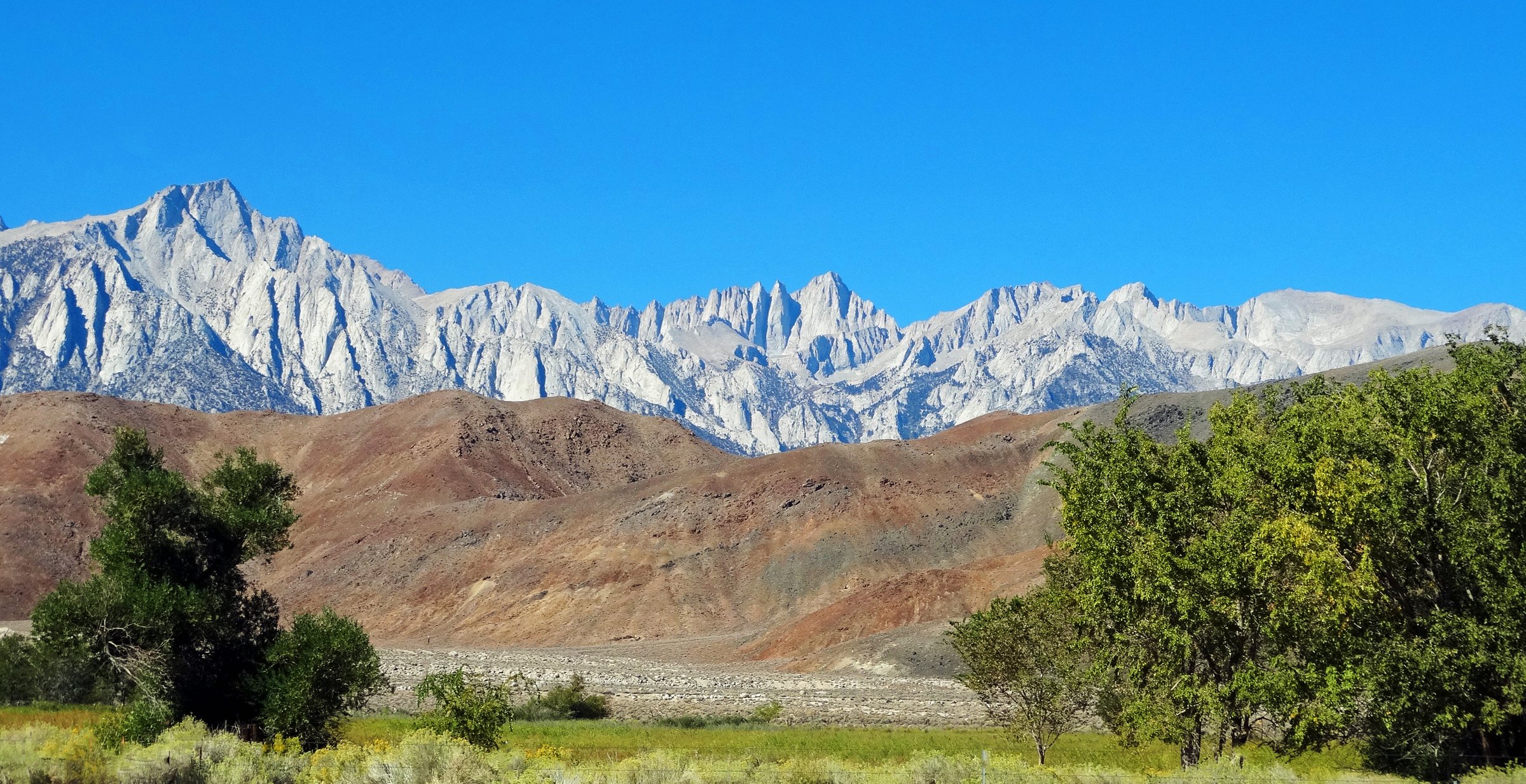
This is the steep side of the Sierra Nevada. Along the eastern escarpment above the Owens Valley, the range rises more than 3,000 m in a single wall, and the highest summit in the contiguous United States stands barely twenty kilometres from a desert floor at 1,150 m. The hiking here is defined by that wall: short, brutally direct approaches from the towns of Lone Pine and Independence on US-395, climbing granite canyons to lake basins, crest passes and 4,000 m summits.
Almost all of the walking is on the Inyo National Forest, in the John Muir and Golden Trout Wildernesses, with Sequoia and Kings Canyon National Parks lying immediately over the crest. The permit rule that governs everything is simple, and better news than most visitors expect: the Forest Service requires no permit for day hiking anywhere in this region except the Mount Whitney Zone. Four of the five routes below can be walked on the day, for free, with no reservation. The fifth requires winning a lottery.
Three roads give access, and all three are gated in winter. Whitney Portal Road climbs 13 miles from Lone Pine to 2,550 m. Onion Valley Road runs 13–15 miles from Independence to 2,804 m and is usually open May to November. Horseshoe Meadow Road climbs over 1,900 m from the valley to a trailhead at 3,048 m, and is usually open from Memorial Day to the first week of November. There is no public transport to any of them: Eastern Sierra Transit’s US-395 buses serve Lone Pine and Independence, and the final miles need a car, a taxi or a paid shuttle.
Altitude is the region’s defining hazard, and the Forest Service is blunt about it. Its wilderness safety guidance warns that altitude illness “can strike anyone — young or old, fit or unfit”, that serious cases have begun as low as 8,000 ft in the Sierra, and that for both HAPE and HACE, immediate descent is the only treatment. Every route below finishes above 3,300 m, and most walkers arrive from sea level. The Horseshoe Meadow campgrounds, at 3,048 m with a one-night limit, exist precisely so that people can sleep high before they walk high; they are the standard acclimatisation stop, and they are worth using.
For the western slope of the same mountains, see the companion entry on Sequoia and Kings Canyon; for the ranges further north, see Mammoth and the Eastern Sierra.
Selection rationale
The five routes are chosen to cover the region’s landscapes and to spread across its three trailheads:
- The Mount Whitney Trail — the iconic summit, and the highest point in the contiguous United States.
- Meysan Lake — the steep east-side glacial cirque, from the same trailhead as Whitney but with a fraction of the traffic and no permit.
- Kearsarge Pass — the classic crest pass, and the region’s historic trans-Sierra route.
- Mount Langley via New Army Pass — the southernmost fourteener in the range, a non-technical 4,277 m summit that needs no lottery.
- Cottonwood Pass and Chicken Spring Lake — the accessible high-plateau and Pacific Crest Trail walk, through classic foxtail-pine country.
Whitney and Meysan share the Whitney Portal roadhead; Langley and Cottonwood Pass share Horseshoe Meadow. In both cases the two routes head in opposite directions into entirely different terrain. Technical routes are excluded, including Whitney’s Mountaineer’s Route, which is a class 3 climb and a separate permit.
Summary table
| # | Hike | Trailhead | Route type | Distance | Gain | Max elevation | Difficulty |
|---|---|---|---|---|---|---|---|
| 1 | Mount Whitney Trail | Whitney Portal | Out-and-back | c. 35 km | c. 1,890 m | 4,421 m | Very strenuous; permit lottery |
| 2 | Meysan Lake | Whitney Portal | Out-and-back | c. 18 km | c. 1,070 m | c. 3,500 m | Strenuous |
| 3 | Kearsarge Pass | Onion Valley | Out-and-back | 14.5–16.1 km | c. 790 m | 3,569 m | Moderate |
| 4 | Mount Langley via New Army Pass | Cottonwood Lakes | Out-and-back | c. 35 km | c. 1,250 m net | 4,277 m | Very strenuous |
| 5 | Cottonwood Pass and Chicken Spring Lake | Horseshoe Meadow | Out-and-back | c. 14.3 km | c. 400–450 m | 3,432 m | Moderate |
1. Mount Whitney Trail
Snapshot
Itinerary
The trail leaves Whitney Portal and climbs immediately through Jeffrey pine and manzanita, crossing into the John Muir Wilderness within the first mile and passing the junction with the North Fork of Lone Pine Creek — the approach for the technical routes, and a separate permit area.
Switchbacks lead to Lone Pine Lake at about 4.5 km and 3,050 m. This lake sits outside the Mount Whitney Zone: the boundary crosses Lone Pine Creek a tenth of a mile beyond it, so the walk this far needs no permit at all. Past the lake, a sign marks entry into the Zone, and from that point a permit is mandatory.
The trail climbs past Bighorn Park to Outpost Camp (3,200 m), then to Mirror Lake beneath Thor Peak, and through the last stunted foxtail pines past Trailside Meadow to Trail Camp at 3,660 m. This is the highest legal campsite and the last reliable water on the mountain — everything above is dry.
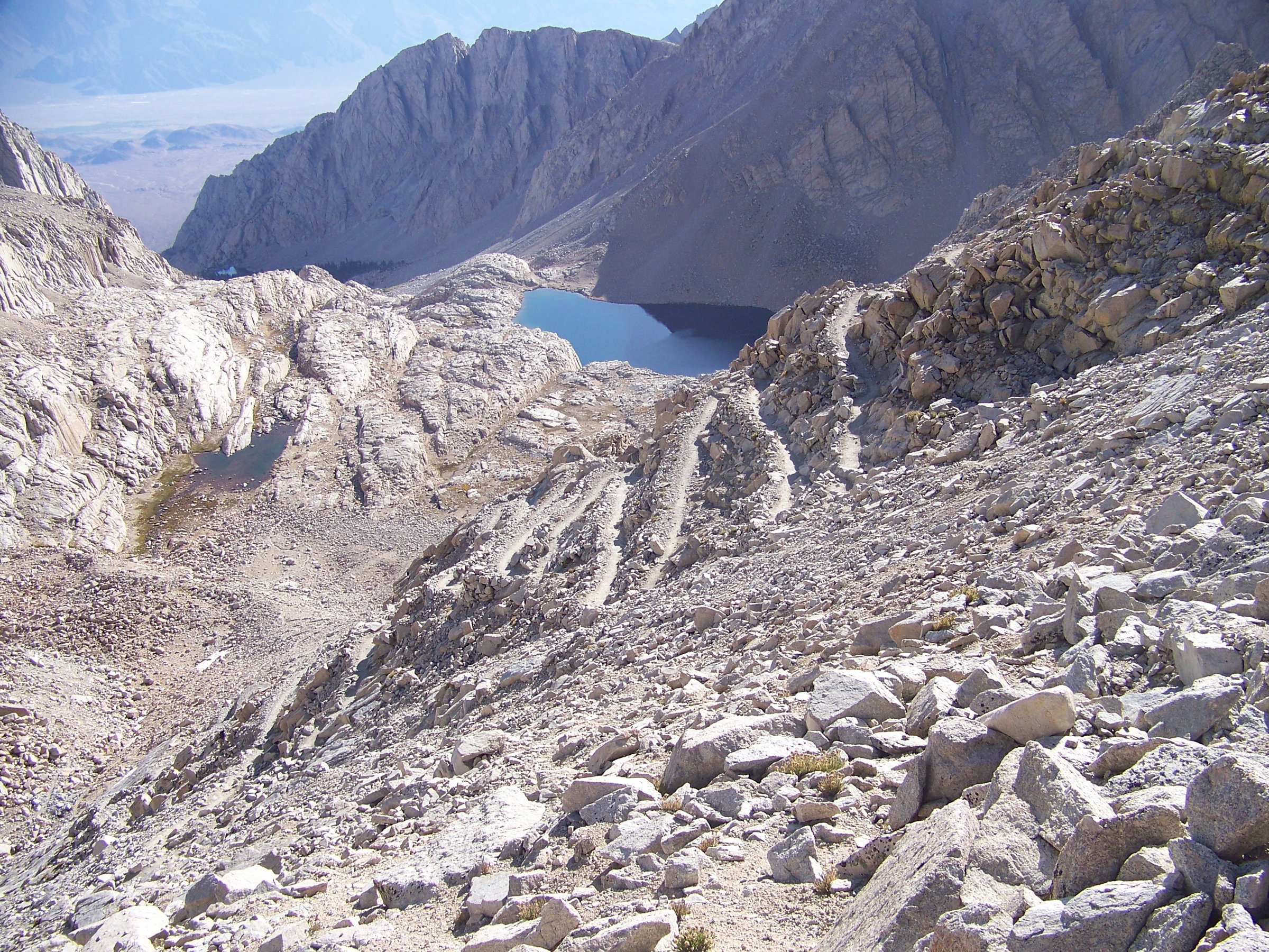
From Trail Camp the trail attacks the headwall in the celebrated switchbacks, traditionally called “the 99”, climbing roughly 490 m. Partway up, a north-facing traverse fitted with a cable handrail holds ice long after the rest of the trail has cleared; in early season this section, not the summit, is often the crux.
The switchbacks top out at Trail Crest, about 4,145 m, on the crest itself and two miles from the summit. The trail drops slightly on the far side to meet the John Muir Trail, whose southern terminus is the Whitney summit, then traverses the west side of the crest — a narrow, rocky shelf with a long drop to the lake basins below. At intervals the rock wall on the east breaks open into the “windows”, notches framing sudden vertical views down to the Owens Valley.
The path finally rounds onto the broad summit plateau and rises to the highest point, where the stone Smithsonian Institution Shelter stands. Built by Gustave Marsh and completed in 1909 to house high-altitude researchers, it was proposed after a visitor was killed by lightning on the summit in 1904, and it was listed on the National Register of Historic Places in 1977. It is the highest permanent building in the contiguous United States — and, despite its origins, it is not a refuge from lightning.
Why it is essential
Mount Whitney is the highest summit in the contiguous United States, and this is the one path that delivers a walker to the top of it without a rope. It is the defining Sierra hike: the southern terminus of the John Muir Trail, a 35 km day that starts in pine forest before dawn and ends on a granite plateau above 4,400 m. Nothing else in the range concentrates so much altitude, exposure and mythology into one out-and-back.
Equipment
Mountain hiking equipment, at the serious end of the scale:
- Sturdy boots and trekking poles
- Full weatherproof shell, warm layers, hat and gloves — the summit is cold in any month
- Headtorch with spare batteries: the day starts and often finishes in the dark
- Sun protection: high-altitude sun on granite and snow is severe
- 3–4 litres of water capacity plus treatment, because Trail Camp is the last source
- Map, GPS and navigation backup
- WAG bag — packing out solid human waste is a requirement, not a suggestion. Kits are available at the Eastern Sierra Visitor Center year-round and at the trailhead in summer
- Ice axe and crampons, plus the skills to use them, in spring and early summer
- Bear canister for overnight trips; food out of the car at the trailhead in all cases
Hazards and notes
Altitude is the biggest single risk. The route gains about 1,890 m and finishes above 4,400 m, and most day hikers arrive from sea level. USFS warns that altitude illness can strike anyone regardless of fitness, that HAPE presents with extreme breathlessness and an audible bubbling or gurgling from the chest, and that HACE brings severe headache, vomiting, confusion and loss of coordination. For both, immediate descent is the only treatment, and the condition can be fatal. Sleep at altitude in the Owens Valley or at Whitney Portal before attempting the day hike.
Snow and ice concentrate on the switchbacks. The cable traverse is north-facing and holds hard ice long after the rest of the trail has melted out, and the cable itself can be buried. USFS states that when snow or ice is on the mountain, winter mountaineering skills and equipment are necessary.
Afternoon thunderstorms are common in summer, and the summit plateau is a wide, open granite table above 4,400 m with no cover. The Smithsonian Shelter does not protect against lightning and must not be treated as a refuge. Turn back rather than push a summit into a building storm.
The traverse from Trail Crest to the summit is not technical in dry conditions, but it is unforgiving of a stumble, of ice, and of altitude-impaired judgement — and it comes at the point in the day when walkers are highest and most tired.
Dogs cannot summit Mount Whitney. They are permitted on the Inyo National Forest section below Trail Crest, but the trail crosses into Sequoia National Park at the crest, and pets are prohibited in the park’s wilderness.
Permits — the lottery
| Item | Detail |
|---|---|
| Where | Recreation.gov, permit 445860 |
| Day hikers | A permit is required. NPS: “All hikers entering the Mt. Whitney zone, including day-hikers, are required to obtain a permit.” |
| Lottery application | 1 February to 1 March. Results posted 15 March |
| Claim deadline | 21 April; unclaimed dates are released to general booking on 22 April |
| Quota season | 1 May to 1 November: 100 day-use and 60 overnight permits per day |
| Outside quota season | Permits are still legally required — they are simply unlimited, and still booked online up to two weeks ahead. There is no self-issue |
| Fees | $6 reservation fee per permit, plus $15 per person for the Whitney Zone |
| Group size | Maximum 15 |
| Lone Pine Lake | Outside the Zone — reachable and returnable without a permit |
GPX / route file
| Source | URL | Format / access | Reuse status |
|---|---|---|---|
| USFS — Mount Whitney | fs.usda.gov | Official route and permit page | No GPX published |
| USFS — Mt. Whitney Trail | fs.usda.gov | Official trail page | No GPX published |
| NPS — Seeing and climbing Mt. Whitney | nps.gov | Official summit elevation and permit rule | — |
| USFS — National Forest System Trails geodata | data-usfs.hub.arcgis.com | Shapefile, KML, GeoJSON | US federal dataset; covers the National Forest portion only, not above Trail Crest |
| OpenStreetMap | openstreetmap.org | OSM ways, exportable to GPX | ODbL 1.0; attribution required |
| Hiking Project | hikingproject.com | GPX download | Proprietary; not redistributable |
Further reading
- USFS — Mount Whitney: lottery, quotas and fees
- USFS — Wilderness safety: altitude, HAPE and HACE
- Recreation.gov — Mt. Whitney permits
2. Meysan Lake
Snapshot
Itinerary
The route begins not at Whitney Portal itself but roughly half a mile below it, from roadside parking near the Whitney Portal Campground. The approach is unusual: USFS states that to reach the trail from the parking area one must walk through the campground and then through a tract of private recreation residences. Signed junctions guide walkers between the cabins, and the trail proper begins where the residence road ends.
From there the path enters the John Muir Wilderness and climbs the Meysan Creek drainage, working up the canyon’s northern flank — the slope that faces the sun, and which carries the long switchback sequence that gives this trail its reputation. Shade is scarce and the gradient unrelenting. The Forest Service’s own summary is simply “steep, strenuous”.
The trail gains the granite basin and reaches Grass Lake at about 3,315 m; USFS places Grass and Peanut Lakes together at 4.0 miles and 10,900 ft. Camp Lake lies a little higher and west, at about 3,399 m. Above these the tread deteriorates markedly: USFS warns the trail “becomes difficult to locate near Meysan Lake”, and the final stretch is effectively route-finding over talus and slab.
Meysan Lake sits at roughly 3,490–3,500 m in a tight glacial cirque, walled by Mount Irvine and Mount Mallory, with Mount LeConte beyond and Lone Pine Peak forming the drainage’s eastern rampart. The basin is also the standard approach for climbing routes on Lone Pine Peak.
Why it is essential
From the same roadhead that launches the most permit-throttled footpath in the Sierra, the Meysan Lakes Trail climbs into an equally dramatic east-side cirque and sees a small fraction of the traffic. It is a hard, honest, sun-hammered ascent to a glacial tarn ringed by Irvine, Mallory and LeConte. Decisively, it lies outside the Mount Whitney Zone, so a day hike requires no permit and no lottery — a rare thing on this side of the range.
Equipment
Mountain hiking equipment:
- Sturdy boots — the upper basin is talus and slab
- Trekking poles for a steep, sustained descent
- Sun protection, and more of it than you think: this is the defining difficulty of the climb
- Substantial water and treatment
- Weatherproof layer and warm layer
- Map, GPS and navigation backup — the upper trail is genuinely hard to follow
- Early start: the ascent is relentless once the sun is on the slope
Hazards and notes
Sun and heat are the defining hazard. The climb works up the sun-facing flank of the canyon with very little shade, at altitude where the UV is severe. Start at dawn and carry more water than the distance suggests.
The upper trail is faint, and the Forest Service says so. It describes the route as infrequently maintained and difficult to locate near the lake. The final approach is route-finding over rock rather than trail-walking. Carry a map and a GPS track.
The cirque is deep and holds snow and ice well into summer even when the switchbacks below are dry. The trailhead sits at about 2,430 m and the route climbs to roughly 3,500 m in a single push with no acclimatisation built into the day, so altitude sickness is a real risk for anyone arriving from sea level. Afternoon thunderstorms are the usual Sierra summer pattern, and the long exposed switchbacks and open basin offer no shelter.
Bear activity at Whitney Portal is high and vehicles are broken into: empty the car completely and use the lockers. A bear canister is not on the Forest’s mandatory list for Meysan, but the upper lakes are at or above the treeline, and Inyo regulations require a canister where there are no trees adequate for hanging food — so in practice, anyone camping high needs one. Dogs are permitted for the whole route, which never enters the national park.
Permits
A day hike requires no permit — confirmed by both the Forest Service and Recreation.gov, which states plainly that “day hiking on Meysan Lakes trail does not require a permit”. Overnight trips need an Inyo National Forest wilderness permit from Recreation.gov permit 233262, entry point “Meysan Lake”, with a small quota of 10 people per day in the 1 May to 1 November quota season, at $6 per permit plus $5 per person.
GPX / route file
| Source | URL | Format / access | Reuse status |
|---|---|---|---|
| USFS — Meysan Lakes Trail | fs.usda.gov | Official trail page | No GPX published |
| USFS — Meysan Lakes Recreation Opportunity Guide | fs.usda.gov | PDF with official waypoint and elevation table | US government work |
| OpenStreetMap — Meysan Lakes Trail (34E03) | openstreetmap.org | OSM relation, exportable to GPX | ODbL 1.0; attribution required |
| Waymarked Trails | hiking.waymarkedtrails.org | GPX / KML export of the OSM relation | ODbL 1.0 |
| AllTrails | alltrails.com | GPX behind paid subscription | Proprietary; not redistributable |
Further reading
3. Kearsarge Pass
Snapshot
Itinerary
The trail begins at the road-end at Onion Valley, 2,804 m, where a parking area offers vault toilets and bear-resistant food lockers, with the campground a short distance below. From the car park the path immediately begins the long ascent of the north wall of the basin, climbing in open, well-graded switchbacks across granite and sage. The valley floor drops away quickly and the view east opens over the Owens Valley. Within the first mile the trail passes above Little Pothole Lake, in a hanging cirque below a seasonal waterfall.
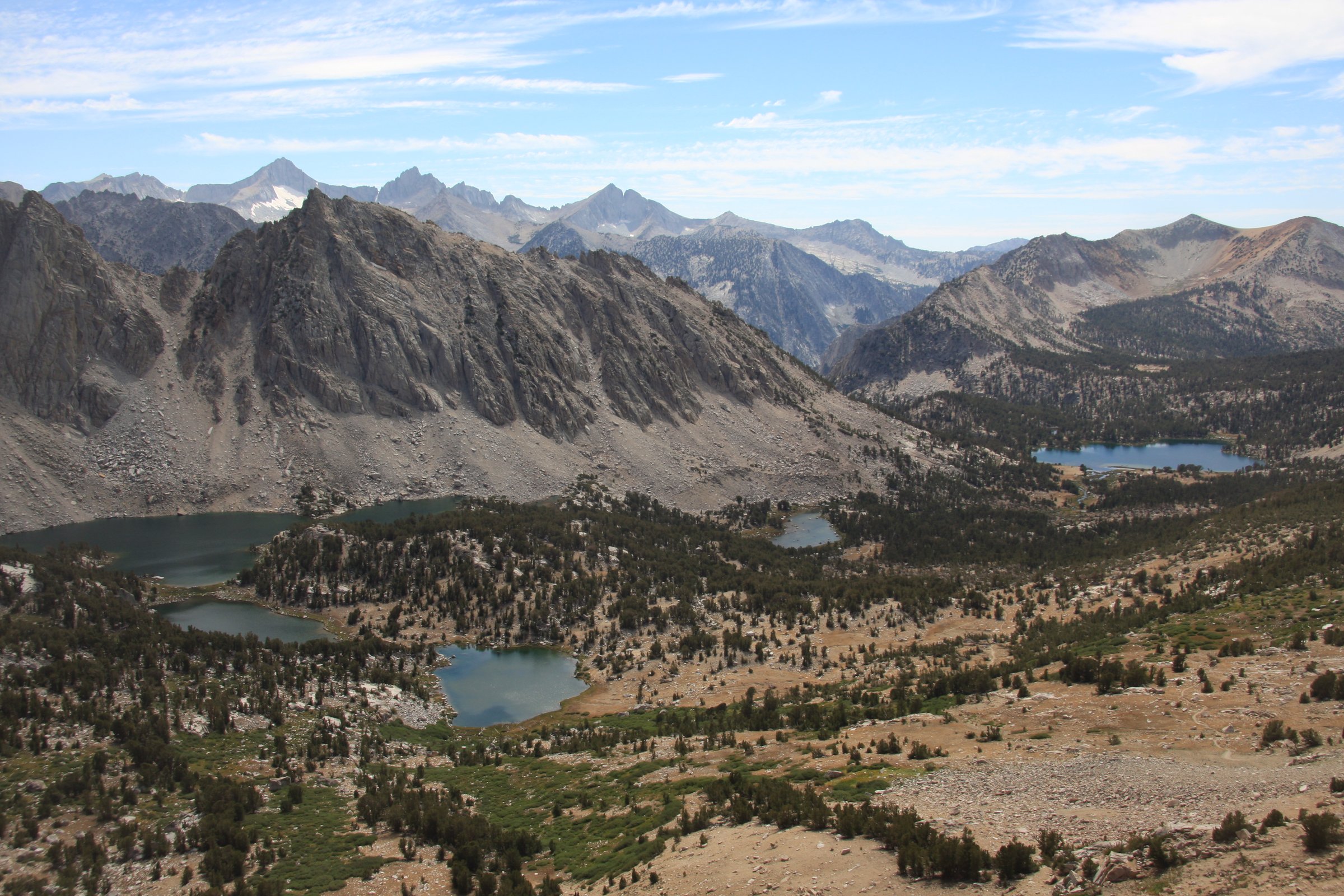
The gradient eases at Gilbert Lake (3,175 m, about 3.5 km in), the first substantial lake, ringed with foxtail and lodgepole pine and the most popular turnaround for those not going to the pass. A short distance further, a spur drops to Flower Lake (3,212 m), where the trail leaves the last of the forest.
Above Flower Lake the trail switchbacks up an increasingly bare slope past Heart Lake (3,294 m), and higher still rounds into the upper cirque above Big Pothole Lake (3,436 m), a deep tarn held in raw granite well below the trail. Final switchbacks work up talus and decomposed granite to the notch on the crest.
Kearsarge Pass, 3,569 m, is a boundary: Inyo National Forest and the John Muir Wilderness behind, Kings Canyon National Park ahead. The view west is one of the great set-pieces of the range — the Kearsarge Lakes immediately below, Bullfrog Lake beyond them, and the serrated ridge of the Kearsarge Pinnacles walling the basin to the south, with the Great Western Divide closing the horizon across the trench of Bubbs Creek.
Walkers with time can descend west into the park towards the Kearsarge Lakes and the John Muir Trail junction near Bullfrog Lake, about 10.5 km from the trailhead. Note that everything west of the pass is national park: no dogs, and no camping at Bullfrog Lake.
Why it is essential
Kearsarge is the classic crest pass of the southern Sierra, and the region’s historic trans-Sierra route. The name records a piece of Civil War score-settling. Farquhar’s Place Names of the High Sierra (1926), quoting Chalfant’s The Story of Inyo, records that Confederate sympathisers had named the Alabama Hills near Lone Pine after the Confederate raider CSS Alabama; staunch Unionists “evened it up” in 1864 by naming their silver claim after USS Kearsarge, the ship that had just sunk the Alabama off Cherbourg. The mining camp was built in 1865 and destroyed by an avalanche the following spring, but the name stuck to the pass, the peak, the pinnacles, the lakes and the town. The first recorded crossing was made in July 1864 by a party of eleven prospectors, among them John Bubbs, whose name the creek below the pass still carries.
The pass is also the standard exit from the high country for John Muir Trail and Pacific Crest Trail walkers resupplying in Independence and Bishop — a role the Pacific Crest Trail Association confirms. And it is simply one of the finest viewpoints in the range, reached on a moderate, well-graded trail with no permit needed for the day.
Equipment
Mountain hiking equipment:
- Sturdy hiking boots
- Weatherproof layer and warm layer — the pass is cold and windy even in high summer
- Sun protection: the route is almost entirely on open, reflective granite above Flower Lake
- Water and treatment; the lower trail is well supplied, but the last 2.5 km above Heart Lake are dry
- Trekking poles
- Map and GPS
- Microspikes and an ice axe if snow lingers on the upper switchbacks in early season
- Bear canister for overnight trips — this is a mandatory canister area
Hazards and notes
The trail is a single, well-graded, heavily travelled and clearly signed path all the way to the pass; navigation is straightforward when it is snow-free. That changes when snow covers the upper switchbacks, and the final north-facing pitch to the notch holds snow well after the lower trail melts out.
Altitude is a genuine risk: the trailhead is already at 2,804 m, and Recreation.gov advises starting early for this high-elevation pass. Sleeping a night at the Onion Valley campground first is the standard mitigation. Everything above Flower Lake is exposed above the treeline with no shelter from afternoon thunderstorms; be over the pass and descending by early afternoon.
The Onion Valley problem is bears, not marmots. USFS states that there has historically been a high level of bear activity at Onion Valley, and that food, trash and scented items must not be stored in vehicles. The campground is patrolled at night when activity is high. A bear-resistant canister is legally required for overnight trips in the Kearsarge Pass area under an Inyo National Forest order — counterbalancing is not an option here.
Dogs are allowed on the Forest Service side, under control, but may not cross the pass into Kings Canyon National Park.
Permits
A day hike to the pass requires no permit; the Forest Service states plainly that day use does not require one. Overnight trips need an Inyo National Forest wilderness permit from Recreation.gov permit 233262, entry point “Kearsarge Pass”. The quota is 60 people per day from 1 May to 1 November, at $6 per permit plus $5 per person; 60% of the quota is released six months ahead and the remaining 40% two weeks ahead. Demand is high and summer dates fill.
GPX / route file
| Source | URL | Format / access | Reuse status |
|---|---|---|---|
| USFS — Kearsarge Pass Trail | fs.usda.gov | Official trail page | No GPX published |
| USFS — Kearsarge Pass Recreation Opportunity Guide | fs.usda.gov | PDF with official mileage table | US government work |
| USFS — Food and refuse storage restrictions | fs.usda.gov | Bear canister forest order | — |
| OpenStreetMap — Kearsarge Pass Trail | openstreetmap.org | OSM way, exportable to GPX | ODbL 1.0; attribution required |
| Hiking Project | hikingproject.com | GPX download | Proprietary; not redistributable |
Further reading
- USFS — Kearsarge Pass Trail
- Farquhar, Place Names of the High Sierra (1926) — the Kearsarge naming
- PCTA — John Muir Trail resupply over Kearsarge Pass
4. Mount Langley via New Army Pass
Snapshot
Itinerary
The Cottonwood Lakes Trail leaves the end of Horseshoe Meadow Road at 3,048 m — an unusually high start that does much of the acclimatisation work before the first step. The path climbs gently through open foxtail pine along Cottonwood Creek, gaining only about 120 m in the first 5.6 km to the Cottonwood Lakes / New Army Pass junction. This is deliberately easy ground; the altitude, not the gradient, sets the pace.
Beyond the junction the trail opens into the Cottonwood Lakes basin, a broad granite amphitheatre holding Lakes 1 to 5 beneath the north face of Mount Langley. Cottonwood Lake 3 is reached at 8.9 km and 3,353 m. The lakes hold California golden trout, the state fish, and have supplied brood stock for the species since 1917.
From the basin the New Army Pass Trail climbs past Long Lake and High Lake in long, well-graded switchbacks to New Army Pass at 13.2 km and about 3,750 m — the highest point on maintained trail, and the Sequoia National Park boundary. The older Old Army Pass, about 100 m lower and rather shorter, breaches the same wall to the north; it is unmaintained, steeper, and its chute holds snow far later in the season.
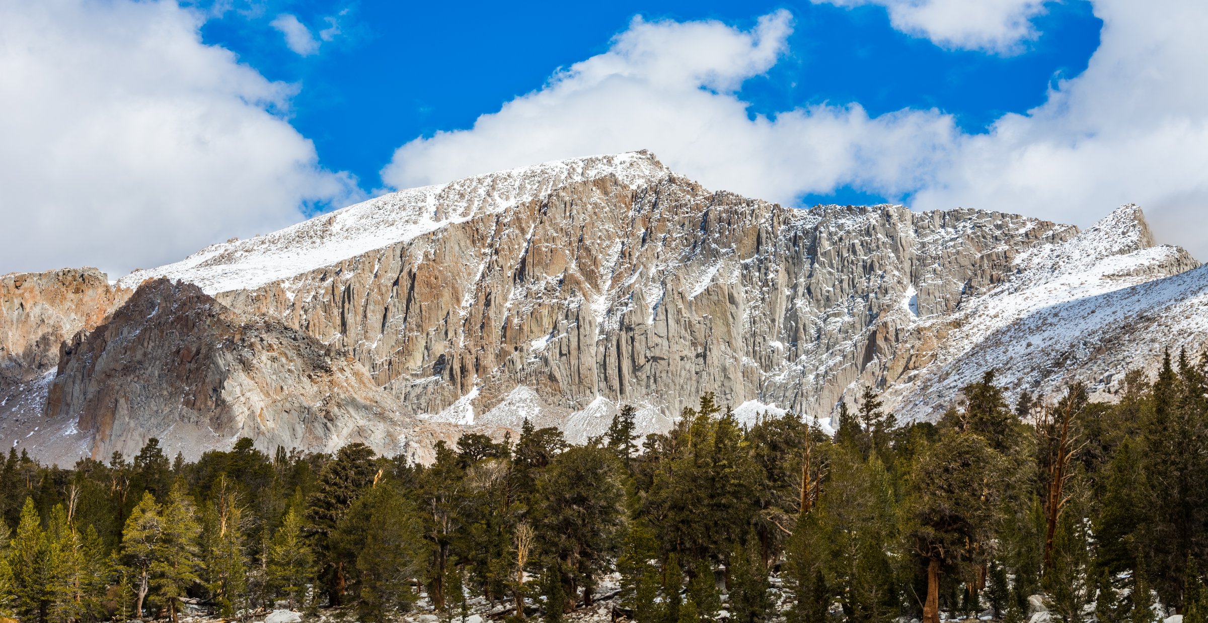
Over the pass the mountain changes character completely. The maintained trail drops away west; the route to Langley turns north and climbs onto a vast, near-level plateau of pale decomposed granite and sand. Nothing here resembles a trail: the way is a braid of sandy use-paths and talus threaded between cairns, and the Park Service has marked a route across it to concentrate traffic and protect the surface. The plateau is far longer than it looks from the pass.
The final rise up Langley’s broad south-western slopes is a long, ankle-deep sandy slog rather than a climb — class 1–2 throughout on the cairned line, with no technical ground. The summit is a rubble crown at the north-eastern edge of the plateau, where the mountain ends abruptly in cliffs. North, the crest runs unbroken to Mount Whitney; west lie the Great Western Divide and the Sequoia backcountry; east the ground falls more than 3,000 m to the Owens Valley.
Why it is essential
Mount Langley is the southernmost fourteener in the United States and the only one in the Sierra that a fit walker can climb in a day with no rope, no scramble and — decisively — no lottery. Where Whitney, twelve miles north, rations access through a permit draw that turns away most applicants, the Forest Service asks nothing at all of the Langley day hiker. And the price of admission is a walk through the Cottonwood Lakes, an alpine basin of granite-bound lakes holding California’s state fish, which would be a destination in its own right if the mountain above it were not 4,277 m high.
Equipment
Mountain hiking equipment, for a very long day:
- Sturdy boots; gaiters are useful in the deep sand
- Trekking poles
- Full weatherproof shell, warm layers, hat and gloves
- Headtorch: the day starts before dawn
- Sun protection — the plateau is a reflective, shadeless expanse
- Water for everything above the basin: there is essentially none past New Army Pass
- Map, compass and a GPS track — this is not optional on the plateau
- Bear canister for overnight trips; this is a mandatory canister area
Hazards and notes
Navigation on the summit plateau is the most under-rated risk on this route. Above New Army Pass the trail fades into multiple sandy use-paths and talus fields, and progress depends on following cairns. In cloud, in a whiteout, or after dark, this is genuinely disorienting terrain, and there are no handrails of any kind. Carry a GPS track and a compass bearing.
The plateau is also vast, flat and entirely exposed, with nothing higher than a walker for miles — a poor place to be caught by an afternoon thunderstorm. Summit early and be descending by early afternoon.
Take New Army Pass, not Old Army Pass. The old pass is lower and shorter, which is precisely what tempts people onto it, but it is unmaintained, damaged by rockfall, requires hands-on scrambling, and its chute holds snow well into summer. Early-season parties without an ice axe and crampons should not attempt it.
The trailhead is at 3,048 m and the summit at 4,277 m, with the whole route above 3,000 m. The high start helps, but a same-day arrival from sea level is a real risk. Sleeping at the trailhead campground the night before is strongly advisable — which is exactly what it is there for.
Dogs are permitted on the Forest Service section as far as New Army Pass, but not on the summit plateau, which lies inside Sequoia National Park.
Permits
A day hike requires no permit — the Forest Service states directly that day use does not require one, and the Cottonwood Lakes area is nowhere near the Mount Whitney Zone. This is the route’s headline practical advantage and it is safe to rely on. Overnight trips need an Inyo National Forest wilderness permit from Recreation.gov permit 233262, entry point “Cottonwood Lakes”, quota 60 people per day from 1 May to 1 November, at $6 per permit plus $5 per person.
GPX / route file
| Source | URL | Format / access | Reuse status |
|---|---|---|---|
| USFS — Cottonwood Lakes Trail | fs.usda.gov | Official trail page; day-use permit rule | No GPX published |
| USFS — Cottonwood Lakes / New Army Pass Recreation Opportunity Guide | fs.usda.gov | PDF with official mileage and elevation table | US government work |
| OpenStreetMap | openstreetmap.org | Cottonwood Lakes, New Army Pass and Mount Langley trails are all mapped; exportable to GPX | ODbL 1.0; attribution required |
| Gaia GPS | gaiagps.com | GPX / KML | Proprietary; not redistributable |
| Hiking Project | hikingproject.com | GPX download | Proprietary; not redistributable |
Further reading
5. Cottonwood Pass and Chicken Spring Lake
Snapshot
Itinerary
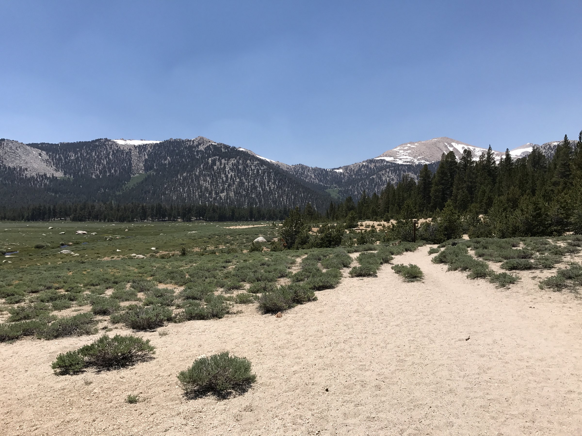
The trailhead sits at the end of Horseshoe Meadow Road at about 3,000 m — a starting altitude higher than most European summits. The trail begins by crossing the broad, sandy floor of Horseshoe Meadow, a level walk on packed decomposed granite between scattered lodgepole pines, with the crest rising ahead. At about 0.5 km a signed junction sends the Trail Pass trail off to the south — the return leg, for those making the loop.
At the western end of the meadow, about 2.3 km in, the path crosses two streams. These are the only running water on the ascent. Beyond them the climb begins: an easy grade stiffening into long, moderately graded switchbacks that gain a little over 355 m. The trees thin as the trail rises, and the view opens back east across the meadow towards the Inyo Mountains standing over the Owens Valley.
Cottonwood Pass (3,392 m) is reached at about 6.0 km, where the trail meets the Pacific Crest Trail on the crest. West of the pass the ground falls away towards the Kern River drainage, with Big Whitney Meadow spread out below and the southern end of the Great Western Divide on the skyline.
Turning north on the PCT, the trail skirts a small meadow and climbs a rocky hillside scattered with gnarled foxtail pines — Pinus balfouriana, a rare high-elevation Californian endemic whose Sierra subspecies grows almost nowhere outside this corner of the range. At about 6.9 km a spur climbs through open meadow to the southern shore of Chicken Spring Lake (3,432 m), roughly 7.2 km from the trailhead.
The lake lies in a granite bowl, its northern and eastern shores walled by cliffs beneath Cirque Peak, its southern side an apron of rocky meadow, scrub willow and more foxtail pine.
The Trail Pass loop. Instead of returning the way they came, walkers can turn south on the PCT from Cottonwood Pass, follow the crest below Trail Peak, and descend over Trail Pass (3,198 m) back to Horseshoe Meadow. The Pacific Crest Trail Association gives this loop as 17.4 km with 440 m of ascent. Note that the loop runs the opposite way from the lake: combining both makes a day of about 19.5 km.
Why it is essential
This is the most accessible crossing of the Sierra crest in the range, and the easiest way for a walker to stand on the Pacific Crest Trail in the High Sierra: a road that climbs to 3,000 m does most of the work, leaving barely 400 m of ascent to a 3,392 m pass. What that buys is the quintessential southern-Sierra plateau — a mile-wide sandy meadow, decomposed granite underfoot, and open groves of foxtail pine, a tree that grows almost nowhere else on Earth. From the pass the whole western half of the range opens at once.
Equipment
Standard hiking equipment, with altitude in mind:
- Hiking shoes or boots
- Weatherproof layer and warm layer — the crest is cold and windy
- Strong sun protection: thin air, high UV, and reflective granite
- Water for the ascent: the meadow crossing is dry and there is nothing between the streams and the lake
- Map and GPS
- Bear canister for overnight trips — required at Chicken Spring Lake
Hazards and notes
Altitude is the hazard, not the terrain. The entire route lies above 3,000 m, from a trailhead at about 3,020 m to 3,432 m at the lake, and there is no low ground to retreat to. Walking straight up after arriving from sea level is a common cause of altitude sickness here. Sleep a night at the trailhead campground first.
The crest at Cottonwood Pass and the whole PCT traverse to the lake are open and exposed, with no shelter above the meadow, and summer afternoon convective storms are routine. Start early and be off the crest by early afternoon.
The meadow crossing is dry, and after the pair of streams at its western end there is no water until the lake. The pass and the north-facing bowl holding the lake keep snow well into early summer, and the lake can remain partly frozen into June.
Bear-resistant canisters are required for overnight parties at Chicken Spring Lake, and campfires are prohibited there. Note that Chicken Spring Lake is in the Golden Trout Wilderness, not Sequoia National Park — the park boundary lies a mile or two further along the PCT — so dogs are permitted on this entire route, under control.
Permits
A day hike requires no permit. Overnight trips need an Inyo National Forest wilderness permit from Recreation.gov permit 233262, entry point “Cottonwood Pass”, with a quota of 40 people per day, at $6 per permit plus $5 per person. The Forest Service’s current trail page gives the quota season as the last Friday in June to 15 September; older publications give different dates, so confirm at booking.
GPX / route file
This is the one route in the region with a genuinely reusable official track: the Pacific Crest Trail Association publishes the PCT centreline under CC BY 4.0, which permits commercial use and adaptation with attribution.
| Source | URL | Format / access | Reuse status |
|---|---|---|---|
| PCTA — official PCT data | pcta.org | GPX, KMZ, GeoJSON, Shapefile. “Central California” covers Cottonwood Pass | CC BY 4.0 — free commercial use and adaptation with attribution to the Pacific Crest Trail Association |
| PCTA — Horseshoe Meadow / Trail Pass / Cottonwood Pass loop map | pcta.org | PDF topo map with official loop statistics | PCTA trip data on a USFS basemap |
| USFS — Cottonwood Pass Trail | fs.usda.gov | Official trail page | No GPX published |
| USFS — Cottonwood Pass Recreation Guide | fs.usda.gov | PDF with official mileage table | US government work |
| OpenStreetMap — Cottonwood Pass Trail | openstreetmap.org | OSM relation for the meadow approach | ODbL 1.0; attribution required |
Further reading
Notes and caveats
- No official GPX exists for any Forest Service trail in this region. The one exception is the Pacific Crest Trail itself, whose centreline the PCTA publishes under CC BY 4.0 — the only openly licensed, redistributable route file in the whole region. Everything else must come from OpenStreetMap (ODbL 1.0) or the USFS trails GIS layer.
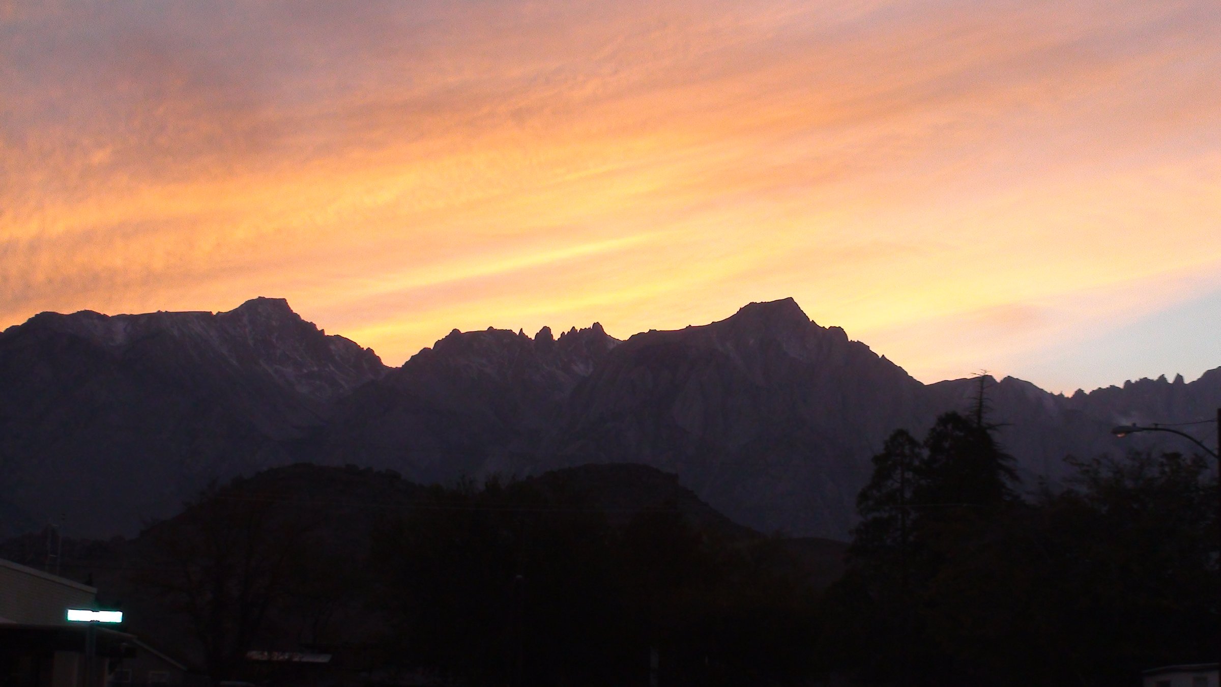
- No licence-compatible photograph of Meysan Lake or Chicken Spring Lake exists on Wikimedia Commons. Both were confirmed as null results after exhaustive searching. The images used show, respectively, Lone Pine Peak above the Meysan drainage, and the Horseshoe Meadow approach.
- The Mount Whitney lottery window is 1 February to 1 March, not mid-March; 15 March is the results date. This is widely misreported.
- Outside the Whitney quota season there is no self-issue permit. A permit remains legally required year-round under Forest Order 05-04-55-25-01; it is simply unlimited in number, and still booked online.
- The “99 switchbacks” has no official count. Neither USFS nor NPS publishes a number, and published counts vary. The name is traditional.
- Mount Whitney’s summit is 4,421 m / 14,505 ft on the modern NAVD88 datum. The 14,494 ft stamped on the old USGS benchmark reflects the 1929 datum; the mountain has not changed.
- Mount Langley’s summit is given as both 14,032 ft (NAVD88) and 14,026 ft (the legacy figure), with the summit benchmark disc reading 14,042 ft. The modern figure is used here.
- USFS publications disagree with each other on the Kearsarge Pass distance (4.5 vs 5 miles one way), on the Cottonwood Pass elevation (11,128 ft on its own basemap vs 11,200 ft in its text), and on the Horseshoe Meadow Road length. Ranges are given above.
- Cottonwood Pass meets the Pacific Crest Trail, not the John Muir Trail; the JMT is further north.
- Road opening and closing dates are snow-dependent and are not fixed. Fees and quotas change annually. Confirm with the Forest Service before travelling.
- Note that the Mount Whitney Trail also appears in the earlier Mammoth and Eastern Sierra entry; it belongs to this region, and the two entries should be reconciled.
Further reading
| Resource | Link |
|---|---|
| Inyo National Forest | fs.usda.gov |
| USFS — Wilderness permits, fees and quotas | fs.usda.gov |
| USFS — Wilderness regulations: bear canisters, pets, group size | fs.usda.gov |
| USFS — Wilderness safety: altitude, HAPE and HACE | fs.usda.gov |
| USFS — Food and refuse storage restrictions | fs.usda.gov |
| Recreation.gov — Mt. Whitney permits and lottery | recreation.gov |
| Recreation.gov — Inyo National Forest wilderness permits | recreation.gov |
| NPS — Seeing and climbing Mt. Whitney | nps.gov |
| PCTA — official PCT data (CC BY 4.0) | pcta.org |
| Eastern Sierra Transit Authority | estransit.com |