Regional overview
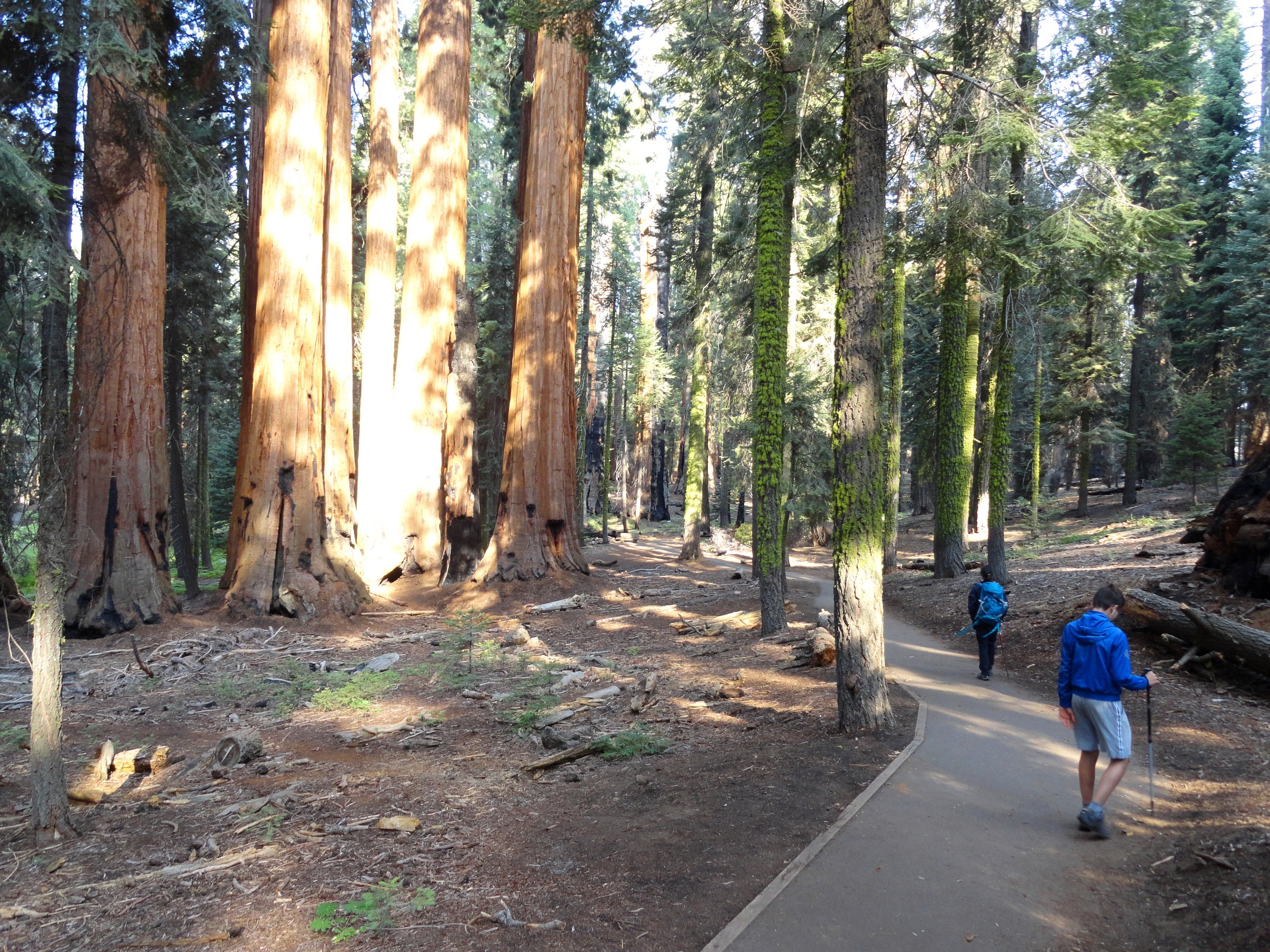
Sequoia and Kings Canyon are two national parks administered as one, occupying the western flank of the southern Sierra Nevada. They hold the largest trees on Earth, one of the deepest canyons in North America, and a high country of granite, tarns and 3,400 m summits. The walking splits cleanly into three characters: the paved, crowded, extraordinary sequoia groves of the Giant Forest at around 2,000 m; the glacially scoured lake basins and peaks reached from Wolverton and Lodgepole; and the remote, road-poor corners at Cedar Grove and Mineral King.
The parks are managed by Sequoia & Kings Canyon National Parks. NPS publishes reliable route descriptions, hazard warnings and access rules, but no official GPX or KML downloads for any of these trails — the route-file tables below therefore point at the NPS route pages, the NPS trails GIS dataset, and OpenStreetMap. One rule shapes every entry here: NPS states plainly that “permits are not required for day hikes, except if hiking Mt. Whitney.” Every route below can be walked on the day, without a reservation.
Access is the real constraint. Two of the five hikes depend on roads that are gated shut for much of the year. The Kings Canyon Scenic Byway (Highway 180) to Cedar Grove generally opens around the fourth Friday in April and closes in mid-November because of rockfall. The Mineral King Road is open only from roughly the Wednesday before Memorial Day to the last Wednesday in October, and takes about 90 minutes to drive its narrow, partly unpaved 40 km. Neither is served by public transport. By contrast the Giant Forest and Lodgepole corridor has a free summer shuttle, running late May to early September in 2026.
Two hazards deserve naming up front. Drowning is the single most common cause of death in these parks, and the rivers are at their most lethal in late spring and early summer — exactly when the waterfalls are at their best. And black bears are active throughout: food must come out of vehicles at every trailhead and go into the storage lockers, whether or not you are staying the night. Pets are prohibited on all park trails, including the paved ones.
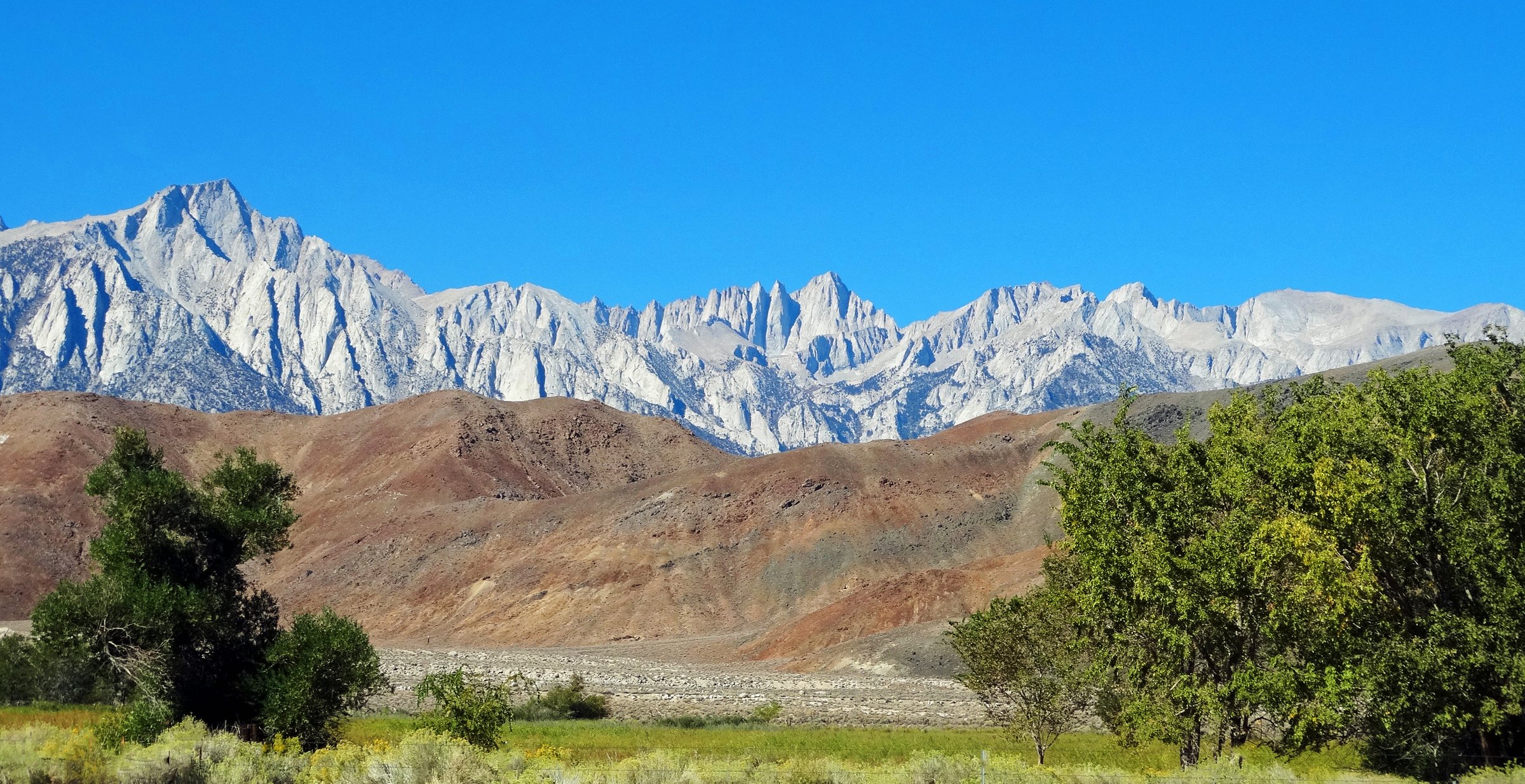
For the neighbouring Sierra regions, see the companion entries on Mount Whitney and the Southern High Sierra, which covers the eastern escarpment on the far side of the crest, and Yosemite and the central Sierra.
Selection rationale
The five routes are chosen to cover the parks’ distinct landscapes without repeating a trailhead more than twice:
- Alta Peak — the summit, and the one maintained trail in Sequoia that carries a walker above 11,000 ft in a day.
- The Lakes Trail to Pear Lake — the glacial lake basin, by way of the Watchtower, a ledge blasted into a sheer granite cliff.
- Mist Falls — the Kings Canyon valley route, up the floor of a glacial trough often compared to Yosemite Valley.
- Monarch Lakes — the Mineral King cirque, in the wildest and least-developed corner of Sequoia.
- The Giant Forest and Moro Rock — the cultural and biological heart of the park: the largest trees on Earth, plus the granite dome that lifts clear of them.
Alta Peak and the Lakes Trail share the Wolverton trailhead, but diverge less than 3 km in and end in completely different terrain. Routes requiring glacier travel, roped climbing or technical scrambling are excluded.
Summary table
| # | Hike | Area | Route type | Distance | Gain | Max elevation | Difficulty |
|---|---|---|---|---|---|---|---|
| 1 | Alta Peak | Giant Forest / Wolverton | Out-and-back | 20.6–22.7 km | c. 1,160–1,220 m | 3,416 m | Strenuous |
| 2 | The Lakes Trail to Pear Lake | Giant Forest / Wolverton | Out-and-back | c. 20.5 km | c. 860 m | 2,911 m | Moderately strenuous |
| 3 | Mist Falls | Cedar Grove, Kings Canyon | Out-and-back | 12.9–13.2 km | c. 245 m | 1,762 m | Moderate |
| 4 | Monarch Lakes | Mineral King | Out-and-back | 13.5–16.1 km | c. 850 m | 3,231 m | Strenuous |
| 5 | Giant Forest and Moro Rock | Giant Forest | Shuttle-assisted linked walk | c. 17 km linked | c. 500–550 m | 2,240 m | Moderate |
1. Alta Peak
Snapshot
Itinerary
The route leaves the eastern end of the Wolverton parking area on the signed Lakes Trail, climbing steadily through red fir and lodgepole above Wolverton Creek. At roughly 2.9 km a fork divides the day: the Lakes Trail continues left towards Heather, Emerald and Pear Lakes, while the Alta Peak route bears right for Panther Gap.
Panther Gap is reached at about 4.5 km and 2,575 m, a notch on the ridge where the view opens abruptly south across the Middle Fork Kaweah canyon to the Great Western Divide. NPS notes there is no water here. The Alta Trail then traverses east across open, sun-exposed slopes to Mehrten Meadow at about 6.1–6.4 km — the only reliable water on the route, and even that can fail late in a dry season.
At roughly 7.7 km a signed junction offers a gentler option: the right branch descends about 1.6 km to Alta Meadow, a broad subalpine meadow facing the Kaweah Peaks, which makes a satisfying lower-effort turnaround. The summit route takes the left branch and begins the steepest section, climbing sandy switchbacks beneath the granite fin of Tharp’s Rock, breaking above the last stunted firs onto open granite and talus. The final few metres require a short, easy scramble on slabs.
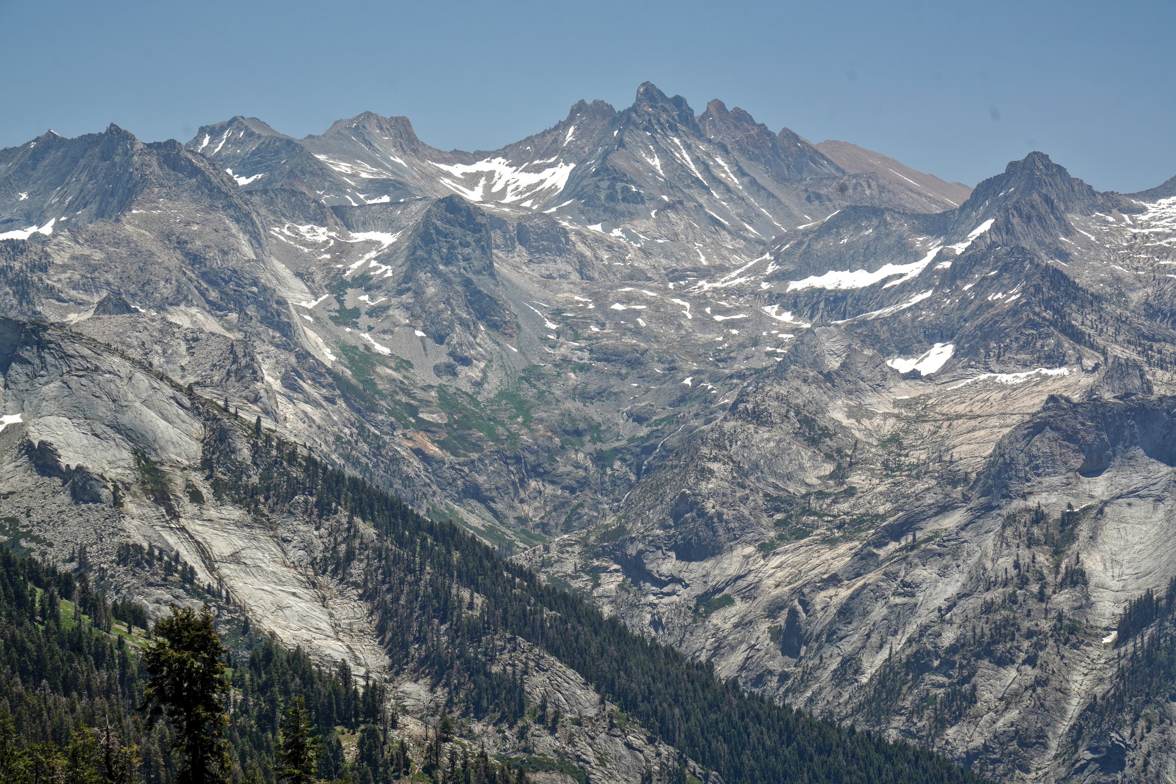
From the summit at 3,416 m the panorama takes in the Great Western Divide, the Kaweah Peaks, Kaweah Queen and the Tablelands. Return by the same route.
Why it is essential
Alta Peak is one of very few Sierra summits above 3,400 m that can be reached on a maintained trail in a single day, and it gives the most complete overview of Sequoia’s high country available to a walker. The route also compresses the park’s entire vertical range into one outing — red fir forest, the sudden canyon-rim view at Panther Gap, subalpine meadow, and then bare granite above the treeline.
Equipment
Mountain hiking equipment:
- Sturdy hiking boots
- Weatherproof layer and warm layer
- Hat and gloves outside high summer
- Trekking poles recommended for the descent
- Sun protection — the traverse above Panther Gap is shadeless
- Headtorch for a long day
- Map, GPS and navigation backup
- Water for the whole day: carry it from the trailhead where possible
- Microspikes if snow lingers on the summit slopes in early season
Hazards and notes
This is a large single-day altitude load: about 1,200 m of ascent finishing above 3,400 m, from a trailhead most visitors reach the same morning. NPS advises a slow ascent and plenty of water. Water is the other planning constraint — there is none at Panther Gap and none at all between Mehrten Meadow and the summit.
The summit is fully exposed to afternoon thunderstorms. NPS advises that distant thunderheads indicate impending lightning activity and that walkers should seek lower ground. Start at dawn and be off the summit early. Patchy snow can persist on the upper slopes into early or mid-July; in winter and spring the upper trail is a serious snow route rather than a hike. Bears are active throughout, and food must be removed from vehicles at the trailhead. Pets are prohibited.
GPX / route file
| Source | URL | Format / access | Reuse status |
|---|---|---|---|
| NPS — Wolverton trailhead | nps.gov | Official route page | NPS public website; no GPX published |
| NPS — Wilderness trail descriptions | nps.gov | Official trail descriptions | No GPX published |
| NPS / IRMA — Trails of Sequoia and Kings Canyon GIS | catalog.data.gov | GIS vector lines (ZIP), not GPX | US federal dataset; no explicit licence stated on the page |
| OpenStreetMap — Alta Peak Trail | openstreetmap.org | OSM ways, exportable to GPX | ODbL 1.0; attribution to OpenStreetMap contributors required |
| Hiking Project | hikingproject.com | GPX download | Proprietary; not redistributable |
Further reading
2. The Lakes Trail to Pear Lake
Snapshot
Itinerary
From Wolverton the Lakes Trail climbs through mixed conifer forest and meadow onto a lateral moraine, passing the Alta Trail junction at about 2.9 km. At roughly 3.4 km comes the decision point of the day: the Watchtower and the Hump divide here and rejoin above Heather Lake.
The Watchtower route is the reason to walk this trail. It switchbacks up to the Watchtower itself, a granite spire standing above the Tokopah Valley, then runs for about half a mile along a ledge blasted from a sheer cliff high above the Marble Fork of the Kaweah River. The tread is a shelf cut into the rock face, with a substantial drop on the outside edge and no railing. It is not technical in dry conditions, but it is genuinely exposed.
The Hump is the alternative, and the mandatory winter line. It climbs through shadier forest over a high point of 2,896 m, gaining about 60 m more than the Watchtower and forgoing both the views and the exposure. Walking up one and down the other is the natural way to see both.
The reunited trail drops to Heather Lake (2,829 m), a rock-rimmed tarn against polished granite, then contours into the glacially scoured headwaters of the Marble Fork past Emerald Lake (2,813 m), with Aster Lake in a granite bowl just off the trail. A final climb over slabs reaches Pear Lake (2,911 m), cupped beneath the Tablelands with Alta Peak on the skyline.
Why it is essential
The Lakes Trail packs a full High Sierra approach — forest, moraine, cliff-edge traverse and a chain of glacier-carved tarns — into a single day from a roadhead served by a free shuttle. The Watchtower ledge is one of the most dramatic pieces of constructed trail in the park, and the choice between it and the sheltered Hump gives the route two distinct characters in one outing.
Equipment
Mountain hiking equipment:
- Sturdy hiking boots with reliable grip for the Watchtower ledge
- Weatherproof layer and warm layer
- Trekking poles
- Sun protection
- Map, GPS and navigation backup
- Water and treatment — NPS advises treating all backcountry water
- Microspikes if any snow remains on the ledge in shoulder season, though the park’s own answer is to take the Hump instead
Hazards and notes
The Watchtower is the hazard that defines this route. NPS closes it in winter “due to extreme danger of falling”, and routes all traffic over the Hump. The ledge is north-facing in places and holds snow and ice long after the lower trail has melted out; a snow patch on a sloping, cliff-edged shelf is not a place to improvise. If the ledge holds snow, take the Hump. NPS publishes live status on its trail conditions page, and it is worth checking the morning of departure — an “open” Watchtower in early season can still carry patches.
Even dry, the ledge is a narrow bench above a sheer drop with no railing, and a poor choice for young children or anyone uneasy with heights. Above, the open granite slabs around the three lakes offer no shelter from afternoon thunderstorms. Pear Lake sits at 2,911 m, and the route spends hours above 2,700 m.
Bear canisters are required for overnight parties at Emerald and Pear Lakes from 1 May to 31 October; day hikers need none, but food must still come out of the car at the trailhead. Marmots are common at the lakes — do not leave packs unattended. Pets are prohibited.
GPX / route file
| Source | URL | Format / access | Reuse status |
|---|---|---|---|
| NPS — Lakes trailhead | nps.gov | Official route page | NPS public website; no GPX published |
| NPS — Pear Lake winter trail (the Hump) | nps.gov | Official route page; Watchtower closure | No GPX published |
| NPS — Trail conditions (Watchtower status) | nps.gov | Live trail status | — |
| OpenStreetMap — “Lakes Trail – The Watchtower” | openstreetmap.org | OSM way, exportable to GPX | ODbL 1.0; attribution required |
| Hiking Project | hikingproject.com | GPX download | Proprietary; not redistributable |
Further reading
3. Mist Falls
Snapshot
Itinerary
The route starts at Road’s End, where Highway 180 terminates east of Cedar Grove, from the trailhead just past the Road’s End Permit Station. Animal-resistant food lockers, vault toilets and a water-filling station are at the trailhead; a short spur reaches Muir Rock, the granite boulder on the Kings River named for John Muir.
The trail crosses Copper Creek and settles into a long, level, sandy walk east up the floor of the South Fork canyon. NPS describes it simply: the sandy trail follows the glaciated South Fork Canyon through forest and chaparral, past an impressive show of rapids and cascades. Granite walls rise thousands of feet on both sides.
At about 3 km the path reaches the Bubbs Creek junction, where the right-hand branch crosses a bridge and climbs towards the high country and the Rae Lakes Loop. The Mist Falls trail bears left; the bridge is worth the few steps as a viewpoint over the confluence.
The grade stays gentle for roughly another kilometre, then the trail turns and climbs in earnest, working up open granite slabs and through wooded switchbacks on the canyon’s east side. Looking back down-canyon, the Sphinx stands clear of its granite base. This section carries the bulk of the ascent.
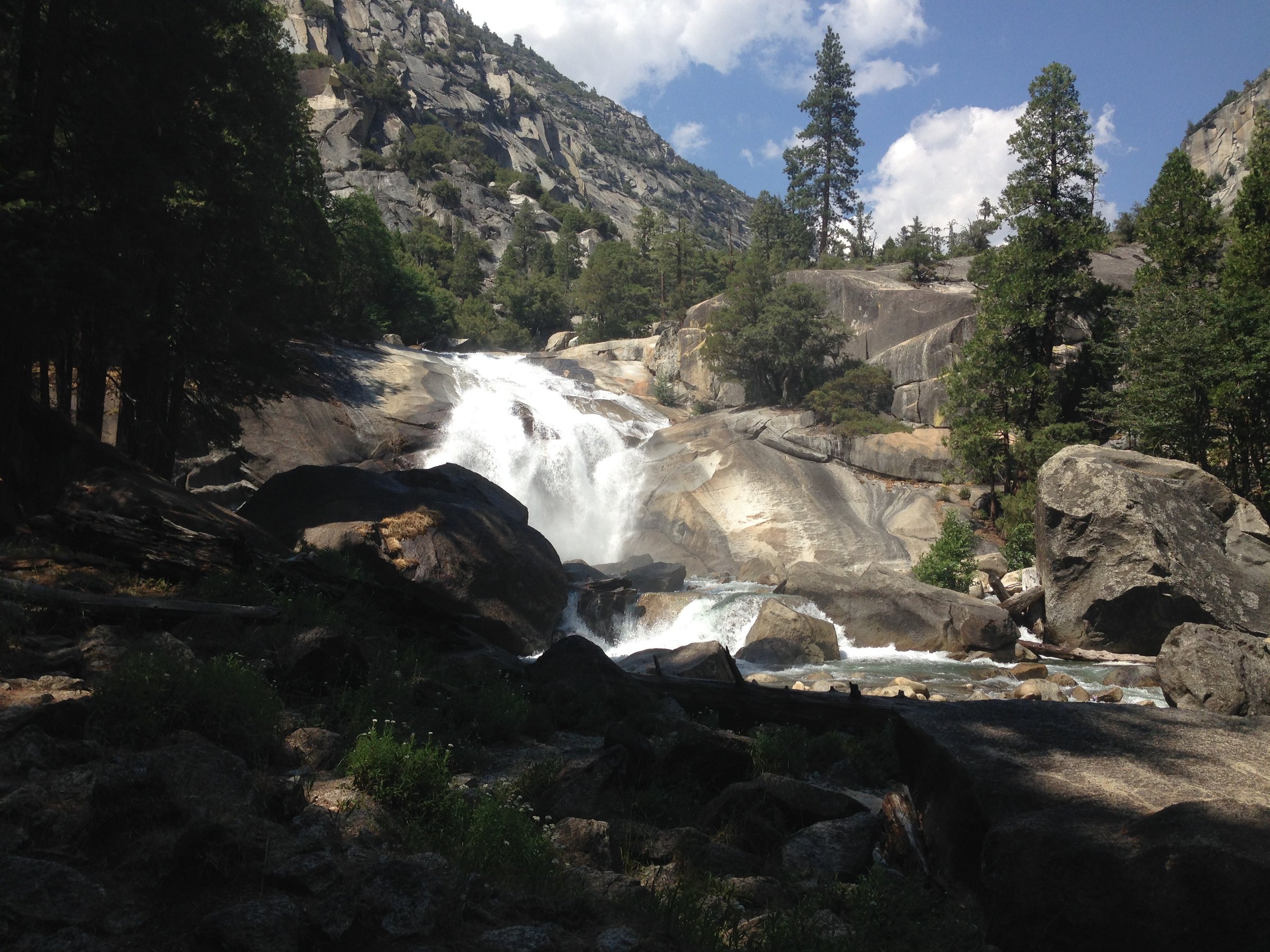
Mist Falls appears at about 6.4 km: a broad cascade sliding over steep, water-polished granite where the South Fork Kings River tips out of the upper canyon, throwing spray across the rock in high water. Most walkers turn here. The trail continues, steepening sharply above the cascade before easing into Paradise Valley — a wilderness-permit destination rather than a day-hike one.
Why it is essential
Cedar Grove is a textbook glacial trough, and NPS itself compares it to Yosemite Valley. The Mist Falls trail is the definitive way to walk that canyon floor and read how it was made, and it delivers the park’s headline waterfall day hike. NPS calls the 8-mile round trip to this “spectacular cascade” a “great all-day walk”.
Equipment
Standard hiking equipment:
- Hiking shoes or boots with good grip — the granite near the falls is polished and wet
- Weatherproof layer
- Sun protection: the canyon floor is low, walled by granite and largely shadeless
- Substantial water — more than the modest ascent suggests, because of the heat
- Food
- Map or GPS
- Insect repellent
Hazards and notes
The river is the hazard here, and it should be taken seriously. NPS states that drowning is the number one cause of death in Sequoia and Kings Canyon, and that the most dangerous period is spring and early summer, when snowmelt makes the water swift, icy and extremely hazardous. Calm-looking water carries a current that “can carry you away in seconds”. At the falls, NPS warns that mist and spray make the surrounding rocks slippery and treacherous, and that people have slipped and fallen in. This matters because the falls are at their most spectacular at exactly the moment the river is at its most lethal.
Access is entirely governed by Highway 180, which generally opens around the fourth Friday in April and closes in mid-November because of rockfall. Check current status with NPS before travelling. Kings Canyon is a very active bear area, and food must go into the trailhead lockers. Midsummer heat on the canyon floor is significant. Poison oak is present. Pets are prohibited.
GPX / route file
| Source | URL | Format / access | Reuse status |
|---|---|---|---|
| NPS — Mist Falls | nps.gov | Official route page | NPS public website; no GPX published |
| NPS — Cedar Grove day hikes | nps.gov | Official route page | No GPX published |
| NPS — Road information (Highway 180 season) | nps.gov | Seasonal access | — |
| NPS / IRMA — Trails of Sequoia and Kings Canyon GIS | catalog.data.gov | GIS vector lines (ZIP) | US federal dataset; no explicit licence stated |
| OpenStreetMap | openstreetmap.org | Mist Falls node; trail mapped as Paradise Valley Trail | ODbL 1.0; attribution required |
| Hiking Project | hikingproject.com | GPX download | Proprietary; not redistributable |
Further reading
4. Monarch Lakes, Mineral King
Snapshot
Itinerary
The route begins at the Sawtooth trailhead, on a spur above the Mineral King Road about a mile beyond the ranger station. The trail climbs immediately, switchbacking up a brushy west-facing slope with widening views back across the valley to Vandever Mountain and Farewell Gap. At about 1.1 km the Timber Gap trail branches left; bear right for Monarch Lakes.
A sustained climb through red fir above Monarch Creek leads to Groundhog Meadow, a small meadow beneath the cliffs of Empire Mountain and home to a resident population of yellow-bellied marmots. Beyond it the trail rock-hops Monarch Creek — the last easy water and the last real shade before the long haul above.
From the creek the trail begins the serious work: a long ascending traverse and switchback sequence through foxtail pines and across the avalanche-scoured Chihuahua Bowl, which NPS notes was named by hopeful miners for a rich mining area in Mexico. The whole climb follows a west-facing slope and bakes in the afternoon. High in the bowl the Crystal Lakes trail forks right; keep left for Monarch.
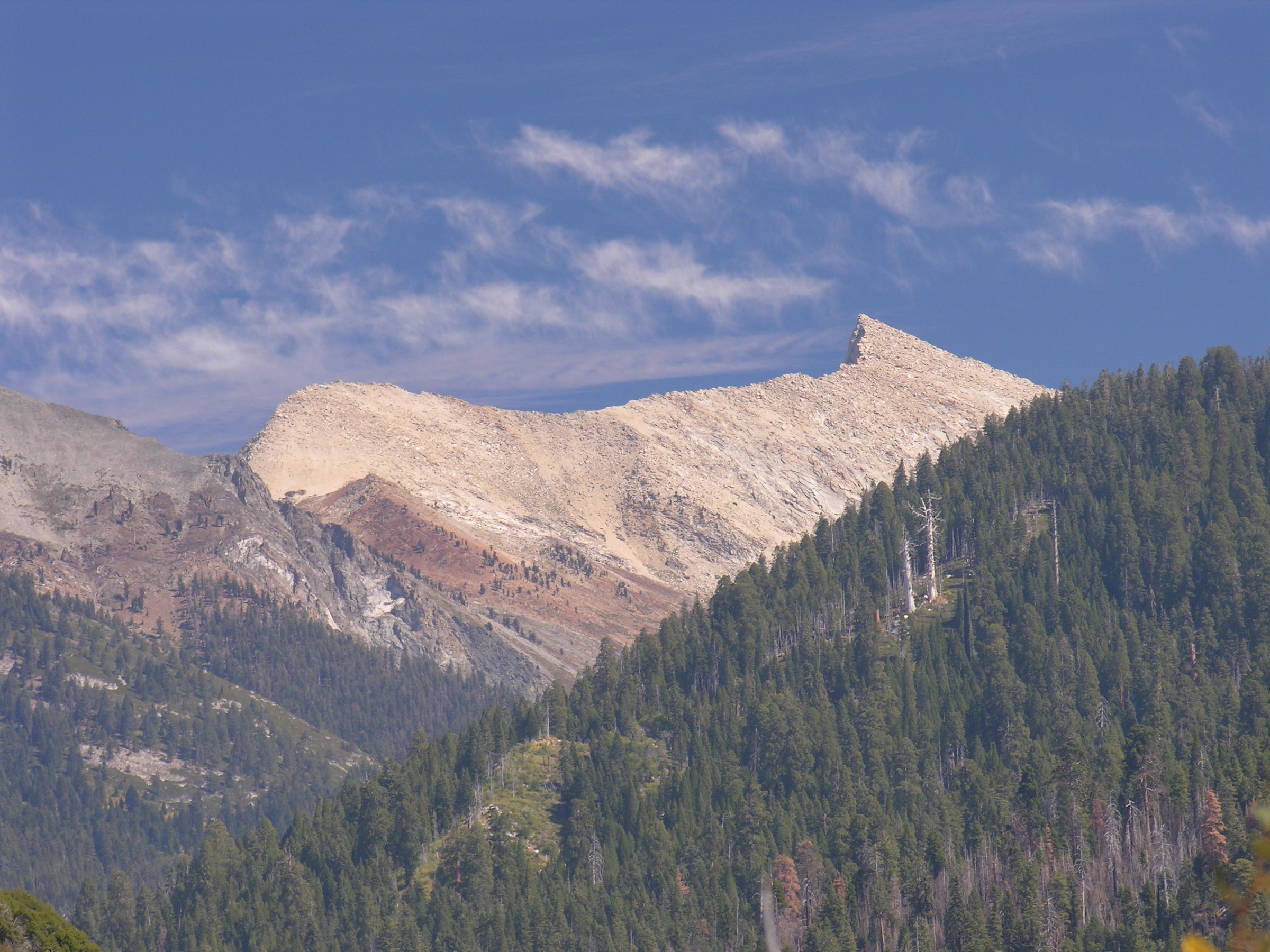
The last stretch contours the northern slope of Monarch Canyon at easy grades, then curves south through braided creek channels and thin meadow to Lower Monarch Lake, set in a granite bowl at 3,167 m directly beneath Sawtooth Peak, with Mineral Peak walling the basin to the south. Upper Monarch Lake lies about 400 m further and 60 m higher, reached by a steep, rougher use-trail up the headwall — a harsher, rockier cirque, and worth the extra effort.
Beyond the lakes the trail climbs 366 m in 2 km to Sawtooth Pass. NPS calls it a strenuous hike giving “one of the grandest views in the southern Sierras”, but warns that “the footing on this portion of the trail is very loose”, and notes that beyond Monarch Lakes the trail is rough and unmaintained.
Why it is essential
Mineral King is the wildest, highest and least-developed corner of Sequoia — a glacially carved valley reached only by a punishing mountain road, with no fuel, no shuttle and no lodge, connected to the rest of the park by trails alone. The climb to Monarch Lakes delivers the full alpine payoff of that isolation in a day: forest, marmot meadows, an avalanche bowl named by nineteenth-century prospectors, and a textbook glacial cirque beneath the serrated crest of Sawtooth Peak.
Equipment
Mountain hiking equipment:
- Sturdy hiking boots
- Trekking poles
- Weatherproof layer and warm layer
- Sun protection and a hat — the ascent is west-facing and shadeless above the creek
- Plenty of water: NPS advises carrying it, since the purity of lakes and streams cannot be guaranteed
- Insect repellent — NPS notes mosquitoes can be a particular nuisance in early summer
- Map and GPS, especially if continuing to Sawtooth Pass
- A tarp for the car (see below)
Hazards and notes
The Mineral King Road governs everything. It runs roughly 40 km from Highway 198 near Three Rivers, is extremely narrow, steep, winding and unpaved in places, and takes about 90 minutes each way. NPS states it is generally open only from the Wednesday before Memorial Day to the last Wednesday in October. Trailers and RVs are not advised and not permitted in the area’s campgrounds, and there is no fuel or electricity in the valley.
The marmots eat cars. NPS states that from spring through mid-summer, the marmots of Mineral King have been known to dine on radiator hoses and car wiring, and lists damage to hoses, belts, electrical wiring, insulation and radiator fluid. The current NPS recommendation is to drive over a tarp and wrap it around the entire vehicle, covering the wheel wells. Note that chicken wire is no longer advised — NPS states that marmots have learned to get around it. The park is not responsible for the damage.
The cirque is high and holds snow into summer; the loose scree above the lakes on the Sawtooth Pass continuation is the crux of that extension, particularly on descent. Afternoon thunderstorms are a real risk on the exposed upper traverse. Bear canisters are not required in the Mineral King area, but food must come out of the car at the trailhead. Pets, bikes and stock are all prohibited on this trail.
GPX / route file
| Source | URL | Format / access | Reuse status |
|---|---|---|---|
| NPS — Mineral King day hikes | nps.gov | Official route page | NPS public website; no GPX published |
| NPS — Monarch Lake | nps.gov | Official route page | No GPX published |
| NPS — Marmots: protecting your vehicle | nps.gov | Official guidance | — |
| NPS — Road information (Mineral King Road season) | nps.gov | Seasonal access | — |
| OpenStreetMap — Sawtooth Pass Trail | openstreetmap.org | OSM way, exportable to GPX | ODbL 1.0; attribution required |
| Hiking Project | hikingproject.com | GPX download | Proprietary; not redistributable |
Further reading
5. The Giant Forest and Moro Rock
Snapshot
Itinerary
The walk begins at the main General Sherman Tree parking area off Wolverton Road. A paved half-mile trail with steps descends to the tree; NPS warns plainly that the return is a 200-foot uphill climb, which catches out visitors who treat the approach as a stroll.
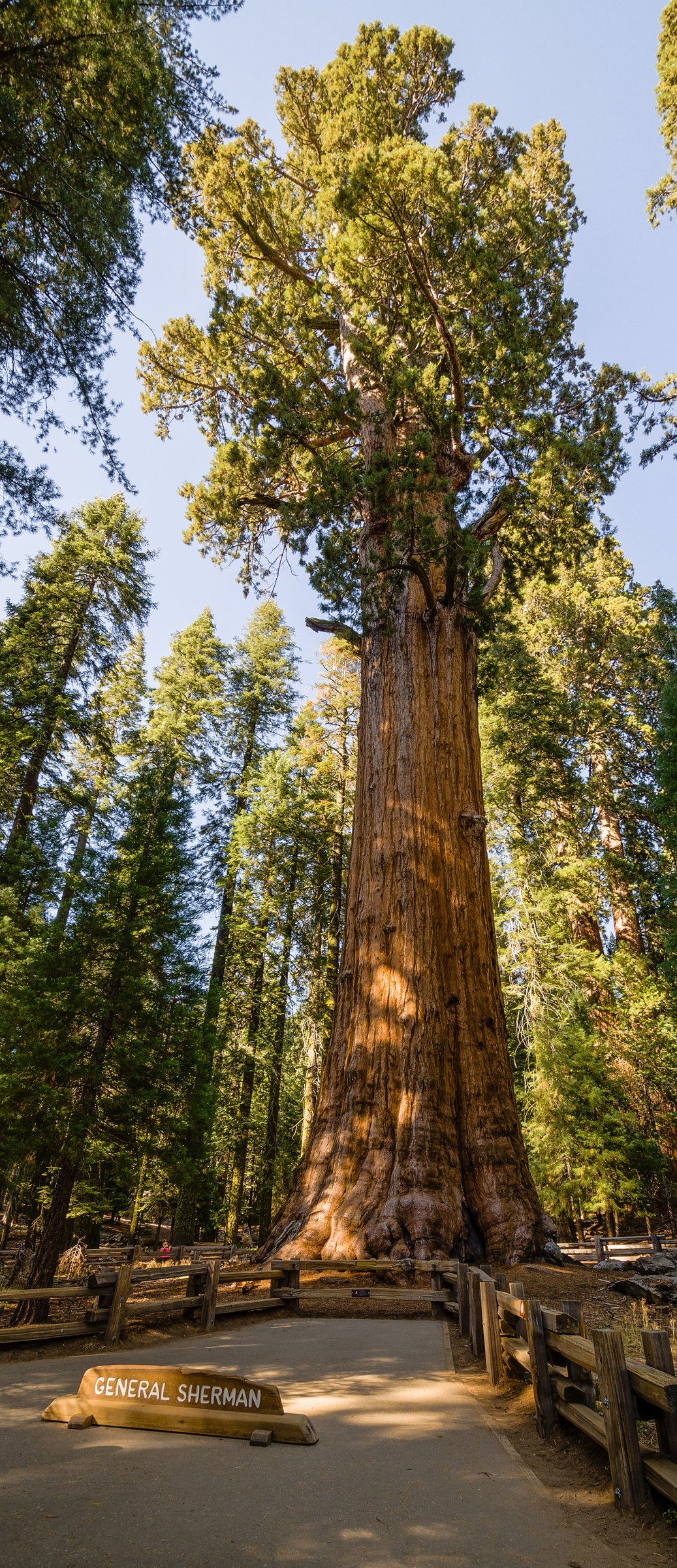
The General Sherman Tree is the largest tree on Earth by volume. NPS gives its trunk volume as 1,486.6 m³ (52,500 cubic feet) and its height as 83.8 m (274.9 ft), and estimates its age at about 2,200 years. It is not the tallest tree, nor the widest. It is the biggest.
From the tree, the Congress Trail runs south into the heart of the grove: a paved 3.2 km loop on a gentle incline, passing the House and Senate groups — dense, tight-packed stands that many walkers find more affecting than Sherman itself — and the President Tree, which NPS describes as the third largest tree in the world.
Beyond the Congress loop the trail network opens out. Linking south by the Trail of the Sequoias, Circle Meadow or the Alta and Huckleberry Meadow trails, the route leaves the pavement and the crowds for quiet, duff-floored forest. Tharp’s Log stands at the edge of Log Meadow: Hale Tharp built this cabin into a fallen, fire-hollowed sequoia in 1861, becoming the first non-Native resident of the Giant Forest. John Muir stopped here in 1875 — the year he named this grove “the Giant Forest” — and called the cabin “a noble den”.
Crescent Meadow lies just west, a flat 2.4 km loop where bright green sedge runs up against the cinnamon bark of the sequoias, and the western terminus of the High Sierra Trail.
The walk finishes at Moro Rock, a granite exfoliation dome standing clear of the forest canopy at 2,050 m. A stone stairway of about 350 steps climbs 91 m in a quarter of a mile to the summit. Built in 1931 by the Civilian Conservation Corps and now on the National Register of Historic Places, it follows the dome’s natural ledges and crevices rather than imposing on them. From the top the view runs 360 degrees: the San Joaquin Valley to the west, and eastward across the Kaweah drainage to the serrated crest of the Great Western Divide.
Why it is essential
This is the cultural and biological core of the park. The Giant Forest holds the largest trees on Earth, and it carries the human history too — Tharp’s hollow-log cabin of 1861, the grove Muir named in 1875, and the CCC’s 1931 stairway. Moro Rock supplies the counterpoint the forest cannot: a granite dome lifting clear of the canopy for a full sweep to the Great Western Divide, making this the one walk that delivers both the trees and the range they grow beneath.
Equipment
Standard hiking equipment:
- Comfortable walking shoes; the Congress Trail is paved but the connecting trails are not
- Weatherproof layer
- Water and food
- Sun protection — NPS notes there is little to no shade at the top of Moro Rock
- Map or GPS for the unpaved connectors between Congress Trail and Crescent Meadow
- A shuttle timetable, if using the free buses to close the loop
Hazards and notes
Lightning on Moro Rock is the most serious hazard. NPS states that Moro Rock is prone to lightning strikes and that “if there is any evidence of an approaching storm, get off the rock quickly but safely” — and elsewhere, “stay away from Moro Rock during thunderstorms or if there’s static in the air”. Sierra afternoon storms build fast in July and August. Climb it early, and descend at the first thunder.
The stairway has steep drop-offs and slippery slopes, though handrails guard the climb; NPS notes it is safe as long as you stay on it. It is still genuinely exposed, and a real problem for anyone with a fear of heights. It closes when icy or snowy.
The Moro Rock–Crescent Meadow Road closes to general motor vehicle traffic on summer weekends and holidays when the shuttles are operating, so on those days the shuttle or walking are the only ways in. In winter, the road is not cleared and Moro Rock is reachable only on foot, skis or snowshoes. Chain controls apply on the Generals Highway in winter.
Bears are active throughout the Giant Forest, including the parking lots. NPS enforces food storage and warns you may be fined for storing it improperly. Pets are prohibited on all trails, including the paved ones, and drones are banned parkwide.
GPX / route file
| Source | URL | Format / access | Reuse status |
|---|---|---|---|
| NPS — Giant Forest and Lodgepole trails | nps.gov | Official route page | NPS public website; no GPX published |
| NPS — Moro Rock | nps.gov | Official route page; lightning warning | No GPX published |
| NPS — Congress Trail | nps.gov | Official route page | No GPX published |
| NPS — Park shuttles | nps.gov | Shuttle routes and season | — |
| OpenStreetMap — Congress Trail | openstreetmap.org | OSM ways, exportable to GPX | ODbL 1.0; attribution required |
| Hiking Project — Giant Forest Loop | hikingproject.com | GPX download | Proprietary; not redistributable |
Further reading
Notes and caveats
- No official GPX or KML exists for any trail in these parks. NPS publishes route descriptions and PDF maps only. The nearest official geodata is the NPS trails GIS dataset on data.gov, which is a GIS vector file rather than a GPX and carries no explicit licence statement. OpenStreetMap (ODbL 1.0) is the only route source with clear reuse terms.
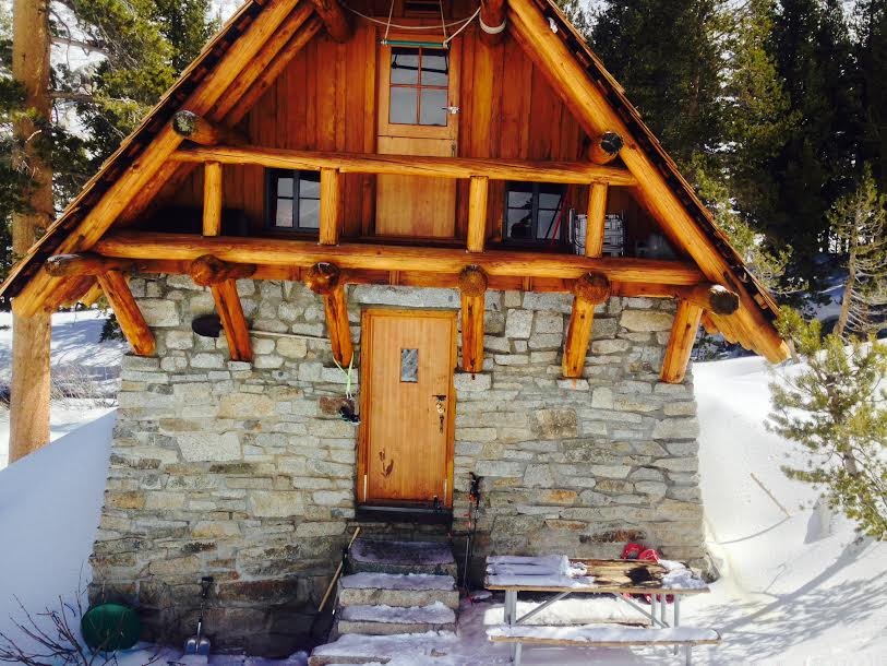
- No licence-compatible photograph of Pear Lake, Heather Lake, Emerald Lake or the Watchtower exists on Wikimedia Commons. This was confirmed as a null result, not an unchecked gap. The image used for hike 2 shows the hut at Pear Lake, the only Commons photograph taken at the destination.
- No Wikimedia Commons photograph of Monarch Lakes exists. The image used shows Sawtooth Peak, the summit that walls the cirque.
- NPS states the Alta Peak trail distance as 12.8 miles but does not say whether that is one-way or round trip; every independent source places the summit at about 6.9 miles one way, so round trip is the only coherent reading. Its “Panther Gap 4 miles” figure does not reconcile with the ~2.8-mile consensus and is left unresolved.
- NPS gives two different distances for Monarch Lakes on two different pages (4.2 miles one way, and a “10-mile route”). The difference appears to be whether Upper Monarch Lake is included.
- NPS also gives two different closing dates for the Mineral King Road (last Wednesday in October, and mid-November) on different pages. The Road Information page wording is used here.
- The NPS Moro Rock trailhead page states the summit elevation as “6,275 ft (2,050 km)” — both the figure and the unit are wrong. The correct figure, 6,725 ft / 2,050 m, is used here.
- The linked Giant Forest walk is a composite. NPS documents the components individually but publishes no total for the combination, so its distance and gain are estimates.
- “Gem of the Sierra”, widely attributed to John Muir for Crescent Meadow, could not be traced to any primary source and is not used here.
- Fees, quotas and shuttle dates change annually. Confirm with NPS before travelling.
Further reading
| Resource | Link |
|---|---|
| NPS — Sequoia & Kings Canyon National Parks | nps.gov |
| NPS — Day hiking (no permit required) | nps.gov |
| NPS — Trail conditions | nps.gov |
| NPS — Road information and conditions | nps.gov |
| NPS — Park shuttles | nps.gov |
| NPS — Fees and passes | nps.gov |
| NPS — River safety | nps.gov |
| NPS — Wilderness food storage and bear canisters | nps.gov |
| NPS — Pets | nps.gov |
| Recreation.gov — wilderness permits (overnight only) | recreation.gov |