Regional overview
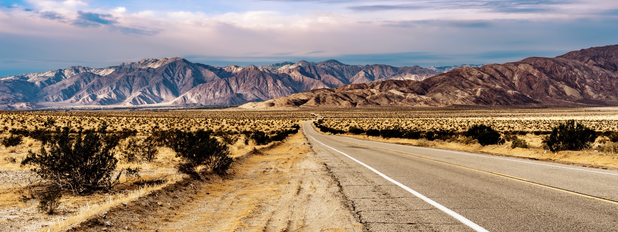
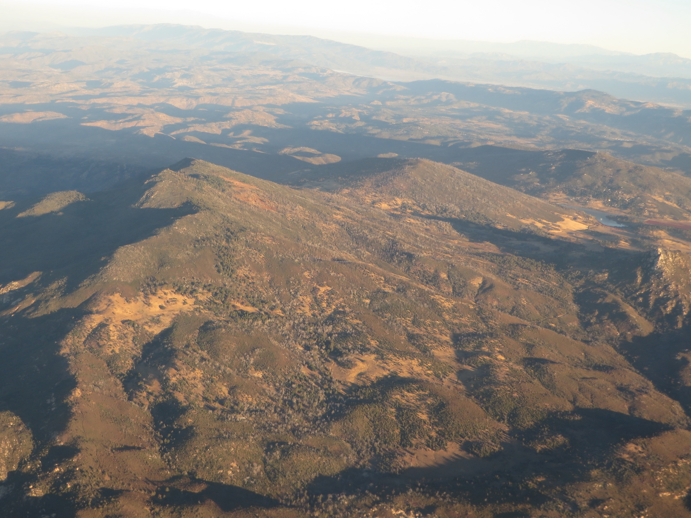
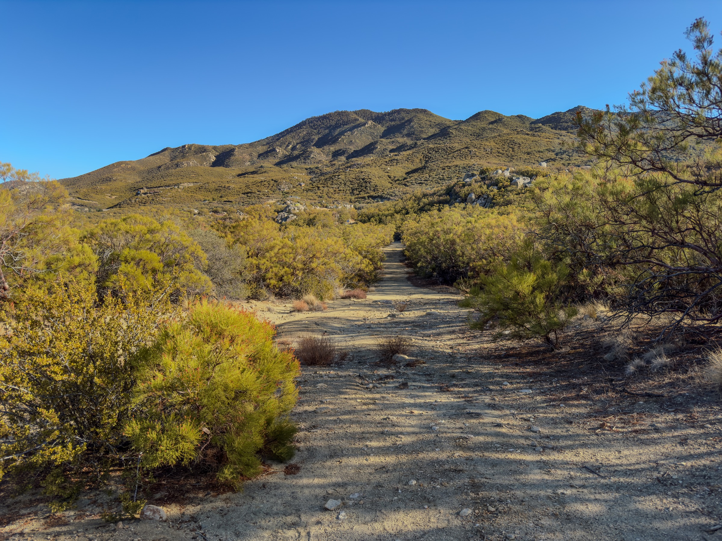
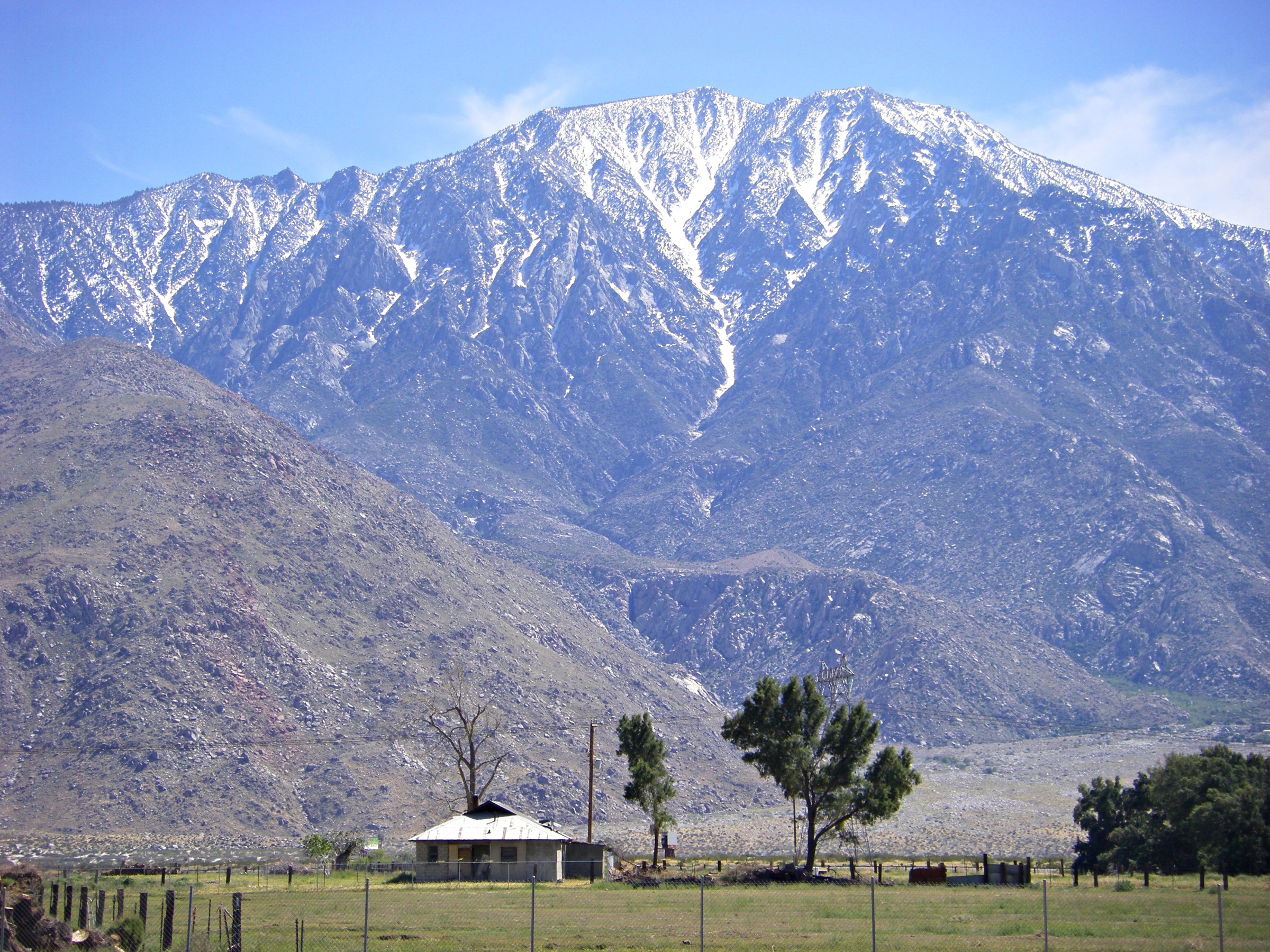
The San Jacinto Mountains are the high, granitic crest above Palm Springs and Idyllwild in southern California, culminating at San Jacinto Peak (3,302 m / 10,834 ft). The core hiking terrain is split between Mount San Jacinto State Park and Wilderness, San Bernardino National Forest lands, and the Santa Rosa and San Jacinto Mountains National Monument. Expect a sharp desert-to-subalpine transition: hot low-elevation trailheads, pine forest and meadows above the tram, and snow or ice on the upper mountain in winter and spring.
Mount San Jacinto State Park requires free day-use wilderness permits for trails beyond the Long Valley ranger station and for the Idyllwild-side wilderness routes. Dogs are prohibited in the wilderness and on the Palm Springs Aerial Tramway except for service animals. Skyline / Cactus to Clouds is a special case: it climbs from the Palm Springs desert floor into alpine terrain, has no dependable water before Long Valley, and should be treated as an expert-only seasonal objective.
Access to the tram-side high country is via the Palm Springs Aerial Tramway; access to the Idyllwild-side routes is by private vehicle on Highway 243. No verified public transport connects the Idyllwild trailheads. Cell service is intermittent to non-existent in the wilderness. Wildfire and weather closures can affect the range across summer, autumn and early spring; verify current State Park and San Bernardino National Forest status before travel.
Selection rationale
The five walks below cover the range’s essential day-hike experiences: the standard high-country summit route from the tram, the full desert-to-peak Skyline / Cactus to Clouds challenge, the steep Idyllwild-side Marion Mountain ascent, the classic Devil’s Slide to Tahquitz Peak route, and the shorter but iconic Idyllwild granite viewpoint at Suicide Rock. Together they capture both the desert-tram east side and the forested Idyllwild west side of the range, at all four common effort levels. Route stats were cross-checked against California State Parks trail pages and the BLM San Jacinto Mountains hiking guide; no downloadable GPX was retrieved, so route-file status rests on the official State Park page, the BLM guide and OpenStreetMap.
Summary table
| # | Hike | Country | Route type | Distance | Gain | Max elevation | Difficulty |
|---|---|---|---|---|---|---|---|
| 1 | San Jacinto Peak from the Palm Springs Aerial Tramway | USA | Out-and-back | 18.7 km | 732 m | 3,302 m | Strenuous |
| 2 | Skyline / Cactus to Clouds | USA | Point-to-point ascent, tram descent | 33.8 km | ≥ 3,048 m | 3,302 m | Extreme |
| 3 | Marion Mountain Trail to San Jacinto Peak | USA | Out-and-back | 17.1 km | 1,372 m | 3,302 m | Very strenuous |
| 4 | Devil’s Slide Trail to Tahquitz Peak | USA | Out-and-back | ~15.4 km | ~716 m | 2,696 m | Strenuous |
| 5 | Deer Springs Trail to Suicide Rock | USA | Out-and-back | 10.6 km | 579 m | 2,289 m | Moderate–strenuous |
1. San Jacinto Peak from the Palm Springs Aerial Tramway
Snapshot
Itinerary
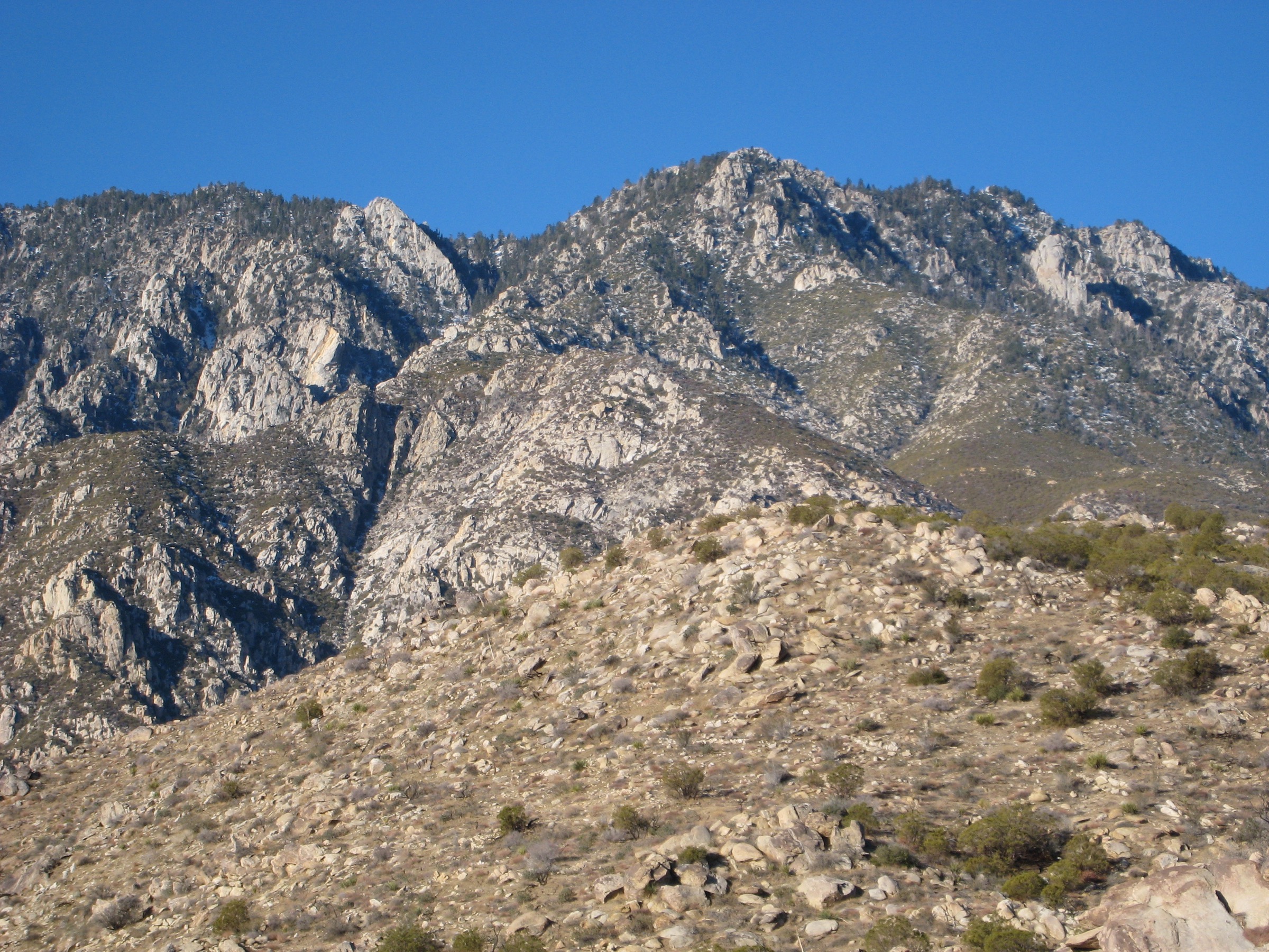
From the Tramway Mountain Station, descend to Long Valley, register for the free wilderness day permit at the ranger station, then climb through Round Valley and Wellman Divide before the final rocky summit spur to San Jacinto Peak. Return the same way; do not miss the last tram descent.
Why it is essential
Best representative summit day for most strong hikers, with the tram turning a huge mountain into a feasible day hike while still delivering the full subalpine forest, meadow and granite-summit experience.
Equipment
- Sturdy hiking boots
- Trekking poles
- 3 L water
- Food for a full day
- Wind and rain shell
- Warm layer (summit is often 15–20 °C colder than Palm Springs)
- Sun protection
- Offline map and GPS
- Microspikes in shoulder season
Hazards and notes
- Free wilderness day permit required beyond Long Valley ranger station.
- Dogs prohibited in the wilderness and on the tram.
- Confirm the final tram descent time before starting — being stranded above Long Valley is a genuine risk.
- Snow and ice can linger on the summit spur into June.
GPX / route file
| Source | URL | Format | Notes |
|---|---|---|---|
| California State Parks — Mount San Jacinto trails page | parks.ca.gov | Official trail description | Use for current stats and wilderness rules |
| BLM — San Jacinto Mountains hiking guide (PDF) | blm.gov | Official route description | Route-narrative reference; direct GPX not retrieved |
| OpenStreetMap search | openstreetmap.org | Source map | Reusable only under ODbL terms with attribution/share-alike |
Sources
- California State Parks — Mount San Jacinto State Park hiking trails
- BLM — Santa Rosa and San Jacinto Mountains National Monument hiking guide
- Palm Springs Aerial Tramway — official website
2. Skyline / Cactus to Clouds
Snapshot
Itinerary
From the Palm Springs Art Museum area, follow the Skyline Trail on a continuous climb into conifer forest and up to the tram station at Long Valley. Continue on the standard high-country route through Round Valley and Wellman Divide to San Jacinto Peak, then descend by tram from the Mountain Station. Attempt only in suitable weather, with a very early start.
Why it is essential
The range’s most iconic vertical traverse, linking desert floor, tram country and the summit in a single massive day — one of Southern California’s defining endurance hikes.
Equipment
- Sturdy hiking boots
- Trekking poles
- 5–7 L water (no reliable resupply before Long Valley)
- High-calorie food
- Sun and heat protection for the lower section
- Warm layers, wind and rain shell for the upper mountain
- Headlamp (start before dawn)
- Emergency bivy and communication
- Microspikes in shoulder season
Hazards and notes
- No reliable water before Long Valley; heat exhaustion and dehydration have caused fatalities.
- Wilderness permit required above Long Valley; dogs prohibited.
- The Skyline segment should not be attempted in hot-season conditions.
- Confirm the last tram descent time and have a fallback plan.
GPX / route file
| Source | URL | Format | Notes |
|---|---|---|---|
| California State Parks — Skyline warning and stats | parks.ca.gov | Official status and hazard guidance | Read the current advisory before travel |
| OpenStreetMap search | openstreetmap.org | Source map | Reusable only under ODbL terms with attribution/share-alike |
| Palm Springs Aerial Tramway — official website | pstramway.com | Official access/operations source | Use for descent-tram logistics, not for route geometry |
Sources
- California State Parks — Mount San Jacinto State Park hiking trails
- Palm Springs Aerial Tramway — official website
- Cactus to Clouds Trail — reference page
3. Marion Mountain Trail to San Jacinto Peak
Snapshot
Itinerary
Climb steeply from the Marion Mountain trailhead on the forested west side of the range and join the high-country trail system before the final push to San Jacinto Peak. Compared with the tram route this is quieter, harder and more self-reliant — no tram shortcut, more gain, sustained climbing.
Why it is essential
The best serious Idyllwild-side summit route and a compact expression of the mountain’s west-slope character.
Equipment
- Sturdy hiking boots
- Trekking poles
- 4 L water and treatment
- Wind and rain shell
- Warm layers
- Sun protection
- Offline map and GPS
- Headlamp
- Microspikes in shoulder season
Hazards and notes
- Wilderness day permit required; dogs prohibited in the wilderness.
- Sustained, steep tread; poor bail-out options once above the trailhead.
- Snow can linger on upper sections through late spring.
GPX / route file
| Source | URL | Format | Notes |
|---|---|---|---|
| California State Parks — Mount San Jacinto trails page | parks.ca.gov | Official trail description | Use for current stats and wilderness rules |
| BLM — San Jacinto Mountains hiking guide (PDF) | blm.gov | Official route description | Route-narrative reference; direct GPX not retrieved |
| OpenStreetMap search | openstreetmap.org | Source map | Reusable only under ODbL terms with attribution/share-alike |
Sources
- California State Parks — Mount San Jacinto State Park hiking trails
- BLM — Santa Rosa and San Jacinto Mountains National Monument hiking guide
- San Bernardino National Forest — Idyllwild Ranger District
4. Devil’s Slide Trail to Tahquitz Peak
Snapshot
Itinerary
From Humber Park in Idyllwild, climb the Devil’s Slide Trail through forest and granite views to Saddle Junction, then continue on the trail system toward the Tahquitz Peak fire lookout. Return the same way.
Why it is essential
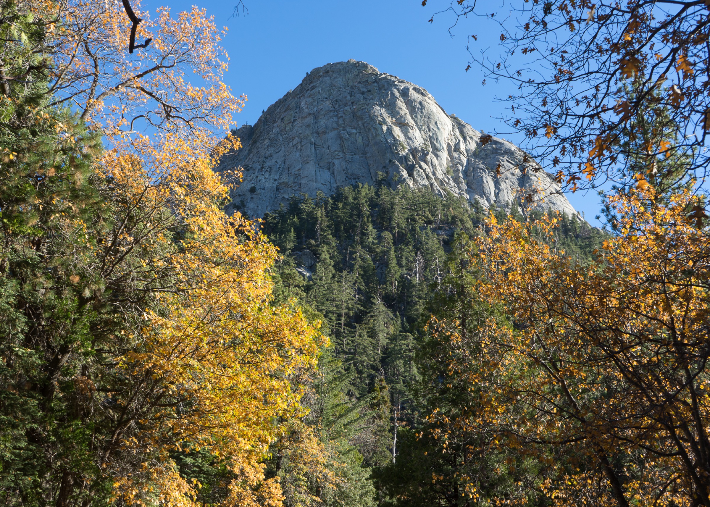
A classic Idyllwild route with views of Lily Rock / Tahquitz Rock, Saddle Junction and a historic lookout summit — the essential Idyllwild trail for hikers who want big granite scenery without committing to San Jacinto Peak.
Equipment
- Sturdy hiking boots
- Trekking poles
- 2.5–3 L water
- Wind and rain shell
- Warm layer
- Sun protection
- Offline map
Hazards and notes
- Wilderness day permit required from Humber Park; dogs prohibited in the wilderness.
- Some sections exposed to sun and afternoon thunderstorms in summer.
- Lookout hours and access can vary; verify current status with the Idyllwild Ranger District.
GPX / route file
| Source | URL | Format | Notes |
|---|---|---|---|
| BLM — San Jacinto Mountains hiking guide (PDF) | blm.gov | Official Devil’s Slide segment verified | Route-narrative reference; direct GPX not retrieved |
| California State Parks — Idyllwild trail context | parks.ca.gov | Official trail description | Use for wilderness rules |
| OpenStreetMap search | openstreetmap.org | Source map | Reusable only under ODbL terms with attribution/share-alike |
Sources
- BLM — Santa Rosa and San Jacinto Mountains National Monument hiking guide
- California State Parks — Mount San Jacinto State Park hiking trails
- Tahquitz Peak — reference page
5. Deer Springs Trail to Suicide Rock
Snapshot
Itinerary
From the Deer Springs trailhead in Idyllwild, climb through pine forest to the signed spur toward Suicide Rock, a granite overlook facing Tahquitz Rock and the forested west side of the San Jacinto high country. Return the same way.
Why it is essential
The best shorter classic from Idyllwild, with strong scenery and lower commitment than the summit hikes — the essential half-day introduction to the range for hikers not yet ready for the tram, Marion Mountain or Skyline.
Equipment
- Hiking shoes or light boots
- Trekking poles (optional)
- 2 L water
- Wind layer and sun protection
- Snacks for a half-day
- Offline map
Hazards and notes
- Wilderness day permit required; dogs prohibited in the wilderness.
- Exposed granite at the overlook — mind the drop-offs.
- Afternoon thunderstorms possible in summer.
GPX / route file
| Source | URL | Format | Notes |
|---|---|---|---|
| California State Parks — Mount San Jacinto trails page | parks.ca.gov | Official trail description | Use for current stats and wilderness rules |
| OpenStreetMap search | openstreetmap.org | Source map | Reusable only under ODbL terms with attribution/share-alike |
Sources
- California State Parks — Mount San Jacinto State Park hiking trails
- San Bernardino National Forest — Idyllwild Ranger District
Region-wide cautions
- Free day-use wilderness permits are required for State Park wilderness routes.
- Dogs are prohibited in the Mount San Jacinto wilderness and on the Palm Springs Aerial Tramway except service animals.
- Winter and spring travel on the upper mountain can require microspikes, crampons, poles and full navigation skills.
- Skyline / Cactus to Clouds has no reliable water before Long Valley and can be dangerous or fatal in hot weather.
- Campfires are prohibited in the wilderness; portable stoves are the appropriate backcountry cooking method where otherwise allowed.
Further reading
- California State Parks — Mount San Jacinto State Park hiking trails
- BLM — Santa Rosa and San Jacinto Mountains National Monument hiking guide
- Palm Springs Aerial Tramway — official website
- San Bernardino National Forest — Idyllwild Ranger District
- San Jacinto Mountains — reference page
Missing data / follow-up work
- No official GPX or KML downloads were retrieved for any of the five routes; route-file status rests on the California State Parks trail page, the BLM San Jacinto hiking guide and OpenStreetMap.
- A licence-compatible route-specific image for Suicide Rock was not resolved above the site’s 2000 px floor; only regional and range-context imagery is currently in place.
- Current-year wilderness permit procedures, quotas, dog rules and fire restrictions should be re-checked against California State Parks and the San Bernardino National Forest before publication.
- The Skyline / Cactus to Clouds advisory and any seasonal closures should be verified against the current State Park status page before recommending the route.