Regional overview
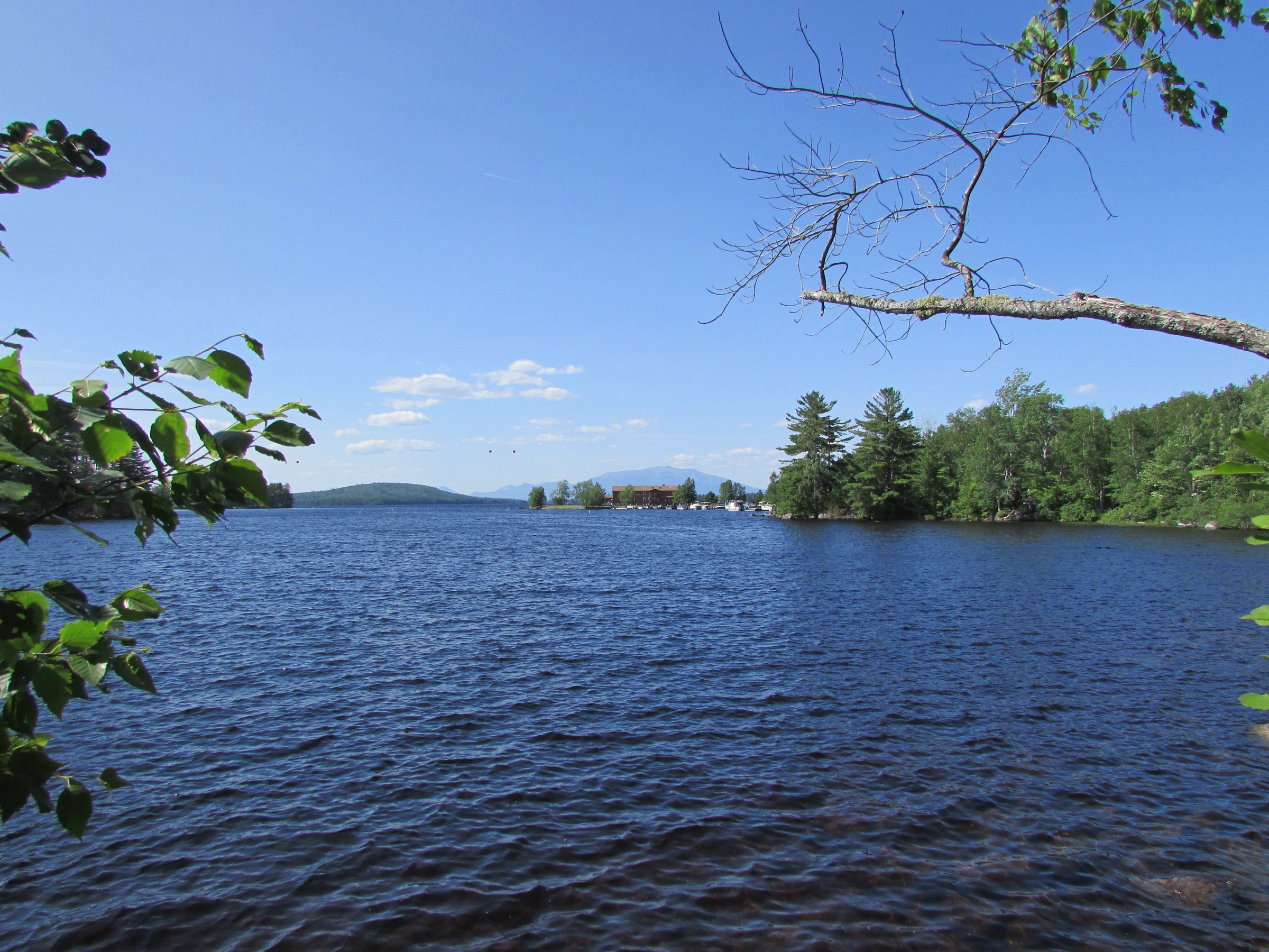
Baxter State Park is the wildest, most self-contained mountain landscape in the eastern United States. Its 209,644 acres — donated in twenty-eight tracts by former Maine Governor Percival Proctor Baxter between 1931 and 1962, and specifically deeded to be kept “forever wild” — enclose the entire Katahdin massif and forty-six other named peaks over 610 m (2,000 ft), a vast complex of glacial cirques, alpine tundra, boreal forest, and one of the largest roadless wildlands anywhere in the Appalachian chain. Katahdin itself — 1,606 m (5,269 ft / BSP publishes 5,267 ft) at Baxter Peak — is the highest point in Maine, the northern terminus of the Appalachian Trail, and the state’s only true above-treeline mountain outside a handful of exposed Rangeley and Bigelow summits.
The park operates as a legally distinct entity from the Maine BPL — governed by the Baxter State Park Authority (BSPA) — and its rules are correspondingly strict. Access is via three gate points: Togue Pond (south, Millinocket approach), Matagamon (north, Patten approach), and Nesowadnehunk (west, seasonal). Day-use requires a Non-Resident Vehicle Pass (US$20 per vehicle at time of writing) plus, for anyone hiking the Katahdin trails, a separate Katahdin Trailhead Pass (KTP) — introduced in 2024 as a US$10 per person reservation-required day-use pass for Katahdin’s five trailheads (Katahdin Stream, Roaring Brook, Abol, Kidney Pond, Chimney Pond via reservation). Maine residents pay no vehicle fee but still need the KTP for Katahdin. Reservations open in early April for the following season and the most popular trailheads (Roaring Brook, Katahdin Stream) sell out within days for peak weekends. Parking outside a reserved trailhead is not permitted. Pets are not allowed anywhere in the park, including the Appalachian Trail through-corridor. Drones are prohibited. There is no cell coverage anywhere in the park. Fires are only permitted at designated ring sites.
The park’s road network is narrow, unpaved, and deliberately slow: the Perimeter Road speed limit is 20 mph and the drive from Togue Pond gate to the Roaring Brook trailhead takes about 40 minutes each way. Roads typically open around 15 May (weather-dependent) and close 15 October for the season, with Katahdin trails closing for the year with weather closures often starting in mid-October. The main hiking season is mid-June to early October; snow lingers in Katahdin’s cirques into July and returns any time from mid-September. Blackflies dominate late May through late June; deer flies follow in July.
Katahdin itself deserves specific description. The massif is a single Silurian-Devonian granite pluton — roughly 30 km long — with three principal summits: Baxter Peak (1,606 m / 5,267 ft, AT northern terminus), Hamlin Peak (1,450 m / 4,756 ft), and Pamola Peak (1,509 m / 4,951 ft) at the head of the Knife Edge. The Knife Edge itself — a 1.1-mile (1.8 km) exposed ridge between Pamola and Baxter Peak, roughly 1.2 m wide at its narrowest and dropping thousands of feet on either side — is graded Class III/IV scrambling with no bail-out. It is the iconic Katahdin traverse and also the section most frequently closed by weather. Above-treeline exposure everywhere on Katahdin is real: the summit plateau of the Tableland alone is at over 1,400 m for kilometres of open tundra. Weather on Katahdin can shift from summer heat to freezing rain within an hour; the BSPA classifies the day’s climbing conditions in five categories at every trailhead register and closes trails outright when Class 4 is posted.
The hiking centres are Millinocket to the south (Togue Pond gate access, most Katahdin trailheads) and Patten to the north (Matagamon gate, north-end country). All park amenities are seasonal. Fuel, groceries, cell coverage and lodging end at Millinocket. Bring everything.
Selection rationale
The five walks below span the range of Katahdin experiences from thru-hiker classic to family-scale day. The Hunt Trail is the Appalachian Trail’s final 5.2 mi from Katahdin Stream Campground to Baxter Peak — the northern terminus AT day and the standard “how to climb Katahdin” route. The Cathedral–Knife Edge–Saddle loop is the mountain’s iconic and most-committed route, combining the technical Cathedral Trail up with the celebrated Knife Edge traverse to Baxter Peak and a controlled descent via the Saddle Trail — the traverse most Katahdin veterans return for. The Hamlin Peak day gives a genuine 4,000-footer alternative to Baxter Peak with markedly less traffic, using the beautiful Chimney Pond approach into the cirque of the Great Basin. South Turner Mountain is the park’s classic short summit day — a compact 6.4 km walk to a bare summit with the definitive frontal view of Katahdin and the Great Basin. The Owl closes the set — Katahdin Stream’s near neighbour, quieter than Katahdin, with a summit ledge looking directly across at the whole west face of the massif and none of the crowds. Together they cover Katahdin’s AT day (Hunt Trail), its iconic ridge (Knife Edge loop), a Katahdin-alternative 4,000-footer (Hamlin), the definitive Katahdin viewpoint (South Turner), and Katahdin’s quiet companion (The Owl).
Summary table
| # | Hike | Country | Route type | Distance | Gain | Max elevation | Difficulty |
|---|---|---|---|---|---|---|---|
| 1 | Katahdin via Hunt Trail (AT northern terminus) | USA | Out-and-back | ~16.7 km (~10.4 mi) | ~1,298 m | 1,606 m | Very strenuous |
| 2 | Katahdin — Cathedral + Knife Edge + Saddle loop | USA | Loop | ~18.0 km (~11.2 mi) | ~1,190 m | 1,606 m | Extreme (Class III/IV) |
| 3 | Hamlin Peak via Chimney Pond and Hamlin Ridge | USA | Out-and-back | ~14.8 km (~9.2 mi) | ~995 m | 1,450 m | Very strenuous |
| 4 | South Turner Mountain (Sandy Stream Pond) | USA | Out-and-back | ~6.4 km (~4.0 mi) | ~499 m | 951 m | Moderate |
| 5 | The Owl via Katahdin Stream | USA | Out-and-back | ~10.6 km (~6.6 mi) | ~762 m | 1,125 m | Strenuous |
1. Katahdin via the Hunt Trail — Appalachian Trail northern terminus
Snapshot
Itinerary
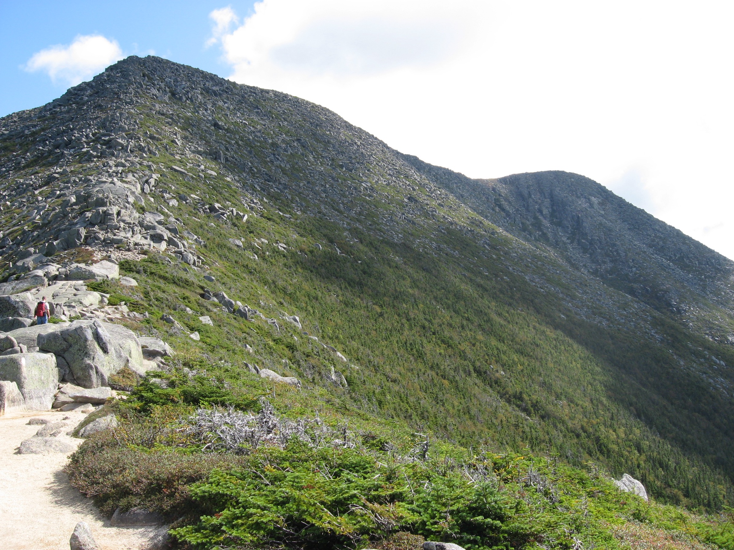
From Katahdin Stream Campground (KTP-reserved trailhead), pick up the Hunt Trail / Appalachian Trail heading north-east. The first ~1.6 km climbs steadily through mixed hardwood and reaches the signed spur to Katahdin Stream Falls, a short worthwhile detour to a 20 m cascade. Beyond the falls the trail steepens as it enters spruce-fir forest and climbs onto the Hunt Spur — an increasingly rocky ridge that abandons soil for pure granite by about the 4.5 km mark. The Hunt Spur boulder scramble follows: roughly 1 km of sustained Class II scrambling on rebar-and-iron-handhold sections, with genuine hand-over-foot movement required in several places. The scramble tops out at The Gateway at about 1,340 m, where the trail breaks onto the vast alpine plateau known as the Tableland. From the Gateway the trail crosses open tundra to Thoreau Spring (the last reliable water, named for Henry David Thoreau, who reached it during his 1846 Katahdin ascent), then climbs the final ~180 m to Baxter Peak at 1,606 m (5,269 ft) — marked by the iconic wooden AT northern terminus sign. The panorama from Baxter is one of the finest in the eastern USA: south down Hunt Spur and across the West Branch Penobscot, east into the Great Basin cirque with the Knife Edge curling to Pamola, north over Hamlin Ridge, and west across the Nesowadnehunk plateau. Return by the same route; there is no shorter way down.
Why it is essential
The Hunt Trail is the final 5.2 miles of the 3,500 km Appalachian Trail — the celebrated northern terminus that every thru-hiker completes at Baxter Peak. It is Katahdin’s most-climbed route and the standard “how to climb the mountain” itinerary. The Hunt Spur boulder scramble is one of the AT’s most technically demanding sections and the Tableland crossing is one of the largest continuous alpine plateaus in the eastern United States. Doing the Hunt Trail is doing the mountain — and doing the AT.
Equipment
- Sturdy boots with sticky rubber for the boulder scramble
- Weatherproof shell — Tableland is fully exposed for ~3 km
- Warm insulating layer, hat and gloves for the summit even in July
- 4 L water — Thoreau Spring is the last source and reliability varies
- Sun protection for the Tableland
- Trekking poles (optional; stow for the scramble)
- Map, compass and downloaded BSPA map
- Headtorch — 12-hour days are common
- Blackfly net and repellent in June
- Cash / KTP printout for the trailhead register
Hazards and notes
- Katahdin Trailhead Pass required — book in advance via baxterstatepark.org (opens early April)
- Alpine exposure for ~3 km on the Tableland; lightning is the primary hazard — check the trailhead class rating (Class 4 = closed) before starting
- Hunt Spur boulder scramble is Class II with rebar aids; descent is slower and harder than ascent — start early
- No pets; no drones; carry all trash out
- No cell coverage anywhere in the park
- Thoreau Spring can go dry in late summer — carry the full 4 L
- Do not descend the Knife Edge from Baxter Peak in marginal weather — return the way you came
- Baxter State Park roads close ~15 October; Katahdin trails close for the winter typically mid-October
GPX / KML links
| Source | URL | Format | Notes |
|---|---|---|---|
| Baxter State Park Authority | baxterstatepark.org | Official park page | KTP, hours, class rating, closures |
| Appalachian Trail Conservancy — Katahdin | appalachiantrail.org | Official AT organisation | Northern terminus context |
| Maine Trail Finder — Hunt Trail | mainetrailfinder.com | State-supported database | Route description |
Sources
2. Katahdin — Cathedral, Knife Edge and Saddle loop
Snapshot
Itinerary
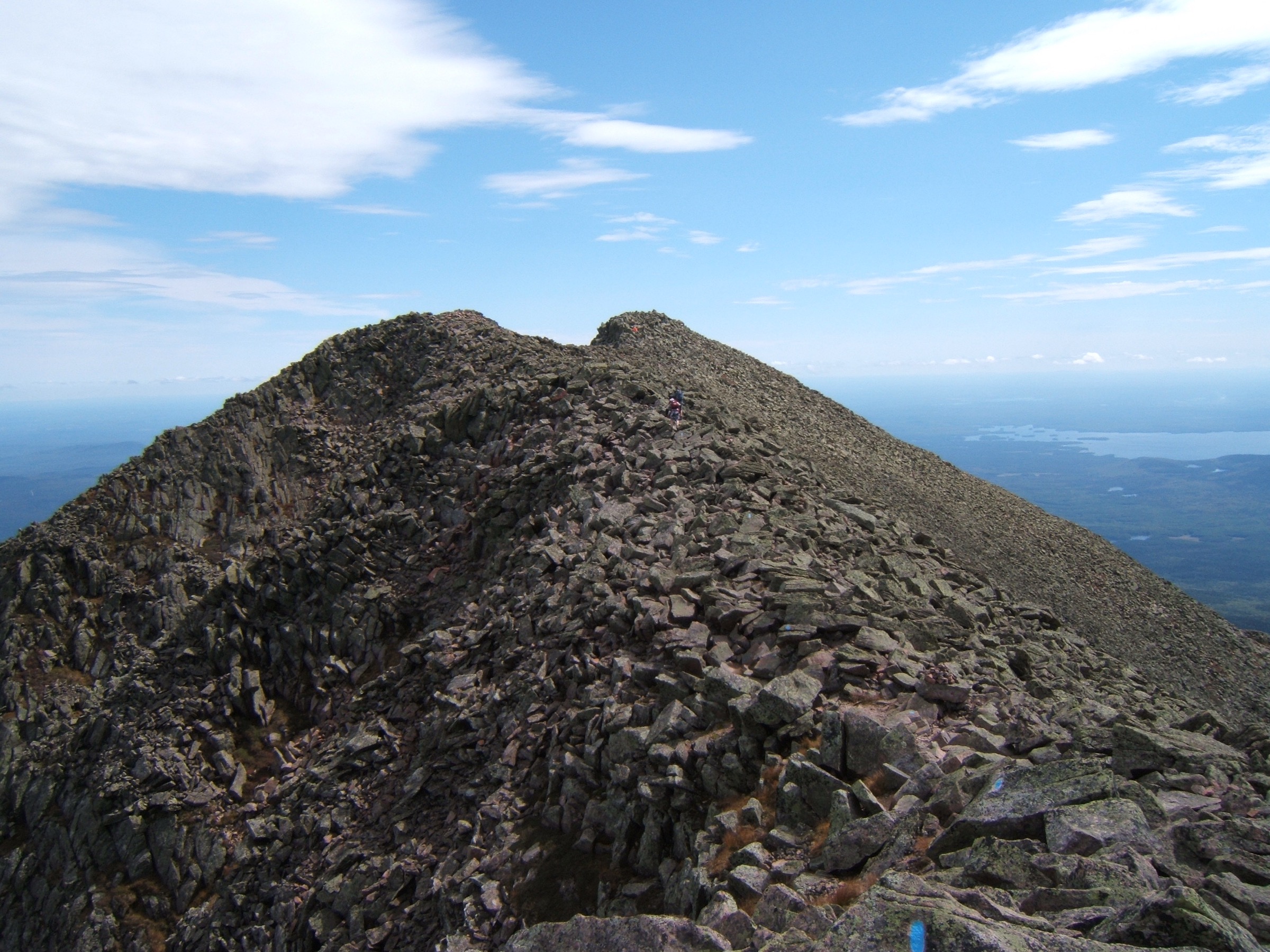
From Roaring Brook Campground (KTP-reserved trailhead), pick up the Chimney Pond Trail heading west. The trail follows the Roaring Brook drainage for ~5.2 km, climbing gradually through mixed forest past Basin Pond to arrive at Chimney Pond at ~880 m — a small blue tarn in the enormous glacial cirque of the Great Basin, hemmed on three sides by 700 m of vertical Katahdin granite. The Chimney Pond Campground here has the park’s ranger station; check the day’s class rating before proceeding. From Chimney Pond, take the Cathedral Trail heading south-west and immediately begin one of the steepest sustained trails in Maine — a boulder-and-slab scramble past the three prominent Cathedral rock formations (Class II with genuine exposure). The Cathedral Trail gains ~730 m in just 2.2 km and tops out on the Tableland just below Baxter Peak at 1,606 m (5,269 ft). From Baxter Peak, descend south-east onto the Knife Edge — a 1.1 mi (1.8 km) exposed Class III/IV traverse over South Peak (1,533 m) and Chimney Peak to Pamola Peak at 1,509 m (4,951 ft). The ridge is roughly 1.2 m wide at its narrowest with thousand-foot drops on both sides; hand-over-foot scrambling is required at the Chimney (a short exposed downclimb between South Peak and Chimney Peak). Once at Pamola, take the Dudley Trail back down to Chimney Pond (a further steep boulder descent), then return by the Chimney Pond Trail to Roaring Brook. The classic variant reverses this — up Saddle, across Knife Edge west-to-east, down Cathedral — but the Cathedral ascent + Knife Edge west-bound + Saddle descent is the more forgiving direction for descent-shy parties.
Why it is essential
The Cathedral / Knife Edge loop is Katahdin’s — and arguably the eastern USA’s — iconic mountain traverse. The Knife Edge is the defining Katahdin experience: 1.8 km of Class III/IV exposed scrambling between Pamola and Baxter Peak, with no possible retreat mid-ridge once committed. It is regularly ranked among the ten most exposed non-technical ridges in North America, and adds Katahdin’s principal summit + Pamola as a bonus. Serious weather commitment, real exposure, and a genuine scrambling challenge — the essential Katahdin day for experienced mountain walkers.
Equipment
- Sticky rubber approach shoes or lightweight boots — the Cathedral scramble and Knife Edge favour precise footwork
- Weatherproof shell — Knife Edge is fully exposed
- Warm insulating layer, hat and gloves for the ridge even in July
- 4 L water — no source above Chimney Pond
- Sun protection for the ridge
- Helmet (optional but recommended by many for the Knife Edge downclimbs)
- Map, compass and downloaded BSPA map
- Headtorch — 13-hour days are common
- Blackfly net and repellent in June
- Cash / KTP printout for the trailhead register
Hazards and notes
- Katahdin Trailhead Pass required — book in advance
- Knife Edge has NO bail-out for 1.8 km — commit only in stable weather with a full weather window
- Class ratings at trailhead register: Cathedral and Knife Edge close at Class 3+ ratings; do not attempt in wet, windy or icy conditions
- Cathedral Trail is one of the steepest sustained trails in Maine — descend only in emergency
- The Chimney downclimb between South and Chimney Peaks is the ridge’s technical crux — reversible only with care
- No pets; no drones; no cell coverage
- Chimney Pond ranger station has a class board and shelter in emergency
- Do NOT attempt the loop as your first Katahdin ascent — climb Hunt Trail first
- Fatalities on the Knife Edge occur roughly annually, most weather-related — respect the class rating
GPX / KML links
| Source | URL | Format | Notes |
|---|---|---|---|
| Baxter State Park Authority | baxterstatepark.org | Official park page | KTP, class rating, closures |
| Maine Trail Finder — Knife Edge | mainetrailfinder.com | State-supported database | Route description |
| Baxter State Park — Trail closures / class ratings | baxterstatepark.org | Official | Daily class rating |
Sources
3. Hamlin Peak via Chimney Pond and Hamlin Ridge
Snapshot
Itinerary
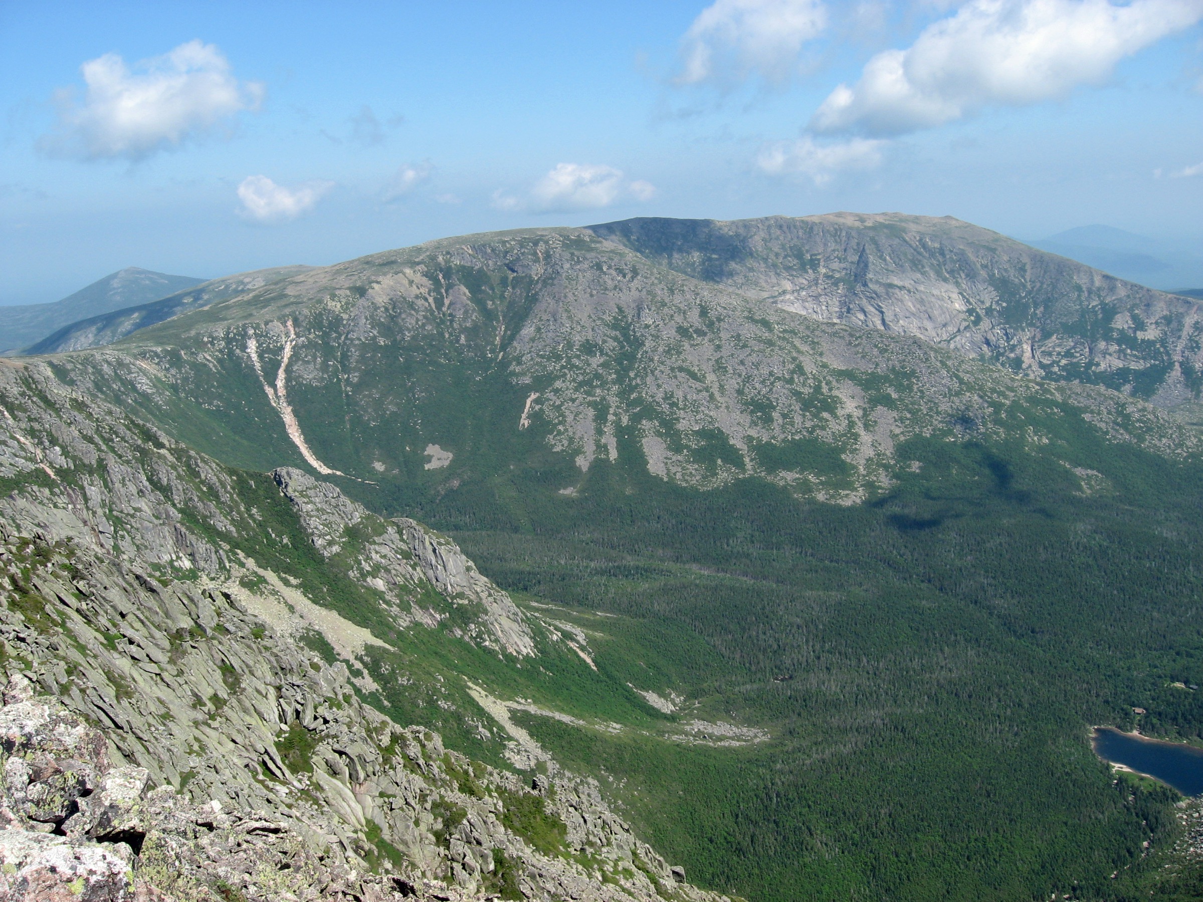
From Roaring Brook Campground (KTP-reserved trailhead), follow the Chimney Pond Trail west for ~5.2 km to Chimney Pond at ~880 m — the same approach as for the Knife Edge loop. At Chimney Pond, check the class rating and pick up the Hamlin Ridge Trail heading north-west out of the campground. The trail immediately climbs steeply out of the cirque onto the ridge — the first 400 m is the crux, a sustained boulder-and-scrub scramble that eventually breaks onto the open Hamlin Ridge itself. The ridge is a magnificent line: an entirely above-treeline arête running roughly 2 km north-west between the Great Basin (south) and the North Basin (north), with continuous views into both cirques and across to the summit plateau of the Tableland. The trail gains steadily along the ridge and reaches Hamlin Peak at 1,450 m (4,756 ft) — Maine’s second-highest summit and one of only three named Maine 4,700-footers. The view is exceptional and typically far less crowded than Baxter Peak: south across the Great Basin to Baxter Peak and the Knife Edge, east down Hamlin Ridge and across the North Basin, west over the Northwest Plateau to the Klondike, and north across the roadless Baxter interior. Return by the same route. A slightly longer variant descends via the North Basin Trail from just below Hamlin to Chimney Pond, adding a fine walk through the smaller North Basin cirque past Blueberry Knoll.
Why it is essential
Hamlin Peak is Maine’s second-highest summit, a legitimate 4,000-footer with all of Katahdin’s alpine character and a fraction of Baxter Peak’s traffic — no Appalachian Trail, no Knife Edge, no Hunt Spur queue. The Hamlin Ridge line between the Great Basin and North Basin cirques is one of the finest ridge walks in the eastern USA, entirely above treeline for the last 2 km. It is the ideal Katahdin day for parties who have already done the Hunt Trail or Knife Edge, or who want a genuine 4,000-footer without the extreme exposure of the Knife Edge crossing.
Equipment
- Sturdy boots with sticky rubber for the Hamlin Ridge scramble
- Weatherproof shell — ridge is fully exposed for ~2 km
- Warm insulating layer, hat and gloves for the summit
- 3.5 L water — no source above Chimney Pond
- Sun protection for the ridge
- Trekking poles for the approach
- Map, compass and downloaded BSPA map
- Headtorch — 10-hour days are common
- Blackfly net and repellent in June
- Cash / KTP printout for the trailhead register
Hazards and notes
- Katahdin Trailhead Pass required — book in advance
- Alpine exposure on the ridge for ~2 km; lightning is the primary hazard — check trailhead class rating
- Hamlin Ridge Trail’s first 400 m out of Chimney Pond is very steep and loose — descend carefully
- The Northwest Plateau above Hamlin is broad and can be confusing in fog — follow cairns carefully
- No pets; no drones; no cell coverage
- Chimney Pond is a checkpoint; consider it as a turn-back option in marginal weather
- Do not attempt Hamlin Ridge Trail in poor weather when Cathedral is closed — the exposure is similar
GPX / KML links
| Source | URL | Format | Notes |
|---|---|---|---|
| Baxter State Park Authority | baxterstatepark.org | Official park page | KTP, class rating, closures |
| Maine Trail Finder — Hamlin Ridge | mainetrailfinder.com | State-supported database | Route description |
Sources
4. South Turner Mountain via Sandy Stream Pond
Snapshot
Itinerary
From the Roaring Brook Campground day-use parking area, follow the Russell Pond Trail briefly north-east, then take the signed South Turner Mountain Trail heading east. Within 400 m the trail passes the western shore of Sandy Stream Pond — a shallow pond with a boardwalk platform that offers the classic frontal view of Katahdin’s east face reflected in still water; it is one of the park’s most-photographed compositions and moose sightings from the platform are near-daily in early morning and evening. Beyond Sandy Stream the trail continues east through mixed forest, gently at first, then climbs steadily through spruce-fir. The final ~1 km steepens dramatically as it breaks onto the summit boulder field, with a short exposed scramble to the summit of South Turner Mountain at 951 m (3,120 ft). The summit is a compact opening in the trees with one of the finest all-Katahdin panoramas in the park — the entire east face and Great Basin cirque directly across the valley, the full Knife Edge in profile, Hamlin Ridge, and Katahdin’s north end, all from a single vantage. Return by the same route; the boulder field descent requires care. Sandy Stream Pond is worth an additional 15 min stop on the descent.
Why it is essential
South Turner is Baxter State Park’s essential moderate day — a compact 6.4 km walk to a bare summit with what many consider the definitive frontal view of Katahdin. It is the standard family / recovery / weather-hold day within the park: short enough for a half-day, no KTP required, and Sandy Stream Pond en route is one of Maine’s most reliable moose-viewing locations. For any Baxter trip involving a Katahdin summit day, South Turner is the ideal contrasting itinerary — the mountain seen whole, from outside.
Equipment
- Sturdy hiking boots with grip on wet granite
- Weatherproof shell
- Warm layer for the summit
- 2 L water
- Sun protection for the summit
- Trekking poles helpful on the steep upper third
- Map, compass and downloaded BSPA map
- Binoculars for moose at Sandy Stream Pond
- Blackfly net and repellent in June
Hazards and notes
- Vehicle reservation for Roaring Brook is strongly recommended in peak season
- KTP is not required for South Turner (non-Katahdin trail)
- Upper boulder field is exposed to lightning and slippery when wet
- No pets; no drones; no cell coverage
- Sandy Stream Pond boardwalk: keep quiet at dawn / dusk for the best moose viewing
- Do not approach moose closer than ~30 m — cows with calves in June are particularly defensive
GPX / KML links
| Source | URL | Format | Notes |
|---|---|---|---|
| Baxter State Park Authority | baxterstatepark.org | Official park page | Access, reservations |
| Maine Trail Finder — South Turner | mainetrailfinder.com | State-supported database | Route description |
Sources
5. The Owl via Katahdin Stream
Snapshot
Itinerary
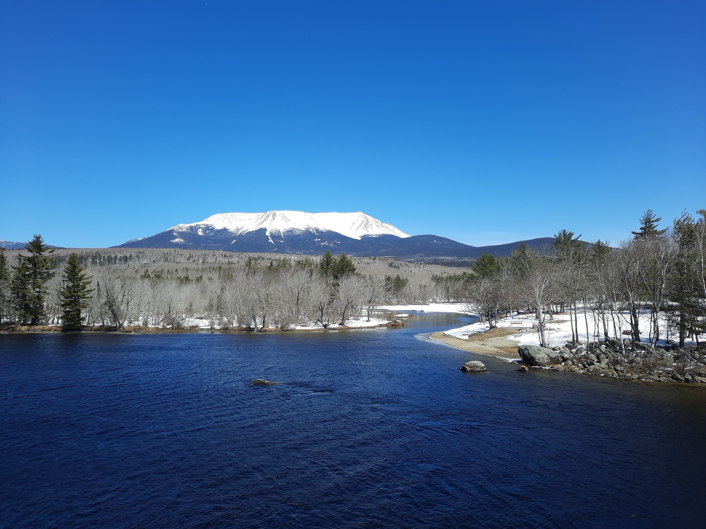
From Katahdin Stream Campground, follow the Hunt Trail / Appalachian Trail north-east for the first ~1.6 km — the same approach as for the Hunt Trail Katahdin ascent — as far as the signed junction with the Owl Trail. The Owl Trail branches left (north-west), immediately leaving AT thru-hiker traffic behind. The trail climbs steadily through spruce-fir forest, crossing several small streams, then steepens into a series of rock-step climbs as it approaches The Owl’s granite face. The upper 500 m is the crux: a sustained boulder-and-slab scramble with one short exposed section requiring hand-over-foot moves on granite ledges (nothing technical, but genuine exposure with the ground falling steeply away). The summit ledge at ~1,125 m (3,700 ft) is a broad open granite viewpoint looking directly east across Katahdin Stream to the west face of Katahdin — the view runs straight up the Hunt Spur, over The Gateway, and across the full Tableland to Baxter Peak. It is one of the very few outside-Katahdin perspectives on the mountain that lets you see the entire Hunt Trail ascent line in one frame, from Katahdin Stream Falls to Thoreau Spring. Return by the same route; the boulder-and-slab section requires care on descent.
Why it is essential
The Owl is Katahdin’s quiet neighbour — a short-of-4,000-feet summit with a first-rate frontal view of the mountain from the west, and none of the traffic. It shares the Katahdin Stream trailhead with the Hunt Trail but branches off within 1.6 km and typically sees a fraction of the walkers. The summit ledge stares directly across at the west face of Katahdin — the Hunt Spur boulder scramble, The Gateway, the Tableland and Baxter Peak all visible at once — making it the definitive “seeing Katahdin from outside” view within the park itself. Ideal as a Katahdin-alternative day, a weather-hold, or a companion day to a Hunt Trail summit.
Equipment
- Sturdy boots with sticky rubber for the upper scramble
- Weatherproof shell
- Warm insulating layer for the summit ledge
- 2.5 L water — treat stream water on the lower trail
- Sun protection for the ledge
- Trekking poles for the descent
- Map, compass and downloaded BSPA map
- Blackfly net and repellent in June
Hazards and notes
- Vehicle reservation for Katahdin Stream is strongly recommended in peak season
- KTP is not required for The Owl (non-Katahdin trail)
- Upper scramble is exposed and slippery when wet — descend with care
- Summit ledge is exposed to lightning
- No pets; no drones; no cell coverage
- The Owl Trail is not maintained to the same standard as Katahdin routes — expect longer stretches without recent tread work
GPX / KML links
| Source | URL | Format | Notes |
|---|---|---|---|
| Baxter State Park Authority | baxterstatepark.org | Official park page | Access, reservations |
| Maine Trail Finder — The Owl | mainetrailfinder.com | State-supported database | Route description |
Sources
Missing data / follow-up work
- South Turner summit photograph — no CC-licensed image of the South Turner summit or the Sandy Stream Pond boardwalk view of Katahdin at ≥2400 px was available at time of writing on Wikimedia Commons. Users are encouraged to consult the BSPA site for representative photography.
- Katahdin Trailhead Pass (KTP) rules for 2026 — the KTP was introduced in 2024 at US$10 per person for the five Katahdin trailheads, with reservations opening in early April. Fees and dates are set annually by the Baxter State Park Authority; verify current rates at baxterstatepark.org before travel.
- Vehicle reservation policy 2026 — the BSPA takes vehicle reservations for peak-season parking at Roaring Brook and Katahdin Stream that typically fill within days of opening. Verify current opening dates and quotas at baxterstatepark.org.
- Katahdin class rating — BSPA posts a Class 1–5 rating each morning at every trailhead register; Class 4 closes Katahdin trails. This is the single most important pre-hike check inside the park.
- Baxter Peak elevation — Wikipedia and USGS both list 5,269 ft (1,606 m); BSPA signage and older publications list 5,267 ft — the difference reflects a 1989 survey re-measurement. Both are still in common use.
- The Owl summit elevation — sources vary between 3,680 ft and 3,730 ft; the figure of ~3,700 ft (~1,125 m) is a mid-range consensus.
- Perimeter road status — the Baxter Perimeter Road is a narrow gravel road with a 20 mph speed limit; road conditions and mud-season openings vary annually. Confirm status with BSPA before travel.
Further reading
| Source | URL |
|---|---|
| Baxter State Park Authority | baxterstatepark.org |
| Appalachian Trail Conservancy | appalachiantrail.org |
| Maine Trail Finder | mainetrailfinder.com |
| Friends of Baxter State Park | friendsofbaxter.org |
| Maine Appalachian Trail Club (MATC) | matc.org |
| Maine Bureau of Parks and Lands | maine.gov/dacf/parks |
| Katahdin Woods and Waters National Monument (adjacent) | nps.gov/kaww |
| USGS — Mount Katahdin | usgs.gov |
| New England 4,000-Footer Committee | amc4000footer.org |