Regional overview
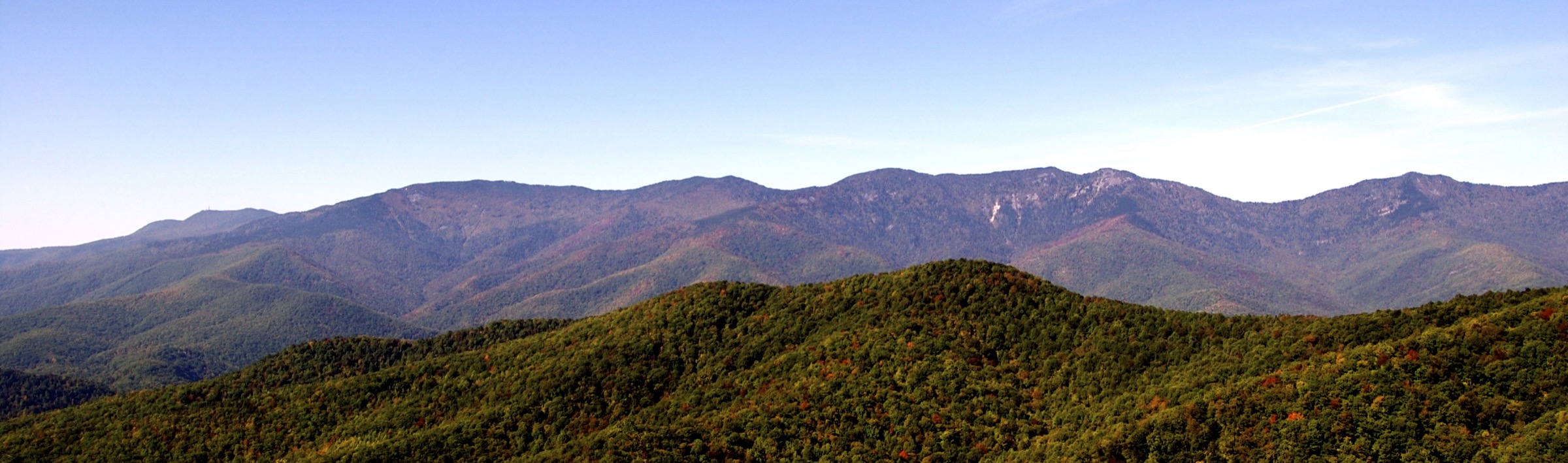
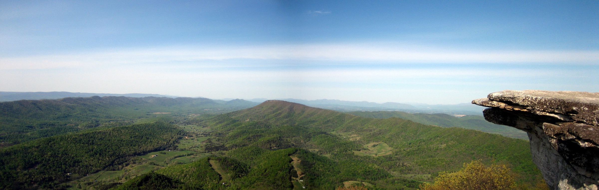
This Virginia Blue Ridge entry covers the central and southwest Virginia Blue Ridge outside the already catalogued Shenandoah / northern Blue Ridge article. The hiking character is defined by Appalachian Trail ridge walks near Roanoke, Blue Ridge Parkway trailheads, steep quartzite outcrops, wooded waterfall gorges and short but hard climbs to historic summit viewpoints.
Most routes are non-technical hikes, but several are physically demanding. Dragon’s Tooth involves hands-on rock scrambling near the crest of Cove Mountain. McAfee Knob and the Apple Orchard Falls loop are long enough to punish a late start. Crabtree Falls has a long record of serious accidents when visitors leave the trail or climb wet rocks. Summer brings heat, thunderstorms, ticks and crowded parking; winter and the shoulder seasons can bring ice, closed Parkway sections and slippery rock.
Access is mainly by private vehicle, with limited seasonal shuttle help around McAfee Knob and Dragon’s Tooth. Official downloadable GPX / KML files were not found for most routes during verification; official route pages, agency maps and secondary route-file sources are listed for each hike below.
Selection rationale
The five routes cover the central and southwest Virginia Blue Ridge: the iconic Appalachian Trail ledge at McAfee Knob, the harder quartzite scramble of Dragon’s Tooth, the historic Sharp Top summit at Peaks of Otter, the major waterfall staircase of Crabtree Falls, and the Apple Orchard Falls / Cornelius Creek stream-and-waterfall loop. Humpback Rocks is not repeated because it already appears in the Shenandoah / northern Blue Ridge entry.
Summary
| # | Hike | Route type | Distance | Gain | Max elevation | Difficulty |
|---|---|---|---|---|---|---|
| 1 | McAfee Knob via the Appalachian Trail | Out-and-back | 12.1–12.9 km | ~480–520 m | ~974 m | Moderate–strenuous |
| 2 | Dragon’s Tooth | Out-and-back (loop option) | 7.2–8.0 km | ~365–630 m | ~922 m | Difficult |
| 3 | Sharp Top Trail | Out-and-back | 4.8 km | 396 m | 1,181 m (3,875 ft) | Strenuous |
| 4 | Crabtree Falls Trail | Out-and-back | 4.8–5.3 km | ~331–363 m | Not resolved | Moderate–strenuous |
| 5 | Apple Orchard Falls and Cornelius Creek Loop | Loop | 9.0–12.5 km | ~529–654 m | ~1,056 m | Moderate–difficult |
1. McAfee Knob via the Appalachian Trail
Snapshot
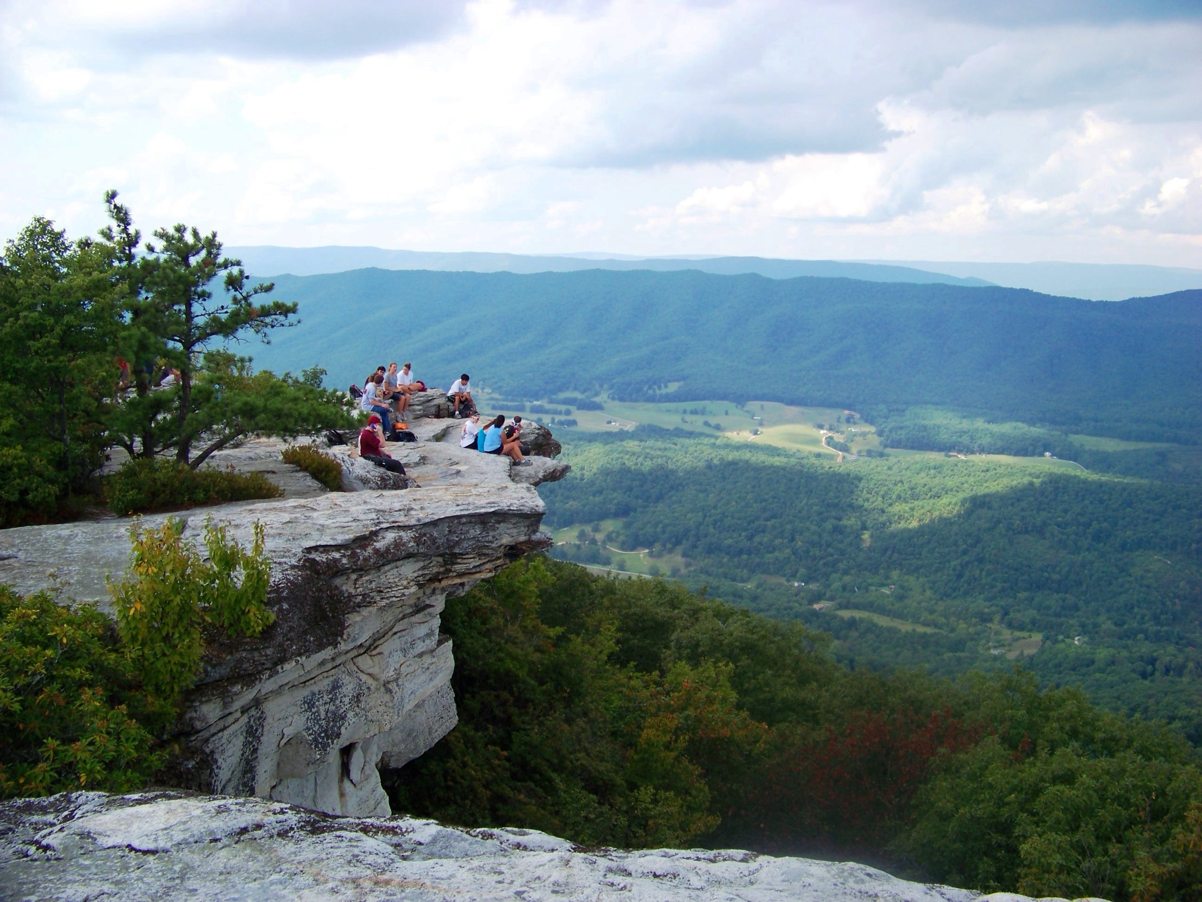
Photo status: no in-body figure was shipped in this pass. A CC BY-SA 3.0 image McAfee Knob by Something Original is available on Wikimedia Commons.
Itinerary
From the VA 311 trailhead, cross the pedestrian bridge and follow the white-blazed Appalachian Trail north. The trail climbs steadily through forest, passing the informational kiosk, boardwalk sections, Johns Spring Shelter and Catawba Mountain Shelter. After an old fire road and a power-line opening, continue to the short spur for McAfee Knob.
Most parties retrace the AT. Some use the fire-road return variant, which changes the distance and walking character but not the summit objective.
Why it is essential
McAfee Knob is one of the best-known viewpoints on the Appalachian Trail and the emblematic Roanoke-area Blue Ridge hike. The overhanging ledge, the broad view toward the Catawba Valley, North Mountain, Tinker Cliffs and the Roanoke Valley, and the managed access issues all make it central to the region’s day-hiking identity.
Equipment
- Sturdy footwear, trekking poles.
- Water, food, sun protection.
- Weather layer; warm layer outside midsummer.
- Map / offline route, headtorch, tick protection.
- Microspikes in icy conditions.
Hazards and notes
- Parking at VA 311 is heavily used; shoulder parking is prohibited and subject to towing.
- ATC notes seasonal shuttle service for the McAfee Knob and Dragon’s Tooth trailheads.
- Dogs must be leashed on the Appalachian Trail.
- No camping or campfires on McAfee Knob or Tinker Cliffs; use only designated overnight sites.
- ATC listed ongoing bear activity in the McAfee Knob area in June 2026; manage food and trash carefully.
GPX / route file
| Source | URL | Format | Notes |
|---|---|---|---|
| Roanoke Outside — Appalachian Trail / McAfee Knob | roanokeoutside.com | Route description and map links | Route and access verification |
| Appalachian Trail Conservancy — Virginia | appalachiantrail.org | Official trail-organisation page | AT context, shuttle and current alerts |
| Trails-Viewer — McAfee Knob via AT | en-us.trails-viewer.com | Secondary route map / profile | Route geometry source; reuse licence unresolved |
No official Appalachian Trail Conservancy GPX or KML was found for this route.
Sources
- ATC — Virginia
- ATC — McAfee Knob pedestrian bridge opens
- ATC — McAfee Knob area bear activity
- Roanoke Outside — Appalachian Trail / McAfee Knob
- Wikimedia Commons — McAfee Knob
2. Dragon’s Tooth
Snapshot
Photo status: no in-body figure was shipped in this pass. A CC BY-SA 2.0 route-area image Virginia countryside on Dragon’s Tooth trail by Scott Teresi is available on Flickr; a licence-compatible photo of the rock feature itself has not been resolved.
Itinerary
Start at the Dragon’s Tooth parking area and follow Dragon’s Tooth Trail toward Lost Spectacles Gap. Join the Appalachian Trail and turn toward the Cove Mountain crest. The upper section becomes steep, rocky and scrambly, with several sections where hands may be needed. A short spur reaches the Dragon’s Tooth quartzite outcrop.
Most hikers return the same way. A common loop variant continues briefly on the Appalachian Trail to the Boy Scout Trail connector, then returns to the lower Dragon’s Tooth Trail near the trailhead.
Why it is essential
Dragon’s Tooth is the hardest and most technical-feeling of the Roanoke-area Triple Crown day hikes. The Tuscarora quartzite spires, exposed rock steps and Appalachian Trail setting make it a distinctive counterpoint to McAfee Knob’s broader ledge walk.
Equipment
- Sturdy boots or shoes with excellent traction; gloves useful on the scramble.
- Water, food, weather layer.
- Map / offline route, headtorch.
- Do not attempt the scramble in icy conditions without appropriate traction and judgement.
Hazards and notes
- The upper trail has rock scrambles and fall consequences; wet leaves, rain, snow or ice make it unsafe.
- The trailhead parking lot is small and fills quickly; parking on VA 311 is not allowed.
- Visit Roanoke notes camping is not allowed at Dragon’s Tooth because the trail / parking area sits within a Special Biological Area.
- Dogs may struggle on the rock sections even where leashed dogs are otherwise allowed.
GPX / route file
| Source | URL | Format | Notes |
|---|---|---|---|
| Visit Virginia’s Blue Ridge — Dragon’s Tooth | visitroanokeva.com | Local guide route description | Access and route verification |
| USFS — Boy Scout Trail | fs.usda.gov | Official connector-trail description | Verifies the loop connector |
| Trailforks — Appalachian Trail / Dragon’s Tooth | trailforks.com | Secondary route map | GPX / KML login-gated; reuse licence unresolved |
No official Forest Service GPX or KML was found for this route.
Sources
- Visit Virginia’s Blue Ridge — Dragon’s Tooth
- USFS — Boy Scout Trail
- Roanoke Outside — Appalachian Trail / Dragon’s Tooth and shuttle notes
- Flickr — Virginia countryside on Dragon’s Tooth trail
3. Sharp Top Trail
Snapshot
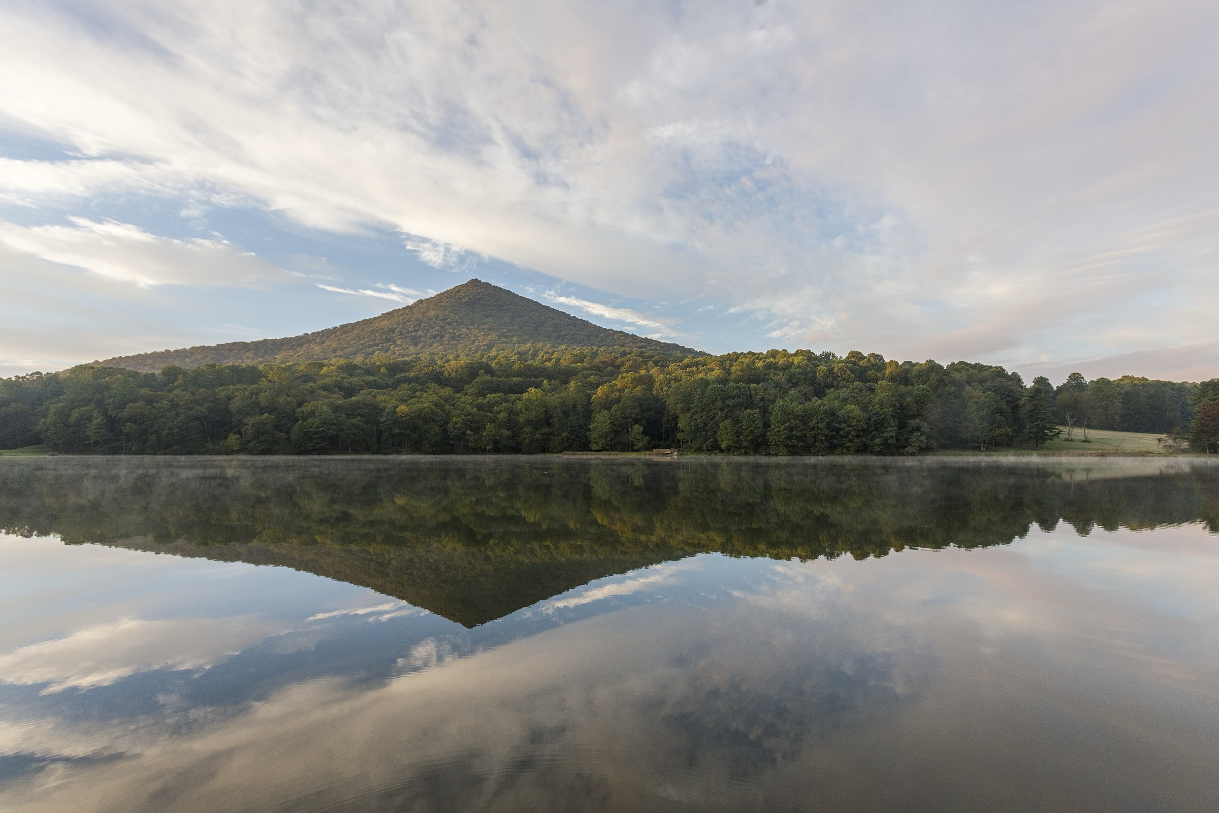
Photo status: no in-body figure was shipped in this pass. A CC BY 2.0 image Hike Peaks of Otter — Sharp Top by vastateparksstaff is available on Wikimedia Commons.
Itinerary
The trail starts near the Peaks of Otter visitor area and climbs directly through forest toward the rocky Sharp Top summit. The route is short but steep — about 1,300 ft in 1.5 mi. Near the summit, rock outcrops open to 360-degree views over the Peaks of Otter, Abbott Lake, the Virginia Piedmont, the Shenandoah Valley and the Allegheny Mountains. The optional Buzzard’s Roost spur adds further rock viewpoints.
Why it is essential
Sharp Top is one of Virginia’s classic Blue Ridge Parkway summit hikes. Its historic tourist tradition, compact difficulty and prominent 360-degree summit view make it a natural representative of the Peaks of Otter landscape.
Equipment
- Hiking shoes or boots.
- Water, food, rain layer, warm layer, sun protection.
- Map / offline route; traction in icy conditions.
Hazards and notes
- NPS states there is no drinking water on the summit.
- Short but steep — treat as strenuous.
- Parkway weather, winter closures or storm damage may affect access.
- The seasonal bus is a concession service; check schedules locally.
GPX / route file
| Source | URL | Format | Notes |
|---|---|---|---|
| NPS — Sharp Top | nps.gov | Official route description | Route and statistic verification |
| NPS — Peaks of Otter hiking trails | home.nps.gov | Official trail listing | Trail description and bus / access notes |
No official National Park Service GPX or KML was found for this route.
Sources
4. Crabtree Falls Trail
Snapshot
Photo status: no in-body figure was shipped in this pass. A public-domain U.S. Forest Service image Crabtree Falls is available on Wikimedia Commons and would be a natural cover candidate.
Itinerary
The trail starts at the Crabtree Falls day-use parking area. A short accessible lower section reaches the first waterfall view. Beyond it, the route climbs steeply beside Crabtree Creek on dirt path, stairs and overlook spurs, passing multiple cascades. The standard day-hike reaches upper viewpoints near the top of the falls before returning the same way.
Why it is essential
Crabtree Falls is one of Virginia’s best-known waterfall hikes and a defining Blue Ridge gorge route. The series of major cascades, the steep forested climb and repeated viewpoints give it a very different character from the ridge and summit hikes elsewhere in this entry.
Equipment
- Hiking shoes or boots with good traction; trekking poles help on descent.
- Water, food, weather layer, sun protection.
- Map / offline route.
- Microspikes in icy periods.
Hazards and notes
- Nelson County warns that serious accidents have occurred when visitors leave the marked trail or climb on wet rocks near the falls.
- Stay behind barriers; do not climb the waterfall rock.
- The day-use area charges a parking / entry fee per Virginia DWR and AllTrails listings.
- Rocks, stairs and roots can be slippery after rain.
GPX / route file
| Source | URL | Format | Notes |
|---|---|---|---|
| Nelson County — Crabtree Falls | nelsoncounty.com | Local tourism route and safety description | Route, safety and management context |
| AllTrails — Crabtree Falls Trail | alltrails.com | Secondary route map / statistics | Route geometry source; reuse licence unresolved |
No official Forest Service GPX or KML was found for this route.
Sources
- Nelson County — Crabtree Falls
- Virginia DWR — Crabtree Falls (U.S. Forest Service)
- AllTrails — Crabtree Falls Trail
- Wikimedia Commons — Crabtree Falls
5. Apple Orchard Falls and Cornelius Creek Loop
Snapshot
Photo status: no licence-compatible image was placed in this pass.
Itinerary
From Sunset Fields, Apple Orchard Falls Trail descends from the Blue Ridge Parkway, crosses the Appalachian Trail, and follows North Creek toward the waterfall. The trail reaches a wooden platform and boardwalk near the falls. Loop variants continue lower and return by Cornelius Creek Trail, using either a spur / connector or an AT segment to close the loop.
Starting from the North Creek trailhead reverses the grade pattern and makes the waterfall a shorter objective, while the full loop gives a more complete stream-and-cascade route.
Why it is essential
Apple Orchard Falls and Cornelius Creek give the Virginia Blue Ridge a strong stream-and-waterfall circuit, distinct from the open-rock summits around Roanoke and Peaks of Otter. The route also ties together the Blue Ridge Parkway, Appalachian Trail and Jefferson National Forest trail system.
Equipment
- Sturdy footwear, trekking poles.
- Water, food, weatherproof layer, warm layer.
- Map / offline route, headtorch.
- Tick protection in warm months; microspikes on icy stairs.
Hazards and notes
- USFS states there is no drinking water; treat natural water.
- The official Apple Orchard Falls Trail is closed to motorised vehicles and to saddle / pack / draft animals under a Forest Supervisor’s Order.
- Loop distances vary because hikers can use different connectors and trailheads.
- Parkway closures, storm damage and forest-road conditions can affect access.
GPX / route file
| Source | URL | Format | Notes |
|---|---|---|---|
| USFS — Apple Orchard Falls Trail | fs.usda.gov | Official trail description | Official trail segment and access details |
| Lexington, Virginia — Apple Orchard Falls Trail | lexingtonvirginia.com | Local guide description | Loop-variant distances |
| Gaia GPS — Apple Orchard Falls Loop | gaiagps.com | Secondary GPX / KML source | Reuse licence unresolved |
No official Forest Service GPX or KML was found for this route.
Sources
- USFS — Apple Orchard Falls Trail
- Lexington, Virginia — Apple Orchard Falls Trail
- Outdooractive — Apple Orchard Falls
- Gaia GPS — Apple Orchard Falls Loop
Region-level sources
| Source | URL |
|---|---|
| Appalachian Trail Conservancy — Virginia | appalachiantrail.org |
| Roanoke Outside — Appalachian Trail | roanokeoutside.com |
| Visit Virginia’s Blue Ridge — Dragon’s Tooth | visitroanokeva.com |
| NPS — Sharp Top | nps.gov |
| NPS — Peaks of Otter hiking trails | home.nps.gov |
| USFS — Boy Scout Trail | fs.usda.gov |
| USFS — Apple Orchard Falls Trail | fs.usda.gov |
| Nelson County — Crabtree Falls | nelsoncounty.com |
| Virginia DWR — Crabtree Falls (U.S. Forest Service) | dwr.virginia.gov |
| Wikimedia Commons — McAfee Knob | commons.wikimedia.org |
| Wikimedia Commons — Sharp Top hike image | commons.wikimedia.org |
| Wikimedia Commons — Crabtree Falls | commons.wikimedia.org |
Missing data / follow-up work
- No official GPX / KML files were found for any of the five routes in this pass.
- Elevation stats vary between route databases for McAfee Knob, Dragon’s Tooth, Crabtree Falls and Apple Orchard Falls, and should be normalised from a single GIS workflow.
- Licence-compatible photo candidates flagged but not shipped — McAfee Knob (Something Original, CC BY-SA 3.0), Sharp Top hike image (vastateparksstaff, CC BY 2.0) and Crabtree Falls (USFS, public domain). Any of these could carry the article cover.
- Dragon’s Tooth needs a clearly licence-compatible image of the rock feature itself; only a route-area view was located.
- Apple Orchard Falls needs a licence-compatible image candidate.
- Current shuttle dates, Parkway closures and storm-damage closures should be re-checked before publication and on the day of travel.