Regional overview
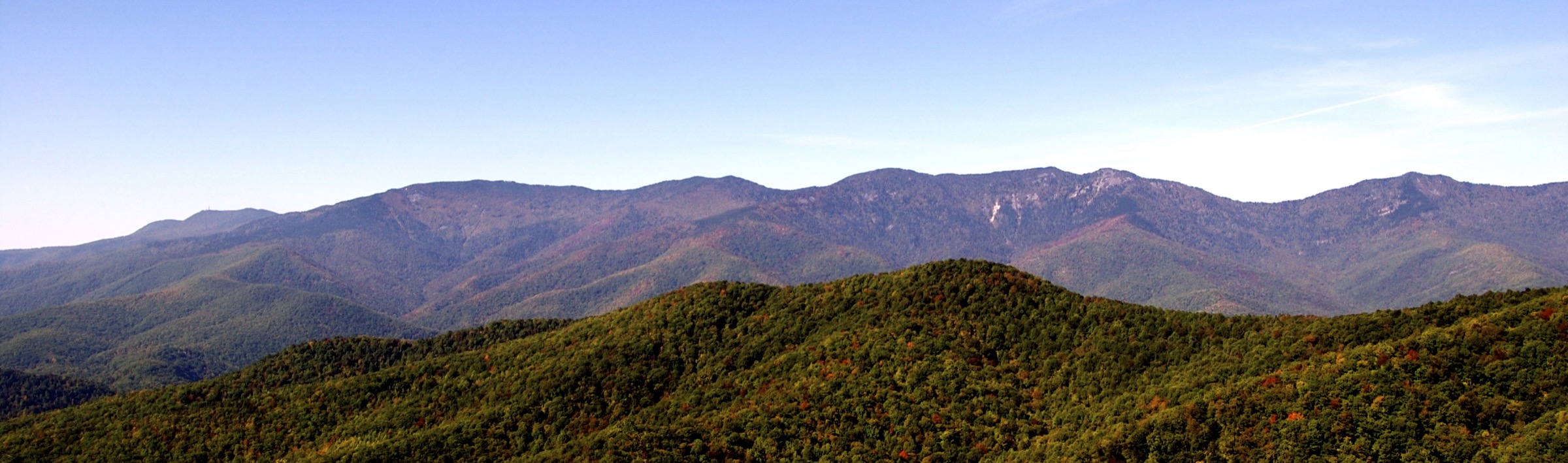
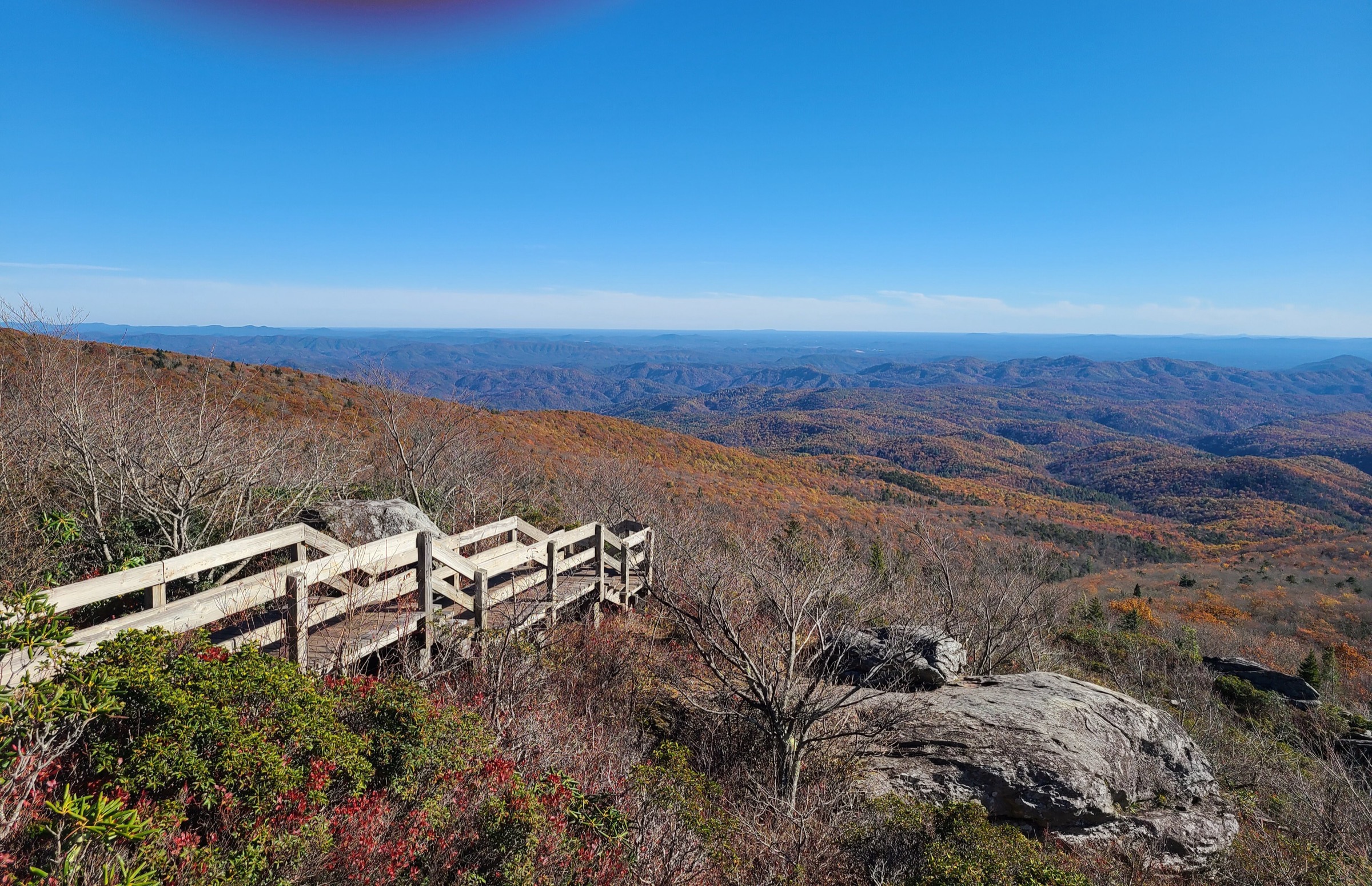
The Roan Highlands cover the high Appalachian Trail ridge system around Roan Mountain, Carvers Gap, Grassy Ridge, Yellow Mountain Gap, Little Hump Mountain and Hump Mountain on the North Carolina / Tennessee border. The hiking character is unusually open for the southern Appalachians: wind-exposed grassy balds, high-elevation spruce-fir forest, rhododendron gardens, Revolutionary War history and long views across the Blue Ridge, the Unaka Mountains and western North Carolina.
The region is compact but fragile. Roan Highlands / SAHC guidance emphasises limited parking at Carvers Gap, damage to sensitive vegetation from off-trail travel, colder and windier conditions than nearby towns, and a U.S. Forest Service burn ban on National Forest land from Hughes Gap to Doll Flats on the Appalachian Trail until 2030. The Roan Mountain Day Use Area had a scheduled vehicle-access reopening date of 29 May 2026; Cloudland / gardens access should still be rechecked locally because Forest Service alerts have separately described closures and repair work around the Cloudland Trail and Roan High Bluff.
Most routes are non-technical hikes on established trails. The main risks are exposure to wind and thunderstorms, fog navigation on open balds, winter ice, heat and sun on grasslands, fragile rare plants, crowding at Carvers Gap and long emergency response times away from the trailheads.
See also: North Carolina High Country, Blue Ridge Mountains · Great Balsam Mountains, Blue Ridge · Shenandoah and Northern Blue Ridge.
Selection rationale
The five hikes represent the essential Roan Highlands experiences: the short classic Round Bald / Jane Bald Appalachian Trail walk, the longer Carvers Gap to Grassy Ridge Bald traverse, the spruce-fir contrast of Roan High Knob, the historic Overmountain Victory route to Yellow Mountain Gap and the remote Hump Mountain bald from US 19E. The set intentionally includes both the heavily visited Carvers Gap core and the quieter northern and eastern bald sections.
Summary table
| # | Hike | Country | Route type | Distance | Gain | Max elevation | Difficulty |
|---|---|---|---|---|---|---|---|
| 1 | Round Bald and Jane Bald from Carvers Gap | USA | Out-and-back | 4.2 km | ~170–230 m | ~1,776 m | Moderate |
| 2 | Carvers Gap to Grassy Ridge Bald | USA | Out-and-back | 7.5–8.0 km | ~300 m | ~1,875–1,878 m | Moderate to strenuous |
| 3 | Roan High Knob via Appalachian Trail | USA | Out-and-back | ~5.1 km | ~240–300 m | ~1,916 m | Moderate to strenuous |
| 4 | Yellow Mountain Gap via Overmountain Victory Trail | USA | Out-and-back | 16.1 km | Unresolved | Highest point of OVNHT | Strenuous |
| 5 | Hump Mountain from US 19E via Appalachian Trail | USA | Out-and-back | 17.2–17.4 km | ~790 m | ~1,703 m | Strenuous |
1. Round Bald and Jane Bald from Carvers Gap
Snapshot
Itinerary
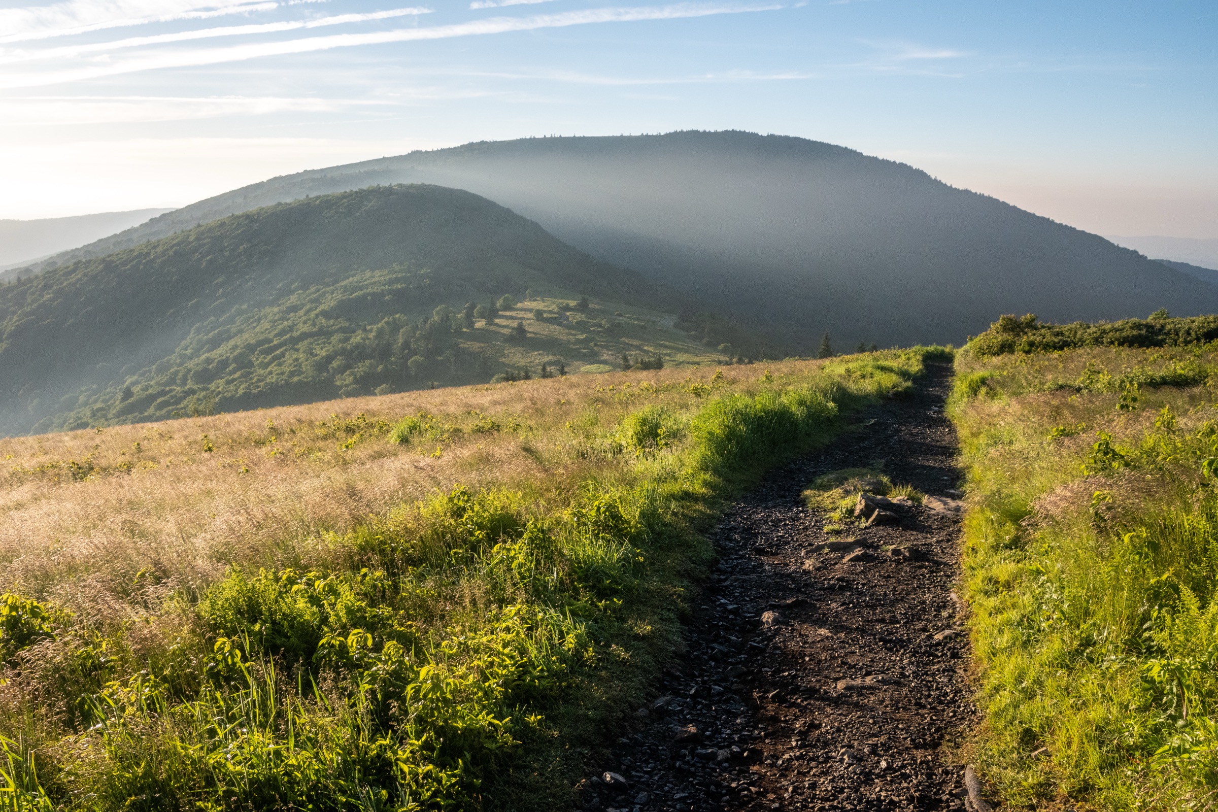
From Carvers Gap, cross to the northbound Appalachian Trail and follow the white blazes through the log fence onto the graded open-bald trail. The route climbs to Round Bald, drops to Engine Gap and climbs again toward Jane Bald and the rock outcrop area described by ATC. Return by the same line, keeping strictly to the hardened trail and avoiding the social paths across the balds.
Why it is essential
This is the shortest classic Roan Highlands hike and the best introduction to the region’s open grass summits. It gives immediate high-elevation views, shows the fragile bald vegetation, and includes the iconic Round Bald / Jane Bald skyline without committing hikers to the longer Grassy Ridge or Hump Mountain routes.
Equipment
- Sturdy walking shoes or boots
- Wind layer and rain shell
- Warm layer
- Sun protection
- Water and food
- Map or offline navigation
- Headtorch
- Traction in winter or freeze-thaw conditions
Hazards and notes
- Carvers Gap parking is limited and regularly exceeds capacity.
- Roan Highlands guidance says temperatures can be 10–15 °F colder than nearby towns and the balds can be very windy.
- Stay strictly on official trails; the balds contain rare and sensitive plant communities.
- The U.S. Forest Service burn ban applies from Hughes Gap to Doll Flats on the Appalachian Trail until 2030.
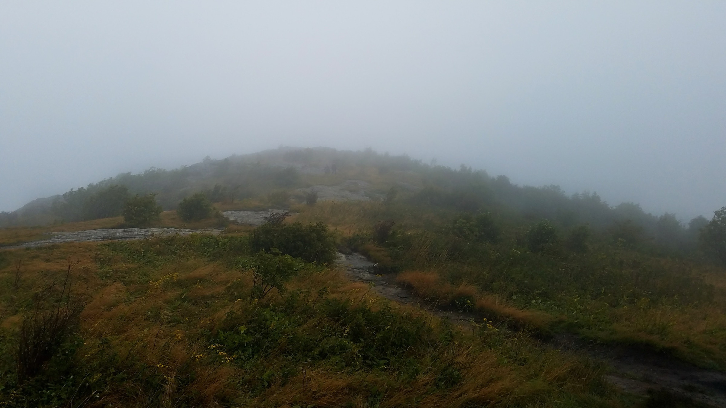
- Fog can make the broad open ridge disorienting despite the short distance.
GPX / route file
| Source | URL | Format | Notes |
|---|---|---|---|
| Appalachian Trail Conservancy — Round Bald and Jane Bald | appalachiantrail.org | Official trail-organisation route page | Use for description, length and access verification; no downloadable route file found |
| Roan Highlands — Trails | roanhighlands.org | Current access / stewardship notes | Alerts and visitor-management notes; not a route file |
| TEHCC — Carvers Gap to US19E | tehcc.org | Maintainer route page with KML link for the longer A.T. section | Useful source geometry for the broader A.T. section; reuse licence unresolved |
Sources
- ATC — Round Bald and Jane Bald
- Roan Highlands — Trails
- Roan Highlands — Information
- TEHCC Wiki — Carver’s Gap to US19E
2. Carvers Gap to Grassy Ridge Bald
Snapshot
Itinerary
From Carvers Gap, follow the Appalachian Trail north over Round Bald, down to Engine Gap and up to Jane Bald. Continue beyond Jane Bald until the signed Grassy Ridge side trail leaves the Appalachian Trail to the right. Follow the narrower spur through rhododendron and open grass to the broad summit area of Grassy Ridge Bald, then return by the same route.
Why it is essential
Grassy Ridge Bald is the full-length version of the iconic Carvers Gap bald walk. The route links Round Bald, Jane Bald and Grassy Ridge into a compact ridge traverse with almost continuous views, rare grassy-bald habitat and a classic southern Appalachian skyline.
Equipment
- Sturdy footwear
- Windproof layer and rain shell
- Insulation outside warm summer days
- Sun hat and sunscreen
- Water and food
- Map or offline navigation
- Headtorch
- Trekking poles useful on the repeated climbs and descents
Hazards and notes
- The open balds are exposed to sun, wind, lightning and fast-moving fog.
- The Grassy Ridge spur can be brushy and muddy; stay on the established tread.
- Carvers Gap frequently fills; use legal parking only.
- Campfires and portable stoves are prohibited by the Forest Service burn ban on the National Forest A.T. corridor from Hughes Gap to Doll Flats until 2030.
- Sensitive vegetation is easily damaged by off-trail travel and informal campsites.
GPX / route file
| Source | URL | Format | Notes |
|---|---|---|---|
| Trail Run Project — Carvers Gap to Grassy Ridge Bald | trailrunproject.com | Secondary route map with GPX download | Route-file source located; geometry reuse licence unresolved |
| Asheville Trails — Roan Highlands to Grassy Ridge Bald | ashevilletrails.com | Secondary guide route and map | Route-stat cross-check only; site restricts reuse of photos, data and text |
| Carolina Mountain Club — SB6K Roan Highlands | carolinamountainclub.org | Local mountain-club route description | Route cross-check and summit elevations; no reusable GPX found |
Sources
- ATC — Round Bald and Jane Bald
- Trail Run Project — Carvers Gap to Grassy Ridge Bald
- Asheville Trails — Roan Highlands to Grassy Ridge Bald
- Carolina Mountain Club — SB6K Roan Highlands
- Roan Highlands — Trails
3. Roan High Knob via Appalachian Trail
Snapshot
Itinerary
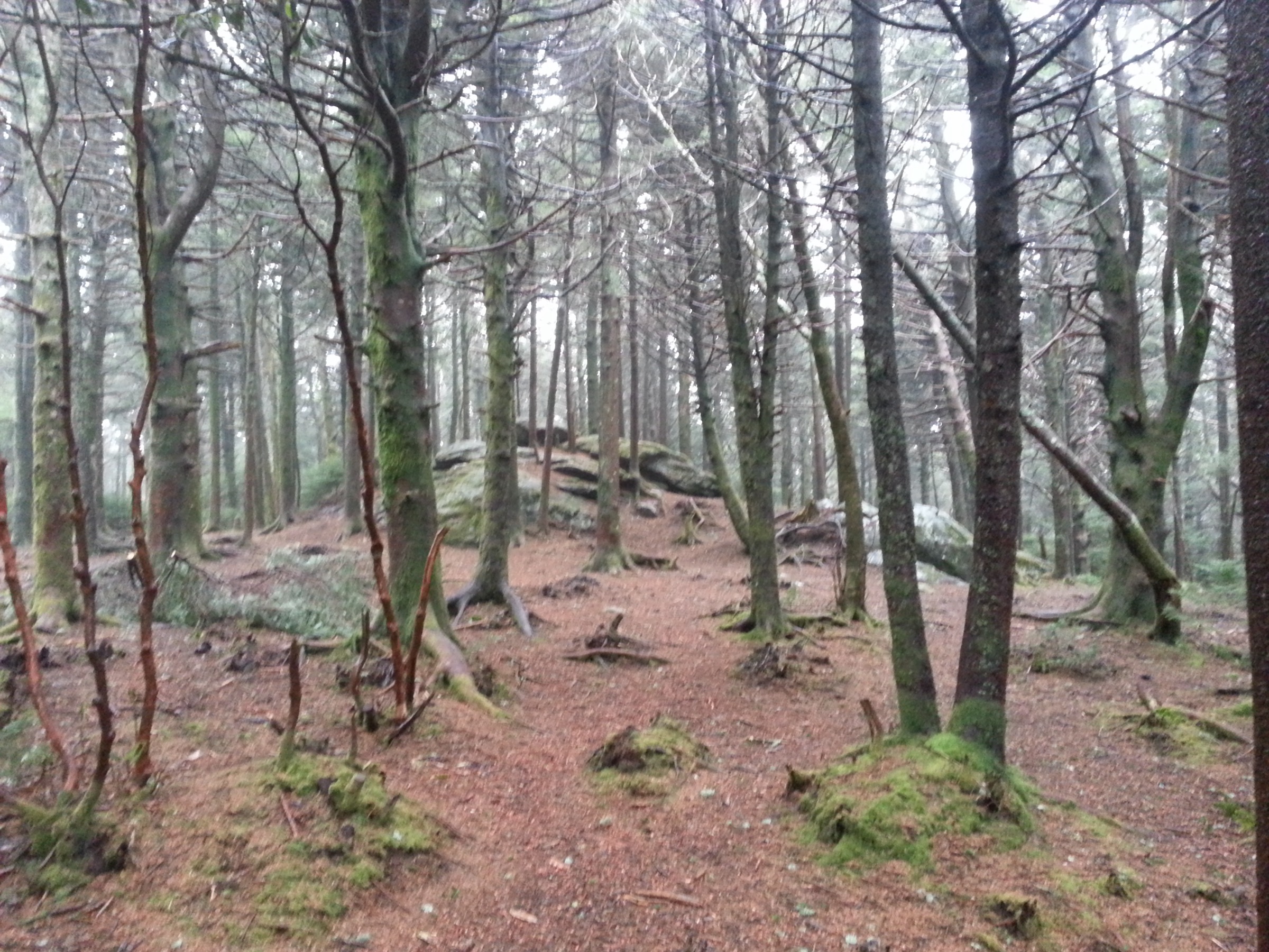
From Carvers Gap, follow the Appalachian Trail south-west into the high-elevation spruce-fir forest. The trail climbs steadily toward Roan High Knob, passing through a very different landscape from the open balds east of the gap. Near the Roan High Knob Shelter area, take the short summit spur to the high point where legally open and signed, then return by the same route.
This entry is not an instruction to use the Roan High Knob Shelter; Roan Highlands listed the shelter as closed for repairs in this source pass.
Why it is essential
Roan High Knob is the forested counterpart to Grassy Ridge. It reaches the highest summit of the Roan Mountain massif and gives hikers the rare southern Appalachian spruce-fir environment that Roan Highlands guidance highlights as threatened and sensitive.
Equipment
- Sturdy hiking footwear
- Windproof and waterproof layers
- Warm layer
- Water and food
- Map or offline navigation
- Headtorch
- Traction in icy conditions
Hazards and notes
- Roan High Knob Shelter was listed as closed for repairs by Roan Highlands during this source pass.
- Spruce-fir ecosystems are sensitive; stay on the official Appalachian Trail and signed side trail.
- Fog, ice, windthrow and winter snow can make this short hike more serious than its distance suggests.
- Any extension toward Roan High Bluff or the Cloudland Trail should be checked with the Appalachian Ranger District before use, because Forest Service alerts have described Cloudland Trail closures and protected cliff closures around Roan High Bluff.
GPX / route file
| Source | URL | Format | Notes |
|---|---|---|---|
| Carolina Mountain Club — SB6K Roan Highlands | carolinamountainclub.org | Local mountain-club route description | Distances and summit-elevation cross-check; no downloadable GPX found |
| Roan Highlands — Trails | roanhighlands.org | Current access / stewardship notes | Current alerts; not a route file |
| TEHCC — Carvers Gap to US19E KML | tehcc.org | KML for the eastbound A.T. section, not the westbound Roan High Knob spur | Not a direct route file for Roan High Knob; useful only for nearby A.T. context |
Sources
- Carolina Mountain Club — SB6K Roan Highlands
- Roan Highlands — Trails
- Roan Highlands — Information
- Forest Service — Roan Mountain / Cloudland Trail closure alert
4. Yellow Mountain Gap via Overmountain Victory Trail
Snapshot
Itinerary
From Hampton Creek Cove, follow the Overmountain Victory National Historic Trail toward Yellow Mountain Gap. The route climbs through the cove and crosses the high gap where the Overmountain Victory Trail meets the Appalachian Trail. Interpretive waysides mark the Revolutionary War route of the Overmountain Men, who crossed the mountains on 27 September 1780 before the Battle of Kings Mountain.
The standard day hike returns the same way. If current signs allow, a short side trail on the North Carolina side leads toward the former Overmountain Shelter viewpoint area; shelter conditions and any closures should be checked before relying on this extension.
Why it is essential
Yellow Mountain Gap is the cultural anchor of the Roan Highlands. It combines a serious mountain crossing with the highest point of the Overmountain Victory National Historic Trail and an Appalachian Trail junction, giving the region a historical dimension beyond its famous views.
Equipment
- Sturdy footwear
- Layered clothing
- Waterproof shell and warm layer
- Water and food
- Map or offline navigation
- Headtorch
- Traction and extra insulation in winter or shoulder-season cold spells
Hazards and notes
- Longer and more committing than the Carvers Gap bald walks.
- NPS lists no facilities at the Hampton Creek Cove trailhead beyond parking and an information kiosk.
- Weather can change quickly; the historical route itself is associated with snow at the gap.
- Check current NPS and local notices for shelter, trail and access status before using side trails.
GPX / route file
| Source | URL | Format | Notes |
|---|---|---|---|
| NPS — Yellow Mountain Gap | home.nps.gov | Official route description and trailhead notes | Route and historical verification; no downloadable GPX/KML found |
| TEHCC — Carvers Gap to US19E | tehcc.org | A.T. section route with Yellow Mountain Gap context and KML link | A.T. junction context; not the full OVNHT approach from Hampton Creek Cove |
Sources
5. Hump Mountain from US 19E via Appalachian Trail
Snapshot
Itinerary
From the Appalachian Trail crossing on US 19E, follow the southbound Appalachian Trail toward Doll Flats. Roan Highlands describes the route as reaching scenic Doll Flats after about 3.0 miles, then continuing 1.6 miles to the edge of Hump Mountain and another 0.8 miles to the summit. Return by the same route.
The line is straightforward in clear weather but crosses broad grassy ground where fog can hide the tread. Follow the white-blazed posts and stay strictly on the official Appalachian Trail.
Why it is essential
Hump Mountain is the wilder northern bookend of the Roan Highlands bald system. It is longer and less convenient than Grassy Ridge, but the open summit, long approach, Doll Flats and sense of remoteness make it one of the defining day hikes of the region for strong walkers.
Equipment
- Sturdy boots or shoes
- Windproof and waterproof layers
- Warm layer
- Sun protection
- Water — more than for the Carvers Gap hikes, especially in summer
- Food
- Navigation and headtorch
- Emergency layer
- Tick protection
Hazards and notes
- Roadside parking at US 19E is limited and the road crossing requires care.
- The route is exposed to lightning, sun, wind and fog on the open balds.
- The Forest Service burn ban applies on National Forest land from Hughes Gap to Doll Flats on the Appalachian Trail until 2030.
- Roan Highlands specifically warns to pay attention to the route in cloudy or foggy weather.
- Shorter alternatives from Roaring Creek Road reach Little Hump Mountain and can be extended to Hump Mountain, but road and route details should be rechecked locally.
GPX / route file
| Source | URL | Format | Notes |
|---|---|---|---|
| Roan Highlands — Similar Local Hikes | roanhighlands.org | Local route description | Route mileage and access notes; no reusable route file found |
| Komoot — Appalachian Trail: US 19E to Hump Mountain | komoot.com | Secondary route map / app route | Route-file source located; geometry reuse licence unresolved |
| TEHCC — Carvers Gap to US19E KML | tehcc.org | KML for the larger A.T. section including the Hump Mountain sector | Route geometry for cross-check; reuse licence unresolved |
Sources
- Roan Highlands — Similar Local Hikes
- Roan Highlands — Trails
- TEHCC Wiki — Carver’s Gap to US19E
- Komoot — Appalachian Trail: US 19E to Hump Mountain
Further reading
- Roan Highlands — Trails
- Roan Highlands — Information
- Roan Highlands — Similar Local Hikes
- Appalachian Trail Conservancy — Round Bald and Jane Bald
- National Park Service — Yellow Mountain Gap
- Carolina Mountain Club — SB6K Roan Highlands
- TEHCC Wiki — Carver’s Gap to US19E
- Trail Run Project — Carvers Gap to Grassy Ridge Bald
- Wikimedia Commons — Roan Mountain category
Missing data / follow-up work
- Official GPX/KML files were not found for the ATC Round Bald / Jane Bald route, the Roan High Knob route or the NPS Yellow Mountain Gap route.
- Elevation gain for Round Bald / Jane Bald, Roan High Knob and Yellow Mountain Gap was not verified from official sources.
- Roan High Bluff and Cloudland access is closure-sensitive; any High Bluff extension should be confirmed with the Appalachian Ranger District immediately before use.
- Roan High Knob Shelter was listed as closed for repairs by Roan Highlands during this pass.
- The Roan Mountain Day Use Area reopening schedule and Cloudland Trail repair status should be rechecked before publication.
- Hump Mountain has no licence-compatible hike-specific photo candidate in this pass.