Regional overview
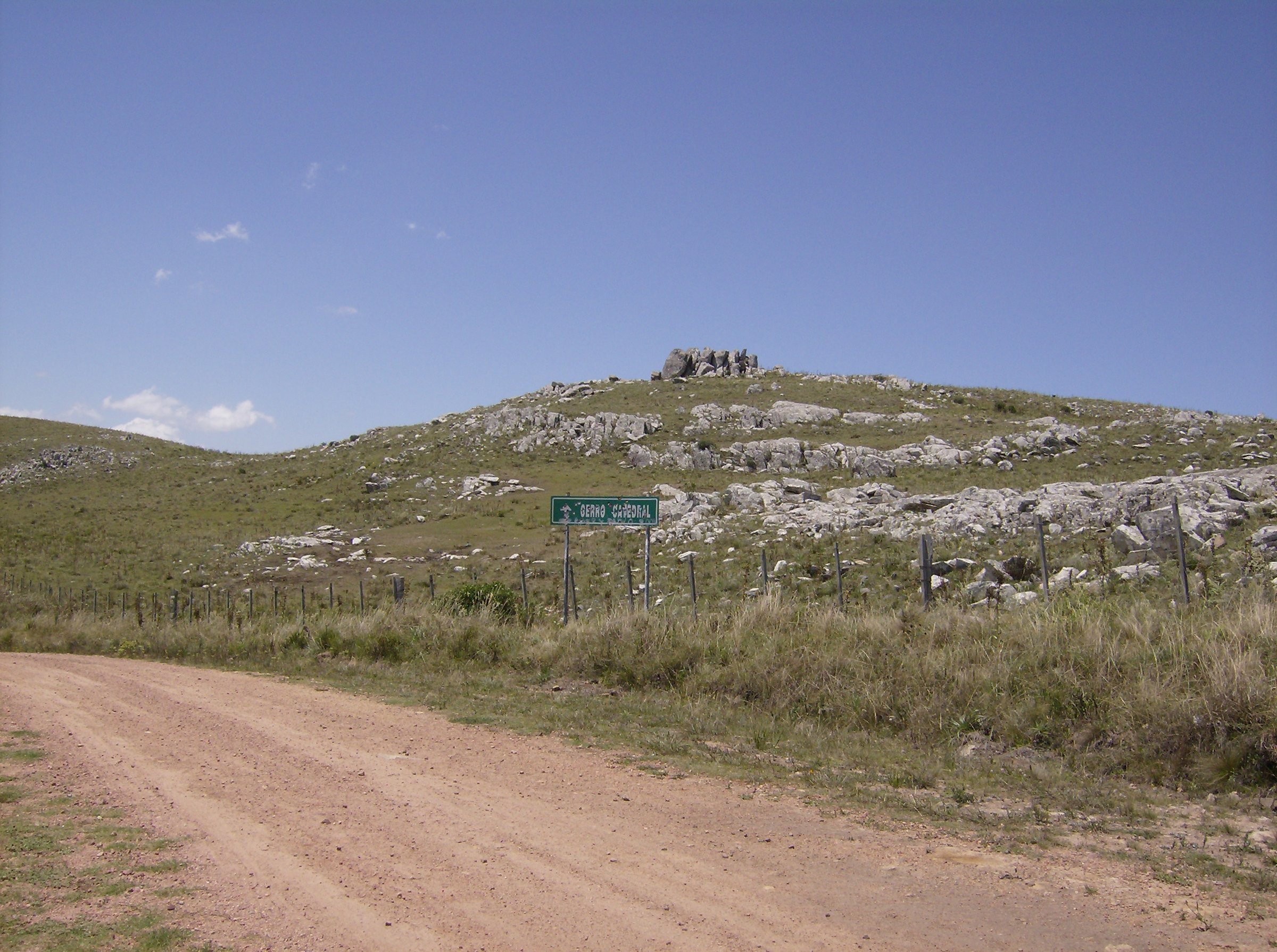
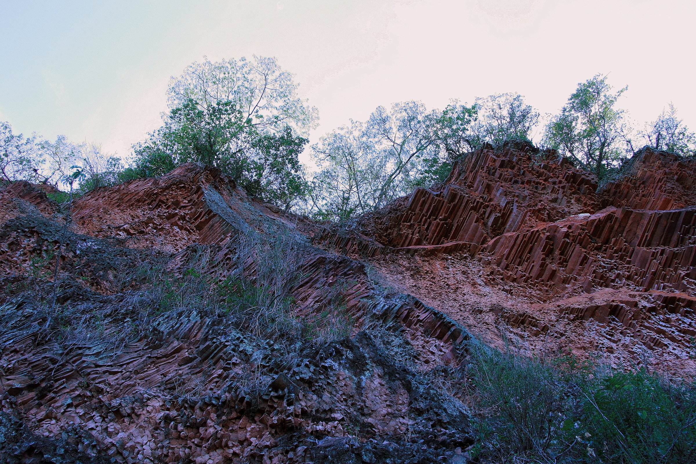
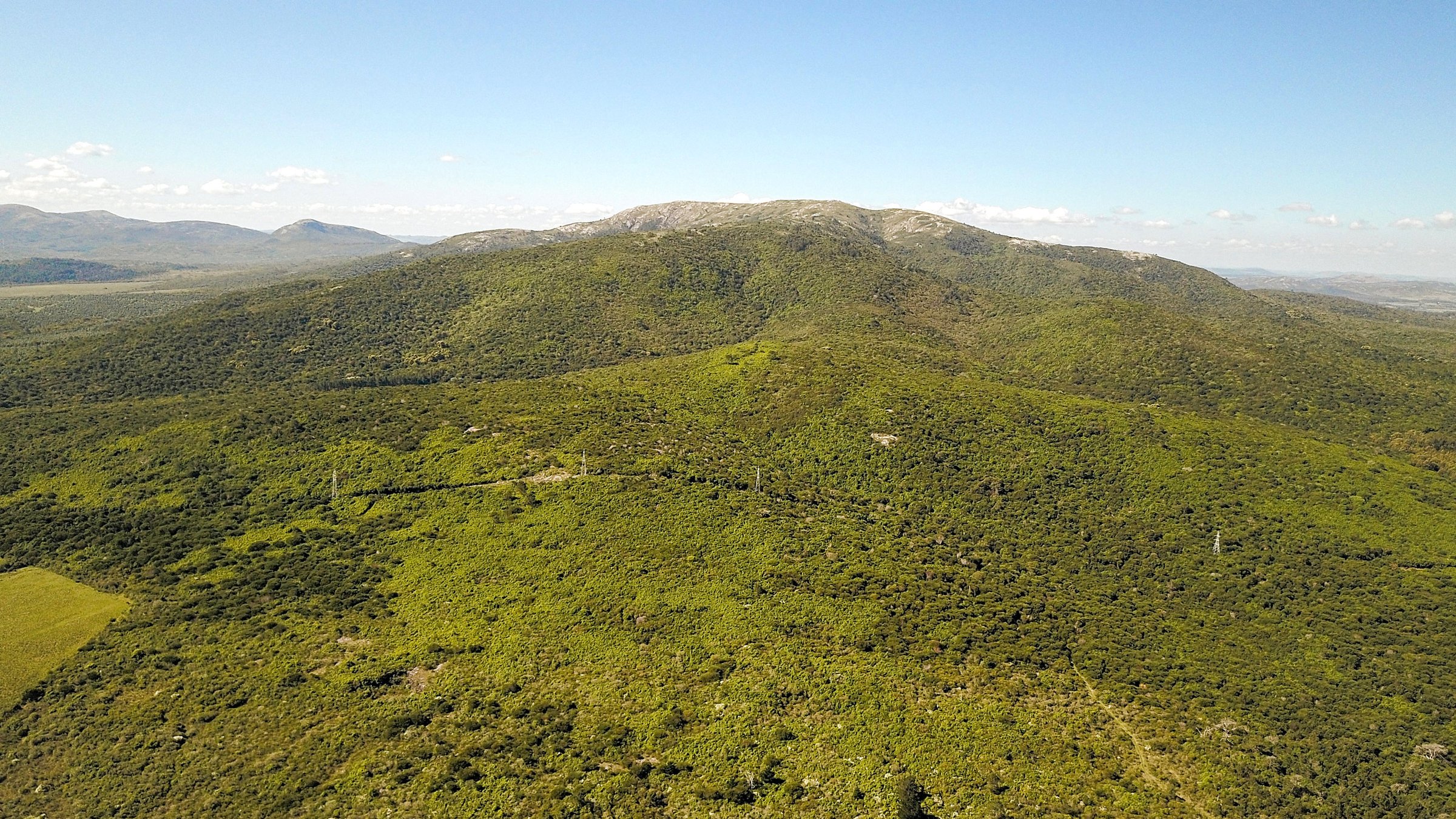
The Sierra de las Ánimas is the best-known hill range of southern Uruguay, running through the Maldonado/Lavalleja borderlands toward the Piriápolis area. It is a low but rugged volcanic landscape of rocky summits, native vegetation, dry grassland, historic routes, small waterfalls, natural pools and coastal viewpoints. Cerro de las Ánimas, formerly Mirador Nacional, is Uruguay’s second-highest summit at about 501 m and remains the range’s emblematic day hike.
Access is the central planning issue. Cerro de las Ánimas and Cañadón de los Espejos are managed through the private “Paseo Sierra de las Ánimas” access, where registration, a fee, rules and opening/closing times apply. Cerro Pan de Azúcar is managed by the Maldonado authorities through ECFA with a strict ascent protocol that can close the route after rain, heat or storms. Other Piriápolis hills are easier but still rocky and slippery after rain.
Selection rationale
The selection combines the range’s defining summit, its principal canyon/pool alternatives, the regulated Pan de Azúcar ascent, and a historic Piriápolis hill walk. This gives a balance between the wild/private Sierra access routes and the more public coastal-hill side of the same landscape.
Summary table
| # | Hike | Country | Route type | Distance | Gain | Max elevation | Difficulty |
|---|---|---|---|---|---|---|---|
| 1 | Cerro de las Ánimas via Cabaña Base | Uruguay | Out-and-back | 10.3 km AllTrails | 465 m AllTrails | 501 m | Moderate to hard |
| 2 | Cañadón de los Espejos | Uruguay | Out-and-back | 7.1 km AllTrails | c. 350-420 m, route-dependent | Moderate | |
| 3 | Pozos Azules | Uruguay | Out-and-back | 10 km Vida Silvestre | Moderate | ||
| 4 | Cerro Pan de Azúcar ascent | Uruguay | Out-and-back | Distance unresolved; ascent time 1 h 30 min official | c. 350-400 m approximate | 423 m | Moderate to hard |
| 5 | Cerro del Toro summit path | Uruguay | Out-and-back / short local circuit | Distance unresolved; about 30 min ascent from Fuente del Toro | c. 150 m approximate | 240-253 m, source-dependent | Moderate |
1. Cerro de las Ánimas via Cabaña Base
Snapshot
Itinerary
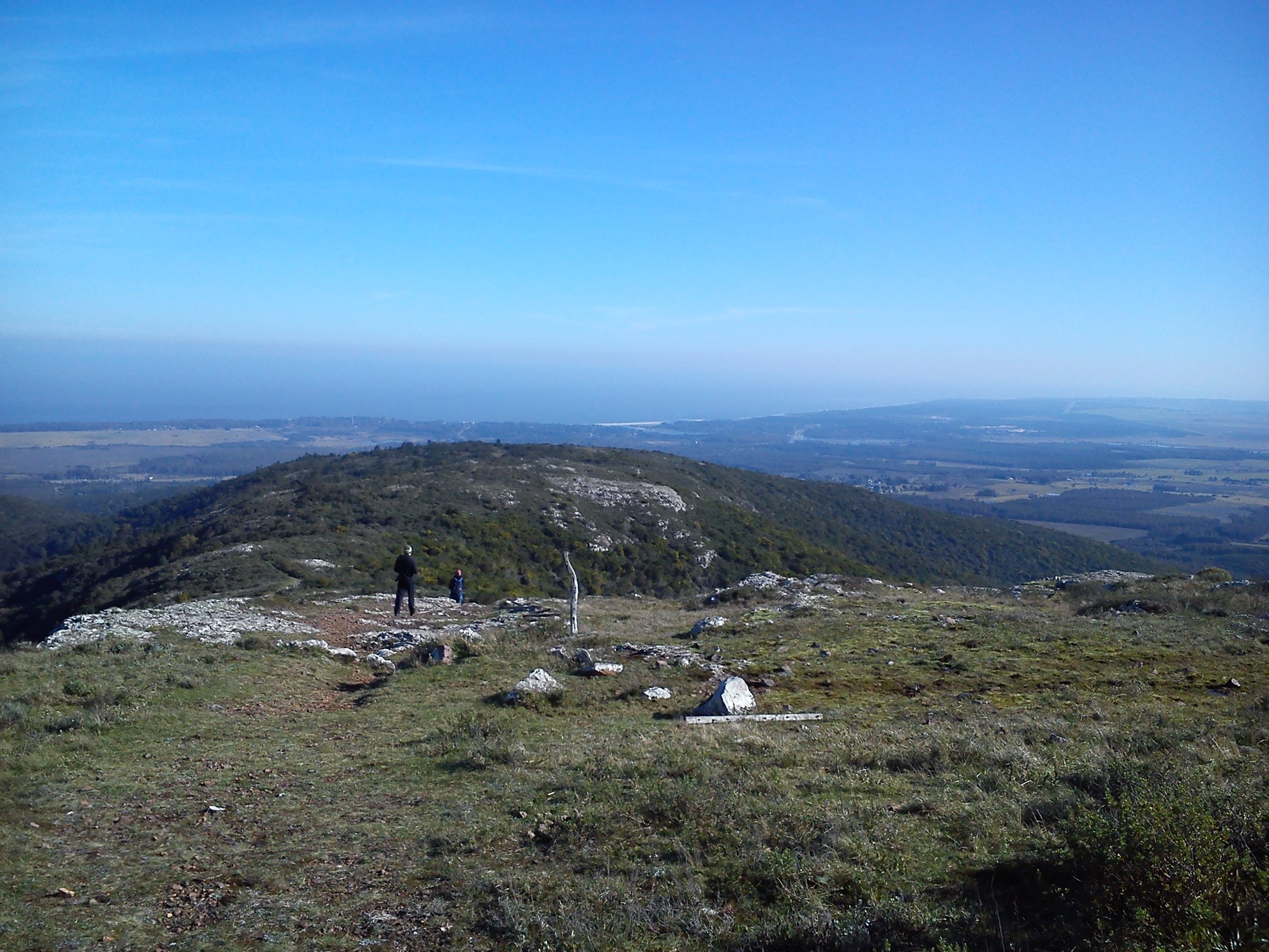
From the Cabaña Base registration point, the route climbs into the Sierra de las Ánimas on the established private-access path. It passes Cerro Chico and reaches Cerro de las Ánimas, the former Mirador Nacional, with broad views over the range, coastal plain and Piriápolis area. Return follows the same managed access route unless the operator specifically authorises a variant.
Why it is essential
This is the range’s signature summit and Uruguay’s second-highest point, with the strongest combination of physical effort, views and historical identity.
Equipment
Hiking shoes, at least 1.5-2 litres of water per person, sun protection, wind layer, snacks and offline map. Carry whatever the Cabaña Base currently requires.
Hazards and notes
Private access, required registration, fee, opening/closing cut-offs, possible no-dog rule, rocky ground, snakes, heat and exposed summit weather. Do not bypass the registration point or cross gates without permission.
GPX / KML links
| Source | URL | Format / access | Reuse status |
|---|---|---|---|
| AllTrails: Cerro de las Ánimas | alltrails.com | Source map / route page | AllTrails terms apply; use for comparison only |
| Wikiloc search: Sierra de las Ánimas | wikiloc.com | Route database search | Wikiloc terms apply; secondary source only |
| OpenStreetMap search: Cerro de las Ánimas | openstreetmap.org | Source map | ODbL; geometry cross-check target |
External links
2. Cañadón de los Espejos
Snapshot
Itinerary
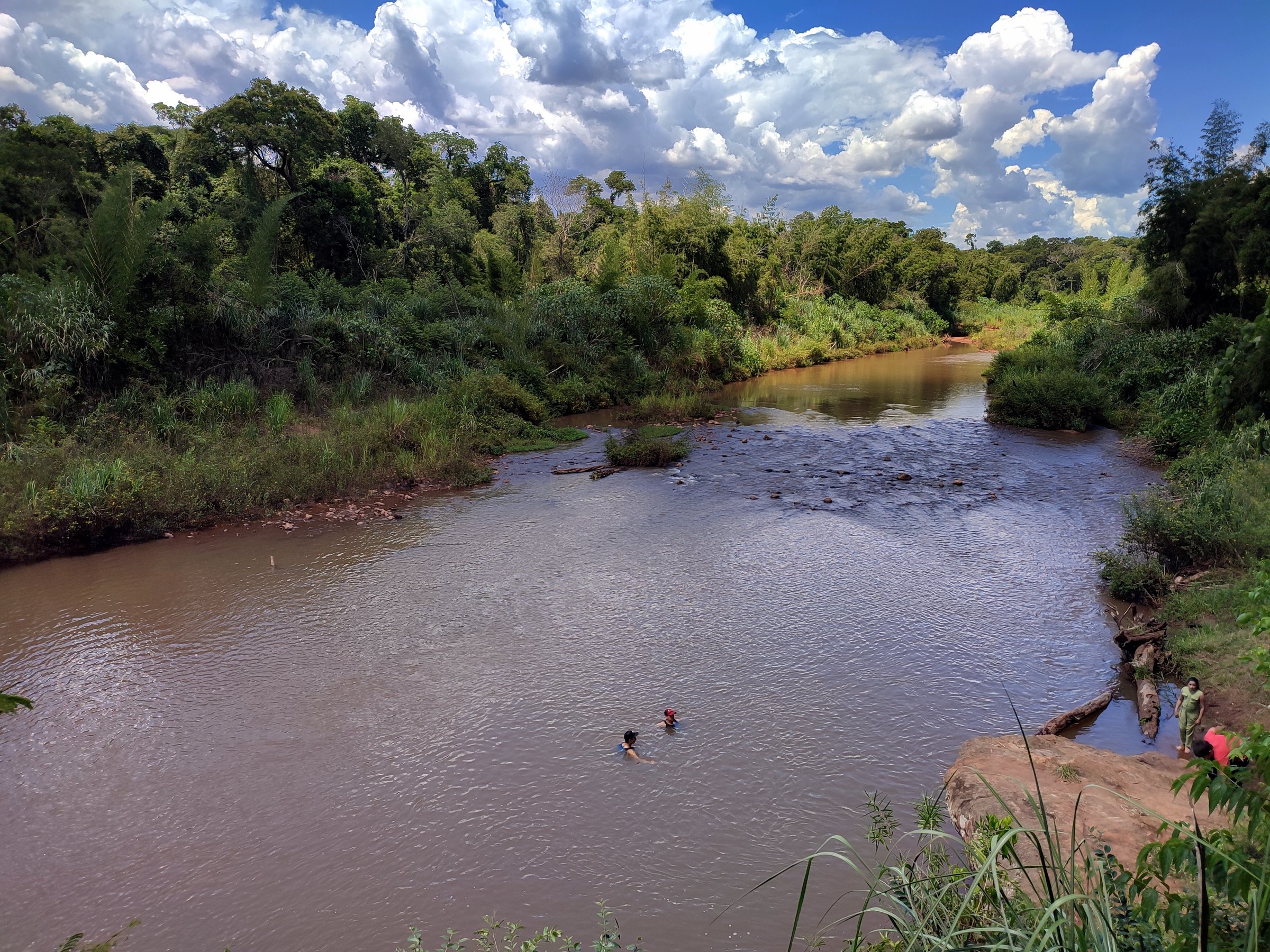
This route leaves the Cabaña Base access area and follows the authorised path toward the Cañadón de los Espejos, a canyon/pool objective within the Sierra de las Ánimas. The current official site snippets describe the Cañadón route as easier than the older Pozos Azules outing, but the site itself was not fully accessible during this pass.
Why it is essential
It is the main canyon-and-water alternative to the summit hike, giving the range’s rocky drainage and pool character rather than only the high viewpoint.
Equipment
Hiking shoes with grip, water, sun protection and a dry bag for electronics if visiting after rain.
Hazards and notes
Private access and operator rules, slippery rock near pools, possible route closure or cut-off times, and risk of getting off route in side gullies. Use the current authorised path only.
GPX / KML links
| Source | URL | Format / access | Reuse status |
|---|---|---|---|
| AllTrails: Cañadón de Los Espejos | alltrails.com | Source map / route page | AllTrails terms apply; use for comparison only |
| Wikiloc: Sierra de las Ánimas y Cañon de los Espejos | es.wikiloc.com | Route page / GPX via platform | Wikiloc terms apply; secondary comparison source |
External links
- Paseo Sierra de las Ánimas — official site
- AllTrails — Cañadón de los Espejos
- Wikiloc — Sierra de las Ánimas y Cañón de los Espejos
3. Pozos Azules
Snapshot
Itinerary
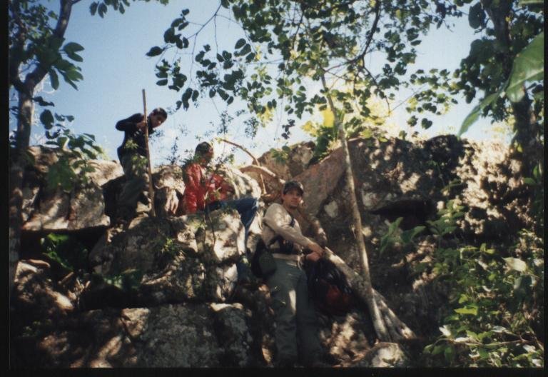
The route crosses open pradera before entering bosque serrano and ascending toward the clear pools and small cascades known as Pozos Azules. Vida Silvestre describes 10 km total walking, with about 5 km on easier grassland and the remainder on increasingly rugged forested paths approaching the main pool.
Why it is essential
Pozos Azules is the most distinctive natural-pool objective in the Sierra de las Ánimas and represents the range’s hidden-waterfall side.
Equipment
Hiking shoes with grip, water, sun protection, insect protection and a small towel if swimming is permitted by the guide/operator.
Hazards and notes
Guided or private-access restrictions must be checked. Slippery rocks, fragile stream habitat and narrow forest paths require care. Do not publish as an independent route unless current legal access is confirmed.
GPX / KML links
| Source | URL | Format / access | Reuse status |
|---|---|---|---|
| Vida Silvestre: Pozos Azules | vidasilvestre.org.uy | Activity route description | Site terms not checked; factual route description only |
| OpenStreetMap search: Pozos Azules Sierra de las Ánimas | openstreetmap.org | Source map | ODbL; geometry cross-check target |
External links
4. Cerro Pan de Azúcar Ascent
Snapshot
Itinerary
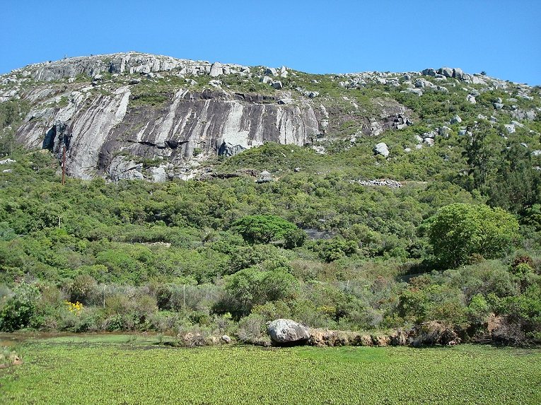
The route starts inside the ECFA reserve and climbs the regulated ascent path to Cerro Pan de Azúcar. It is a short but sustained rocky climb with wide summit views over Piriápolis, Sierra de las Ánimas and the coast. Return is by the same authorised ascent path.
Why it is essential
Pan de Azúcar is the most recognisable public hill ascent in the Piriápolis/Sierra de las Ánimas area and one of Uruguay’s classic summit walks.
Equipment
The Maldonado protocol requires at least 1 litre of water per person, identity document, suitable trekking clothes, closed lace-up footwear, long pants or leggings, sports shirt and a light backpack so hands stay free.
Hazards and notes
Maldonado’s 2025 protocol describes the path as rocky, steep and slippery. Registration and a preventive environmental/safety briefing are required. The official 2025 update increased daily capacity to 400 people and the upper age limit to 65; previous protocol notes included a 72-hour closure after rain. Recheck current status immediately before publication.
GPX / KML links
| Source | URL | Format / access | Reuse status |
|---|---|---|---|
| Maldonado ECFA protocol news | maldonado.gub.uy | Official route/access source | Government site terms; use facts only; no GPX found |
| OpenStreetMap search: Cerro Pan de Azúcar | openstreetmap.org | Source map | ODbL; geometry cross-check target |
External links
- Maldonado — new Cerro Pan de Azúcar ascent protocol
- Maldonado — ECFA agenda of guided visits and protocol
- Maldonado — Cerro Pan de Azúcar ascent reopened
5. Cerro del Toro Summit Path
Snapshot
Itinerary
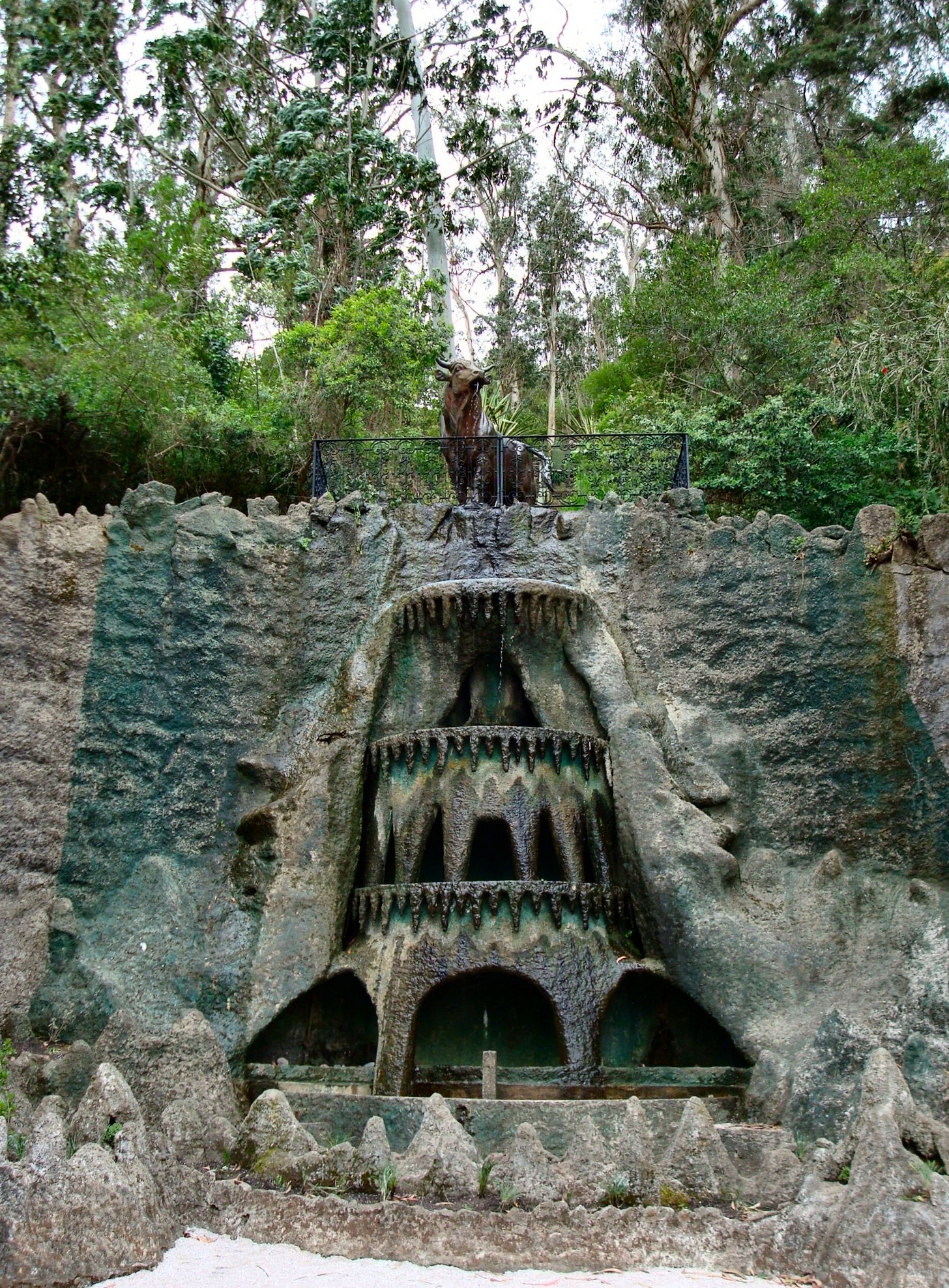
From the Fuente del Toro area, continue uphill on the footpath and rougher summit route through dense vegetation to Cerro del Toro’s high points. The walk links Francisco Piria’s historic fountain landscape with a genuine short hill climb and 360-degree coastal/sierras views.
Why it is essential
Cerro del Toro is one of the emblematic Piriápolis hills, explicitly described by local tourism sources as part of the Sierra de las Ánimas, and gives the region its cultural/coastal viewpoint day.
Equipment
Hiking shoes, water and sun protection. A walking pole is useful on the steep or slippery sections.
Hazards and notes
Short does not mean trivial: local sources warn that the ascent beyond the fountain uses escarped steps/paths, can be slippery after rain and is not suitable for people with poor mobility.
GPX / KML links
| Source | URL | Format / access | Reuse status |
|---|---|---|---|
| Wikiloc: Cerro del Toro - Piriápolis | es.wikiloc.com | Route page / GPX via platform | Wikiloc terms apply; secondary comparison source |
| OpenStreetMap search: Cerro del Toro Piriápolis | openstreetmap.org | Source map | ODbL; geometry cross-check target |
External links
External links
| Source | URL |
|---|---|
| Paseo Sierra de las Ánimas | sierradelasanimas.com |
| AllTrails — Cerro de las Ánimas | alltrails.com |
| AllTrails — Cañadón de los Espejos | alltrails.com |
| Wikiloc — Sierra de las Ánimas y Cañón de los Espejos | es.wikiloc.com |
| Wikiloc — Cerro del Toro, Piriápolis | es.wikiloc.com |
| Vida Silvestre — Pozos Azules | vidasilvestre.org.uy |
| Infoturismo19 — Sierra de las Ánimas y Pozos Azules | infoturismo19.com.uy |
| Maldonado — Cerro Pan de Azúcar protocol | maldonado.gub.uy |
| Maldonado — ECFA guided visits and protocol | maldonado.gub.uy |
| Maldonado — Cerro Pan de Azúcar ascent reopened | maldonado.gub.uy |
| Piriápolis Portal — Cerro del Toro | piriapolisportal.com.uy |
| Infocasas — Cerro del Toro | infocasas.com.uy |