Regional overview
Sierra Carapé is the eastern Maldonado upland chain and part of the broader Cuchilla Grande system. It is best known for Cerro Catedral, Uruguay’s national high point at 513.66 m, but the walking character is not an alpine summit network. It is a rural hill landscape of granite and gneiss, panoramic dirt roads, working estancias, wind-farm-altered ridges, cave parks, short managed eco-trails and private guided routes around Aiguá, Ruta 109, Ruta 39 and Ruta 13.
The source base is thin. Official tourism pages verify the Aiguá/Carapé setting and Grutas de Salamanca; Commons and secondary route sources verify Cerro Catedral and the range; private/ecotourism operators provide the most concrete trail descriptions for several walking objectives. Treat this entry as a conservative draft: all five hikes are plausible day objectives, but several need field GPS and legal-access confirmation before final guidebook publication.
Selection rationale
The selection prioritises the national high point, the best-known cave park near Aiguá, the Ruta 109/Carapé viewpoint landscape, and two managed/private eco-walks that provide actual foot routes in a region otherwise dominated by scenic roads and private rural land.
Summary table
| # | Hike | Country | Route type | Distance | Gain | Max elevation | Difficulty | Photo status |
|---|---|---|---|---|---|---|---|---|
| 1 | Cerro Catedral high-point walk | Uruguay | Out-and-back | Short walk from nearby dirt road; exact distance unresolved | Low to moderate | 513.66 m | Easy to moderate | Commons image found |
| 2 | Grutas de Salamanca cave and ridge trail | Uruguay | Out-and-back / short loop | Short park trail; exact distance unresolved | c. 200 m area per Aiguá identity source | Easy to moderate | Commons image found | |
| 3 | Mirador del Urubú / Ruta 109 Sierras de Carapé walk | Uruguay | Out-and-back / viewpoint walk | Short viewpoint walk; exact distance unresolved | Low | Easy | Commons regional image found | |
| 4 | Tao Sierras de Aiguá: waterfalls and Cerro del León circuit | Uruguay | Guided loop / linked paths | 2 km cañada path plus c. 3 km cerro circuit per operator | Moderate | No open exact image found | ||
| 5 | Ruta 109 - Cerro Catedral / Las Cañas rural approach | Uruguay | Out-and-back / road-and-track walk | Distance unresolved; requires field GPX | Up to 513.66 m if linked to summit | Moderate | Commons regional image found |
1. Cerro Catedral high-point walk
Snapshot
Itinerary
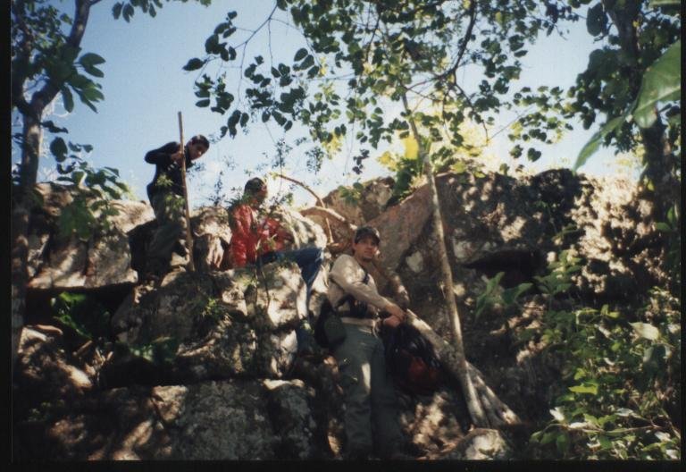
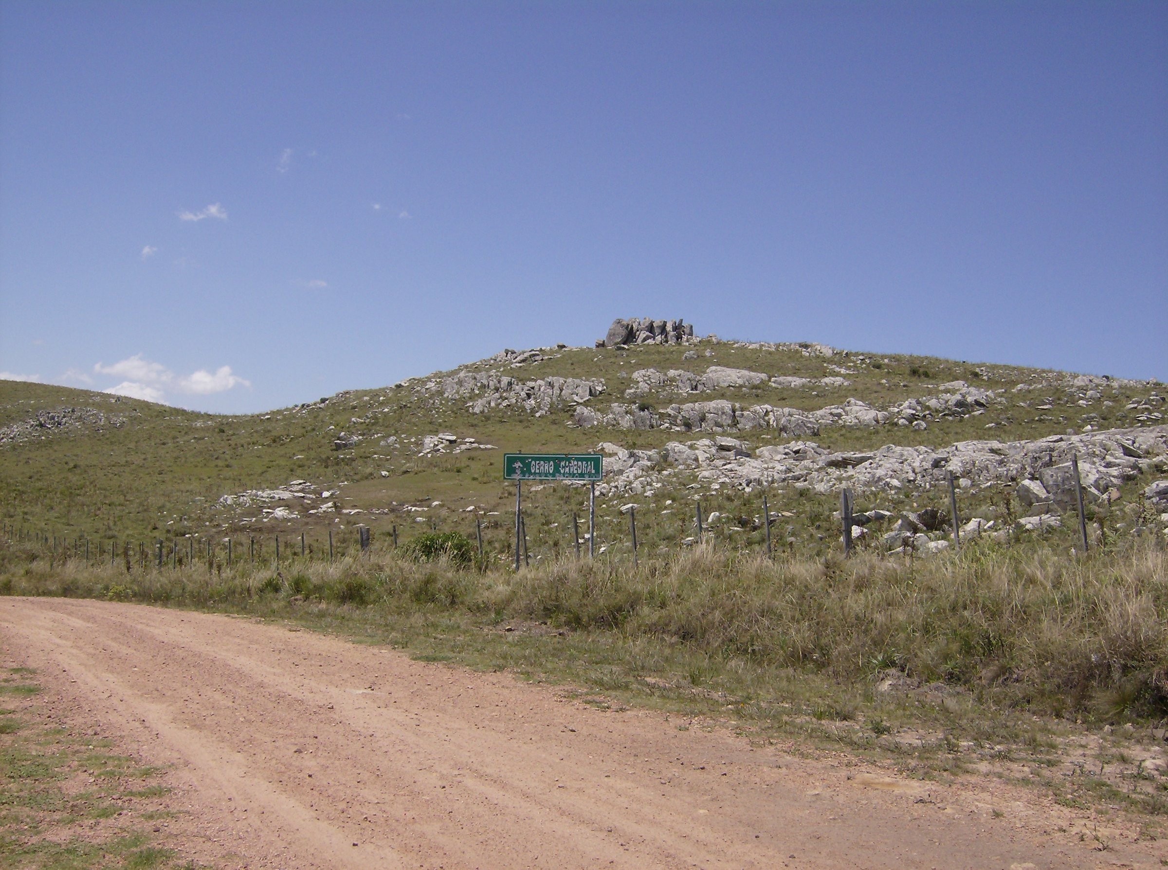
The route reaches Uruguay’s high point from the rural dirt-road network around Camino al Cerro Catedral, close to Ruta 109 and Ruta 39. The summit itself is near a road and is not a long mountain ascent, but the final approach should be walked respectfully across the authorised access line to the marker and rocky high ground.
Why it is essential
Cerro Catedral is the highest point in Uruguay and the defining summit of Sierra Carapé.
Equipment
Walking shoes, water, sun protection, wind layer, offline map and a vehicle plan suitable for dirt roads.
Hazards and notes
Access road condition, fog, wind, private-property boundaries, wind-farm/service-road confusion and lack of published official GPX. Confirm legal access locally before publication.
Photos
| Image | Source | Author | Licence | Reuse notes | Attribution |
|---|---|---|---|---|---|
| CerroCatedral.jpg | commons.wikimedia.org | Scheridon | CC BY-SA 3.0 | Commercial reuse and modification allowed with attribution and share-alike | Scheridon, CC BY-SA 3.0, via Wikimedia Commons |
| Cerro Catedral en Uruguay.jpg | commons.wikimedia.org | Scheridon | CC BY-SA 3.0 | Commercial reuse and modification allowed with attribution and share-alike | Scheridon, CC BY-SA 3.0, via Wikimedia Commons |
GPX / KML links
| Source | URL | Format | Licence / terms | Reuse status |
|---|---|---|---|---|
| Peakbagger: Cerro Catedral, Uruguay | peakbagger.com | Summit/source map | Peakbagger terms apply | Location reference only |
| OpenStreetMap search: Cerro Catedral Uruguay | openstreetmap.org | Source map | ODbL | Geometry cross-check target |
External links
2. Grutas de Salamanca cave and ridge trail
Snapshot
Itinerary
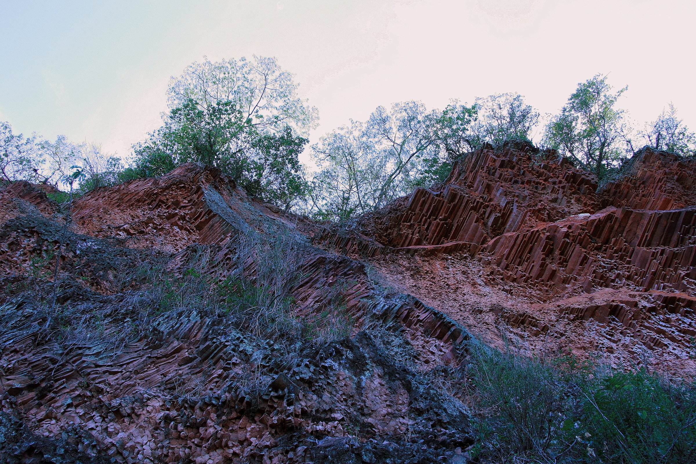
The walk follows the park path through wooded, humid cave terrain to the Grutas de Salamanca, including the Cueva de Lemos area and nearby viewpoints. The route is short but distinctive, combining native vegetation, cave microclimate and serrano rock.
Why it is essential
Grutas de Salamanca is the best-known managed natural walking site near Aiguá and gives Sierra Carapé a cave/forest route rather than only summit and road viewpoints.
Equipment
Grippy shoes, water, insect protection and a small headlamp only if legal cave access requires it. Follow park staff instructions in cave areas.
Hazards and notes
Slippery cave rock, low light, humidity, fragile vegetation and possible closures. Do not enter unauthorised cave passages.
Photos
| Image | Source | Author | Licence | Reuse notes | Attribution |
|---|---|---|---|---|---|
| Cueva de Lemos, Grutas de Salamanca, Maldonado, Uruguay.jpg | commons.wikimedia.org | Lspm | CC BY-SA 4.0 | Commercial reuse and modification allowed with attribution and share-alike | Lspm, CC BY-SA 4.0, via Wikimedia Commons |
| Grutas de Salamca, vista desde la cima.jpg | commons.wikimedia.org | Lspm | CC BY-SA 4.0 | Commercial reuse and modification allowed with attribution and share-alike | Lspm, CC BY-SA 4.0, via Wikimedia Commons |
GPX / KML links
| Source | URL | Format | Licence / terms | Reuse status |
|---|---|---|---|---|
| OpenStreetMap search: Grutas de Salamanca Uruguay | openstreetmap.org | Source map | ODbL | Geometry cross-check target |
| Maldonado Aiguá page | maldonado.gub.uy | Official attraction/source page | Government site terms | Facts only; no GPX found |
External links
3. Mirador del Urubú / Ruta 109 Sierras de Carapé walk
Snapshot
Itinerary
This is a short viewpoint-based walk rather than a long trail: park at the Mirador del Urubú area on Ruta 109 and walk the authorised picnic/viewpoint paths, using the site as a panorama over the Sierras de Carapé and Cerro Catedral. A longer route should only be published if a legal footpath beyond the viewpoint is field-verified.
Why it is essential
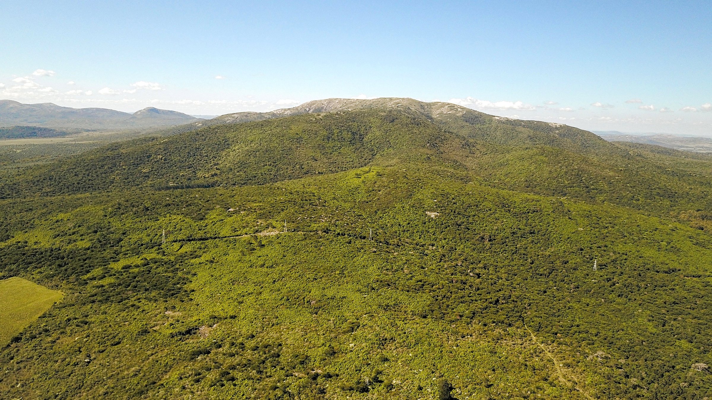
The Ruta 109 corridor is one of the most visible public ways to experience the Carapé landscape, and Ambá describes Mirador del Urubú as an ecotourism attraction with views where Cerro Catedral stands out.
Equipment
Comfortable shoes, sun protection and water.
Hazards and notes
Roadside access, traffic, wind, unfenced edges and the temptation to wander onto private land. Keep this as a viewpoint walk unless permissions are clear.
Photos
| Image | Source | Author | Licence | Reuse notes | Attribution |
|---|---|---|---|---|---|
| Sierras de Carapé (38913251362) (2).jpg | commons.wikimedia.org | Marcelo Campi | CC BY-SA 2.0 | Contextual range image; commercial reuse and modification allowed with attribution and share-alike | Marcelo Campi, CC BY-SA 2.0, via Wikimedia Commons |
GPX / KML links
| Source | URL | Format | Licence / terms | Reuse status |
|---|---|---|---|---|
| Ambá: Ecoturism, Sierras de Carapé | amba.org.uy | Source description | Site terms not checked | Facts only; no GPX found |
| OpenStreetMap search: Mirador del Urubú Ruta 109 | openstreetmap.org | Source map | ODbL | Geometry cross-check target |
External links
4. Tao Sierras de Aiguá - waterfalls and Cerro del León circuit
Snapshot
Itinerary
The operator-described outing follows a 2 km path along a cañada with small waterfalls and native woodland, then continues after a break to an approximately 3 km Cerro del León circuit with views of the Sierras de Carapé and the Aiguá valley. This should be treated as a managed/private route unless independent access is explicitly confirmed.
Why it is essential
It is one of the few published foot-route descriptions in the Aiguá/Carapé area and adds water, native forest and a small summit circuit to a region otherwise documented mostly through road viewpoints.
Equipment
Hiking shoes, water, sun/insect protection and whatever the operator requires. Carry a change of socks if stream margins are wet.
Hazards and notes
Private/managed access, stream crossings, slippery rocks, variable water levels and unclear independent route rights. Do not publish the track as public without operator permission.
Photos
Photo status: No licence-compatible exact image found in this pass.
GPX / KML links
| Source | URL | Format | Licence / terms | Reuse status |
|---|---|---|---|---|
| Tao Sierras de Aiguá: senderismo y cabalgatas | espaciotao.com.uy | Operator route description | Operator terms not checked | Facts only; no GPX found |
| Tao Sierras de Aiguá: agencias y grupos | espaciotao.com.uy | Operator route description | Operator terms not checked | Facts only; no GPX found |
External links
5. Ruta 109 - Cerro Catedral / Las Cañas rural approach
Snapshot
Itinerary
This candidate uses the rural approach landscape around Las Cañas, Ruta 39 and Ruta 109 to create a longer walking day toward the Cerro Catedral area. Search snippets and official tourism material indicate that Cerro Catedral is reached by local roads/tracks in this sector, but a legal, publishable walking line was not found in this pass.
Why it is essential
The high point itself is very short if reached by vehicle. A carefully verified rural approach would turn Cerro Catedral from a drive-up landmark into a meaningful Sierra Carapé day walk.
Equipment
Hiking shoes, water, sun protection, offline map, phone/GPS, and road-walking visibility. A vehicle shuttle or local guide may be needed.
Hazards and notes
This is the least resolved route in the entry. Do not publish turn-by-turn instructions until private-property boundaries, legal access, road conditions and a clean GPX have been verified.
Photos
| Image | Source | Author | Licence | Reuse notes | Attribution |
|---|---|---|---|---|---|
| SierraCarape.jpg | commons.wikimedia.org | Scheridon | CC BY-SA 3.0 | Contextual range image; commercial reuse and modification allowed with attribution and share-alike | Scheridon, CC BY-SA 3.0, via Wikimedia Commons |
| Marco del Cerro Catedral.jpg | commons.wikimedia.org | Scheridon | CC BY-SA 3.0 | Useful if the route reaches the summit marker; commercial reuse and modification allowed with attribution and share-alike | Scheridon, CC BY-SA 3.0, via Wikimedia Commons |
GPX / KML links
| Source | URL | Format | Licence / terms | Reuse status |
|---|---|---|---|---|
| OpenStreetMap search: Las Cañas Cerro Catedral Uruguay | openstreetmap.org | Source map | ODbL | Geometry cross-check target |
| Rocha official tourism guide | turismorocha.gub.uy | Official guide PDF / road context | Government/guide terms not checked | Facts only |
External links
External links
| Source | URL |
|---|---|
| Maldonado — Aiguá | maldonado.gub.uy |
| Maldonado — Aiguá identidad | maldonado.gub.uy |
| LPTUR — Grutas Salamanca | lptur.uy |
| Rocha official tourism guide PDF | turismorocha.gub.uy |
| Ambá — Ecoturism, Sierras de Carapé | amba.org.uy |
| Tao Sierras de Aiguá — senderismo y cabalgatas | espaciotao.com.uy |
| Tao Sierras de Aiguá — agencias y grupos | espaciotao.com.uy |
| Peakbagger — Cerro Catedral, Uruguay | peakbagger.com |