Regional overview
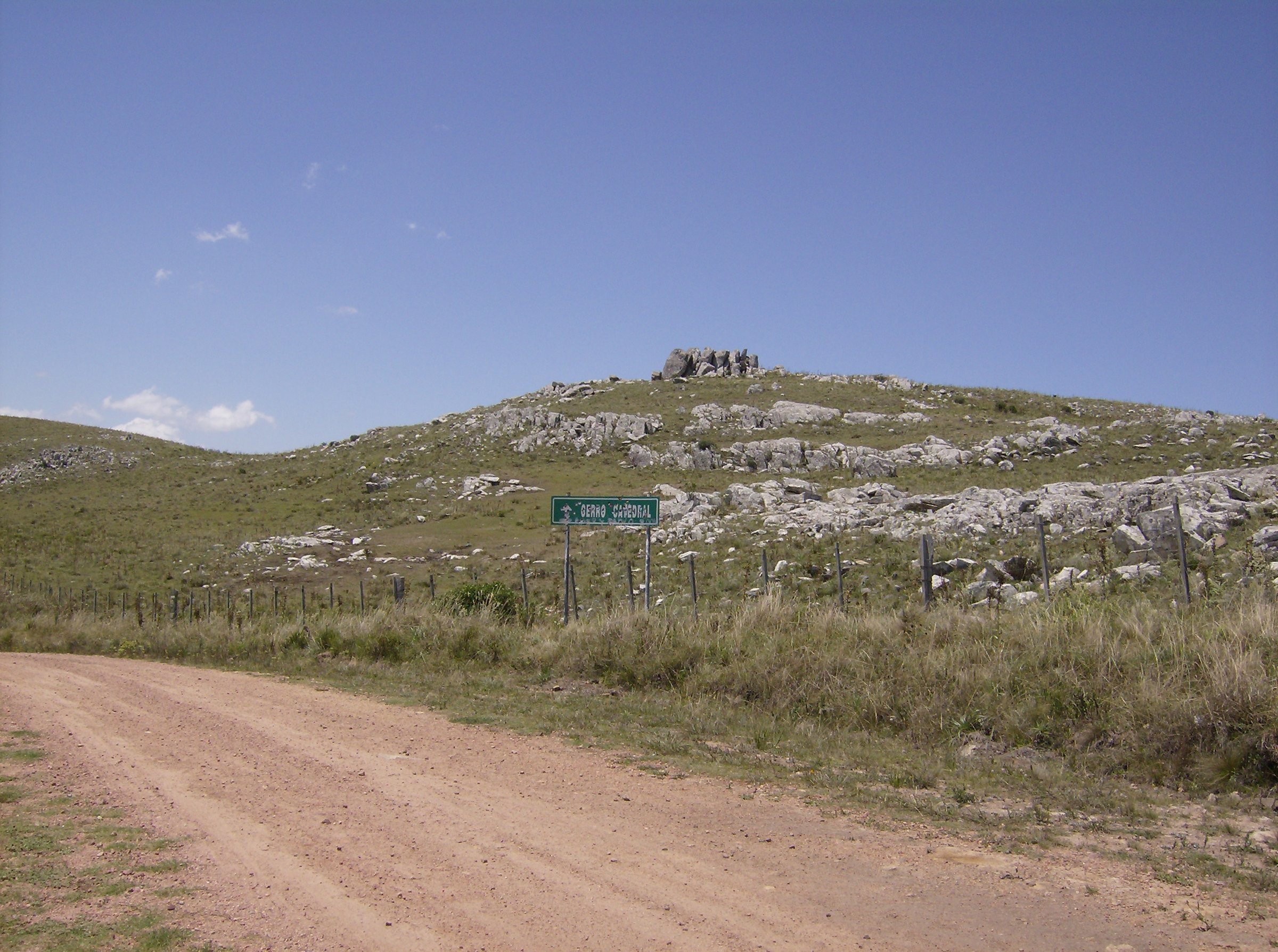
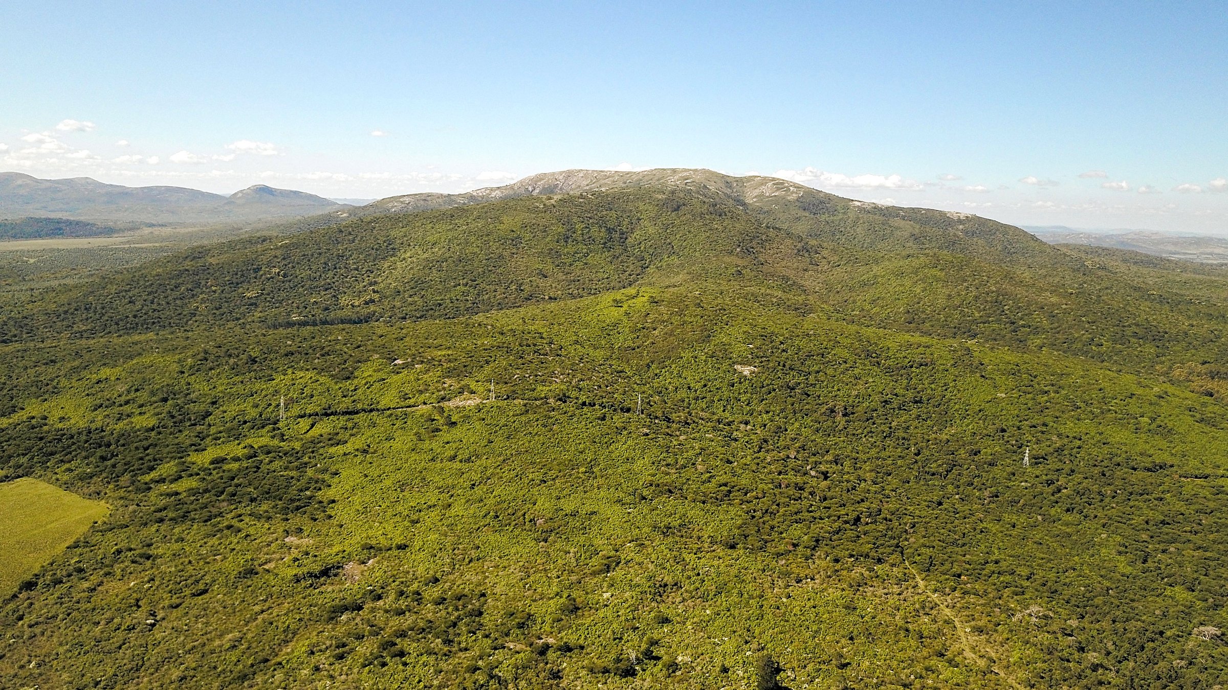
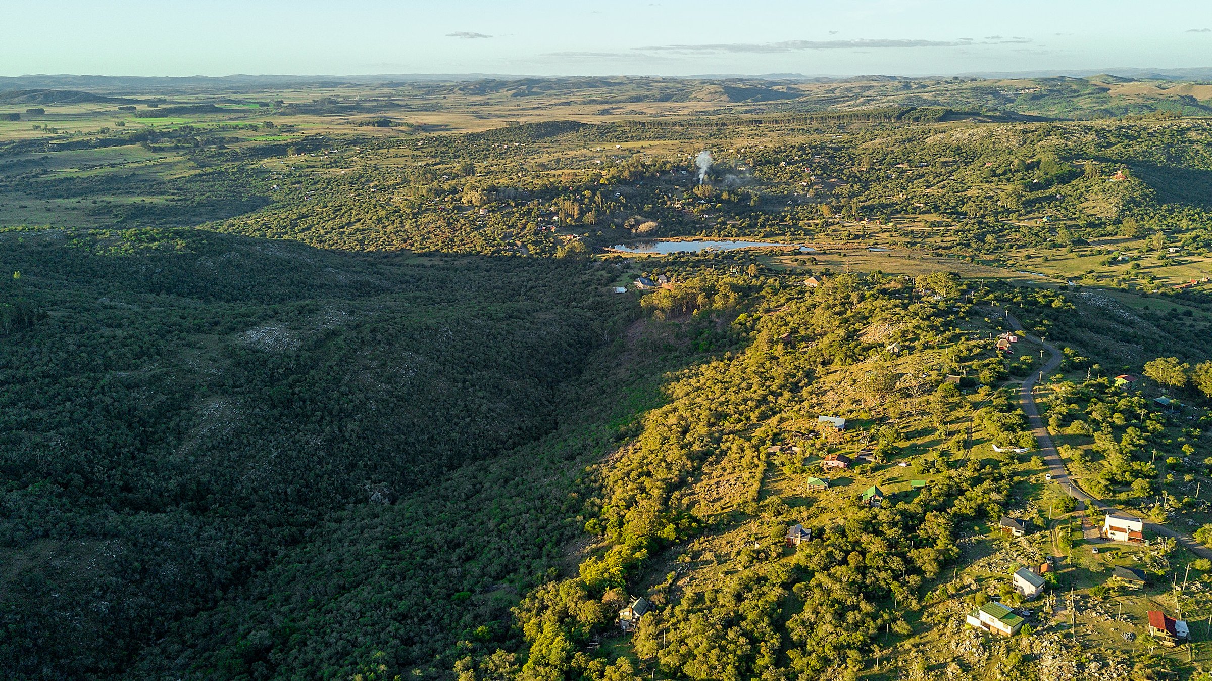
The Cuchilla Grande is Uruguay’s broad eastern upland spine rather than a single alpine range. In hiking terms it is a landscape of low granite and volcanic hills, grassy cuchillas, native woodland pockets, caves, pilgrimage hills, waterfalls, protected ravines and rural access tracks around Lavalleja, Maldonado, Treinta y Tres and Rocha. The walking is low-altitude by international mountain standards, but the terrain can still be rocky, hot, exposed, slippery after rain, and poorly waymarked outside managed visitor sites.
For this general Cuchilla Grande entry, the selection avoids duplicating the more specific Sierra de las Ánimas and Sierra Carapé entries except where a site is also one of the defining Cuchilla Grande landmarks. The five hikes below are the best-supported candidates found in this pass: Arequita, Salto del Penitente, Villa Serrana, Quebrada de los Cuervos, and Cerro del Verdún.
Selection rationale
This set balances a national-park hill and cave route, a waterfall park, a small serrano village/water route, Uruguay’s classic protected ravine walk, and the cultural-pilgrimage hill above Minas. Route geometry is unevenly published: Arequita, Quebrada de los Cuervos and Cerro del Verdún have third-party route pages with statistics; Salto del Penitente and Villa Serrana have official/tourism confirmation but need final field GPS before publication.
Summary table
| # | Hike | Country | Route type | Distance | Gain | Max elevation | Difficulty |
|---|---|---|---|---|---|---|---|
| 1 | Cerro Arequita and Gruta Colón | Uruguay | Out-and-back | 1.3 km AllTrails | 111 m AllTrails | c. 305 m hill; exact route high point unresolved | Moderate |
| 2 | Salto del Penitente waterfall viewpoints | Uruguay | Out-and-back / short loop | c. 1-3 km unresolved | c. 300-350 m area | Easy to moderate | |
| 3 | Villa Serrana: Baño de la India and lake-side paths | Uruguay | Out-and-back / local loop | 0.6 km AllTrails for Baño de la India; longer village loop unresolved | Low | c. 250-350 m area | Easy |
| 4 | Quebrada de los Cuervos main ravine trail | Uruguay | Loop / ravine circuit | c. 3 km | c. 120-150 m, approximate | c. 270-300 m mirador area | Moderate |
| 5 | Cerro del Verdún ascent | Uruguay | Out-and-back | 3.1 km Pacer | 170 m Pacer | c. 326 m | Moderate |
1. Cerro Arequita and Gruta Colón

Snapshot
Itinerary
The walk climbs from the Arequita visitor area through the low woodland and ombu landscape toward the twin rocky masses of Cerro Arequita. The common route reaches the high ground and the Gruta Colón area; access into the cave is reported as guided/fee-based and should be checked locally before publication.
Why it is essential
Arequita is one of the best-known natural symbols of Lavalleja. In November 2024 Uruguay’s Ministry of Environment announced Parque Nacional Arequita’s entry into the national protected-area system, covering Cerro Arequita, Cerro de los Cuervos, part of the upper Santa Lucía River, ombu woodland, wetlands and grasslands.
Equipment
Light hiking shoes with good grip, sun protection, water, and a small daypack. Carry a headlamp only if a legitimate guided cave visit is confirmed; do not enter caves independently.
Hazards and notes
Rocky ground, sun exposure, cave-access controls, and fragile protected-area habitats. Stay on existing paths and confirm current park/land-manager rules.
GPX / KML links
| Source | URL | Format / access | Reuse status |
|---|---|---|---|
| AllTrails: Cerro Arequita | alltrails.com | Source map / route page | AllTrails terms apply; use for comparison only |
| OpenStreetMap search: Cerro Arequita | openstreetmap.org | Source map | ODbL; geometry cross-check target |
External links
2. Salto del Penitente Waterfall Viewpoints
Snapshot
Itinerary
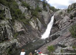
This short day-hike focuses on the established visitor paths around Salto del Penitente, where Arroyo Penitente drops over a high rock wall. The practical route is to link the upper viewpoint, lower cascade area and park approach paths, returning to the visitor area. A final article GPX should be created from a current field walk because official downloadable geometry was not found.
Why it is essential
Salto del Penitente is one of the defining waterfall landscapes of the Cuchilla Grande and a standard Lavalleja nature stop alongside Arequita and Villa Serrana.
Equipment
Walking shoes with grip, water, sun protection and a light rain layer. Avoid smooth-soled shoes on wet rock.
Hazards and notes
Slippery rock, unfenced drops, storm runoff, and paid/managed activity zones. Rappel, zipline or other adventure activities are outside the hiking route and require operator rules/equipment.
GPX / KML links
| Source | URL | Format / access | Reuse status |
|---|---|---|---|
| OpenStreetMap search: Salto del Penitente | openstreetmap.org | Source map | ODbL; geometry cross-check target |
| Wikiloc search: Salto del Penitente | wikiloc.com | Route database search | Wikiloc terms apply; use only as secondary comparison |
External links
3. Villa Serrana: Baño de la India and Lake-Side Paths
Snapshot
Itinerary
The verified short component follows the stream to Baño de la India, a small waterfall and pool near Villa Serrana. For a fuller day-hike, the route should be extended on local paths and quiet roads around the lake, dam, village viewpoints and Ventorrillo de la Buena Vista, but that combined route needs a clean GPX before publication.
Why it is essential
Villa Serrana is the classic inhabited serrano landscape of Lavalleja: low hills, water, rural architecture and short walking objectives. It gives the catalogue a softer cultural-landscape day between Arequita and the wilder ravine/waterfall routes.
Equipment
Comfortable walking shoes, sun protection and water. Add offline navigation if extending beyond the short signed Baño de la India path.
Hazards and notes
Short paths may be simple, but rural extensions can involve road walking, private property boundaries and unclear waymarking. Confirm local access before publishing a longer loop.
GPX / KML links
| Source | URL | Format / access | Reuse status |
|---|---|---|---|
| AllTrails: Baño de la India | alltrails.com | Source map / route listing | AllTrails terms apply; use for comparison only |
| OpenStreetMap search: Villa Serrana Baño de la India | openstreetmap.org | Source map | ODbL; geometry cross-check target |
External links
4. Quebrada de los Cuervos Main Ravine Trail
Snapshot
Itinerary
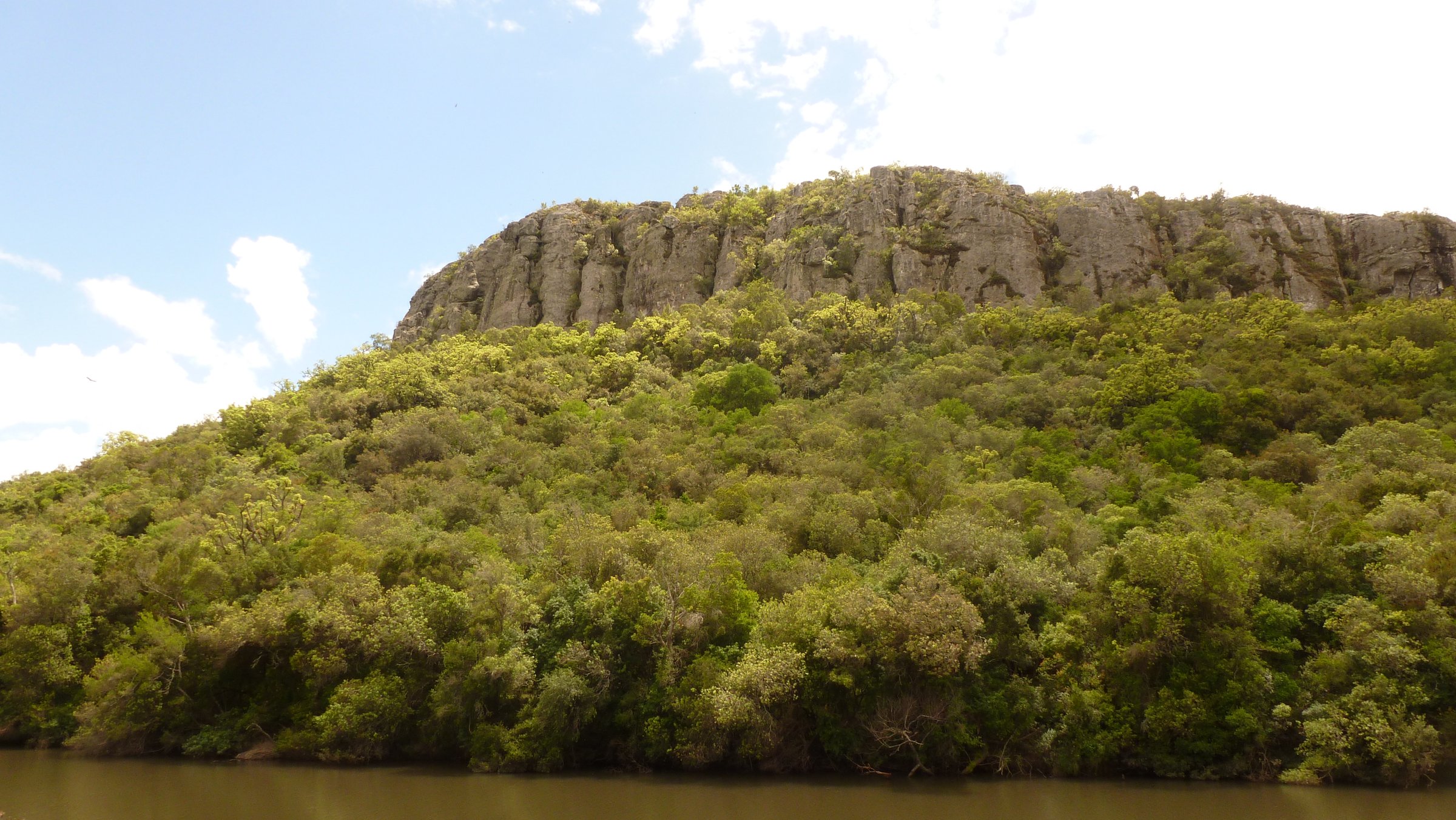
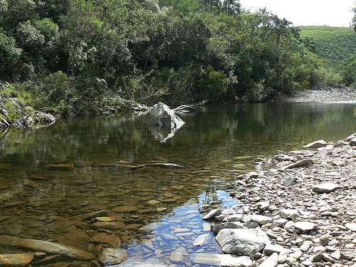
The classic route starts at or near the mirador, descends into the Quebrada de los Cuervos landscape, reaches the Arroyo Yerbal Chico corridor, then climbs back out to the upper visitor area. The official protected-area page stresses staying on identified trails and not leaving the defined route.
Why it is essential
Quebrada de los Cuervos is one of Uruguay’s landmark protected landscapes and the best-known ravine hike linked to the Cuchilla Grande system.
Equipment
Hiking shoes, water, sun protection, insect protection, and a dry bag or waterproof pouch in wet conditions.
Hazards and notes
Slippery stone, steep ravine descent/ascent, high water, and possible route closures after rain. Treinta y Tres authorities have previously limited access to the mirador only after heavy precipitation when the trail was unsafe.
GPX / KML links
| Source | URL | Format / access | Reuse status |
|---|---|---|---|
| Wikiloc: Quebrada de los Cuervos | es.wikiloc.com | Route page / GPX via platform | Wikiloc terms apply; secondary comparison source |
| OpenStreetMap search: Quebrada de los Cuervos | openstreetmap.org | Source map | ODbL; geometry cross-check target |
External links
- Ministerio de Ambiente — Quebrada de los Cuervos y Sierras del Yerbal
- Gobierno de Treinta y Tres — reapertura Quebrada de los Cuervos
- Wikiloc — Quebrada de los Cuervos
5. Cerro del Verdún Ascent
Snapshot
Itinerary
The ascent follows the established road/path to the hilltop religious site above Minas. It is more of a cultural and viewpoint hill walk than a wilderness trail, but the climb gives a clear sense of the Minas basin and surrounding Cuchilla Grande hills.
Why it is essential
Cerro del Verdún is one of Lavalleja’s defining cultural hills and the pilgrimage counterpart to the natural landmarks of Arequita, Penitente and Villa Serrana.
Equipment
Walking shoes, sun protection and water. A reflective vest is useful if walking any road sections.
Hazards and notes
Road traffic on approaches, heat, exposed slopes and crowding during religious events. Check event dates and local traffic controls before publication.
GPX / KML links
| Source | URL | Format / access | Reuse status |
|---|---|---|---|
| Pacer: Camino de ascenso al Verdún | mypacer.com | Route page | Pacer terms apply; secondary source only |
| Wikiloc: Cerro Virgen del Verdún | gl.wikiloc.com | Route page / GPX via platform | Wikiloc terms apply; secondary comparison source |
| OpenStreetMap search: Cerro del Verdún | openstreetmap.org | Source map | ODbL; geometry cross-check target |
External links
External links
| Source | URL |
|---|---|
| Ministerio de Ambiente — Parque Nacional Arequita | gub.uy |
| Ministerio de Ambiente — Quebrada de los Cuervos y Sierras del Yerbal | ambiente.gub.uy |
| Gobierno de Treinta y Tres — reapertura Quebrada de los Cuervos | treintaytres.gub.uy |
| Lavalleja Productivo — Turismo aventura | lavallejaproductivo.com |
| Uruguay Natural — Lavalleja places | uruguaynatural.com |
| AllTrails — Cerro Arequita | alltrails.com |
| AllTrails — Villa Serrana | alltrails.com |
| Wikiloc — Quebrada de los Cuervos | es.wikiloc.com |
| Wikiloc — Cerro Virgen del Verdún | gl.wikiloc.com |
| Pacer — Camino de ascenso al Verdún | mypacer.com |
| Wikipedia — Cerro del Verdún | es.wikipedia.org |