Regional overview
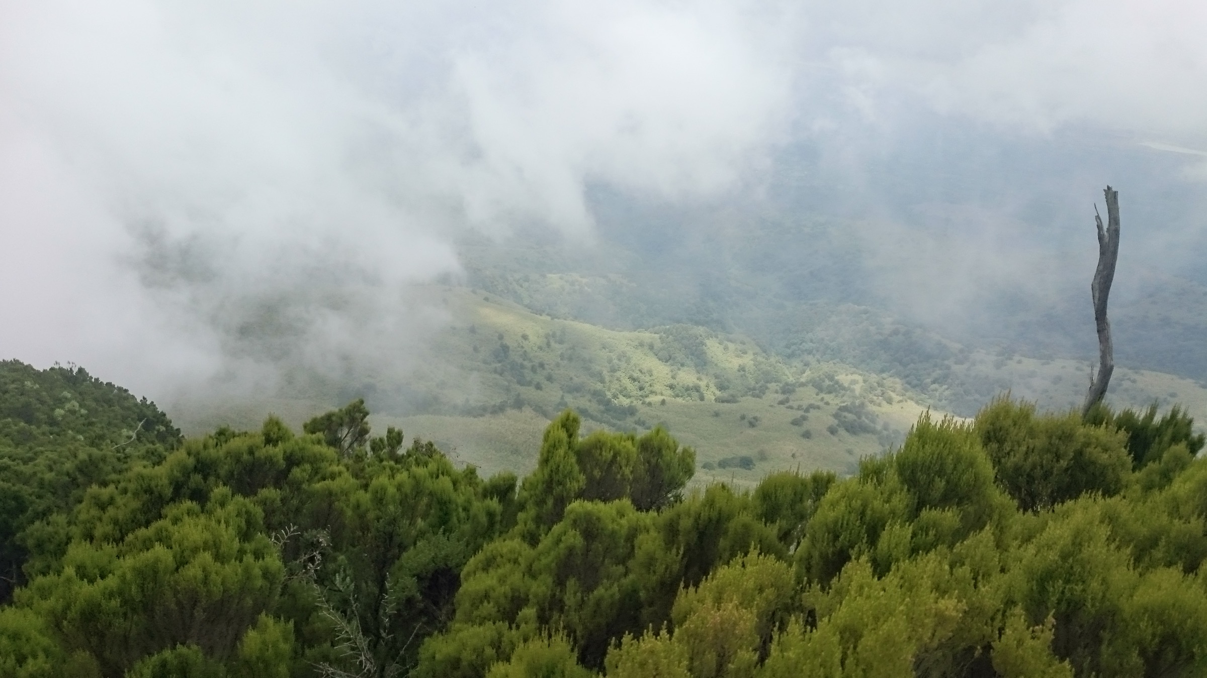
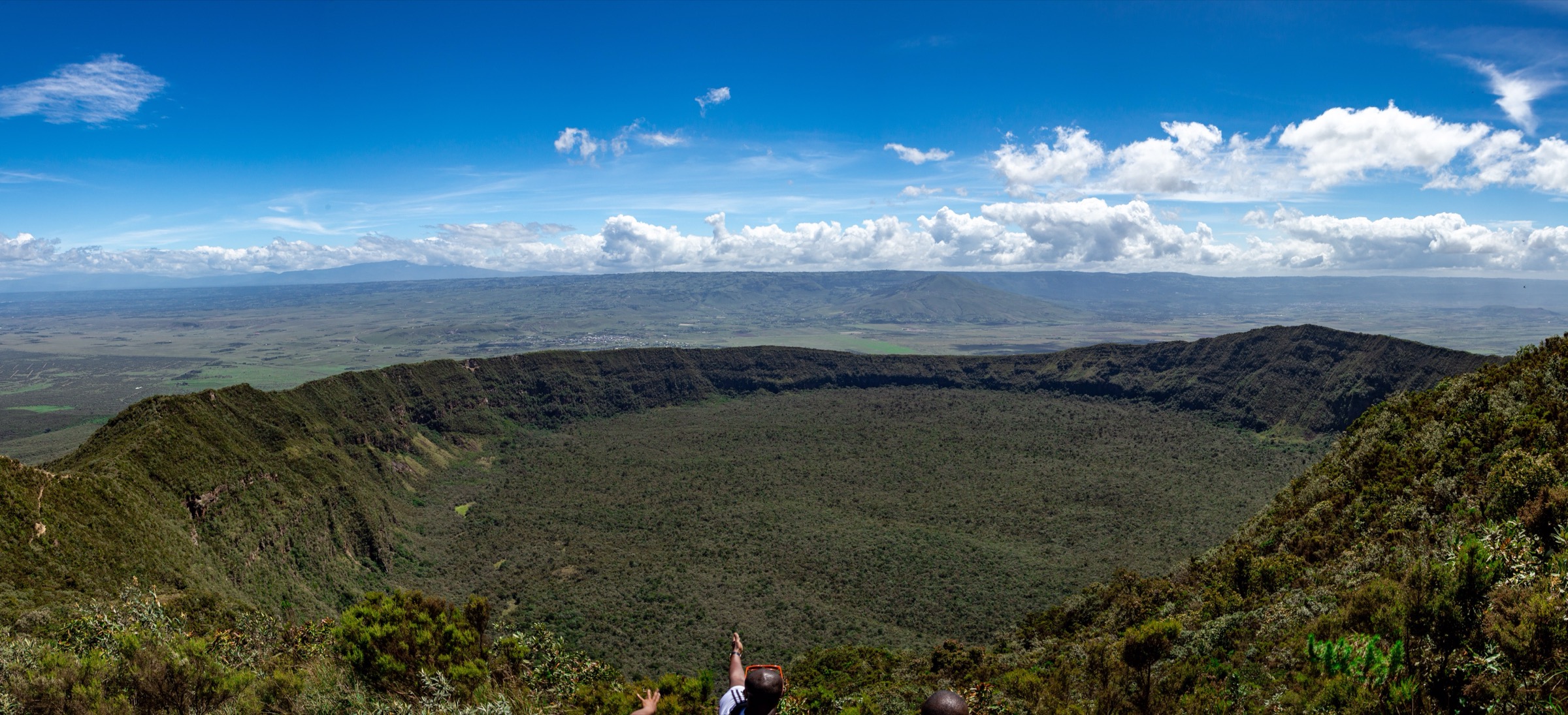
Mount Elgon is a transboundary extinct volcano on the Kenya-Uganda border, with one of the largest calderas in the world and a mosaic of montane forest, bamboo, moorland, and Afro-alpine zones rising to the high points of Wagagai and Koitoboss. The massif is protected as a national park on both sides. The Uganda Wildlife Authority lists Wagagai, the caldera, Endebess Bluff, Sipi Falls, hot springs, and Kitum Cave as the key trekking attractions; the Kenya Wildlife Service confirms hiking, cave exploration, Koitoboss, and Endebess Bluff as core activities.
The walking character ranges from short waterfall and cave visits at lower elevations to long high-altitude summit days. Conditions are wet year-round, with the driest months running roughly December to February. Ranger or guide arrangements are standard for inner-park days, and many tracks require local verification because published route geometry is limited.
This article assembles five Mount Elgon day-hike candidates from both sides of the border. The selection is closer to catalogue-ready than the neighbouring Mau Escarpment and Cherangani entries, but several stats and trail lines still need on-the-ground verification, and most candidates do not yet have legally reusable GPX/KML.
Selection rationale
The five hikes cover the principal Mount Elgon themes across both countries: the Kenya-side high summit at Koitoboss; the Endebess Bluff escarpment viewpoint walk; the Kitum and Makingeny elephant caves; the Sipi Falls three-waterfall route on the Ugandan flank; and the Kapkwai Forest Exploration Centre day trail as the Uganda-side montane-forest counterpart.
Summary table
| # | Hike | Country | Route type | Distance | Gain | Max elevation | Difficulty |
|---|---|---|---|---|---|---|---|
| 1 | Koitoboss Peak from the Kenyan road-end | Kenya | Out-and-back | Unresolved | Unresolved | 4,222 m | Hard |
| 2 | Endebess Bluff walk | Kenya | Out-and-back | Unresolved | Unresolved | ca. 2,563 m | Moderate |
| 3 | Kitum Cave and Makingeny Cave walk | Kenya | Out-and-back / short link walk | Unresolved; ca. 1.5 km between caves | Unresolved | Unresolved | Easy / moderate |
| 4 | Sipi Falls three-waterfall walk | Uganda | Loop / out-and-back network | Unresolved | Unresolved | Unresolved; falls at ca. 95 m, 74 m, 85 m drops | Moderate |
| 5 | Kapkwai Forest Exploration Centre day trail | Uganda | Out-and-back / loop | Unresolved | Unresolved | ca. 2,050 m at Kapkwai | Moderate |
1. Koitoboss Peak from the Kenyan road-end

Snapshot
Itinerary
Koitoboss is the highest point on the Kenyan side of Mount Elgon at 4,222 m. The route runs from a road-end / Koitoboss area trailhead to the summit and back. KWS confirms the summit as a hiking objective, and Peakbagger entries reference Koitoboss as a Mount Elgon subsidiary high point. The exact public trailhead, route distance, and ascent need local verification and an independent GPX recording.
Why it is essential
Koitoboss is the headline Kenya-side high summit of Mount Elgon and the natural counterpart to Wagagai on the Ugandan flank.
Equipment
- Sturdy boots, full rain shell, warm and wind layers, hat and gloves for altitude.
- Headtorch, navigation backup, first-aid kit, emergency shelter.
- Ranger / guide arrangement; altitude awareness.
Hazards and notes
- Altitude weather can change quickly; rain and cold are routine.
- Confirm ranger requirements and current KWS gate access.
GPX / KML links
| Source | URL | Format / access | Reuse status |
|---|---|---|---|
| KWS — Mount Elgon National Park | kws.go.ke | Park information | Reference only |
| Peakbagger: Mount Elgon (Koitoboss reference) | peakbagger.com | Peak summary | Peakbagger terms; no open GPX confirmed |
| OpenStreetMap search: Koitoboss | openstreetmap.org | Source map/search | OSM data is ODbL; no route relation selected; geometry cross-check only |
External links
2. Endebess Bluff walk

Snapshot
Itinerary
Endebess Bluff is a Mount Elgon viewpoint at about 2,563 m, reached from the Chorlim / Endebess gate on the Kenyan side. The route is an out-and-back walk to the bluff with escarpment, gorge, mesa, and river panoramas. Distance and ascent are not separately published. KWS gives the road approach as Nairobi-Kitale-Endebess and the air approach via Eldoret or Kitale.
Why it is essential
Endebess Bluff is the headline Kenya-side mid-elevation viewpoint and the most accessible Mount Elgon panoramic walk.
Equipment
- Sturdy boots, rain shell, warm layer.
- Headtorch, navigation backup, first-aid kit.
- KWS gate clearance.
Hazards and notes
- Weather exposure on the bluff and slippery ground after rain.
- Confirm current gate access and any ranger requirements.
GPX / KML links
| Source | URL | Format / access | Reuse status |
|---|---|---|---|
| KWS — Mount Elgon National Park | kws.go.ke | Park information | Reference only |
| OpenStreetMap search: Endebess Bluff | openstreetmap.org | Source map/search | OSM data is ODbL; no route relation selected; geometry cross-check only |
External links
3. Kitum Cave and Makingeny Cave walk

Snapshot
Itinerary
Kitum Cave and Makingeny Cave are the famous elephant salt caves on the Kenyan side of Mount Elgon. KWS notes Kitum Cave extends about 200 m into the mountain and that Makingeny lies about 1.5 km from Kitum. The walk links the two caves as an out-and-back or short link route from the Kenyan cave access area. The exact walking distance and any elevation gain on the link are not separately published.
Why it is essential
The Kitum and Makingeny caves are the most distinctive walking objective on Mount Elgon, famous for elephants that excavate salt deep inside the cave system.
Equipment
- Sturdy boots, rain shell, warm layer.
- Headtorch (essential for cave interior), spare batteries.
- Ranger / guide arrangement; protective face covering for bat-guano environments.
Hazards and notes
- Cave wildlife, bat guano and associated disease risk, darkness, and wet rock are the main hazards.
- Ranger or guide arrangement is strongly recommended.
GPX / KML links
| Source | URL | Format / access | Reuse status |
|---|---|---|---|
| KWS — Mount Elgon National Park | kws.go.ke | Park information | Reference only |
| OpenStreetMap search: Kitum Cave | openstreetmap.org | Source map/search | OSM data is ODbL; no route relation selected; geometry cross-check only |
External links
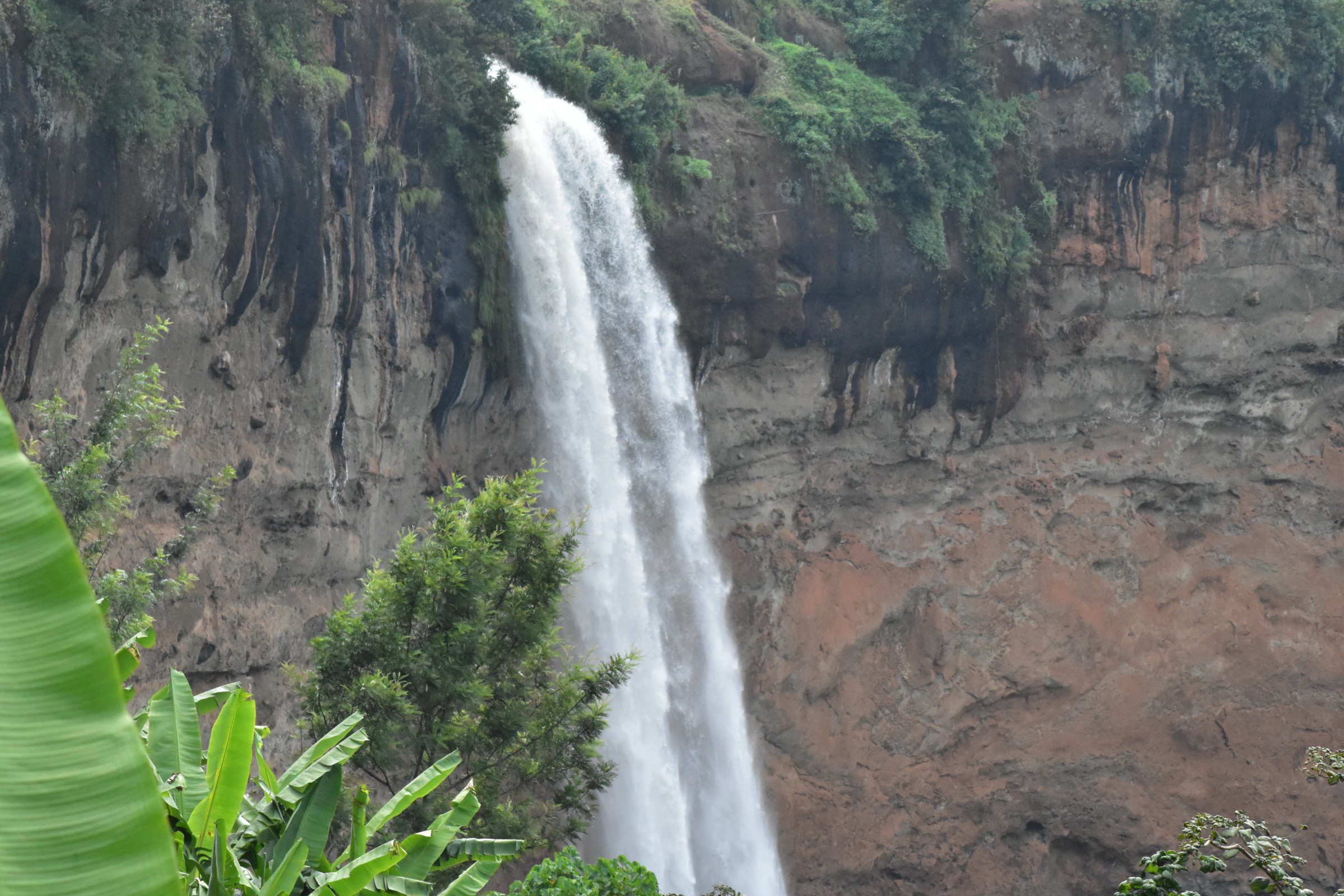
4. Sipi Falls three-waterfall walk
Snapshot
Itinerary
The Sipi Falls walk links the three principal waterfall drops on the Ugandan flank of Mount Elgon, with the falls reported at roughly 95 m, 74 m, and 85 m. The route is a loop or out-and-back network from Sipi village, normally walked with a local guide. Distance and ascent are not separately published in the sources checked.
Why it is essential
Sipi Falls is the classic lower-Elgon waterfall hike and the most photographed walking objective on the Ugandan side of the massif.
Equipment
- Sturdy boots, rain shell, warm layer.
- Headtorch, navigation backup, first-aid kit.
- Local guide.
Hazards and notes
- Slippery rock near the falls and along viewpoints; flash-flood awareness after heavy rain.
- Confirm current guide and viewpoint arrangements in Sipi village.
GPX / KML links
| Source | URL | Format / access | Reuse status |
|---|---|---|---|
| OpenStreetMap search: Sipi Falls | openstreetmap.org | Source map/search | OSM data is ODbL; no route relation selected; geometry cross-check only |
| Wikiloc search: Sipi Falls | wikiloc.com | Search page | Wikiloc terms apply if a track is later selected; no legal GPX found |
External links
- Wikipedia — Sipi Falls
- Wikipedia — Mount Elgon
- Uganda Wildlife Authority — Mount Elgon National Park
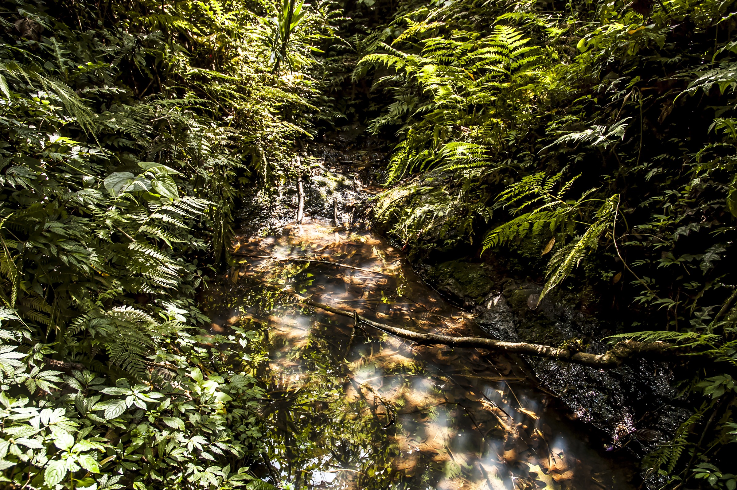
5. Kapkwai Forest Exploration Centre day trail / Chebonet-Tutum forest walk

Snapshot
Itinerary
The Kapkwai Forest Exploration Centre is the day-walk hub on the Ugandan side of Mount Elgon, sitting at about 2,050 m. The candidate is a Chebonet-Tutum-style forest walk through montane forest, bamboo, waterfalls, caves, and birding habitat, with UWA brochure and local ranger guidance. No GPX file was found in this pass.
Why it is essential
Kapkwai is the Uganda-side montane-forest counterpart to Sipi Falls — a forest, bamboo, waterfall, and birding day without committing to a multi-day summit trek.
Equipment
- Sturdy boots, rain shell, warm layer.
- Insect protection, navigation backup, first-aid kit.
- Local ranger / guide arrangement.
Hazards and notes
- Wet ground, slippery roots, and unresolved trail distances are the main concerns.
- Confirm UWA day-trail options at the Kapkwai centre before walking.
GPX / KML links
| Source | URL | Format / access | Reuse status |
|---|---|---|---|
| UWA — Mount Elgon National Park | ugandawildlife.org | Park information | Reference only |
| OpenStreetMap search: Kapkwai | openstreetmap.org | Source map/search | OSM data is ODbL; no route relation selected; geometry cross-check only |
| Wikiloc search: Mount Elgon Uganda | wikiloc.com | Search page | Wikiloc terms apply if a track is later selected; candidate source only |
External links
Missing data / follow-up work
- No official or reusable GPX/KML route files found for any of the five hikes.
- Distances, ascents, descents, and walking times are not separately published for most of the routes; max elevations and cave-link distance are the main verified statistics.
- Direct Wikimedia Commons file URLs for the selected photos were not supplied in the source spec; search-URL placeholders are used and should be replaced with file URLs at publication time.
- UWA brochures, KWS gate information, and current ranger / guide arrangements should be confirmed before practical publication of any route.
External links
| Source | URL |
|---|---|
| Wikipedia — Mount Elgon | en.wikipedia.org |
| Wikipedia — Kitum Cave | en.wikipedia.org |
| Wikipedia — Sipi Falls | en.wikipedia.org |
| Uganda Wildlife Authority — Mount Elgon National Park | ugandawildlife.org |
| Kenya Wildlife Service — Mount Elgon National Park | kws.go.ke |
| Peakbagger — Mount Elgon | peakbagger.com |
| OpenStreetMap | openstreetmap.org |
| Wikiloc search | wikiloc.com |
| AllTrails search | alltrails.com |