Regional overview
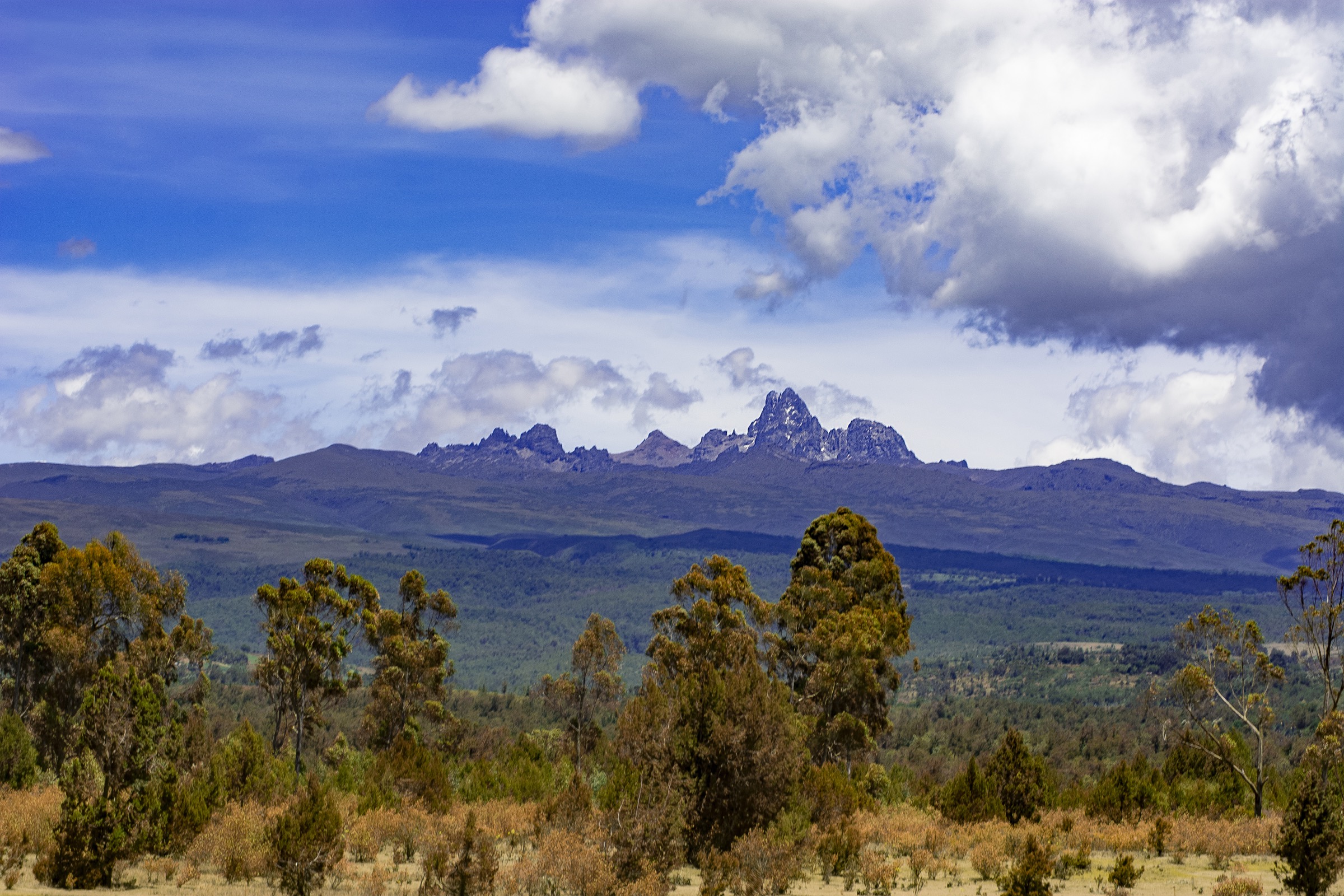
The central Kenyan Rift between Naivasha and Nakuru carries three of East Africa’s most recognisable young volcanoes — Mount Longonot, Mount Suswa, and Menengai — each set inside the steep walls of the Gregory Rift and each offering a full-day walk on or into a caldera. Longonot is a sharply built 2,776 m stratovolcano with an 1.8 km summit crater perched above an older 8 by 12 km caldera; Suswa is a 2,356 m shield volcano with a rare double caldera and an extensive lava-tube system on its north-eastern flank; Menengai is a low broad shield at 2,278 m holding one of the largest intact calderas on Earth, roughly 12 by 8 km, on Nakuru’s northern doorstep.
The three sit within day-trip range of Nairobi and Nakuru and form a compact volcanic triangle on either side of the Mai Mahiu - Narok and Nairobi - Nakuru highways. Longonot is protected as Mount Longonot National Park under the Kenya Wildlife Service; access requires a KWS conservation fee and the gate sits about 60 km north-west of Nairobi. Suswa is community land managed by the Mount Suswa Conservancy on Maasai group ranches, with a conservancy gate fee and locally arranged guides. Menengai sits in the Menengai Forest Reserve under the Kenya Forest Service, with a barrier on the road from Nakuru town to the main rim viewpoint and a KFS guide normally required for floor descents.
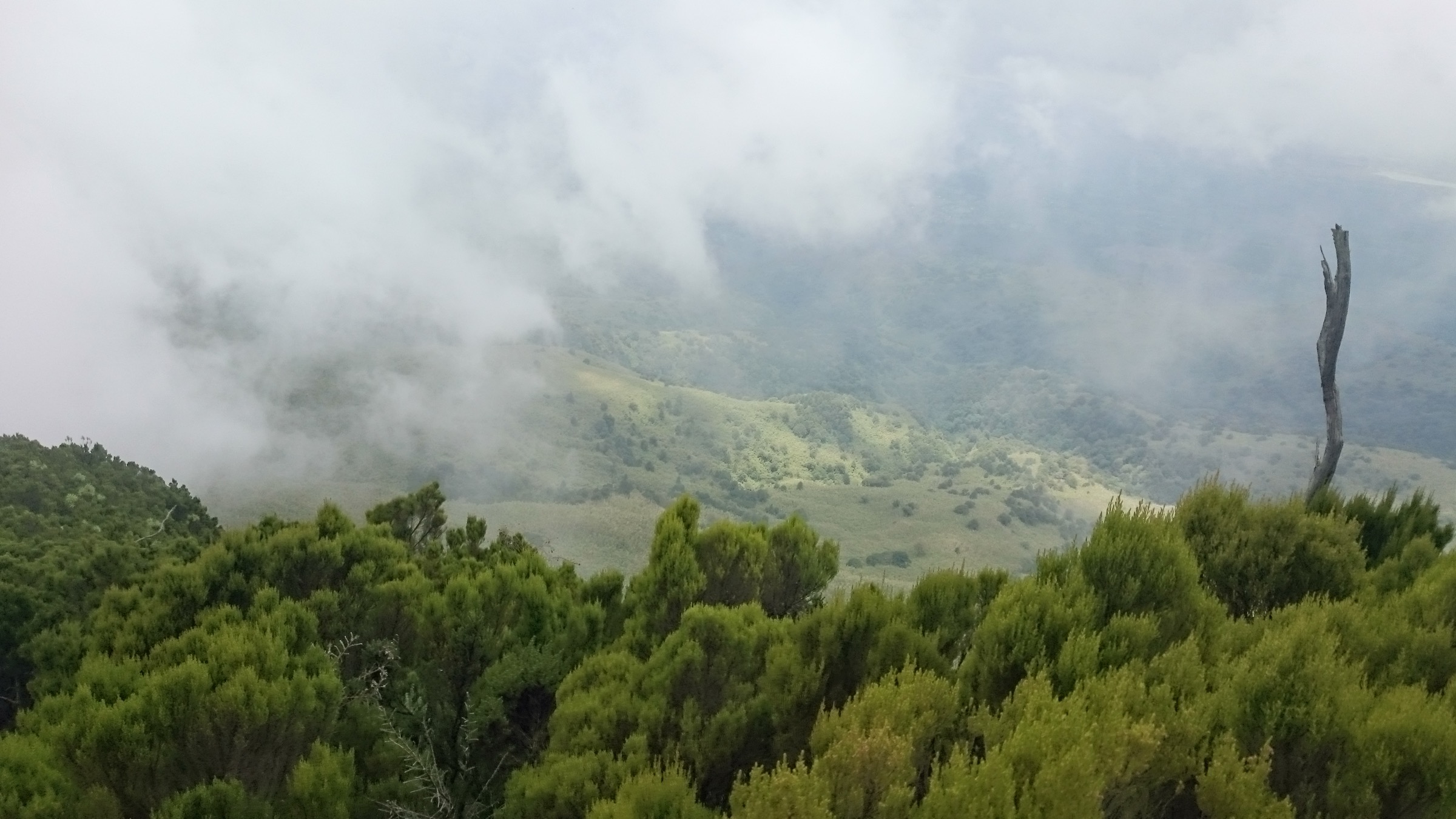
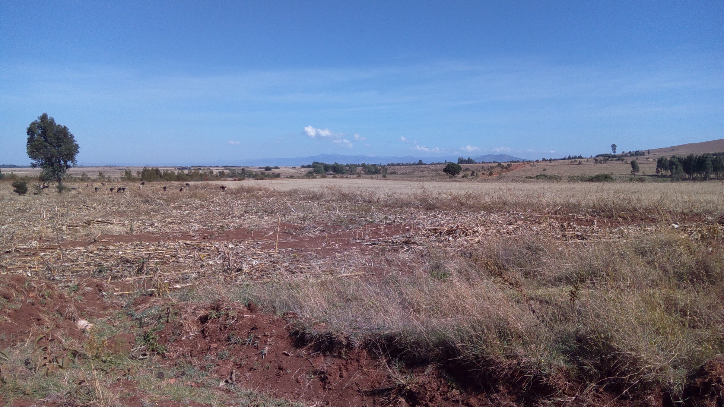
The walking character is open volcanic landscape: ash and trachyte underfoot, sparse acacia and leleshwa scrub on the outer flanks, occasional grassy crater floors with grazing wildlife, and frequently a steady wind on exposed rims. Forest cover is thin compared with Aberdares or Mount Kenya. There is little shade on Longonot and Menengai’s rims, and exposed sun and dust are usually the main hazards. Best conditions are the drier windows of January-February and June-September; the long rains of March-May and the short rains of October-November can turn ash trails to slippery mud.
Common-sense precautions apply across all three: wildlife in Longonot National Park (zebra, giraffe, buffalo), unstable lava-tube ceilings and unmarked vents in the Suswa cave field, geothermal works on the Menengai floor, and steep eroded steps on Longonot’s initial climb. Reliable water and food are not available on any of the rims, and there is no public transport directly to the gates — most walkers use private vehicles, organised day tours, or matatu plus boda-boda transfers from Naivasha, Mai Mahiu, or Nakuru.
Selection rationale
The five hikes cover the three named volcanoes proportionally — two on Longonot (the full crater rim loop and the shorter gate-to-rim and Lake Naivasha viewpoint), two on Suswa (the inner-summit ascent and the lava-cave and outer-rim loop), and one on Menengai (the main viewpoint and crater-floor descent). The set captures the principal volcanic landforms of the central Kenyan Rift, balances the iconic Longonot circuit against the less-walked Suswa caves, and includes one option on each gate side accessible without specialist skills.
Summary table
| # | Hike | Country | Route type | Distance | Gain | Max elevation | Difficulty |
|---|---|---|---|---|---|---|---|
| 1 | Mount Longonot crater rim circuit | Kenya | Loop with out-and-back access | 13.5 km | ~630 m | 2,776 m | Hard |
| 2 | Longonot gate to crater rim and Lake Naivasha viewpoint | Kenya | Out-and-back | 6.2 km | ~480 m | ~2,580 m | Moderate |
| 3 | Mount Suswa summit via Rauch’s Trail | Kenya | Out-and-back | ~10 km | ~600 m | 2,356 m | Moderate to hard |
| 4 | Suswa lava caves and outer crater rim loop | Kenya | Loop / out-and-back | 12-15 km | ~535 m | ~2,200 m | Moderate |
| 5 | Menengai Crater viewpoint and floor descent | Kenya | Out-and-back | 8 km | ~500 m | 2,278 m | Moderate |
1. Mount Longonot crater rim circuit
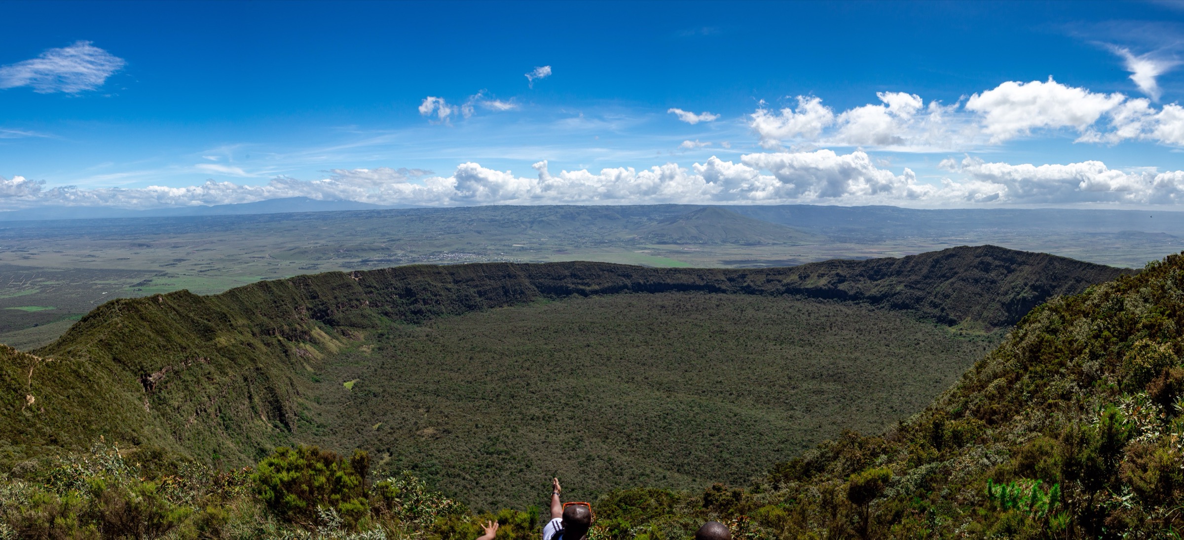
Snapshot
Itinerary
From the KWS gate at roughly 2,150 m the path climbs steeply on heavily eroded ash and lava tread for about 3.1 km, gaining around 630 m to the first crater-rim shoulder. The rim opens onto a deep, vegetated 1.8 km crater set inside the wider 8 by 12 km Pleistocene caldera. The 7.2 km loop traverses the rim clockwise or anticlockwise over a series of ash-and-trachyte humps, including a short scrambly section toward the 2,776 m summit on the north-east rim. Views extend south-west to Lake Naivasha and the Mau Escarpment, and east to the Kinangop plateau. Return is by the same access path.
Why it is essential
Longonot’s crater rim is the headline volcanic day-hike of the central Kenyan Rift — a complete loop around an intact young summit crater perched above a Pleistocene caldera, with summit, rim traverse, and Lake Naivasha view in a single circuit. It is the route that defines the region’s “rim walk” character.
Equipment
- Sturdy hiking shoes or boots with good grip
- Sun hat and high-SPF sun protection
- Minimum 2-3 L water per person
- Wind layer for the rim
- KWS conservation fee paid at gate
- Trekking poles helpful on the loose descent
Hazards and notes
- Steep, heavily eroded ash steps on the access trail.
- Loose underfoot on rim humps; one notable scrambly section near the summit.
- No water sources on the mountain.
- Sun and wind exposure on the rim.
- Wildlife encounters possible (zebra, giraffe, buffalo) on lower slopes.
- KWS conservation fee required; rules vary by citizen / resident / non-resident status.
GPX / KML links
| Source | URL | Format / access | Reuse status |
|---|---|---|---|
| AllTrails — Mount Longonot | alltrails.com | Route reference; GPX behind account | GPX reuse unresolved |
| OpenStreetMap — Mount Longonot search | openstreetmap.org | Source map / search | OSM data is ODbL; geometry cross-check only |
External links
- Wikipedia — Mount Longonot
- Kenya Wildlife Service — Mount Longonot National Park
- Smithsonian Global Volcanism Program — Longonot
2. Longonot gate to crater rim and Lake Naivasha viewpoint

Snapshot
Itinerary
The 3.1 km access path climbs directly from the KWS gate at about 2,150 m to the first crater rim shoulder. The tread is dry ash, gravel, and broken rock cut into steep step-like sections. From the rim shoulder the route opens onto a broad western view: the Naivasha basin below, the Mau Escarpment in the distance, and the inner Longonot crater dropping away to the east. Return is on the same path; walkers who do not want the full circuit can turn back here.
Why it is essential
The gate-to-rim shoulder section is the standard short option for the volcano — Longonot’s classic view of Lake Naivasha and the Mau without committing to the full rim loop. It is the most widely walked half of the route by visitors short on time or fitness.
Equipment
- Sturdy hiking shoes or boots
- Sun hat and sun protection
- 2 L water per person
- Light wind layer for the rim
- KWS conservation fee paid at gate
Hazards and notes
- Steep eroded steps on the access path.
- No water on the climb.
- Strong sun.
- Wildlife on lower slopes — keep distance from buffalo in particular.
- KWS conservation fee required.
GPX / KML links
| Source | URL | Format / access | Reuse status |
|---|---|---|---|
| AllTrails — Mount Longonot | alltrails.com | Route reference; full loop track | GPX reuse unresolved |
| OpenStreetMap — Mount Longonot search | openstreetmap.org | Source map / search | OSM data is ODbL; geometry cross-check only |
External links
- Wikipedia — Mount Longonot
- Kenya Wildlife Service — Mount Longonot National Park
- Smithsonian Global Volcanism Program — Longonot
3. Mount Suswa summit via Rauch’s Trail

Snapshot
Itinerary
Rauch’s Trail starts on the north-eastern side of the conservancy, marked at the trailhead with a wooden sign. The path climbs through open Maasai grazing land and acacia scrub onto the outer crater rim and then traverses to the inner caldera. The summit at 2,356 m is the high point of the inner crater rim, looking south-west across the inner caldera moat and the tilted central block. Return is by the same line. Conservancy guides are normally arranged at the gate.
Why it is essential
Suswa’s summit ascent is the cleanest way to see Suswa’s defining geology — a shield volcano with a moat-like inner crater surrounding a tilted central block, a landform that has few parallels in East Africa. The viewpoint from the inner rim is the key vantage on this structure.
Equipment
- Sturdy hiking shoes or boots
- Sun hat and sun protection
- 2-3 L water per person; no water on the mountain
- Wind layer for the rim
- Mount Suswa Conservancy entry fee paid at gate
- Local guide arranged through the conservancy
Hazards and notes
- Remote location; no on-mountain services.
- Sun and wind exposure on the open rim.
- Snakes occur on the inner crater moat.
- Wildlife in the conservancy includes buffalo and hyena.
- Guide and conservancy fee normally required.
- Access road is rough; 4WD recommended.
GPX / KML links
| Source | URL | Format / access | Reuse status |
|---|---|---|---|
| Wikiloc search — Mount Suswa | wikiloc.com | Search page; user tracks | Wikiloc terms apply on selection; reuse unresolved |
| OpenStreetMap — Mount Suswa search | openstreetmap.org | Source map / search | OSM data is ODbL; geometry cross-check only |
External links
4. Suswa lava caves and outer crater rim loop

Snapshot
Itinerary
The north-eastern flank of Suswa carries one of the most complex lava-tube systems documented in East Africa, with over 70 collapsed roof entrances and several kilometres of tubes mapped. The loop links a representative sample of accessible cave entrances, including bat-occupied chambers, with a section of the outer crater rim. Guides from the conservancy lead the cave visits and the rim walk. Distance varies from about 12 km on the half-crater option (about 535 m of ascent) to the full inner-rim circuit at 22 km if extended.
Why it is essential
The Suswa caves are an internationally significant volcanic feature — one of the most braided lava-tube networks known — and combining them with an outer-rim walk is the standard non-summit way to experience the volcano. The route balances geology, wildlife (bats, baboons), and rim views in one day.
Equipment
- Sturdy hiking shoes or boots
- Headtorch with spare batteries for cave entries
- Helmet recommended for low cave roofs
- Sun hat and sun protection on the rim
- 2-3 L water per person
- Mount Suswa Conservancy entry fee paid at gate
- Local guide arranged through the conservancy
Hazards and notes
- Unstable lava-tube ceilings and unmarked collapse holes.
- Bat guano and respiratory hazard in some chambers.
- No water on the mountain.
- Sun and wind exposure on the rim.
- Guide and conservancy fee normally required for legal cave access.
GPX / KML links
| Source | URL | Format / access | Reuse status |
|---|---|---|---|
| Wikiloc search — Suswa caves | wikiloc.com | Search page; user tracks | Wikiloc terms apply on selection; reuse unresolved |
| OpenStreetMap — Mount Suswa search | openstreetmap.org | Source map / search | OSM data is ODbL; geometry cross-check only |
External links
5. Menengai Crater viewpoint and floor descent

Snapshot
Itinerary
From the main southern viewpoint at 2,278 m the path drops steeply down forested and grassy switchbacks to the broad caldera floor, which carries lava boulder fields, ongoing GDC geothermal works, and grazing land. The downhill is the easier half — about 30 to 60 minutes to the floor. The return climb to the rim is the strenuous part and the reason the round trip is rated moderate rather than easy. Some routes loop briefly across the floor before returning. KFS staff at the road barrier collect entry fees and a guide is normally required.
Why it is essential
Menengai is the third pillar of the central Rift volcanic triangle and one of the world’s largest intact calderas, second only to a handful of other shields globally. The viewpoint and floor descent gives a complete look at this 90 km² caldera in half a day from Nakuru, complementing the Longonot and Suswa routes.
Equipment
- Sturdy hiking shoes or boots
- Sun hat and sun protection
- 2 L water per person
- KFS entry fee paid at the road barrier
- Guide normally required for floor descents
Hazards and notes
- Steep return climb to the rim.
- Active geothermal works on the floor — keep clear of well pads and steam vents.
- Sun and wind exposure on the rim.
- Limited mobile signal on the floor.
- KFS guide normally required; rules and fees vary year to year.
GPX / KML links
| Source | URL | Format / access | Reuse status |
|---|---|---|---|
| AllTrails — Menengai Crater | alltrails.com | Route reference; GPX behind account | GPX reuse unresolved |
| OpenStreetMap — Menengai search | openstreetmap.org | Source map / search | OSM data is ODbL; geometry cross-check only |
External links
Missing data / follow-up work
- No officially published GPX/KML downloads were located for any of the five routes; AllTrails, Wikiloc, and OpenStreetMap are used as geometry references only.
- KWS, Mount Suswa Conservancy, and KFS fee schedules change frequently; confirm current rates before travel.
- Public transport details to the Longonot, Suswa, and Menengai gates are limited; access is normally by private vehicle, organised tour, or matatu plus boda-boda transfer.
- Mount Suswa summit and cave-loop distances and ascents vary between sources; the figures above are best-available approximations and a route-specific GPS track is needed to firm them up.
- Menengai floor access conditions can change because of active GDC geothermal works; check current Kenya Forest Service rules before descending.