Regional overview
The Aberdare Range, known locally as Nyandarua, is a 160 km north-to-south highland chain in central Kenya, west of Mount Kenya and forming the eastern wall of the Great Rift Valley. The range straddles Nyandarua, Nyeri, Murang’a, Kiambu and Laikipia counties, holds an average elevation of about 3,500 m, and rises to 4,001 m at Ol Doinyo Lesatima (Mount Satima) in the north and 3,906 m at Mount Kinangop in the south. The western slopes drop sharply to the Kinangop Plateau and the Rift floor; the eastern slopes descend more gradually toward Nyeri and the Kikuyu highlands.
Aberdare National Park, gazetted in 1950 and managed by the Kenya Wildlife Service (KWS), protects 767 km² of the high massif. It is structured around four landscape bands: lower montane rainforest, a thick bamboo belt at roughly 2,400-3,000 m, the open Hagenia and Erica heath, and the high tussock-grass moorland with giant lobelia and giant groundsel above the treeline. The park encloses both summits, the headwaters of the Chania, Karuru and Gura rivers, and the historic forest hideouts associated with the Mau Mau campaign of the 1950s, including Dedan Kimathi.
Walking access is regulated. Day-hikes onto the moorland summits from Njabini or Mutarakwa typically rely on the southern KWS posts and Forest Stations at the park boundary; armed-ranger escorts are normally compulsory because of elephant and buffalo in the forest and bamboo zones. Inside the park, KWS entry fees apply to citizens, residents and non-residents, with non-residents paying USD 70 per 24-hour entry as of late 2025. Bookings and payments go through eCitizen. Treetops, the Ark and the Mutubio side give vehicle access to the waterfalls and high moorlands.
Weather is the other constraint. The Aberdares straddle the Equator at altitude and receive heavy rainfall, especially during the long rains (March-May) and short rains (October-November). The drier windows, broadly January-February and June-September, are preferred for summits. Mist, mud, freezing nights and cold rain are normal above 3,000 m and dictate the equipment list.
Selection rationale
The five hikes span the range from south to north and cover its main themes: the iconic strenuous southern summit (Elephant Hill) and its harder neighbour (Mount Kinangop); the highest peak (Ol Doinyo Lesatima via the Wandare trail); the northern moorland traverse (Table Mountain from Shamata); and a representative waterfall and Rift-edge walk from the Mutubio side (Karuru, Chania and Magura). Together they sample the bamboo zone, the moorland with its giant groundsels, the Dragon’s Teeth volcanic cones, and the deep gorges of the eastern fault scarp.
Summary table
| # | Hike | Country | Route type | Distance | Gain | Max elevation | Difficulty |
|---|---|---|---|---|---|---|---|
| 1 | Elephant Hill from Njabini Forest Station | Kenya | Out-and-back | 18.7 km | 1,189 m | 3,658 m | Hard |
| 2 | Mount Kinangop from Njabini | Kenya | Out-and-back | ~28 km | ~1,700 m | 3,906 m | Very hard |
| 3 | Ol Doinyo Lesatima via Wandare trail | Kenya | Out-and-back | ~21 km | ~900 m | 4,001 m | Hard |
| 4 | Table Mountain from Shamata Gate | Kenya | Out-and-back | ~16 km | ~1,100 m | 3,971 m | Hard |
| 5 | Karuru, Chania and Magura waterfalls walk | Kenya | Mixed walks from Mutubio | ~10 km combined | ~300 m combined | ~3,000 m | Moderate |
1. Elephant Hill from Njabini Forest Station
Snapshot
Itinerary
The trail leaves the Njabini Forest Station gate at about 2,500 m and follows a rising forest track through indigenous montane rainforest. From around 2,800 m the path steepens sharply and enters a dense bamboo belt, often deeply muddy after rain. The bamboo thins toward 3,200 m at the spot hikers commonly call “point despair”, from which the route emerges onto open heath and tussock-grass moorland. The final ridge climb passes scattered giant lobelia and Erica before reaching the summit cairn at 3,658 m, with views west to the Kinangop Plateau and Rift Valley and east toward Mount Kenya in clear weather. Descent is by the same line.
Why it is essential
Elephant Hill is the best-known day-hike in the Aberdares and the standard southern introduction to the range. The route crosses every Aberdare vegetation band in a single day and is consistently rated by Kenyan hiking clubs as one of the country’s most strenuous popular outings.
Equipment
- Sturdy waterproof boots with good tread for mud and slippery bamboo.
- Full waterproof shell and warm mid-layer.
- Hat and gloves for the summit ridge outside midsummer.
- Trekking poles recommended for the bamboo descent.
- 2-3 L water, food, navigation, headtorch.
- KWS / Forest Station entry fee and armed-ranger arrangement.
Hazards and notes
- Deep, slippery mud in the bamboo zone for much of the year.
- Sudden cold rain, mist and afternoon storms at altitude.
- Elephant and buffalo are present in the lower forest; an armed escort is normally compulsory.
- The summit area can be exposed and very cold in poor weather.
- Long day with sustained altitude above 3,000 m.
GPX / KML links
| Source | URL | Format / access | Reuse status |
|---|---|---|---|
| AllTrails — Elephant Hill, Nyandarua | alltrails.com | Route reference; AllTrails account required for GPX download | GPX reuse unresolved |
| OpenStreetMap search: Elephant Hill Njabini | openstreetmap.org | Source map/search | OSM data is ODbL; no route relation selected; geometry cross-check only |
External links
2. Mount Kinangop from Njabini
Snapshot
Itinerary
From Njabini Forest Station the route follows the Elephant Hill line through forest and bamboo to the 3,658 m summit, then drops about 200 m onto open moorland and continues northwards across a long undulating tussock plateau toward Kinangop. The final climb crosses marshy ground around giant groundsel before reaching the rocky 3,906 m summit. The return is via the same line. A northern variation starts from Mutarakwa and reaches the summit by a separate moorland ascent.
Why it is essential
Kinangop is the second-highest summit in the Aberdares and the toughest standard day-hike in the range. It is widely used by Kenyan hiking clubs as the headline pre-Kilimanjaro fitness test in the country.
Equipment
- Sturdy waterproof boots, gaiters useful for marshy ground.
- Full waterproof shell, warm mid-layer, hat and gloves.
- Trekking poles strongly recommended.
- 3 L water, ample food, navigation, headtorch (very plausible finish in dark).
- KWS / Forest Station fee and armed-ranger arrangement.
Hazards and notes
- Long sustained day with significant altitude exposure.
- Bog and tussock navigation on the moorland between Elephant Hill and Kinangop.
- Cold, mist and rain are normal; whiteouts make navigation harder.
- Elephant and buffalo in the lower forest; armed escort required.
- Slow groups have finished in darkness; plan an early start.
GPX / KML links
| Source | URL | Format / access | Reuse status |
|---|---|---|---|
| AllTrails — Mount Kinangop, Nyandarua | alltrails.com | Route reference; AllTrails account required for GPX download | GPX reuse unresolved |
| OpenStreetMap search: Mount Kinangop | openstreetmap.org | Source map/search | OSM data is ODbL; no route relation selected; geometry cross-check only |
External links
3. Ol Doinyo Lesatima via the Wandare trail

Snapshot
Itinerary
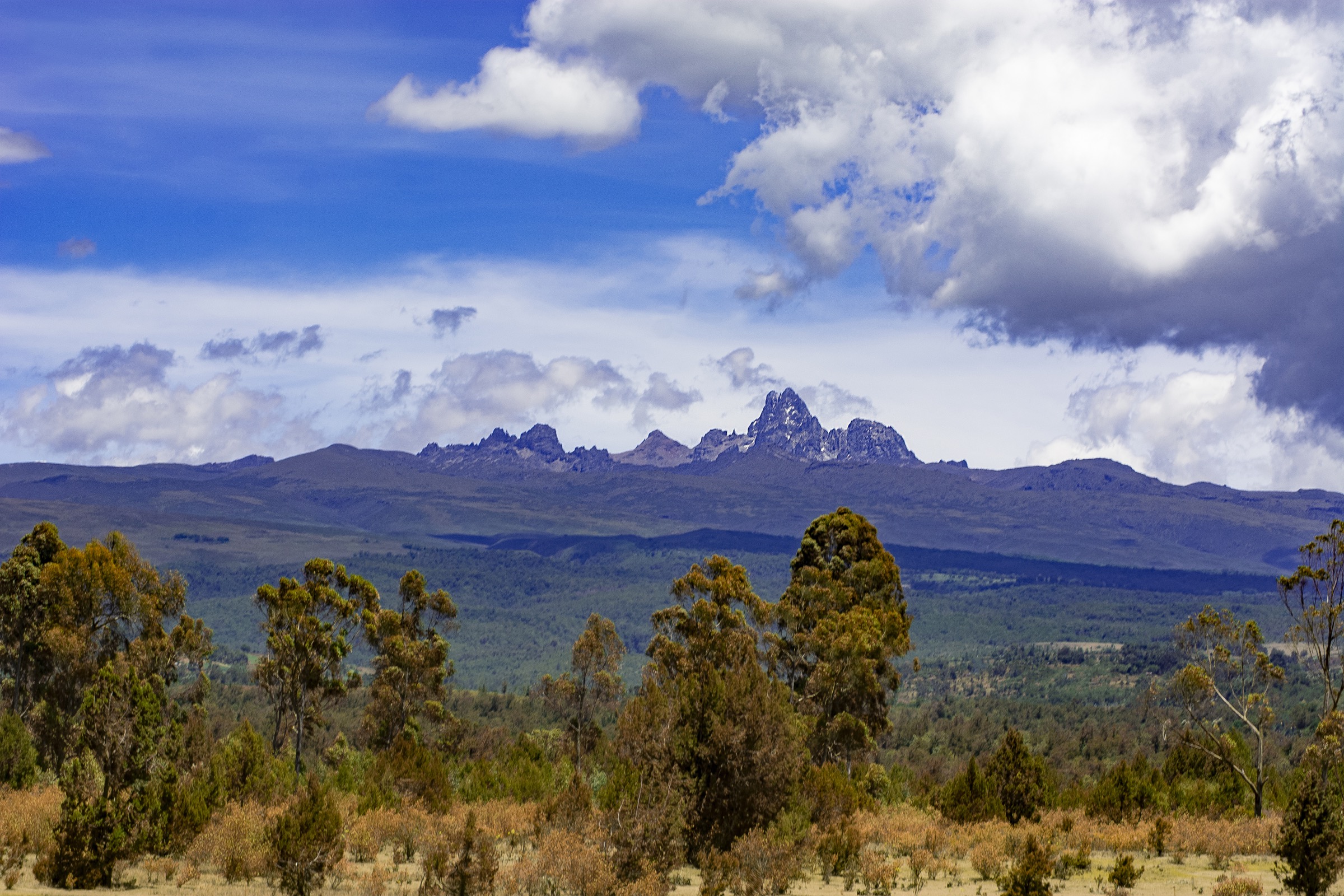
The Wandare trail starts from the open moorland above the bamboo zone and rises gradually across the tussock-grass plateau toward the Dragon’s Teeth — a row of sharp volcanic cones that flank the summit. The walking line winds through wet, boggy ground dotted with giant lobelia and senecio, with views of moraines on the north-west flank between roughly 3,600 m and 3,800 m. The final approach climbs a more defined ridge to the 4,001 m cairn, the highest point in the Aberdares and Kenya’s third-highest summit after Mount Kenya and Mount Elgon. Return is on the same line.
Why it is essential
Lesatima is the high point of the range, the Dragon’s Teeth are the most distinctive volcanic feature of the Aberdares, and the moorland approach gives the clearest experience of the range’s giant Afro-alpine flora.
Equipment
- Sturdy boots, gaiters useful for marshy ground.
- Full waterproof shell, warm layers, hat and gloves.
- Trekking poles recommended.
- 2-3 L water, food, navigation backup.
- KWS entry fee, armed-ranger escort and Aberdare National Park booking via eCitizen.
Hazards and notes
- High moorland with cold wind, mist and possible storms; navigation hard in poor visibility.
- Boggy and uneven ground throughout.
- Long approach drive on poor roads; allow time for the Mutubio side.
- Elephant and buffalo present in lower forest belts approached on foot.
- Acclimatisation matters: the summit is at 4,001 m.
GPX / KML links
| Source | URL | Format / access | Reuse status |
|---|---|---|---|
| Hiking Adventures — Oldoinyo LeSatima (Wandare route) | hikingadventures.net | Public hike report with map | Reuse terms not stated; track for reference only |
| OpenStreetMap search: Mount Satima | openstreetmap.org | Source map/search | OSM data is ODbL; no route relation selected; geometry cross-check only |
External links
4. Table Mountain from Shamata Gate

Snapshot
Itinerary
From Shamata Gate, the first roughly 11 km is a forest road that climbs from about 2,850 m to 3,450 m through indigenous forest. With a 4WD vehicle and KWS authorisation, parties commonly drive this section to the forest edge near the Twin Peaks. From there a walking line crosses open moorland dotted with Erica and giant heather, gives way to tussock-grass marshes with giant groundsel and giant lobelia, and climbs onto the broad flat-topped plateau of Table Mountain at about 3,971 m. The summit plateau has small ponds and marshy hollows; mist is normal. The return follows the same line.
Why it is essential
Table Mountain is the headline objective of the northern Aberdares moorland and the standard counterpart to Lesatima from the Shamata side. The flat-topped massif, the giant groundsel marshes and the Twin Peaks together represent the high northern character of the range that the southern Elephant Hill / Kinangop ridges do not show.
Equipment
- Waterproof boots, gaiters helpful for boggy tussock ground.
- Full waterproof shell, warm mid-layer, hat and gloves.
- Trekking poles helpful on uneven moorland.
- 2-3 L water, food, navigation backup, headtorch.
- KWS entry fee, armed-ranger escort, advance booking via eCitizen.
Hazards and notes
- Persistent cold, mist and fog; whiteouts common.
- Uneven, boggy ground on the moorland.
- Forest road may be rough or impassable in the wet without 4WD.
- Elephant and buffalo present in the forest section; armed escort required.
- Long day if walking the road section both ways.
GPX / KML links
| Source | URL | Format / access | Reuse status |
|---|---|---|---|
| Hiking Adventures — Table Mountain (Aberdares) | hikingadventures.net | Public hike report with map | Reuse terms not stated; track for reference only |
| OpenStreetMap search: Aberdare Table Mountain | openstreetmap.org | Source map/search | OSM data is ODbL; no route relation selected; geometry cross-check only |
External links
5. Karuru, Chania and Magura waterfalls walk from Mutubio

Snapshot
Itinerary
This is a combined-objective day inside Aberdare National Park, normally entered through Mutubio Gate from the Rift side or Chania (Treetops) Gate from the east. From the Karuru carpark a short walk (about 1 km) leads to a wooden viewing platform at the top of Karuru Falls, the highest waterfall in Kenya at 273 m in three drops of 117 m, 26 m and 130 m. From the same platform Gura Falls is visible across the gorge. The Chania approach uses a roughly 6 km forest road to reach the three terraced viewing platforms of Chania Falls. A short loop near the Magura (Queen’s Cave) viewpoint adds the cave-and-waterfall combination beneath which Queen Elizabeth II passed during her 1952 Treetops visit and which carries Mau Mau-era forest-fighter associations.
Why it is essential
The Karuru-Chania-Magura sequence is the most accessible representative landscape of the central Aberdares: deep eastern gorges, the highest waterfall in Kenya, the cave system used by Mau Mau forest fighters under Dedan Kimathi, and a manageable mid-altitude walking day for parties not aiming at a summit.
Equipment
- Standard hiking boots; trails are short but can be muddy.
- Rain shell and warm layer; afternoon mist and rain are common.
- Sun protection and 2 L water.
- KWS entry fee and 4WD vehicle for the internal road network.
- Binoculars useful for the Karuru-Gura gorge view.
Hazards and notes
- Wooden viewing platforms are at the top of long drops; supervise children.
- No legal hiking trails reach the base of Karuru or Gura Falls.
- Wildlife (elephant, buffalo) is present along the forest roads.
- KWS rules require fishing permits and pre-booking for areas along the Chania and Karuru rivers.
- Park roads can become impassable after heavy rain.
GPX / KML links
| Source | URL | Format / access | Reuse status |
|---|---|---|---|
| OpenStreetMap search: Karuru Falls | openstreetmap.org | Source map/search | OSM data is ODbL; no route relation selected; geometry cross-check only |
| OpenStreetMap search: Chania Falls Aberdare | openstreetmap.org | Source map/search | OSM data is ODbL; no route relation selected; geometry cross-check only |
External links
Missing data / follow-up work
- Direct reusable GPX/KML downloads were not collated; AllTrails, Hiking Adventures and OSM pages were used as source maps without confirmed reusable GPX files.
- Distances and gains for Mount Kinangop and Table Mountain vary 20-30% between hike-reports and depend on whether the driveable forest road is walked or driven.
- The exact distance and route of the combined Karuru-Chania-Magura walk depends on which gate is used and which segments are driven; the figures shown are an order-of-magnitude combined estimate from public hike reports.
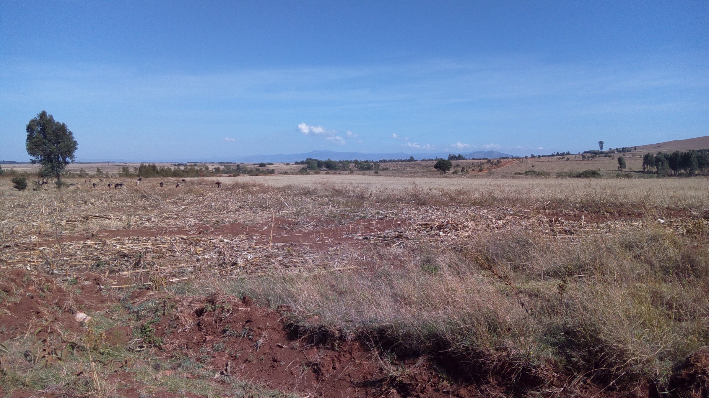
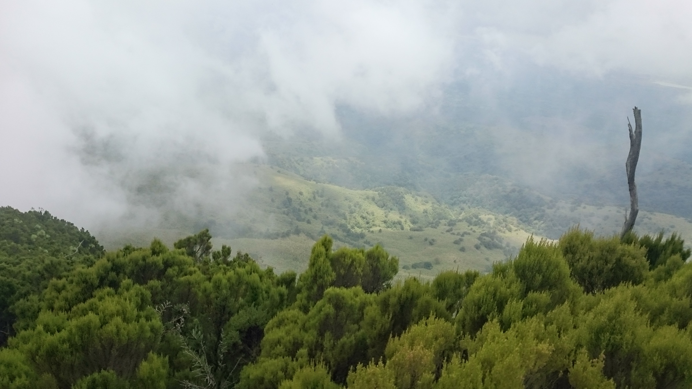
- Site-specific licence-compatible photographs for Elephant Hill, Mount Kinangop and Table Mountain were not found on Wikimedia Commons in this pass; the cover Aberdare-range image and a moorland landscape are reused for those hikes.
- Current armed-ranger contact numbers and KWS booking lead times should be re-confirmed with the Aberdare National Park warden before each visit.