Regional overview
The Mau Escarpment is a fault scarp on the western edge of the Kenyan Rift, topping about 3,000 m and carrying the Mau Forest on its western slopes. The Mau Forest is East Africa’s largest indigenous montane forest and Kenya’s largest single drainage basin, feeding rivers that supply much of western Kenya and downstream Rift lakes.
The walking character is a mix of high cool-temperate forest, archaeological rock-shelter approaches, the fumarolic volcanic margin of the Rift, and community-managed indigenous forests. Access is uneven and depends on permits, local guide arrangements, and current conservation rules. Many sites require navigation support, and route lines are not consistently published.
This article is a non-operational research catalogue for the Mau Escarpment region. Public, legally reusable route geometry was not found for the five candidates in this pass. They are presented as a planning shortlist to be confirmed locally and rebuilt with verified stats, trailheads, and GPX/KML files before publication as a practical hiking guide.
Selection rationale
The five candidates cover the principal Mau Escarpment themes: a Middle / Late Stone Age rock shelter at Enkapune Ya Muto, a Pastoral Neolithic cave at Njoro River, a representative Mau montane-forest spring walk on the Kericho side, the Rift-margin volcanic ridge of Ol Doinyo Eburru, and the broader Mau Forest Complex via the Loita / Naimina Enkiyio Forest. All five remain Candidate only because route geometry, statistics, GPX/KML files, and trailhead access were not confirmed in this pass.
Summary table
| # | Hike | Country | Route type | Distance | Gain | Max elevation | Difficulty |
|---|---|---|---|---|---|---|---|
| 1 | Enkapune Ya Muto / Twilight Cave approach | Kenya | Out-and-back; details unresolved | Unresolved | Unresolved | ca. 2,400 m site | Candidate only |
| 2 | Njoro River Cave approach | Kenya | Out-and-back; details unresolved | Unresolved | Unresolved | Unresolved | Candidate only |
| 3 | Mau Forest spring / Kericho forest-edge walk | Kenya | Out-and-back / loop; details unresolved | Unresolved | Unresolved | Unresolved | Candidate only |
| 4 | Ol Doinyo Eburru ridge and fumaroles | Kenya | Out-and-back / ridge walk | Unresolved | Unresolved | 2,856 m | Candidate only |
| 5 | Loita / Naimina Enkiyio Forest edge walk | Kenya | Out-and-back; details unresolved | Unresolved | Unresolved | ca. 2,300 m forest | Candidate only |
1. Enkapune Ya Muto / Twilight Cave approach
Snapshot
Itinerary
A publication-ready itinerary was not verified. Enkapune Ya Muto, also called Twilight Cave, is a Mau Escarpment rock shelter at around 2,400 m. The candidate is a guide-supported out-and-back from the nearest legal access point. No reliable walking line, distance, ascent, or GPX/KML was found in this pass.
Why it is essential
Enkapune Ya Muto is a major Middle-to-Late Stone Age rock-shelter site on the Mau Escarpment and one of the East African sites associated with early ostrich-eggshell beads, making it the headline archaeological objective of the region.
Equipment
- Sturdy boots, layers for highland weather, rain shell.
- Headtorch, navigation backup, first-aid kit.
- Local guide arrangement and any required permissions.
Hazards and notes
- Access permissions and the exact public trailhead are unresolved.
- Treat as a research candidate; confirm site-protection rules before visiting.
GPX / KML links
| Source | URL | Format / access | Reuse status |
|---|---|---|---|
| OpenStreetMap search: Enkapune Ya Muto | openstreetmap.org | Source map/search | OSM data is ODbL; no route relation selected; geometry cross-check only |
| Wikiloc search: Mau Escarpment | wikiloc.com | Search page | Wikiloc terms apply if a track is later selected; candidate source only |
External links
2. Njoro River Cave approach

Snapshot
Itinerary
A publication-ready itinerary was not verified. Njoro River Cave is a Pastoral Neolithic archaeological site on the Mau Escarpment near Njoro. The candidate is a short guide-supported out-and-back from a locally agreed access point near 0.64639, 36.05417. No walking line, distance, or GPX/KML was found.
Why it is essential
Njoro River Cave is a key Pastoral Neolithic site in East Africa and an early reference point for radiocarbon-dated cultural sequences in the region, making it the second archaeological pillar of the Mau Escarpment shortlist.
Equipment
- Sturdy footwear, layers, rain shell.
- Headtorch, first-aid kit, navigation backup.
- Local guide and any required permissions.
Hazards and notes
- Access permissions and exact route unresolved.
- Treat as a research candidate; respect any site-protection or community rules.
GPX / KML links
| Source | URL | Format / access | Reuse status |
|---|---|---|---|
| OpenStreetMap search: Njoro River Cave | openstreetmap.org | Source map/search | OSM data is ODbL; no route relation selected; geometry cross-check only |
| Wikiloc search: Njoro Kenya | wikiloc.com | Search page | Wikiloc terms apply if a track is later selected; candidate source only |
External links
3. Mau Forest spring / Kericho forest-edge walk
Snapshot
Itinerary
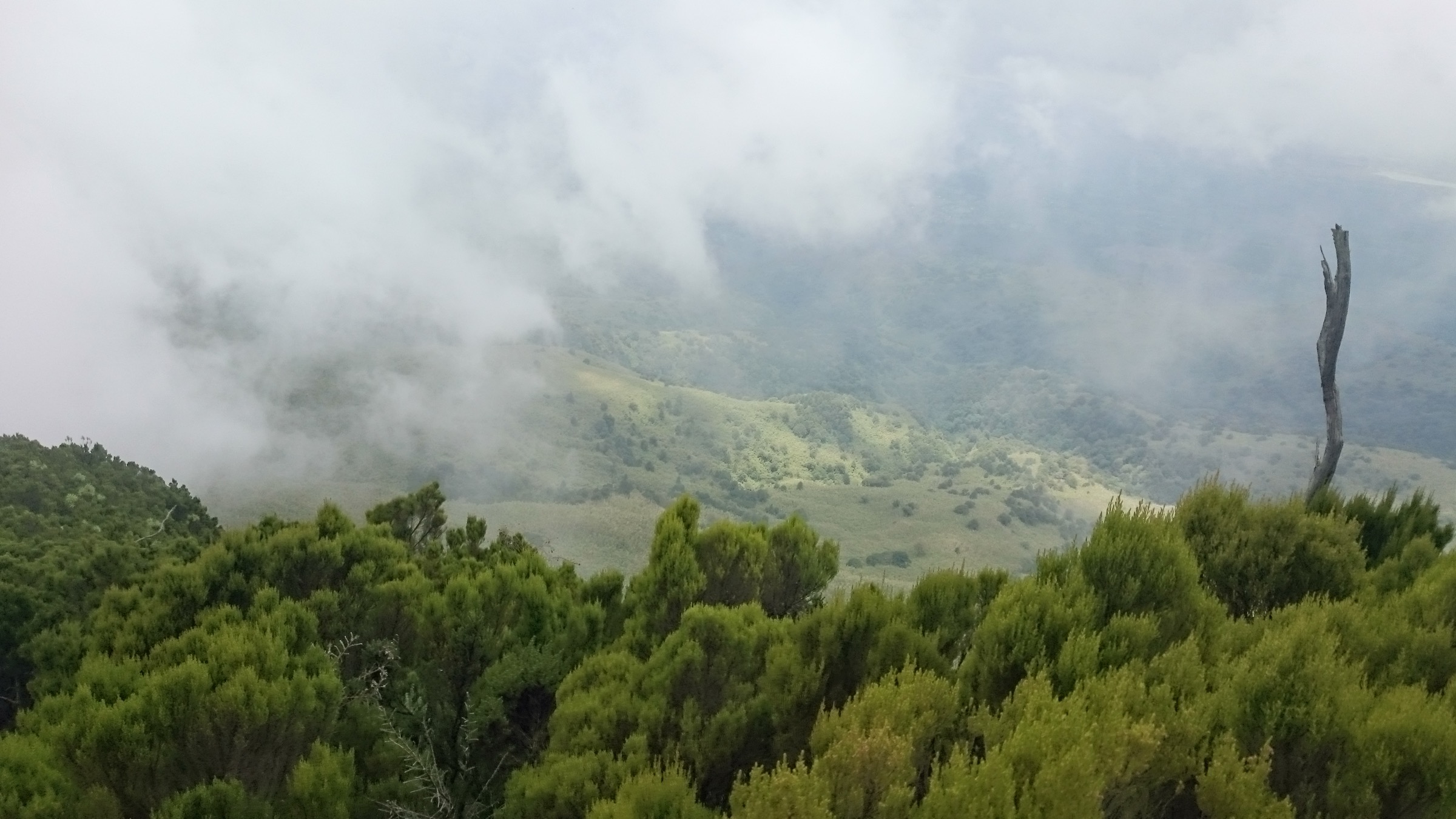
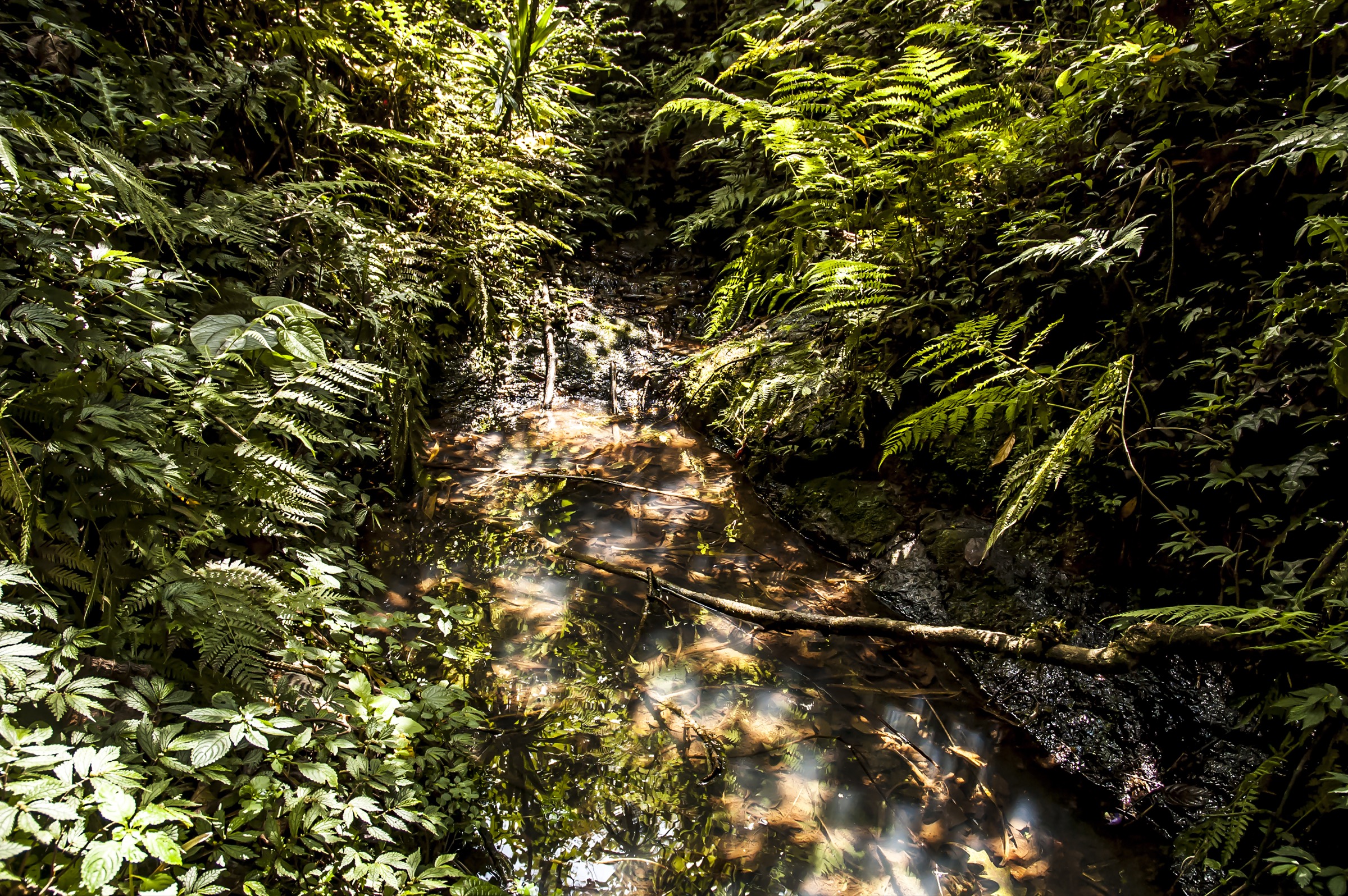
A publication-ready itinerary was not verified. The candidate is a representative Mau Forest spring or forest-edge walk from a Kericho-side access point, with a local guide. The reference image is “Mau Forest natural spring.” No walking line, distance, gain, or GPX/KML was found.
Why it is essential
The walk represents the headline Mau Forest character — indigenous montane forest, springs, and water-tower ecology — that defines the wider Mau Escarpment landscape and its downstream river systems.
Equipment
- Waterproof boots, full rain shell, warm layer.
- Insect protection, navigation backup, first-aid kit.
- Local guide and any required forest-access permissions.
Hazards and notes
- Access permissions, wet ground, and navigation are the main constraints.
- Conservation restrictions may apply; confirm forest-station rules before entry.
GPX / KML links
| Source | URL | Format / access | Reuse status |
|---|---|---|---|
| OpenStreetMap search: Mau Forest Kericho | openstreetmap.org | Source map/search | OSM data is ODbL; no route relation selected; geometry cross-check only |
| Wikiloc search: Mau Forest Kericho | wikiloc.com | Search page | Wikiloc terms apply if a track is later selected; candidate source only |
External links
4. Ol Doinyo Eburru ridge and fumaroles

Snapshot
Itinerary
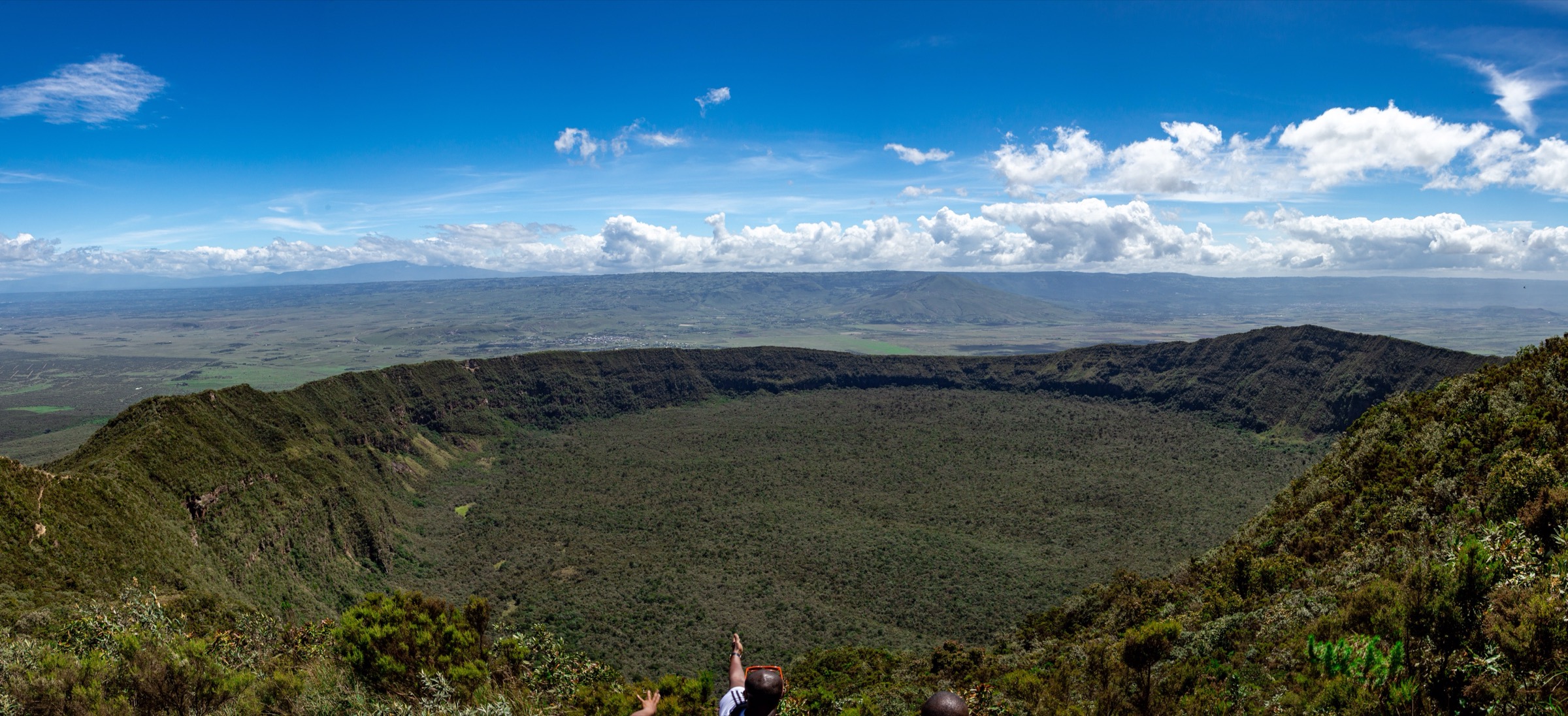
A publication-ready itinerary was not verified. Ol Doinyo Eburru is a volcanic ridge complex on the Mau / Rift margin, reaching about 2,856 m, with craters and fumaroles. The candidate is a guide-supported ridge walk from Eburru village. No reliable distance, ascent, or GPX/KML was found.
Why it is essential
Ol Doinyo Eburru is the clearest day-hikeable volcanic landform on the Mau Escarpment / Rift margin, with craters and active fumaroles, complementing the archaeology and forest themes in the shortlist.
Equipment
- Sturdy boots, layers, rain shell, wind layer.
- Headtorch, navigation backup, first-aid kit.
- Local guide; awareness of fumarole / hot-ground hazards.
Hazards and notes
- Fumarole and unstable-ground hazards, weather exposure, and unresolved access are the main concerns.
- Confirm geothermal-area and conservation rules before walking.
GPX / KML links
| Source | URL | Format / access | Reuse status |
|---|---|---|---|
| OpenStreetMap search: Ol Doinyo Eburru | openstreetmap.org | Source map/search | OSM data is ODbL; no route relation selected; geometry cross-check only |
| Wikiloc search: Eburru Kenya | wikiloc.com | Search page | Wikiloc terms apply if a track is later selected; candidate source only |
External links
5. Loita / Naimina Enkiyio Forest edge walk
Snapshot
Itinerary
A publication-ready itinerary was not verified. The Loita / Naimina Enkiyio Forest, at about 2,300 m, is a culturally important community-managed upland forest. The candidate is a community-guided edge walk from Entasekera or another Loita access point. No reliable walking line, distance, ascent, or GPX/KML was found.
Why it is essential
If the project treats Mau broadly as the Mau Forest Complex, Loita / Naimina Enkiyio is the principal southern community-forest counterpart to the northern Mau blocks and a culturally significant Maasai landscape.
Equipment
- Sturdy footwear, layers, rain shell.
- Insect protection, navigation backup, first-aid kit.
- Community guide and any required cultural permissions.
Hazards and notes
- Remote access, navigation, and community-permission protocols are the main constraints.
- Treat as a research candidate; coordinate with local custodians before entry.
GPX / KML links
| Source | URL | Format / access | Reuse status |
|---|---|---|---|
| OpenStreetMap search: Loita Forest | openstreetmap.org | Source map/search | OSM data is ODbL; no route relation selected; geometry cross-check only |
| Wikiloc search: Loita Hills Kenya | wikiloc.com | Search page | Wikiloc terms apply if a track is later selected; candidate source only |
External links
Missing data / follow-up work
- No official or reusable GPX/KML route files found for any of the five candidates.
- No verified route distances, ascents, descents, walking times, or precise public trailhead coordinates found.
- Licence-compatible route-specific photographs are limited; Hikes 1 and 5 have no hike-specific image, and the Hike 2 image is an artefact rather than a landscape view.
- Direct Wikimedia Commons file URLs for the selected photos were not supplied in the source spec; search-URL placeholders are used and should be replaced with file URLs at publication time.
- Permits, community permissions, conservation rules, and current guide availability all need on-the-ground verification before practical publication.
External links
| Source | URL |
|---|---|
| Wikipedia — Mau Escarpment | en.wikipedia.org |
| Wikipedia — Mau Forest | en.wikipedia.org |
| Wikipedia — Enkapune Ya Muto | en.wikipedia.org |
| Wikipedia — Njoro River Cave | en.wikipedia.org |
| Wikipedia — Ol Doinyo Eburru | en.wikipedia.org |
| Wikipedia — Loita Forest | en.wikipedia.org |
| OpenStreetMap | openstreetmap.org |
| Wikiloc search | wikiloc.com |
| AllTrails search | alltrails.com |