Regional overview
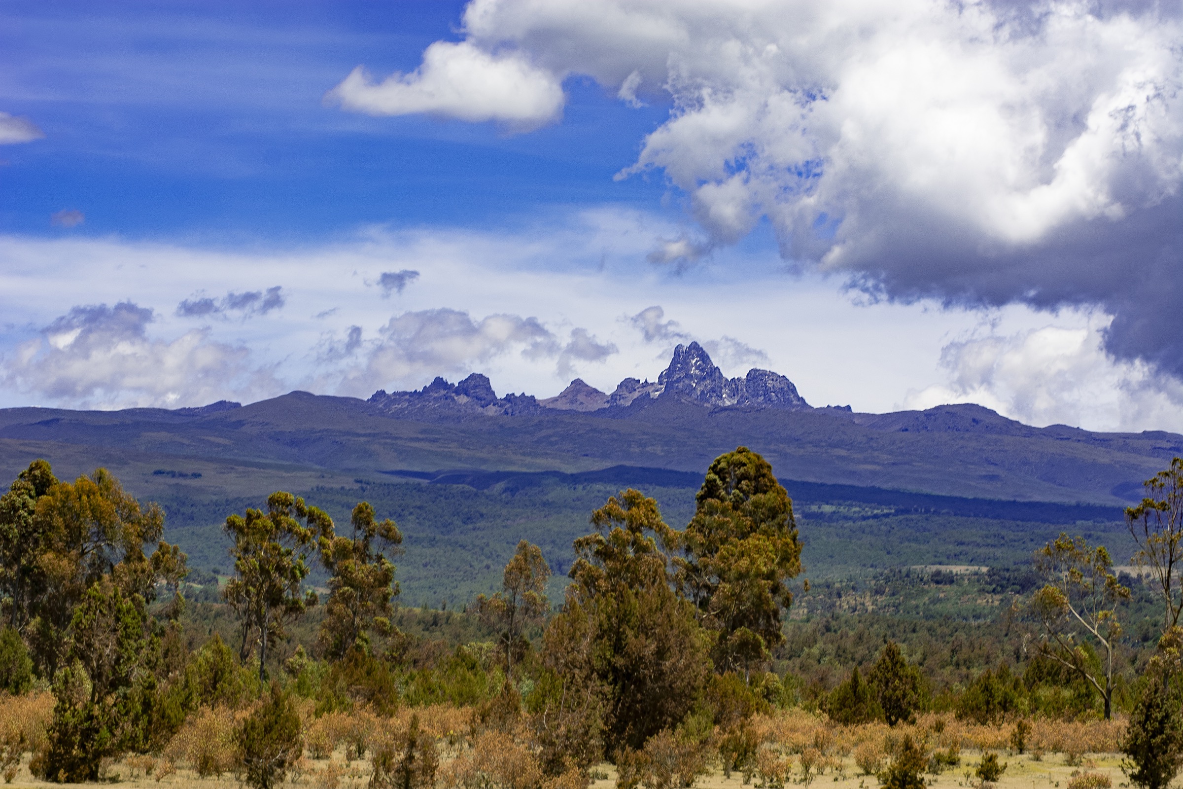
Mount Kenya is an extinct stratovolcano in central Kenya, straddling the Equator about 150 km north-north-east of Nairobi. Its highest summits — Batian (5,199 m) and Nelion (5,188 m) — are technical rock climbs; the third summit, Point Lenana (4,985 m), is the standard non-technical trekking objective. The mountain sits inside Mount Kenya National Park and the surrounding Mount Kenya Forest Reserve, jointly inscribed on the UNESCO World Heritage list in 1997.
Walking access is regulated by the Kenya Wildlife Service (KWS). Day-stages on the mountain typically form parts of the four main trekking routes — Sirimon from the north-west, Chogoria from the east, Naro Moru from the west, and the less-used Burguret from the west. Park entry fees are charged per 24-hour period at citizen, resident, and non-resident rates, with non-residents paying USD 52 per adult day at the time of writing. Bookings and payments go through eCitizen. Most overnight parties use Old Moses Camp (3,300 m) on Sirimon, Shipton’s Camp (4,236 m) at the head of the Mackinder Valley, Mackinder’s Camp (4,200 m) in the Teleki Valley, or the Chogoria Bandas (3,000 m) and Lake Ellis camp (3,500 m) on the eastern moorland.
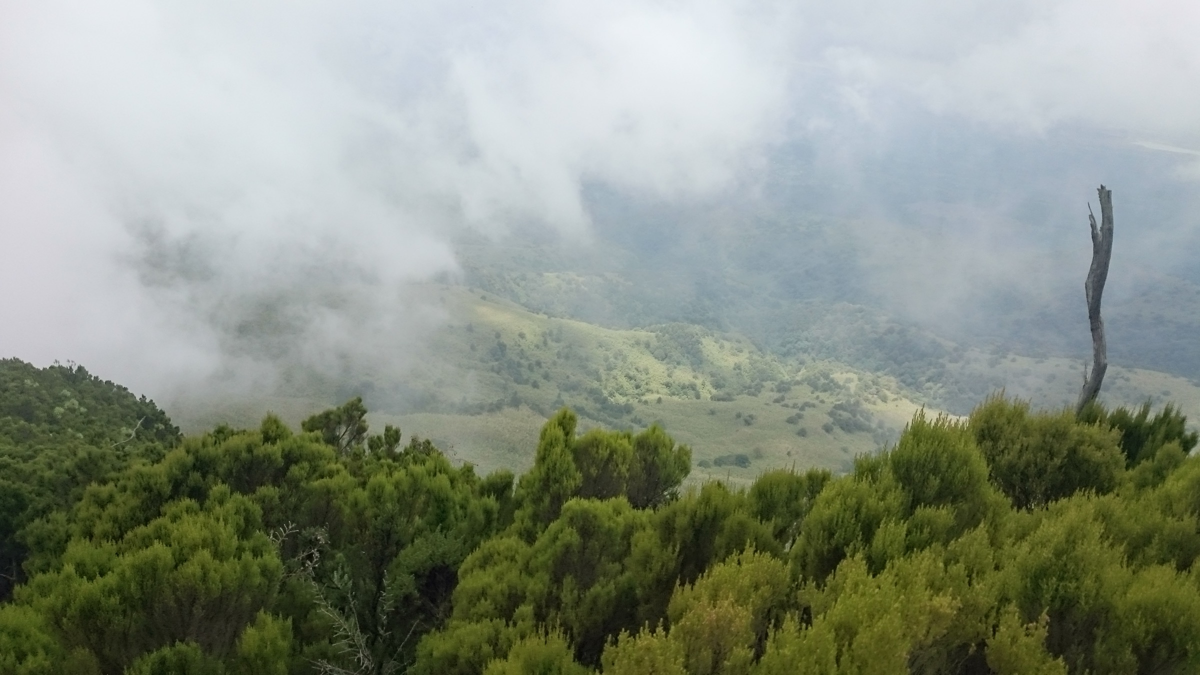
Vegetation runs through four bands: lower montane forest with cedar and podocarpus to about 2,500 m; a bamboo and Hagenia belt to about 3,000 m; open giant heather and tussock moorland with giant lobelia and giant groundsel to roughly 4,300 m; and a sparse Afro-alpine zone of glacial tarns, moraines and shrinking ice fields above. Rainfall is high on all flanks, with the wettest face on the south-east. The drier walking windows are January-February and June-September. The long rains of March-May and the short rains of October-November bring heavy mud and reduced visibility on the moorland.
Acclimatisation governs the timing of all multi-day plans. The standard Sirimon-Chogoria traverse takes four to five days, and the conservative recommendation is to spend an extra night at Old Moses or Shipton’s before pushing for Point Lenana. Altitude sickness, cold and storm conditions on the summit ridge are the main hazards above 4,500 m. Wildlife in the lower forest belt — buffalo, elephant, and bushbuck — is the main hazard below 3,000 m, and KWS rangers may be required as armed escort on lower-flank approaches.
Selection rationale
The five day-stages cover the principal trekking lines on the massif: three sequential Sirimon stages from gate to summit, one Chogoria moorland walk that samples the eastern lake country without the long Mintos-summit push, and the classic Naro Moru Teleki Valley approach. Together they trace forest, bamboo, moorland, and Afro-alpine zones in proportion, and they include the non-technical 4,985 m summit day at Point Lenana.
Summary table
| # | Hike | Country | Route type | Distance | Gain | Max elevation | Difficulty |
|---|---|---|---|---|---|---|---|
| 1 | Sirimon Gate to Old Moses Camp | Kenya | Point-to-point | ~9 km | ~650 m | 3,300 m | Moderate |
| 2 | Old Moses Camp to Shipton’s Camp | Kenya | Point-to-point | ~14 km | ~940 m | 4,236 m | Hard |
| 3 | Shipton’s Camp to Point Lenana and return | Kenya | Out-and-back | ~10 km | ~750 m | 4,985 m | Hard/strenuous |
| 4 | Chogoria Bandas to Lake Ellis | Kenya | Out-and-back | ~10-12 km | ~500 m | 3,500 m | Moderate |
| 5 | Naro Moru Met Station to Mackinder’s Camp | Kenya | Point-to-point | ~9 km | ~1,150 m | 4,200 m | Hard |
1. Sirimon Gate to Old Moses Camp
Snapshot
Itinerary
From Sirimon Gate at 2,650 m the route follows a graded forest track north-west through indigenous cedar and podocarpus forest, then climbs through Hagenia and giant heather as the trees thin around 3,000 m. The track passes from forest into open moorland at the Sirimon roadhead, then rises gently to Old Moses Camp at 3,300 m, perched on a moorland shoulder with views north toward Timau and east to the bamboo-clad lower slopes. The stage is the standard first day on the Sirimon route and is usually walked, though motorised access to a point above the gate is permitted in dry conditions.
Why it is essential
This is the classic forest-to-moorland approach on the most popular northern route up Mount Kenya. The stage sets the acclimatisation baseline for the higher Sirimon days and exposes walkers to the full lower-vegetation sequence in three to four hours.
Equipment
- Sturdy boots with good tread
- Rain shell and warm mid-layer
- Trekking poles helpful for the steady climb
- 2 L water, food, headtorch
- KWS park entry fee (eCitizen) and route booking required
Hazards and notes
- Buffalo and occasional elephant sign in the forest belt below 3,000 m.
- Cold rain and mist common above 3,000 m.
- Sustained but moderate gradient; main constraint is altitude exposure on day one.
- Forest tread is firm in dry weather and slippery in the wet.
GPX / KML links
| Source | URL | Format / access | Reuse status |
|---|---|---|---|
| Adventure Alternative — Mount Kenya route descriptions | adventurealternative.com | Operator route notes; no GPX download | GPX reuse unresolved |
| OpenStreetMap search: Sirimon Gate Mount Kenya | openstreetmap.org | Source map/search | OSM data is ODbL; no route relation selected; geometry cross-check only |
External links
- UNESCO — Mount Kenya National Park / Natural Forest
- Kenya Wildlife Service — Mount Kenya National Park
- Mount Kenya National Park — official portal
2. Old Moses Camp to Shipton’s Camp
Snapshot
Itinerary
From Old Moses the line crosses open moorland and contours into the upper Liki North valley, then drops slightly before re-climbing onto a broad ridge and entering the Mackinder Valley. The mid-section traverses tussock and giant groundsel terrain with the north faces of Batian and Nelion ahead. The final pull climbs scree and grass toward Shipton’s Camp at 4,236 m, set in the upper Mackinder Valley below the north faces. Most parties walk this stage in a single day from Old Moses; some break it with a side acclimatisation walk to the Liki North hut area.
Why it is essential
This is the main Sirimon acclimatisation stage and the standard approach to the high camp used for the summit day. The route crosses the most photographed moorland on the mountain — open Afro-alpine ground with giant lobelia and senecio — and brings walkers under the technical north faces.
Equipment
- Sturdy boots
- Warm insulating layer, hat and gloves
- Full rain shell
- Trekking poles
- 2-3 L water, food, headtorch
- Altitude headache medication and acclimatisation plan
- KWS park booking and route fee
Hazards and notes
- Significant height gain to above 4,200 m; acute mountain sickness possible.
- Cold wind and afternoon storms typical on the upper moorland.
- Boggy ground after rain on the Liki North traverse.
- Limited shelter on the open valley floor.
GPX / KML links
| Source | URL | Format / access | Reuse status |
|---|---|---|---|
| Adventure Alternative — Mount Kenya route descriptions | adventurealternative.com | Operator route notes; no GPX download | GPX reuse unresolved |
| OpenStreetMap search: Shipton’s Camp Mount Kenya | openstreetmap.org | Source map/search | OSM data is ODbL; no route relation selected; geometry cross-check only |
External links
3. Shipton’s Camp to Point Lenana and return

Snapshot
Itinerary
The standard summit day starts from Shipton’s Camp at 02:00-03:00 in the dark. The path climbs scree and stepped rock past the Hausburg Tarn area and onto the ridge leading to the Lewis Glacier basin, then turns up steep loose scree to Point Lenana at 4,985 m, normally reached at sunrise. The summit is the third peak of Mount Kenya and the only non-technical trekking objective, the higher Batian and Nelion summits being roped rock climbs. Descent retraces the line back to Shipton’s, with parties either resting at the camp or continuing the same day down the Sirimon line or over to the Chogoria descent.
Why it is essential
This is the non-technical summit of Mount Kenya and the headline objective of every standard Sirimon, Chogoria, or Naro Moru itinerary. It is one of the highest non-technical points in Africa accessible without rope or technical gear.
Equipment
- Insulated jacket and warm baselayers
- Hat, gloves, balaclava or buff
- Sturdy boots; microspikes occasionally useful on icy sections
- Trekking poles
- Headtorch with spare batteries
- 1-2 L water (will freeze without insulation)
- High-energy snacks
- Altitude medication and emergency plan
Hazards and notes
- Severe altitude illness risk above 4,500 m; descent is the cure.
- Sub-freezing temperatures and cold wind at the summit, especially before sunrise.
- Loose scree and short stepped rock sections on the final approach.
- Occasional ice on the ridge; conditions vary year to year as the Lewis Glacier retreats.
- Pre-dawn navigation in poor visibility requires a competent guide.
GPX / KML links
| Source | URL | Format / access | Reuse status |
|---|---|---|---|
| Adventure Alternative — Mount Kenya route descriptions | adventurealternative.com | Operator route notes; no GPX download | GPX reuse unresolved |
| OpenStreetMap search: Point Lenana Mount Kenya | openstreetmap.org | Source map/search | OSM data is ODbL; no route relation selected; geometry cross-check only |
External links
- UNESCO — Mount Kenya National Park / Natural Forest
- Mountain Club of Kenya
- Mount Kenya National Park — official portal
4. Chogoria Bandas to Lake Ellis

Snapshot
Itinerary
From the Bandas above Chogoria Gate at about 3,000 m the route follows a moorland track north-west, leaving the bamboo and Hagenia belt and climbing onto open Afro-alpine ground. The line passes giant heather and tussock with views west to the Gorges Valley and Mount Kenya’s eastern walls. After roughly 5-6 km the path drops slightly into the Lake Ellis basin at about 3,500 m — a moorland tarn ringed by giant lobelia and senecio, used as a fly-camp by Chogoria-route parties heading on to Mintos and Point Lenana. Return is on the same line, or some parties extend over the moorland toward Lake Michaelson on a separate day.
Why it is essential
Lake Ellis gives the most representative lower-elevation Chogoria moorland day on the mountain — open Afro-alpine tarn country with the Gorges Valley as backdrop — and avoids the higher altitude and longer commitment of the Mintos and summit push above. It is the standard acclimatisation walk for east-side parties.
Equipment
- Sturdy waterproof boots; gaiters helpful on boggy sections
- Full rain shell and warm mid-layer
- Sun hat, sun protection, hat and gloves
- Trekking poles useful on uneven moorland
- 2 L water, food, headtorch
- KWS park entry fee and Chogoria-side booking via eCitizen
Hazards and notes
- Mist and rapid weather change on the open moorland.
- Boggy and tussock ground throughout the upper section.
- Buffalo and elephant possible in the forest belt below the Bandas.
- Camp at Lake Ellis is exposed and very cold at night.
- The lower forest track may be 4WD-only after rain.
GPX / KML links
| Source | URL | Format / access | Reuse status |
|---|---|---|---|
| Mount Kenya National Park — Chogoria route notes | mtkenyapark.org | Route reference page | No GPX published; geometry reference only |
| OpenStreetMap search: Lake Ellis Mount Kenya | openstreetmap.org | Source map/search | OSM data is ODbL; no route relation selected; geometry cross-check only |
External links
- Mount Kenya National Park — official portal
- UNESCO — Mount Kenya National Park / Natural Forest
- Kenya Wildlife Service
5. Naro Moru Met Station to Mackinder’s Camp

Snapshot
Itinerary
From the Met Station at 3,050 m, the path leaves the upper forest and rises onto open moorland in the Teleki Valley. The middle section is the notorious “vertical bog” — a long, steep, perpetually wet stretch of tussock and peat that climbs roughly 400-500 m and is the defining experience of the Naro Moru route. Above the bog, the path firms up as it enters the upper Teleki Valley, with the Lewis Glacier basin and Batian-Nelion north-west faces ahead. Mackinder’s Camp at 4,200 m sits on the valley floor below the Teleki summit approach, opposite the south face. The stage is the standard western approach to the high camp used for the Point Lenana summit push.
Why it is essential
This is the classic Teleki Valley day on Mount Kenya and the historic western approach to the summit, used by most early ascents and still the shortest route to the upper Mackinder Valley. The vertical bog is the iconic feature.
Equipment
- Sturdy waterproof boots; gaiters strongly recommended
- Full rain shell and warm mid-layer
- Hat and gloves
- Trekking poles for the bog and steep upper section
- 2-3 L water, food, headtorch
- Altitude medication and acclimatisation plan
- KWS park entry fee and Naro Moru booking via eCitizen
Hazards and notes
- Persistent deep mud and standing water in the vertical bog through most of the year.
- Significant height gain to above 4,200 m; acute mountain sickness possible.
- Cold rain, mist and afternoon storms typical above the forest line.
- Buffalo and elephant possible on the lower forest section below Met Station.
- Slippery tussock and peat make a slow pace likely.
GPX / KML links
| Source | URL | Format / access | Reuse status |
|---|---|---|---|
| Adventure Alternative — Mount Kenya route descriptions | adventurealternative.com | Operator route notes; no GPX download | GPX reuse unresolved |
| OpenStreetMap search: Mackinder’s Camp Mount Kenya | openstreetmap.org | Source map/search | OSM data is ODbL; no route relation selected; geometry cross-check only |
External links
Missing data / follow-up work
- No officially published GPX/KML downloads were located for any of the five Mount Kenya day-stages; Adventure Alternative, the Mount Kenya National Park portal, and OpenStreetMap are used as geometry references only.
- Distances and elevation gains on the Sirimon and Naro Moru stages vary between operators and the Mountain Club of Kenya by 10-20%; figures given are best-available approximations and a route-specific GPS track is needed to firm them up.
- Public transport details to Sirimon Gate, Chogoria Gate and Naro Moru Gate are limited; access is normally by private vehicle, organised tour, or matatu plus boda-boda transfer.
- KWS fee schedules and conservation rates change frequently; confirm current citizen, resident and non-resident rates on eCitizen before travel.
- Site-specific licence-compatible photographs for the Sirimon Gate-Old Moses and Old Moses-Shipton’s stages were not found on Wikimedia Commons in this pass; the cover Mount Kenya slopes image is reused for those hikes with credit.
- The Mount Kenya summit ridge has multiple recently retreating glaciers (Lewis, Tyndall); summit-day ice conditions on the Point Lenana approach should be re-checked annually with the warden or the Mountain Club of Kenya.