Regional overview
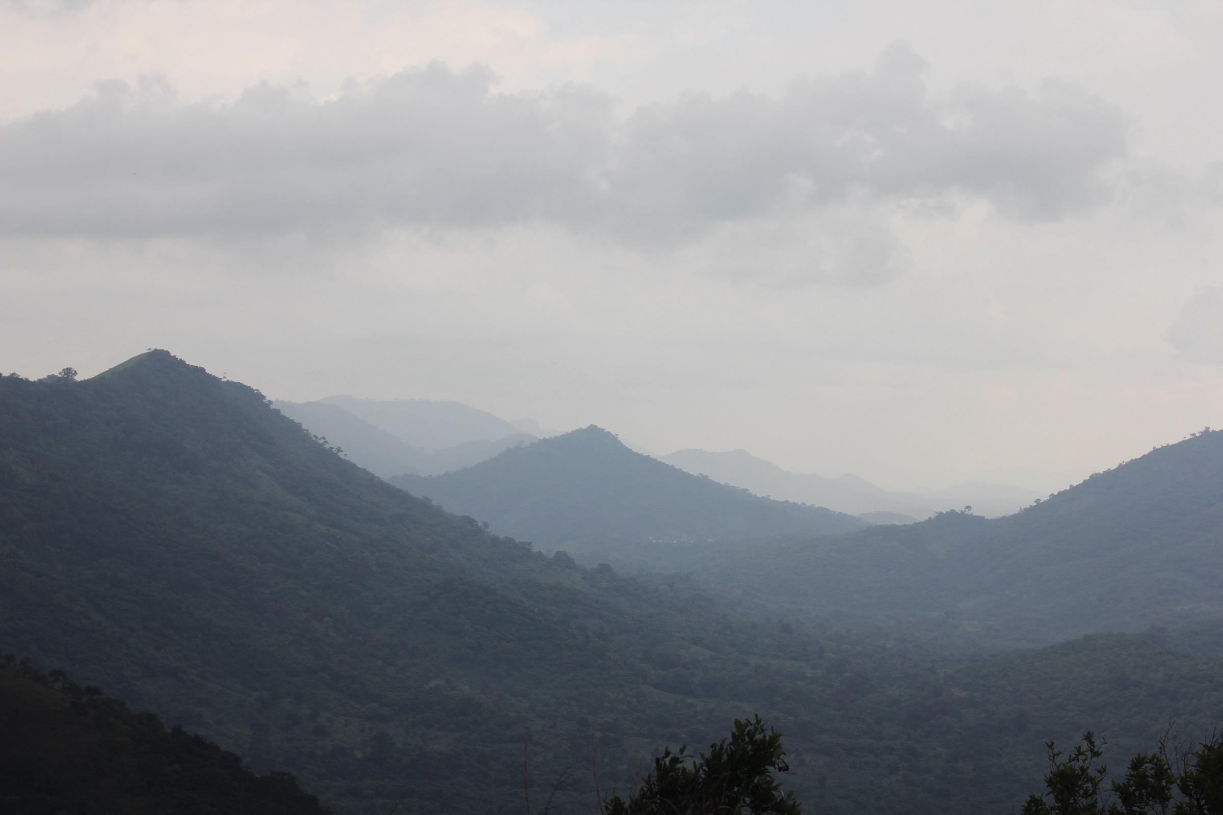
The Atakora range is a low quartzite mountain chain that runs south-west to north-east across the centre of Togo and into north-western Benin, with the eastern end fraying out toward Upper East Ghana. The Togolese half of the chain is usually called the Togo Mountains, the Beninese half the Atakora (also Atacora), and the average elevation is around 700 m. The highest accepted summit on the chain is Mont Sokbaro at 658 m on the Togo-Benin border; Mont Agou at 986 m in southern Togo is geologically the same orogeny but lies outside the Atakora day-hike sub-region and is not covered here.
The walking centres are spread along the Benin side. Natitingou is the departmental capital of Atacora and the main hub for the Kota Falls and the Koutammakou approach. Tanguiéta sits at the western foot of the range and is the gateway to Tanougou Falls and to the Pendjari corridor. Boukombé, on the road south-west of Natitingou, is the access town for the Tata-Somba villages of Koussoukoingou and Koutammakou, with the UNESCO-inscribed cultural landscape continuing across the Togolese border via Nadoba.
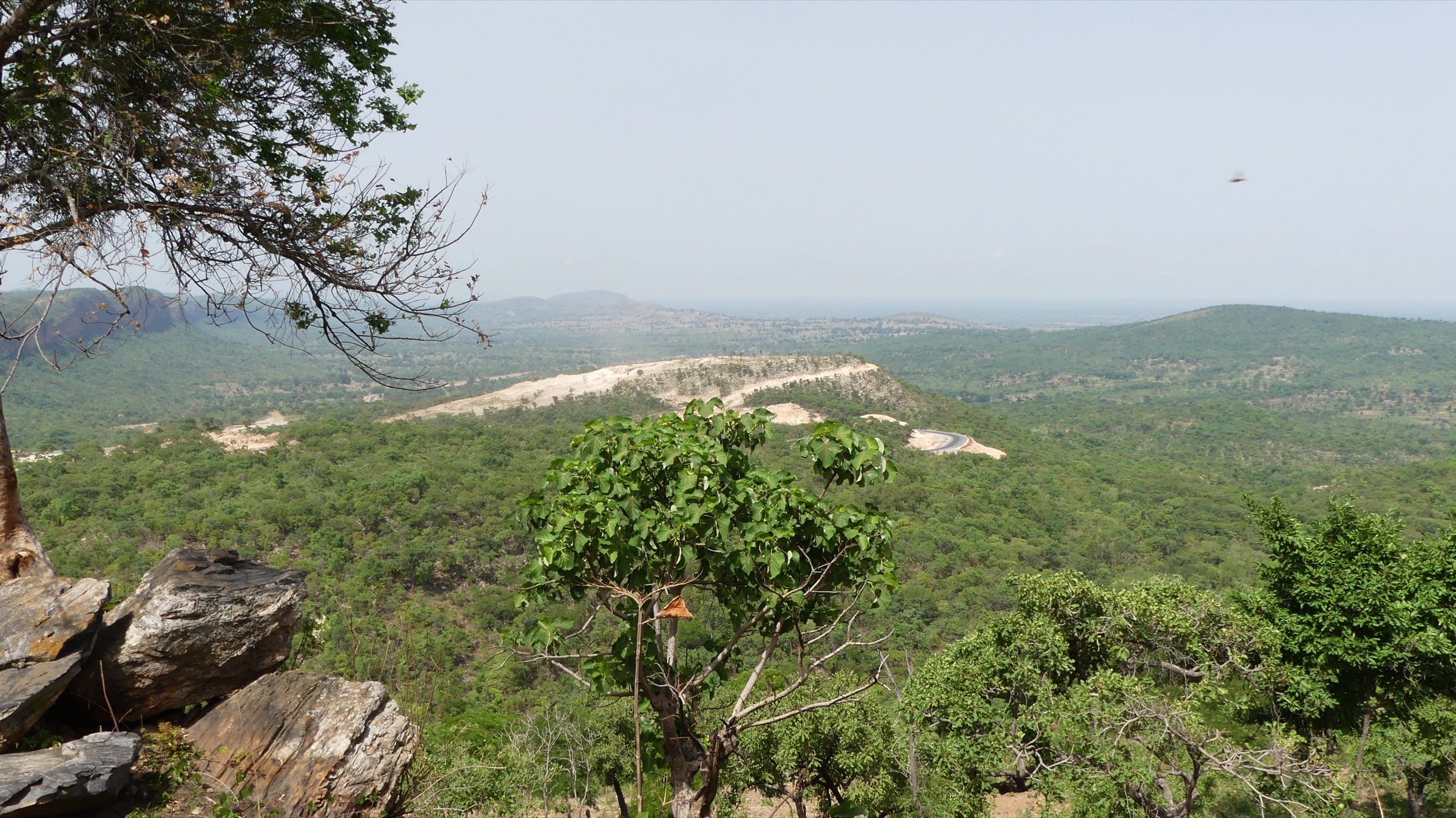
Terrain is dry savanna grading into wooded laterite slopes, with quartzite ridges, scattered baobabs, seasonal cascades, and the iconic two-storey earthen Tata-Somba houses of the Batammariba. The single rainy season runs roughly May to September; the dry season runs November to February and is the practical hiking window. The Harmattan blows dust haze in from the Sahara from December to January, cutting visibility but keeping daytime temperatures down. Mid-March to mid-May is hot.
A security caveat applies. Northern Benin’s Atakora and Alibori departments, including the Pendjari and W national-park corridors, have been affected by Sahel-region armed-group incidents in recent years, and some access roads near the parks have seen incursions. Conditions change. Walkers should consult current UK FCDO and US State Department travel advice and local park operators before travelling, and treat the figures in this entry as route descriptions rather than a green light for any given border zone.
Selection rationale
The five hikes balance the range’s main landforms and walking styles. Tanougou Falls and Kota Falls are the two classic Atakora cascade walks, each on a different side of the chain. The Koussoukoingou-to-Boukombé traverse is the headline Tata-Somba savanna route on the Beninese side of Koutammakou. The Nadoba cultural-landscape circuit is the same UNESCO-inscribed landscape from the Togolese side. Mont Sokbaro is the highest accepted peak on the chain and supplies the summit option. Pendjari interior walks are deliberately excluded — they require armed escorts and are not safely walked as day-hikes under current conditions.
Summary table
| # | Hike | Country | Route type | Distance | Gain | Max elevation | Difficulty |
|---|---|---|---|---|---|---|---|
| 1 | Tanougou Falls trail above Tanguiéta | Benin | Out-and-back | ~3 km | ~150 m | ~300 m | Easy to moderate |
| 2 | Kota Falls circuit near Natitingou | Benin | Short loop / out-and-back | ~1 km | ~35 m | ~430 m | Easy |
| 3 | Koussoukoingou to Boukombé Tata-Somba traverse | Benin | Point-to-point | 12-15 km | ~250 m | ~520 m | Moderate |
| 4 | Nadoba Koutammakou cultural-landscape walk | Togo | Loop | 6-10 km | ~150 m | ~350 m | Easy to moderate |
| 5 | Mont Sokbaro ascent from Aledjo-Koura | Togo / Benin | Out-and-back | 5-8 km | ~250 m | 658 m | Moderate |
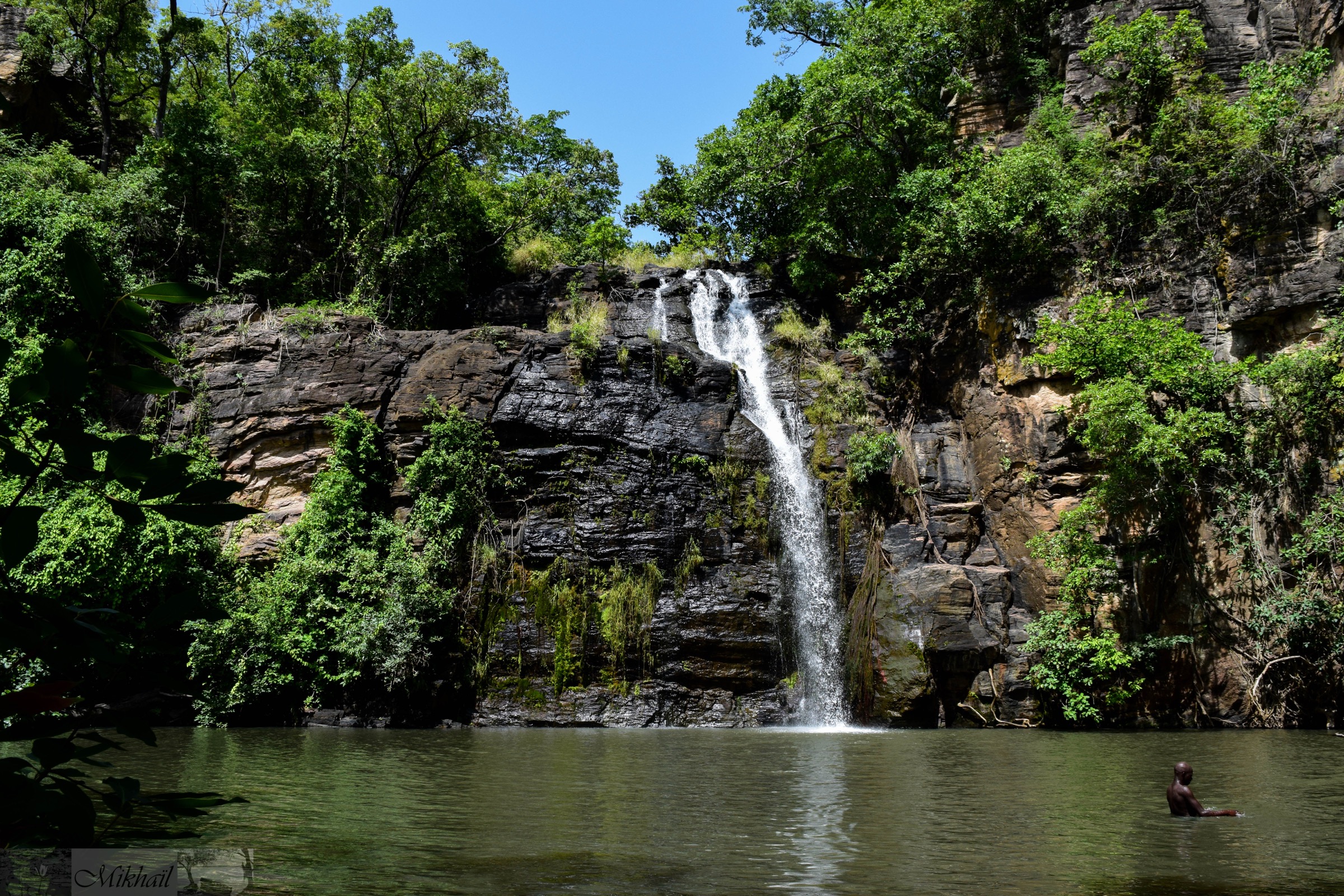
1. Tanougou Falls trail above Tanguiéta
Snapshot
Itinerary
The trail starts at the Tanougou village campement at the foot of the falls, around 20 km north-east of Tanguiéta on a signed track off the Pendjari road. A short, shaded path of a few hundred metres climbs over laterite and lateritic boulders to the base pool, where the 15 m cascade drops into a wide bathing basin. Most walkers stop here. A guided upper option scrambles steeply up the right-hand side of the cascade onto the rim, where the river arrives across a sloping rock platform with a view back down the wooded valley toward the Atakora foothills. Return is on the same path.
Why it is essential
Tanougou is the most accessible cascade walk on the Beninese side of the Atakora and the standard introduction to the range. The combination of a short approach, a swimmable plunge pool, and a steep optional climb to the falls’ rim packs the main Atakora landscape — laterite outcrops, gallery forest, savanna ridges — into a half-day on foot.
Equipment
- Hiking shoes or sandals with grip
- Swimwear and a quick-dry towel
- Sun hat and high-SPF sun protection
- 1.5-2 L water per person
- Insect repellent for the gallery forest
- Entry fee paid at the village campement; guide normally arranged here
Hazards and notes
- Wet rock on the upper scramble; one short steep step requires hands.
- Strong undertow possible in the base pool during peak flow.
- Snakes recorded in the valley undergrowth.
- Limited shade on the return ridge in the hot pre-rain months.
- Pendjari corridor security; check current FCDO/State Dept advice before travel.
GPX / KML links
| Source | URL | Format / access | Reuse status |
|---|---|---|---|
| OpenStreetMap — Tanougou Falls search | openstreetmap.org | Source map / search | OSM data is ODbL; geometry cross-check only |
| AllTrails search — Tanougou | alltrails.com | Route reference; GPX behind account | GPX reuse unresolved |
| Wikiloc search — Tanougou | wikiloc.com | Search page; user tracks | Wikiloc terms apply on selection; reuse unresolved |
External links
2. Kota Falls circuit near Natitingou
Snapshot
Itinerary
A short forest path from the Kota car park drops through the Panatia botanical garden along a network of laid-out trails to the foot of the cascade, where a string of falls drops down the eastern slope of the Atakora. The base of the main fall is a designated swimming area. A higher branch climbs to a viewpoint above the cascade, with a view back across the wooded slope toward the Natitingou basin. The figures here come from the AllTrails route and represent the short loop; a number of longer extensions are possible on the garden’s network of paths.
Why it is essential
Kota is the closest cascade walk to Natitingou and the easiest way to see the eastern flank of the Atakora on foot. It pairs naturally with a Tata-Somba visit on the same day and is widely listed by Beninese tourism sources as a standard half-day stop.
Equipment
- Hiking shoes or sandals
- Swimwear and towel
- Sun hat and sun protection
- 1 L water per person
- Small entry fee usually collected at the garden gate
Hazards and notes
- Slippery rocks at the base of the falls.
- Mosquitoes in the gallery forest, especially at dusk.
- Visit short of dawn or after 1500 to avoid mid-day heat in March-May.
- The route is well-trafficked but unmarked beyond the garden paths.
GPX / KML links
| Source | URL | Format / access | Reuse status |
|---|---|---|---|
| AllTrails — Chutes de Kota | alltrails.com | Route reference; GPX behind account | GPX reuse unresolved |
| OpenStreetMap — Kota Falls search | openstreetmap.org | Source map / search | OSM data is ODbL; geometry cross-check only |
External links
3. Koussoukoingou to Boukombé Tata-Somba traverse
Snapshot
Itinerary
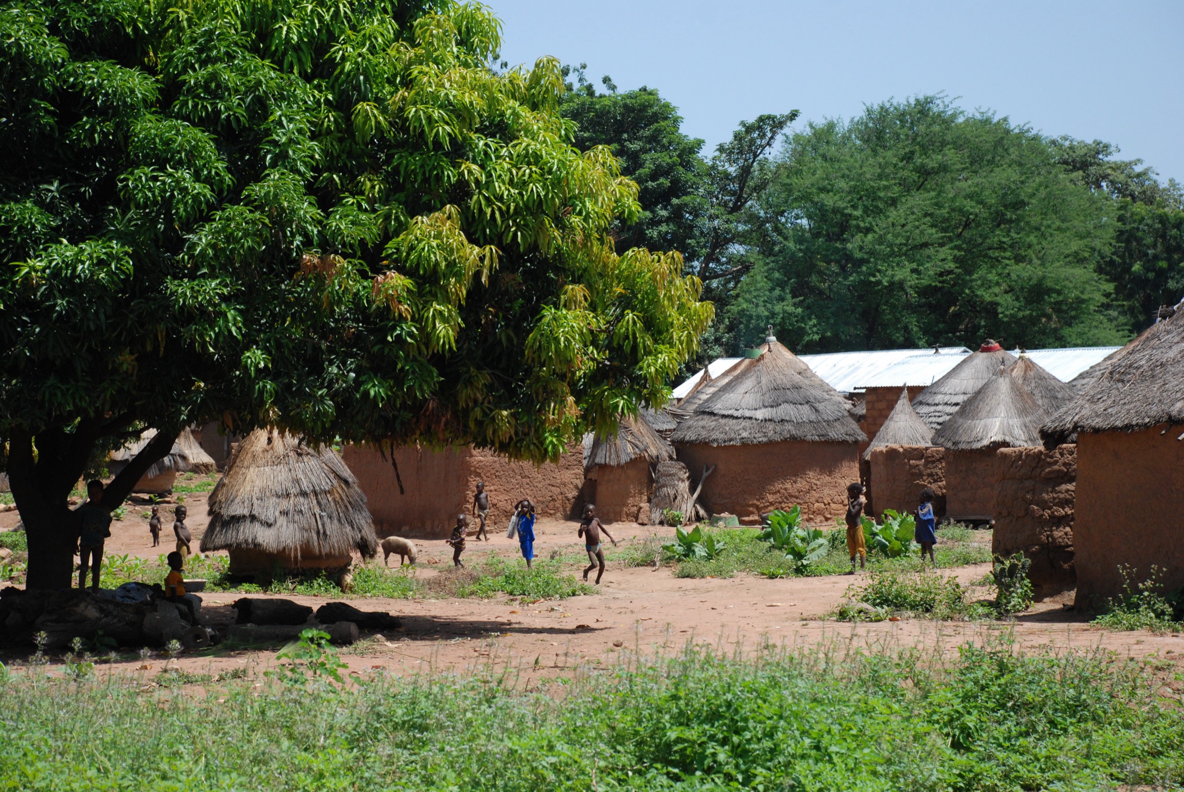
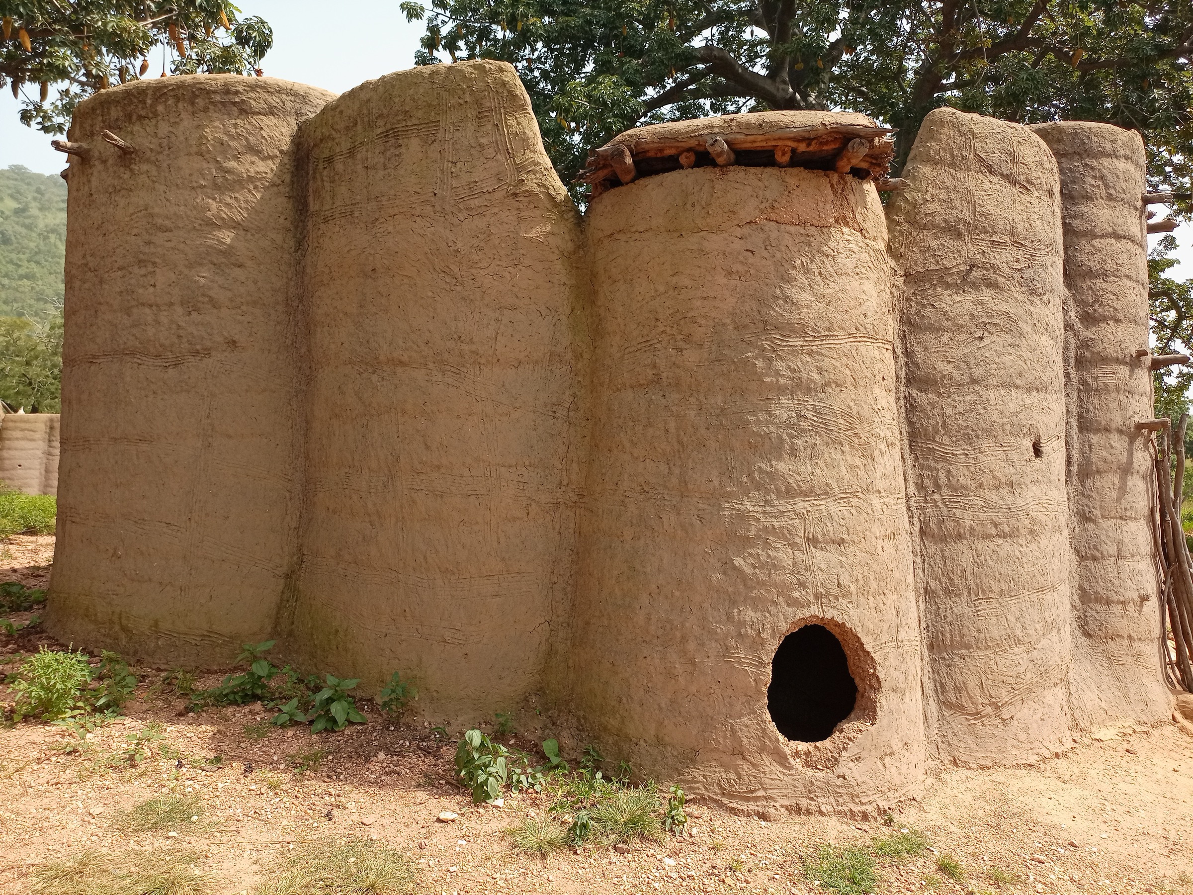
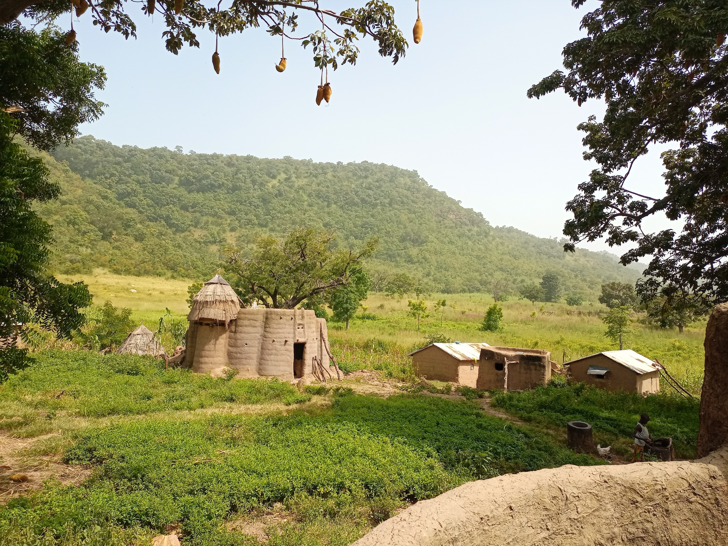
Koussoukoingou sits on a ridge at around 456 m, about 20 km from the Togolese border and 25 km south-west of Natitingou. The Eco-Bénin walking route descends west through the village, drops across a small valley with seasonal river-pools, passes the Takouanta vegetable garden, and contours under the rolling Atakora ridges toward Boukombé. Tata-Somba compounds — the two-storey Batammariba earthen “fortresses” of the Otammari — are scattered across the savanna throughout. The line is informal; village guides arranged by the Eco-Bénin association at Koussoukoingou’s “Perle de l’Atacora” co-operative lead the route. Boukombé sits at around 220-260 m and supplies the return transport.
Why it is essential
This is the headline cultural-landscape walking route on the Beninese side of the Atakora and the most direct way to see the inhabited UNESCO-recognised Tata-Somba landscape on foot, rather than from a vehicle. The combination of a designated cultural landscape, the most photographed vernacular architecture in West Africa, and the rolling Atakora skirt makes it the cultural-historical pick for the region.
Equipment
- Hiking shoes with grip on dry laterite
- Sun hat and high-SPF sun protection
- Minimum 3 L water; very little reliable water on the route
- Light long sleeves for sun
- Cash for guide and home-stay fees
- Modest dress; the route passes private compounds
- Eco-Bénin / Perle de l’Atacora village fees and guide arrangement
Hazards and notes
- Limited shade and high mid-day temperatures.
- Limited water; carry the day’s supply.
- Live, inhabited compounds — photography only with permission.
- Border-zone caveat: parts of Atacora department have been affected by Sahel-region security incidents; check current advice before travelling.
- Snakes recorded in the savanna.
GPX / KML links
| Source | URL | Format / access | Reuse status |
|---|---|---|---|
| Eco-Bénin — Koussoukoingou page | ecobenin.org | Operator description, no GPX | — |
| OpenStreetMap — Koussoukoingou | openstreetmap.org | Source map / search | OSM data is ODbL; geometry cross-check only |
| Wikiloc search — Koussoukoingou | wikiloc.com | Search page; user tracks | Wikiloc terms apply on selection; reuse unresolved |
External links
- Eco-Bénin — Séjour chez l’Otammari, pays Somba
- UNESCO — Koutammakou, the Land of the Batammariba
- Kossoucoingou — Wikipedia
- Boukoumbé — Wikipedia
4. Nadoba Koutammakou cultural-landscape walk
Snapshot
Itinerary
Nadoba is the largest village of the Togolese inscribed area of Koutammakou and the standard entry point from Kandé. A guided circuit usually starts at the village centre, visits a working Tata-Somba compound, follows a baobab-and-millet savanna path out to the surrounding hamlets, and loops back via cultivated bottoms below the ridges. The longest standard option extends a couple of kilometres into the core inscribed zone south toward the Beninese border. There is no marked trail; the line is set by the local guide, and distance and ascent vary with the route chosen.
Why it is essential
Nadoba is the most accessible part of the Koutammakou cultural landscape on the Togolese side, and a walking circuit here is the most considered way to see the Batammariba landscape — clay-and-straw “tata” houses set in baobab savanna with the Atakora ridges in the background. It complements the Boukombé route on the Beninese side and is the standard cultural-historical pick for travellers entering from Togo.
Equipment
- Light hiking shoes
- Sun hat and high-SPF sun protection
- 2 L water per person
- Modest dress for village walking
- Cash for guide and household visits
- Camera permission to be checked individually
Hazards and notes
- Open savanna with very little shade; mid-day heat is the principal hazard.
- Live, inhabited compounds; photography only with permission.
- The dirt road from Kandé degrades fast in the rains.
- Nadoba sits close to the Benin border; check current Togo and Benin travel advice before travelling.
GPX / KML links
| Source | URL | Format / access | Reuse status |
|---|---|---|---|
| UNESCO — Koutammakou inscribed landscape map | whc.unesco.org | Inscribed-area boundary map | Reference only; not a route file |
| OpenStreetMap — Nadoba | openstreetmap.org | Source map / search | OSM data is ODbL; geometry cross-check only |
| Wikiloc search — Koutammakou | wikiloc.com | Search page; user tracks | Wikiloc terms apply on selection; reuse unresolved |
External links
- UNESCO — Koutammakou, the Land of the Batammariba
- Worldheritagesite.org — Koutammakou
- Wikipedia — Togo Mountains
5. Mont Sokbaro ascent from Aledjo-Koura
Snapshot
Itinerary
Mont Sokbaro sits 58 km from Bassila on the Togo-Benin border, with the trailside villages of Tchèmbèré, Aledjo-Koura, and Akaradè on the access tracks off the RN2. No marked path exists; informal field-and-forest paths climb from village level (around 400-450 m) onto the quartzite massif, reaching the accepted 658 m summit in 1-2 hours of walking for fit walkers. SRTM data indicate a nearby point at 672 m about 2.5 km south-east — the actual highest ground may sit there rather than on the named summit. Return is on the same route. The hill is one of several candidates for “highest point of Benin”; recent expeditions have suggested the true high point is a different hill further north toward Burkina Faso.
Why it is essential
Sokbaro is the highest accepted summit on the Atakora chain and the standard summit objective for walkers visiting the range. It is included here as the “important summit” of the catalogue. The route is short, unmarked, and lightly walked, which is part of the appeal but also the reason it cannot be sourced like a developed national-park trail.
Equipment
- Sturdy hiking shoes with grip on quartzite and laterite
- Sun hat and high-SPF sun protection
- Minimum 2-3 L water per person; no water on the climb
- Light long sleeves and trousers for grass and thorn cover
- Local guide arranged in Bassila or Aledjo-Koura
- Basic first aid; remote location
Hazards and notes
- Unmarked routes; navigation by local guide only.
- Heat is the principal hazard year-round.
- Snakes and biting insects in the grass.
- The hill straddles the international border; passport and entry-stamp status should be in order before any cross-border movement.
- Stat figures here are best-estimate approximations; route distance and ascent are not confirmed by a published track.
GPX / KML links
| Source | URL | Format / access | Reuse status |
|---|---|---|---|
| OpenStreetMap — Mont Sokbaro | openstreetmap.org | Source map / search | OSM data is ODbL; geometry cross-check only |
| PeakVisor — Mont Sokbaro | peakvisor.com | Summit reference page | No reusable GPX |
| Wikiloc search — Sokbaro | wikiloc.com | Search page; user tracks | Wikiloc terms apply on selection; reuse unresolved |
External links
- Wikipedia — Mont Sokbaro
- Wikipedia — Togo Mountains
- Britannica — Atakora Mountains
- ExplorersWeb — A Mud Hut Is the New “Roof of Benin”
Missing data / follow-up work
- No officially published GPX/KML downloads were located for any of the five routes; AllTrails, Wikiloc, OpenStreetMap, and operator pages are used as geometry references only.
- Tanougou, Kota, and Koussoukoingou route statistics (distance, ascent) are best-available approximations and need a published GPS track to firm up.
- Mont Sokbaro route distance, ascent, and access vary noticeably between sources; the summit-elevation question is contested (658 m vs. SRTM 672 m vs. a more northerly true high point reported by recent expeditions).
- Public transport details to all five trailheads are limited; access in practice is by bush taxi, zem, or private 4WD plus arranged guide.
- The northern Benin / Togo borderland security situation (Atacora, Alibori, Pendjari, W parks) has changed materially since 2019; route notes should be read alongside current UK FCDO / US State Department travel advice rather than relied on for safety.
- A clean cover-licence photo of Mont Sokbaro itself could not be confirmed in this pass; a Tata-Somba landscape stands in for the Sokbaro hike figure.
- Pendjari and W national-park interior walking options were deliberately excluded; armed-escort wildlife driving routes do not match the day-hike scope of this catalogue.