There is a particular kind of mountain route that feels halfway between hiking and climbing.
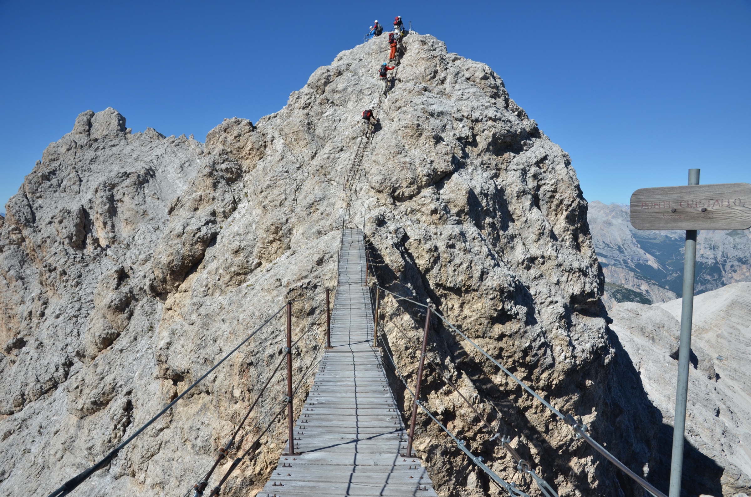
You are not simply walking. The ground drops away too sharply for that. But you are not climbing in the traditional sense either. There is no rope team, no lead climber placing protection, no belayer feeding out slack below. Instead, you move along a line of steel: clipped to a cable, stepping from rock to rung, from ledge to ladder, from one iron anchor to the next.
This is via ferrata: literally, the “iron way”.
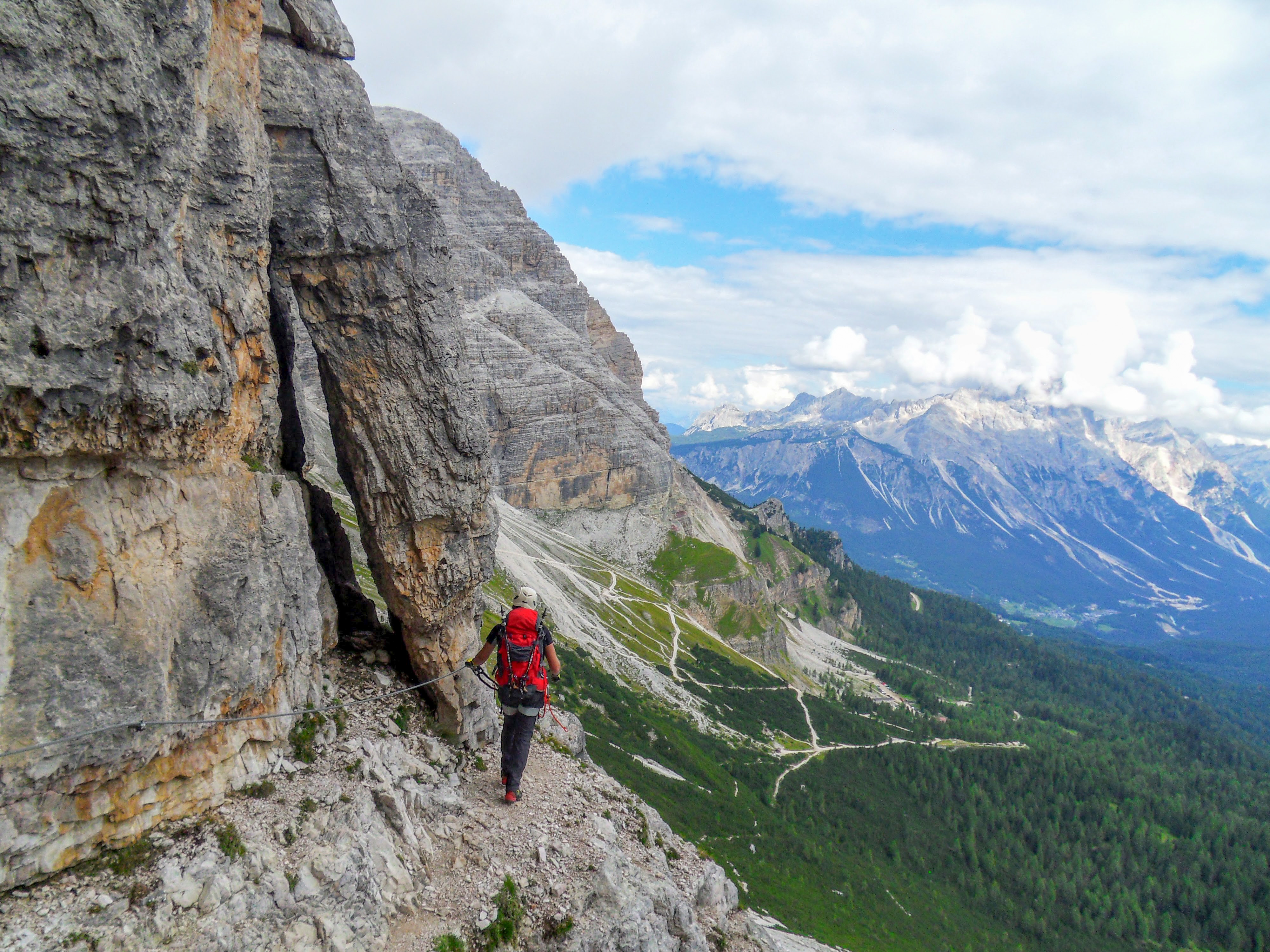
A via ferrata route is a protected mountain itinerary equipped with fixed aids such as steel cables, ladders, rungs, pegs, bridges and other artificial features. The climber wears a helmet, harness and specialist via ferrata lanyard, clipping into the cable as they move. The result is an unusual hybrid: more exposed and technical than hiking, but more accessible than traditional rock climbing.
That accessibility is part of its appeal. Via ferrata allows people with good fitness, a head for heights and the right equipment to enter terrain that would otherwise require climbing skills, ropes and a trained partner. It opens up cliffs, ridges, towers and high mountain traverses to a much wider range of outdoor users.
But via ferrata is not just an adventure activity. It is also a form of mountain infrastructure. It is geography made physical: a human line across rock, exposure and terrain. And in the Alps, those iron lines often carry a deep historical memory.
- From early Alpine routes to the Great War
- A new life after the war
- Where via ferrata is found today
- How via ferrata is graded
- The appeal of the iron way
- A fragmented global picture
- Storm and OpenData.Earth: building a global via ferrata heatmap
- Why this matters
- What you need for via ferrata
- External links
From early Alpine routes to the Great War
The origins of via ferrata go back to the 19th century, when early mountaineers and mountain communities began installing fixed aids on exposed routes. Iron pins, carved steps, ropes and fixed protection were used to make difficult passages safer and more manageable.
These early equipped routes were not always “via ferrata” in the modern sense. Some were exposed hiking paths, summit routes or mountain crossings where fixed aids helped climbers through the most difficult sections. But they established the basic idea: that metal, rope and engineering could make steep mountain terrain accessible to people who were not climbing in the full traditional style.
The activity’s most powerful historical association, however, is with the First World War.
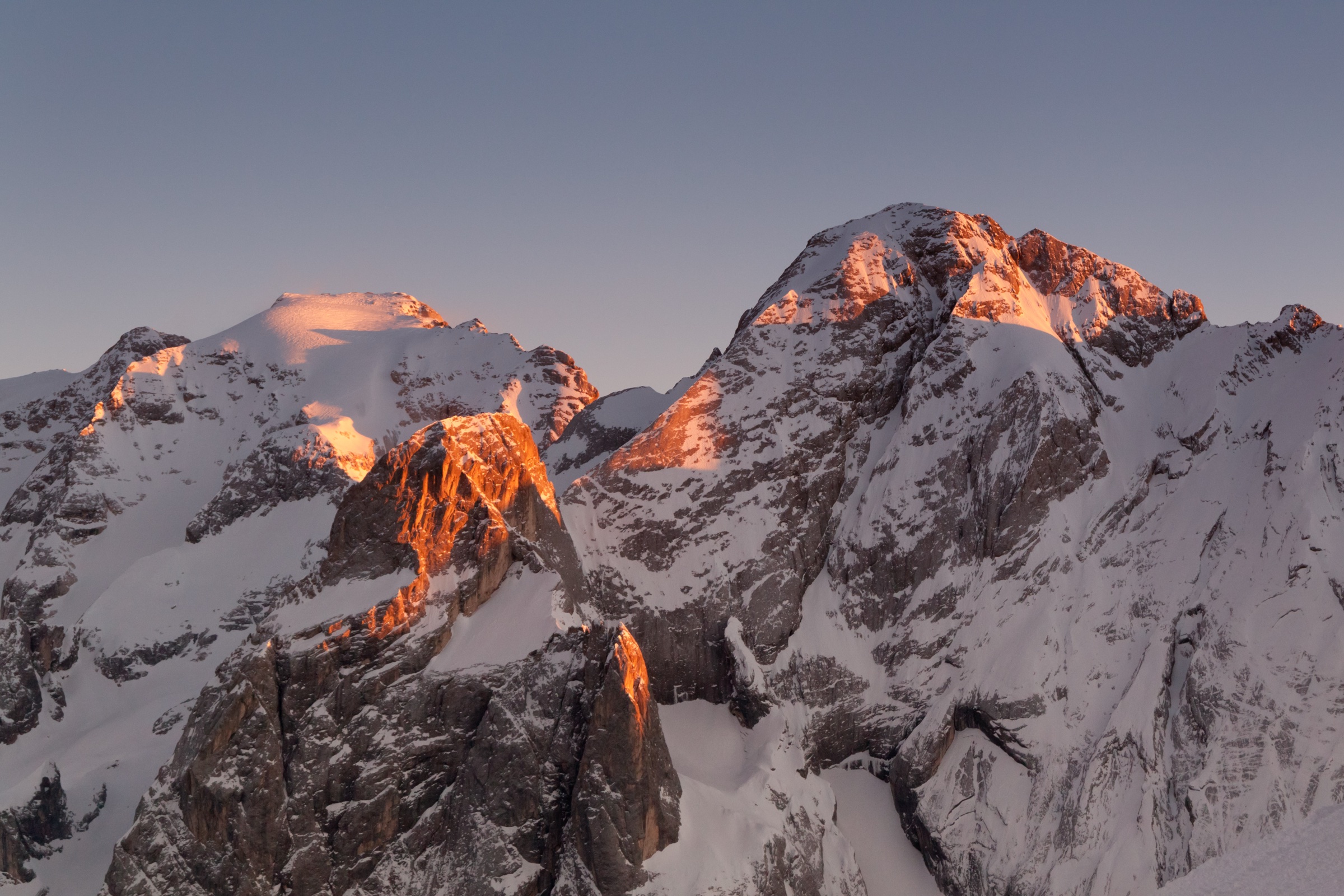
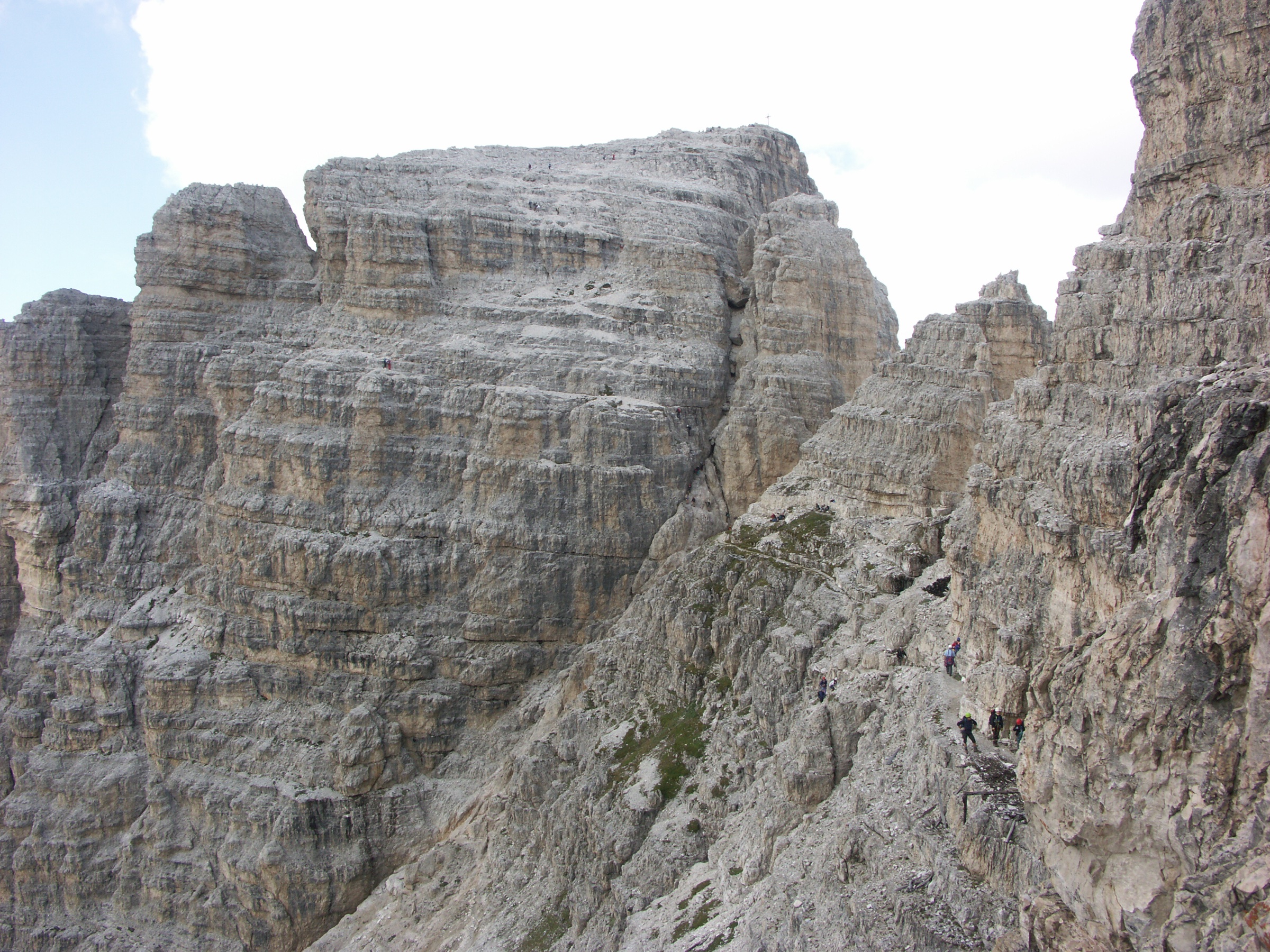
During the war, the Dolomites became one of Europe’s most extraordinary and brutal mountain frontiers. Italian and Austro-Hungarian forces fought across ridges, summits, cliffs, glaciers and tunnels. Soldiers had to move men, weapons, food and supplies through terrain that was often vertical, snowbound and exposed to enemy fire. To do that, they built fixed lines across the mountains: ladders, cables, steps, tunnels and protected passages.
In that context, the “iron way” was not recreational. It was military infrastructure, built to reach outposts, observation points and defensive positions in terrain where ordinary movement was almost impossible.
Many modern via ferrata routes in the Dolomites pass through or near this history. Some follow old wartime lines. Others move through landscapes where trenches, tunnels, barracks and memorials still mark the rock. For today’s climber, the experience can be strangely layered: the beauty of the mountains, the pleasure of movement, and the knowledge that these routes once belonged to a very different world.
A new life after the war
After the war, the meaning of these routes changed.
What had been built for soldiers gradually became part of Alpine outdoor culture. Old lines were restored. New routes were installed. Mountain clubs, local communities and tourism organisations began to maintain and promote via ferrata as a way for people to experience high, exposed terrain without the full demands of traditional alpinism.
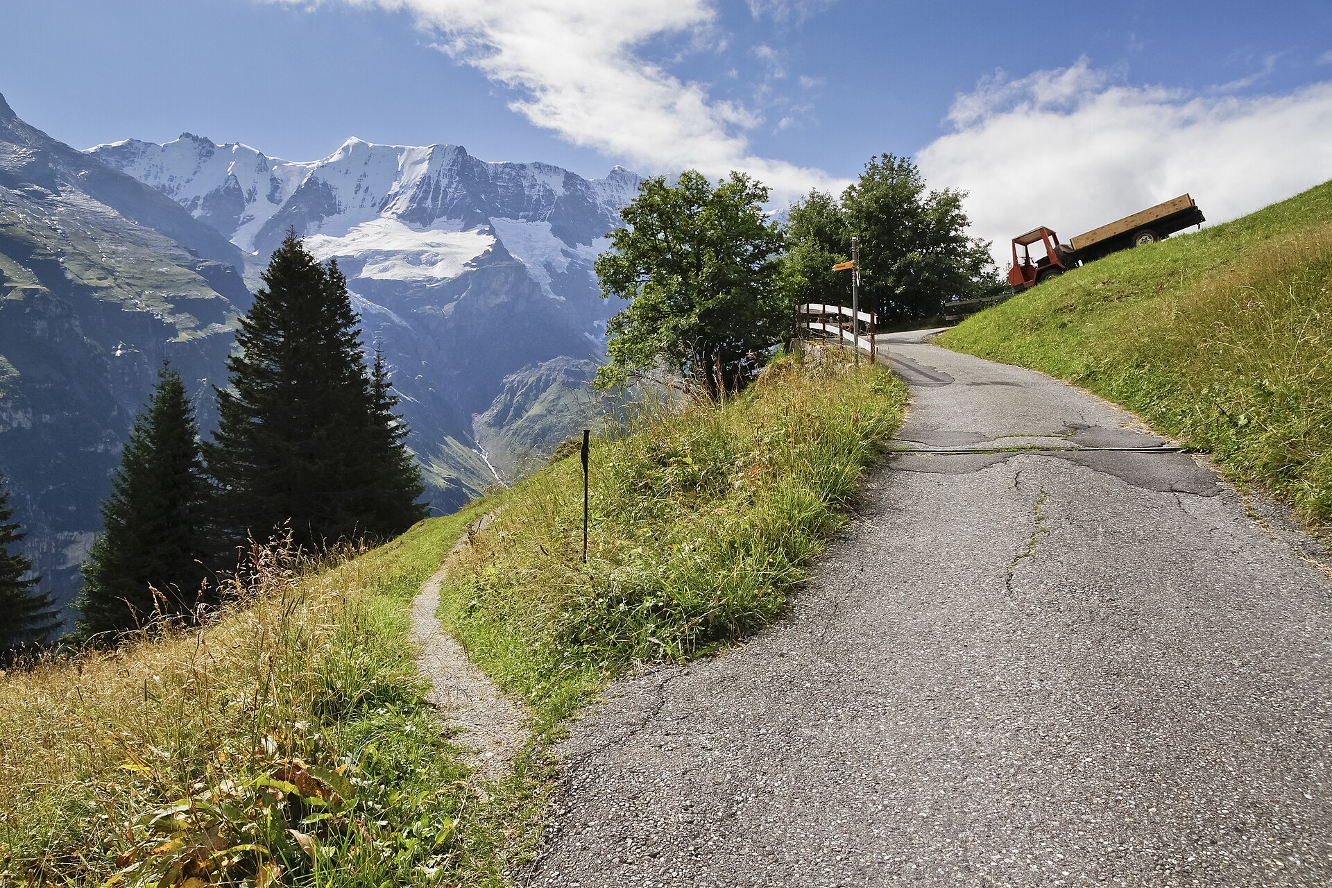
This transformation was especially strong in the Dolomites, where via ferrata became almost inseparable from the landscape. The limestone towers, sheer walls and high passes of the region were ideal for the activity. Routes could connect huts, passes, ridges and summits, allowing long mountain journeys through terrain that felt both wild and engineered.
Over time, via ferrata developed its own identity. It was no longer simply a protected hiking path, and it was not simply climbing with extra metal. It became a discipline with its own equipment, guidebooks, difficulty grades, route culture and etiquette.
The classic experience is still Alpine: a long approach, a cable rising into steep rock, a summit or pass, and a descent back through scree, meadows or forest. But modern via ferrata now includes many different styles. Some routes are historic and mountaineering in character. Some are short and athletic, built on cliffs close to towns or ski resorts. Some are family-friendly. Others are extremely exposed, overhanging and physically demanding, closer to an outdoor climbing gym bolted onto a mountain wall.
Where via ferrata is found today
Via ferrata remains most strongly associated with Europe, and especially with the Alps.
Italy is the spiritual home of the activity, with the Dolomites at its centre. Routes around Cortina d’Ampezzo, Alta Badia, Val Gardena, the Brenta Dolomites, Sella, Marmolada and many other areas form one of the densest and most historically important via ferrata landscapes in the world.
Austria has an enormous via ferrata culture of its own, usually known in German as Klettersteig. Austrian routes range from relatively gentle mountain itineraries to highly athletic sport ferratas, and the country has one of Europe’s most developed grading traditions.
Switzerland has fewer routes than Italy or Austria, but many are spectacular, often set in high Alpine scenery or dramatic limestone and granite terrain. France has a large network too, especially in the Alps, where many routes are designed with tourism and accessibility in mind: cliff routes, gorge routes, bridges, ladders and routes close to mountain villages or ski areas.
Slovenia is another important via ferrata country, with routes in the Julian Alps and other mountain areas. Spain has become a major destination, with via ferrata routes spread across the Pyrenees, Catalonia, Aragón, Andalusia and other regions. Germany, the Czech Republic, Slovakia, Romania, Norway, Croatia, Bosnia and Herzegovina, Kosovo, Greece and other European countries all have routes of varying density and style.
Beyond Europe, via ferrata has spread steadily. There are routes in North America, including commercial and resort-based routes in the United States and Canada. There are routes in the Middle East, Asia and elsewhere, often connected to mountain tourism, adventure parks, guided experiences or local climbing development.
This global spread matters because via ferrata is not one single thing. A Dolomite wartime route, an Austrian Klettersteig, a French cliff route above a village, a Spanish canyon ferrata and a North American resort route may all use cables and lanyards, but they can feel completely different. Each reflects local rock, local culture, local regulation and local ideas about access to the mountains.
How via ferrata is graded
One reason via ferrata can be confusing for newcomers is that difficulty grades vary by country.
Italy, France, Austria, Germany and Switzerland all use or have used different systems. Some grades focus on overall seriousness. Others emphasise technical difficulty, exposure, strength, endurance or the amount of artificial aid. A route might be physically easy but extremely exposed. Another might be short but overhanging and strenuous. A third might be technically moderate but long, remote and serious because of altitude, weather and descent.
This is important because via ferrata can look safer than it is.
The presence of a cable does not remove mountain risk. Falls on via ferrata can generate very high forces, which is why specialist energy-absorbing lanyards are essential. Rockfall remains a danger. Weather can turn a secure-feeling route into a hazardous one. Lightning is a serious risk on steel cables. Snow, ice, wet rock, crowding, poor technique and fatigue can all create problems.
A sensible via ferrata plan means looking beyond the headline grade. Climbers need to understand the approach, descent, route length, exposure, altitude, escape options, weather and whether the route is suitable for their experience. In other words, via ferrata sits in the same terrain as mountaineering, and it deserves the same respect.
The appeal of the iron way
So why has via ferrata become so popular?
Part of the answer is access. Via ferrata gives non-climbers a way into vertical terrain. It offers the drama of exposure without requiring years of climbing experience. For hikers, it can be a natural next step. For climbers, it can be a way to move quickly through big mountain terrain without carrying a full climbing rack and rope. For families, guides and mountain destinations, it can open up a structured adventure that is easier to manage than independent alpinism.
Part of the answer is also emotion.
Via ferrata is intensely physical. You feel the rock, the air, the height, the metal under your hands. The route gives you a line to follow, but you still have to move through the exposure yourself. The cable does not make the fear disappear. It simply makes the route possible.
That balance is what makes the activity so memorable. Via ferrata is accessible, but not passive. It is protected, but not risk-free. It is engineered, but still wild. It lets people experience the architecture of the mountains directly: walls, towers, gullies, ridges, ladders, bridges and summits.
For many people, that first moment of clipping into the cable is unforgettable.
A fragmented global picture
Despite its growth, via ferrata remains surprisingly difficult to map at a global scale.
That is partly because the activity is so local. A route may be built and maintained by a municipality, a guide company, a ski resort, a mountain club, a national park, a tourism office or a private operator. Information may be published in guidebooks, on local websites, in PDF brochures, on outdoor platforms, in national climbing portals, or only in the knowledge of local users.
The result is a scattered data landscape.
Some countries have excellent route information. Others have partial or inconsistent coverage. Some routes have precise names, grades, lengths and GPS traces. Others are represented only by a vague description or a tourism listing. Some routes are publicly accessible. Others are seasonal, guided-only, temporarily closed, commercially operated or subject to local restrictions.
For a user planning an outing, this fragmentation is inconvenient. For anyone trying to understand the global development of via ferrata, it is a much bigger problem. Individual route pages can tell you about one climb. They do not easily show the shape of the activity as a whole.
Where are the real centres of via ferrata activity? Which regions are growing? How does via ferrata relate to terrain, tourism, population, mountain access and protected areas? Where are the gaps in public data? Where are routes under-documented, duplicated, misclassified or missing entirely?
These are mapping questions.
And they are exactly the kind of questions that become visible when individual routes are transformed into geographic data.
Storm and OpenData.Earth: building a global via ferrata heatmap
Storm, in collaboration with OpenData.Earth, is assembling what is intended to become the most comprehensive heatmap of via ferrata activity in the world.
The aim is not simply to produce another list of famous routes. It is to understand the geography of via ferrata at scale: where routes exist, where they cluster, how dense different regions are, and how this activity has spread from its historic Alpine core into a wider global network.
A heatmap can reveal patterns that are hard to see from individual route descriptions alone. The Dolomites and Austrian Alps stand out immediately, but the wider picture is more complex. There are dense pockets in France and Spain. There are historic and modern routes across Slovenia, Switzerland and Germany. There are emerging and scattered routes in other parts of Europe. Beyond Europe, there are new concentrations linked to tourism, resorts and adventure infrastructure.
The value of this work is not only visual. A comprehensive via ferrata heatmap can help identify where data is strong and where it is weak. It can show where public information is duplicated, incomplete or inconsistent. It can support better route discovery, better outdoor planning and better understanding of how people use mountain terrain.
For Storm, this fits into a wider mission: building tools that help people understand the outdoors not as isolated points of interest, but as living geographic systems. Routes, snow, terrain, weather, access, activity and risk all interact. Via ferrata is a perfect example. It is both a route and an experience; both infrastructure and culture; both local and global.
For OpenData.Earth, the project reflects a broader belief: that outdoor knowledge should be more open, more structured and more useful. The world’s mountains are full of human-made lines — trails, climbs, ski tours, passes, huts, ferratas — but much of that information remains fragmented. Open data can help connect it.
The iron ways began as fixed lines through difficult terrain. Today, mapping them properly is another kind of fixed line: a way of connecting local knowledge into a global picture.
Why this matters
Via ferrata is often described as a bridge between hiking and climbing. That is true, but it is also a bridge between other worlds.
It connects history and recreation. It connects local mountain culture and global outdoor tourism. It connects physical infrastructure and digital mapping. It connects the emotional experience of exposure with the practical need for accurate route information.
As the activity grows, good data becomes more important. People need to know where routes are, how difficult they are, whether they are maintained, how to access them and what conditions might affect them. Communities need to understand how outdoor users move through their terrain. App developers, cartographers, researchers and open-data projects need better foundations for building useful tools.
Via ferrata may have begun as the iron road across the mountain. But in the digital age, those iron roads are becoming data lines too.
To map them well is to understand something larger: how humans make mountains accessible, how outdoor cultures spread, and how a route bolted into a cliff in one valley can become part of a global pattern.
The steel cable is still local. The story is now worldwide.
What you need for via ferrata
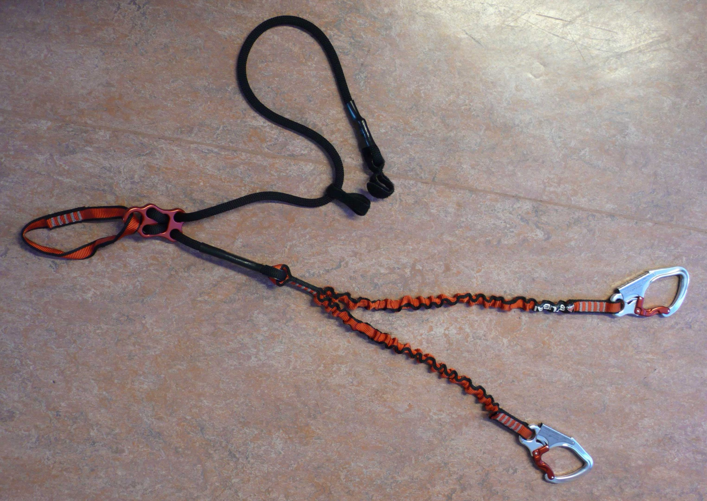
A typical via ferrata kit
Beginners should start on easy routes, go with someone experienced or hire a qualified guide. The cable is not a guarantee of safety. Route difficulty, exposure, weather, rockfall, descent and fatigue all matter.