Regional overview
The Rungwe volcanic region — also called the Rungwe Volcanic Province or Mount Rungwe massif — is the major Pleistocene-to-Holocene volcanic complex of southwestern Tanzania. It sits at the junction of the eastern and western arms of the East African Rift, between Lake Nyasa / Malawi to the south and the Tukuyu plateau, and is dominated by two large volcanic edifices — Mount Rungwe at roughly 2,961 m and Kyejo (Kiejo) to the south near Lake Nyasa — flanked by a scatter of smaller Holocene maars on the Tukuyu plateau, of which Lake Masoko (Kisiba) is the most accessible. The Smithsonian Global Volcanism Program records Kyejo’s only historically documented eruption around 1800.
The walking character is short, often steep tropical day-walks through montane forest, bamboo, heath and tea country, mostly inside Rungwe Forest Nature Reserve and adjacent forest blocks. Rainfall on the southeastern slopes of Mount Rungwe reaches up to 3 m a year, the highest in Tanzania, so the dry season from roughly June to October is the practical window for hiking. Most of the named day-walks are guided from Tukuyu, the main hiking base; Mbeya to the north and Kyela toward Lake Nyasa also serve as gateways.
Compared with the Kipengere Range to the east, the Rungwe area has noticeably more tourist infrastructure because of Mount Rungwe Forest Reserve guided programmes and the maar-lake circuit on the Tukuyu plateau. Public route statistics from Tanzania Forest Service or government tourism portals remain limited, so the entries below combine verified geological and locational data from Wikipedia, the Smithsonian Global Volcanism Program and OpenStreetMap with route information cross-checked against tourism and trip-report sources, marked “Partially verified” where appropriate.
Mbeya Peak and Loleza Peak above Mbeya are part of the Poroto / Mbeya Range and are catalogued separately. Ngozi Crater Lake and Daraja la Mungu are also catalogued under the Poroto Mountains entry — Wikipedia describes the Ngozi caldera rim as the high point of the Poroto Mountains, and Daraja la Mungu lies on the Poroto / Rungwe boundary along the Kiwira river. The present entry focuses on objectives unambiguously inside the Rungwe Volcanic Province south and southeast of the Poroto crest.
Selection rationale
The five entries cover the defining landscape types of the region: a Holocene maar-lake walk (Lake Masoko / Kisiba), the high volcanic summit (Mount Rungwe), a basalt-gorge waterfall (Kaporogwe), the tallest waterfall in Rungwe District (Malamba), and a southern-flank lava-flow / viewpoint walk on the historically active Kyejo. Mount Rungwe is the anchor mountain objective; the maar-lake and waterfall walks are short cultural-landscape walks that together represent the Rungwe province at a human scale.
Summary table
| # | Hike | Country | Route type | Distance | Gain | Max elevation | Difficulty |
|---|---|---|---|---|---|---|---|
| 1 | Lake Masoko (Kisiba) maar walk | Tanzania | Short interpretive walk around a maar crater | ~2-3 km circuit | Minor | ~840 m (rim) | Easy |
| 2 | Mount Rungwe summit from Tukuyu side | Tanzania | Out-and-back summit hike | ~16 km (trip-report figure) | ~1,300-1,500 m | ~2,961 m | Hard |
| 3 | Kaporogwe Falls walk | Tanzania | Short out-and-back to waterfall and cave | Unresolved (short) | Modest | Unresolved | Easy-moderate |
| 4 | Malamba Waterfalls walk | Tanzania | Short out-and-back to a high plunge waterfall | Short, figures unresolved | Modest | Unresolved | Easy-moderate |
| 5 | Kyejo (Kiejo) volcano lava-flow viewpoint walk | Tanzania | Candidate flank/lava-flow walk | Unresolved | Unresolved | ~2,176 m (summit) | Candidate only |
1. Lake Masoko (Kisiba) maar walk
Snapshot
Itinerary
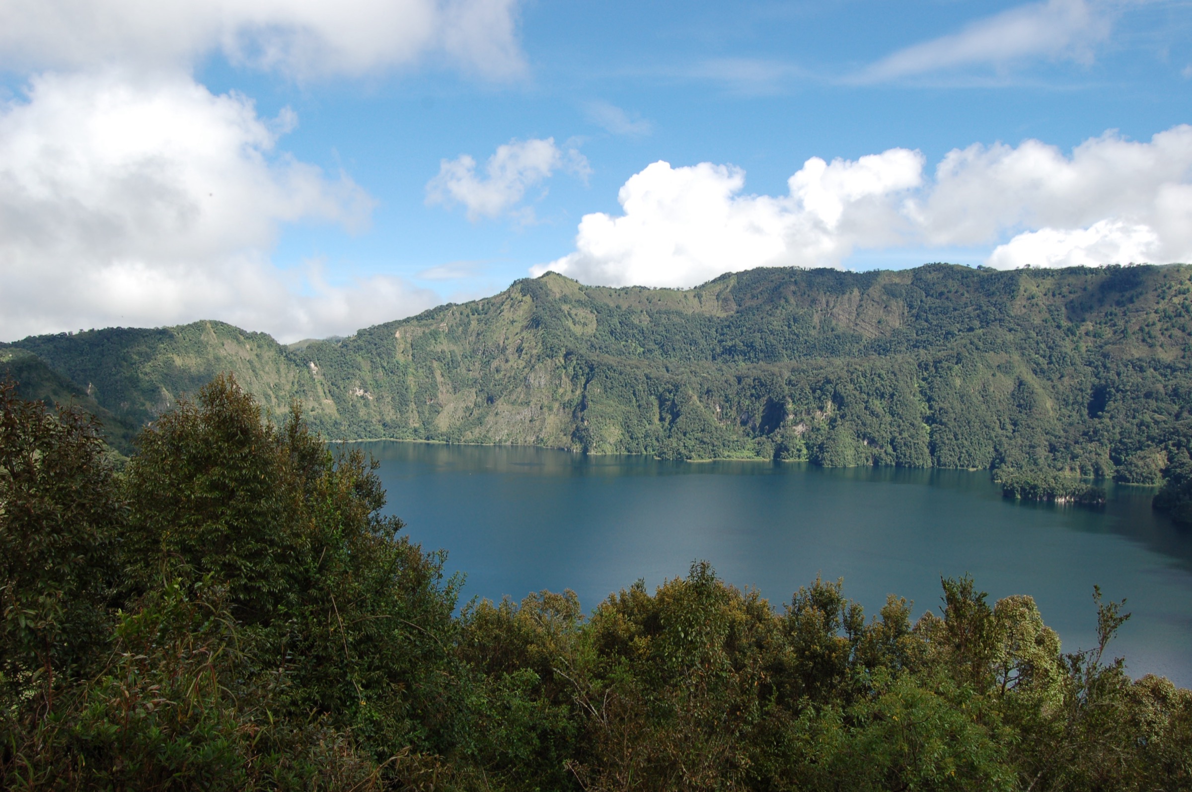
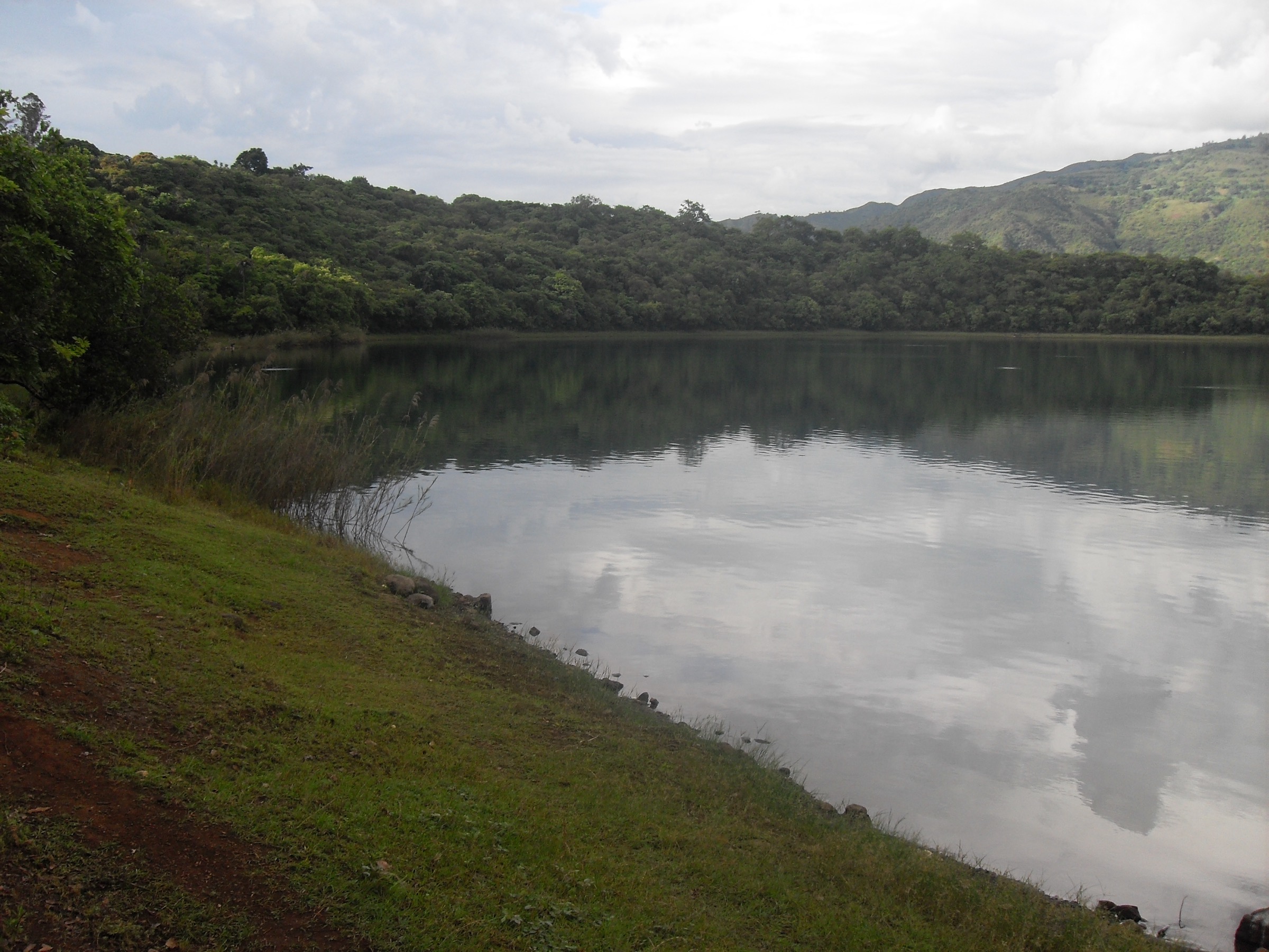
From the Tukuyu–Kyela road south of Tukuyu, a short access road and footpath drop into Lake Masoko, also called Kisiba Crater Lake, a near-circular Holocene maar about 700 m across set in a bowl of secondary forest and small farms. The walk descends from the rim to a swimming and picnic point on the eastern shore, with the option of following local paths part-way around the rim for changing viewpoints into the lake. Most visitors return to the rim road by the same route.
Why it is essential
Lake Masoko is the most accessible maar of the Rungwe Volcanic Province and one of the standard short objectives on the Tukuyu plateau. It is also a benchmark site in East African palaeoclimate research — its sediments have been cored repeatedly by international teams reconstructing the past 50,000 years of climate in the southern Rift. The walk pairs the geological story with a calm, easily reached crater-lake visit, and works as a half-day complement to Kaporogwe Falls and Malamba Falls in the same area.
Equipment
Light walking equipment: grippy footwear, sun and rain protection, water, and swimwear if planning to swim. A local guide is helpful for orientation around informal paths and is generally arranged at the road.
Hazards and notes
Crater walls and lake-edge paths can be slippery after rain. The lake has been the subject of geochemistry studies and shows seasonal stratification; swimming is informal and not supervised. Verify access permissions and any visitor fees with local guides on the day.
GPX / KML links
| Source | URL | Format / access | Reuse status |
|---|---|---|---|
| OpenStreetMap search — Lake Masoko / Kisiba | openstreetmap.org | Source map / search | OSM data is ODbL; not a route file |
| Wikiloc search — Masoko / Kisiba | wikiloc.com | Search page | Wikiloc terms apply if a track is later selected; no GPX selected here |
External links
- Wikipedia — Rungwe Volcanic Province
- Tanzania Tourism — Masoko Crater Lake
- U.S. Department of State Tanzania Travel Advisory, 31 October 2025
2. Mount Rungwe summit from Tukuyu side
Snapshot
Itinerary
The standard guided ascent registers at the Tukuyu forest office, where a per-group fee and guide are arranged, then drives to a forest-reserve trailhead and climbs through upper-montane forest. At roughly 2,600 m the forest gives way to a belt of bamboo, then heathland between about 2,600 and 2,800 m with Erica, Protea and Aloe species, before the summit ridge and high point near 2,961 m. Descent retraces the ascent line. The full day is reported at roughly 16 km and about 6-8 hours moving time, with around 1,300-1,500 m of ascent depending on the start point.
Why it is essential
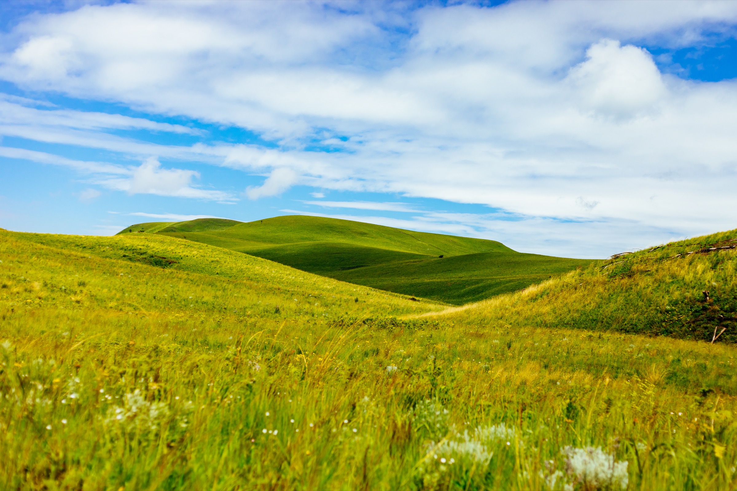
Mount Rungwe is the highest point of the Rungwe Volcanic Province and southern Tanzania’s second-highest peak after Loleza / Mbeya area summits in some lists, or its equal depending on source. It is the defining objective of the massif and the only verified guided summit day-hike of the volcanic region. Its biodiversity, forest belt and high rainfall make it ecologically distinct from the drier Kipengere highlands.
Equipment
Mountain hiking equipment: sturdy boots, warm and weatherproof layers, hat and gloves for the upper slopes, sun protection, navigation backup, plenty of water and food, and a headtorch in case of late descent. A guide is required by reserve management and strongly recommended due to overgrown paths.
Hazards and notes
Paths can be overgrown and indistinct, and the upper slopes can be cold, wet and misty even in the dry season. Daylight is limited for a 6-8 hour day, so an early start is standard. Reserve fees and guide arrangements must be completed in Tukuyu before driving to the trailhead.
GPX / KML links
| Source | URL | Format / access | Reuse status |
|---|---|---|---|
| OpenStreetMap — Mount Rungwe location | openstreetmap.org | Source map / location | OSM data is ODbL; not a route file |
| Hiking Adventures trip report — Hike 156 | hikingadventures.net | Third-party trip-report and route description | Author’s copyright; route distance / gain referenced only |
External links
- Wikipedia — Mount Rungwe
- Smithsonian Global Volcanism Program — Rungwe
- Hiking Adventures — Mount Rungwe
- U.S. Department of State Tanzania Travel Advisory, 31 October 2025
3. Kaporogwe Falls walk
Snapshot
Itinerary
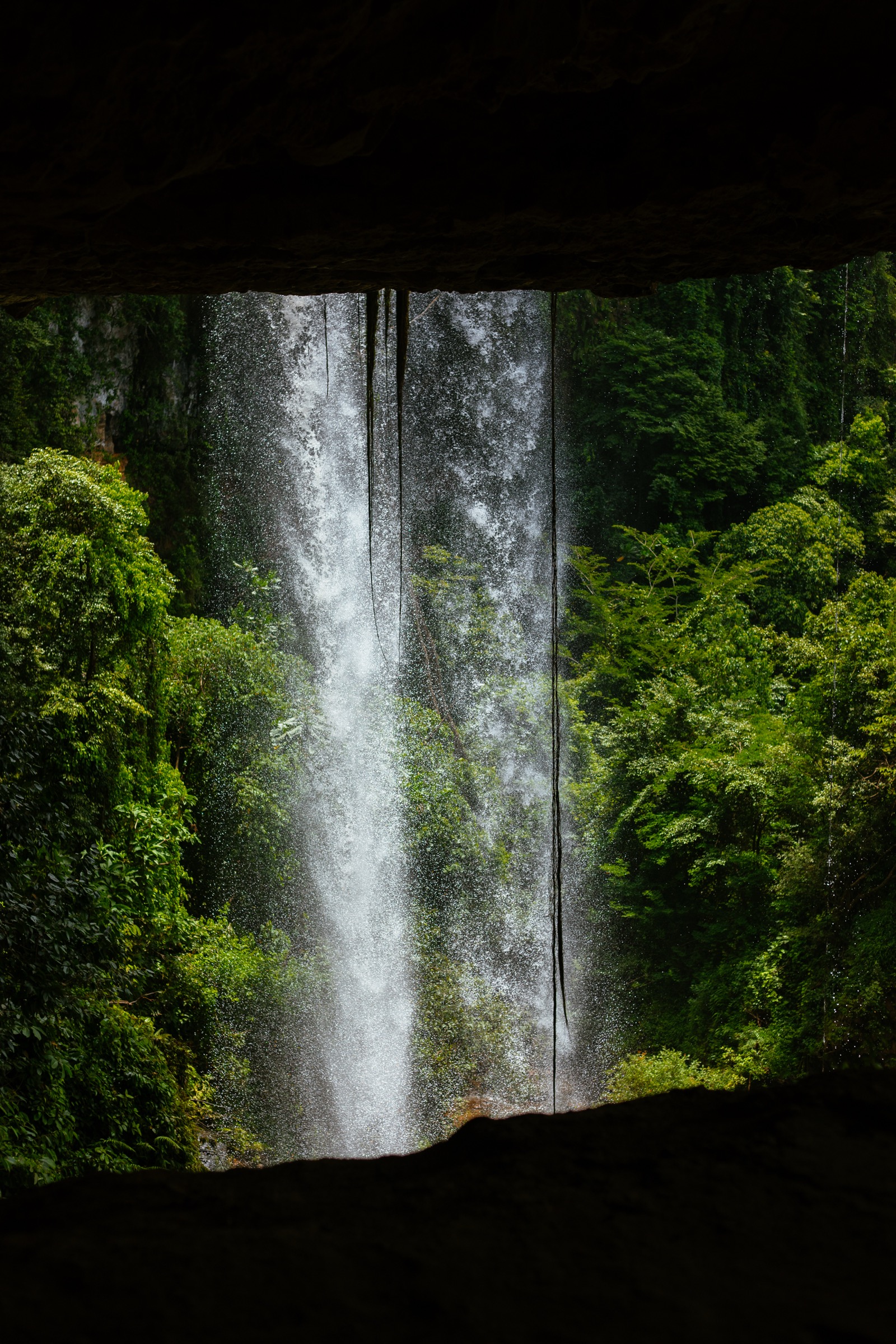
Tourism sources put Kaporogwe Falls at about 10-25 km from Tukuyu, on a tributary of the Kiwira River (the Kala River). The falls drop about 25 m over a basalt gorge with a large cave behind the curtain and a plunge pool below. The walk descends from the access track to a viewpoint above the falls, then by a short scramble to the pool and cave. Source distances from Tukuyu vary between 10 and 25 km, so trailhead access should be confirmed locally.
Why it is essential
The Kaporogwe walk shows the basalt and lava-flow geology of the Rungwe plateau at a human scale, with a clearly defined waterfall, cave behind the curtain, and swimming pool. It is the principal short-walk objective on the Tukuyu side and is repeatedly listed by Tanzania Tourism among the area’s destinations.
Equipment
Light hiking equipment: grippy footwear, sun and rain protection, water, and swimwear if planning to swim. A guide is helpful for the route into the cave and is generally arranged at the trailhead.
Hazards and notes
The descent to the pool is steep, and the rocks behind the waterfall are slippery. Flow is heavier and pool depth less predictable after rain. Swimming is reported but not officially supervised.
GPX / KML links
| Source | URL | Format / access | Reuse status |
|---|---|---|---|
| OpenStreetMap search — Kaporogwe Falls | openstreetmap.org | Source map / search | OSM data is ODbL; not a route file |
| Wikiloc search — Kaporogwe | wikiloc.com | Search page | Wikiloc terms apply if a track is later selected; no GPX selected here |
External links
- Tanzania Tourism — Kaporogwe Falls
- Visit Tanzania — Kaporogwe Falls
- U.S. Department of State Tanzania Travel Advisory, 31 October 2025
4. Malamba Waterfalls walk
Snapshot
Itinerary
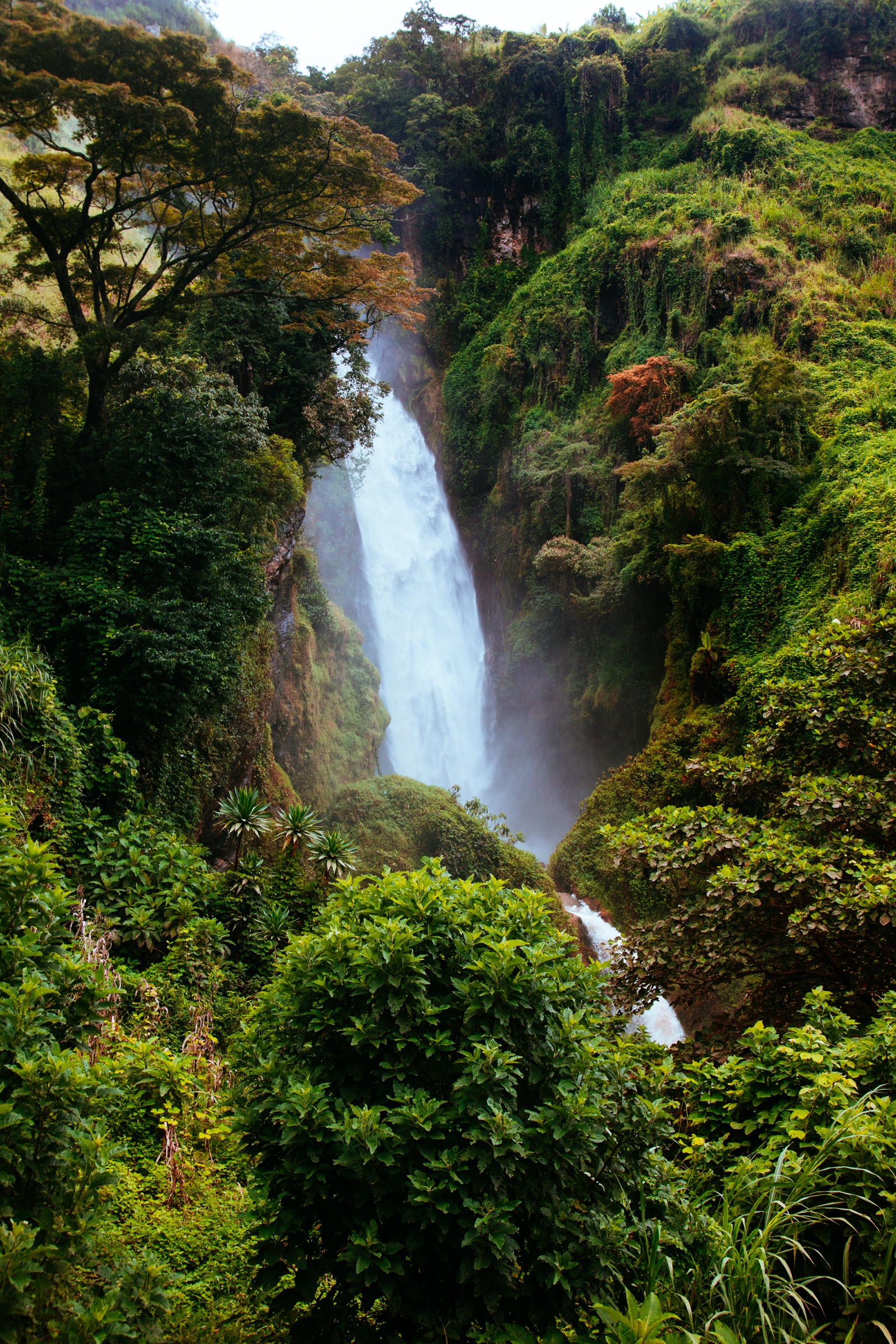
From Tukuyu, a side road of roughly 15 km leads to Suma Malamba village, from which a short footpath descends to a viewpoint above the falls and a steeper trail to the base. The waterfall drops about 80 m as a single sheer plunge over a basalt step into a forested gorge — locally cited as the tallest waterfall in Rungwe District. Most visitors return to the village by the same path.
Why it is essential
Malamba completes the Rungwe District waterfall pair alongside Kaporogwe: where Kaporogwe is a wider, shorter curtain with a cave behind it, Malamba is a tall, narrow plunge in a deeper forested gorge, dropping over the same basalt geology of the Tukuyu plateau. The walk is short enough to combine with Lake Masoko in a single day from Tukuyu.
Equipment
Light hiking equipment: grippy footwear, sun and rain protection, water, and a light waterproof for spray near the base. A local guide is helpful for the descent route and is generally arranged at the village.
Hazards and notes
The descent to the base is steep and slippery, especially after rain, and the river above the lip is dangerous at high flow. The trail is informal and not signposted. Confirm access on the day and consider hiring a local guide at Suma Malamba village.
GPX / KML links
| Source | URL | Format / access | Reuse status |
|---|---|---|---|
| OpenStreetMap search — Malamba / Suma Malamba | openstreetmap.org | Source map / search | OSM data is ODbL; not a route file |
| Wikiloc search — Malamba Falls | wikiloc.com | Search page | Wikiloc terms apply if a track is later selected; no GPX selected here |
External links
- Wikimedia Commons — Malamba Waterfalls
- U.S. Department of State Tanzania Travel Advisory, 31 October 2025
5. Kyejo (Kiejo) volcano lava-flow viewpoint walk
Snapshot
Itinerary
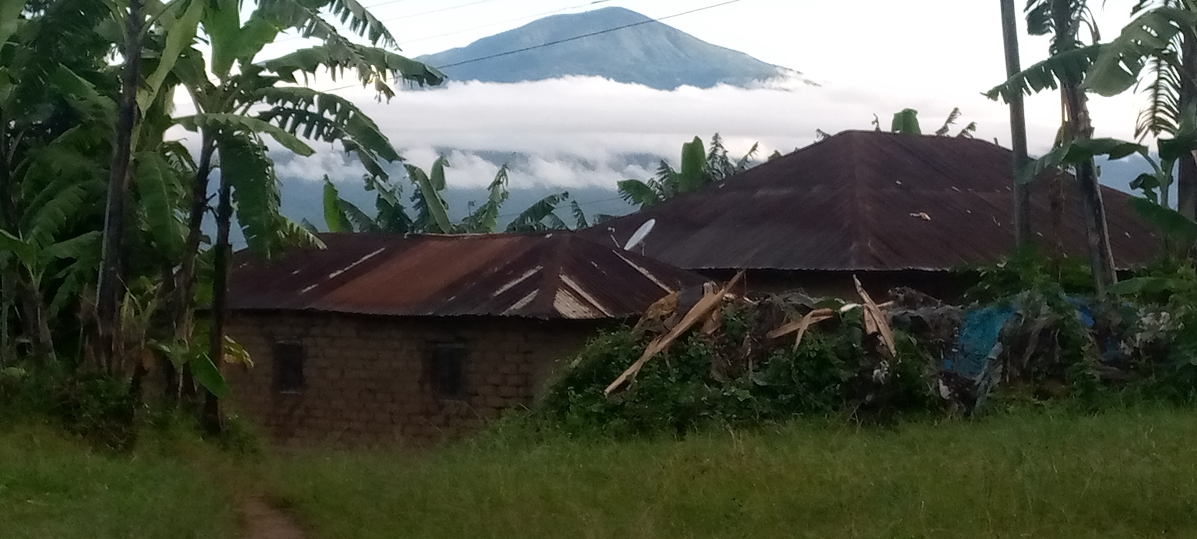
This is a candidate flank or viewpoint walk on Kyejo, the southernmost potentially active volcano of continental Africa and the third-largest volcano of the Rungwe Volcanic Province after Ngozi and Rungwe. The only historically documented eruption, around 1800, occurred at the Sarabwe and Fiteko parasitic cones on the northwestern slope and produced lava flows that travelled about 8 km. No public, standardised guided day-walk route, trailhead, distance or ascent figure was verified for this catalogue.
Why it is essential
Kyejo is the second-largest active volcano of the Rungwe complex after Mount Rungwe and the most recently active. A short walk to a lava-flow viewpoint would complete the regional picture by adding a historically active volcano to the maar-lake (Masoko) and forest summit (Rungwe) entries. Persistent hot springs document continuing hydrothermal activity.
Equipment
Mountain hiking equipment depending on the final route: sturdy footwear, sun and rain protection, navigation backup, water, food and headtorch. Local guiding is essential.
Hazards and notes
This is a research target only. Active hydrothermal features, off-trail terrain on lava flows, route-finding and access permission all need local verification before a publication-ready route can be added.
GPX / KML links
| Source | URL | Format / access | Reuse status |
|---|---|---|---|
| OpenStreetMap — Kyejo / Kiejo | openstreetmap.org | Source map / location | OSM data is ODbL; not a route file |
| Smithsonian Global Volcanism Program — Kyejo | volcano.si.edu | Volcano profile | Source data, not a route file |
External links
- Wikipedia — Kyejo
- Smithsonian Global Volcanism Program — Kyejo
- U.S. Department of State Tanzania Travel Advisory, 31 October 2025
Missing data / follow-up work
- Lake Masoko (Kisiba) walking statistics and a marked trailhead remain informal; route distance and gain are estimated rather than officially published.
- Mount Rungwe summit route distance and elevation gain rely on a third-party trip report; an official Tanzania Forest Service / Rungwe Forest Nature Reserve route file or signed-distance table would be preferable.
- Kaporogwe Falls trailhead access and distance from Tukuyu vary between published sources (about 10 km vs about 25 km) and should be confirmed locally.
- Malamba Waterfalls walking statistics are not publicly published; the entry is labelled Candidate only pending a verified distance and gain figure.
- Kyejo / Kiejo flank or viewpoint walk has no standardised public day-hike route; the entry remains a research target only.
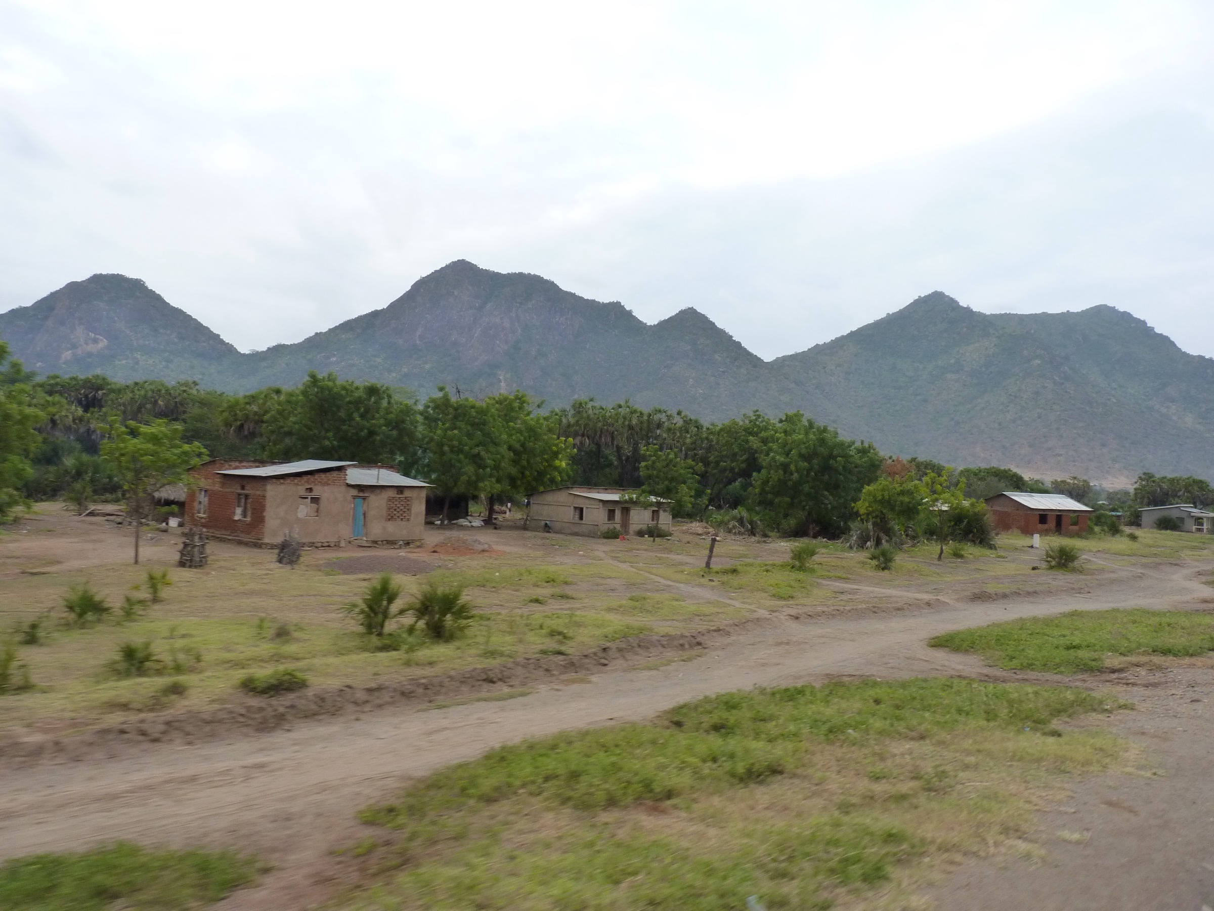
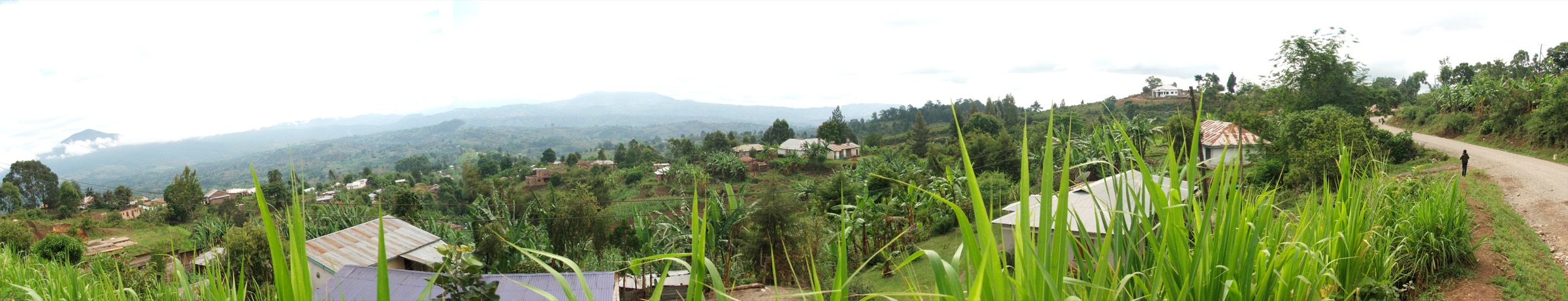
- No high-resolution image specifically of Kyejo (Kiejo) was located; a regional / representative Tukuyu panorama is used.
- All published GPX / KML route files in this catalogue are external; no third-party tracks have been re-hosted.
- Ngozi Crater Lake and Daraja la Mungu are catalogued in the Poroto Mountains entry; readers expecting them under “Rungwe” should follow that cross-reference.
- Tanzania is under a U.S. “Reconsider Travel” (Level 3) advisory as of 31 October 2025, including specific mention of Mbeya among cities where unrest has been reported; conditions should be re-checked before travel.
External links
| Resource | Link |
|---|---|
| Wikipedia — Rungwe Volcanic Province | en.wikipedia.org |
| Wikipedia — Mount Rungwe | en.wikipedia.org |
| Wikipedia — Kyejo | en.wikipedia.org |
| Smithsonian Global Volcanism Program — Rungwe | volcano.si.edu |
| Smithsonian Global Volcanism Program — Kyejo | volcano.si.edu |
| Tanzania Tourism — Masoko Crater Lake | tanzaniatourism.com |
| Tanzania Tourism — Kaporogwe Falls | tanzaniatourism.com |
| Hiking Adventures — Mount Rungwe trip report | hikingadventures.net |
| U.S. Department of State Tanzania Travel Advisory, 31 October 2025 | travel.state.gov |