.jpg)
Regional overview
The Poroto Mountains form a high volcanic range east of Mbeya in southwestern Tanzania, part of the geological Rungwe Volcanic Province and described by Wikipedia as a northwestward extension of the Kipengere Range. The published range area is 240.34 km², and the northern rim of the Ngozi caldera is recorded as the highest point in the Poroto range proper at about 2,621 m. Mount Rungwe rises immediately to the south of the Porotos and is treated in a separate article in this series.
Walking character is dominated by montane evergreen rainforest, volcanic ridges, and crater-rim viewpoints. Ngozi and the southern Poroto slopes are among the rainiest places in Tanzania, with the Poroto Ridge Forest Reserve (established 1937) and the smaller Ngalijembe Forest Reserve protecting most of the high forest. The Kiwira River drains the southern slopes towards Lake Malawi and carves a series of basalt features in the foothills, including the natural arch known as Daraja la Mungu.
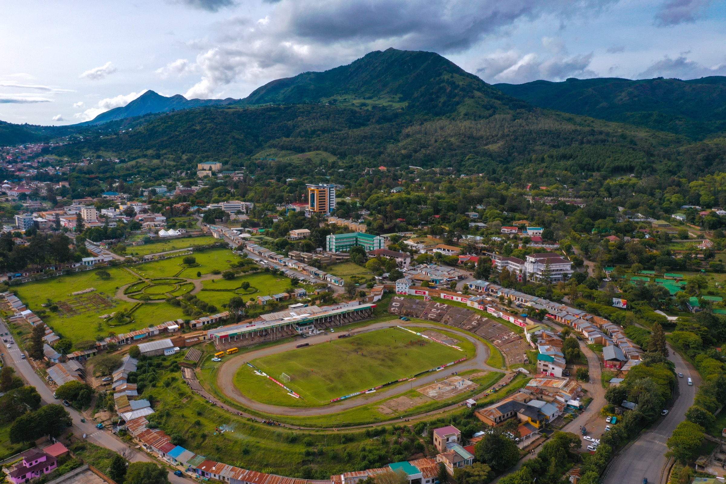
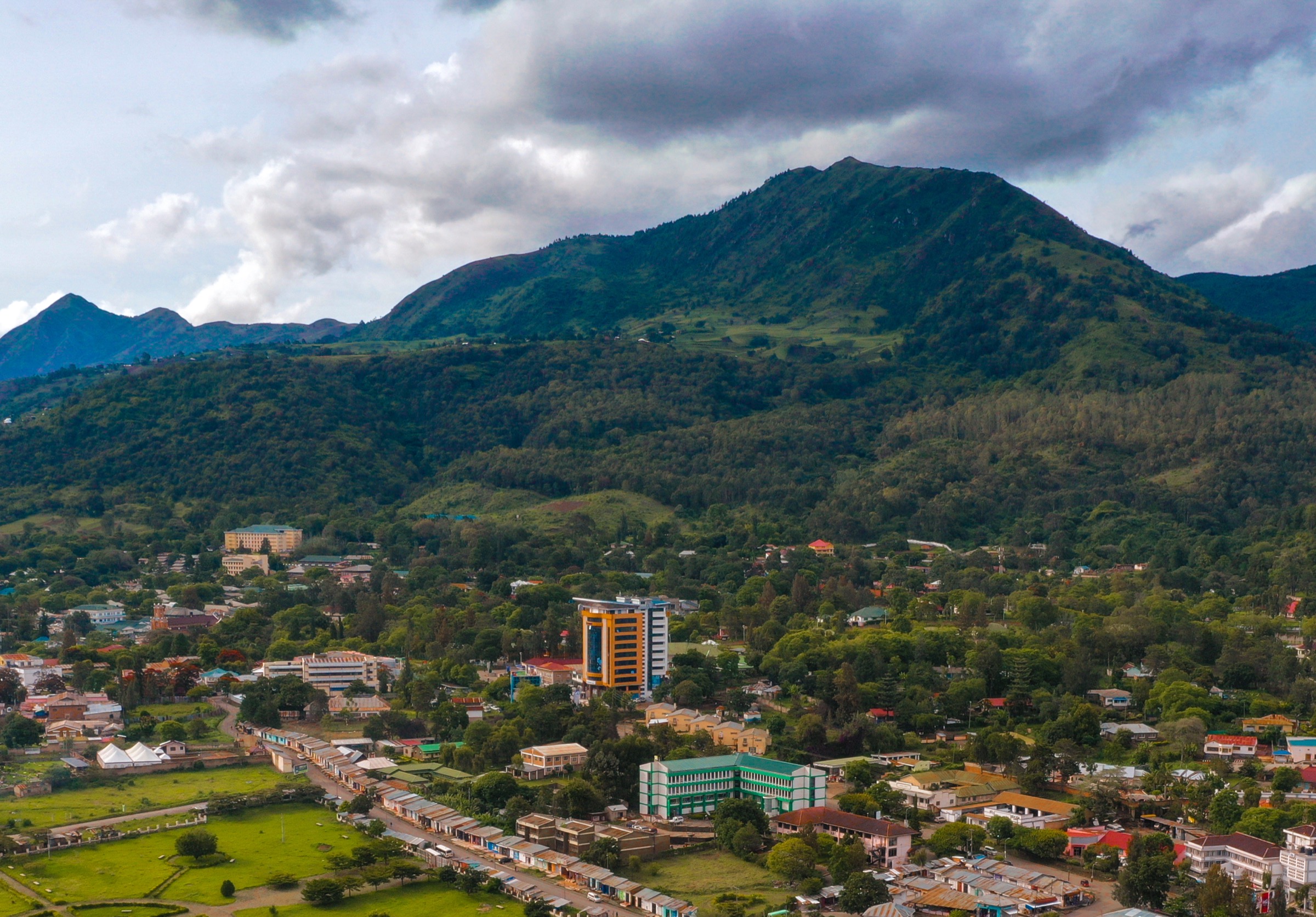
Mbeya town, west of the Poroto range, is the principal hiking base. The Mbeya Range — a separate arc of peaks immediately north of Mbeya city including Mbeya Peak (2,820 m commonly cited; 2,895 m on the Wikipedia range article) and Loleza Peak (around 2,656 m to 2,809 m depending on source) — is geographically distinct from the Porotos on Wikipedia but is treated together with the Porotos in most regional tourism material because it shares the same volcanic province and the same Mbeya-town logistics. Both clusters are covered below, with the regional separation flagged in each entry.
Walking infrastructure is light. Guides are arranged informally through Mbeya hotels and small local agencies; there is no public trail-system map of the Poroto Ridge Forest Reserve. Route statistics in this catalogue are drawn from secondary tour-operator sources and Wikiloc tracks where available, and unresolved fields are clearly labelled.
Selection rationale
Ngozi Crater Lake is the unambiguous anchor — it sits inside the Poroto Ridge Forest Reserve and its northern rim is the Poroto range high point. Mbeya Peak and Loleza Peak are the two signature Mbeya-base summit walks and are included with a clear note that they belong to the adjacent Mbeya Range rather than the Porotos in strict Wikipedia terms. A Kitulo Plateau gateway walk represents the eastern margin of the Poroto block where it meets the Livingstone/Kipengere country. The Kiwira valley Bridge of God adds a short forest and basalt-gorge walk on the southern Poroto foothills, accessible from Tukuyu.
Summary table
| # | Hike | Country | Route type | Distance | Gain | Max elevation | Difficulty |
|---|---|---|---|---|---|---|---|
| 1 | Ngozi Crater Lake rim walk | Tanzania | Out-and-back | Unresolved (around 2 hours one way per tourism sources) | Unresolved | 2,621 m (north rim) | Moderate |
| 2 | Mbeya Peak from Lunji Farm | Tanzania | Out-and-back | Unresolved | Unresolved | 2,820 m (Lonely Planet; 2,895 m per Wikipedia Mbeya Range) | Moderate-hard |
| 3 | Loleza Peak from Mbeya town | Tanzania | Out-and-back | Around 15.5 km per Wikiloc-style logs | Around 962 m per Wikiloc-style logs | 2,656 m (Mbeya Range article); 2,809 m (Loleza Mountain Wikipedia) | Moderate |
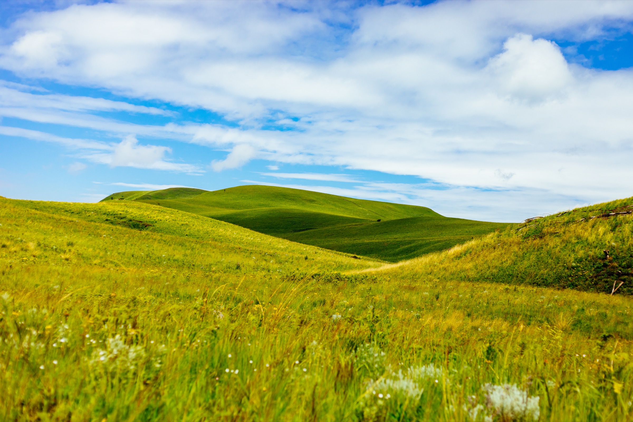
| 4 | Kitulo Plateau gateway walk from Matamba | Tanzania | Out-and-back/loop candidate; geometry unresolved | Unresolved | Unresolved | About 2,600 m plateau level | Easy-moderate candidate |
| 5 | Daraja la Mungu and Kiwira valley walk | Tanzania | Short out-and-back/local walk | Unresolved (short) | Unresolved (small) | Below 1,800 m | Easy |
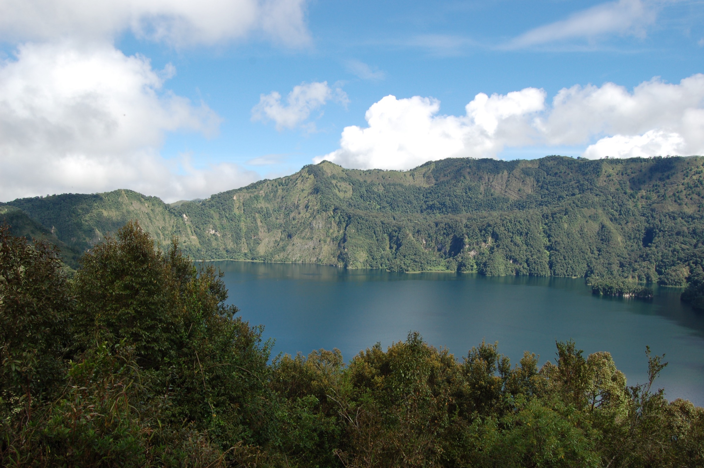
1. Ngozi Crater Lake rim walk
Snapshot
Itinerary
From the gate signed off the Mbeya-Kyela highway near Isongole, the route follows a forest road through the Poroto Ridge Forest Reserve and then climbs through montane evergreen rainforest to the rim of the Ngozi caldera. Tour operators and Wikiloc-style trail descriptions report a more gentle lower section on an old road and a steeper, sometimes root-bound climb in the upper half. Most accounts give around two hours from the foothill to the rim. The standard objective is a rim viewpoint above the lake, which lies about 200 m below the high north rim.
Why it is essential
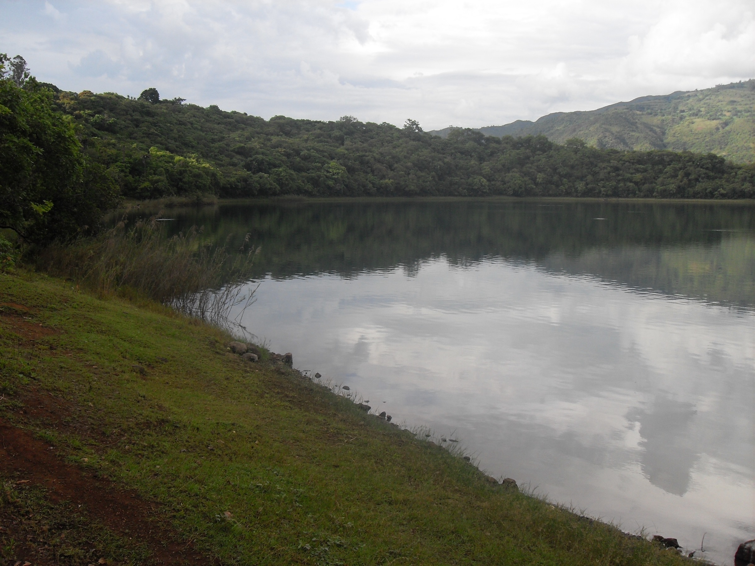
Ngozi is the high point of the Poroto Mountains and the second-largest crater lake in Africa, with a verified surface area of 3.1 km², a maximum depth of 74 m, and a Holocene volcanic history that includes a major Plinian eruption around 12,000 years ago. It is the defining single objective of any Poroto day-hike catalogue and the only walk in this list whose route, gate, and forest setting are documented in multiple secondary sources.
Equipment
Mountain hiking equipment for a wet montane forest: sturdy boots with good grip for muddy and root-bound trail, weatherproof layer, warm layer for the rim, water, food, and headtorch. A local guide is recommended and is the standard arrangement at the gate.
Hazards and notes
Mud and slippery roots in the upper section are the main practical issues. The lake itself is associated with large subaqueous CO2 emissions and local legends of “killing power”, and the published volcanic record notes that the limnic-eruption risk is not zero. Descent to the lake shore is not part of this rim-viewpoint route. Mist, cold, and afternoon rain are common even in the dry season.
GPX / KML links
| Source | URL | Format / access | Reuse status |
|---|---|---|---|
| Wikiloc — Ngozi crater lake trail | wikiloc.com | User-uploaded GPS track | Wikiloc terms apply; track not selected for redistribution in this pass |
| OpenStreetMap — Lake Ngozi | openstreetmap.org | Source map | OSM data is ODbL; location cross-check only |
External links
- Wikipedia — Lake Ngozi
- Wikipedia — Poroto Mountains
- Tanzania Tourism — Lake Ngozi
- U.S. Department of State Tanzania Travel Advisory, 31 October 2025
2. Mbeya Peak from Lunji Farm
Snapshot
Itinerary
From central Mbeya, take a daladala to the Mbalizi junction, get off at the Utengule Coffee Lodge sign, follow the dirt road for about 1 km to the St Mary’s Seminary turn, then continue up past the seminary to Lunji Farm. A vehicle can be parked at Lunji Farm. The walking route continues on foot from Lunji Farm to the summit ridge and on to Mbeya Peak. Lonely Planet records about five hours for the return trip and recommends a local guide arranged through a Mbeya hotel or travel agency.
Why it is essential
Mbeya Peak is the highest point of the Mbeya Range that forms the immediate skyline north-west of Mbeya town, and is the standard Mbeya-base summit objective. It belongs to the Mbeya Range rather than the Porotos in strict Wikipedia terms, but is logistically and culturally part of the same Mbeya hiking unit and is included here on that basis.
Equipment
Mountain hiking equipment: boots, layers, weatherproof shell, warm layer for the summit, sun protection on the open upper slopes, water, food, and headtorch. Trekking poles are useful on the steeper sections.
Hazards and notes
Steep, unmaintained trail, mist, and route-finding on the upper slopes are the main concerns. Lonely Planet specifically recommends only climbing with a guide. Overgrazing and erosion in the Mbeya Range are documented and can affect the upper trail surface.
GPX / KML links
| Source | URL | Format / access | Reuse status |
|---|---|---|---|
| Wikiloc — trails in Mbeya | wikiloc.com | Trail-database listing | Wikiloc terms apply; no specific track selected in this pass |
| OpenStreetMap — Mbeya area | openstreetmap.org | Source map | OSM data is ODbL; location cross-check only |
External links
- Wikipedia — Mbeya Range
- Lonely Planet — Mbeya Peak
- Tranquil Kilimanjaro — Mbeya Range
- U.S. Department of State Tanzania Travel Advisory, 31 October 2025
3. Loleza Peak from Mbeya town
Snapshot
Itinerary
The standard line follows the powerline trail up the south face directly above Mbeya town, or an alternative contour route that crosses the first sub-summit marked with a large Christian cross before continuing to the main peak. Tour-operator logs report a total distance of about 15.5 km and about 962 m of ascent. Town-base logistics are unusually easy compared to the rest of the catalogue: the walk begins in Mbeya itself with no vehicle transfer required.
Why it is essential
Loleza is the immediate town-side hill walk for Mbeya and the most accessible summit objective in the Mbeya/Poroto cluster. It is also the type locale for the moth species Zamarada loleza, giving the hill a small additional point of interest. Including it alongside Mbeya Peak provides a shorter, less demanding alternative summit.
Equipment
Boots, water, sun protection, a light layer for the summit, and a phone or map for the upper junctions. A local guide is recommended in line with general Mbeya Range guidance.
Hazards and notes
The most-cited concern is route-finding on the powerline and contour options. The two elevation figures recorded in different Wikipedia articles (2,656 m vs 2,809 m) suggest the high-point reading is still contested; the practical summit objective is the obvious named hill above the city. Theft and access along the powerline corridor should be checked locally before setting off alone.
GPX / KML links
| Source | URL | Format / access | Reuse status |
|---|---|---|---|
| Wikiloc — trails in Mbeya | wikiloc.com | Trail-database listing | Wikiloc terms apply; no specific track selected in this pass |
| OpenStreetMap — Loleza Mountain | openstreetmap.org | Source map | OSM data is ODbL; location cross-check only |
External links
- Wikipedia — Loleza Mountain
- Wikipedia — Mbeya Range
- U.S. Department of State Tanzania Travel Advisory, 31 October 2025
4. Kitulo Plateau gateway walk from Matamba
Snapshot
Itinerary
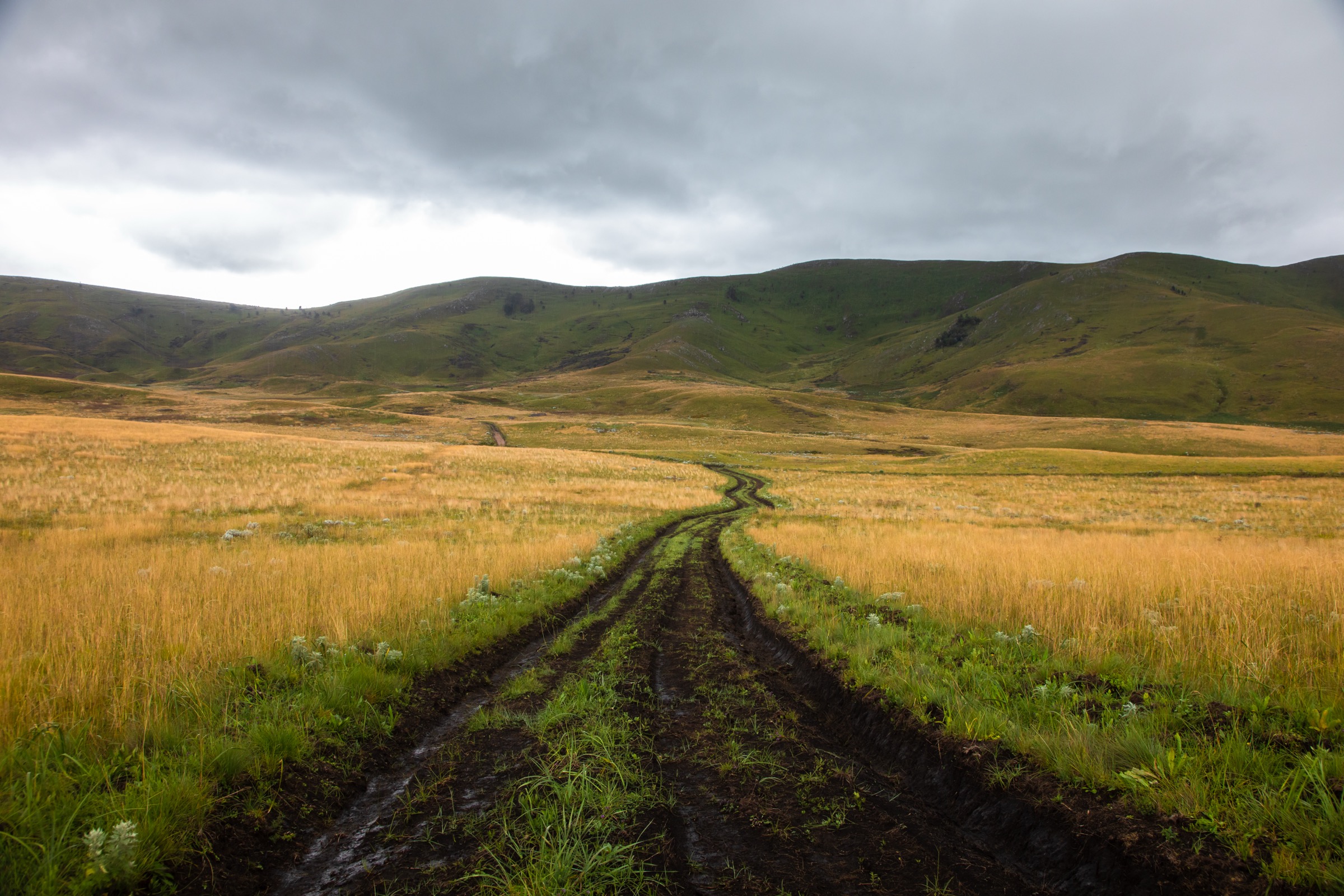
Kitulo National Park sits between the Livingstone/Kipengere mountains and the eastern margin of the Poroto block. From the Matamba Gate, plateau walks follow park tracks across undulating montane grassland and patches of upper forest. TANAPA describes informal hiking trails on the plateau but no formal trail-system map; a specific line for a one-day walk has not been verified for this pass.
Why it is essential
The plateau is the obvious complement to the Ngozi forest walk: a high, open montane-grassland landscape on the eastern shoulder of the Poroto block, with its own distinct flora — Kitulo is widely known for orchid and wildflower displays in the wet season. It also captures the geographical relationship between the Porotos and the Kipengere Range, which Wikipedia treats as a single continuous high-altitude block.
Equipment
Walking shoes or boots, weatherproof layer, warm layer for high-plateau wind, sun protection at altitude, water, and food. Park fees apply at the gate.
Hazards and notes
Surface mud after rain, exposure at 2,600 m, and limited shade are the main practical issues. The specific walking line and park-fee rules should be confirmed at the gate. This entry is a regional candidate rather than a measured published route.
GPX / KML links
| Source | URL | Format / access | Reuse status |
|---|---|---|---|
| OpenStreetMap — Kitulo National Park | openstreetmap.org | Source map | OSM data is ODbL; location cross-check only |
| Wikiloc search | wikiloc.com | Search page | Wikiloc terms apply if a track is later selected; no track selected in this pass |
External links
- Wikipedia — Kitulo National Park
- TANAPA — Kitulo National Park
- Wikipedia — Poroto Mountains
- U.S. Department of State Tanzania Travel Advisory, 31 October 2025
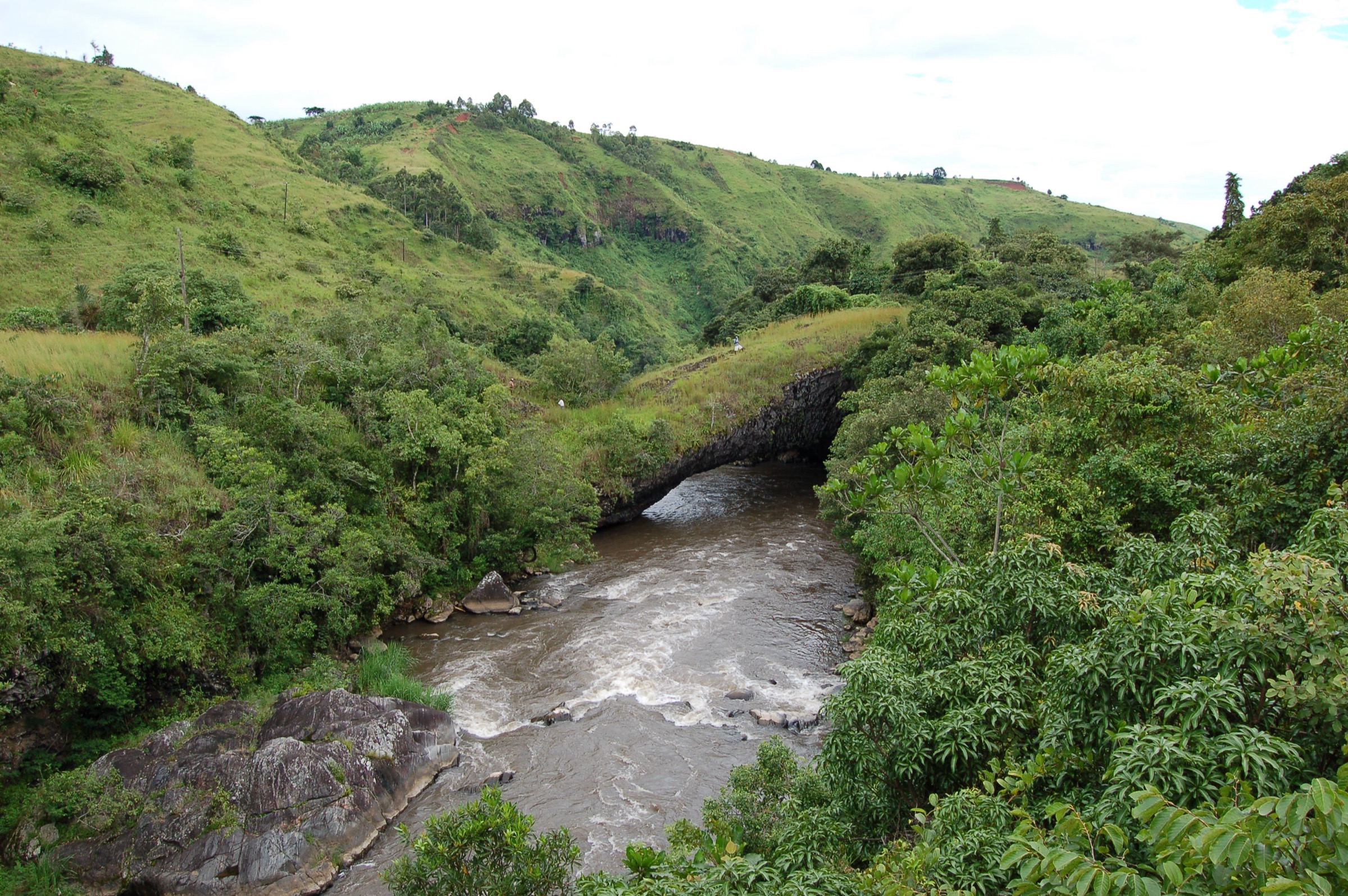
5. Daraja la Mungu and Kiwira valley walk
Snapshot
Itinerary
From the highway junction near Kiwira town, a short walk descends to the Kiwira river to the natural arch known as Daraja la Mungu, “Bridge of God”, a 40 m basalt span about 3 m wide formed where the river has cut through cooling lava. Kijungu Waterfalls lie within about 10 m of the bridge. The walking distance from the road to the site is short and is mainly a visit rather than a full hike, but it captures the southern Poroto foothills’ volcanic landscape concisely.
Why it is essential
The Kiwira valley is the principal drainage line off the southern Poroto slopes and connects the high Ngozi/Poroto Ridge country to the Lake Malawi-side foothills. The Bridge of God provides a clear, photographable example of the basalt lava-tube and arch features of the Rungwe Volcanic Province and is one of the few formally identified short-walk objectives on this side of the range.
Equipment
Day-walk footwear, water, sun protection, and a small first-aid kit. The riverbank can be slippery; a light dry bag for cameras or phones is sensible.
Hazards and notes
The river is fast through the arch and there have been reports of strong currents in the plunge pool below the falls; the formal recommendation is to view rather than swim unless conditions are clearly safe and a knowledgeable local guide is present. The walking line, distance, and ascent are not formally published and would need on-site confirmation.
GPX / KML links
| Source | URL | Format / access | Reuse status |
|---|---|---|---|
| OpenStreetMap — Daraja la Mungu | openstreetmap.org | Source map | OSM data is ODbL; location cross-check only |
| Tracks4Africa — Bridge of God | tracks4africa.co.za | Listing only | Third-party terms; no GPX selected |
External links
- Wikipedia — Poroto Mountains
- Tracks4Africa Padkos — Bridge of God
- U.S. Department of State Tanzania Travel Advisory, 31 October 2025
Missing data / follow-up work
- No published, licence-compatible GPX or KML for the standard Mbeya Peak, Loleza, Kitulo, or Bridge of God day-hike lines was selected in this pass; Wikiloc and tour-operator tracks exist but were not redistributed.
- Mbeya Peak elevation is given as both 2,820 m (Lonely Planet and most tour operators) and 2,895 m (Wikipedia Mbeya Range article); Loleza is given as 2,656 m (Mbeya Range article) and 2,809 m (Loleza Mountain article). The correct survey value is not resolved.
- Standalone Mbeya Peak distance and elevation gain from Lunji Farm are unresolved; only the combined Loleza-plus-Mbeya-Peak track (about 21 km, around 1,700 m gain) is reported.
- Ngozi distance, elevation gain, and time are described qualitatively in tour-operator material but not measured in a single verified source.
- Kitulo Plateau walking lines and current park fees are unresolved; the entry is included as a candidate Poroto-edge walk only.
- The Mbeya Range / Poroto Mountains classification differs between Wikipedia and regional tourism use; Wikipedia treats the two as separate, while tour operators routinely group them. This catalogue follows the tourism grouping with a clear note.
- Mount Rungwe sits immediately south of the Porotos and is covered in a separate article in this series; Ngozi is treated as a Poroto Mountains entry on the basis of the Wikipedia Lake Ngozi article, which records the northern rim of the Ngozi caldera as the high point of the Poroto range.
- Tanzania is under a U.S. Department of State Level 3 “Reconsider Travel” advisory dated 31 October 2025, citing unrest, crime, terrorism, and targeting of LGBTQ individuals. Conditions should be re-checked before travel.
External links
| Resource | Link |
|---|---|
| Wikipedia — Poroto Mountains | en.wikipedia.org |
| Wikipedia — Lake Ngozi | en.wikipedia.org |
| Wikipedia — Mbeya Range | en.wikipedia.org |
| Wikipedia — Loleza Mountain | en.wikipedia.org |
| Wikipedia — Kitulo National Park | en.wikipedia.org |
| TANAPA — Kitulo National Park | tanzanianationalparks.com |
| Tanzania Tourism — Lake Ngozi | tanzaniatourism.com |
| Lonely Planet — Mbeya Peak | lonelyplanet.com |
| Tranquil Kilimanjaro — Mbeya Range | tranquilkilimanjaro.com |
| Wikiloc — Ngozi crater lake trail | wikiloc.com |
| Tracks4Africa Padkos — Bridge of God | tracks4africa.co.za |
| U.S. Department of State Tanzania Travel Advisory, 31 October 2025 | travel.state.gov |