Regional overview
The Udzungwa Mountains form the largest crystalline block of Tanzania’s Eastern Arc, running northeast-southwest across the Morogoro and Iringa regions of south-central Tanzania. The range rises abruptly from the Kilombero floodplain to a forested plateau above 1,500 m and culminates at Luhombero peak at 2,579 m. The most accessible walking is concentrated inside Udzungwa Mountains National Park, gazetted in 1992 and managed by the Tanzania National Parks Authority (TANAPA). The park covers roughly 1,990 km² and protects an unbroken altitudinal gradient from 250 m lowland miombo to montane rainforest, bamboo zones, and submontane heath.
Biodiversity is the headline draw. More than a quarter of Eastern Arc vertebrate species are endemic, and the Udzungwa block harbours the Udzungwa red colobus, the Sanje crested mangabey, the Udzungwa forest partridge, and the grey-faced sengi. EAMCEF and WWF have supported management and ecotourism since gazettement.
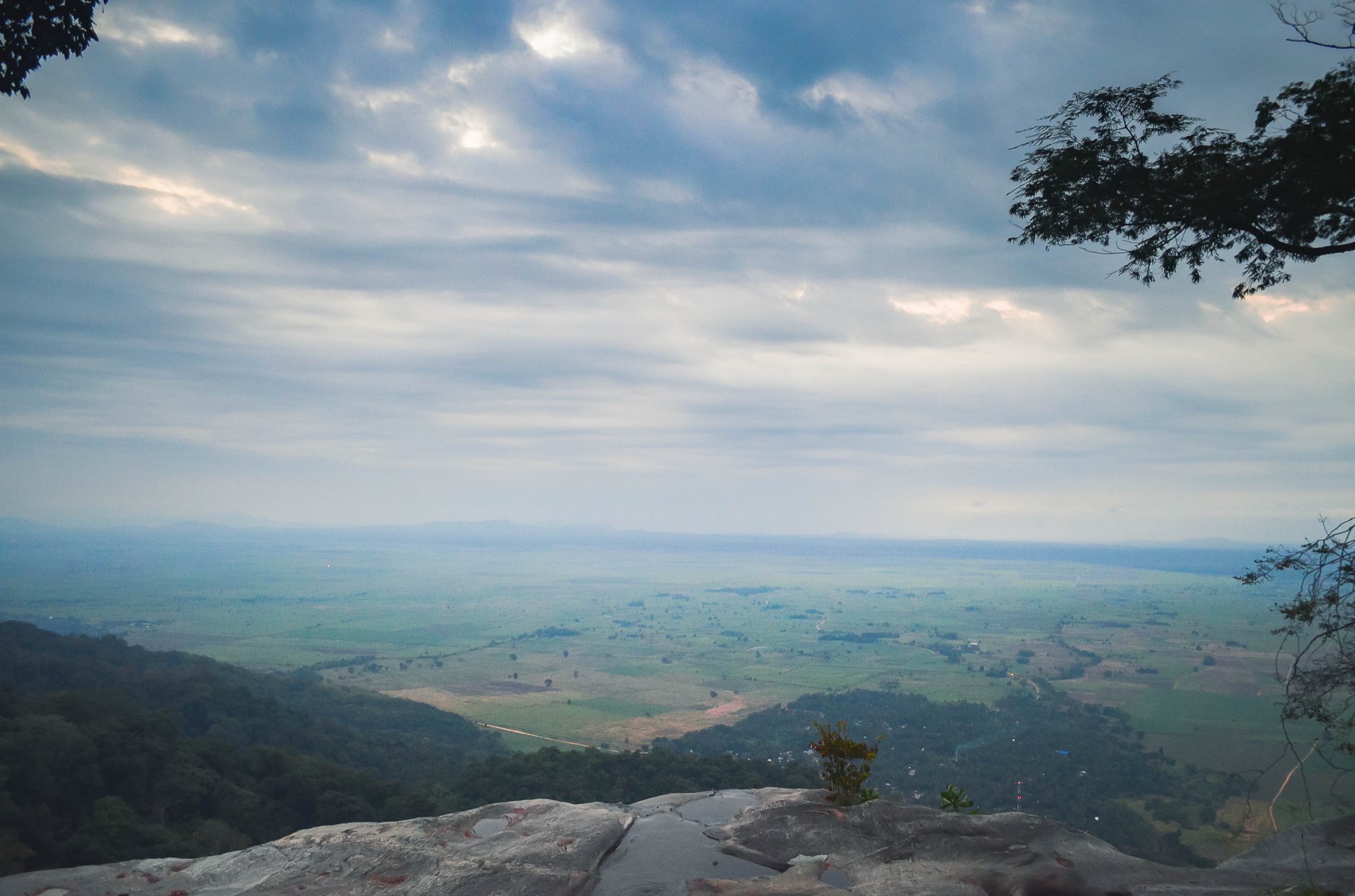
Practical hiking is based at the eastern park gate at Mang’ula, on the TAZARA railway line between Dar es Salaam and Mbeya. All hikes inside the park require an armed or unarmed park ranger or guide, hired at headquarters at an additional cost above the daily entry fee. Trail signage is minimal, mapping is informal, and the network is essentially a set of out-and-back forest paths rather than a developed waymarked system. The dry season (June-October) gives firmer trails and clearer views over the Kilombero valley; the wet season (November-May) makes upper sections muddy, leech-prone, and slippery, especially on the Sanje and Hidden Valleys routes.
Selection rationale
The five entries below are the only day hikes inside the park that appear consistently in TANAPA-affiliated and operator literature with route stats, named waterfall destinations, and verifiable ranger-station start points. Sanje Waterfalls is the headline route. Prince Bernhard provides the short, accessible counterpoint behind park headquarters. Njokamoni adds a quieter, primate-rich alternative at a similar grade to Sanje. Sonjo is the easiest forest trail, with two waterfalls and a circuit option. Hidden Valleys is the only confirmed full-day mountain walk inside the park that does not require an overnight camp; Mwanihana Peak and Luhombero are excluded as they exceed day-hike constraints.
Summary table
| # | Hike | Country | Route type | Distance | Gain | Max elevation | Difficulty |
|---|---|---|---|---|---|---|---|
| 1 | Sanje Waterfalls | Tanzania | Out-and-back / optional circuit | ~6-12 km | ~450 m | Unresolved | Moderate |
| 2 | Prince Bernhard Waterfalls | Tanzania | Out-and-back | ~1-1.5 km | 30-80 m | Unresolved | Easy |
| 3 | Njokamoni Waterfall | Tanzania | Out-and-back | ~5-6.5 km | ~400-700 m | ~730 m | Moderate |
| 4 | Sonjo Waterfalls | Tanzania | Out-and-back / loop | ~3 km | ~120 m | Unresolved | Easy |
| 5 | Hidden Valleys (Campsite 3 loop) | Tanzania | Loop | ~14 km | ~1,000 m | ~1,300 m | Strenuous |
1. Sanje Waterfalls
Snapshot
Itinerary
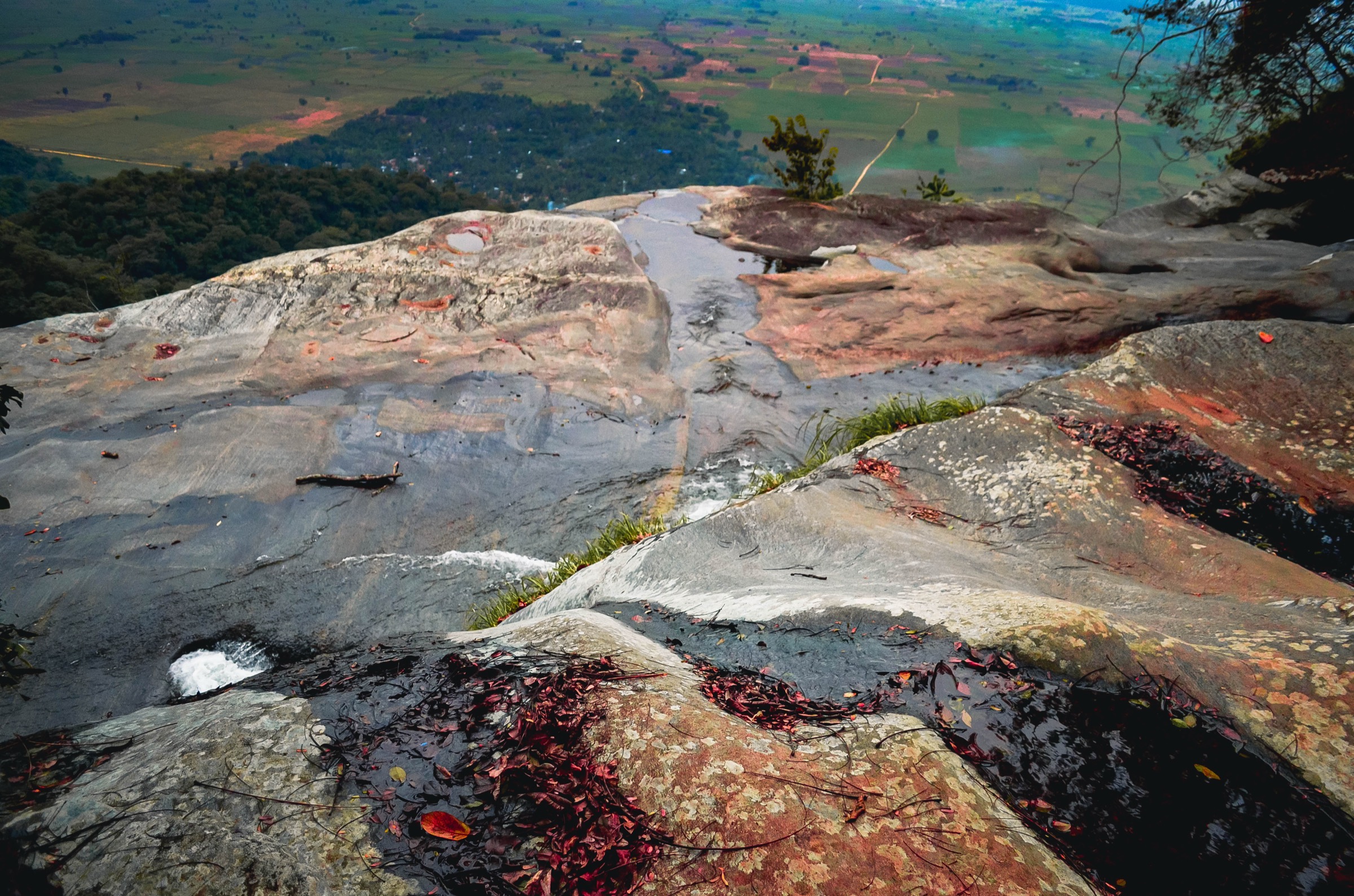
The trail leaves park headquarters at Mang’ula, crosses cultivation strips on the park boundary, and enters lowland rainforest. The path zigzags up a steep forested ridge above the Sanje stream, gaining height steadily through mixed evergreen forest where Udzungwa red colobus and black-and-white colobus are regularly seen. After roughly two to three hours the route reaches the base of the lower fall, then continues on a steeper switchback section to plunge pools above the main 170 m drop, where swimming is permitted at hikers’ own risk. Views from the upper terrace extend east across the Kilombero floodplain. The same path is normally used for descent; a longer circuit returns via the Sanje ranger post on the lower flank, adding distance but reducing repetition.
Why it is essential
Sanje is the signature day hike of the Eastern Arc, ascending continuous endemic-rich rainforest to the tallest waterfall in any Tanzanian national park, cited at 170-180 m. It is the most likely day on which a fit walker will see endemic primates and reach a high-impact natural feature inside a single half-day window.
Equipment
- Sturdy trail shoes with grip; long trousers for nettles and biting flies.
- Two litres of water; sun protection above the canopy.
- Lightweight rain shell in wet season; insect repellent.
Hazards and notes
- Steep and slippery in rain; leeches in wet months.
- Park ranger or guide is mandatory and arranged at headquarters.
- Park entry fee and separate guide fee apply; confirm current rates at TANAPA.
- Plunge pool currents are strong in high flow.
GPX / KML links
| Source | URL | Format / access | Reuse status |
|---|---|---|---|
| Udzungwa Forest Camp (operator) — Sanje Trail | udzungwaforestcamp.com | KML | Terms not stated; reference only |
| Wikiloc — “Udzungwa waterfall, Tanzania (17.02.2019)” | wikiloc.com | GPX (account download) | Wikiloc proprietary; link only |
External links
- Wikipedia — Udzungwa Mountains National Park
- TANAPA — Udzungwa Mountains National Park
- EAMCEF — Udzungwa
2. Prince Bernhard Waterfalls
Snapshot
Itinerary
A short forest track leaves the rear of the park headquarters compound at Mang’ula, climbs gently along the southern bank of a small stream, and emerges at the base of the Prince Bernhard cascade after about 500 m. The path can be extended a further 1.5 km up to campsite 2 inside the park boundary for a longer forest walk without significant elevation gain. The route is the standard introduction for visitors arriving at headquarters to pay fees, and is the only park trail open as a half-hour stroll without a half-day commitment.
Why it is essential
The falls were named for Prince Bernhard of the Netherlands, then president of the World Wildlife Fund at the time the park was being gazetted, who was unable at age 84 to climb to the top of Sanje. The trail therefore provides the official memorial entry point to the park and the easiest exposure to lowland rainforest for visitors with limited time or mobility.
Equipment
- Trail shoes, water, insect repellent.
- No specialised kit required.
Hazards and notes
- Ranger or guide still required by park rules.
- Path is short but root-tangled and slippery after rain.
- Wildlife is mostly birds and arboreal primates around the canopy near headquarters.
GPX / KML links
| Source | URL | Format / access | Reuse status |
|---|---|---|---|
| OpenStreetMap search: Prince Bernhard Waterfalls Udzungwa | openstreetmap.org | Source map / search | OSM data is ODbL; geometry cross-check only |
External links
3. Njokamoni Waterfall
Snapshot
Itinerary
The trail starts at park headquarters, traverses lowland forest behind the Hondo Hondo camp area, and ascends a forested spur towards the Njokamoni catchment. The path passes through pristine evergreen and submontane forest that is notably less trafficked than the Sanje route, which improves the chance of encountering troops of habituated Sanje mangabey, Udzungwa red colobus, and forest duikers. The destination is a single-drop fall of roughly 40 m where the Njokamoni stream cuts a plunge pool over a stepped cliff. Return is by the same path to headquarters, or operators sometimes terminate the walk at Hondo Hondo camp at the lower trailhead.
Why it is essential
Njokamoni is the practical alternative to Sanje for hikers seeking the same effort and waterfall-payoff format but better primate and forest mammal sightings, and for groups that want to avoid the busier headline trail. It is the second most commonly recommended day hike for first-time park visitors after Sanje.
Equipment
- Trail shoes with grip; long trousers; two litres of water.
- Sun and rain protection; insect repellent.
Hazards and notes
- Ranger or guide mandatory.
- Elephant presence in lower forest is occasional; rangers carry rifles where needed.
- Steep slippery sections in wet months.
GPX / KML links
| Source | URL | Format / access | Reuse status |
|---|---|---|---|
| OpenStreetMap search: Njokamoni Udzungwa | openstreetmap.org | Source map / search | OSM data is ODbL; geometry cross-check only |
External links
4. Sonjo Waterfalls
Snapshot
Itinerary
The Sonjo trail leaves the eastern park boundary north of Mang’ula and follows a gently graded forest path beside the Sonjo stream. The first cascade is reached in roughly 20 minutes; continuing on a steeper 15-minute section gains a second fall. A short circuit returns past a third cascade and rejoins the entry path. Sonjo is also the lower-elevation approach used for the long Mwanihana Peak ascent, but the day-hike version stops at the waterfalls. Habitat is intact lowland rainforest with high bird diversity.
Why it is essential
Sonjo is the gentlest forest walk in the park that still offers waterfall destinations and a credible exposure to lowland Eastern Arc rainforest. It is the standard recovery walk after a Sanje or Njokamoni day, and the natural option for visitors with reduced fitness or limited time.
Equipment
- Trail shoes, water, insect repellent.
- Light rain shell.
Hazards and notes
- Ranger or guide required.
- Trail is forested and shaded; slippery in rain.
- Park entry and guide fees as elsewhere.
GPX / KML links
| Source | URL | Format / access | Reuse status |
|---|---|---|---|
| OpenStreetMap search: Sonjo Udzungwa | openstreetmap.org | Source map / search | OSM data is ODbL; geometry cross-check only |
External links
5. Hidden Valleys (Campsite 3 loop)
Snapshot
Itinerary
The route starts at campsite 3, just past the park headquarters turning, and ascends a side valley to the watershed between the Njokamoni and Moyer rivers. The trail then drops on a steep, occasionally slippery path used by elephants down into the Moyer drainage, where it crosses the stream several times and traverses a meandering grassy valley floor preferred by buffalo and elephant. The trail then climbs back to the ridge and descends to Hondo Hondo, completing the loop above the lowland rainforest belt. Walking the loop from the Hondo Hondo end is recommended in midday heat because the ascent is more shaded. Total round trip is reported at about 14 km with around 1,000 m of vertical gain, topping out above 1,300 m.
Why it is essential
Hidden Valleys is the only documented full-day mountain loop inside the park; it provides the only one-day exposure to the upper forest and grassy valley habitats reached otherwise only on the multi-day Mwanihana or Luhombero treks. It is the catalogue’s strenuous representative.
Equipment
- Sturdy boots with ankle support; long trousers.
- Minimum two litres of water; sun cover.
- Rain shell and warm layer (cool at altitude); whistle.
Hazards and notes
- Armed ranger is mandatory because the route passes through buffalo and elephant terrain.
- River crossings can be impassable in heavy rain.
- Start early; allow eight hours.
- Park entry fee plus an additional armed-guard fee applies; confirm rates at headquarters.
GPX / KML links
| Source | URL | Format / access | Reuse status |
|---|---|---|---|
| OpenStreetMap search: Hidden Valleys Udzungwa | openstreetmap.org | Source map / search | OSM data is ODbL; geometry cross-check only |
External links
Missing data / follow-up work
- No legally redistributable GPX/KML files were located for any of the five hikes; the Wikiloc track for Sanje is proprietary and the Udzungwa Forest Camp KML has undeclared terms.
- Several stats disagree between sources, notably Sanje distance (6 km one-way vs. 12 km round trip) and Njokamoni elevation gain (400 m vs. 700 m); the canonical TANAPA brochure would be the resolving source.
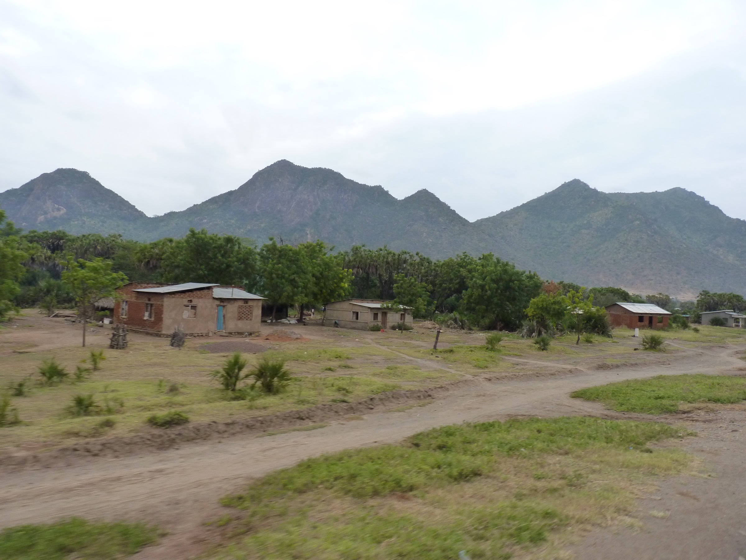
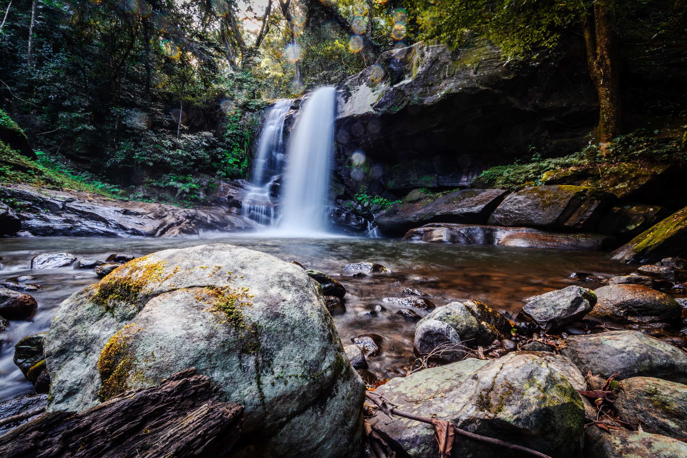
- No subject-verified Wikimedia Commons photographs were located for Prince Bernhard Waterfalls, Sonjo Waterfalls, Njokamoni Waterfall, or the Hidden Valleys loop; the Njokamoni section uses a region-illustrative forest view.
- Current 2026 entry and guide fees should be confirmed against TANAPA’s official price list.
External links
| Source | URL |
|---|---|
| Wikipedia — Udzungwa Mountains National Park | en.wikipedia.org |
| Wikipedia — Udzungwa Mountains | en.wikipedia.org |
| TANAPA — Udzungwa Mountains National Park | tanzanianationalparks.com |
| EAMCEF — Udzungwa | easternarc.or.tz |
| Udzungwa Mountains National Park (community site) | udzungwa.org |
| Udzungwa Forest Lodge — hiking | udzungwaforestlodge.com |
| Curious On Tanzania — hiking in Udzungwa | curiousontanzania.com |
| Wikivoyage — Udzungwa Mountains National Park | en.wikivoyage.org |
| Wikiloc search — Udzungwa | wikiloc.com |
| OpenStreetMap | openstreetmap.org |