.jpg)


Regional overview
This entry is intentionally conservative: the Tajik Pamir has many outstanding trekking landscapes, but public day-hike route files and precise statistics are sparse. A GBAO permit is normally required for Gorno-Badakhshan travel, and border/security conditions should be checked immediately before any trip.
The Tajik Pamir is a high, dry, thinly populated mountain world of plateau basins, desert lakes, glaciated ranges, deep river valleys, and isolated Pamiri villages. Much of the practical day hiking sits near the Pamir Highway, Khorog/Murghab road corridor, Bartang Valley, Wakhan Valley, and lake basins such as Karakul, Bulunkul, and Yashilkul. The landscape is often above 3,000-4,000 m, so “short” hikes can be serious because of altitude, remoteness, weather, and weak rescue infrastructure.
UNESCO’s Tajik National Park (Mountains of the Pamirs) protects a very large part of the high Pamir, including high plateaux, 7,000 m peaks, glaciers, lakes, rare wildlife, and major tectonic landscapes. Route geometry for the hikes below should be manually rebuilt from OSM, satellite/map review, or local guide GPS tracks before publication.
Summary table
| # | Hike | Country | Route type | Distance | Gain | Max elevation | Difficulty |
|---|---|---|---|---|---|---|---|
| 1 | Jizeu / Jisev Valley from Bartang road bridge | Tajikistan | Out-and-back | approx. 10-14 km | approx. 400-600 m | approx. 2,700-2,900 m | Moderate-hard |
| 2 | Karakul village lakeshore and crater-rim viewpoint | Tajikistan | Out-and-back / informal loop | approx. 6-12 km | approx. 100-300 m | approx. 4,000-4,150 m | Moderate at altitude |
| 3 | Bulunkul to Yashilkul lakeshore | Tajikistan | Out-and-back | approx. 10-18 km | approx. 100-250 m | approx. 3,800-3,900 m | Moderate |
| 4 | Pshart Valley day hike from Murghab side | Tajikistan | Out-and-back | approx. 10-16 km | approx. 400-700 m | approx. 4,100-4,300 m | Hard at altitude |
| 5 | Yamchun Fortress and Bibi Fatima Springs | Tajikistan | Out-and-back / road-and-trail ascent | Short day walk; exact distance unresolved | approx. 390-400 m | approx. 3,120-3,140 m | Moderate |
1. Jizeu / Jisev Valley from Bartang road bridge

Snapshot
Itinerary
Cross from the Bartang road and climb the side valley toward the car-free Jizeu/Jisev settlement and small lakes. The route follows a village access path through dry lower slopes into greener side-valley terrain.
Why it is essential
Jizeu is one of the best-known short Pamir village hikes: a real walking approach, lake scenery, Pamiri homestay culture, and a sharp contrast with the stark Bartang road.
Equipment
- Hiking shoes, sun protection, water, food, wind/rain layer.
- Offline maps and local confirmation of bridge/trail condition.
Hazards and notes
- Remote valley access, loose slopes, limited communications, and possible route ambiguity around side paths.
GPX / KML links
| Source | URL | Format / access | Reuse status |
|---|---|---|---|
| OpenStreetMap search | openstreetmap.org | Map / search | OSM data is ODbL; route relation not selected |
| Wikiloc search: Gorno-Badakhshan | wikiloc.com | Search / user tracks | No legally reusable GPX/KML confirmed |
External links
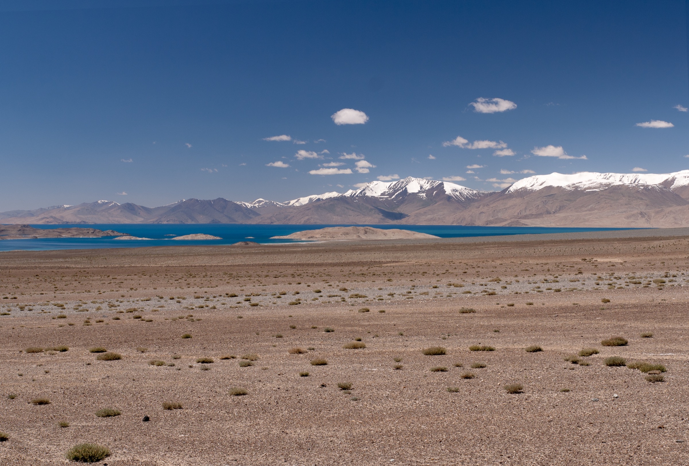
2. Karakul village lakeshore and crater-rim viewpoint
Snapshot
Itinerary
Walk from Karakul village along the lake edge or up a low dry ridge for views over the impact-crater basin, lake islands/peninsula, and the Trans-Alay skyline. This is a route concept rather than a single waymarked trail.
Why it is essential
Karakul is the emblematic high-desert lake of the Tajik Pamir Highway and one of the region’s most accessible 4,000 m landscapes.
Equipment
- Windproof layers, sun protection, water.
- Warm hat/gloves outside midsummer, offline map, and conservative turnaround time.
Hazards and notes
- Altitude, wind chill, poor shelter, navigation in open terrain.
- Border/security sensitivities near the northern Pamir.
GPX / KML links
| Source | URL | Format / access | Reuse status |
|---|---|---|---|
| OpenStreetMap search | openstreetmap.org | Map / search | OSM data is ODbL; no specific route relation confirmed |
| Waymarked Trails map context | waymarkedtrails.org | Map context | No reusable route file |
External links
3. Bulunkul to Yashilkul lakeshore

Snapshot
Itinerary
Walk from the Bulunkul settlement/lake basin toward nearby Yashilkul, using vehicle tracks and open lakeshore terrain for views across wetlands, desert hills, and the freshwater lake. The exact line should be selected with a local guide or current map because tracks shift and wet ground can redirect travel.
Why it is essential
Bulunkul and Yashilkul show the gentler but very high Pamir plateau: lakes, bird habitat, Kyrgyz/Pamiri settlement edges, and broad open walking.
Equipment
- Windproof/warm layers, sun protection, water, food.
- Offline map/GPS and local advice on marshy ground.
Hazards and notes
- Altitude, wind, cold, marsh/wetland detours.
- Dogs near settlements, and poor communications.
GPX / KML links
| Source | URL | Format / access | Reuse status |
|---|---|---|---|
| OpenStreetMap search | openstreetmap.org | Map / search | OSM data is ODbL; no reusable route file found |
| Waymarked Trails context | waymarkedtrails.org | Map context | No reusable route file |
External links
4. Pshart Valley day hike from Murghab side

Snapshot
Itinerary
Use a vehicle drop on the Pshart Valley road and walk up-valley on tracks and open alpine-desert terrain toward a viewpoint or shepherd-camp turnaround. Do not present this as a fixed marked trail without a GPS track.
Why it is essential
Pshart is a representative Murghab-area day objective: open high Pamir terrain, broad valleys, yak/shepherd landscapes, and straightforward customisation by vehicle drop.
Equipment
- Full high-desert mountain day kit, windproof layers, warm hat/gloves.
- Water, food, offline GPS, and local guide/driver coordination.
Hazards and notes
- Altitude, weather, no shelter, navigation.
- Vehicle reliability and very limited rescue.
GPX / KML links
| Source | URL | Format / access | Reuse status |
|---|---|---|---|
| OpenStreetMap search | openstreetmap.org | Map / search | OSM data is ODbL; no reusable GPX/KML confirmed |
| Wikiloc search: Murghob | wikiloc.com | Search / user tracks | No reusable GPX/KML confirmed |
External links
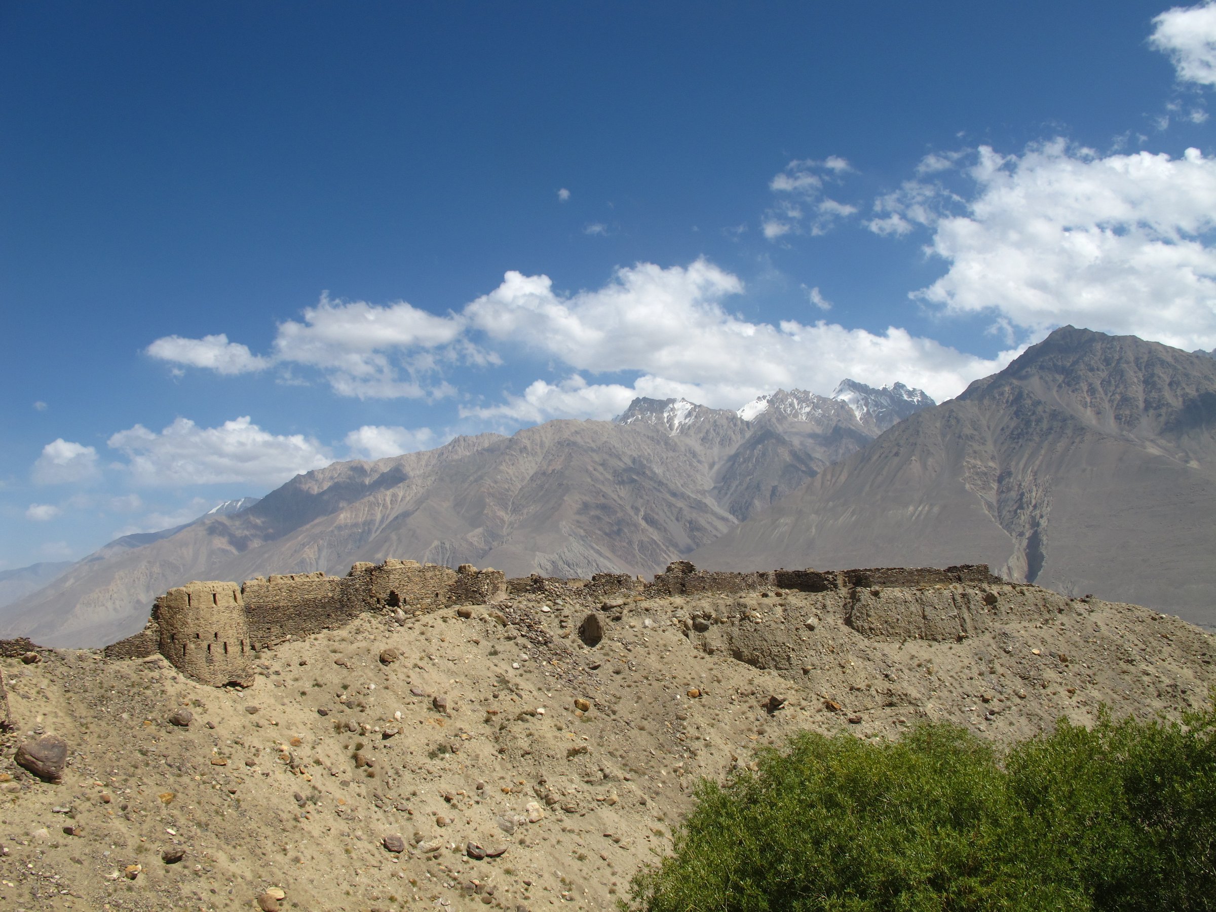
5. Yamchun Fortress and Bibi Fatima Springs

Snapshot
Itinerary
Climb from the lower Wakhan road/village level toward Yamchun Fortress, then optionally continue higher toward Bibi Fatima hot springs. The fortress gives a major viewpoint across the Panj valley toward Afghanistan and the Hindu Kush.
Why it is essential
This is the signature Tajik Wakhan viewpoint and one of the most accessible historic high points in the Tajik Pamir.
Equipment
- Walking shoes/boots, water, sun protection, wind layer.
- Modest clothing for village/springs access, and cash for local fees.
Hazards and notes
- Steep loose ground, hot-spring access rules.
- Road conditions, and border-area sensitivity.
GPX / KML links
| Source | URL | Format / access | Reuse status |
|---|---|---|---|
| OpenStreetMap search | openstreetmap.org | Map / search | OSM data is ODbL; route relation not selected |
| Komoot highlight/source map | komoot.com | Source map / highlight | Komoot terms apply; no reusable GPX confirmed |
External links
Missing data / follow-up work
- Route geometry for all five hikes should be manually rebuilt from OSM, satellite/map review, or local guide GPS tracks before publication.
- Distances, elevation gains, and maximum elevations are approximate; no reliable downloadable GPX/KML files were confirmed.
- A GBAO permit is normally required for Gorno-Badakhshan travel; border/security conditions should be checked immediately before any trip.
- No Jizeu-specific Commons image was found; the entry uses a broader Bartang Valley photo as visual context.
- Pshart Valley should not be presented as a fixed marked trail without a verified GPS track.
External links
| Source | URL |
|---|---|
| UNESCO — Tajik National Park (Mountains of the Pamirs) | whc.unesco.org |
| Tajikistan e-visa / GBAO permit | evisa.tj |
| OpenStreetMap | openstreetmap.org |
| Waymarked Trails — Hiking | hiking.waymarkedtrails.org |
| Wikiloc — Gorno-Badakhshan | wikiloc.com |