


_2.jpg)
.jpeg)
Regional overview
Taiwan’s Central Mountain Range is a steep, humid, typhoon-cut mountain spine with subtropical forest low down, cloud forest and cypress belts in the middle elevations, and exposed 3,000 m “Baiyue” alpine ridges above the roads. Day hiking is unusually varied: some famous high summits are reached from paved passes above 3,000 m, while historic cross-island trails and gorge paths have serious access controls because landslides, rockfall, bridges, and weather can change the route quickly.
The five hikes below balance the region’s essential characters: an accessible high alpine summit area at Hehuanshan, a classic Taroko gorge cliff trail, an eastern Batongguan/Walami historic forest route, a southern cross-range heritage trail, and one high Jiaming/Xiangyang objective that is iconic but only a day hike for very fit and acclimatised parties.
Taiwan high-mountain access, typhoon damage, earthquake damage, permits, and road openings change frequently; check the relevant park or forest authority before publication or field use.
Summary table
| # | Hike | Country | Route type | Distance | Gain | Max elevation | Difficulty |
|---|---|---|---|---|---|---|---|
| 1 | Hehuanshan high-road loop / Main Peak-Easy Baiyue sector | Taiwan | Loop / linked out-and-backs | 5.8 km | 416 m | ca. 3,421 m | Moderate-hard at altitude |
| 2 | Zhuilu Old Road, Taroko Gorge | Taiwan | Out-and-back | 6.4 km | 682 m | Unresolved | Hard; exposed cliff path |
| 3 | Walami Trail / Batongguan eastern approach | Taiwan | Out-and-back or point-to-point section | 4.5-13.5 km | 209-412 m short variants | Unresolved | Moderate-hard |
| 4 | Jinshuiying Historic Trail east section | Taiwan | Point-to-point | 15.4 km | Gain unresolved; 200-1,450 m range | ca. 1,450 m | Hard |
| 5 | Xiangyang Mountain / Jiaming Lake National Trail high route | Taiwan | Out-and-back | 25.9 km full route | 1,937 m full route | 3,603 m at Xiangyang; 3,310 m at lake | Very hard; borderline day hike |
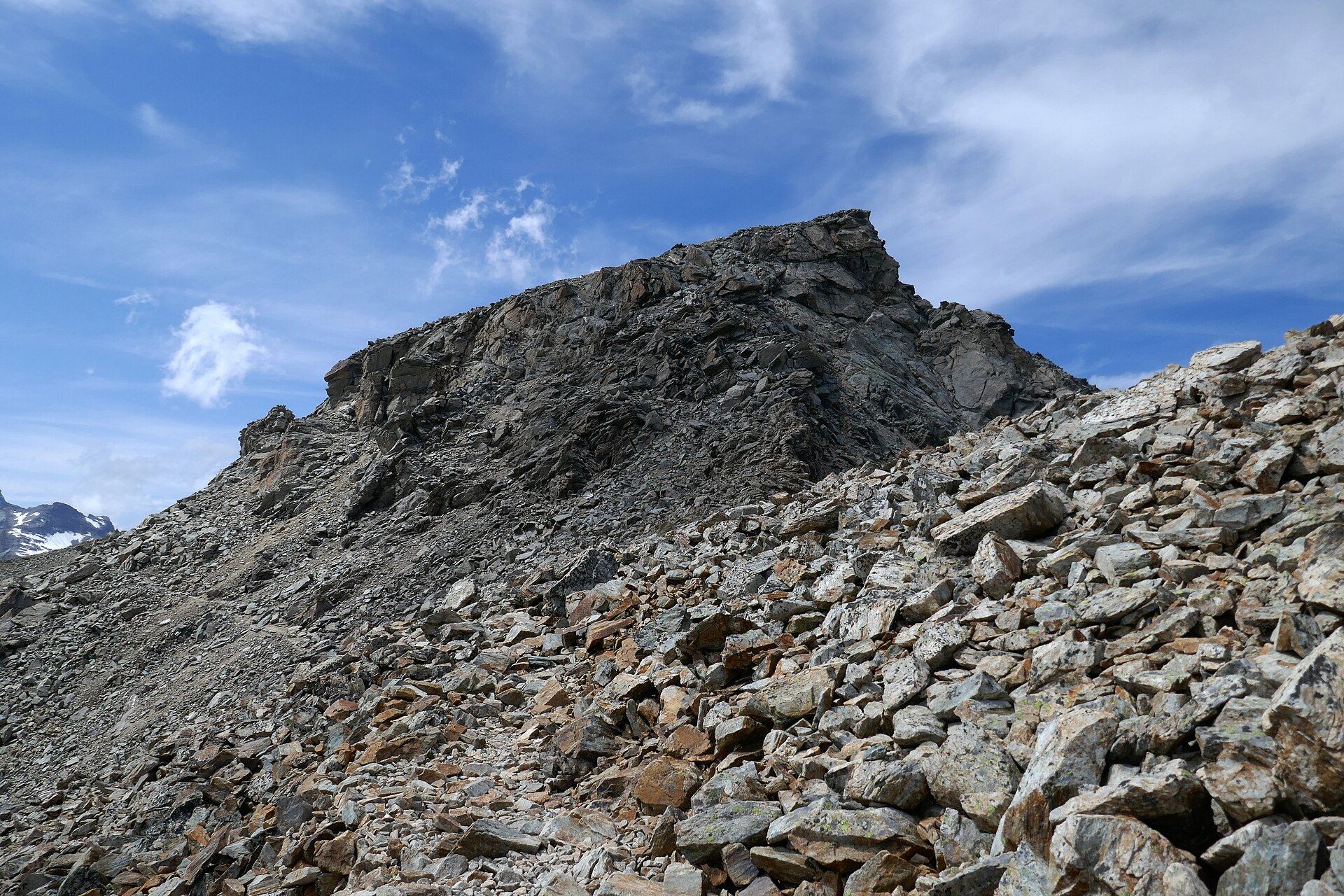
1. Hehuanshan high-road loop / Main Peak-Easy Baiyue sector

Snapshot
Itinerary
Use the Wuling-Hehuanshan roadhead to combine the broad, road-accessible Hehuanshan Main Peak side with nearby high-point paths such as East Peak or Shimen, depending current access and weather. The hiking is short but starts around 3,100-3,275 m, so altitude and weather matter out of proportion to the distance.
Why it is essential
Hehuanshan is the Central Range’s most accessible high alpine landscape: open 3,000 m ridges, Baiyue peaks, winter snow possibility, and broad views without a multi-day expedition.
Equipment
- Warm and waterproof layers
- Sun protection
- Gloves/hat outside summer
- Food and water
- Offline map
- Headlamp
- Microspikes may be needed after snow or freeze-thaw
Hazards and notes
- Altitude sickness, sudden cold wind, fog, and lightning.
- Snow/ice in colder months.
- Traffic along road links and crowded parking.
GPX / KML links
| Source | URL | Format / access | Reuse status |
|---|---|---|---|
| AllTrails: Hehuan Loop | alltrails.com | Source route / app track | AllTrails terms apply; GPX reuse unresolved |
| AllTrails: Hehuanshan East Peak Trail | alltrails.com | Source route / app track | AllTrails terms apply; GPX reuse unresolved |
| OpenStreetMap search: Hehuanshan | openstreetmap.org | Map source | OSM data is ODbL; geometry cross-check only |
External links
2. Zhuilu Old Road, Taroko Gorge

Snapshot
Itinerary
The route climbs from Taroko Gorge to the historic Zhuilu cliff road, crossing forest and ledge sections to the famous narrow trail cut high above the Liwu River gorge. It is a permit-controlled hike and should only be attempted when Taroko National Park officially lists it open.
Why it is essential
It is Taiwan’s most famous engineered gorge walk: a historic Truku/Japanese-era route, marble gorge exposure, and one of the clearest examples of how trail-building crosses the Central Range’s unstable terrain.
Equipment
- Helmet if locally recommended
- Grippy shoes
- Sun/rain protection
- Water
- Permit documents/ID
- Offline route
- No fear of exposed ledges
Hazards and notes
- Serious cliff exposure, rockfall, and landslides.
- Damaged bridges/trail structures and heat.
- Permit enforcement; AllTrails marks the trail closed at the time of this pass — official Taroko status must govern any plan to walk it.
GPX / KML links
| Source | URL | Format / access | Reuse status |
|---|---|---|---|
| AllTrails: Zhuilu Old Road | alltrails.com | Source route / app track | AllTrails terms apply; GPX reuse unresolved |
| Taroko National Park (official) | taroko.gov.tw | Park authority page | Status/permit check; no GPX |
| OpenStreetMap search: Zhuilu Old Road Taroko | openstreetmap.org | Map source | OSM data is ODbL; geometry cross-check only |
External links
3. Walami Trail / Batongguan eastern approach

Snapshot
Itinerary
Follow the Walami / Batongguan eastern approach through low-to-mid elevation forest, suspension bridges, stream valleys, historic police-road remnants, and waterfall viewpoints. Short day users can turn around at Shanfeng Waterfall/Jiaxin-type objectives; stronger parties with permits can continue deeper toward Walami Cabin.
Why it is essential
Walami is the most practical day-window into the Batongguan historic corridor on the east side of the Central Range, combining Bunun/colonial history, forest ecology, and Yushan National Park terrain without requiring a full cross-range trek.
Equipment
- Trail shoes
- Rain shell
- Leech/insect awareness in warm wet periods
- Water and food
- Permit if entering restricted sections
- Offline map
Hazards and notes
- Slippery bridges and steps, rockfall.
- Damaged trail structures after storms.
- River/side-stream hazards and wildlife/bee risk.
- Check Yushan National Park notices before committing to a turnaround point.
GPX / KML links
| Source | URL | Format / access | Reuse status |
|---|---|---|---|
| AllTrails: Walami Short Trail | alltrails.com | Source route / app track | AllTrails terms apply; GPX reuse unresolved |
| AllTrails: Walami Trail | alltrails.com | Source route / app track | AllTrails terms apply; GPX reuse unresolved |
| Yushan National Park (official) | ysnp.gov.tw | Park authority page | Status/permit check; no GPX |
| OpenStreetMap search: Walami Trail Taiwan | openstreetmap.org | Map source | OSM data is ODbL; geometry cross-check only |
External links
- Yushan National Park
- AllTrails — Walami Short Trail
- AllTrails — Walami Trail
- Wikimedia Commons — Walami Trail (panoramio)
4. Jinshuiying Historic Trail east section

Snapshot
Itinerary
Traverse the restored walking section of the Jinshuiying Historic Trail through humid forest, old police/settlement sites, and a low cross-range pass before descending toward the Taitung side. This is a one-way logistics hike, not a casual loop.
Why it is essential
Jinshuiying is one of Taiwan’s classic east-west historic routes across the southern Central Range, important for Qing, Japanese-era, Indigenous, trade, telegraph, and military history.
Equipment
- Boots/trail shoes
- Rain shell
- Long sleeves
- Water treatment
- Food
- Headlamp
- Offline map
- First-aid kit
- Current permit/access documents if required
Hazards and notes
- Landslides and bridge damage.
- Poor phone signal and difficult evacuation.
- Hornet incidents reported in the region.
GPX / KML links
| Source | URL | Format / access | Reuse status |
|---|---|---|---|
| OpenStreetMap search: Jinshuiying Historic Trail | openstreetmap.org | Map source | OSM data is ODbL; geometry cross-check only |
| Wikipedia (zh) — Jinshuiying Historic Trail | zh.wikipedia.org | Source page / references | Encyclopedia content; no GPX |
External links
- Wikipedia (zh) — Jinshuiying Historic Trail
- Wikimedia Commons — Jinshuiying Historic Trail (Pingtung section)
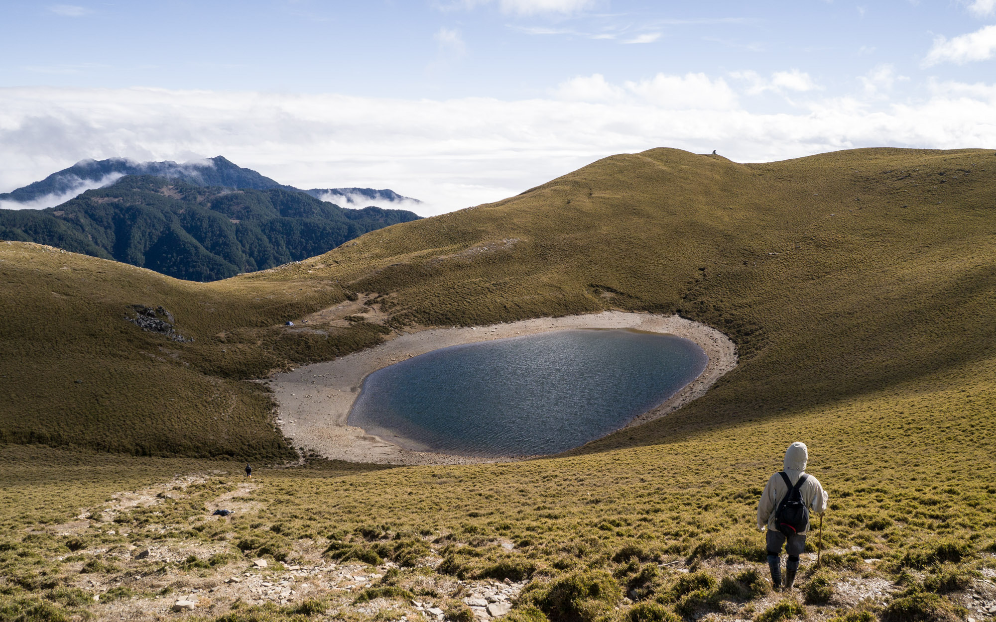
5. Xiangyang Mountain / Jiaming Lake National Trail high route

Snapshot
Itinerary
Use the Jiaming Lake National Trail corridor from Xiangyang toward Xiangyang Mountain and, for only the strongest and properly permitted parties, the Jiaming Lake high basin. The sensible catalogue day-hike interpretation is Xiangyang Mountain or an alpine-viewpoint section; the full lake route is usually treated as an overnight or very long ultra day.
Why it is essential
Jiaming Lake is one of Taiwan’s signature high alpine lakes, and Xiangyang Mountain is an accessible Baiyue-style high point on the same celebrated trail system.
Equipment
- Full high-mountain kit
- Warm/waterproof layers
- Headlamp
- Gloves/hat
- Emergency shelter
- Offline GPS
- Water/food
- Permits
- Altitude/weather margin
Hazards and notes
- Altitude sickness, exhaustion, long return, and darkness.
- Cold rain and trail erosion.
- Permit/hut regulations apply.
GPX / KML links
| Source | URL | Format / access | Reuse status |
|---|---|---|---|
| Jiaming Lake National Trail (official) | jmlnt.forest.gov.tw | Official trail portal | Official terms apply; permit/status reference |
| AllTrails: Chiaming Lake | alltrails.com | Source route / app track | AllTrails terms apply; GPX reuse unresolved |
| OpenStreetMap search: Jiaming Lake National Trail | openstreetmap.org | Map source | OSM data is ODbL; geometry cross-check only |
External links
Missing data / follow-up work
- Hehuanshan official Taroko trail-page details were not fully captured in this pass.
- Zhuilu Old Road current open status is unresolved and likely closed/restricted; Taroko National Park status must govern any planning.
- Walami / Batongguan exact official permit boundary and current bridge/trail status remain unresolved.
- Jinshuiying Historic Trail exact GPS gain/loss and current permit/access status are unresolved; no direct reusable GPX/KML was confirmed.
- Xiangyang-only day-hike statistics (distance, gain, time) were not separately resolved.
External links
| Source | URL |
|---|---|
| Taroko National Park | taroko.gov.tw |
| Yushan National Park | ysnp.gov.tw |
| Jiaming Lake National Trail (official) | jmlnt.forest.gov.tw |
| AllTrails — Hehuan Loop | alltrails.com |
| AllTrails — Hehuanshan East Peak Trail | alltrails.com |
| AllTrails — Zhuilu Old Road | alltrails.com |
| AllTrails — Walami Short Trail | alltrails.com |
| AllTrails — Walami Trail | alltrails.com |
| AllTrails — Chiaming Lake | alltrails.com |
| Wikipedia (zh) — Jinshuiying Historic Trail | zh.wikipedia.org |