
Regional overview
Public route data for this region is sparse; several interior hikes are day walks only inside multi-day guided access trips. Distances are not invented where sources did not publish them.
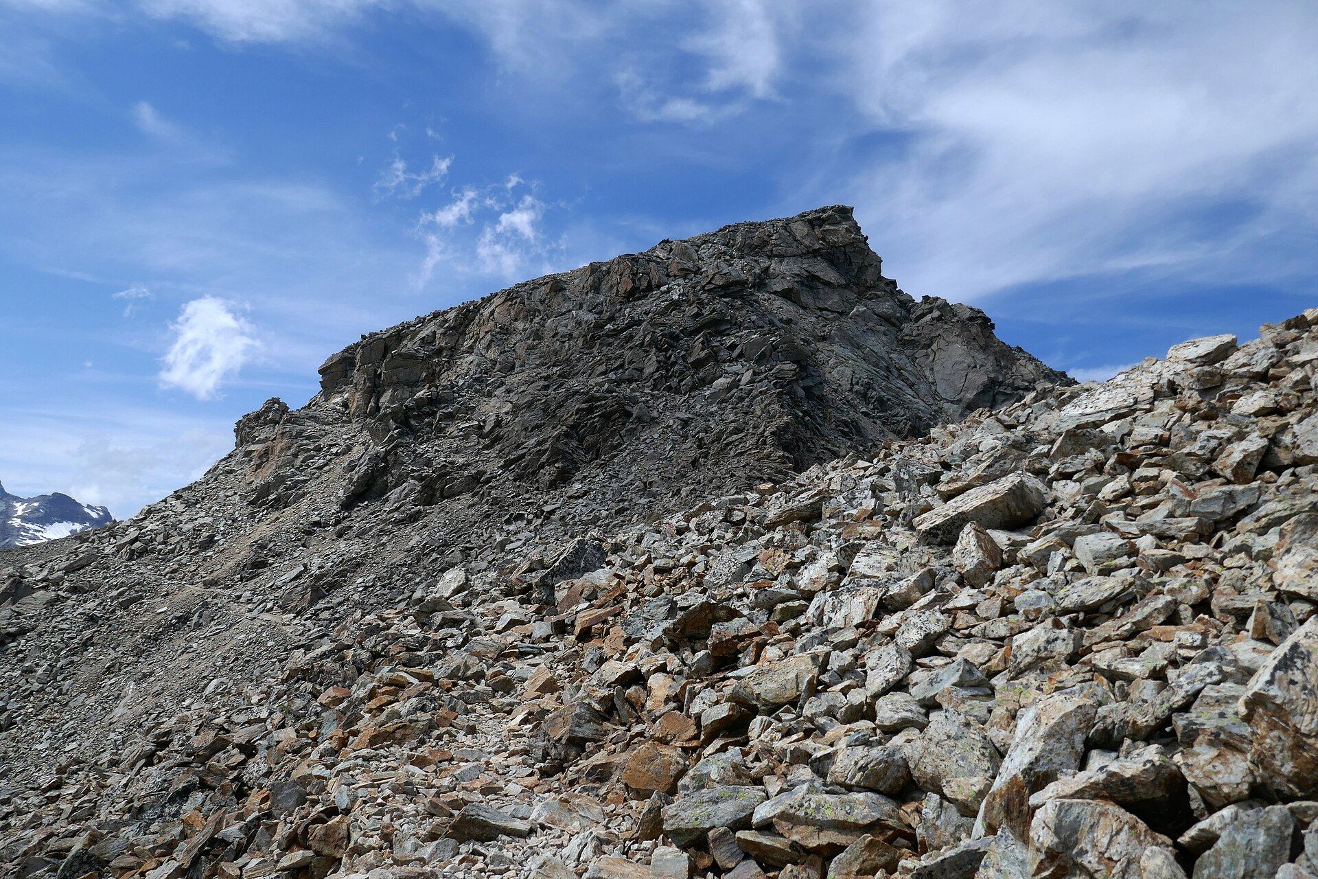
The Suriname and French Guiana interior highlands are low- to mid-elevation Guiana Shield country: rainforest plateaux, granite inselbergs, river rapids, isolated villages, and humid forest ridges rather than alpine terrain. The walking character is tropical and logistical. The hardest part is often not gradient but access, heat, rain, mud, river travel, and the need for local permissions or guides.
Suriname’s best-known hiking areas are Brownsberg Nature Park, Raleighvallen / Voltzberg in the Central Suriname Nature Reserve, and the Palumeu-Kasikasima expedition area. In French Guiana, the village of Saul is the most practical interior walking base, with signed forest trails in and around the Guiana Amazonian Park.
The reliable season is the relatively drier period, often August-November, though heavy rain can occur at any time. River levels, airstrip operations, trail maintenance, protected-area rules, and guide availability should be checked locally before committing to any interior route.
Selection rationale
The selection balances the most sourceable and representative interior objectives: one accessible Suriname plateau viewpoint, two famous Suriname inselberg / monolith objectives, and two Saul forest-highland routes in French Guiana. Coastal French Guiana walks such as Montagne des Singes and Mont Grand Matoury were excluded because they are outside the supplied interior-highlands brief.
Summary table
| # | Hike | Country | Route type | Distance | Gain | Max elevation | Difficulty |
|---|---|---|---|---|---|---|---|
| 1 | Mazaroni Top, Brownsberg Nature Park | Suriname | Out-and-back | 2.1 km | 64 m | c. 508-515 m | Easy |
| 2 | Voltzberg from Raleighvallen / Fungu Tabiki | Suriname | Out-and-back day ascent inside guided trip | Unresolved | Unresolved | c. 240-245 m | Moderate-hard |
| 3 | Kasikasima summit / viewpoint approach | Suriname | Guided out-and-back inside expedition | Unresolved | Unresolved | 718 m | Hard |
| 4 | Roche Bateau, Saul | French Guiana | Loop / forest circuit | 14 km | Unresolved | Unresolved | Hard |
| 5 | Monts La Fumee, Saul | French Guiana | Loop / forest circuit | 9 km | Unresolved | Unresolved | Moderate-hard |

1. Mazaroni Top, Brownsberg Nature Park
Snapshot
Itinerary
The short route leaves the Brownsberg visitor/camp area and follows the plateau trail to Mazaroni Top, a viewpoint over the Brokopondo Reservoir and surrounding rainforest. It is best treated as the core sourceable Brownsberg viewpoint walk. The better-known Leo and Irene waterfall trails are nearby Brownsberg objectives, but their exact current public statistics were not verified in this pass.
Why it is essential
Brownsberg is Suriname’s most accessible highland rainforest walking area, and Mazaroni Top gives the classic reservoir-and-forest panorama from the plateau.
Equipment
- Standard tropical hiking equipment: grippy shoes, water, rain layer, sun protection, insect repellent.
- Offline map/GPS, and cash/booking proof for park arrangements if required locally.
Hazards and notes
- Road conditions up Brownsberg can be poor after rain.
- Illegal gold mining has been reported as a long-term threat to the park; current access and safety should be checked locally.
- Waterfall side trails can be muddy and slippery.
GPX / KML links
| Source | URL | Format / access | Reuse status |
|---|---|---|---|
| AllTrails: Mazaroni Top | alltrails.com | Source map / route page | AllTrails terms apply; direct GPX not retrieved |
| OpenStreetMap search: Brownsberg / Mazaroni | openstreetmap.org | Map / search | OSM data is ODbL; geometry cross-check target |
External links
2. Voltzberg from Raleighvallen / Fungu Tabiki
Snapshot
Itinerary
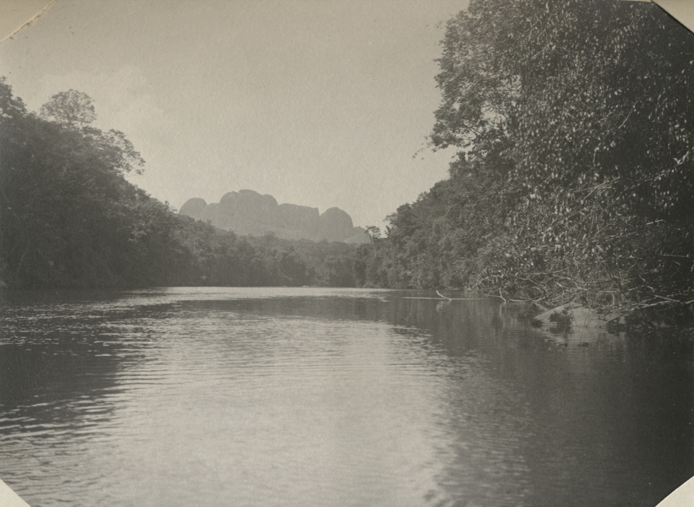
The route starts from the Raleighvallen / Fungu Tabiki area in the Central Suriname Nature Reserve and follows rainforest paths toward the exposed granite dome of Voltzberg. The final ascent reaches open rock and a wide rainforest panorama. The precise public route geometry, distance and ascent were not verified.
Why it is essential
Voltzberg is the best-known granite dome day objective in the Central Suriname Nature Reserve and a signature Guiana Shield inselberg hike, closely linked with Raleighvallen and Guianan cock-of-the-rock birding.
Equipment
- Mountain-tropical day kit: grippy shoes, 2-3 litres water, food, rain layer, sun hat, insect repellent, long sleeves.
- Navigation backup, and guide/permit arrangements.
- Avoid exposed granite during lightning.
Hazards and notes
- This is remote rainforest travel. Heat, dehydration, sudden storms, slippery roots.
- River logistics and lack of rescue access are the main issues.
- The granite dome can be dangerous in rain or lightning.
GPX / KML links
| Source | URL | Format / access | Reuse status |
|---|---|---|---|
| OpenStreetMap search: Voltzberg | openstreetmap.org | Map / search | OSM data is ODbL; geometry cross-check only |
External links
- UNESCO — Central Suriname Nature Reserve
- Wikipedia — Central Suriname Nature Reserve
- Wikipedia — Voltzberg
3. Kasikasima summit / viewpoint approach
Snapshot
Itinerary
The Kasikasima objective is normally reached as part of a Palumeu-based jungle expedition. After boat access toward the mountain area, the walking day climbs rainforest slopes and granite outcrops to a high viewpoint on the multi-summit massif. Public source material verifies the mountain, elevation and expedition access, but not a publishable route line or statistics.
Why it is essential
Kasikasima is one of Suriname’s most famous remote interior mountains and a defining tepui-country / Guiana Shield objective, but its catalogue status remains candidate-only until route geometry is obtained from a reputable source.
Equipment
- Guided rainforest expedition kit: sturdy shoes, long sleeves, rain protection, water treatment, food, insect repellent, headtorch, dry bags, first-aid kit.
- Satellite/guide communications, and locally required permissions.
Hazards and notes
- Remote access, river travel, heat, insects, slippery rock, sudden storms.
- Very limited rescue options make this a serious undertaking despite modest absolute altitude.
- Do not attempt without local arrangements.
GPX / KML links
| Source | URL | Format / access | Reuse status |
|---|---|---|---|
| METS: Kasikasima Jungle Expedition | mets.sr | Tour source page, no GPX found | Commercial tour terms; no route-file reuse stated |
| OpenStreetMap search: Kasikasima | openstreetmap.org | Map / search | OSM data is ODbL; geometry cross-check only |
External links
4. Roche Bateau, Saul
Snapshot
Itinerary
From Saul, the Roche Bateau route follows one of the village’s longer forest layons through primary rainforest, ridges and creek terrain. Published summary information describes it as the most diverse of the Saul trails and gives 14 km with a 7-8 hr walking time.
Why it is essential
Roche Bateau is the longest and most varied sourceable Saul day route, representing the French Guiana interior walking network inside the wider Guiana Amazonian Park context.
Equipment
- Sturdy shoes, rain layer, water, food, insect repellent, long sleeves.
- GPS/offline map, headtorch, and local trail-condition advice.
Hazards and notes
- Heat, mud, slippery roots, stream crossings, falling branches.
- Navigational errors in dense forest are the main hazards.
- Trail condition should be checked in Saul before departure.
GPX / KML links
| Source | URL | Format / access | Reuse status |
|---|---|---|---|
| Rando Amazonie route portal | randoamazonie.guyane-parcnational.fr | Official route portal, not reachable in this pass | Terms not checked; follow-up required |
| OpenStreetMap search: Roche Bateau Saul | openstreetmap.org | Map / search | OSM data is ODbL; geometry cross-check only |
External links
5. Monts La Fumee, Saul
Snapshot
Itinerary
The Monts La Fumee trail leaves Saul for humid forest ridges around the village. The public Saul trail summary gives a 9 km route and about 5 hr of walking. Detailed ascent, descent and route-file data were not recovered in this pass.
Why it is essential
Monts La Fumee is a classic medium-length Saul forest-highland walk and complements the longer Roche Bateau route without requiring a technical objective.
Equipment
- Standard tropical hiking equipment plus navigation backup, headtorch.
- Insect protection and local trail-condition advice.
Hazards and notes
- Rain can make the route muddy and slow.
- Dense forest makes navigation errors more consequential than the raw distance suggests.
GPX / KML links
| Source | URL | Format / access | Reuse status |
|---|---|---|---|
| Rando Amazonie route portal | randoamazonie.guyane-parcnational.fr | Official route portal, not reachable in this pass | Terms not checked; follow-up required |
| OpenStreetMap search: Monts La Fumee Saul | openstreetmap.org | Map / search | OSM data is ODbL; geometry cross-check only |
External links
Missing data / follow-up work
- Obtain route geometry and verified distances for Voltzberg and Kasikasima from park/operator/guide sources.
- Revisit Rando Amazonie when reachable and download/check any GPX/KML for Saul routes.
- Verify exact Commons file licences for Voltzberg, Kasikasima and Saul route images; reverify the cover Kasikasima 1904 photo licence before publication.
- Confirm current Brownsberg park access, fees, safety and waterfall-trail condition locally.
External links
| Source | URL |
|---|---|
| AllTrails — Mazaroni Top | alltrails.com |
| UNESCO — Central Suriname Nature Reserve | whc.unesco.org |
| ProtectedPlanet — Central Suriname Nature Reserve | protectedplanet.net |
| Parc Amazonien de Guyane | parc-amazonien-guyane.fr |
| METS — Kasikasima Jungle Expedition | mets.sr |
| Wikipedia — Brownsberg Nature Park | en.wikipedia.org |
| Wikipedia — Voltzberg | en.wikipedia.org |
| Wikipedia — Kasikasima | en.wikipedia.org |
| Wikipedia — Guiana Amazonian Park | en.wikipedia.org |
| Wikipédia — Saül (Guyane) | fr.wikipedia.org |
| Wikimedia Commons — Brownsberg Nature Park | commons.wikimedia.org |
| Wikimedia Commons — Voltzberg | commons.wikimedia.org |
| Wikimedia Commons — Saül (Guyane) | commons.wikimedia.org |