Regional overview
The Sri Lankan Central Highlands form a compact but varied mountain walking region of pilgrimage stairs, montane cloud forest, wet patana grasslands, tea-country paths, cliff viewpoints, waterfalls, and rugged conservation forest. The UNESCO World Heritage property comprises Peak Wilderness Protected Area, Horton Plains National Park, and Knuckles Conservation Forest.
The main hiking centres for this selection are Nallathanniya/Maskeliya for Adam’s Peak, Ohiya/Pattipola and Nuwara Eliya for Horton Plains, Ella for Ella Rock, and Kandy/Matale-side access for Knuckles. Many hikes are short by Himalayan or Alpine standards, but humidity, rain, mud, leeches, and dense mist can make them more serious than the distance suggests.
The best general window is the drier pilgrimage/trekking season from roughly December to April or May, depending on sub-region. Off-season conditions can include heavy rain, poor visibility, very slippery paths, swollen streams, leeches, and strong wind on exposed high ground.
Protected-area rules matter. Horton Plains, Peak Wilderness, and Knuckles all need current entry, guide, opening-time, and conservation restrictions checked before publication or field use.
Selection rationale
The five hikes represent the essential range of the Central Highlands: the nationally famous Sri Pada / Adam’s Peak pilgrimage summit, the classic Horton Plains World’s End loop, the higher Kirigalpotta summit route, the tea-country viewpoint hike to Ella Rock, and the cloud-forest/ridge traverse of the Knuckles 5 Peak Trail.
Summary table
| # | Hike | Country | Route type | Distance | Gain | Max elevation | Difficulty |
|---|---|---|---|---|---|---|---|
| 1 | Adam’s Peak / Sri Pada from Nallathanniya | Sri Lanka | Out-and-back | 9.5 km | 966 m | 2,164 m on source trace; summit commonly cited 2,243 m | Hard |
| 2 | Horton Plains World’s End Loop | Sri Lanka | Loop | 8.4 km | 348 m | 2,201 m | Moderate |
| 3 | Kirigalpotta from Horton Plains | Sri Lanka | Out-and-back | 10.8 km | 432 m | 2,346 m on source trace; summit commonly cited 2,388 m | Hard |
| 4 | Ella to Ella Rock | Sri Lanka | Out-and-back | 9.7 km | 466 m | 1,357 m | Moderate |
| 5 | Knuckles 5 Peak Trail | Sri Lanka | Out-and-back | 7.7 km | 676 m | 1,832 m | Hard |
1. Adam’s Peak / Sri Pada from Nallathanniya

Snapshot
Itinerary
The route climbs the famous pilgrim stairway from Nallathanniya toward Sri Pada, passing tea-country settlement edges, forested slopes, shrine/rest points, and the final long stair sections to the summit precinct. Sunrise ascents are common in season, but crowds can be heavy.
The same route is normally descended to Nallathanniya. The AllTrails route trace records a lower maximum elevation than the commonly cited summit elevation, so the route-stat maximum and summit context are kept separate.
Why it is essential
Adam’s Peak / Sri Pada is Sri Lanka’s best-known mountain pilgrimage and one of the defining walking routes of the Central Highlands. Its cultural importance, summit form, and protected-area setting make it unavoidable in an essential list.
Equipment
- Mountain hiking equipment for a long stair climb: sturdy shoes, water, food, rain layer, warm layer for summit waiting, and headtorch for pre-dawn starts
- Navigation backup despite the obvious main-season stairs
- Modest clothing and respect for the religious setting
Hazards and notes
- Crowds, fatigue on long stairs, slippery steps, and cold wind near the summit
- Off-season rain, mist, and wind can make the ascent significantly harder
- Protected-area and pilgrimage-season rules should be checked before publication
- The AllTrails maximum elevation differs from the widely cited summit elevation
GPX / KML links
| Source | URL | Format / access | Reuse status |
|---|---|---|---|
| AllTrails — Adam’s Peak | alltrails.com | Source route page | AllTrails terms apply; GPX download/reuse not confirmed |
External links
2. Horton Plains World’s End Loop

Snapshot
Itinerary
The loop crosses Horton Plains’ high grasslands and cloud-forest patches, linking Little World’s End, the main World’s End escarpment viewpoint, and Baker’s Falls. The route is a managed national-park walk and is usually done early because mist often closes the views later in the day.
Why it is essential
World’s End is the classic Horton Plains day walk: short, scenic, highly representative, and part of the Central Highlands World Heritage landscape.
Equipment
- Standard hiking equipment: hiking shoes, rain layer, warm layer, water, food, sun protection, and map/GPS
- Camera/weather protection for mist and rain
Hazards and notes
- Cliff-edge exposure at viewpoints; stay behind barriers and signed limits
- Mist can remove visibility quickly
- Boardwalks, steps, and rock can be slippery
- National-park entry fees, opening times, and protected-area restrictions need current confirmation
GPX / KML links
| Source | URL | Format / access | Reuse status |
|---|---|---|---|
| AllTrails — World’s End Trail | alltrails.com | Source route page | AllTrails terms apply; GPX download/reuse not confirmed |
External links
- AllTrails — World’s End Trail
- Wikipedia — Horton Plains National Park
- UNESCO — Central Highlands of Sri Lanka
3. Kirigalpotta from Horton Plains

Snapshot
Itinerary
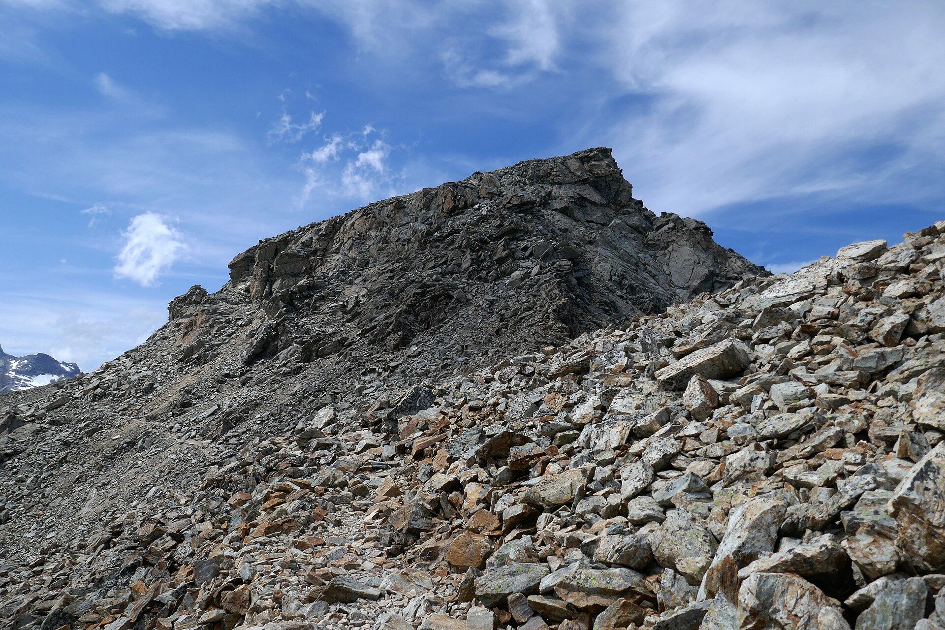
The route leaves the Horton Plains highland plateau and crosses wet patana grassland, boggy ground, bamboo, cloud forest, and open ridge sections toward Kirigalpotta. The upper ridge has rougher terrain and an exposed final rock-slab section in poor weather.
The route returns the same way. Mud and waterlogged ground are normal features rather than exceptional obstacles.
Why it is essential
Kirigalpotta adds a true high-summit objective to the Horton Plains entry. It complements the World’s End loop with a longer, wilder route through montane grassland and cloud forest.
Equipment
- Mountain hiking equipment: sturdy boots, rain layer, warm layer, water, food, navigation backup, and headtorch
- Trekking poles useful for mud and boggy sections
- Leech precautions after rain
Hazards and notes
- Mud, waterlogged paths, hidden holes, mist, and navigation difficulty
- The final summit ridge/rock section can be exposed in wind or rain
- National-park entry and route rules need current confirmation
- The route-trace maximum differs from commonly cited summit elevation
GPX / KML links
| Source | URL | Format / access | Reuse status |
|---|---|---|---|
| AllTrails — Kirigalpotta | alltrails.com | Source route page | AllTrails terms apply; GPX download/reuse not confirmed |
External links
- AllTrails — Kirigalpotta
- Wikipedia — Horton Plains National Park
- UNESCO — Central Highlands of Sri Lanka
4. Ella to Ella Rock

Snapshot
Itinerary
From Ella, the route heads toward Kithalella-side paths, tea plantations, forest and eucalyptus shade, then climbs more steeply to the Ella Rock viewpoint. The AllTrails description notes unclear paths and a steeper rocky/scrambly upper section.
The route returns to Ella by the same general line. Publication use should verify the safest legal variant where the route interacts with railway-side paths.
Why it is essential
Ella Rock is the classic hill walk of Sri Lanka’s tea-country tourist corridor. It adds a lower-elevation viewpoint hike, railway access, plantations, and the Ella Gap landscape to the Central Highlands selection.
Equipment
- Standard hiking equipment: grippy shoes, water, sun protection, rain layer, map/GPS, and food
- Trekking poles optional for the steeper descent
Hazards and notes
- Unclear junctions and informal local path variants can cause navigation errors
- The upper climb is steep and can be slippery after rain
- Avoid unsafe behaviour near active railway infrastructure; the exact legal walking line should be checked locally
- Heat and sun exposure can be significant despite moderate altitude
GPX / KML links
| Source | URL | Format / access | Reuse status |
|---|---|---|---|
| AllTrails — Ella to Ella Rock | alltrails.com | Source route page | AllTrails terms apply; GPX download/reuse not confirmed |
External links
5. Knuckles 5 Peak Trail

Snapshot
Itinerary
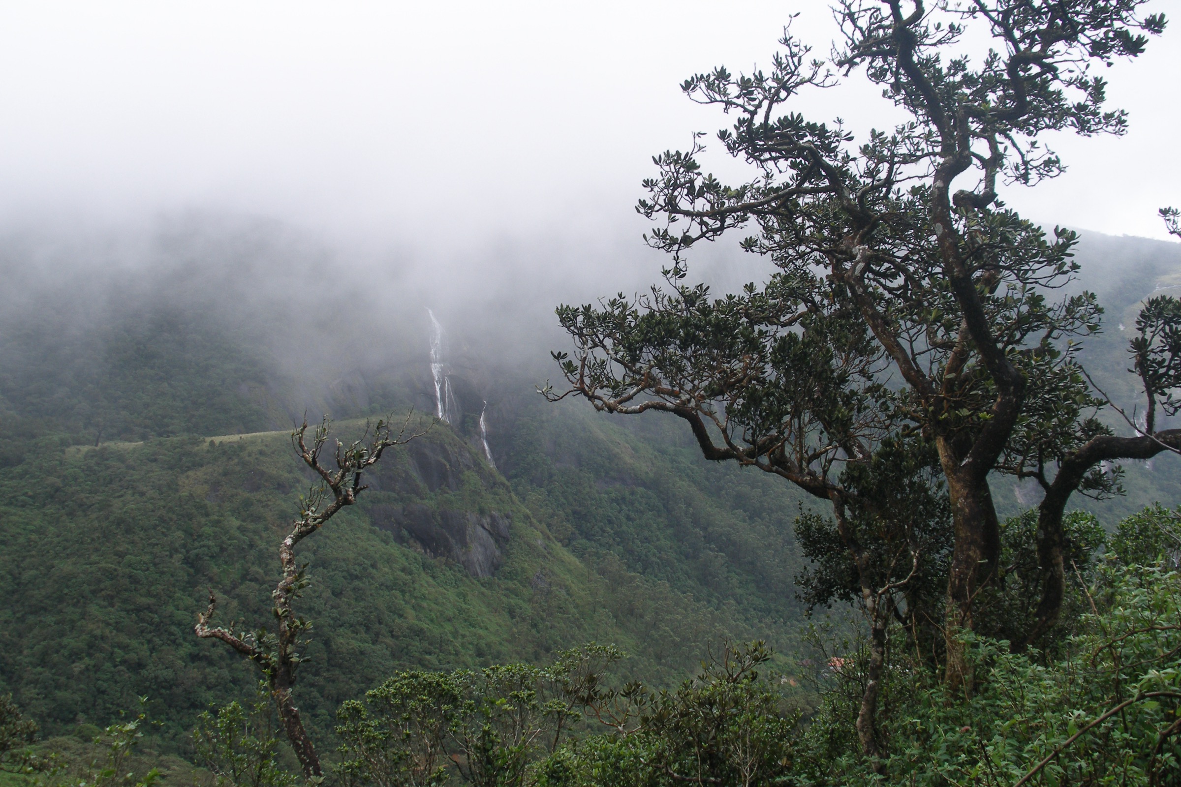
The route climbs into the Knuckles / Dumbara ridge system, linking a sequence of five peaks through grassland, cloud forest, pygmy forest, and rocky ridgeline terrain. The AllTrails review summary notes marked paths and strong views, but also steep climbs, muddy access roads, and leeches.
The route returns by the same line. A local access check is needed because Knuckles trails may be subject to conservation-area permissions, weather closures, or guide expectations.
Why it is essential
Knuckles gives the Central Highlands list a distinct ecological and topographic identity beyond Peak Wilderness and Horton Plains: misty ridges, isolated forest, biodiversity, and the range profile that gives the mountains their English name.
Equipment
- Mountain hiking equipment: sturdy boots, rain layer, warm layer, water, food, navigation backup, and headtorch
- Leech protection and trekking poles recommended in wet conditions
Hazards and notes
- Mud, leeches, poor visibility, steep ridges, and slippery rock
- Access roads may be rough or muddy
- Conservation-forest entry, guide rules, and dog restrictions need current confirmation
- Cloud and rain can remove views and make navigation more serious
GPX / KML links
| Source | URL | Format / access | Reuse status |
|---|---|---|---|
| AllTrails — Knuckles 5 Peak Trail | alltrails.com | Source route page | AllTrails terms apply; GPX download/reuse not confirmed |
External links
- AllTrails — Knuckles 5 Peak Trail
- Wikipedia — Knuckles Mountain Range
- UNESCO — Central Highlands of Sri Lanka
Missing data / follow-up work
- No official GPX/KML downloads were found for the five hikes in this pass.
- All route statistics use AllTrails source-route pages; official protected-area route sheets should be substituted where available.
- Adam’s Peak and Kirigalpotta have source-route maximum elevations lower than commonly cited summit elevations; field/GIS reconciliation is needed.
- Horton Plains and Knuckles entry fees, opening times, guide requirements, and conservation restrictions need current local confirmation.
- Ella Rock needs a legally confirmed path variant where railway-adjacent walking is involved.
- Public transport notes are access context only; timetables were not verified.
External links
| Resource | Link |
|---|---|
| UNESCO — Central Highlands of Sri Lanka | whc.unesco.org |
| AllTrails — Adam’s Peak | alltrails.com |
| AllTrails — World’s End Trail | alltrails.com |
| AllTrails — Kirigalpotta | alltrails.com |
| AllTrails — Ella to Ella Rock | alltrails.com |
| AllTrails — Knuckles 5 Peak Trail | alltrails.com |
| Wikipedia — Adam’s Peak | en.wikipedia.org |
| Wikipedia — Horton Plains National Park | en.wikipedia.org |
| Wikipedia — Ella, Sri Lanka | en.wikipedia.org |
| Wikipedia — Knuckles Mountain Range | en.wikipedia.org |