Regional overview
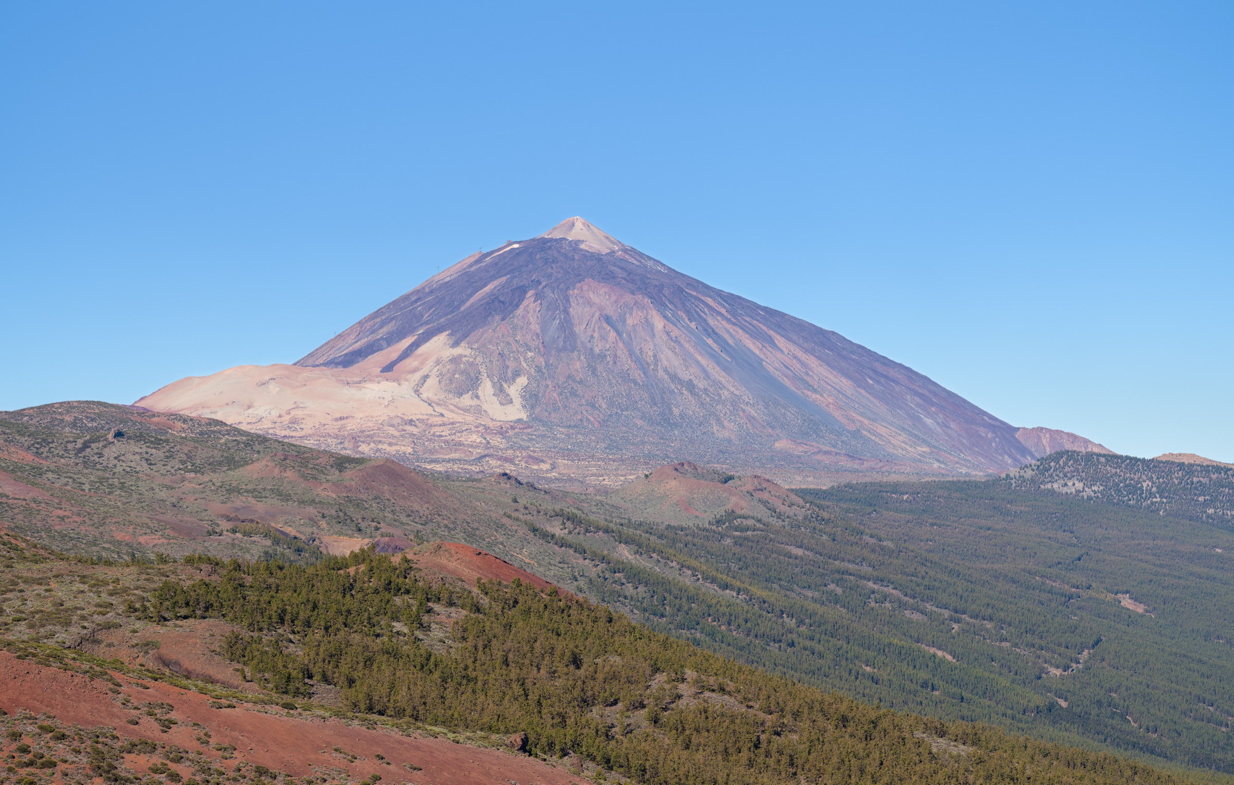
Tenerife’s Teide Massif is a high volcanic walking region centred on Teide National Park, Las Cañadas, the Teide-Pico Viejo complex, and marked park trails across pumice, lava, caldera walls, and high desert. This entry also includes Masca Gorge, because it is one of Tenerife’s defining protected ravine day hikes even though it sits on the Teno side rather than in the Teide crater.
The hiking character is exposed, dry, volcanic, and access-sensitive. Sun, wind, altitude, poor visibility, snow or ice at height, rockfall, and protected-area rules matter more than route-finding on the marked classics. Route/access status was checked in this pass on 2026-06-12; permits, cable-car operation, booking windows, and closures must still be checked immediately before publication or travel.
Selection rationale
The five hikes cover the main Teide ascent corridor, a short emblematic lava-and-rock loop, the high Pico Viejo descent, the classic Las Cañadas traverse, and Tenerife’s best-known controlled ravine walk.
Summary table
| # | Hike | Country | Route type | Distance | Gain | Max elevation | Difficulty |
|---|---|---|---|---|---|---|---|
| 1 | Montaña Blanca Trail - Teide Peak - PNT 07 | Spain | Point-to-point | 8.3 km | 1,194 m | 3,536 m | High |
| 2 | Roques de García - PNT 03 | Spain | Loop | 3.5 km | 211 m | 2,187 m | Low |
| 3 | Teide - Pico Viejo - TF-38 / PNT 09 | Spain | Point-to-point | 9.3 km | 109 m | 3,498 m | High |
| 4 | Siete Cañadas - PNT 04 | Spain | Point-to-point | 16.6 km | 585 m | 2,221 m | Intermediate |
| 5 | Camino del Barranco de Masca | Spain | Controlled descent / out-and-back variant | 5 km one-way; 8.5 km out-and-back | 837 m out-and-back | ca. 750 m | High |
1. Montaña Blanca Trail - Teide Peak - PNT 07
Snapshot
Itinerary
The marked PNT 07 route starts at the foot of Montaña Blanca and climbs through pale pumice and volcanic blocks below Teide. It steepens toward the Altavista/La Rambleta area and finishes near La Fortaleza lookout by the upper cable-car station. Any continuation onto the final Teide summit path is permit-controlled and is not automatically covered by this route entry.
Why it is essential
This is the classic non-technical walking approach into the highest Teide landscape and the most direct day-hike expression of Tenerife’s altitude, lava fields, and volcanic scale.
Equipment
Mountain footwear, warm and windproof layers, sun protection, high water capacity, navigation backup, and permit/cable-car documentation where relevant.
Hazards and notes
Altitude, intense sun, cold wind, loose volcanic ground, poor visibility, and winter ice/snow are the main issues. The official route reaches the high Teide area; summit access must be checked separately through the current permit system.
GPX / KML links
| Source | URL | Format / access | Reuse status |
|---|---|---|---|
| WebTenerife official trail page | webtenerife.co.uk | Official route page / source map | Website terms not fully checked; route-file reuse unresolved |
| Wikiloc — PNT 07 Montaña Blanca - La Rambleta | wikiloc.com | GPX/source route page | Wikiloc terms apply; reuse not confirmed |
External links
- WebTenerife — Montaña Blanca - Pico Teide
- Wikiloc — PNT 07 Montaña Blanca - La Rambleta
- Tenerife ON — permit and route information
2. Roques de García - PNT 03
Snapshot
Itinerary
The loop starts at La Ruleta and circles the Roques de García formations. It descends toward Llano de Ucanca, passes lava and eroded volcanic towers, and climbs back to the start.
Why it is essential
This is the compact signature walk of Teide National Park: short, scenic, and directly among the park’s emblematic rock towers and lava forms.
Equipment
Walking shoes or boots, sun protection, water, wind layer, and navigation backup.
Hazards and notes
The route is short but exposed to high-altitude sun, wind, and sudden weather shifts. Stay on marked paths to protect fragile volcanic terrain.
GPX / KML links
| Source | URL | Format / access | Reuse status |
|---|---|---|---|
| WebTenerife official trail page | webtenerife.co.uk | Official route page / source map | Website terms not fully checked; route-file reuse unresolved |
External links
3. Teide - Pico Viejo - TF-38 / PNT 09
Snapshot
Itinerary
From La Rambleta near the Pico Viejo lookout, the route crosses high black lava toward the Pico Viejo crater, then descends via Degollada de Chahorra and the Narices del Teide vents to the TF-38 road.
Why it is essential
PNT 09 is the major high-level descent through the Teide-Pico Viejo volcanic complex and the 1798 eruption landscape.
Equipment
Mountain footwear, warm and windproof layers, sun protection, plenty of water, navigation backup, and transport/cable-car contingency planning.
Hazards and notes
The net descent can make the route look easier than it is. It remains high, loose, exposed, and serious in wind, cold, poor visibility, or cable-car disruption.
GPX / KML links
| Source | URL | Format / access | Reuse status |
|---|---|---|---|
| WebTenerife official trail page | webtenerife.co.uk | Official route page / source map | Website terms not fully checked; route-file reuse unresolved |
| Wikiloc — PNT 09 Teide - Pico Viejo - Mirador de Las Narices del Teide | wikiloc.com | GPX/source route page | Wikiloc terms apply; reuse not confirmed |
External links
- WebTenerife — Teide - Pico Viejo
- Wikiloc — PNT 09 Teide - Pico Viejo - Mirador de Las Narices del Teide
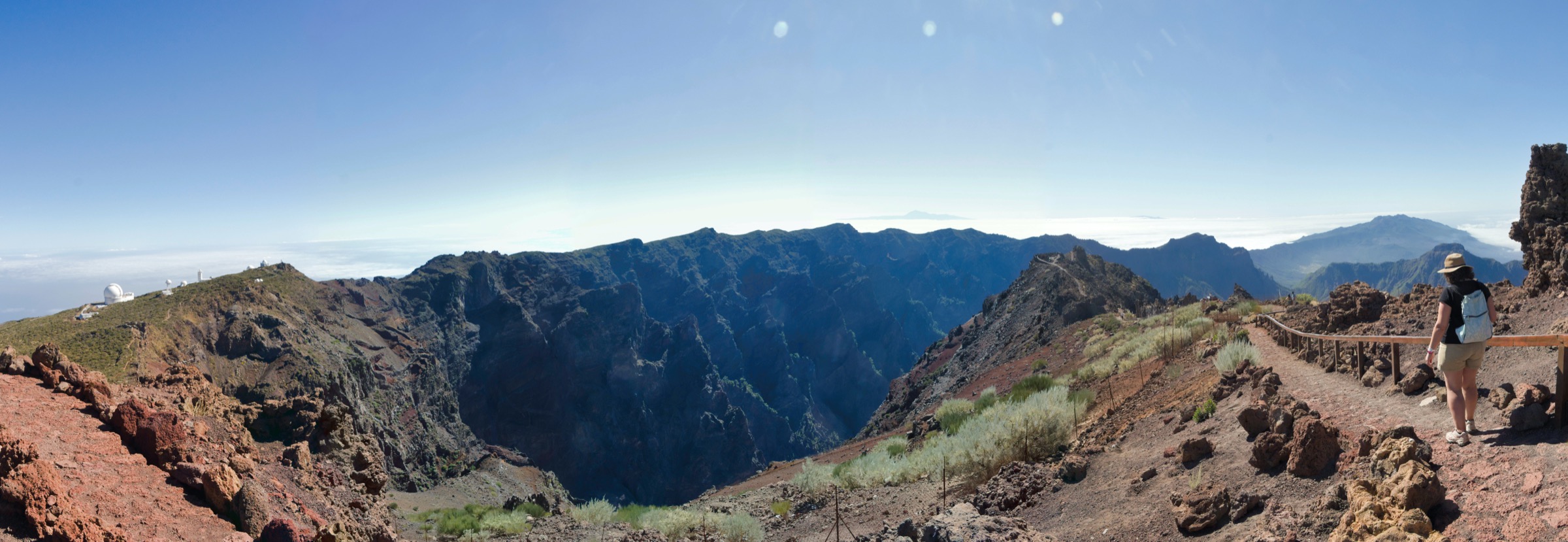
4. Siete Cañadas - PNT 04
Snapshot
Itinerary
The route crosses the eastern side of Las Cañadas from El Portillo to Cañada Blanca, following the old Camino de Chasna below the caldera walls through open lava, pumice, and high volcanic basin scenery.
Why it is essential
This is the classic long traverse of Las Cañadas: the best day hike for experiencing the scale of the Teide caldera walls without climbing to the summit zone.
Equipment
Walking boots or robust trail shoes, sun and wind protection, water, food, navigation backup, and a transport plan for both ends.
Hazards and notes
The route is long, open, and shade-poor. Heat, wind, sudden weather changes, and missed bus connections are practical hazards.
GPX / KML links
| Source | URL | Format / access | Reuse status |
|---|---|---|---|
| WebTenerife official trail page | webtenerife.co.uk | Official route page / source map | Website terms not fully checked; route-file reuse unresolved |
| Wikiloc — Las Siete Cañadas | wikiloc.com | Secondary GPX/source route page | Wikiloc terms apply; reuse not confirmed |
External links
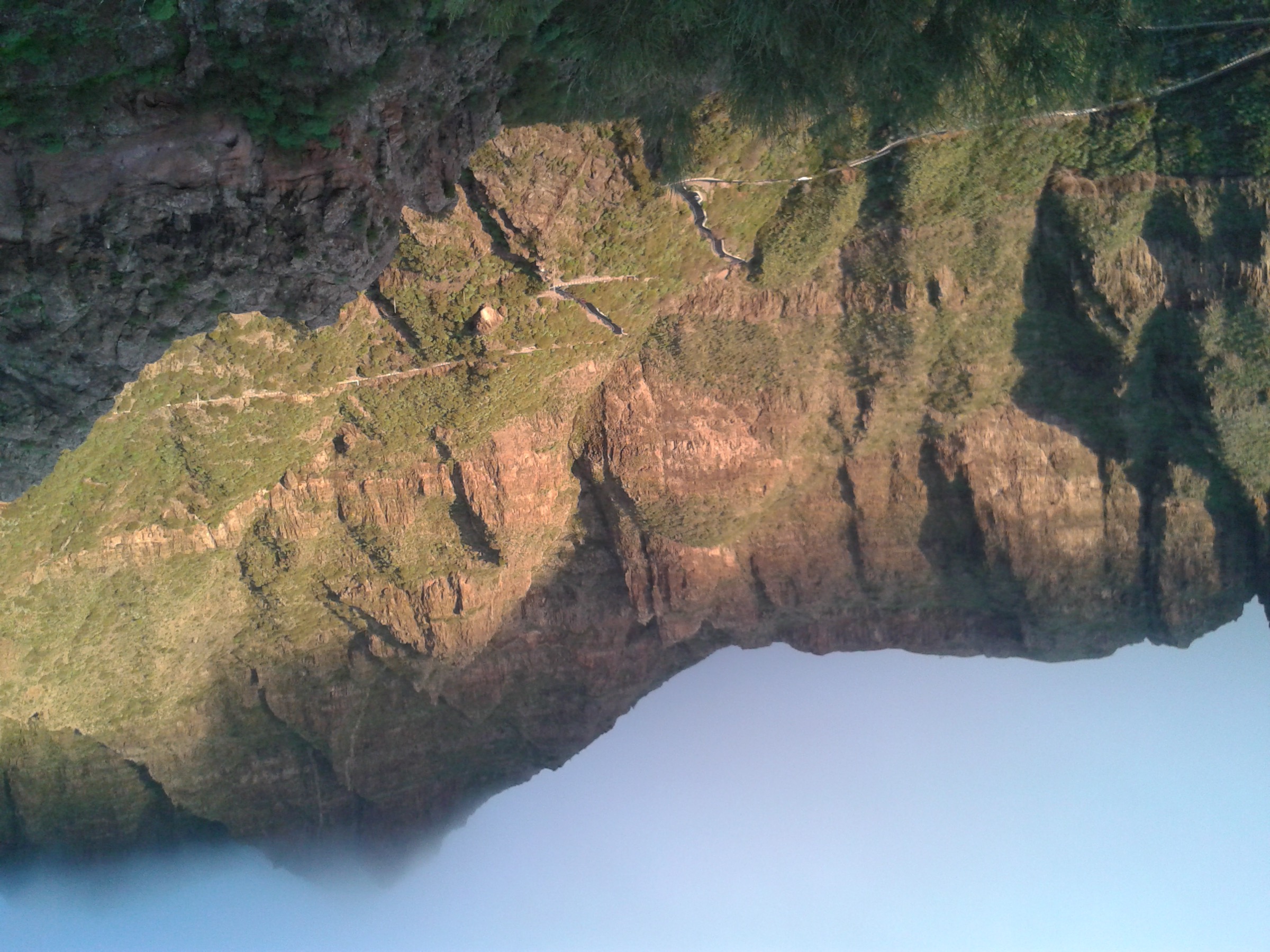
5. Camino del Barranco de Masca
Snapshot
Itinerary
The official controlled route descends from Masca hamlet through Barranco de Masca to the beach, after checks at the Masca Visitors’ Centre. If sea transfer is unavailable or if walking the out-and-back version, the return climb is strenuous.
Why it is essential
Masca is Tenerife’s best-known ravine walk: steep volcanic canyon scenery, a dramatic descent to the sea, and a heavily managed protected-area access model.
Equipment
Compliant hiking footwear, helmet if required by the official rules, sun protection, water, and clothing suitable for rockfall, wet ground, and weather exposure.
Hazards and notes
The official safety material identifies falls, rockfall, impact, slippery ground, and flooding as major risks. Booking, transport, footwear, helmet, and sea-condition rules are part of the route rather than optional logistics.
GPX / KML links
| Source | URL | Format / access | Reuse status |
|---|---|---|---|
| Official Camino del Barranco de Masca booking/access page | caminobarrancodemasca.com | Official route/access page | Website terms not fully checked; route-file reuse unresolved |
| Official Camino del Barranco de Masca safety page | caminobarrancodemasca.com | Official safety page | Safety rules verified; route geometry not reusable from this page |
| AllTrails — Camino del Barranco de Masca | alltrails.com | GPX/source route page | AllTrails terms apply; reuse not confirmed |
External links
- Camino del Barranco de Masca — booking/access
- Camino del Barranco de Masca — safety page
- AllTrails — Camino del Barranco de Masca
Missing data / follow-up work
- Recheck all Teide permits, weather closures, cable-car status, and Masca booking/transport rules immediately before publication.
- Official WebTenerife pages verify statistics but do not provide clearly reusable GPX/KML files in this pass.
- The Siete Cañadas image candidate is representative of the Teide massif; a route-specific open image remains unresolved.
External links
| Source | URL |
|---|---|
| WebTenerife — official trail pages | webtenerife.co.uk |
| Tenerife ON — permit and route information | tenerifeon.es |
| Camino del Barranco de Masca — official site | caminobarrancodemasca.com |
| Wikiloc | wikiloc.com |
| AllTrails | alltrails.com |