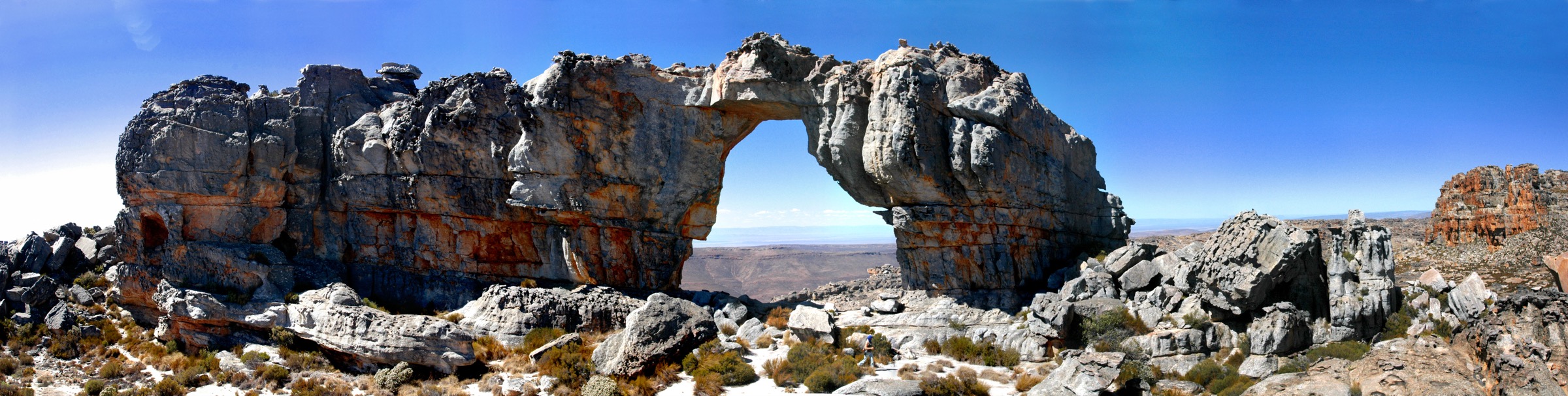
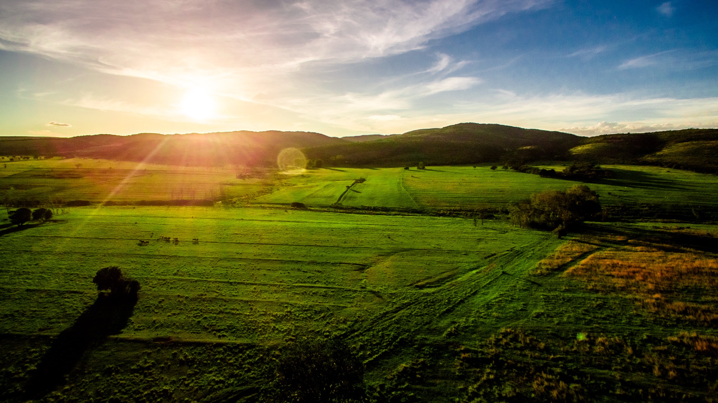
Regional overview
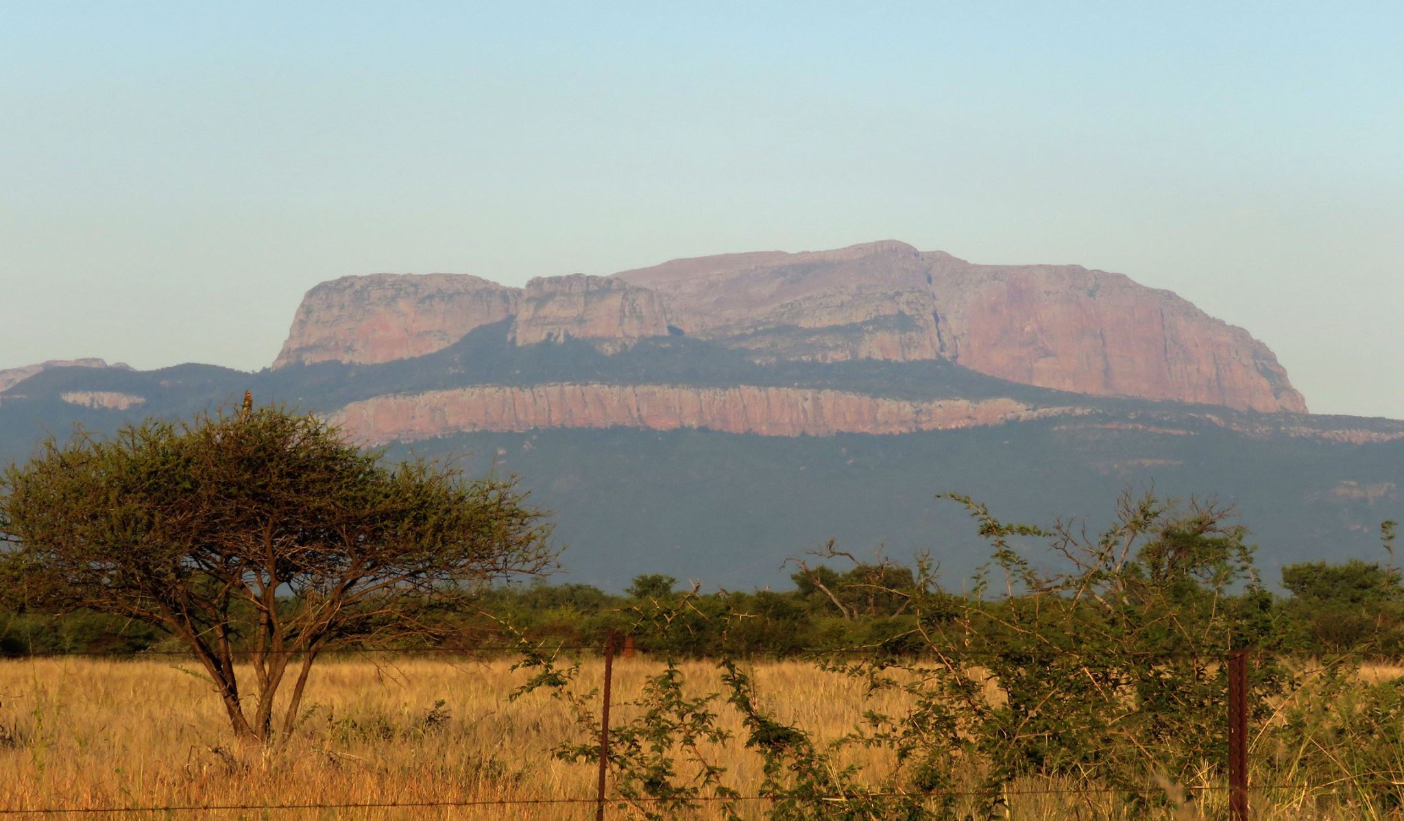
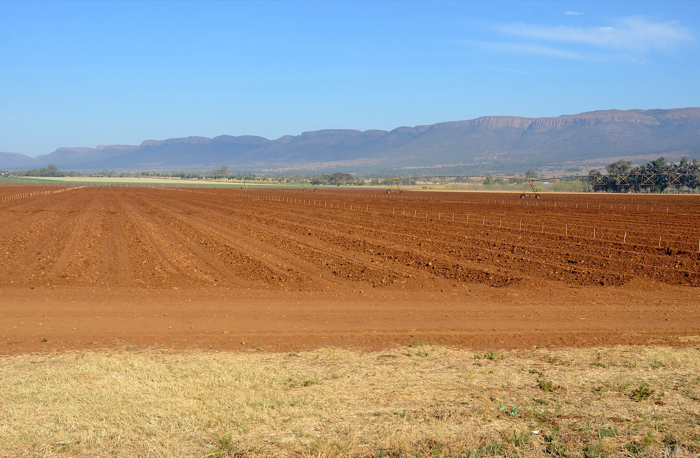
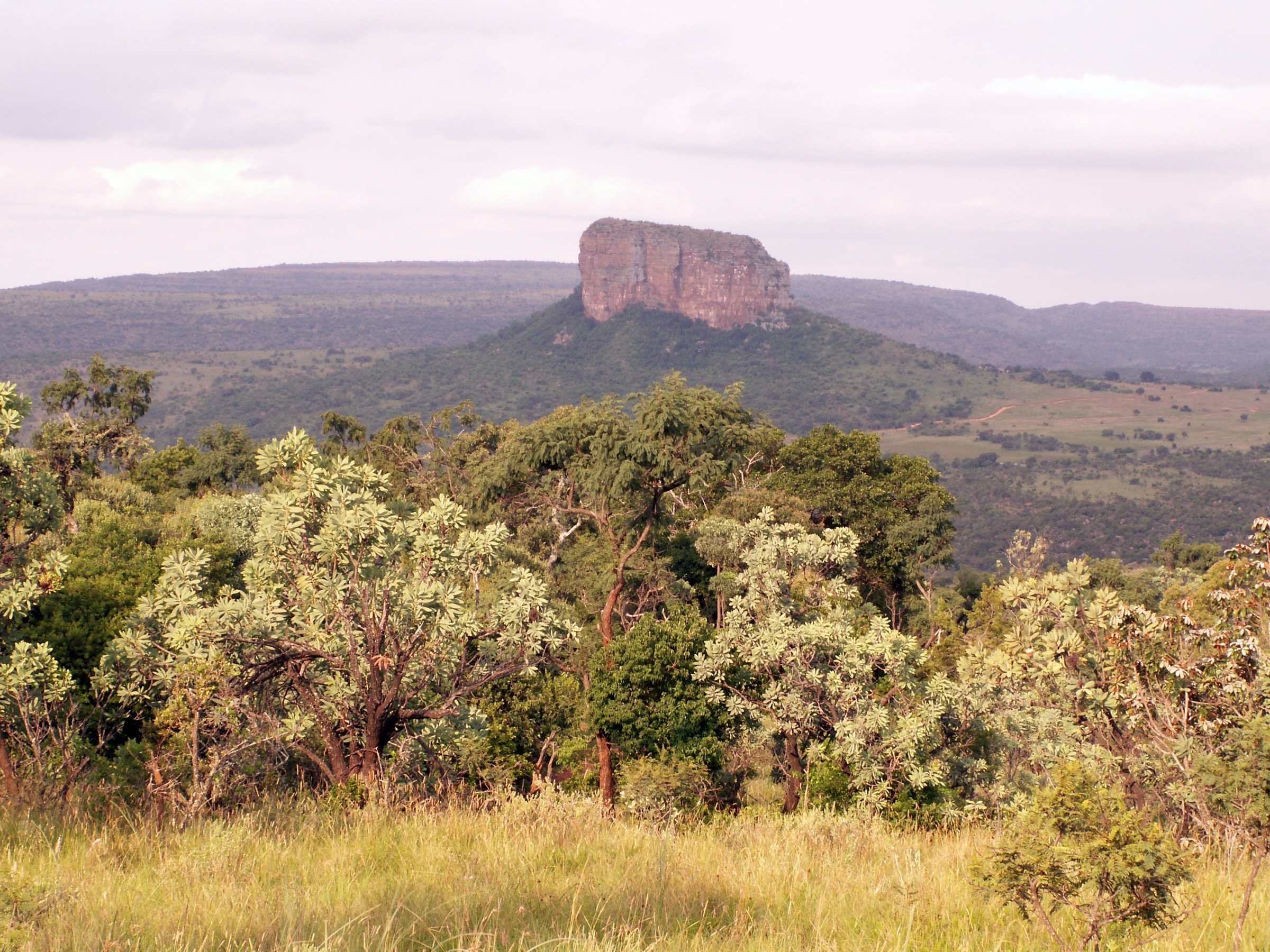
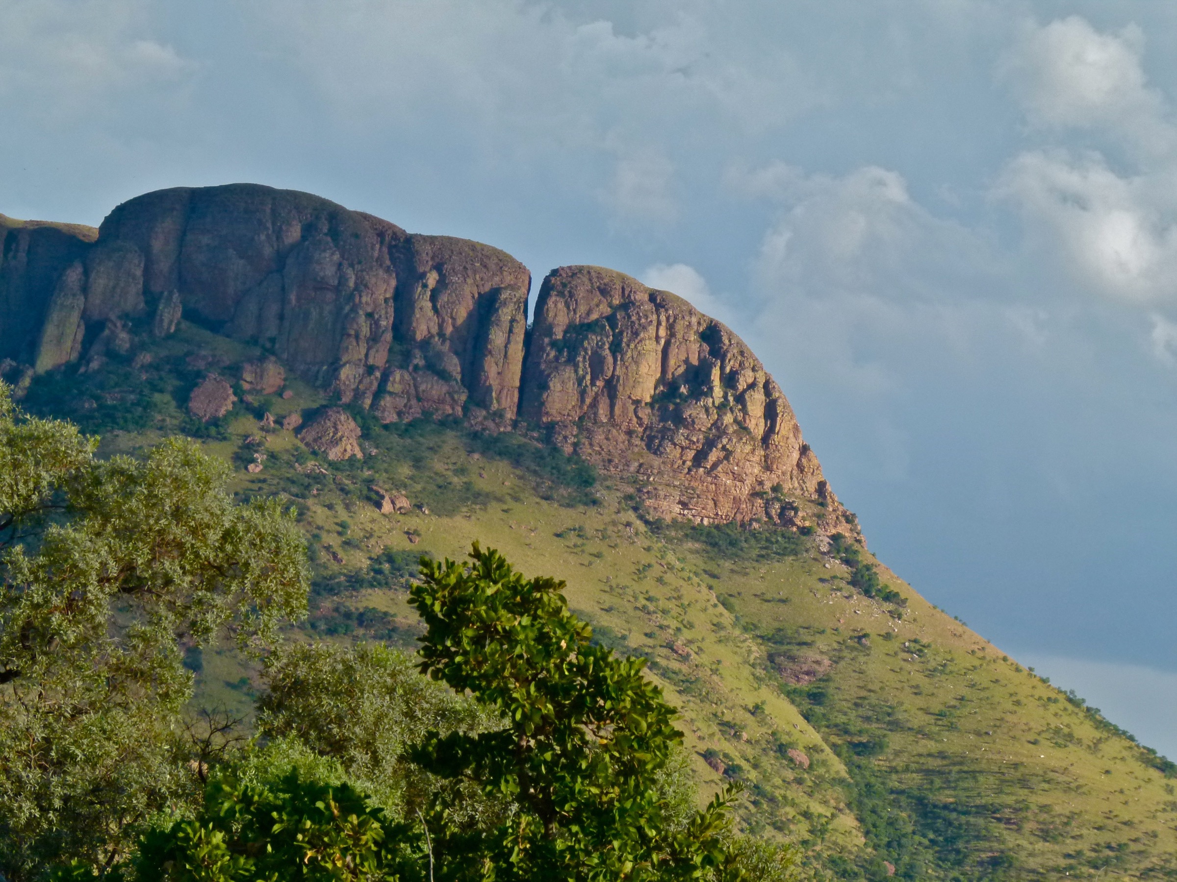
The Waterberg is a broad sandstone plateau and bushveld region in Limpopo, shaped by ridges, kloofs, seasonal streams, game farms, private reserves and protected areas. Hiking here is less about long, continuous public footpaths and more about well-managed reserve routes: lodge loops, trail networks, viewpoints and short wilderness circuits where access rules matter as much as the line on the map.
The walking is often moderate on paper but more serious in practice. Rocky sandstone, summer heat, loose descents, tall grass, wildlife management rules and private-reserve gates can all change the character of a route. The cooler dry months are the most comfortable period for most hikers. In summer, start early, carry more water than the distance suggests, and avoid exposed ridges during thunderstorms.
This selection prioritises routes with the strongest available source trail data: two official Lindani lodge circuits, two day-hike options from the Bateleur / Stamvrug network, and the short but regionally important Lenong Viewpoint walk in Marakele National Park.
Selection rationale
The Waterberg has many advertised walks, but public route data is uneven. The selection is source-led rather than padded with poorly documented trails. The result is a practical five-route set:
- Lindani Mountain Trail — the strongest ridge-and-lookout circuit in the official Lindani hiking material.
- Lindani Melkrivier Trail — a demanding river, gorge and sandstone circuit with matching official and Trailforks data.
- Bateleur / Stamvrug Escarpment Trail — a compact circular day trail in a well-known Waterberg reserve network.
- Bateleur / Stamvrug Kloof Trail — a longer kloof-and-base-camp line; valuable, but its day-hike use needs careful on-site confirmation.
- Lenong Viewpoint circular walk — too short to be a full day hike, but important enough to include as the Waterberg’s most iconic high viewpoint.
Summary table
| # | Hike | Area | Route type | Distance | Elevation gain | Max elevation | Difficulty |
|---|---|---|---|---|---|---|---|
| 1 | Lindani Mountain Trail | Lindani Game & Lodges | Loop | 11.3 km official; 9.8 km recorded variant | 254 m recorded variant | c. 1,420 m | Moderate / difficult |
| 2 | Lindani Melkrivier Trail | Lindani Game & Lodges | Loop | 10.2 km | c. 305 m | c. 1,371 m | Moderate / difficult |
| 3 | Bateleur / Stamvrug Escarpment Trail | Bateleur Nature Reserve / Stamvrug | Loop | 6.4 km | 211 m | c. 1,630 m | Moderate |
| 4 | Bateleur / Stamvrug Kloof Trail | Bateleur Nature Reserve / Stamvrug | Point-to-point or network variant | 11.6 km official; 13 km in older descriptions | 150 m official | c. 1,630 m | Moderate |
| 5 | Lenong Viewpoint circular walk | Marakele National Park | Loop | 0.44 km | 15 m | 2,058 m | Short but rocky |
Before you go
Required equipment
Lindani trail network (Mountain Trail, Melkrivier Trail)
- Sturdy hiking shoes or boots.
- Sun hat, sunscreen and at least 2 litres of water per person in cool conditions; more in summer.
- Food, offline map or GPS track, first-aid kit and a headtorch.
- Trekking poles are useful on rocky descents and in steep gorges.
Bateleur / Stamvrug trail network (Escarpment Trail, Kloof Trail)
- Hiking shoes or boots.
- Water, sun protection, offline map, first-aid kit and a light layer.
- More water than for the Escarpment Trail if doing the Kloof Trail; carry a headtorch.
- Confirm transport or return logistics if the Kloof Trail is being used as a point-to-point line.
Lenong Viewpoint (Marakele)
- Hiking shoes, water, sun protection, wind layer and binoculars.
- A full hiking pack is unnecessary for the short walk, but weather can be more exposed at the viewpoint than in the lower bushveld.
Current access and safety notes
- Confirm access directly. Several routes are on private reserves or guest lodge trail systems.
- Check gate times, day-visitor rules, guide requirements and dangerous-game restrictions before setting out.
- Carry offline navigation. Mobile reception can be weak and reserve trails may overlap or use local route names.
- Start early in summer. Heat, thunderstorms and lightning are the main seasonal hazards.
- Treat wildlife as a real route factor. Do not approach animals, feed animals, leave marked areas or walk at night without explicit permission.
1. Lindani Mountain Trail
Snapshot
Itinerary
The Mountain Trail is Lindani’s headline sandstone ridge circuit. It climbs through rocky Waterberg terrain to a high lookout, then loops back across kloof, woodland and open reserve country. The official route also allows two optional short add-ons: the Big Tree & Burnt Rocks Loop and the Rock Table Loop. A signed shortcut via Yellowwood Gorge can reduce the outing to roughly 6 km.
Use the current Lindani map on arrival, because the 11.3 km official line and the shorter 9.8 km public recorded variant do not appear to be identical. Treat 11.3 km as the official full circuit and the shorter figure as a recorded route variant.
Why it is essential
This is the best Waterberg ridge-and-lookout circuit in the source set. It gives the region a proper sandstone high-ground walk rather than only short bushveld loops.
Hazards and notes
- Expect rocky sections, steep ascents and descents, hot exposed ground in summer, ticks, snakes and reserve wildlife.
- Lindani specifically advises hikers to carry water and food and to start early in summer.
- Do not assume public access: confirm the current trail rules before travelling.
GPX / KML links
| Source | URL | Format / access | Reuse status |
|---|---|---|---|
| Lindani official hiking PDF | lindani.co.za | PDF route description and map | Best source for official distance, route character and variants; no standalone GPX in the PDF |
| Trailforks: Lindani Game & Lodges region | trailforks.com | App route / route pages | Lindani routes represented in Trailforks; download and reuse terms need checking |
| AllTrails: Lephalale Mountain Trail | alltrails.com | Recorded route page | Useful for alternative statistics; route-file reuse not cleared |
External links
- Lindani official hiking PDF
- AllTrails — Lephalale Mountain Trail
- Trailforks — Lindani Game & Lodges region
2. Lindani Melkrivier Trail
Snapshot
Itinerary
The Melkrivier Trail is a varied Waterberg loop crossing river-side ground, steep gorges, rocky ascents and descents, smooth trail and open viewpoint sections. The route is not extreme in distance, but the terrain makes it physically demanding. Lindani also notes a shorter signed option of roughly 7 km.
Follow the current on-site signs carefully, because Lindani’s trail network contains overlapping walking, running and biking lines. Describe it as a signed Lindani reserve trail rather than as a freely accessible public path.
Why it is essential
This is the strongest river-and-gorge walk in the Waterberg set. It complements the Mountain Trail by adding steeper kloof terrain and a more varied sandstone-and-stream landscape.
Hazards and notes
- Steep gorges and rocky ascents / descents are explicitly noted by Lindani.
- Summer heat is a serious factor, and an early start is recommended.
- Check reserve access, parking point and any wildlife restrictions before departure.
GPX / KML links
| Source | URL | Format / access | Reuse status |
|---|---|---|---|
| Lindani official hiking PDF | lindani.co.za | PDF route description and map | Best official source for route description and distance |
| Trailforks: Lindani Melkrivier Trail MRT | trailforks.com | Route page / app route | Provides distance, climb, descent and elevation range; download and reuse terms need checking |
| AllTrails: Melkrivier Trail | alltrails.com | Recorded route page | Useful secondary statistics; route-file reuse not cleared |
External links
3. Bateleur / Stamvrug Escarpment Trail
Snapshot
Itinerary
The Escarpment Trail is the most compact high-ground option in the Stamvrug network. It loops from the reserve trail base towards the escarpment, giving a short but satisfying Waterberg plateau outing with rocky ground, bushveld and views.
Because Bateleur / Stamvrug publishes several overlapping day, overnight and stay-and-explore routes, the exact trailhead and line should be taken from the current reserve map rather than inferred from older third-party descriptions.
Why it is essential
It is a manageable half-day route in one of the Waterberg’s better documented hiking networks. It gives the list a shorter option without dropping into a purely casual nature walk.
Hazards and notes
- Book or confirm day access before travelling.
- Start early in summer, especially if combining the route with another short trail.
- The reserve advises hikers not to wait until dark if lost and to send a WhatsApp location and trail name to the reserve contact rather than trying to backtrack blindly.
- Carry enough water even though the distance is short.
GPX / KML links
| Source | URL | Format / access | Reuse status |
|---|---|---|---|
| Bateleur official hiking table | bateleurnaturereserve.co.za | Website route table | Best source for current day-trail distance, gain and time |
| Bateleur / Stamvrug official trail map | bateleurnaturereserve.co.za | PDF map | Shows trail network and 6.4 km Escarpment Trail; no GPX found |
| AllTrails: Bateleur Escarpment Trail | alltrails.com | Recorded route page | Useful secondary route source; reuse terms not cleared |
External links
- Bateleur Nature Reserve hiking page
- Bateleur / Stamvrug official trail map (PDF)
- Fagala Voet — Stamvrug Hiking Trail
- AllTrails — Bateleur Escarpment Trail
4. Bateleur / Stamvrug Kloof Trail
Snapshot
Itinerary
The Kloof Trail represents the more committing side of the Stamvrug network: kloof country, reserve tracks, base-camp terrain and longer walking between named areas. It is valuable for a Waterberg guide because it shows the ravine-and-plateau character that short loops cannot fully capture.
Be careful with naming. In some older Stamvrug descriptions, Kloof and Leopard trails are described as 13 km base-camp-to-base-camp backpacking legs. The current Bateleur table lists Kloof Trail as 11.6 km and point-to-point. Treat it as a route requiring direct confirmation, not as a simple public loop.
Why it is essential
This is the longer Bateleur / Stamvrug selection and the best candidate for hikers who want a proper half-day to full morning route rather than a short viewpoint circuit.
Hazards and notes
- Do not treat this as a casual loop without checking the current reserve map and booking rules.
- If the trail is being used as a point-to-point line between base camps, logistics matter.
- Summer starts should be before the heat builds; follow reserve instructions if lost.
- Confirm transport or return logistics if the current route is point-to-point.
GPX / KML links
| Source | URL | Format / access | Reuse status |
|---|---|---|---|
| Bateleur official hiking table | bateleurnaturereserve.co.za | Website route table | Current source for 11.6 km, 150 m elevation and 4 hr estimate |
| Bateleur / Stamvrug official trail map | bateleurnaturereserve.co.za | PDF map | Shows Kloof Trail in the current network; no GPX found |
| Fagala Voet: Stamvrug description | fagalavoet.co.za | Trail network description | Useful for older base-camp route context; current details should be checked directly |
| AllTrails: Bateleur Kloof Trail | alltrails.com | Recorded route page | Useful secondary route source; reuse terms not cleared |
External links
- Bateleur Nature Reserve hiking page
- Bateleur / Stamvrug official trail map (PDF)
- Fagala Voet — Stamvrug Hiking Trail
- AllTrails — Bateleur Kloof Trail
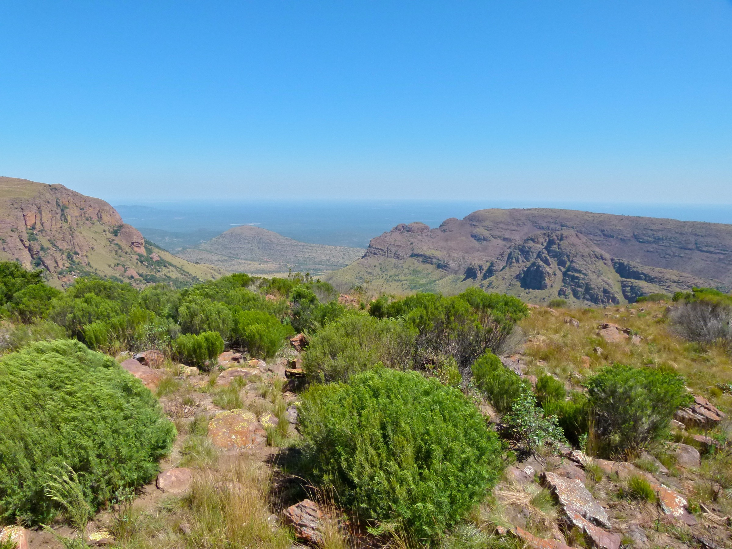
5. Lenong Viewpoint circular walk, Marakele National Park
Snapshot
Itinerary
From the Lenong Viewpoint parking area, a very short circular walk explores the high ground around the information shelter and mast area. The route is not a full day hike and should not be marketed as one. It is included because Lenong is the most recognisable high viewpoint in the Waterberg and gives access to Marakele’s mountain identity: Kransberg cliffs, open views and Cape vulture country.
The Wikiloc recording notes sporadic white shoe-print markers and no fully formal trail indication at the time of recording. Keep the description conservative: this is a short viewpoint walk around permitted visitor areas, not a signed long-distance path.
Why it is essential
Lenong gives the Waterberg list its highest, most dramatic national-park viewpoint. It also balances the private-reserve routes with a SANParks setting.
Hazards and notes
- Avoid the viewpoint in lightning, dense mist or strong wind.
- Stay within permitted visitor areas and follow SANParks rules.
- The access road is part of the experience and should be checked locally if weather has been poor.
GPX / KML links
| Source | URL | Format / access | Reuse status |
|---|---|---|---|
| Wikiloc: Lenong Viewpoint circular walk | wikiloc.com | Route page with download option | Stats and route description found; route-file reuse terms not cleared |
| SANParks Marakele brochure | sanparks.org | Official park material | Confirms Lenong Viewpoint and park context; not a GPX source |
External links
- Wikiloc — Lenong Viewpoint circular walk
- SANParks — Marakele National Park brochure (PDF)
- SANParks — Marakele National Park infographic (PDF)
External links
| Source | URL |
|---|---|
| Lindani official hiking PDF | lindani.co.za |
| Trailforks — Lindani Game & Lodges | trailforks.com |
| Trailforks — Lindani Melkrivier Trail MRT | trailforks.com |
| Bateleur Nature Reserve hiking page | bateleurnaturereserve.co.za |
| Bateleur / Stamvrug official map (PDF) | bateleurnaturereserve.co.za |
| Fagala Voet — Stamvrug Hiking Trail | fagalavoet.co.za |
| SANParks — Marakele National Park brochure | sanparks.org |
| SANParks — Marakele infographic | sanparks.org |
| Wikiloc — Lenong Viewpoint circular walk | wikiloc.com |