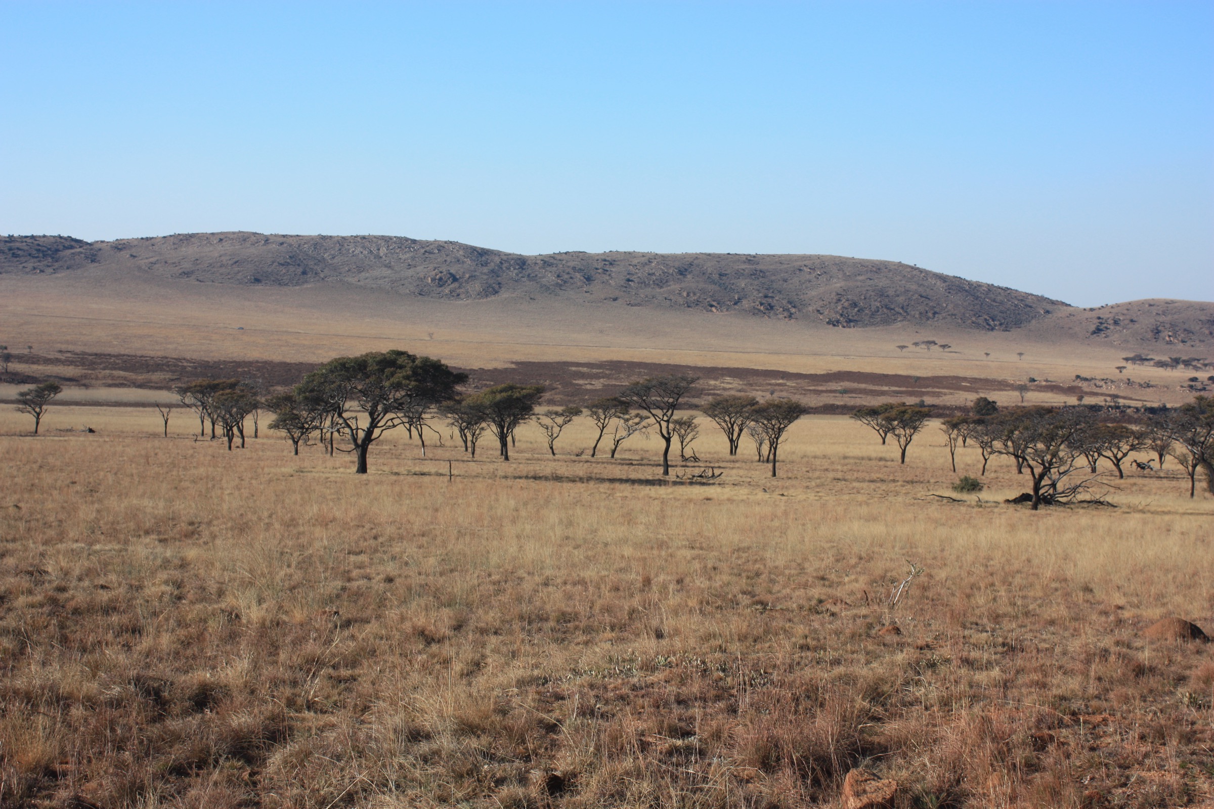
Regional overview
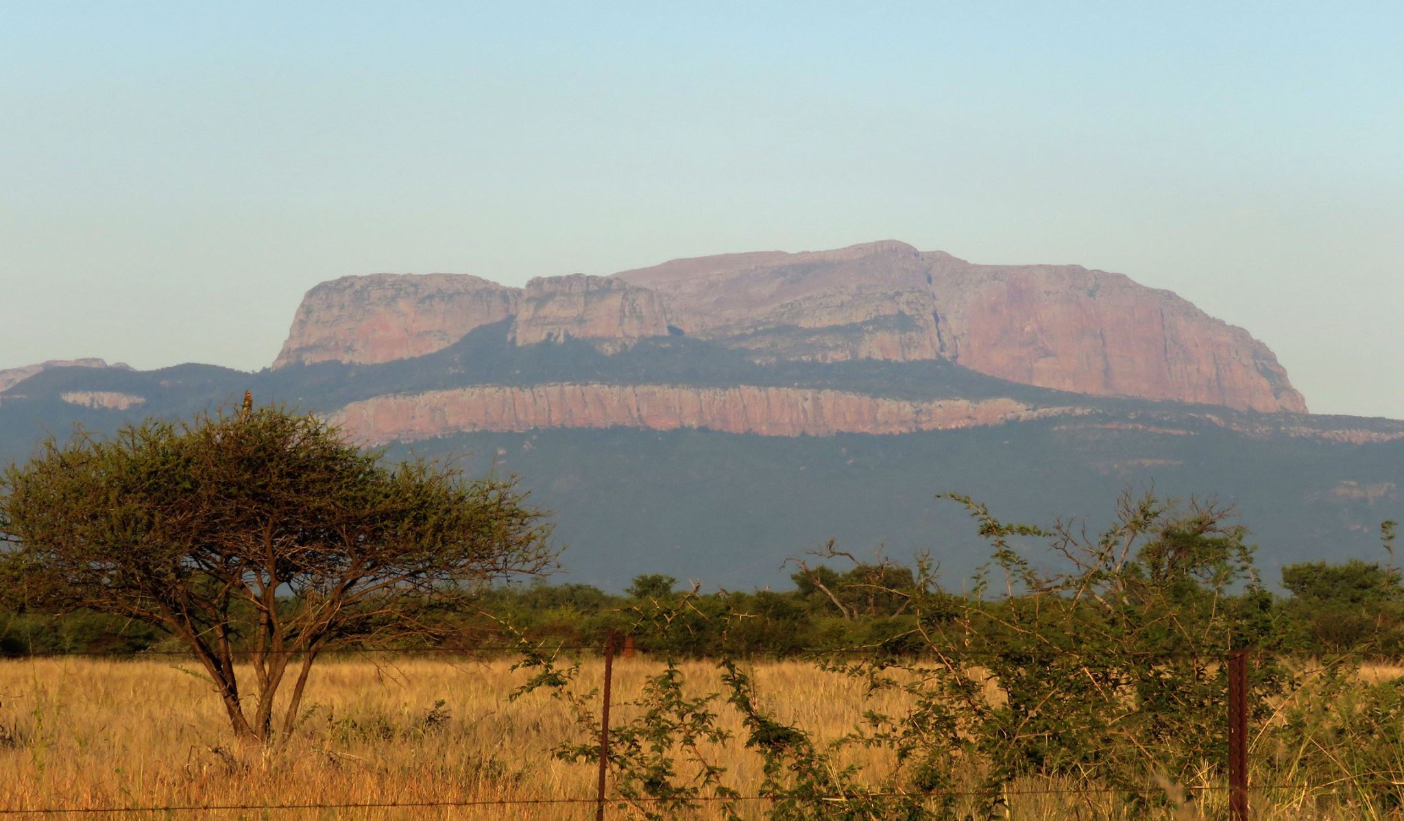
The Magaliesberg is not a single waymarked hiking corridor. It is a long, broken ridge system of quartzite, kloofs, private farms, provincial reserves and permit-controlled mountain properties running between the Pretoria / Hartbeespoort side in the east and Rustenburg in the west. The UNESCO Magaliesberg Biosphere Reserve lies between Pretoria and Johannesburg to the east and Rustenburg to the west, at the meeting point of grassland, savannah and remnant Afromontane forest habitats.
For hikers, the region is defined by short but often rugged days: river crossings, dry ridge ascents, hot exposed slopes, clear rock pools, kloofs, ladders, old dolomite workings and wide Highveld views. Distances can look modest on paper, but Magaliesberg terrain is rocky, steep in short bursts, and often more tiring than the numbers suggest.
The best general walking season is the cooler, drier half of the year, roughly April to September. Summer can still be good for pool walks, but heat, little shade, afternoon thunderstorms and slippery rock after rain make early starts important. Many trailheads are private or permit-controlled, so check booking rules, gate times, start cut-offs and dog restrictions before travelling.
Selection rationale
These five hikes were selected to represent the main day-hiking styles of the Magaliesberg rather than simply the longest routes:
- Hennops Krokodilberg Route — the accessible eastern classic, combining river crossings, viewpoints and historic features.
- Rustig high loop / 13 km option — a strenuous private-farm ridge day with sustained ascent.
- West Pools, Mountain Sanctuary Park — the short rock-pool experience that gives the region its summer appeal.
- Castle Gorge via Maretlwane / Castle Gorge access — a permit-controlled kloof and pool objective with wilder route-finding.
- Peglarae Trail, Kgaswane Mountain Reserve — a protected-area walk on the Rustenburg side of the range.
Summary table
| # | Hike | Area | Route type | Distance | Elevation gain | Max elevation | Difficulty |
|---|---|---|---|---|---|---|---|
| 1 | Hennops Krokodilberg Route | Hennops / eastern Magaliesberg | Loop | 10.0 km official; 10.0–10.3 km app-recorded | 331–400 m | 1,495 m app-derived | Moderate to hard |
| 2 | Rustig high loop / 13 km option | Rustig / Hekpoort–Skeerpoort | Loop | 9, 13 or 18 km official; 13 km usual reference | c. 610–645 m | c. 1,680 m app-derived | Hard |
| 3 | West Pools, Mountain Sanctuary Park | Mountain Sanctuary Park / Buffelspoort | Out-and-back | c. 3.2 km | c. 80 m | c. 1,507 m app-derived | Easy |
| 4 | Castle Gorge via Maretlwane | Central Magaliesberg / Maretlwane | Out-and-back | c. 7–10 km | c. 210 m minimum | c. 1,450 m app-derived | Moderate to hard |
| 5 | Peglarae Trail, Kgaswane Mountain Reserve | Kgaswane / Rustenburg side | Loop | 4.6–5.5 km | c. 165–175 m | c. 1,630–1,635 m app-derived | Moderate |
Before you go
Required equipment
Hennops, Rustig and Peglarae (managed venue and reserve loops)
- Sturdy hiking shoes or light boots with good grip on rock.
- Water: at least 1 litre per person per 2 hours at Hennops; Rustig recommends 4–5 litres per person; 1–2 litres for Peglarae.
- Sun hat, sunscreen and light long sleeves for exposed slopes.
- Small first-aid kit, snacks and offline route map.
- Trekking poles on Rustig if you prefer support on steep descents; headtorch for the longer 5–6 hour day.
West Pools, Mountain Sanctuary Park
- Trail shoes or sandals with reliable grip on wet rock.
- Swimwear and a small towel if swimming is permitted and conditions are safe.
- Sun protection and drinking water even though the route is short.
- Offline map or reception-issued map; do not rely on painted waymarks.
- Dry bag or waterproof phone pouch.
Castle Gorge
- Proper hiking shoes or boots with grip on wet and dry rock.
- Enough water for the approach; do not assume stream water is safe without treatment.
- Navigation backup: downloaded map, GPS track and/or permit-supplied route map.
- Hat, sunscreen and snacks for a slow day.
- Tick repellent — ticks are reported in the area — and a small dry bag for electronics near pools.
Current access and safety notes
- Several routes cross private land or protected properties. Confirm booking rules, gate times, start cut-offs and dog restrictions before travelling.
- Distances and ascent figures vary between venue maps, user-recorded tracks and commercial route apps. Treat the figures here as article-grade planning statistics, not survey-grade measurements.
- For publication, use a freshly created or independently verified GPX/KML track rather than copying coordinates from commercial platforms.
- Magaliesberg terrain is rocky and steep in short bursts; afternoon thunderstorms and slippery rock after rain make early starts important.
1. Hennops Krokodilberg Route
Snapshot
Itinerary
The Krokodilberg Route starts from Hadeda Camp and quickly gives the hike its signature feature: the Hennops River crossing. Depending on the exact line and current venue set-up, hikers use suspension-bridge and cable-car river crossings before the trail leaves the river corridor and climbs into the surrounding Magaliesberg slopes.
The middle section is the hill-walking part of the route. Expect rocky ground, exposed slopes, short steeper pulls and views back across the river valley and plateau. The route also passes or approaches several of the historical features for which Hennops is known, including traces of old settlements, caves, old dolomite mines and lime ovens.
The return leg descends from the higher ground back towards the Hennops River, rejoining the trailhead area at Hadeda Camp. The full loop is short enough for a half day, but it is not a casual stroll: heat, rough footing and the river-crossing infrastructure make it feel more adventurous than its 10 km distance suggests.
Why it is essential
Hennops is the best eastern-Magaliesberg introduction for many visitors from Johannesburg and Pretoria. It combines three things in one compact loop: river crossings, a real hill climb and the cultural-historic features of the Hennops valley.
Hazards and notes
- The official Krokodilberg Route is not recommended for children under 12 or unfit adults.
- Start cut-offs are important: Hennops lists weekday starts from 07:00 to 13:00; weekends and public holidays start at 06:00 to 13:00 in October–March and 07:00 to 13:00 in April–September.
- Facilities close at 17:00.
- No pets, no alcohol and no music on the trails.
- River crossings, rocky descents and hot exposed slopes require care after rain or in summer heat.
- There are no water points on the trail.
GPX / KML links
| Source | URL | Format / access | Reuse status |
|---|---|---|---|
| Hennops official hiking page | hennopstrails.co.za | Official route description and map download | Use for facts and venue notes; do not assume the map can be republished |
| Hika: Krokodilberg Route | hika.app | Route page with stats | Use as a comparison source only |
| Hiking Project: Krokodilberg Route | hikingproject.com | Route page / possible GPX download | Terms need checking before reuse |
| AllTrails: Hennops Krokodilberg Route | alltrails.com | Route page | Terms need checking before reuse |
External links
- Hennops Hiking Trail
- Hika — Krokodilberg Route
- Hiking Project — Krokodilberg Route
- AllTrails — Hennops Krokodilberg Route
2. Rustig high loop / 13 km option
Snapshot
Itinerary
Rustig is the strenuous ridge day of this selection. From the day-visitor area the longer trail options climb quickly away from the farm and into the rocky southern slopes of the Magaliesberg. The walking alternates between open grassland, rocky gullies, steeper pulls, ladders or constructed features on some variants, and broad views over the surrounding ridges.
The 13 km high-loop option is the best fit for a single hard day-hike article. It gives a proper Magaliesberg workout without committing to the full 18 km route. Hikers should expect sustained ascent, rough footing and slow progress in hot weather. Venue maps and on-the-ground markings matter here: Rustig lists 9 km, 13 km and 18 km options together, and app-recorded lines do not always correspond perfectly with the official route maps.
The route returns to the day-visitor area, where facilities make the hike easier to manage than a remote kloof day. It is still a demanding walk and should not be treated as a family stroll.
Why it is essential
Rustig adds the hard private-farm ridge circuit that every Magaliesberg day-hike list needs. It is close enough to Johannesburg and Pretoria for a day trip, but steep and sustained enough to feel like a real mountain route.
Hazards and notes
- The longer 9, 13 and 18 km options have a 09:00 start cut-off.
- No children under 13 are allowed on the longer routes.
- No pets are allowed because of wild animals, especially baboons.
- Heat exposure is the main practical hazard; there is limited shade on parts of the route.
- Distances vary by selected variant. Match your article GPX to the actual route map used on the day.
GPX / KML links
| Source | URL | Format / access | Reuse status |
|---|---|---|---|
| Rustig official day hikes page | rustig.co.za | Official route options and map links | Use for access, timing, water and venue rules |
| Wikiloc: Rustig 13 km Trail | wikiloc.com | User-recorded route page / downloadable track for account users | Terms need checking before reuse; useful for comparison |
| AllTrails: Rustig Hiking Trail | alltrails.com | Route page | Terms need checking before reuse |
External links
- Rustig — Day hikes
- Wikiloc — Rustig 13 km Trail
- AllTrails — Rustig Hiking Trail
- Hiking South Africa — Rustig Karee Trail
3. West Pools, Mountain Sanctuary Park
Snapshot
Itinerary
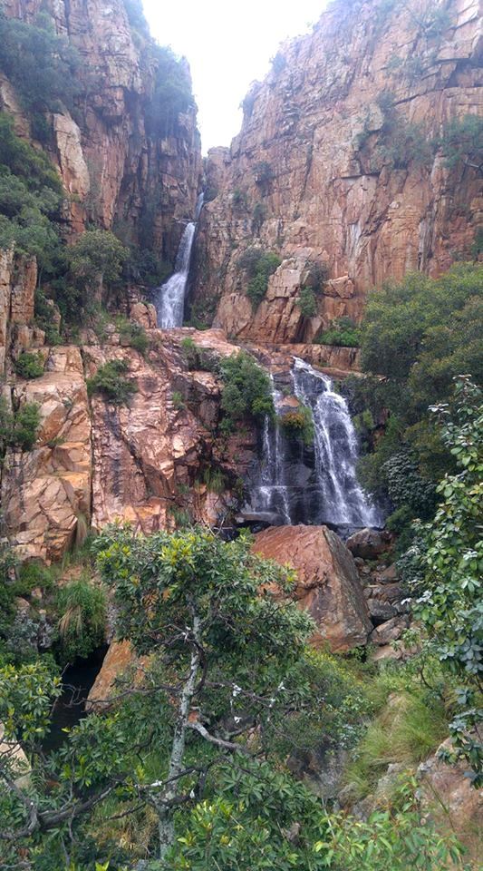
West Pools is the short rock-pool walk in this selection. From the Mountain Sanctuary Park reception or camp area, paths lead through open sandstone country towards stream-fed pools cut into the rock. The walk is short, but the terrain is part of the appeal: pale rock slabs, natural basins, small cascades after rain and classic Magaliesberg vegetation.
This is less a peak-bagging walk than a place-based outing. Most visitors will spend longer at the pools than on the approach, especially in warm weather. The return is normally by the same line, although experienced visitors staying in the park can combine the pools with longer routes such as Perdewater Grotto or other park paths if access rules and conditions allow.
Why it is essential
Mountain Sanctuary Park is one of the Magaliesberg’s signature rock-pool landscapes. Including West Pools balances the harder ridge walks with the relaxed, water-and-sandstone side of the range.
Hazards and notes
- Access rules for day visitors have varied in public sources. Do not publish without a direct confirmation from Mountain Sanctuary Park or its current booking channel.
- The reserve is known for unmarked or lightly marked walking rather than formal painted trail markers.
- Wet rock around the pools can be slippery.
- Avoid jumping into pools unless depth, submerged rocks and local rules are absolutely clear.
- Crowding can be an issue on hot weekends; respect visitor limits and quiet-use rules.
GPX / KML links
| Source | URL | Format / access | Reuse status |
|---|---|---|---|
| AllTrails: West Pools | alltrails.com | Route page | Terms need checking before reuse |
| South African Tourism: Mountain Sanctuary Park | southafrica.net | Destination context | Use for context only |
| Mountain Sanctuary Park / Norflex guide | thenorflexguide.co.za | Access and walking-style context | Use for context; confirm with venue before publication |
External links
- AllTrails — West Pools
- South African Tourism — Mountain Sanctuary Park
- Norflex Guide — Mountain Sanctuary Park
4. Castle Gorge via Maretlwane
Snapshot
Itinerary
Castle Gorge is the wilder kloof objective in this list. Depending on the booking route, hikers approach through Maretlwane or Castle Gorge permit access, crossing open Magaliesberg terrain before entering the more enclosed gorge-and-pool landscape. The appeal is not distance but atmosphere: water-worn rock, steep sides, quiet pools and a more remote feel than the managed day-hike venues.
The route is usually treated as an out-and-back. Navigation can be less obvious than at venues such as Hennops or Rustig, and the exact line depends on the access arrangement supplied with the permit. Some groups turn around at the first major pool objective; others continue further into the gorge. The return follows the same broad route back to the access point.
Why it is essential
Castle Gorge is one of the classic Magaliesberg kloof-and-pool objectives. It gives the article a permit-controlled wilderness walk and adds a very different character from the managed private-farm trails.
Hazards and notes
- The Johannesburg Hiking Club booking page states that hikers must book at least three days in advance and that “No permit means no entry”.
- Castle Gorge is described by the permit issuer as wilderness rather than a formal venue; it requires a good level of fitness.
- Commercial or third-party hiking groups may not be allowed permits under current booking rules.
- Maretlwane states that access to Castle Gorge is one of the most sought-after day walks and limits access to sixteen hikers at any one time.
- The MCSA Castle Gorge page warns that areas above and below the waterfalls are slippery and dangerous, and that accidents have occurred.
- Do not hike alone; this is not the route for first-time Magaliesberg walkers.
GPX / KML links
| Source | URL | Format / access | Reuse status |
|---|---|---|---|
| Johannesburg Hiking Club: Castle Gorge booking | jhbhiking.co.za | Permit and booking source | Use for access and safety notes; maps may be supplied after permit issue |
| Maretlwane Experience | maretlwane.co.za | Access and property context | Use for access context |
| MCSA Magaliesberg: Castle Gorge | magaliesberg.mcsa.org.za | Property, safety and access context | Use for safety and permit notes |
| AllTrails: Castle Gorge via Maretlwane | alltrails.com | Route page | Terms need checking before reuse |
| Trailforks: Castle Gorge / Piranha Pool Hiking Trail | trailforks.com | Route page / possible GPX/KML for users | Terms need checking before reuse |
External links
- Johannesburg Hiking Club — Castle Gorge booking
- Maretlwane Experience
- MCSA — Castle Gorge property
- AllTrails — Castle Gorge via Maretlwane
- Trailforks — Castle Gorge / Piranha Pool
5. Peglarae Trail, Kgaswane Mountain Reserve
Snapshot
Itinerary
The Peglarae Trail is a compact day loop in Kgaswane Mountain Reserve, above Rustenburg. From the visitor centre or trailhead area, the route heads into open reserve terrain and begins climbing through rocky slopes and grassland. The path is generally easier to follow than the wilder Castle Gorge routes, but it is still steep and stony in places.
The high section gives views across the reserve and towards Rustenburg. From there the loop descends gradually through open terrain, crossing tracks or reserve paths before returning to the visitor centre area. Wildlife sightings are possible — the reserve brochure lists abundant antelope and bird life — but the main appeal is the combination of protected-area scenery, rocky Magaliesberg walking and a manageable half-day distance.
Why it is essential
Peglarae gives the selection a public protected-area route on the western, Rustenburg side of the Magaliesberg. It is shorter than Rustig and less logistically complex than Castle Gorge, but it still provides rocky slopes, open views and reserve atmosphere.
Hazards and notes
- The North West Parks brochure describes the Peglarae Trail as approximately 5.5 km over fairly steep and rocky terrain.
- Gate times are listed in the brochure as 07:30–19:00 in summer and 07:30–18:00 in winter, but these should be checked before travel.
- Visitors must stay in designated areas and follow reserve rules.
- Mobile reception may be unreliable in parts of the reserve; the brochure notes no cellphone reception at campsites but reception on the plateau.
- Do not disturb wildlife and do not feed animals.
GPX / KML links
| Source | URL | Format / access | Reuse status |
|---|---|---|---|
| North West Parks Kgaswane brochure | parksnorthwest.co.za | Official reserve brochure | Use for route existence, distance and reserve notes; no GPX found |
| AllTrails: Peglarae Hiking Trail | alltrails.com | Route page | Terms need checking before reuse |
| Ostrich Trails: Peglarae Trail Kgaswane | ostrichtrails.com | Route guide with map and stats | Terms need checking before reuse; useful for comparison |
| SA-Venues: Peglarae Trail | sa-venues.com | Route context | Use as secondary context only |
External links
- North West Parks — Kgaswane brochure (PDF)
- AllTrails — Peglarae Hiking Trail
- Ostrich Trails — Peglarae Trail Kgaswane
- SA-Venues — Peglarae Trail
External links
| Source | URL |
|---|---|
| UNESCO Magaliesberg Biosphere Reserve | unesco.org |
| Magaliesberg Biosphere — hiking trails | magaliesbergbiosphere.org.za |
| Magaliesberg Biosphere — geology and topography | magaliesbergbiosphere.org.za |
| Hennops Hiking Trail | hennopstrails.co.za |
| Rustig — day hikes | rustig.co.za |
| South African Tourism — Mountain Sanctuary Park | southafrica.net |
| Johannesburg Hiking Club — Castle Gorge booking | jhbhiking.co.za |
| Maretlwane Experience | maretlwane.co.za |
| MCSA — Castle Gorge | magaliesberg.mcsa.org.za |
| North West Parks — Kgaswane brochure | parksnorthwest.co.za |