Regional overview
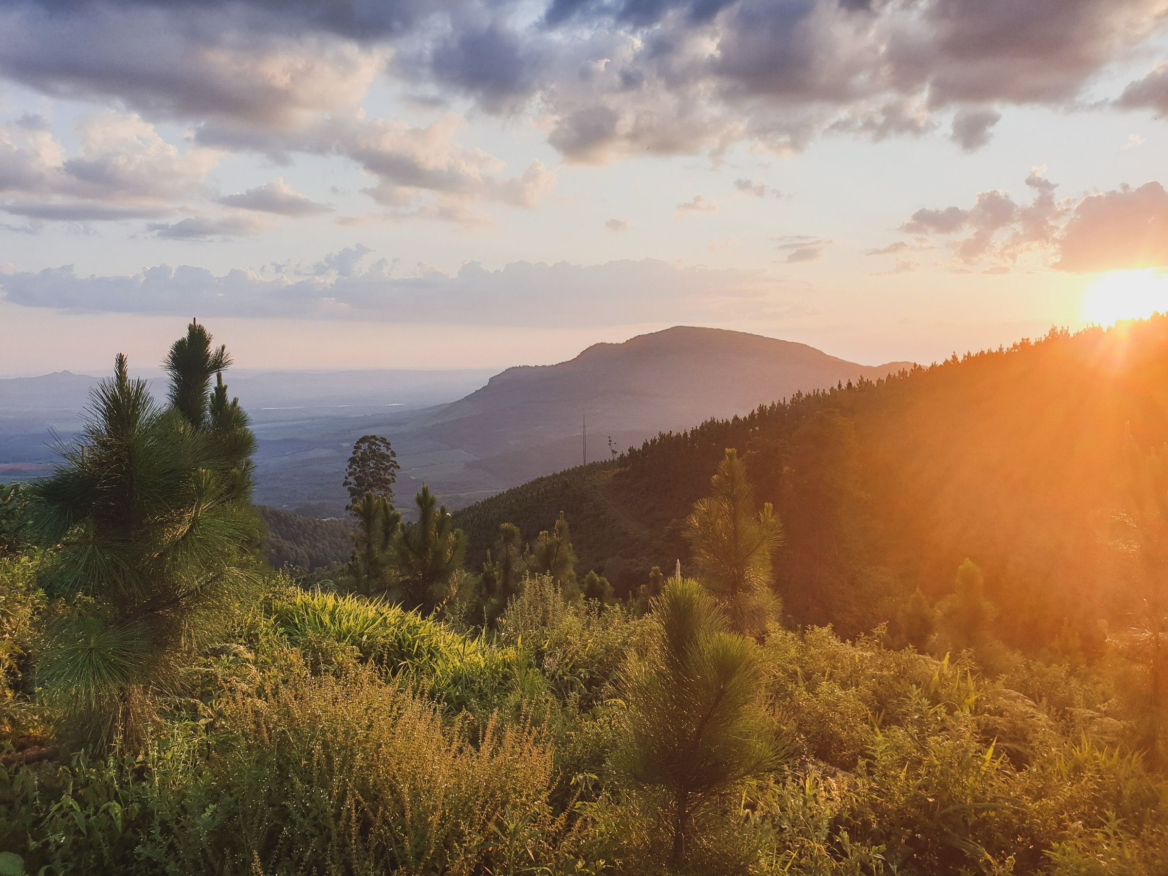
The Soutpansberg is South Africa’s far-northern mountain range: a long, east–west wall across Limpopo where dry bushveld, sandstone and quartzite ridges, mistbelt forest, plantations, waterfalls and Venda cultural landscapes meet. It is a rewarding hiking region, but it is not a simple public-trail destination. Access is split between forestry land, private wilderness properties, lodge trail networks and guided slackpacking routes, so every walk below should be treated as access-dependent until the current operator or authority has confirmed entry, route condition and booking requirements.
The walking here is more humid and forested than in many better-known northern South African ranges. Expect tree ferns, indigenous forest, shaded gullies, plantations, high ridges and wide views towards the Venda valleys, the Limpopo lowlands and, from the higher western range, Botswana and Zimbabwe. Summer can bring heat, ticks, mist, thunderstorms and swollen or unsafe streams. The safer planning window is usually the cooler, drier period from roughly March to October, with early starts still recommended.
This is a deliberately conservative essential day-hikes list. Some classic Soutpansberg routes are historically overnight trails, guided multi-day sections or lodge-only walks. They are included where they make strong day objectives for fit walkers, but the article keeps access and verification limits visible rather than presenting private or semi-private routes as ordinary public trailheads.
Selection rationale
The five entries below cover the strongest currently sourced Soutpansberg hiking themes:
- Hanglip for the central range’s best-known day-hike landmark.
- Entabeni Phadzima View for eastern Soutpansberg forest and valley views.
- Entabeni Redwood Trail and Vera’s Tears for waterfall, forest and plantation walking.
- Old Salt Trail Day 3 via Mt Lajuma for the range high point and the western Soutpansberg’s big-mountain character.
- Leshiba Wilderness walks for self-guided lodge trails, guided rock-art walks and the region’s cultural dimension.
Summary table
| # | Hike | Area | Route type | Distance | Elevation gain | Max elevation | Difficulty |
|---|---|---|---|---|---|---|---|
| 1 | Hanglip Forest Reserve loop | Central Soutpansberg | Loop | 15.6–15.8 km | c. 531 m | c. 1,524 m on route; landmark c. 1,719 m | Moderate |
| 2 | Entabeni Phadzima View Trail | Entabeni State Forest / Levubu side | Loop | c. 16 km; 8–12 km shorter options | TBC | TBC | Moderate to difficult |
| 3 | Entabeni Redwood Trail and Vera’s Tears | Entabeni State Forest | Loop | c. 16 km; 8–12 km shorter options | TBC | TBC | Moderate |
| 4 | Old Salt Trail Day 3: Sigurwana to Lajuma via Mt Lajuma | Western Soutpansberg / Lajuma | Guided point-to-point | 15.1 km | c. 545 m | c. 1,727 m | Very difficult |
| 5 | Leshiba Wilderness rock-art and marked-trails walk | Leshiba Wilderness | Lodge trail / guided walk | 1.5–2.5 hr guided; 10 marked trails on property | TBC | c. 1,200 m plateau context | Easy to moderate |
Before you go
Required equipment
Hanglip and Old Salt Trail / Mt Lajuma (mountain day hikes)
- Hiking boots or grippy trail shoes with good edging on rock.
- At least 2 litres of water per person, more in hot conditions; 2–3 litres on the Lajuma day unless the guide confirms refills.
- Sun protection, insect repellent, light waterproof layer and a warm/windproof layer for misty ridge conditions.
- Offline map or GPS track with battery reserve, headtorch and first-aid kit.
- Trekking poles for the steep, rocky Lajuma descent if comfortable using them.
Entabeni Phadzima View and Redwood Trail (forest day hikes)
- Boots or grippy shoes for wet forest tracks.
- Water for a full day; do not assume stream water is drinkable.
- Insect repellent and tick checks after the walk.
- Offline map, operator map or GPS track.
- Waterproof layer for mist and forest drizzle; basic first-aid kit.
Leshiba Wilderness walks
- Comfortable walking shoes or boots.
- Water, sunhat, sunscreen and insect repellent.
- Small daypack, camera and binoculars.
- Warm layer for early morning walks.
- Follow lodge rules for walking near wildlife and rock-art sites.
Current access and safety notes
- Every walk in this article is access-dependent. Confirm entry, route condition and booking requirements with the current operator or authority before travelling.
- Public GPX availability is weak across the region. Where no reusable route file is available, use only a source link until an original GPX has been created from field survey, operator permission or independently verified coordinates.
- Older Soutpansberg trail notes mention bilharzia concerns in some streams; avoid untreated water unless a current local source confirms it is safe.
- Ticks are a realistic hazard. Use repellent and check clothing after every walk.
- The safer planning window is roughly March–October; summer can bring heat, mist, thunderstorms and swollen or unsafe streams.
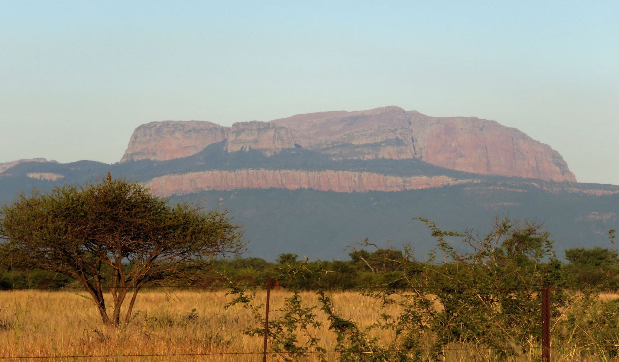
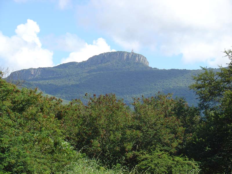
1. Hanglip Forest Reserve loop
Snapshot
Itinerary
Start near the old hiking office in the forestry area outside Louis Trichardt / Makhado and follow the forest and mountain-bike trail network into Hanglip Forest Reserve. The route moves between plantation margins, indigenous forest, shaded stream sections and more open slopes below the distinctive Hanglip landmark.
This is a substantial day hike rather than a casual forest stroll. Start early, carry all water needed for the day unless the current operator confirms safe sources, and keep a GPS/offline map available because older descriptions and modern app-recorded routes do not always refer to exactly the same line.
Why it is essential
Hanglip is one of the most recognisable landmarks in the central Soutpansberg. It also has the clearest modern public statistics among the routes in this selection, making it the strongest publishable Soutpansberg day-loop candidate once current access has been confirmed.
Hazards and notes
- Confirm access, permit requirements and route status before travelling.
- Paths may be wet, eroded, overgrown or poorly signed.
- Ticks are a realistic hazard in the region.
- Older Soutpansberg trail notes mention bilharzia concerns in some streams; avoid untreated water unless a current local source confirms it is safe.
GPX / KML links
| Source | URL | Format / access | Reuse status |
|---|---|---|---|
| First Ascent route note | firstascent.co.za | Stats and coordinate context | No reusable GPX identified |
| AllTrails: Hanglip Forest Reserve | alltrails.com | Source route page | Route-file reuse not confirmed |
| SA-Venues: Hanglip Hiking Trail | sa-venues.com | Context source | Current business details must be verified |
External links
- First Ascent — Hanglip Forest Reserve day hike
- AllTrails — Hanglip Forest Reserve
- SA-Venues — Hanglip Hiking Trail
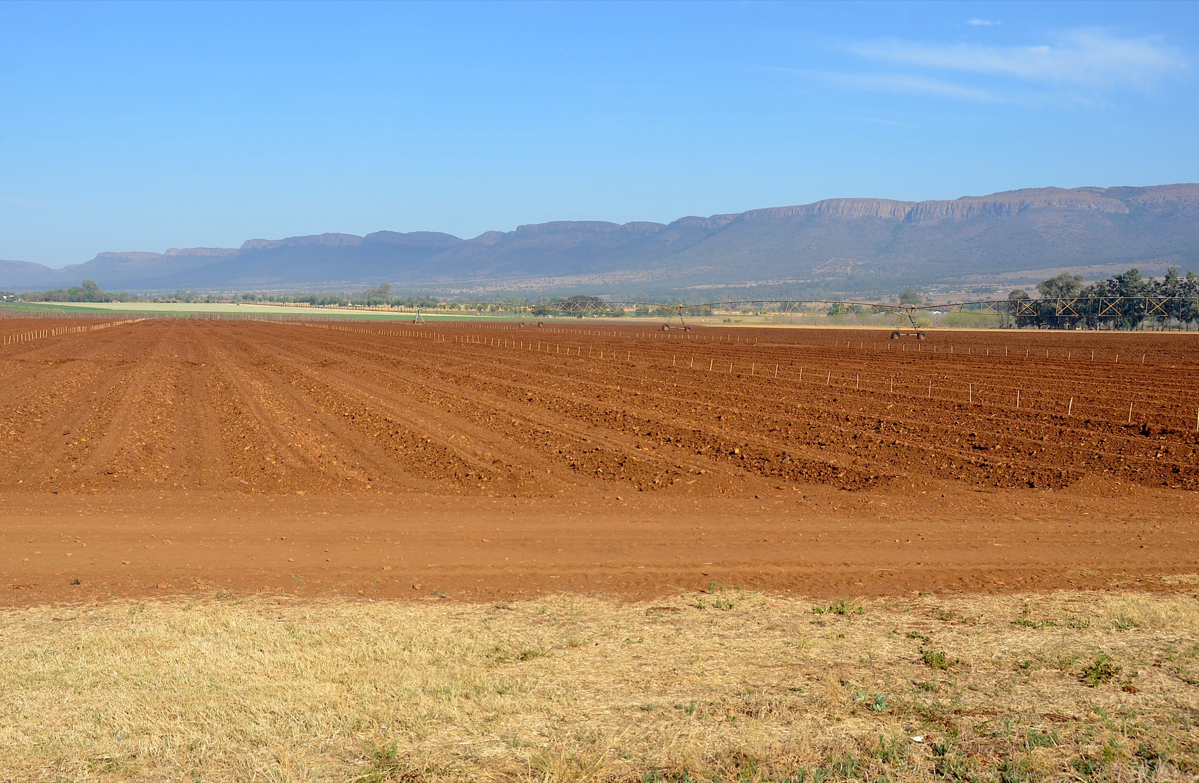
2. Entabeni Phadzima View Trail
Snapshot
Itinerary
From Entabeni Hikers Hut, the Phadzima View Trail heads north through indigenous subtropical forest, passing the small Ebbe Dam before climbing towards views over the Phadzima valley. The route is known for its forest atmosphere, large tree ferns and optional extensions towards Thate-Vondo View and Mathiva Peak for very fit parties.
Because the Entabeni trail system is described as a figure-eight with two roughly 16 km loops, walkers should obtain the current map before publication or use. The shorter options reported within the loops make the route flexible, but only if the junctions are clear and maintained.
Why it is essential
Phadzima View gives the eastern Soutpansberg entry its classic combination of dense forest, tree ferns and valley outlooks. It is the best candidate for showing how different this range feels from the drier bushveld hiking areas further south and west.
Hazards and notes
- Booking and operator details may have changed; verify directly before publication.
- Forest paths can be slippery, muddy or obscured by vegetation.
- The optional high-level additions should be treated as strenuous until the exact current line is confirmed.
- Tick checks after the walk are recommended.
GPX / KML links
| Source | URL | Format / access | Reuse status |
|---|---|---|---|
| SA-Venues: Entabeni Hiking Trail | sa-venues.com | Confirms figure-eight system, route character and booking caveat | No GPX found |
| ShowMe: Entabeni Hiking Trail | showmesa.co.za | Confirms two 16 km loop options and major features | No GPX found |
External links
3. Entabeni Redwood Trail and Vera’s Tears
Snapshot
Itinerary
The Redwood Trail leaves the hut in the opposite direction from the Phadzima View route. It passes through pine plantation and indigenous forest, with large redwoods, fungi-rich woodland sections, Vera’s Tears waterfall and a lookout point. The longer version continues towards Klein Australia View, opening the forest walk into wider views over the Levubu farming country.
This is the more waterfall-and-forest-focused half of the Entabeni figure-eight. It can be presented as a separate day hike only once the current operator map confirms the exact line, junctions and available shorter alternatives.
Why it is essential
Together with Phadzima View, the Redwood Trail is one of Entabeni’s two classic loops. It adds a waterfall, plantation-to-indigenous-forest transitions and a gentler forest character to the Soutpansberg shortlist.
Hazards and notes
- Wet rock near the waterfall may be slippery.
- Streams should not be treated as safe drinking water without current local confirmation.
- Route maintenance and booking status require direct confirmation.
GPX / KML links
| Source | URL | Format / access | Reuse status |
|---|---|---|---|
| SA-Venues: Entabeni Hiking Trail | sa-venues.com | Confirms Redwood Trail character, Vera’s Tears and Klein Australia View | No GPX found |
| ShowMe: Entabeni Hiking Trail | showmesa.co.za | Confirms Redwood forest, fungi, waterfall and lookout features | No GPX found |
External links
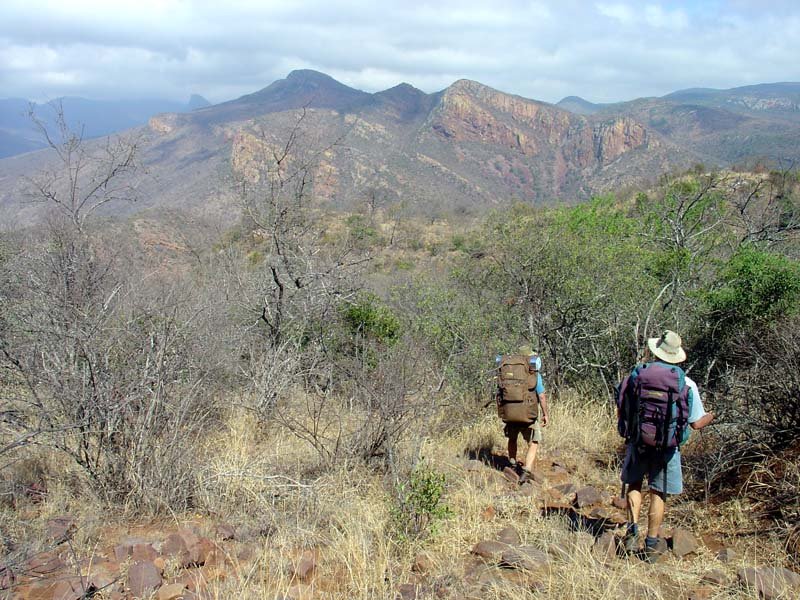
4. Old Salt Trail Day 3: Sigurwana to Lajuma via Mt Lajuma
Snapshot
Itinerary
This is the high-point day of the Old Salt Trail. From Sigurwana Lodge the route heads towards a rocky cliff and forested waterfall area, then climbs to a ridge with a mix of open grassland, rocky outcrops and small forest patches. The approach to Mt Lajuma uses jeep tracks and single-track sections before the final climb to the saddle and summit area.
The descent retraces to the saddle, then drops steeply and rockily towards the open grassy area known as “The Patches” before continuing through forest and road sections to Lajuma Wilderness Camp. Short scrambling, rough rock and exposed-feeling moves are part of the source description, so this should be described as a guided mountain day for experienced hikers rather than a general walking route.
Why it is essential
Mt Lajuma is the strongest summit objective in the Soutpansberg selection. It gives the article a proper high-level mountain day, with big views across the Limpopo Valley and the western range, while also connecting the hiking story to the Old Salt Trail’s guided conservation and cultural landscape.
Hazards and notes
- The operator describes this section as very difficult and recommends high fitness and hiking experience.
- Scrambling, awkward rocky moves and a steep rocky descent are part of the route.
- Treat this as a guided product unless the relevant landowners / operators explicitly approve an independent day itinerary.
GPX / KML links
| Source | URL | Format / access | Reuse status |
|---|---|---|---|
| Fagala Voet: The Old Salt Trail | fagalavoet.co.za | Confirms 15.1 km Day 3, c. 545 m gain and route character | No reusable GPX identified |
| Endangered Wildlife Trust: Old Salt Trail | ewt.org | Regional / context source for the full trail | No GPX identified |
External links
5. Leshiba Wilderness rock-art and marked-trails walk
Snapshot
Itinerary
Leshiba should be treated as a lodge-based walking destination, not as a public trailhead. The official guest information describes guided walks, specialised walks integrating tracking, birding, medicinal plants, trees and archaeology, and 10 well-marked hiking trails that guests may walk without a guide. It also notes seven San Bushman rock-art sites that can be visited on guided walks.
A flexible lodge-walk entry is the safest published version: a guided rock-art walk for cultural context, or a self-guided marked trail chosen on arrival with the lodge team.
Why it is essential
A Soutpansberg guide should not be only about distance and elevation. Leshiba brings the range’s rock art, Venda cultural landscape, wildlife walking and lodge-based self-guided trail network into the article. It is access-restricted, but it fills a theme that the other four entries do not.
Hazards and notes
- Leshiba states that it does not allow day visitors and has a two-night minimum stay.
- The official guest pack notes limited mobile reception and no municipal electricity.
- The last 3 km approach is a steep mountain road; a high-clearance vehicle or arranged transfer may be needed.
- Rock-art access should be guided unless the lodge explicitly says otherwise.
GPX / KML links
| Source | URL | Format / access | Reuse status |
|---|---|---|---|
| Leshiba official site | leshiba.co.za | Confirms guest-only / no-day-visitor access policy and activity context | No route file |
| Leshiba Guest Information Pack | leshiba.co.za | Confirms guided walks, 10 marked trails, rock-art sites and logistical notes | No route file |
External links
External links
| Source | URL |
|---|---|
| First Ascent — Hanglip Forest Reserve day hike | firstascent.co.za |
| AllTrails — Hanglip Forest Reserve | alltrails.com |
| SA-Venues — Entabeni Hiking Trail | sa-venues.com |
| ShowMe — Entabeni Hiking Trail | showmesa.co.za |
| Fagala Voet — The Old Salt Trail | fagalavoet.co.za |
| Endangered Wildlife Trust — Old Salt Trail Soutpansberg | ewt.org |
| Leshiba Wilderness | leshiba.co.za |
| Leshiba Guest Information Pack 2025 (PDF) | leshiba.co.za |