Regional overview
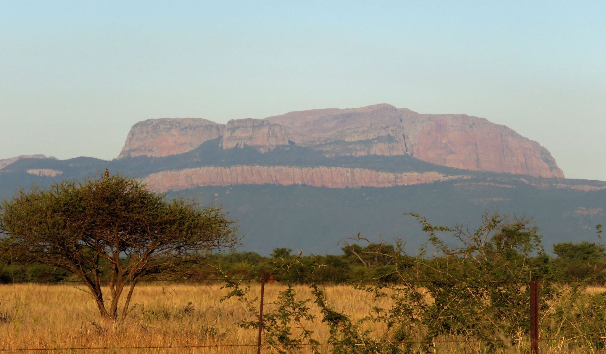
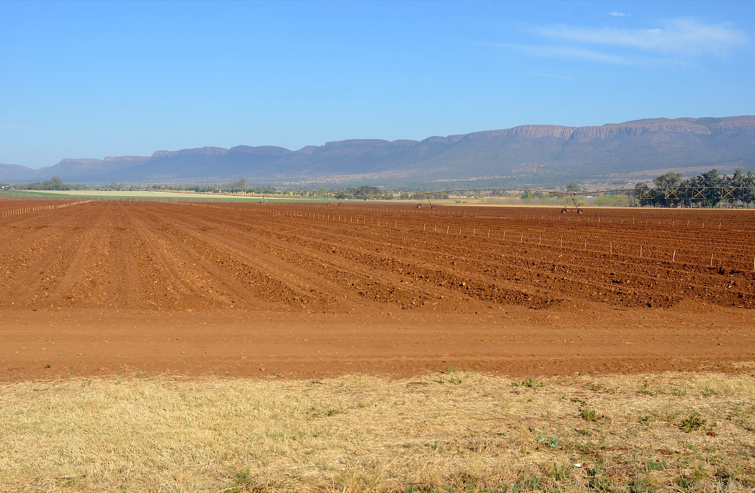
The Sneeuberg is the high Karoo mountain country around Compassberg, Nieu-Bethesda, Graaff-Reinet / Camdeboo and the Bankberg-Mountain Zebra area. It is part of South Africa’s Great Escarpment but has a very different hiking character from the wetter Drakensberg and Limpopo escarpments: open grassland, dolerite ridges, big-sky plateaus, dry valleys, Karoo shrub, deep heat, sharp cold and long access roads.
The region’s essential day walks are split between three kinds of access. Compassberg and Sneeuberg Nature Reserve are private or access-managed high-country routes. Camdeboo National Park gives the best public SANParks walking options near Graaff-Reinet, including the long Eerstefontein Day Walk and the short but famous Valley of Desolation / Crag Lizard viewpoint trail. Mountain Zebra National Park adds guided walking on Salpeterkop, with wildlife and Anglo-Boer War history.
This article keeps the entries source-led. Several obvious Sneeuberg objectives have limited public route data, so route-file and access gaps are marked clearly rather than filled in from inference.
Selection rationale
This five-route set represents the Sneeuberg without straying into unrelated mountain regions:
- Compassberg Summit — the iconic high point of the Sneeuberg and wider Karoo escarpment.
- Sneeuberg Nature Reserve: Gordonville to Kliphuis — a published high-country day section through private reserve grassland and river country.
- Eerstefontein Day Walk — the main longer SANParks day walk in Camdeboo National Park.
- Crag Lizard / Valley of Desolation Trail — short, but the most famous viewpoint walk in the Camdeboo-Sneeuberg setting.
- Salpeterkop Hike — Mountain Zebra National Park’s guided summit / war-relic hike.
Before you go
Current access and safety notes
- Confirm permission and access. Compassberg requires landowner permission; Sneeuberg Nature Reserve routes are for guests or guided/arranged groups; Mountain Zebra guided hikes must be booked through SANParks.
- Expect exposed weather. The same route can produce intense heat, freezing wind, snow or lightning depending on season and altitude.
- Carry more water than the distance suggests. Some route descriptions explicitly state that there is no water on the mountain.
- Use offline navigation. Some private high-country routes are poorly marked, partly on jeep track, partly on veld, and not supported by public GPX files.
- In national parks, respect wildlife rules and stay on approved walking routes or with the official guide.
Summary table
| # | Hike | Area | Route type | Distance | Elevation gain | Max elevation | Estimated time | Difficulty |
|---|---|---|---|---|---|---|---|---|
| 1 | Compassberg Summit | Compassberg / Nieu-Bethesda | Out-and-back summit hike | Official distance unresolved; driven-trailhead variant recorded by MCSA at 4.46 km; farmstead approach includes about 6 km jeep track each way | About 805 m from Sneeuberg source (c. 1,700 m to 2,505 m); exact gain by start point varies | 2,502-2,505 m | 8 hr return from Nieu-Bethesda / Sneeuberg sources; shorter from driven trailhead in MCSA report | Moderate to difficult / hard |
| 2 | Sneeuberg Nature Reserve: Gordonville to Kliphuis | Sneeuberg Nature Reserve | Point-to-point guided / arranged day section | 16 km official brochure | 460 m official brochure | Route max unresolved; reserve map shows nearby high points over 2,000 m | Full day; exact walking time not separately published | Moderate to hard |
| 3 | Eerstefontein Day Walk | Camdeboo National Park | Loop with 5, 11 and 14 km options | 14 km official long option; 14.5 km AllTrails | 435 m secondary source | 998 m secondary source | 4-4.5 hr secondary source | Moderate |
| 4 | Crag Lizard / Valley of Desolation Trail | Camdeboo National Park | Loop / viewpoint trail | 1.5 km official; 1.9 km AllTrails recorded loop | 54 m secondary source | 1,392 m secondary source | 45 min official | Easy to moderate; cliff-edge caution |
| 5 | Salpeterkop Hike | Mountain Zebra National Park | Guided summit loop / hike | 5.0 km secondary source | 377 m secondary source | 1,509 m secondary source | SANParks guided time window about 6 hr; AllTrails moving estimate 2-2.5 hr | Hard / challenging |
1. Compassberg Summit
Snapshot
Itinerary
Compassberg is the Sneeuberg’s defining summit. Nieu-Bethesda’s local route page describes it as the highest peak in the Sneeuberg range and one of the highest free-standing peaks in southern Africa, with the climb taking about 4 hours each way from Compassberg Farmstead. The same source says permission is needed from the landowners and that the farm is about an hour from Nieu-Bethesda on gravel roads.
The walking line is described as following a jeep track for about 6 km from the farmstead to the foot of the mountain, then climbing straight up a gully to a ledge, where cairns indicate the way to the summit. The route is exposed and poorly marked, with no water on the mountain and a final scrambling section. A Mountain Club of South Africa South Cape report confirms the access-sensitive nature of the route and records a shorter driven-trailhead ascent of 4.46 km total, after a long rough drive beyond the office/reception.
Why it is essential
Compassberg is the iconic high point of the Sneeuberg. It is the route that best represents the region’s high, exposed Karoo escarpment walking and long summit views.
Hazards and notes
No water on the mountain, poor marking, exposure to wind, lightning and winter cold, rough access road, possible scrambling near the top, private-land permission requirements and long rescue times. Do not attempt in bad weather.
GPX / KML links
| Source | URL | Format / access | Reuse status |
|---|---|---|---|
| Nieu-Bethesda: Compassberg Climb | nieu-bethesda.com | Source route description; page links to a downloadable map | Website terms not assessed; map-file terms unresolved; best route-description source, no reusable GPX verified |
| Sneeuberg Nature Reserve activities page | sneeuberg.com | Private reserve activity source | Website terms not assessed; confirms Compassberg as an 8-hour hike for fit guests, no GPX |
| MCSA South Cape meet report | southcape.mcsa.org.za | Club trip report | Club website terms not assessed; useful access/statistics cross-check only |
External links
- Nieu-Bethesda — Compassberg Climb
- Sneeuberg Nature Reserve — Activities
- MCSA South Cape — Compassberg & Murch Point report
2. Sneeuberg Nature Reserve: Gordonville to Kliphuis
Snapshot
Itinerary
Sneeuberg Nature Reserve publishes a three-day, 50 km guided hiking product across its private high-altitude grasslands. The first day is a 16 km section from Gordonville to Kliphuis with 460 m of ascent and 695 m of descent. The brochure describes a vantage point over Renosterberg, rock formations, grassy plateau, a lunch spot above the river, river walking through poplar forest and a dam-view finish with arranged transport.
This entry treats that first day as the strongest single-day section of the published Sneeuberg Hiking Trail product. It should not be rewritten as a public self-guided route unless the reserve confirms that day use, access, guiding and transport are available.
Why it is essential
This route represents the private-reserve high-country character of the Sneeuberg: open escarpment grassland, igneous rock formations, riverine corridors, farm history and big Karoo views.
Hazards and notes
Private access, guide/booking requirements, point-to-point transport logistics, exposed high ground, heat, cold, river sections and limited public route data. Follow the operator’s instructions rather than third-party route guesses.
GPX / KML links
| Source | URL | Format / access | Reuse status |
|---|---|---|---|
| Sneeuberg Hiking Trail brochure | b-cdn.springnest.com | Official/host brochure with section distances and elevation | Brochure terms not assessed; best source for day-section stats, no GPX |
| Sneeuberg reserve map | sneeuberg.com | Reserve map PDF | Map copyright shown as CABEX Maps; reuse not cleared; useful orientation source only, do not reuse cartography without permission |
| Sneeuberg Nature Reserve activities page | sneeuberg.com | Activity page | Website terms not assessed; confirms reserve hiking context, no GPX |
External links
- Sneeuberg Nature Reserve — Activities
- Sneeuberg Hiking Trail brochure (PDF)
- Sneeuberg reserve map (PDF)
3. Eerstefontein Day Walk
Snapshot
Itinerary
SANParks lists the Eerstefontein Day Walk as starting and ending at Spandaukop gate, with three route options of 5 km, 11 km and 14 km and rest spots at Eerstefontein and Agtersfontein. The AllTrails long-loop record describes a 14.5 km loop near Graaff-Reinet, with about 435 m of elevation gain and an average time of 4-4.5 hours.
This is the most substantial publicly documented day walk in Camdeboo National Park. Expect rocky Karoo walking, wildlife, open sun and long views rather than a shaded mountain trail.
Why it is essential
Eerstefontein gives the Sneeuberg article its best official longer day walk. It is public and more of a true hike than the short Valley of Desolation viewpoint circuit.
Hazards and notes
Heat, exposed walking, rocky or overgrown sections, wildlife area rules, possible weak phone signal and park access hours. Check gate times and conservation-fee requirements before starting.
GPX / KML links
| Source | URL | Format / access | Reuse status |
|---|---|---|---|
| SANParks: Camdeboo Hikes, Walks & Trails | sanparks.org | Official route description | SANParks terms not assessed; best official source, no GPX |
| Camdeboo Visitors Map PDF | sanparks.org | Official visitor map PDF | SANParks terms not assessed; useful source map, do not reuse cartography without clearance |
| AllTrails: Eerstefontein Trail | alltrails.com | Route page / app source route | AllTrails terms apply; direct GPX reuse not confirmed; useful for ascent/max elevation and route reconstruction, reusable GPX unresolved |
External links
- SANParks — Camdeboo Hikes, Walks & Trails
- SANParks — Camdeboo Visitors Map (PDF)
- AllTrails — Eerstefontein Trail
4. Crag Lizard / Valley of Desolation Trail
Snapshot
Itinerary
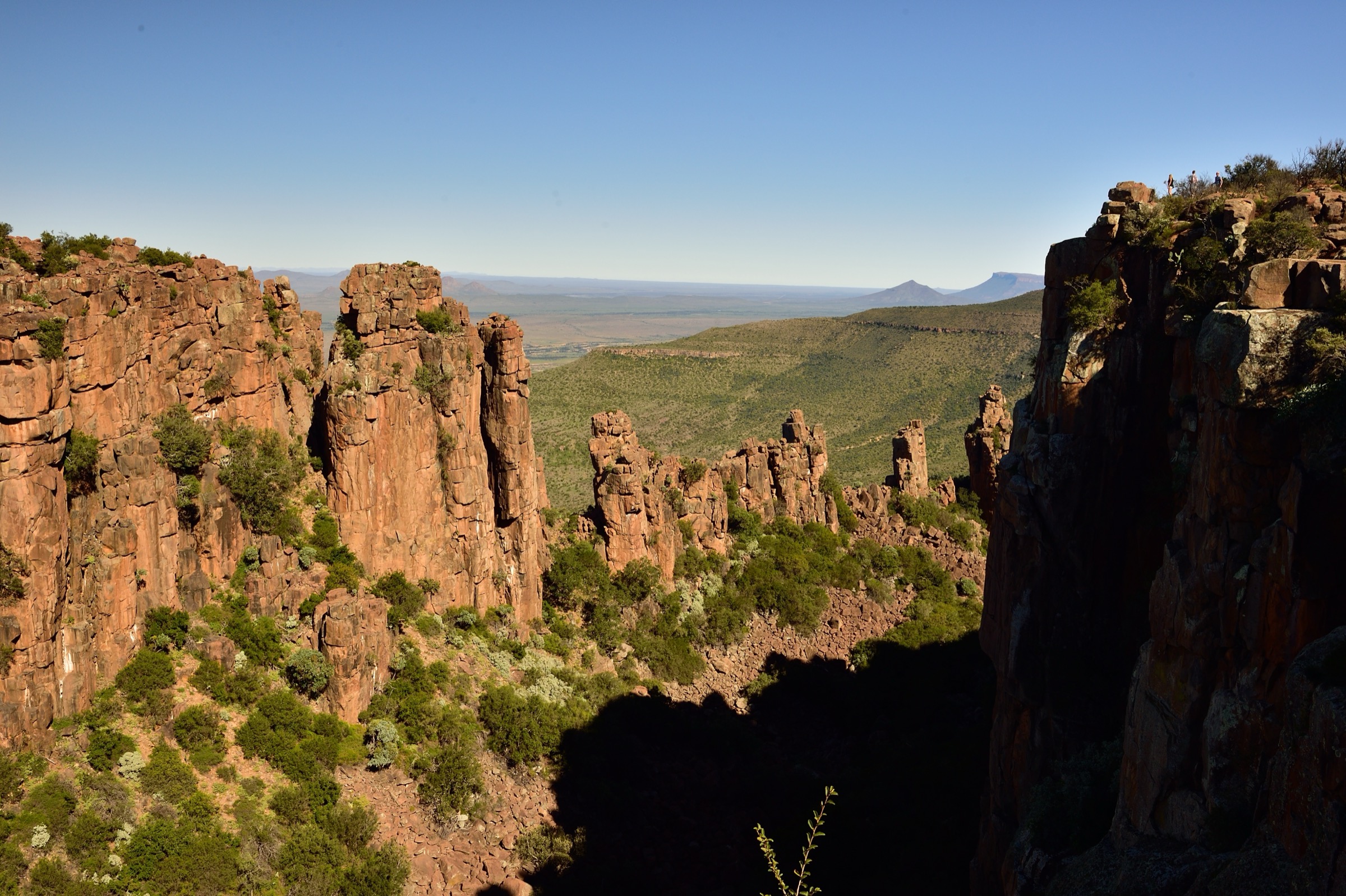
The Crag Lizard Trail starts at the Valley parking area and runs for about 1.5 km via the Valley of Desolation viewpoints. SANParks lists it as a 45-minute marked trail. Although it is short, it is the iconic walk in Camdeboo: dolerite columns, escarpment-edge views, Spandaukop and the broad Karoo below.
Wikiloc and AllTrails both record slightly longer loop variants around the viewpoints, with low ascent but exposed cliff-edge terrain. The Wikiloc route notes that some drops are severe and that wet, windy or stormy conditions require extra caution.
Why it is essential
The Valley of Desolation is the most famous landscape in the Camdeboo-Sneeuberg area. A Sneeuberg article without this walk would miss the region’s most recognisable viewpoint, even though the route is much shorter than a typical full day hike.
Hazards and notes
Cliff exposure, heat, lightning, wind, snakes, uneven rock and tourist traffic. The short distance should not make walkers casual around the drop-offs.
GPX / KML links
| Source | URL | Format / access | Reuse status |
|---|---|---|---|
| SANParks: Camdeboo Hikes, Walks & Trails | sanparks.org | Official route description | SANParks terms not assessed; best official source, no GPX |
| AllTrails: Valley of Desolation Trail | alltrails.com | Route page / app source route | AllTrails terms apply; direct GPX reuse not confirmed; useful for secondary statistics, reusable GPX unresolved |
| Wikiloc: East Cape Crag Lizard Trail | wikiloc.com | Route page with download/send-to-GPS functionality | Wikiloc terms apply; download may require account; source route found, coordinate reuse/licensing unresolved |
| Crag Lizard Trail Map image on Commons | commons.wikimedia.org | Photo of route map / information board | CC BY-SA 2.0 for photo; underlying map rights not independently assessed; useful visual cross-check, do not reuse as a clean map without checking underlying rights |
External links
- SANParks — Camdeboo Hikes, Walks & Trails
- AllTrails — Valley of Desolation Trail
- Wikiloc — East Cape Crag Lizard Trail
5. Salpeterkop Hike
Snapshot
Itinerary
SANParks lists Salpeterkop as a guided hike in Mountain Zebra National Park, ascending the mountain for a view over the park and a rare Anglo-Boer War relic. The official activity notes require booking, neutral-coloured clothing, walking shoes, water and a small snack, and warn that participants should be fairly fit and prepared for a challenging climb.
AllTrails records a 5.0 km loop with about 377 m of gain and a hard rating. It also describes the summit’s Anglo-Boer War chess-board relic, associated with British troops who used the mountain as a lookout post.
Why it is essential
Salpeterkop adds the Mountain Zebra / Bankberg side of the Sneeuberg region: guided walking among Karoo wildlife, a prominent summit and a distinctive war-history objective.
Hazards and notes
Guided-only activity context, challenging climb, heat, wildlife rules, weather cancellations, age/medical restrictions and park booking requirements. Do not attempt independently unless SANParks explicitly permits it.
GPX / KML links
| Source | URL | Format / access | Reuse status |
|---|---|---|---|
| SANParks: Mountain Zebra Hikes, Walks & Trails | sanparks.org | Official guided activity source | SANParks terms not assessed; best official source, no GPX |
| Mountain Zebra Visitors Map PDF | sanparks.org | Official visitor map PDF | SANParks terms not assessed; useful source map, do not reuse cartography without clearance |
| AllTrails: Salpeterkop Trail | alltrails.com | Route page / app source route | AllTrails terms apply; direct GPX reuse not confirmed; useful for secondary statistics, reusable GPX unresolved |
External links
- SANParks — Mountain Zebra Hikes, Walks & Trails
- SANParks — Mountain Zebra Visitors Map (PDF)
- AllTrails — Salpeterkop Trail
External links
| Source | URL |
|---|---|
| Nieu-Bethesda — Compassberg Climb | nieu-bethesda.com |
| Sneeuberg Nature Reserve — Activities | sneeuberg.com |
| Sneeuberg Hiking Trail brochure (PDF) | b-cdn.springnest.com |
| Sneeuberg reserve map (PDF) | sneeuberg.com |
| SANParks — Camdeboo Hikes, Walks & Trails | sanparks.org |
| SANParks — Camdeboo Visitors Map (PDF) | sanparks.org |
| SANParks — Mountain Zebra Hikes, Walks & Trails | sanparks.org |
| SANParks — Mountain Zebra Visitors Map (PDF) | sanparks.org |
| MCSA South Cape — Compassberg & Murch Point report | southcape.mcsa.org.za |
| AllTrails — Eerstefontein Trail | alltrails.com |
| AllTrails — Valley of Desolation Trail | alltrails.com |
| AllTrails — Salpeterkop Trail | alltrails.com |
| Wikiloc — East Cape Crag Lizard Trail | wikiloc.com |