Regional overview
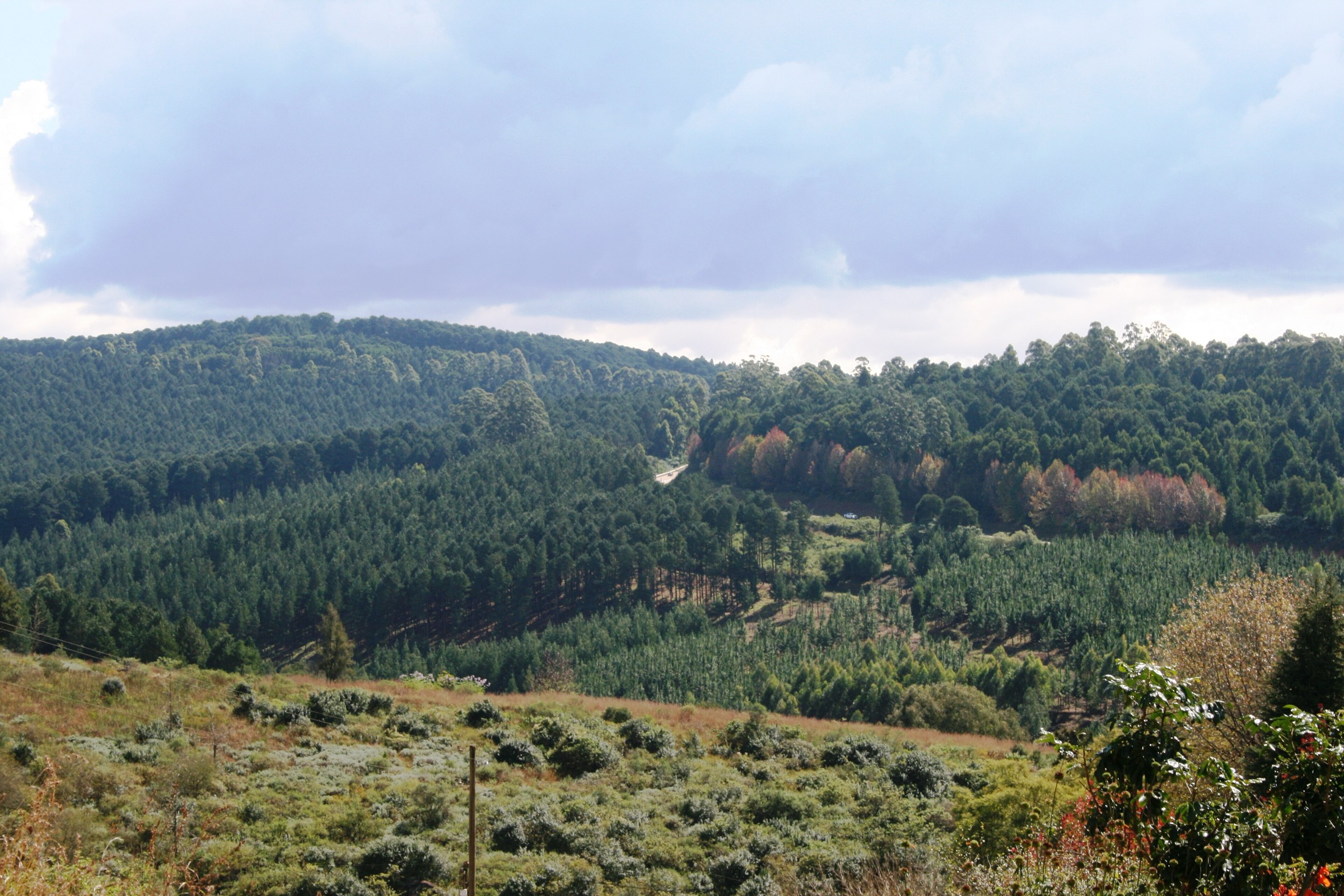
The Limpopo Escarpment entry is centred on the Magoebaskloof, Haenertsburg, Woodbush and Wolkberg edge of the Great Escarpment in Limpopo. Local tourism describes Magoebaskloof and Haenertsburg as lying at the north-eastern tip of the Drakensberg, with mistbelt forest, high grassland, waterfalls, deep kloofs, plantations, the Great Letaba catchment and the Iron Crown above Haenertsburg.
The walking character is wetter, greener and more access-sensitive than many South African escarpment areas. Trails often pass through state forest, private farms, village commons or conservancy land rather than a single national-park trail network. Expect slippery forest paths, mist, summer rain, steep short climbs, stream crossings, forestry roads and occasional route ambiguity.
The Wolkberg Wilderness is important to the region, but official/local tourism guidance states that there are no formal trails there and that hiking should be undertaken only by experienced hikers. For that reason, this pass does not force Serala Peak or a Wolkberg no-path route into the essential day-hike list.
Before you go
- Confirm access, permits and parking with the current operator before travelling. SAFCOL, Magoebaskloof Hotel, local tourism operators and private landowners each control different routes.
- Carry offline navigation. Forest trails can be well marked in places but still confusing where forestry roads, hotel paths and old tracks meet.
- Wet forest rock, roots and clay can be slippery even on short routes.
- Summer brings rain, mist and thunderstorms; winter and autumn are usually clearer and cooler, but nights can be cold.
- Do not treat the Wolkberg Wilderness as a casual waymarked hiking area. If entering that wilderness area, arrange experienced local guidance and current access permission.
Selection rationale
This five-hike set balances the region’s essentials without inventing unsupported routes:
- Summit Iron Crown - the iconic Limpopo high point above Haenertsburg.
- Louis Changuion Hiking Trail - the best documented village grassland / forest loop.
- Magoebaskloof Hiking Trail forest day section - the classic SAFCOL forest-and-waterfall trail system represented as a one-day section.
- Debegeni Falls walk - the region’s best-known waterfall walk, with official attraction context and secondary route statistics.
- Lesodi / Swartbos Trail - the accessible mistbelt forest loop near Magoebaskloof Hotel.
Data confidence
| Status | Meaning |
|---|---|
| Official route verified | Route existence, distance or route options are supported by an official or local tourism source. |
| Secondary route-stat verified | Ascent, max elevation or exact GPX-style distance comes from AllTrails, Trailforks, Wikiloc or another public route database rather than the official operator. |
| Access-sensitive | The route may be on private, state-forest or operator-managed land; current permission must be confirmed. |
| Route-file unresolved | A source-map or route page was found, but reusable GPX/KML rights were not confirmed. |
Summary table
| # | Hike | Area | Type | Distance | Elevation gain | Max elevation | Time | Difficulty | Verification status |
|---|---|---|---|---|---|---|---|---|---|
| 1 | Summit Iron Crown | Iron Crown / Wolkberg above Haenertsburg | Out-and-back summit hike | 9.5 km secondary source | 850 m secondary source | 2,117 m secondary route max; regional sources give Iron Crown about 2,126 m | 5-5.5 hr secondary source | Hard | Regional high-point context verified; route stats secondary |
| 2 | Louis Changuion Hiking Trail | Haenertsburg Grassland Nature Reserve | Loop | 10 km official; 9.7 km secondary source | 312 m secondary source | 1,545 m secondary source | 4-5 hr official; 3-3.5 hr secondary source | Moderate | Official route verified |
| 3 | Magoebaskloof Hiking Trail forest day section | SAFCOL Magoebaskloof / Woodbush trail system | Point-to-point hut-to-hut day section | 12.3 km official Woodbush-Waterfall section; 12.9 km secondary source route | 271 m secondary source for public route variant | 1,680 m secondary source | 4-4.5 hr secondary source | Moderate | Official trail system verified; exact day-section line needs operator confirmation |
| 4 | Debegeni Falls walk | Debegeni Falls / Ramadipha River | Out-and-back waterfall walk | 4.3 km secondary source | 147 m secondary source | 1,108 m secondary source | 1-1.5 hr secondary source | Moderate | Official waterfall context verified; route stats secondary |
| 5 | Lesodi / Swartbos Trail | Swartbos Forest / Magoebaskloof Hotel | Loop | 3.7 km secondary source; about 4 km local tourism birding source | 108 m secondary source | 1,439 m secondary source | 1-1.5 hr secondary source | Moderate | Official tourism trail and map verified |
1. Summit Iron Crown
Snapshot
Itinerary
Iron Crown is the region’s obvious high-point objective. It rises above Haenertsburg and is described by Magoebaskloof Tourism as the highest point in Limpopo, within the Wolkberg high plateau that reaches about 2,126 m. The public AllTrails route is a hard 9.5 km out-and-back with about 850 m of climbing and an estimated 5-5.5 hours.
The route should be treated as a strenuous mountain day rather than a casual village walk. Expect steep climbing, exposed grassland or ridge terrain, possible rough track, mist and rapid weather changes. Because the official tourism sources verify the mountain but not a public turn-by-turn trailhead, the final guidebook route should not be published without current local access confirmation.
Why it is essential
Iron Crown is the signature summit of the Limpopo Escarpment around Haenertsburg and Magoebaskloof. It gives the catalogue a true high-point objective, balancing the forest and waterfall walks below.
Equipment
Boots or sturdy trail shoes, warm/windproof layer, rain shell, sun protection, 2-3 litres of water, food, offline map/GPS, first-aid kit and headtorch. Trekking poles are useful on steep grass and loose ground.
Hazards and notes
High exposure to weather, steep ascent, mist, navigation uncertainty, possible private/state-land access rules and limited water. Do not attempt in lightning, very poor visibility or without confirmed access.
Photos
| Image | Image URL | Source page URL | Author | Licence | Reuse notes | Attribution | Verification status |
|---|---|---|---|---|---|---|---|
| Magoebaskloof, Limpopo, South Africa | commons.wikimedia.org | commons.wikimedia.org | South African Tourism | CC BY 2.0 | Commercial reuse and modification appear allowed with attribution; region-level, not summit-specific | South African Tourism, CC BY 2.0, via Wikimedia Commons | Verified open-licence region image |
GPX / KML links
| Source | URL | Format | Licence / terms | Reuse status |
|---|---|---|---|---|
| AllTrails: Summit Iron Crown | alltrails.com | Route page / app source route | AllTrails terms apply; direct GPX reuse not confirmed | Useful for statistics and later manual route reconstruction; reusable GPX unresolved |
| Magoebaskloof Tourism: About the area | magoebasklooftourism.co.za | Regional tourism source | Website terms not assessed | Verifies Iron Crown / Wolkberg context, not a GPX |
External links
2. Louis Changuion Hiking Trail
Snapshot
Itinerary
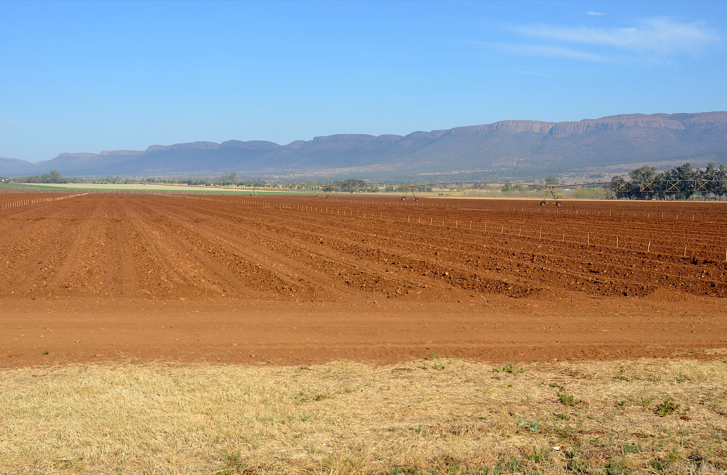
The Louis Changuion Trail is the best documented village-based hike in the Limpopo Escarpment. It starts and ends in Haenertsburg and loops through the Haenertsburg Grassland Nature Reserve, with rare Woodbush Granite Grasslands, patches of indigenous forest, streams, long views and a greenstone “rhino rubbing rock” described by local tourism.
The route is waymarked with a 10 km yellow-footprint option and a shorter 5 km white-footprint option. The trail-board image on Wikimedia Commons states that the circular route starts beside the village hall in Rissik Street, where parking is available, and takes about 4-5 hours.
Why it is essential
This is the catalogue’s grassland, village and natural-history route. It is shorter and more accessible than Iron Crown or the Magoebaskloof hut sections, but it represents a threatened highland grassland habitat that is central to Haenertsburg’s identity.
Equipment
Trail shoes or light boots, water, sun protection, rain shell in wet season, and a local map or GPS track. Stay on the marked trail to reduce erosion and avoid getting lost.
Hazards and notes
Slippery grass and forest sections when wet, grassland fire risk, exposed sun, possible route confusion at shortcuts, and conservation restrictions. Local signage asks walkers not to smoke, light fires, remove plants, damage wildlife or leave litter.
Photos
| Image | Image URL | Source page URL | Author | Licence | Reuse notes | Attribution | Verification status |
|---|---|---|---|---|---|---|---|
| Louis Changuion hiking trail, starting point | commons.wikimedia.org | commons.wikimedia.org | JMK | CC BY-SA 4.0 | Commercial reuse appears allowed with attribution and share-alike; modification allowed under same/compatible licence | JMK, CC BY-SA 4.0, via Wikimedia Commons | Verified route-specific open image |
| Magoebaskloof, Limpopo, South Africa | commons.wikimedia.org | commons.wikimedia.org | South African Tourism | CC BY 2.0 | Region-level image; commercial reuse and modification appear allowed with attribution | South African Tourism, CC BY 2.0, via Wikimedia Commons | Verified open-licence region image |
GPX / KML links
| Source | URL | Format | Licence / terms | Reuse status |
|---|---|---|---|---|
| AllTrails: Louis Changuion Hiking Trail | alltrails.com | Route page / app source route | AllTrails terms apply; direct GPX reuse not confirmed | Useful for statistics; reusable GPX unresolved |
| Trailforks: Louis Changuoin Hiking Trail | trailforks.com | Route page | Trailforks terms apply; download rights not assessed | Secondary route-source candidate |
| Magoebaskloof Tourism route page | magoebasklooftourism.co.za | Official/local tourism description | Website terms not assessed | Best public source for official distance, waymarking and route character; no GPX found |
External links
- Magoebaskloof Tourism Association — Louis Changuion Trail
- Magoebaskloof Tourism Association — Hiking
- AllTrails — Louis Changuion Hiking Trail
- Trailforks — Louis Changuoin Hiking Trail
3. Magoebaskloof Hiking Trail forest day section
Snapshot
Itinerary
SAFCOL describes the Magoebaskloof Hiking Trail as a 2-5 night system near Tzaneen, with route options from 20.5 km to 60.4 km. A Trail Options PDF lists several hut-to-hut stages that can be interpreted as day sections; the Woodbush Hut to Waterfall Hut leg is given as 12.3 km on one two-night option and 13.8-15 km in some longer options, depending on the chosen itinerary.
For a day-hike catalogue, this entry treats the forest trail as a one-day point-to-point section rather than the full multi-day trail. The public AllTrails Magoebaskloof Hiking Trail route gives a similar-length 12.9 km point-to-point walk with forest, rivers, waterfalls and wildlife.
Why it is essential
The Magoebaskloof Hiking Trail is the classic forest hiking system of the Limpopo Escarpment. A carefully selected day section gives the catalogue a proper immersion in indigenous forest, streams, ravines and waterfalls without presenting the full multi-day trail as a day hike.
Equipment
Boots or grippy trail shoes, rain shell, warm layer, food, 2 litres of water, offline map/GPS, first-aid kit and headtorch. Pack for wet roots, mud and stream-side terrain.
Hazards and notes
Point-to-point logistics, wet slippery ground, steep short ascents/descents, stream crossings, confusing hut-trail variants and current forestry access rules. Confirm the exact hut section and parking/shuttle plan with SAFCOL before publication or use.
Photos
| Image | Image URL | Source page URL | Author | Licence | Reuse notes | Attribution | Verification status |
|---|---|---|---|---|---|---|---|
| Magoebaskloof Canopy Tour on the Letaba River | upload.wikimedia.org | commons.wikimedia.org | Emilien Lebourgeois | Public Domain Mark / Commons public-domain file | Commercial reuse and modification appear allowed where the public-domain dedication is valid; route-atmosphere image, not the SAFCOL trail itself | Emilien Lebourgeois, public domain, via Wikimedia Commons | Verified open image with PDM caveat |
| Magoebaskloof, Limpopo, South Africa | commons.wikimedia.org | commons.wikimedia.org | South African Tourism | CC BY 2.0 | Region-level image; commercial reuse and modification appear allowed with attribution | South African Tourism, CC BY 2.0, via Wikimedia Commons | Verified open-licence region image |
GPX / KML links
| Source | URL | Format | Licence / terms | Reuse status |
|---|---|---|---|---|
| SAFCOL: Magoebaskloof Hiking Trail | safcol.co.za | Official trail description | Website terms not assessed | Confirms official trail system; no standalone GPX found |
| Trail Options PDF | fagalavoet.co.za | PDF route-options table | Terms not stated in PDF used in this pass | Best public section-distance source; no GPX |
| AllTrails: Magoebaskloof Hiking Trail | alltrails.com | Route page / app source route | AllTrails terms apply; direct GPX reuse not confirmed | Useful for route statistics and later manual reconstruction; reusable GPX unresolved |
External links
- SAFCOL — The Magoebaskloof Hiking Trail
- Trail Options PDF
- AllTrails — Magoebaskloof Hiking Trail
- Hiking South Africa — Magoebaskloof Hiking Trail
4. Debegeni Falls walk
Snapshot
Itinerary
Debegeni / Debengeni Falls is one of the most recognisable natural sites in Magoebaskloof. SAFCOL describes the falls as clear water cascading into a pool, with entrance fees for visitors. A Forestry South Africa recreational map places Debengeni Waterfall at the base of the Magoebaskloof Mountains where the Ramadipa River descends about 80 m into a pool, and notes that part of the overnight hiking trail passes the waterfall.
The public AllTrails route is a moderate 4.3 km out-and-back with about 147 m of gain. Treat that route as the source-map candidate rather than an official SAFCOL GPX.
Why it is essential
This is the catalogue’s waterfall entry. Even though it is shorter than the preferred 5-25 km day-hike range, it is regionally important enough to include because Debegeni is one of the best-known Magoebaskloof forest-waterfall objectives.
Equipment
Grippy shoes, water, sun/rain protection, small daypack and offline route map. Take care if swimming or approaching wet rock.
Hazards and notes
Slippery rocks, no-lifeguard swimming risk, wet forest path, flashier summer flows after rain, picnic-site crowding in season and changing SAFCOL entrance/access rules.
Photos
Photo status: No route-specific licence-compatible Debegeni Falls image was verified in this pass. The following image is a nearby Magoebaskloof / Letaba-region candidate only.
| Image | Image URL | Source page URL | Author | Licence | Reuse notes | Attribution | Verification status |
|---|---|---|---|---|---|---|---|
| Magoebaskloof Canopy Tour on the Letaba River | upload.wikimedia.org | commons.wikimedia.org | Emilien Lebourgeois | Public Domain Mark / Commons public-domain file | Commercial reuse and modification appear allowed where the public-domain dedication is valid; nearby regional image, not Debegeni-specific | Emilien Lebourgeois, public domain, via Wikimedia Commons | Verified open image with PDM caveat |
GPX / KML links
| Source | URL | Format | Licence / terms | Reuse status |
|---|---|---|---|---|
| SAFCOL: Debengeni Falls | safcol.co.za | Official attraction page | Website terms not assessed | Confirms waterfall access/fee context; no GPX |
| Forestry South Africa recreational map PDF | forestrysouthafrica.co.za | PDF location / attraction source | PDF terms not assessed | Confirms waterfall setting and GPS context; not a route file |
| AllTrails: Debegeni Falls | alltrails.com | Route page / app source route | AllTrails terms apply; direct GPX reuse not confirmed | Useful for statistics; reusable GPX unresolved |
External links
5. Lesodi / Swartbos Trail
Snapshot
Itinerary
The Swartbos Trail, also known as the Lesodi Trail, is the region’s most accessible mistbelt forest loop. Magoebaskloof Tourism says it starts across the road from Sandford Heights Nursery and next to Magoebaskloof Hotel, and that maps are available at both. The official PDF explains that Swartbos is part of the Grootbosch / Woodbush forest reserve context and gives rare access to northern mistbelt forest.
The trail passes forest features such as the Cathedral Tree, sawpits, The Nose, The Pipe and The Knoll viewpoint. The AllTrails Lesodi Hiking Trail entry records a 3.7 km loop with about 108 m of gain.
Why it is essential
This is the short, high-quality forest representative of the Limpopo Escarpment list. It adds an indigenous mistbelt forest walk that is more practical as a casual day route than the longer SAFCOL hut trail.
Equipment
Trail shoes with good grip, water, rain shell in wet weather, insect protection, and a copy of the local map. A camera or binoculars are worthwhile for forest birds.
Hazards and notes
Slippery roots and rocks, wet clay, short steep sections, dense forest route-finding and fragile habitat. Do not leave the marked route or remove plants.
Photos
| Image | Image URL | Source page URL | Author | Licence | Reuse notes | Attribution | Verification status |
|---|---|---|---|---|---|---|---|
| Magoebaskloof Canopy Tour on the Letaba River | upload.wikimedia.org | commons.wikimedia.org | Emilien Lebourgeois | Public Domain Mark / Commons public-domain file | Commercial reuse and modification appear allowed where the public-domain dedication is valid; regional forest / gorge image, not Lesodi-specific | Emilien Lebourgeois, public domain, via Wikimedia Commons | Verified open image with PDM caveat |
| Magoebaskloof, Limpopo, South Africa | commons.wikimedia.org | commons.wikimedia.org | South African Tourism | CC BY 2.0 | Region-level image; commercial reuse and modification appear allowed with attribution | South African Tourism, CC BY 2.0, via Wikimedia Commons | Verified open-licence region image |
GPX / KML links
| Source | URL | Format | Licence / terms | Reuse status |
|---|---|---|---|---|
| Magoebaskloof Tourism hiking page | magoebasklooftourism.co.za | Official/local tourism description | Website terms not assessed | Confirms trail start and character; no GPX |
| Swartbos Trail Map and Info PDF | magoebasklooftourism.co.za | PDF map/info sheet | PDF terms not assessed | Best official/local map source found; no GPX |
| AllTrails: Lesodi Hiking Trail | alltrails.com | Route page / app source route | AllTrails terms apply; direct GPX reuse not confirmed | Useful for statistics; reusable GPX unresolved |
External links
- Magoebaskloof Tourism Association — Hiking
- Swartbos Trail Map and Info PDF
- Magoebaskloof Tourism Association — Birding in Haenertsburg / Magoebaskloof
- AllTrails — Lesodi Hiking Trail
External links
| Source | URL |
|---|---|
| Magoebaskloof Tourism Association — About the area | magoebasklooftourism.co.za |
| Magoebaskloof Tourism Association — Hiking | magoebasklooftourism.co.za |
| Magoebaskloof Tourism Association — Louis Changuion Trail | magoebasklooftourism.co.za |
| SAFCOL — Magoebaskloof Hiking Trail | safcol.co.za |
| SAFCOL — Debengeni Falls | safcol.co.za |
| Trail Options PDF | fagalavoet.co.za |
| Forestry South Africa recreational map PDF | forestrysouthafrica.co.za |
| AllTrails — Summit Iron Crown | alltrails.com |
| AllTrails — Louis Changuion Hiking Trail | alltrails.com |
| AllTrails — Magoebaskloof Hiking Trail | alltrails.com |
| AllTrails — Debegeni Falls | alltrails.com |
| AllTrails — Lesodi Hiking Trail | alltrails.com |
| Trailforks — Louis Changuoin Hiking Trail | trailforks.com |