Regional overview
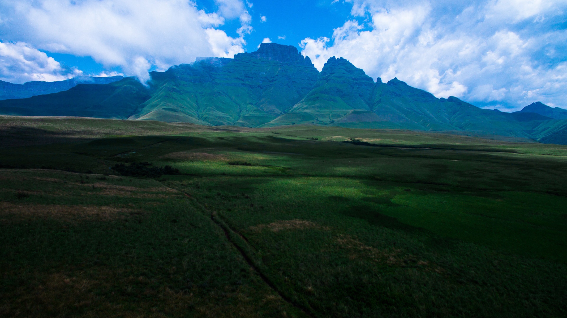
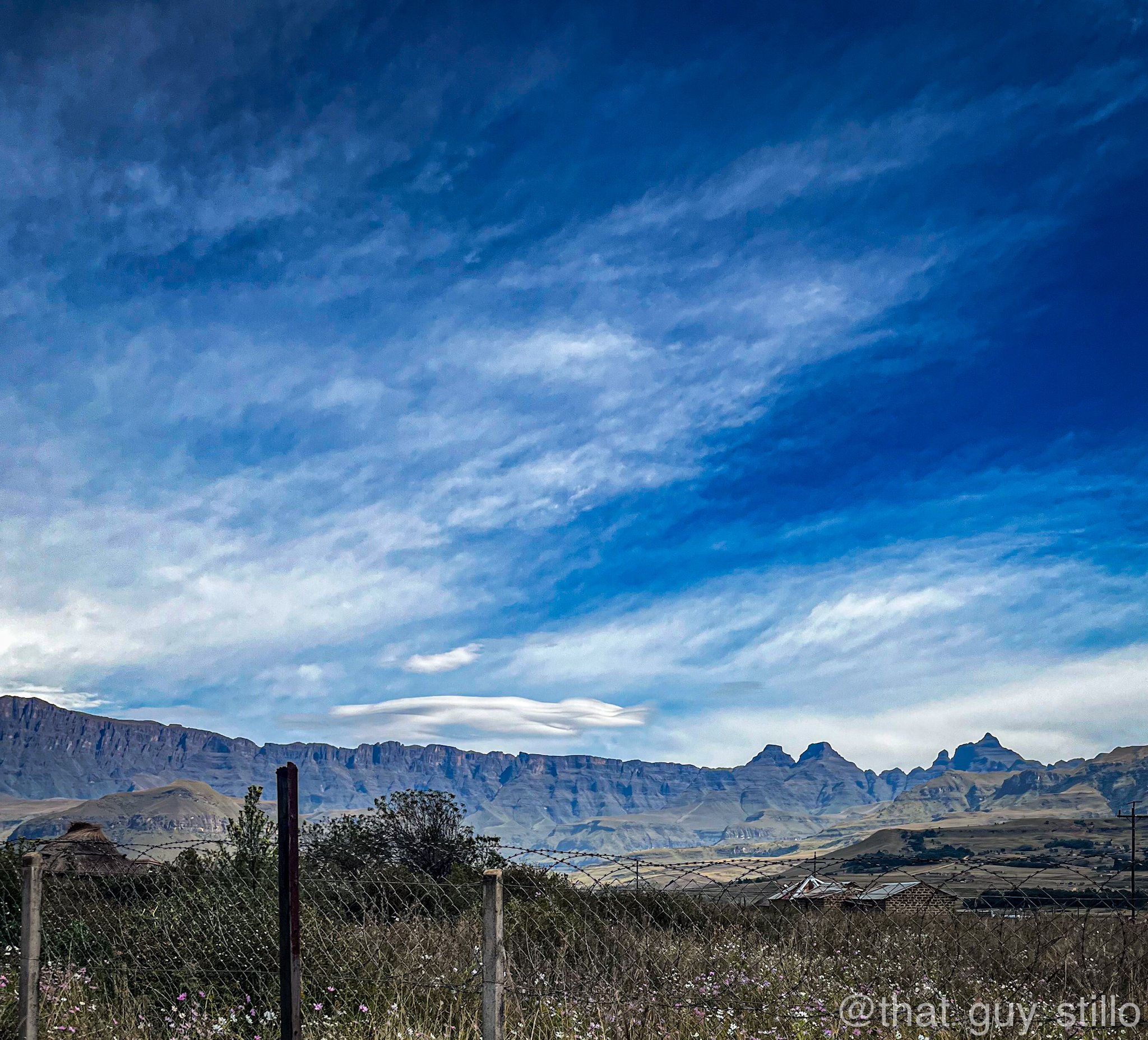
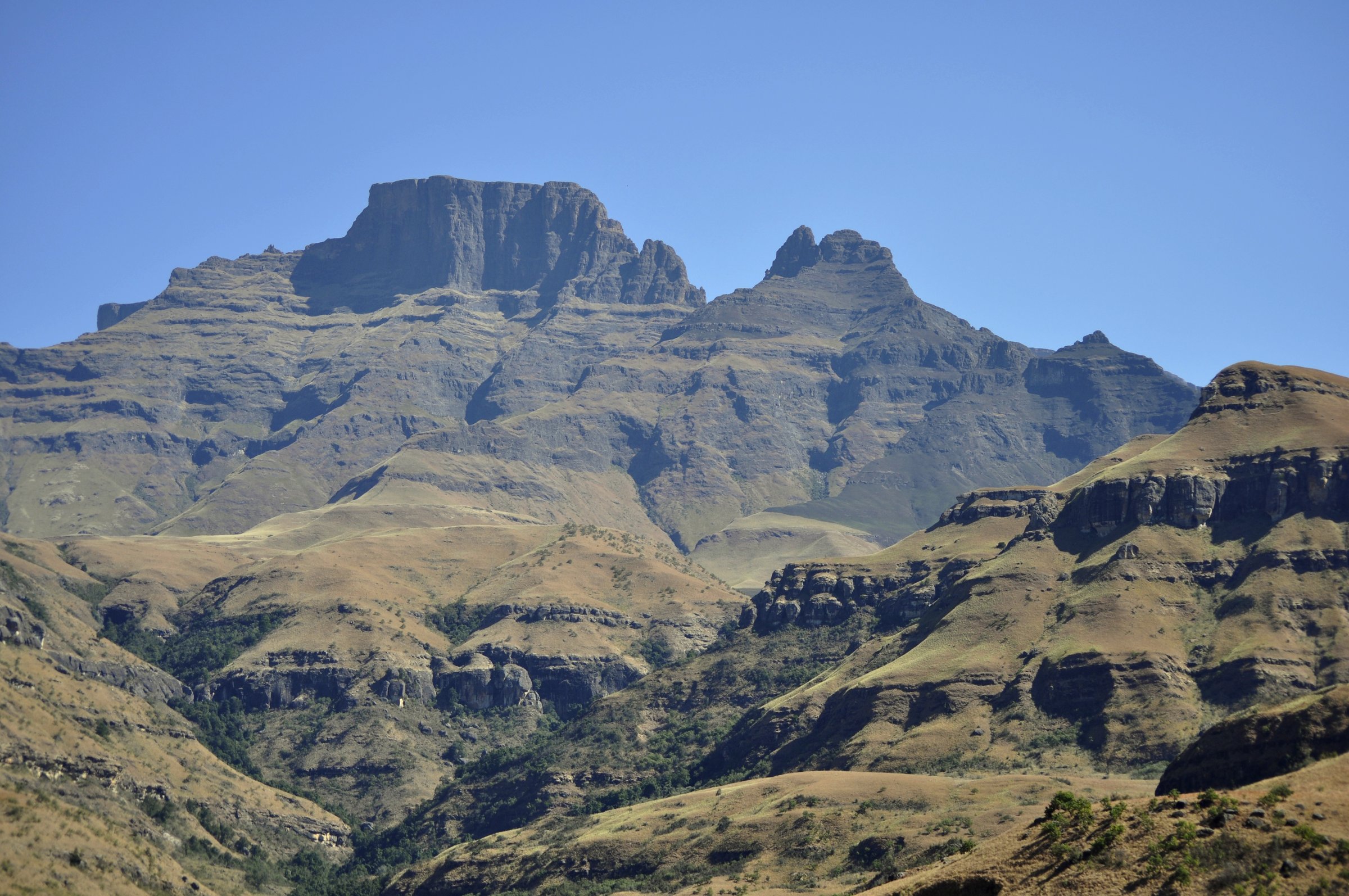
The Central Drakensberg is the Cathedral Peak, Didima, Monk’s Cowl, Champagne Castle, and Injasuthi heart of the uKhahlamba-Maloti range. It has a strong guidebook identity: freestanding basalt peaks, sandstone caves, river valleys, forested gorges, and long contour paths below the main escarpment.
Day hiking is more varied here than in the compact Northern Drakensberg. Routes range from short gorge and waterfall walks to full mountain days such as Cathedral Peak, where the final summit section includes scrambling and serious exposure. Monk’s Cowl and Injasuthi provide classic mid-level loops and cave routes, while the Champagne Castle massif dominates the skyline.
The most reliable walking seasons are the cooler, drier months from autumn to spring. Summer hiking is possible but thunderstorms, heat, swollen rivers, and lightning on ridges are significant hazards. Snow and ice can affect higher slopes in winter, especially after cold fronts.
Selection rationale
These five hikes were selected to represent the Central Drakensberg’s main hiking characters: a famous summit, a shaded gorge, waterfall circuits, the Sphinx / Blind Man’s Corner viewpoint route, and an Injasuthi cave-and-valley loop. The rough Champagne Castle contour-path candidate was replaced by the Injasuthi loop because the latter has a clearer day-hike record and avoids duplicating the Monk’s Cowl approach.
Summary table
| # | Hike | Route type | Distance | Elevation gain | Max elevation | Difficulty |
|---|---|---|---|---|---|---|
| 1 | Cathedral Peak summit route | Out-and-back | 19.0 km | 1,554 m | 3,004 m | Hard / strenuous |
| 2 | Rainbow Gorge from Didima Camp | Out-and-back | 5.8 km | 225 m | Moderate | |
| 3 | Sterkspruit Falls and Nandi Falls Loop | Loop | 9.8 km | 406 m | Moderate | |
| 4 | Keartland’s Pass, Blind Man’s Corner and Crystal Falls Loop | Loop | 11.6 km | 683 m | Hard | |
| 5 | Injasuthi Cataract Valley, Old Woman Stream and Grindstone Caves Loop | Loop | 11.9 km | 657 m | Hard |
Before you go
Permits and access
Central Drakensberg routes use Ezemvelo KZN Wildlife reserves and adjoining private hotel land at Cathedral Peak. Day-visitor entry, hours, fees, and any closures should be confirmed locally before travel. Dogs are listed as not allowed on several of the consulted AllTrails records; current park rules should be checked locally.
Standard Central Drakensberg day-hiking kit
For all five routes, carry:
- Sturdy hiking shoes or boots with grip for grass slopes, loose rock, and wet sandstone.
- Weatherproof and windproof layers, warm layer, sun hat, sunglasses, sunscreen, and enough water for the planned day.
- Map/GPS, navigation backup, headtorch, first-aid kit, and food.
For Cathedral Peak, add a higher margin of safety: an early start, confidence on exposed scrambling, and consideration of a helmet for rockfall on the summit block. A local guide is recommended for walkers unfamiliar with the route or exposure. Trekking poles help on the longer loops and on stream-rich routes.
Common hazards
The Central Drakensberg is exposed and weather-sensitive on its high ground. Across all five routes, expect that storms can build fast (heat, lightning, mist, swollen rivers, and winter ice on higher slopes are all serious), that water levels and flash runoff after rain make stream crossings and gorges hazardous, that paths can become faint or confusing on intersecting contour systems, and that rock shelters and any archaeological or rock-art sites should be treated as protected cultural heritage.
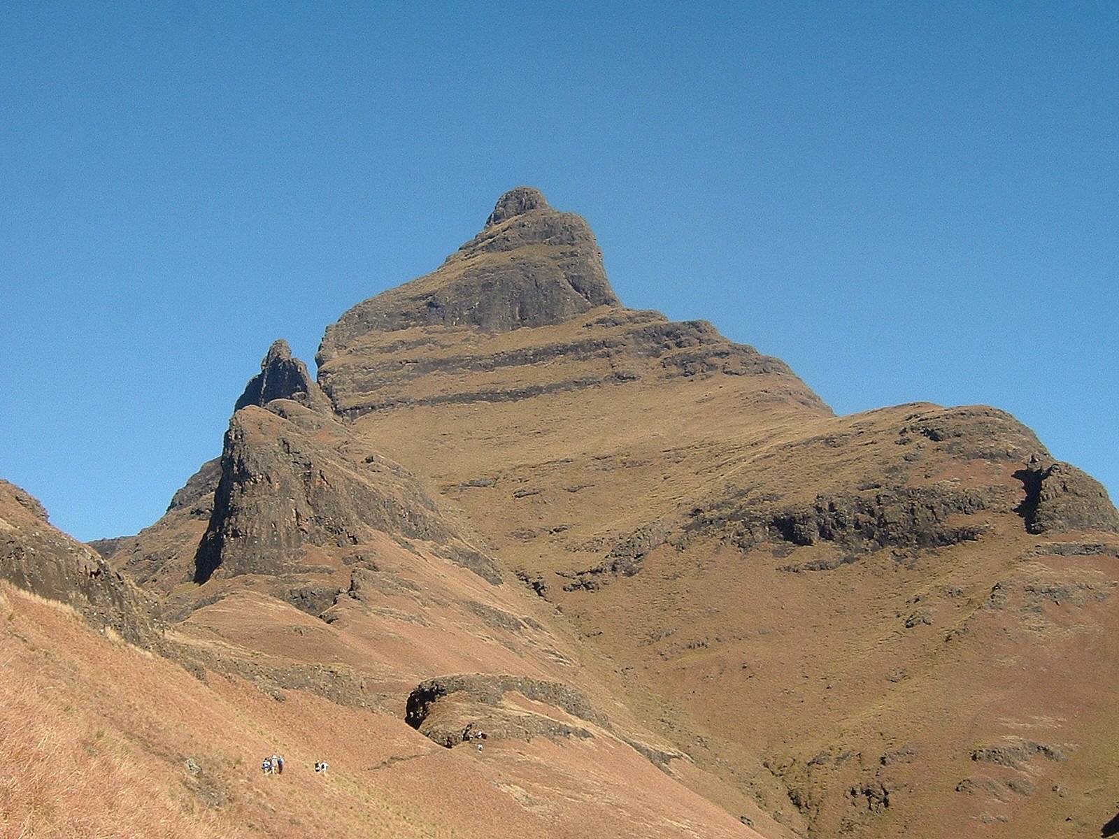
1. Cathedral Peak summit route
Snapshot
Itinerary
The route starts from the Cathedral Peak Hotel / Didima side and climbs steadily towards Orange Peel Gap and the upper Cathedral Peak ridge. The approach crosses open grass slopes and rocky ribs before the final summit block. The last section involves exposed scrambling and route-finding on steep ground.
The return follows the ascent route. In poor weather, the summit block and descent can become significantly more serious, especially if mist removes visual route cues.
Why it is essential
Cathedral Peak is one of the defining summits of the Central Drakensberg. It is visually distinctive, widely recognised, and gives a full-value mountain day that contrasts strongly with the lower gorge and waterfall walks.
Hazards and notes
- Exposure, scrambling, and loose rock on the summit block; rockfall risk warrants a helmet for some parties.
- The route should be avoided in thunderstorms or strong wind.
- Mist on the upper ridge can quickly remove visual route cues.
GPX / KML links
| Source | URL | Format | Notes |
|---|---|---|---|
| AllTrails: Cathedral Peak | alltrails.com | Route page / app map | Source-map only; do not reuse geometry without separate export-rights check |
| Cathedral Peak Hotel hiking guide | cathedralpeak.co.za | PDF guide / route descriptions | Descriptive verification only; no route geometry reused |
| OpenStreetMap search: Cathedral Peak | openstreetmap.org | OSM map / search | OSM data is ODbL; candidate geometry cross-check only |
External links
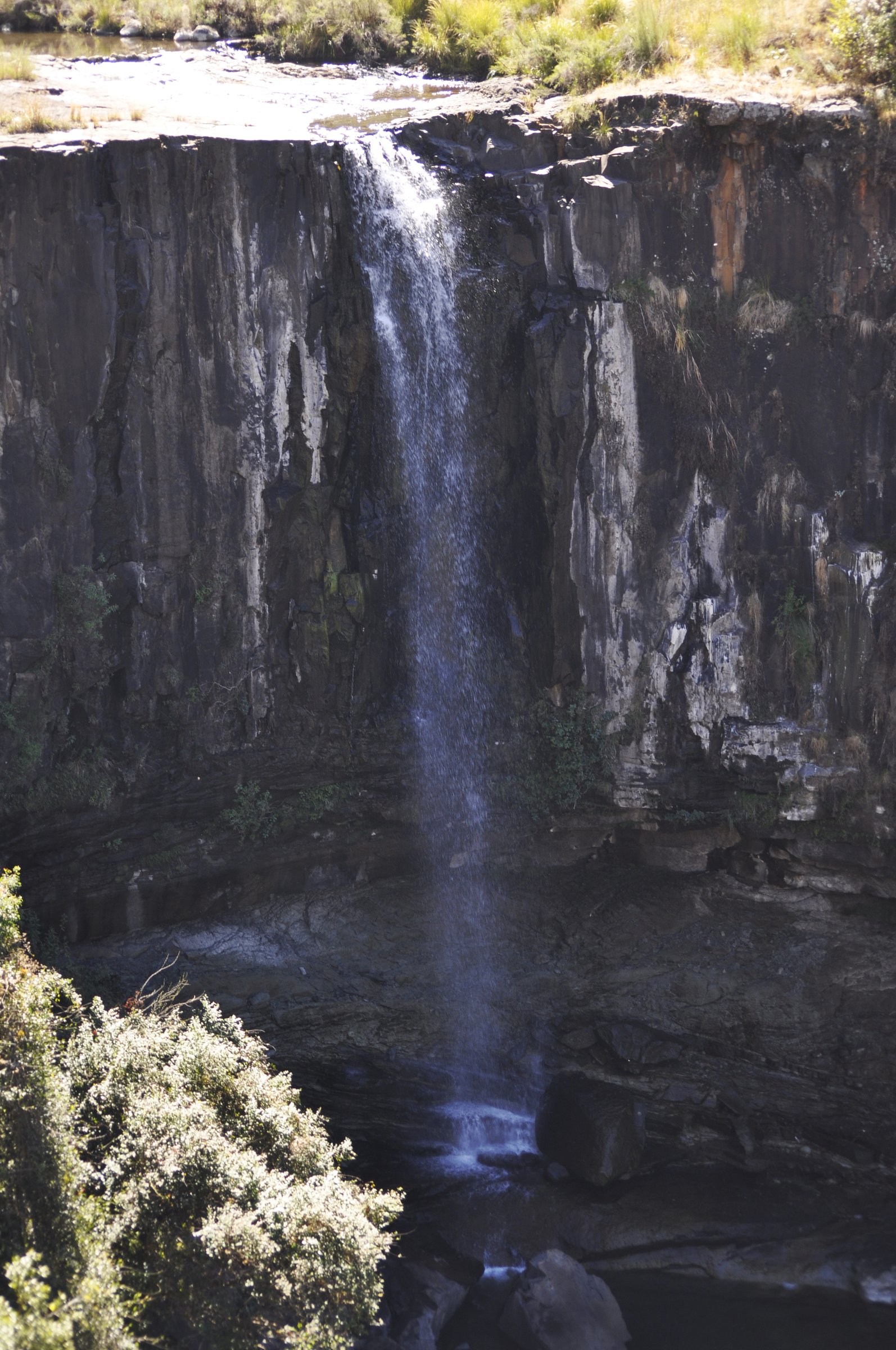
2. Rainbow Gorge from Didima Camp
Snapshot
Itinerary
The walk begins near Didima Camp and follows the valley into Rainbow Gorge. The path passes through riverine vegetation and narrows between sandstone walls, with short rocky sections and stream crossings depending on water level. The normal day objective is the shaded gorge and chockstone / waterfall area before returning the same way.
Why it is essential
Rainbow Gorge is the accessible Cathedral Peak gorge walk. It gives a close, shaded sandstone-valley experience and balances the more exposed summit and ridge routes in the Central Drakensberg selection.
Hazards and notes
- Wet rock, river crossings, and flash runoff after storms are the main issues.
- The gorge should not be entered during heavy rain or thunderstorm runoff.
GPX / KML links
| Source | URL | Format | Notes |
|---|---|---|---|
| AllTrails: Rainbow Gorge from Didima Camp | alltrails.com | Route page / app map | Source-map only; do not reuse geometry without separate export-rights check |
| Cathedral Peak Hotel hiking guide | cathedralpeak.co.za | PDF guide / route descriptions | Descriptive verification only |
External links
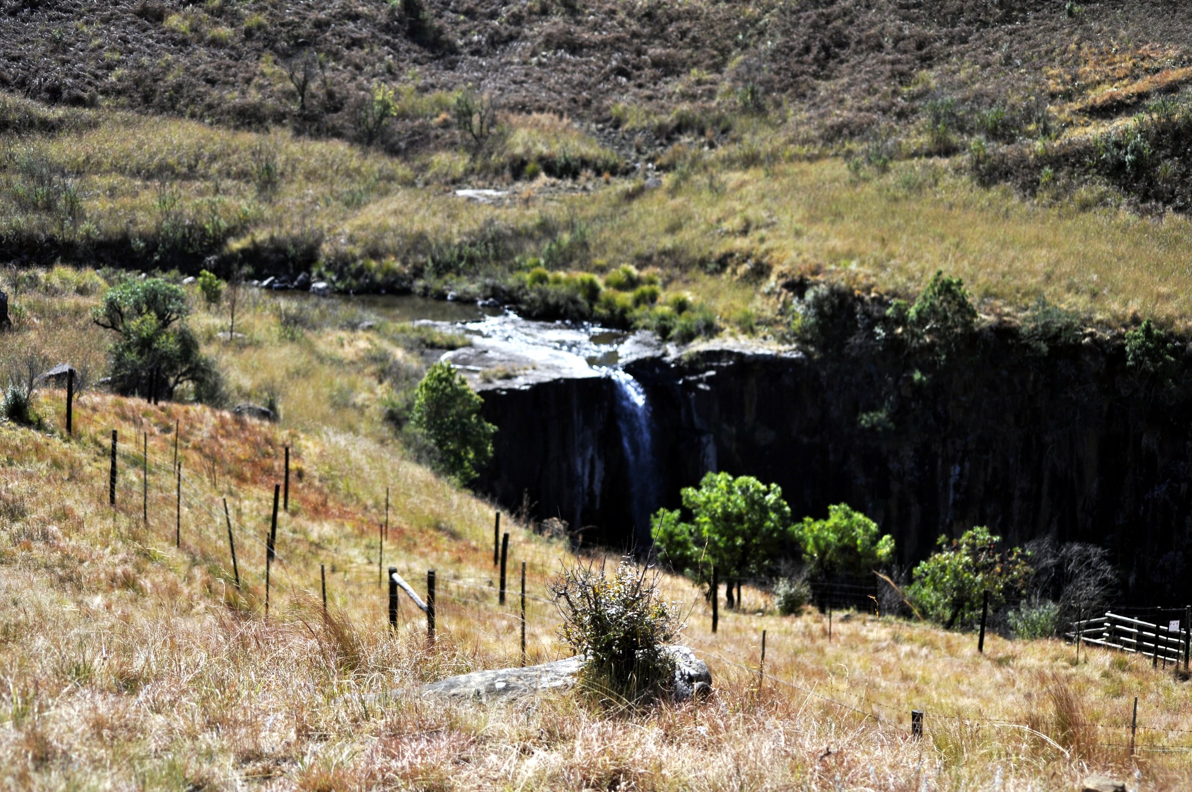
3. Sterkspruit Falls and Nandi Falls Loop
Snapshot
Itinerary
From Monk’s Cowl, the trail network links lower valley paths, river crossings, and waterfall spurs. The loop can include the Sterkspruit Falls viewpoint and Nandi Falls, using the lower Monk’s Cowl paths before returning to the day-visitor area.
This is a flexible route: shorter waterfall-only walks are possible, while the full loop gives a more complete half-day hike.
Why it is essential
Sterkspruit and Nandi Falls are the classic lower Monk’s Cowl waterfall objectives. They give a representative Central Drakensberg walk for days when the higher Sphinx / Blind Man’s Corner route is too exposed or when a shorter day is needed.
Hazards and notes
- Stream crossings and wet rock can be slippery.
- Summer thunderstorms can make the lower valleys unsafe.
GPX / KML links
| Source | URL | Format | Notes |
|---|---|---|---|
| AllTrails: Nandi Falls Loop | alltrails.com | Route page / app map | Source-map only; do not reuse geometry without separate export-rights check |
| AllTrails: Sterkspruit Falls | alltrails.com | Route page / app map | Secondary short-variant source |
External links
4. Keartland’s Pass, Blind Man’s Corner and Crystal Falls Loop
Snapshot
Itinerary
The route climbs from Monk’s Cowl through the Sphinx / Keartland’s Pass area to Blind Man’s Corner, a major viewpoint on the lower contour-path system. It then loops back via Crystal Falls and the lower paths to the day-visitor area.
The climb is sustained and open, with broad views across the Champagne Castle and Monk’s Cowl skyline. The descent includes waterfall and stream sections before returning to the start.
Why it is essential
Blind Man’s Corner is one of the defining Central Drakensberg viewpoints and a gateway to the contour path. This loop gives the route a complete day-hike shape without committing to an overnight escarpment approach.
Hazards and notes
- The route is exposed to heat, wind, lightning, and mist.
- Water availability varies by season.
- Navigation can become confusing on intersecting paths around the contour path and waterfall loops.
GPX / KML links
| Source | URL | Format | Notes |
|---|---|---|---|
| AllTrails: Keartland’s Pass, Blind Man’s Corner, and Crystal Falls Loop | alltrails.com | Route page / app map | Source-map only; do not reuse geometry without separate export-rights check |
| OpenStreetMap search: Blind Man’s Corner | openstreetmap.org | OSM map / search | OSM data is ODbL; candidate geometry cross-check only |
External links
- AllTrails, “Keartland’s Pass, Blind Man’s Corner, and Crystal Falls Loop”
- Ezemvelo KZN Wildlife general Drakensberg information
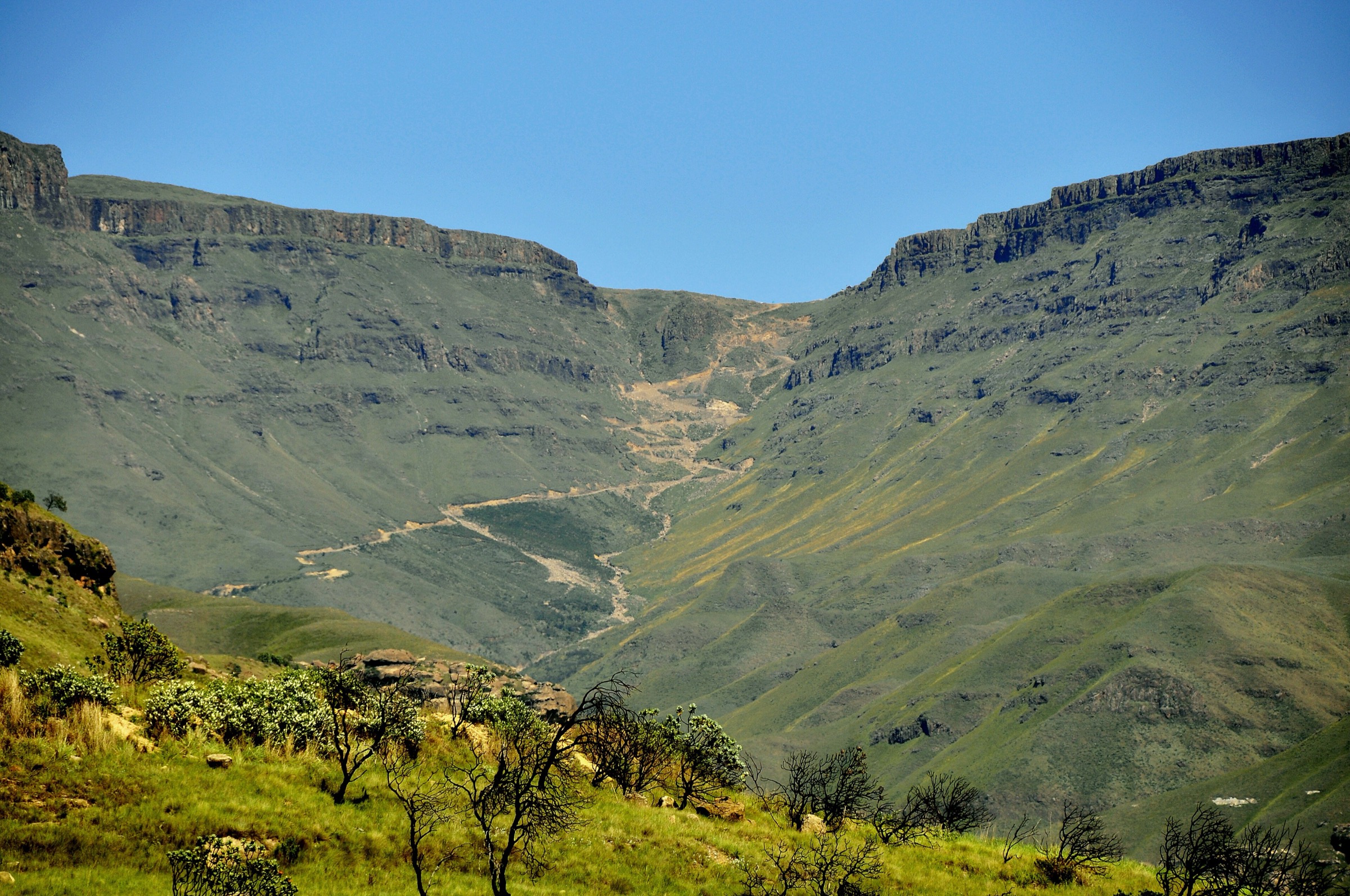
5. Injasuthi Cataract Valley, Old Woman Stream and Grindstone Caves Loop
Snapshot
Itinerary
The loop leaves Injasuthi and follows the Cataract Valley / Old Woman Stream path system towards the Grindstone Caves area. It combines river-valley walking, open grass slopes, and cave viewpoints before returning to the camp through the lower path network.
The route gives a different Central Drakensberg character from Cathedral and Monk’s Cowl: more cave-focused, quieter, and strongly shaped by sandstone shelters and tributary valleys.
Why it is essential
Injasuthi is a major Central Drakensberg hiking centre, and a cave-and-valley loop is needed for a balanced catalogue. Grindstone Caves and the Old Woman Stream area represent the cultural and geological side of the range without requiring an overnight cave booking.
Hazards and notes
- Stream crossings can rise after rain.
- Paths may be faint away from the camp network, and mist can complicate navigation.
- Rock shelters and archaeological or rock-art sites should be treated as protected cultural heritage; touching, marking, or disturbing surfaces is inappropriate and may be illegal.
GPX / KML links
| Source | URL | Format | Notes |
|---|---|---|---|
| AllTrails: Injisuthi Cataract Valley – Old Womans Stream – Grindstone Caves Loop | alltrails.com | Route page / app map | Source-map only; do not reuse geometry without separate export-rights check |
| OpenStreetMap search: Injasuthi Grindstone Caves | openstreetmap.org | OSM map / search | OSM data is ODbL; candidate geometry cross-check only |
External links
- AllTrails, “Injisuthi Cataract Valley – Old Womans Stream – Grindstone Caves Loop”
- Ezemvelo KZN Wildlife general Drakensberg information
External links
| Source | URL |
|---|---|
| Ezemvelo KZN Wildlife | kznwildlife.com |
| Cathedral Peak Hotel hiking guide PDF | cathedralpeak.co.za |
| AllTrails: Cathedral Peak | alltrails.com |
| AllTrails: Rainbow Gorge from Didima Camp | alltrails.com |
| AllTrails: Nandi Falls Loop | alltrails.com |
| AllTrails: Sterkspruit Falls | alltrails.com |
| AllTrails: Keartland’s Pass, Blind Man’s Corner, and Crystal Falls Loop | alltrails.com |
| AllTrails: Injisuthi Cataract Valley – Old Womans Stream – Grindstone Caves Loop | alltrails.com |