Regional overview
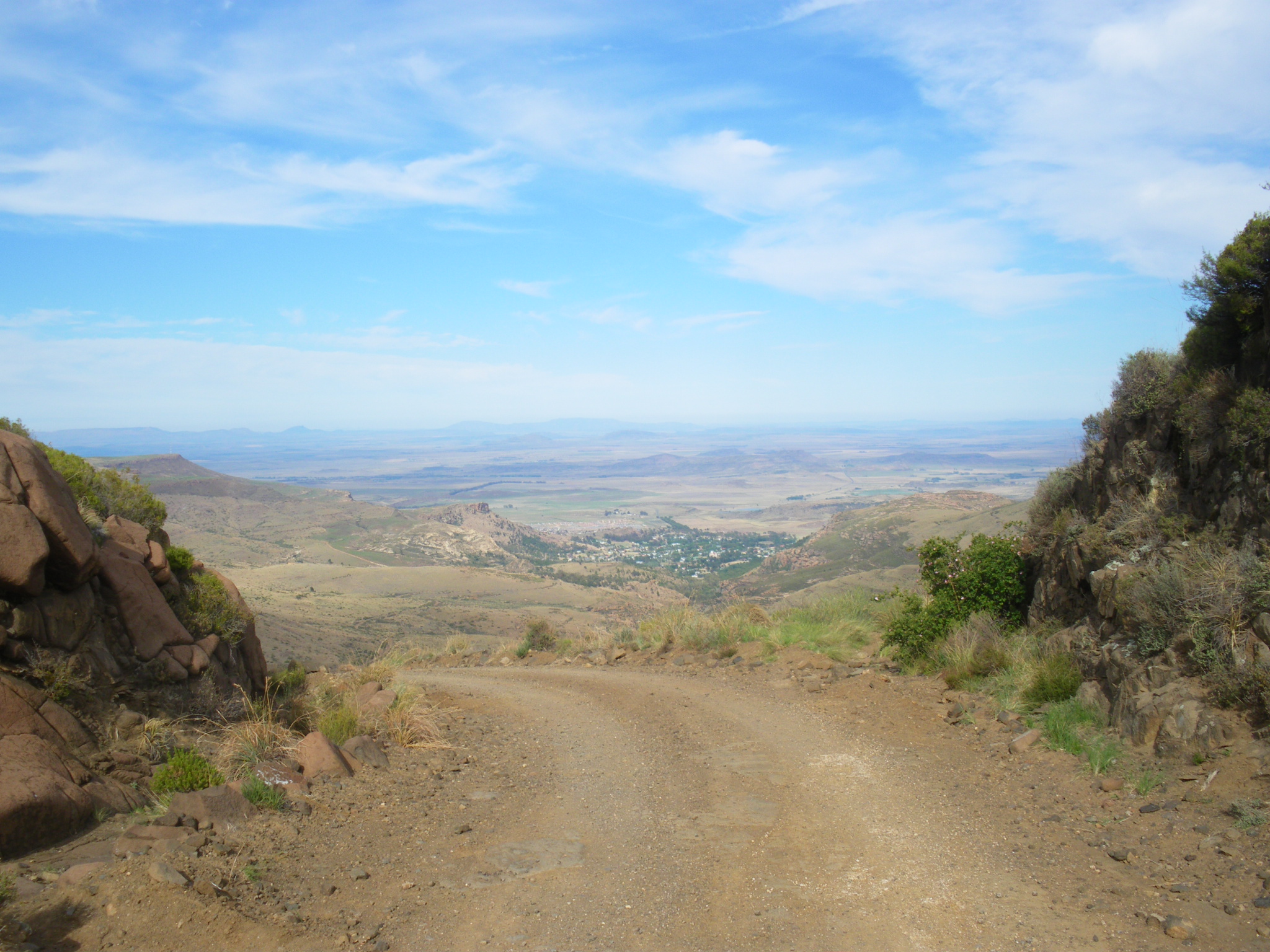
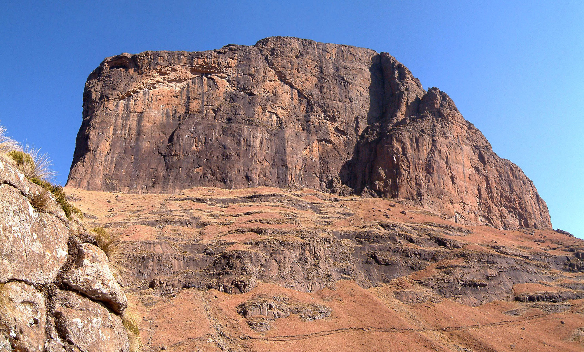
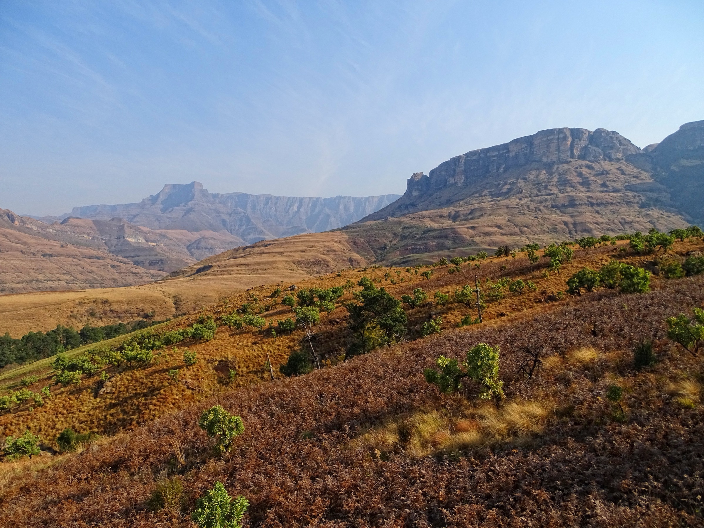
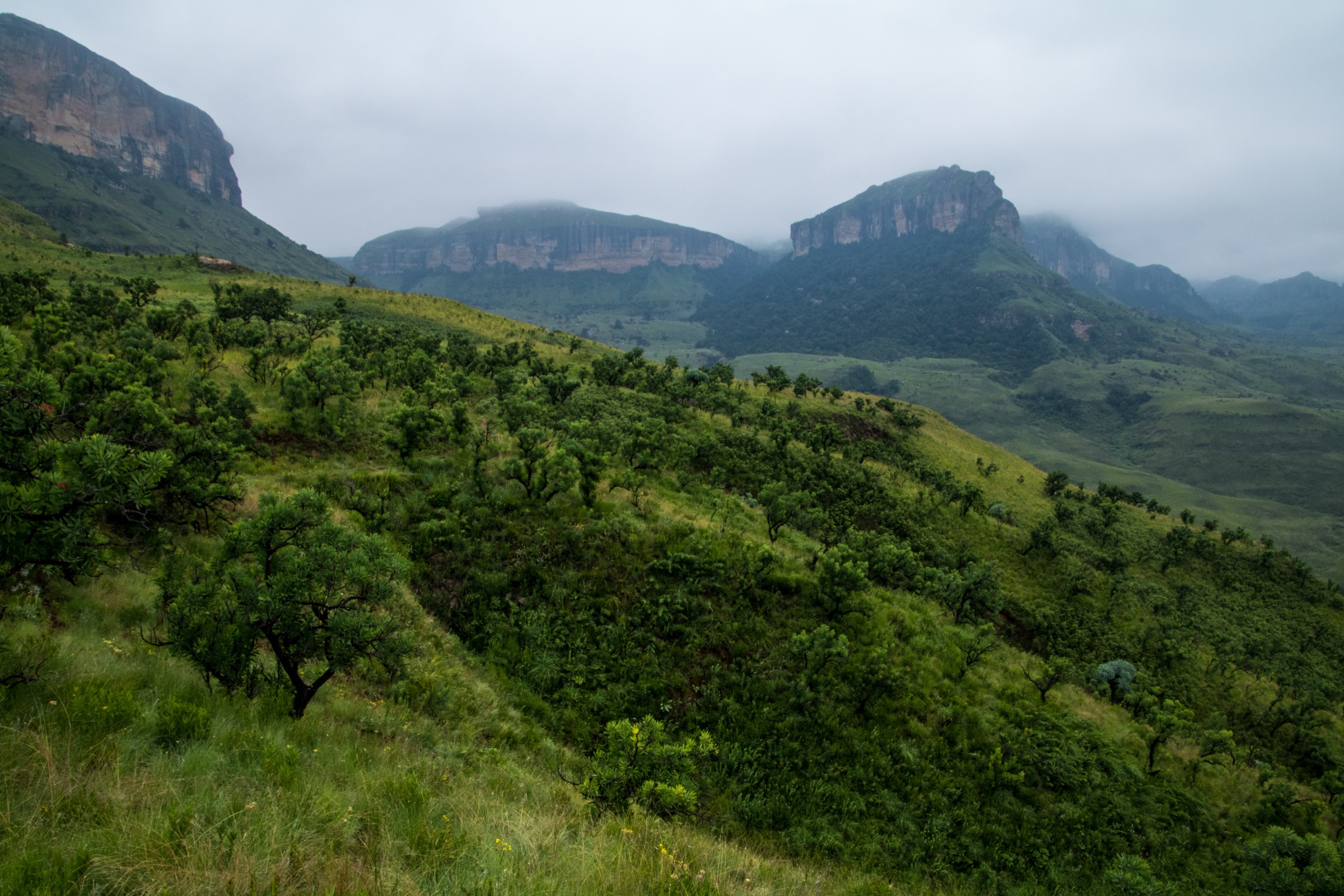
The Northern Drakensberg is the most abrupt part of the uKhahlamba-Maloti escarpment: a high basalt wall above sandstone foothills, grassland valleys, river gorges, and cliff-lined amphitheatres. Royal Natal National Park gives access to the Amphitheatre from the KwaZulu-Natal side, while the Sentinel car park and Witsieshoek side approach the escarpment from the Free State and Lesotho-border side.
The walking ranges from short waterfall loops near Mahai and Thendele to strenuous escarpment days using chain ladders, exposed traverses, and high plateau navigation. Summer brings thunderstorms and fast river rises; winter and early spring can bring ice, snow, and very cold wind on the escarpment.
Access is normally by private vehicle or lodge transfer. Royal Natal routes require park entry and current Ezemvelo KZN Wildlife rules should be checked before departure. The Sentinel car park approach is separately managed via the Witsieshoek / Sentinel access road and may involve road fees, gate controls, and seasonal security or road-condition advice.
Selection rationale
The five hikes below cover the classic northern pattern: the Tugela Gorge below the Amphitheatre, the high Sentinel / chain-ladders route to the top of Tugela Falls, a quieter Royal Natal waterfall walk, a mid-level Royal Natal viewpoint-and-waterfall loop, and an easy lower-valley waterfall walk. The selection uses route records with current online statistics where available; maximum-elevation data is still incomplete for several lower routes.
- Tugela Gorge Trail — the classic low-level approach to the Amphitheatre.
- Tugela Falls via Sentinel Peak and Chain Ladders — the signature high-level escarpment day.
- Thendele Camp to Gudu Falls Pool — a quieter Royal Natal waterfall route.
- Tiger Falls, Lookout Rock and Cascades Loop — a mid-level Mahai-area sampler.
- Cascades and McKinlay’s Pool Walk — an easy lower-valley acclimatisation walk.
Summary table
| # | Hike | Route type | Distance | Gain | Max elevation | Difficulty |
|---|---|---|---|---|---|---|
| 1 | Tugela Gorge Trail | Out-and-back | 13.8 km | 626 m | Hard | |
| 2 | Tugela Falls via Sentinel Peak and Chain Ladders | Out-and-back | 11.7 km | 753 m | ~3,050 m; needs GIS backfill | Hard |
| 3 | Thendele Camp to Gudu Falls Pool | Out-and-back | 11.3 km | 594 m | Hard | |
| 4 | Tiger Falls, Lookout Rock and Cascades Loop | Loop | 6.1 km | 311 m | Moderate | |
| 5 | Cascades and McKinlay’s Pool Walk | Loop / short out-and-back variant | 2.3 km | 59 m | Easy–moderate |
Before you go
Required equipment
The Northern Drakensberg mixes high escarpment days with lower waterfall walks. The same baseline kit applies across all five routes, with extras noted per hike:
- Mountain hiking equipment: sturdy boots, weatherproof layer, warm layer, sun protection, food, water, map/GPS and a navigation backup.
- Trekking poles useful on riverbed, boulder and steep waterfall sections; headtorch for late finishes.
- Wind- and waterproof layers plus warm hat/gloves outside midsummer on the Sentinel route; microspikes if snow or ice is present.
- A local guide is recommended for the chain ladders by anyone uncomfortable with exposure.
Current access and safety notes
- Summer thunderstorms are common; afternoon storms can raise rivers quickly and make the Sentinel ladders unsafe in lightning, high wind or ice.
- River crossings and boulder-hopping in Tugela Gorge can be slow or unsafe in high water.
- The chain ladders are exposed and unsuitable in ice, severe vertigo or storms; the escarpment edge is dangerous in mist.
- Royal Natal park entry, gate hours, dog rules and temporary closures should be checked with Ezemvelo KZN Wildlife before departure.
- Sentinel road fees, gate arrangements, security advice and winter ladder conditions should be checked with the Witsieshoek / Sentinel access provider before travel.
- Maximum elevations are unresolved for four lower Royal Natal routes; only the Sentinel route has a working approximate high point (~3,050 m).
1. Tugela Gorge Trail
Snapshot
Itinerary
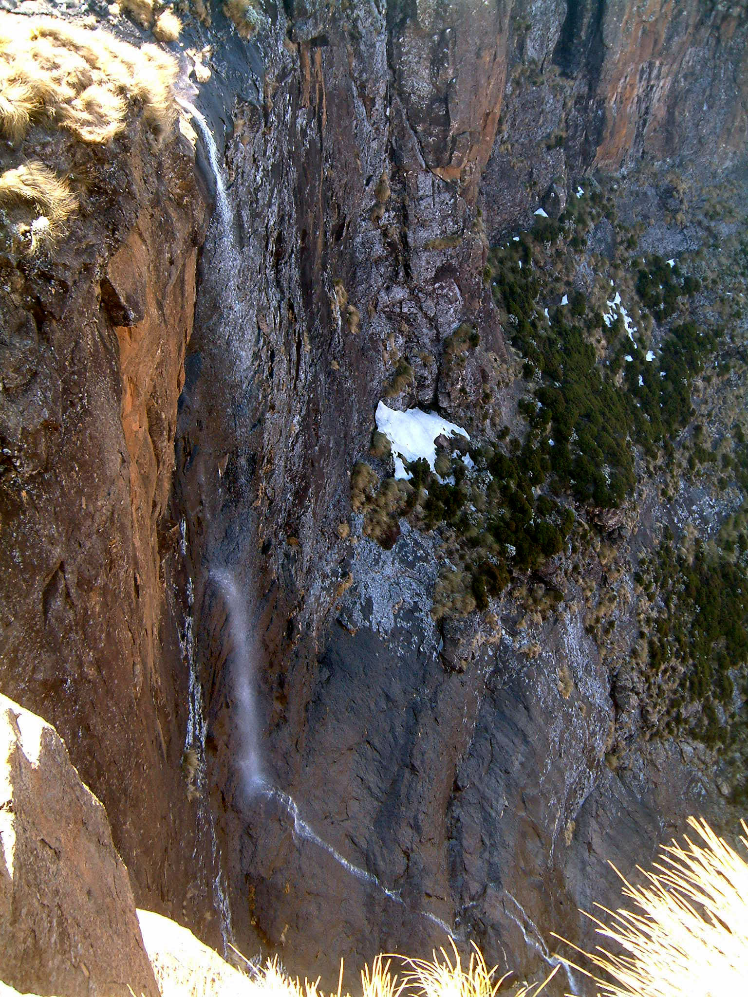
The route leaves the Royal Natal / Thendele side of the park and follows the Tugela River valley towards the Amphitheatre. The lower section uses a clear valley path through grassland and light forest, with the Amphitheatre cliffs ahead. Higher in the gorge, the walk becomes rougher where the river narrows and the path uses boulders, river crossings, and ladders or rock steps depending on the current line.
The normal day-hike objective is the inner gorge viewpoint below the Amphitheatre rather than the top of Tugela Falls. The return follows the same route. Wet conditions, high water, or storm runoff can make the upper gorge slow or unsafe.
Why it is essential
Tugela Gorge is the classic low-level approach to the Amphitheatre. It gives a close view of the basalt wall and the Tugela River without committing to the high escarpment route, and it is one of the best-known Royal Natal day walks.
Hazards and notes
- River crossings and boulder-hopping are the main technical issues.
- Summer thunderstorms can raise the Tugela quickly; early morning starts reduce heat and thunderstorm exposure.
- Dogs are listed as not allowed on the AllTrails record; current Ezemvelo protected-area rules should be checked locally.
- Park entry and access hours were not fully verified in this pass.
GPX / KML links
| Source | URL | Format / access | Reuse status |
|---|---|---|---|
| AllTrails: Tugela Gorge Trail | alltrails.com | Route page / app map | AllTrails terms apply; GPX export terms not verified |
| ArcGIS Royal Natal National Park trail item | arcgis.com | Web map / route layer | Geometry cross-check only; item terms not clearly stated |
| OpenStreetMap search | openstreetmap.org | OSM map/search | OSM data is ODbL; candidate geometry cross-check only |
External links
2. Tugela Falls via Sentinel Peak and Chain Ladders
Snapshot
Itinerary
From Sentinel car park, the path traverses below the Sentinel cliffs, climbs to the chain ladders, and reaches the Amphitheatre plateau above Tugela Falls. The usual objective is the escarpment edge and waterfall viewpoint, with the option to walk along the plateau edge in clear weather before returning by the same route.
The chain ladders are fixed vertical metal ladders on exposed ground. A gully alternative is sometimes used, but it can be loose, steep, and more difficult in poor conditions. On the plateau, mist can make navigation difficult because the landscape is open and the escarpment edge drops abruptly.
Why it is essential
This is the signature high-level Northern Drakensberg day hike: the Sentinel, chain ladders, Amphitheatre rim, and Tugela Falls are the most internationally recognised features of the range.
Hazards and notes
- The chain ladders are exposed and unsuitable in lightning, high wind, ice, or severe vertigo.
- The escarpment edge is dangerous in mist; afternoon storms are common in summer.
- Access fees, gate times, road condition, and security arrangements should be checked with the Sentinel / Witsieshoek access provider before departure.
GPX / KML links
| Source | URL | Format / access | Reuse status |
|---|---|---|---|
| AllTrails: Tugela Falls Hike via Sentinel Peak | alltrails.com | Route page / app map | AllTrails terms apply; GPX export terms not verified |
| OpenStreetMap search | openstreetmap.org | OSM map/search | OSM data is ODbL; candidate geometry cross-check only |
External links
3. Thendele Camp to Gudu Falls Pool
Snapshot
Itinerary
The route starts from the Thendele side of Royal Natal and climbs away from the main valley towards Gudu Falls. It passes through grassland and forested drainage lines before reaching the waterfall pool. The return follows the same line.
This is a quieter alternative to Tugela Gorge, with a more sustained climb and closer waterfall objective rather than an escarpment-wall approach.
Why it is essential
Gudu Falls represents the Royal Natal waterfall-and-forest side of the Northern Drakensberg. It balances the larger Amphitheatre routes with a substantial day walk focused on a single waterfall basin.
Hazards and notes
- The route is steep enough to feel strenuous and can be slippery after rain.
- Thunderstorms, heat, and unclear side paths are the main seasonal issues.
- Dogs are listed as not allowed on the AllTrails record; current park rules should be checked locally.
GPX / KML links
| Source | URL | Format / access | Reuse status |
|---|---|---|---|
| AllTrails: Thendele Camp to Gudu Falls Pool | alltrails.com | Route page / app map | AllTrails terms apply; GPX export terms not verified |
| ArcGIS Royal Natal National Park trail item | arcgis.com | Web map / route layer | Geometry cross-check only; item terms not clearly stated |
External links
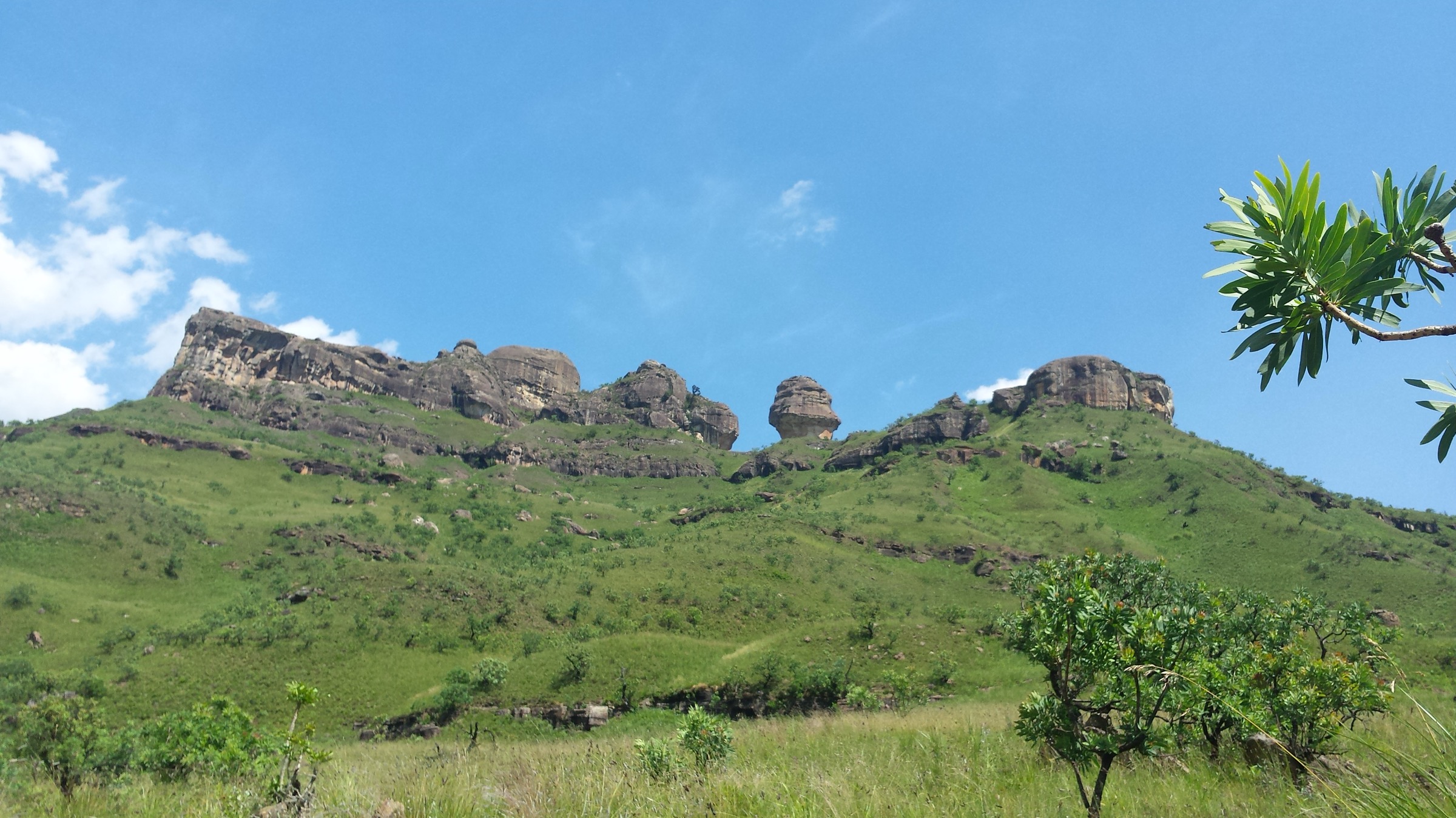
4. Tiger Falls, Lookout Rock and Cascades Loop
Snapshot
Itinerary
This compact loop links lower Royal Natal features above the Mahai area. The route climbs from the valley floor to Tiger Falls and Lookout Rock, then returns via the Cascades side of the trail network. It gives a short but varied sample of the sandstone foothills, views towards the Amphitheatre, and lower waterfalls.
Why it is essential
The loop is a practical half-day Royal Natal classic. It provides accessible views and waterfall scenery without the length of Tugela Gorge or the exposure of the Sentinel route.
Hazards and notes
- Rock near waterfalls can be slippery.
- Summer thunderstorms can arrive quickly, even on short routes.
- Keep to marked paths and verify current Ezemvelo day-visitor access, entry fees and dog restrictions.
GPX / KML links
| Source | URL | Format / access | Reuse status |
|---|---|---|---|
| AllTrails: Tiger Falls, Lookout Rock, Cascades loop | alltrails.com | Route page / app map | AllTrails terms apply; GPX export terms not verified |
| ArcGIS Royal Natal National Park trail item | arcgis.com | Web map / route layer | Geometry cross-check only; item terms not clearly stated |
External links
5. Cascades and McKinlay’s Pool Walk
Snapshot
Itinerary
This short lower-valley walk follows the Mahai-side trail network to the Cascades and pool sections often used for an easy Royal Natal outing. The route can be walked as a compact loop or as a short out-and-back depending on the current path and chosen pool objective.
Why it is essential
The Cascades / McKinlay’s Pool walk is the accessible entry point to Northern Drakensberg hiking. It suits acclimatisation days, mixed-ability groups, and visitors needing a short route that still shows the watercourse and sandstone foothills of Royal Natal.
Hazards and notes
- Wet rock near pools can be slippery and flash runoff can affect streams after storms.
- Swimming safety and current local restrictions were not verified.
- Check Royal Natal access hours and park rules locally.
GPX / KML links
| Source | URL | Format / access | Reuse status |
|---|---|---|---|
| AllTrails: Cascades Hike | alltrails.com | Route page / app map | AllTrails terms apply; GPX export terms not verified |
| ArcGIS Royal Natal National Park trail item | arcgis.com | Web map / route layer | Geometry cross-check only; item terms not clearly stated |
External links
External links
| Source | URL |
|---|---|
| Ezemvelo KZN Wildlife | kznwildlife.com |
| Witsieshoek Mountain Lodge / Sentinel access | witsieshoek.co.za |
| ArcGIS — Royal Natal National Park trails | arcgis.com |
| AllTrails — Tugela Gorge Trail | alltrails.com |
| AllTrails — Tugela Falls Hike via Sentinel Peak | alltrails.com |
| AllTrails — Thendele Camp to Gudu Falls Pool | alltrails.com |
| AllTrails — Tiger Falls, Lookout Rock, Cascades loop | alltrails.com |
| AllTrails — Cascades Hike | alltrails.com |