Regional overview
The Outeniqua Mountains rise immediately behind George, Wilderness, and the Garden Route coast. Their hiking character shifts quickly from steep CapeNature mountain routes at Witfontein and historic Cradock Pass to lush SANParks forest-and-river trails in the Wilderness section of Garden Route National Park.
The five selected day hikes deliberately combine high Outeniqua mountain walking with lower forest, river, and dune-edge routes that explain why the range matters to the Garden Route: water, indigenous forest, historic passes, and sea-to-mountain views.
Selection rationale
Cradock Peak supplies the essential summit, Cradock Pass supplies the historic mountain crossing, and the three SANParks Wilderness trails cover the iconic forest/river/wetland side of the Outeniqua foothills. George Peak is important but omitted because a complete source-backed route block was not verified in this pass.
Summary table
| # | Hike | Country | Route type | Distance | Gain | Max elevation | Difficulty | Photo status |
|---|---|---|---|---|---|---|---|---|
| 1 | Cradock Peak from Witfontein | South Africa | Out-and-back summit hike | Approx. 18 km | Reported as approx. 1,578 m by George Trails; needs recalculation | 1,578 m | Very hard / strenuous | No licence-compatible image found in this pass |
| 2 | Cradock Pass Trail | South Africa | Out-and-back or one-way historic pass walk | 8.4 km | Moderate | No licence-compatible image found in this pass | ||
| 3 | Half-collared and Giant Kingfisher Trail | South Africa | Out-and-back / linear return forest-river trail | 7 km official SANParks; George Trails also records 7 km | Approx. 209 m from George Trails | Easy to moderate | No licence-compatible image found in this pass | |
| 4 | Brown-hooded Kingfisher Trail | South Africa | Out-and-back linear route | 5 km total; 2.5 km each way | Easy to moderate | No licence-compatible image found in this pass | ||
| 5 | Cape Dune Mole-Rat Trail | South Africa | Loop options | 6 km loop or 3 km shorter loop | Easy to moderate | No licence-compatible image found in this pass |
1. Cradock Peak from Witfontein
Snapshot
Itinerary
From Witfontein Forest Station, the route follows forest roads and plantation tracks to the base of the Outeniqua slopes, crosses a stream, then climbs the foothills, railway line area, and upper path to the saddle between George Peak and Cradock Peak.
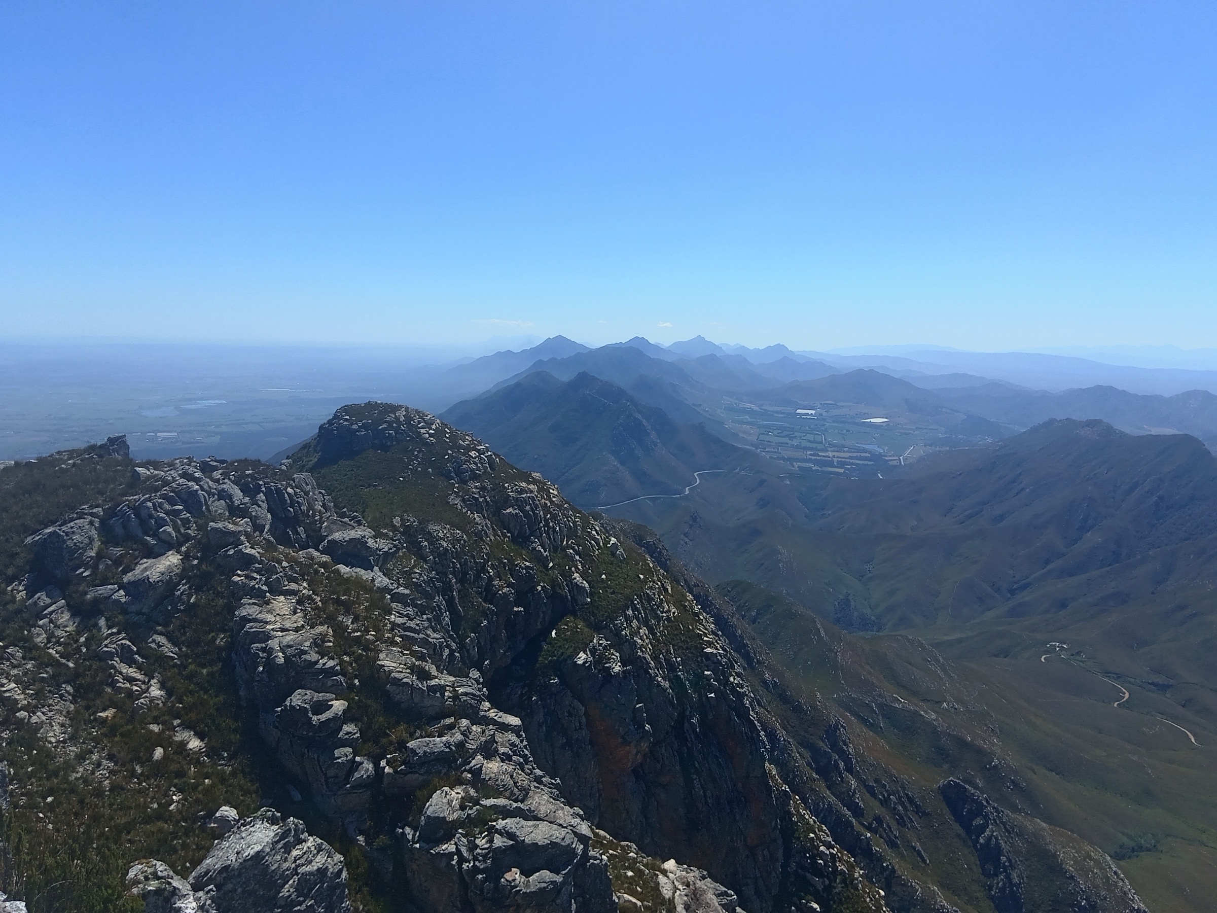
At the saddle, turn left for Cradock Peak. George Trails notes a rocky scramble near the small weather station at the top, with extensive views over the Garden Route and toward the Swartberg on clear days. Return by the same line.
Why it is essential
Cradock Peak is the highest summit in the Outeniqua Mountains and the essential serious mountain day above George.
Equipment
- Sturdy hiking shoes or boots with grip for sandstone, loose quartzite, forest roots, and wet rock.
- Sun hat, sunglasses, sunscreen, and enough water for exposed Cape Fold Belt conditions.
- Warm layer, windproof/rain shell, headlamp, first-aid kit, food, and offline map/GPS backup.
- Valid reserve, private-land, or national-park permit where required.
Hazards and notes
- Weather changes quickly; wind, mist, winter cold, and summer heat can all become serious.
- Fire closures, flood damage, reserve gate times, and permit rules should be checked before publication or field use.
- Cell coverage can be absent in kloofs, wilderness areas, and higher mountain basins.
- Snakes, baboons, loose rock, river crossings, and slippery wet rock are plausible route hazards.
- George Trails warns that mountain weather changes quickly and that warm/wind-resistant clothing is needed even in sunny forecasts.
- The top section includes rocky scrambling that can be slippery and intimidating.
- Water is limited after the lower stream crossing.
Photos
Photo status: No licence-compatible image found in this pass.
| Image / subject | Image URL | Source page URL | Author | Licence | Reuse notes | Attribution |
|---|---|---|---|---|---|---|
| Unresolved | Unresolved | Unresolved | Unresolved | Unresolved | No licence-compatible image found in this pass | Unresolved |
GPX / KML links
| Source | URL | Format | Licence / terms | Reuse status |
|---|---|---|---|---|
| George Trails: Cradock Peak | georgetrails.org.za | Route page with GPX link noted | George Trails terms; GPX file terms not verified | Stats/geometry source; direct GPX reuse unresolved |
| CapeNature Outeniqua day visitor information sheet | capenature.co.za | Official access/rules PDF | CapeNature terms | Factual verification only |
External links
2. Cradock Pass Trail
Snapshot
Itinerary
Starting at the Witfontein office, this hike follows the historic route once used by settlers with ox-wagons to cross the Outeniqua Mountains from the Little Karoo to the coast. CapeNature notes it can be walked one-way with private transport arranged or as a return route depending on fitness.
The route is less summit-focused than Cradock Peak, but it gives a direct sense of the mountain-pass history that shaped travel between Oudtshoorn and George.
Why it is essential
Cradock Pass is the historically essential Outeniqua route: a mountain crossing rather than just a viewpoint, with official CapeNature day-walk status.
Equipment
- Sturdy hiking shoes or boots with grip for sandstone, loose quartzite, forest roots, and wet rock.
- Sun hat, sunglasses, sunscreen, and enough water for exposed Cape Fold Belt conditions.
- Warm layer, windproof/rain shell, headlamp, first-aid kit, food, and offline map/GPS backup.
- Valid reserve, private-land, or national-park permit where required.
Hazards and notes
- Weather changes quickly; wind, mist, winter cold, and summer heat can all become serious.
- Fire closures, flood damage, reserve gate times, and permit rules should be checked before publication or field use.
- Cell coverage can be absent in kloofs, wilderness areas, and higher mountain basins.
- Snakes, baboons, loose rock, river crossings, and slippery wet rock are plausible route hazards.
- Water is limited along the trail according to CapeNature.
- Bookings, gate times, and the 08:30 cut-off need confirmation before publication.
Photos
Photo status: No licence-compatible image found in this pass.
| Image / subject | Image URL | Source page URL | Author | Licence | Reuse notes | Attribution |
|---|---|---|---|---|---|---|
| Unresolved | Unresolved | Unresolved | Unresolved | Unresolved | No licence-compatible image found in this pass | Unresolved |
GPX / KML links
| Source | URL | Format | Licence / terms | Reuse status |
|---|---|---|---|---|
| CapeNature Outeniqua day visitor information sheet | capenature.co.za | Official route distance/time/access PDF | CapeNature terms | Factual verification only; no route file |
| OpenStreetMap search: Cradock Pass Trail | openstreetmap.org | Map/source geometry cross-check | OSM data ODbL | Attribution required for OSM-derived data |
External links
3. Half-collared and Giant Kingfisher Trail
Snapshot
Itinerary
From Ebb & Flow, follow the Half-collared Kingfisher route through mature riverine forest along the Touw River. SANParks describes the walk as the most popular trail in the Wilderness region, close to the river and accessible by foot or canoe in parts.
The route crosses the Touw River by pontoon to connect with the Giant Kingfisher section and continues to a waterfall picnic/swimming objective. Return the same way, allowing time for the pontoon and wet boardwalk/forest sections.
Why it is essential
This is the signature Wilderness forest-and-river hike: yellowwoods, birds, riverbank walking, pontoon crossing, and waterfall in one accessible route.
Equipment
- Sturdy hiking shoes or boots with grip for sandstone, loose quartzite, forest roots, and wet rock.
- Sun hat, sunglasses, sunscreen, and enough water for exposed Cape Fold Belt conditions.
- Warm layer, windproof/rain shell, headlamp, first-aid kit, food, and offline map/GPS backup.
- Valid reserve, private-land, or national-park permit where required.
Hazards and notes
- Weather changes quickly; wind, mist, winter cold, and summer heat can all become serious.
- Fire closures, flood damage, reserve gate times, and permit rules should be checked before publication or field use.
- Cell coverage can be absent in kloofs, wilderness areas, and higher mountain basins.
- Snakes, baboons, loose rock, river crossings, and slippery wet rock are plausible route hazards.
- Flooding or high water can affect river/pontoon logistics.
- Boardwalks, roots, and wet stones can be slippery.
Photos
Photo status: No licence-compatible image found in this pass.
| Image / subject | Image URL | Source page URL | Author | Licence | Reuse notes | Attribution |
|---|---|---|---|---|---|---|
| Unresolved | Unresolved | Unresolved | Unresolved | Unresolved | No licence-compatible image found in this pass | Unresolved |
GPX / KML links
| Source | URL | Format | Licence / terms | Reuse status |
|---|---|---|---|---|
| SANParks Garden Route hikes page | sanparks.org | Official route description/time; no GPX found | SANParks terms | Factual verification only |
| George Trails: Half-collared Kingfisher Trail | georgetrails.org.za | Route page with GPX link noted | George Trails terms; GPX terms unresolved | Stats/geometry source; direct GPX reuse unresolved |
| Wikiloc: Half Collared Kingfisher Trail | wikiloc.com | Source route page / GPX via Wikiloc | Wikiloc terms apply | Candidate GPX/source route; reuse not confirmed |
External links
- SANParks — Garden Route hikes, walks and trails
- George Trails — Half-collared Kingfisher Trail
- AllTrails — Half-collared Kingfisher Trail
4. Brown-hooded Kingfisher Trail
Snapshot
Itinerary
The trail follows the Duiwe River valley through dense thicket and forest, crossing the river five times on the way to a waterfall objective. SANParks frames it as a birding and botany-friendly route with picnic opportunities.
Return the same way from the waterfall, taking care on wet crossings and not starting if the river is in flood or rain is expected.
Why it is essential
The Brown-hooded Kingfisher Trail complements the busier Touw River route with a quieter Duiwe River valley walk, waterfall, and strong forest-birding value.
Equipment
- Sturdy hiking shoes or boots with grip for sandstone, loose quartzite, forest roots, and wet rock.
- Sun hat, sunglasses, sunscreen, and enough water for exposed Cape Fold Belt conditions.
- Warm layer, windproof/rain shell, headlamp, first-aid kit, food, and offline map/GPS backup.
- Valid reserve, private-land, or national-park permit where required.
Hazards and notes
- Weather changes quickly; wind, mist, winter cold, and summer heat can all become serious.
- Fire closures, flood damage, reserve gate times, and permit rules should be checked before publication or field use.
- Cell coverage can be absent in kloofs, wilderness areas, and higher mountain basins.
- Snakes, baboons, loose rock, river crossings, and slippery wet rock are plausible route hazards.
- Multiple river crossings can become unsafe after rain.
- Wet forest paths and rocks can be slippery.
Photos
Photo status: No licence-compatible image found in this pass.
| Image / subject | Image URL | Source page URL | Author | Licence | Reuse notes | Attribution |
|---|---|---|---|---|---|---|
| Unresolved | Unresolved | Unresolved | Unresolved | Unresolved | No licence-compatible image found in this pass | Unresolved |
GPX / KML links
| Source | URL | Format | Licence / terms | Reuse status |
|---|---|---|---|---|
| SANParks Garden Route hikes page | sanparks.org | Official route description/time; no GPX found | SANParks terms | Factual verification only |
| OpenStreetMap search: Brown-hooded Kingfisher Trail | openstreetmap.org | Map/source geometry cross-check | OSM data ODbL | Attribution required for OSM-derived data |
External links
5. Cape Dune Mole-Rat Trail
Snapshot
Itinerary
SANParks lists two options for the Cape Dune Mole-Rat Trail: a 6 km loop and a shorter 3 km loop. The route crosses several vegetation types and includes sandy sections with views over Rondevlei and Swartvlei lake.
This route should be walked as the Outeniqua foothill-to-wetland counterpoint to the steep George mountain routes. Carry water because SANParks specifically advises taking liquid refreshments on this trail.
Why it is essential
The Outeniqua Mountains shape the Garden Route’s lakes and coastal forest edge; this trail captures that mountain-wetland transition better than another summit route would.
Equipment
- Sturdy hiking shoes or boots with grip for sandstone, loose quartzite, forest roots, and wet rock.
- Sun hat, sunglasses, sunscreen, and enough water for exposed Cape Fold Belt conditions.
- Warm layer, windproof/rain shell, headlamp, first-aid kit, food, and offline map/GPS backup.
- Valid reserve, private-land, or national-park permit where required.
Hazards and notes
- Weather changes quickly; wind, mist, winter cold, and summer heat can all become serious.
- Fire closures, flood damage, reserve gate times, and permit rules should be checked before publication or field use.
- Cell coverage can be absent in kloofs, wilderness areas, and higher mountain basins.
- Snakes, baboons, loose rock, river crossings, and slippery wet rock are plausible route hazards.
- Soft sandy trail can be hot and tiring.
- Open wetland/dune-edge sections need sun and wind protection.
Photos
Photo status: No licence-compatible image found in this pass.
| Image / subject | Image URL | Source page URL | Author | Licence | Reuse notes | Attribution |
|---|---|---|---|---|---|---|
| Unresolved | Unresolved | Unresolved | Unresolved | Unresolved | No licence-compatible image found in this pass | Unresolved |
GPX / KML links
| Source | URL | Format | Licence / terms | Reuse status |
|---|---|---|---|---|
| SANParks Garden Route hikes page | sanparks.org | Official route description/options; no GPX found | SANParks terms | Factual verification only |
| OpenStreetMap search: Cape Dune Mole-Rat Trail | openstreetmap.org | Map/source geometry cross-check | OSM data ODbL | Attribution required for OSM-derived data |
External links
Missing data and follow-up
- Open-licence route-specific photos were not verified for the Outeniqua hikes in this pass.
- Cradock Peak elevation gain should be recalculated from GPX because the local route page reports a gain equal to the peak altitude.
- Direct GPX links from George Trails were noted in page text but not captured as reusable URLs; revisit with browser/download tools if GPX files are needed.
External links
| Source | URL |
|---|---|
| CapeNature — Outeniqua day visitor information sheet (PDF) | capenature.co.za |
| George Trails — Cradock Peak | georgetrails.org.za |
| SANParks — Garden Route hikes, walks and trails | sanparks.org |
| George Trails — Half-collared Kingfisher Trail | georgetrails.org.za |