Regional overview
Praslin’s hill country is lower than Mahé but botanically exceptional. The walking landscape centres on Praslin National Park, the UNESCO-listed Vallée de Mai, the restored Fond Ferdinand reserve, and short cross-island tracks through palm forest, wetland, farmland, granite, and coastal viewpoints.
The island’s day hikes are generally short by mountain standards, but heat, humidity, wet clay, steep side tracks, and exposed glacis sections make conservative timings sensible. The best season is usually any settled dry spell; forest walks can be pleasant in light rain but become slippery.
Access is usually by road from Grande Anse, Baie Sainte Anne, Anse Volbert, Mont Plaisir, or the south-coast road near Anse Marie Louise. Some routes cross or approach private resort land, so access permission should be confirmed.
Selection rationale
These five hikes cover Praslin’s essential hill walking: the UNESCO palm forest, the official Glacis Noire trail in Praslin National Park, the Fond Ferdinand coco de mer reserve, the Salazie-Pasquière cross-island loop, and the Anse Georgette / Anse Lazio northern hill-and-coast route.
Summary table
| # | Hike | Country | Route type | Distance | Gain | Max elevation | Difficulty |
|---|---|---|---|---|---|---|---|
| 1 | Vallée de Mai forest trails | Seychelles | Loop network | 1-2 km | Low | c. 200 m area | Easy |
| 2 | Glacis Noire Trail | Seychelles | Out-and-back | 1.4 km | Not stated | c. 367 m | Moderate |
| 3 | Fond Ferdinand | Seychelles | Out-and-back / guided loop | c. 2 km | Not stated | c. 200+ m | Easy-moderate |
| 4 | Salazie-Pasquière Loop | Seychelles | Loop / road-linked traverse | 6.9 km | 519 m total | c. 225 m | Moderate |
| 5 | Anse Georgette via Anse Lazio | Seychelles | Out-and-back / permission exit variant | 7 km | c. 200 m | c. 102 m | Moderate |
1. Vallée de Mai forest trails

Snapshot
Itinerary
The signed visitor trails loop through the protected coco de mer palm forest from the visitor centre. The paths give access to the main palm-forest stands, interpretive panels, black parrot habitat, and shaded prehistoric-looking forest typical of central Praslin.
Why it is essential
Vallée de Mai is Praslin’s defining natural site and a UNESCO World Heritage reserve. It is botanically and culturally central to any Praslin hills catalogue.
Equipment
Standard hiking equipment: comfortable walking shoes, water, light rain layer or umbrella, and insect/tick awareness as locally appropriate.
Hazards and notes
SIF states that the site is a strict no-smoking area because fire is a major threat. The visitor centre is accessible, and part of the forest is wheelchair accessible, but the full trail network should be checked locally.
GPX / KML links
| Source | URL | Format / access | Reuse status |
|---|---|---|---|
| SIF Vallée de Mai visitor page | sif.sc | Official site/source information | Source information only; no GPX found |
| SPGA — Hiking in Seychelles guide | spga.gov.sc | PDF source map/guide | Text/maps/photos rights reserved; source-map reference only |
External links
2. Glacis Noire Trail

Snapshot
Itinerary
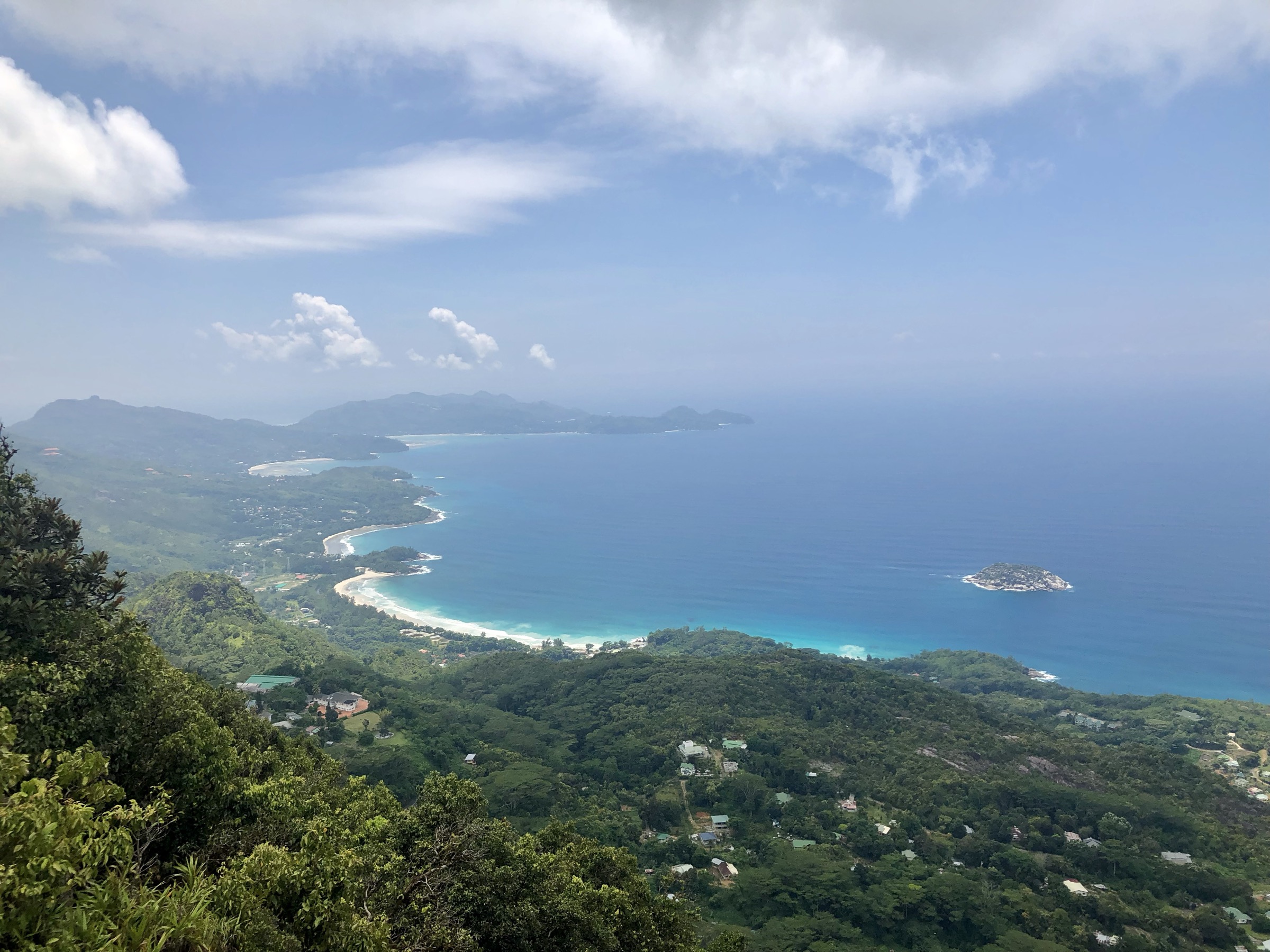
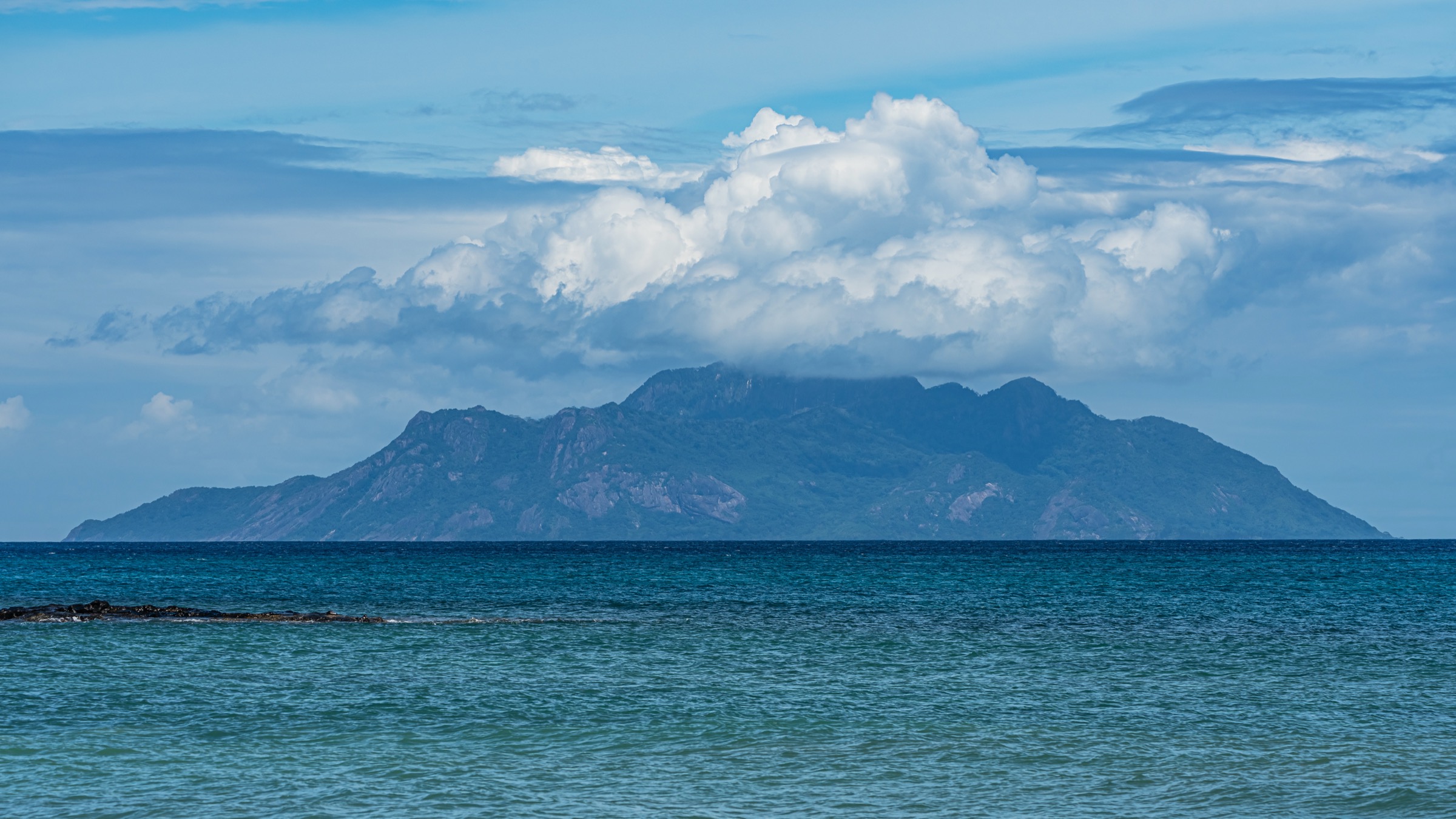
The official trail starts from the main road and follows an old forestry path into Praslin National Park. The first section is wide and red-earth surfaced before the path climbs through palm forest and endemic vegetation to the fire tower viewpoint, with views toward Curieuse and surrounding islands.
Why it is essential
SPGA describes Glacis Noire as Praslin’s official trail and places it inside Praslin National Park, making it the island’s key highland viewpoint walk.
Equipment
Standard hiking equipment, with grippy shoes, water, and sun protection for the upper viewpoint.
Hazards and notes
The trail can be muddy and slippery after rain. Respect national-park rules and remain on marked paths.
GPX / KML links
| Source | URL | Format / access | Reuse status |
|---|---|---|---|
| SPGA — Glacis Noire Nature Trail Guide | spga.gov.sc | PDF source map/guide | Official PDF; source-map reference only |
| Tourism Seychelles API listing | api.seychelles.com | Official listing | API terms not checked; attribute/stat source only |
External links
3. Fond Ferdinand

Snapshot
Itinerary
From the visitor centre, the maintained reserve trail climbs the side of the hill through restored coco de mer forest. The route gives close views of male and female coco de mer palms before reaching a broad viewpoint over islands including Coco, Félicité, La Digue, and Curieuse.
Why it is essential
Fond Ferdinand is a major Praslin palm-forest reserve and a quieter hill-walk complement to Vallée de Mai, with one of the island’s best accessible viewpoints.
Equipment
Standard hiking equipment, with water and sun protection.
Hazards and notes
Guided access may be the normal visitor format; confirm current opening times and access rules before publication.
GPX / KML links
| Source | URL | Format / access | Reuse status |
|---|---|---|---|
| SPGA — Hiking in Seychelles guide | spga.gov.sc | PDF source map/guide | Text/maps/photos rights reserved; source-map reference only |
External links
4. Salazie-Pasquière Loop

Snapshot
Itinerary
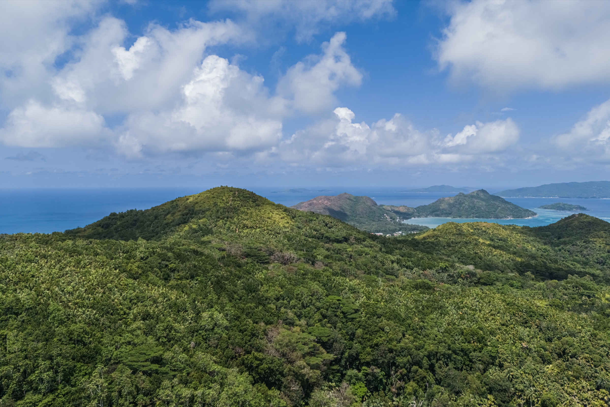
The route climbs from the Grande Anse side above Britannia cemetery, joins the Pasquière track, crosses the Plaine Hollandaise wetland/canal landscape, descends toward the north coast, and returns through Salazie farming country and forest to Grande Anse.
Why it is essential
This is the most complete cross-island hill walk in the Praslin guide, linking rural settlements, forest, wetland, and north-coast views.
Equipment
Standard to mountain hiking equipment: grippy shoes, water, sun protection, rain layer, and navigation backup.
Hazards and notes
The north-side descent can be steep and slippery in rain. Road sections and unclear junctions require attention.
GPX / KML links
| Source | URL | Format / access | Reuse status |
|---|---|---|---|
| SPGA — Hiking in Seychelles guide | spga.gov.sc | PDF source map/guide | Text/maps/photos rights reserved; source-map reference only |
External links
5. Anse Georgette via Anse Lazio

Snapshot
Itinerary
The route approaches Anse Lazio through forest and granite terrain, then climbs back inland behind the houses and coco de mer grove toward the ridge. It descends and climbs through dense forest before reaching the Anse Georgette side. Return is by the same route unless access through the Lemuria resort has been arranged.
Why it is essential
This route combines Praslin’s northern hill paths with two of its famous granite-framed beaches, giving the island’s strongest hill-to-coast walking day.
Equipment
Standard hiking equipment, with good footwear, water, sun protection, and swim gear if conditions are safe.
Hazards and notes
The guide notes poor signage, steep/slippery descents, and permission-dependent access through Lemuria. Beach swimming conditions and resort access should be checked locally.
GPX / KML links
| Source | URL | Format / access | Reuse status |
|---|---|---|---|
| SPGA — Hiking in Seychelles guide | spga.gov.sc | PDF source map/guide | Text/maps/photos rights reserved; source-map reference only |
External links
External links
| Source | URL |
|---|---|
| SIF — Vallée de Mai | sif.sc |
| SPGA — Glacis Noire Nature Trail Guide (PDF) | spga.gov.sc |
| SPGA — Hiking in Seychelles guide (PDF) | spga.gov.sc |
| SPGA downloads page | spga.gov.sc |
| Tourism Seychelles API — Glacis Noire listing | api.seychelles.com |