Regional overview
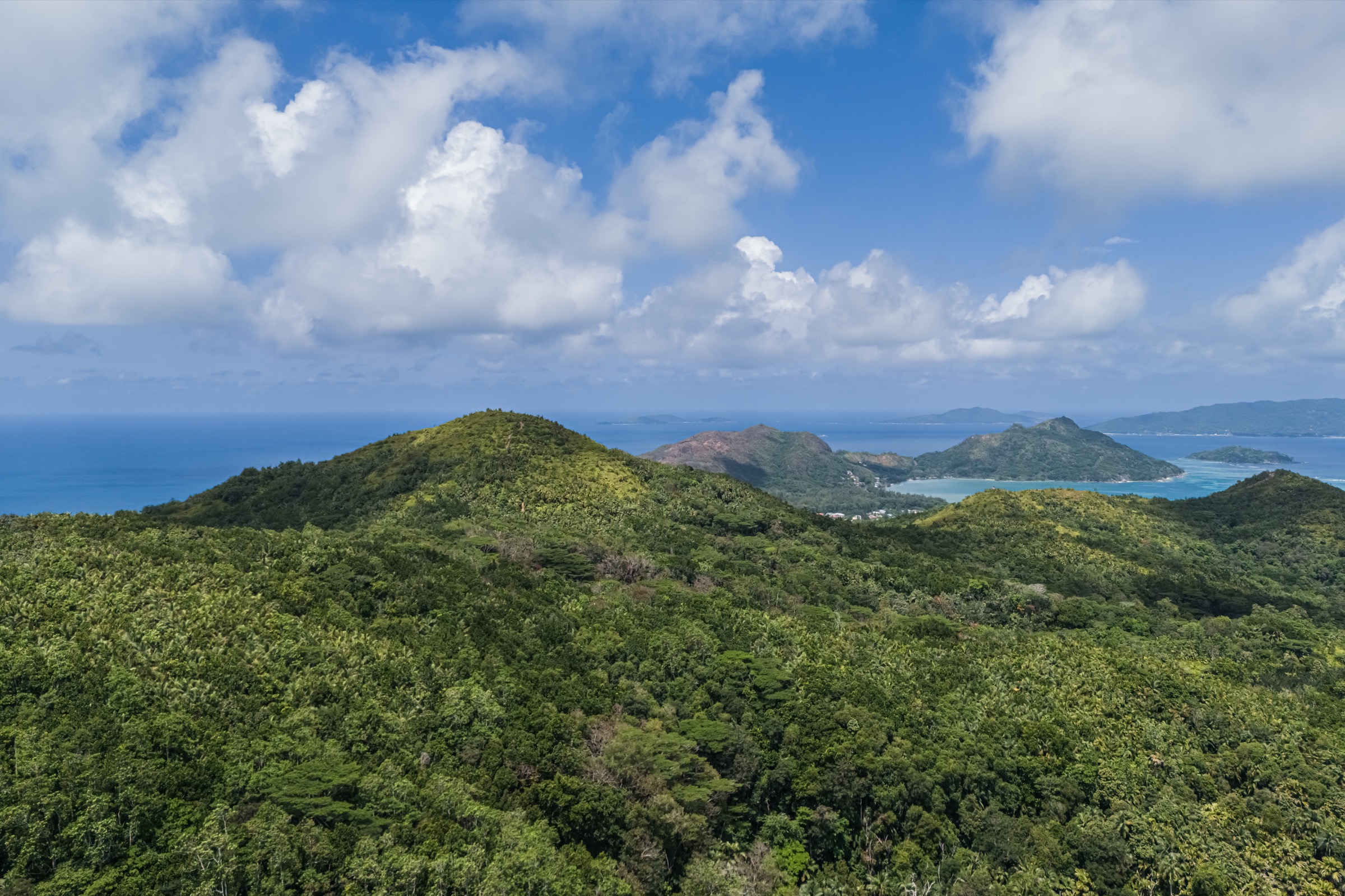
The Mahé Highlands are dominated by Morne Seychellois National Park, a humid granitic mountain landscape of forested ridges, open glacis slabs, cloud forest, former cinnamon/tea areas, and short but steep summit trails. The main hiking access road is the Sans Souci road between Victoria and the west coast, with additional trailheads around Le Niol, Bel Ombre, Port Glaud, and the upper roads above Victoria.
The walking character is compact, steep, humid, and often slippery rather than long-distance. Many routes are only 1-5 km on paper, but heat, wet granite, roots, and dense vegetation make timings conservative. The best walking conditions are usually the drier, less humid spells, with early starts recommended before cloud builds on the summits.
SPGA manages the principal official trails. Several trails have entrance fees and published opening hours; Morne Seychellois is specifically listed by SPGA as requiring a licensed guide because of its difficulty and summit section.
Selection rationale
These five hikes represent the Mahé highland set: the national high point, the classic Copolia viewpoint, the Morne Blanc west-coast cloud-forest lookout, the culturally important Trois Frères trail, and the longer Mare aux Cochons wetland/forest route in the centre of the national park.
Summary table
| # | Hike | Country | Route type | Distance | Gain | Max elevation | Difficulty |
|---|---|---|---|---|---|---|---|
| 1 | Morne Seychellois Nature Trail | Seychelles | Out-and-back | 4.3-4.6 km return | c. 641 m | 905 m | Hard |
| 2 | Copolia Trail | Seychelles | Out-and-back | 1.4-1.9 km | 142-242 m | c. 482-494 m | Moderate |
| 3 | Morne Blanc Nature Trail | Seychelles | Out-and-back | 2.1-3.2 km | c. 231-270 m | c. 623-667 m | Moderate |
| 4 | Trois Frères Nature Trail | Seychelles | Out-and-back | 1.4-1.9 km | c. 174-237 m | c. 415 m | Easy-moderate |
| 5 | Mare aux Cochons | Seychelles | Loop / out-and-back variant | 7-10 km | c. 270 m | c. 430 m | Moderate-hard |
1. Morne Seychellois Nature Trail

Snapshot
Itinerary
The route climbs from Sans Souci Road into dense, humid mountain forest, crossing streams, granite boulders, old cinnamon-plantation areas, and progressively wetter cloud-forest vegetation. The trail leads to the narrow summit of Morne Seychellois, the highest point in Seychelles. Return is normally by the same route.
Why it is essential
Morne Seychellois is the national high point and the defining mountain of Mahé. It is the most serious day hike in the island highlands and gives the clearest summit objective in the region.
Equipment
Mountain hiking equipment: sturdy boots with good grip, water, food, weatherproof layer, navigation backup, headtorch for delays, and a licensed guide as required by SPGA.
Hazards and notes
SPGA states that hikers must be accompanied by a licensed guide because of the trail’s difficulty. The route is steep, humid, slippery after rain, and exposed to rapid cloud build-up. SPGA listing data shows opening 08:00-12:00 and an entrance fee; confirm current ticketing and guide arrangements before travel.
GPX / KML links
| Source | URL | Format / access | Reuse status |
|---|---|---|---|
| SPGA — Morne Seychellois Nature Trail Guide | spga.gov.sc | PDF source map/guide | Official PDF; source-map reference only |
| AllTrails — Morne Seychellois Nature Trail | alltrails.com | Web route source | AllTrails terms apply; source-map reference only |
External links
2. Copolia Trail

Snapshot
Itinerary
From the Sans Souci road, the path climbs through luxuriant forest with endemic palms and then reaches more open granite boulder and glacis terrain. The final platform gives wide views over Mahé’s east coast, Victoria, the airport, and nearby islands.
Why it is essential
Copolia is the most recognised short highland viewpoint walk on Mahé and gives a compact cross-section of forest, endemic plants, granite slabs, and island panoramas.
Equipment
Standard hiking equipment, with grippy shoes, sun protection for the open granite, and enough water for humid conditions.
Hazards and notes
Granite and boardwalks can be slippery after rain. The official SPGA listing notes managed access and an entrance fee. Keep to marked paths on the summit glacis.
GPX / KML links
| Source | URL | Format / access | Reuse status |
|---|---|---|---|
| SPGA — Copolia Nature Trail Guide | spga.gov.sc | PDF source map/guide | Official PDF; source-map reference only |
| AllTrails — Val Riche / Copolia Trail | alltrails.com | Web route source | AllTrails terms apply; source-map reference only |
External links
3. Morne Blanc Nature Trail

Snapshot
Itinerary
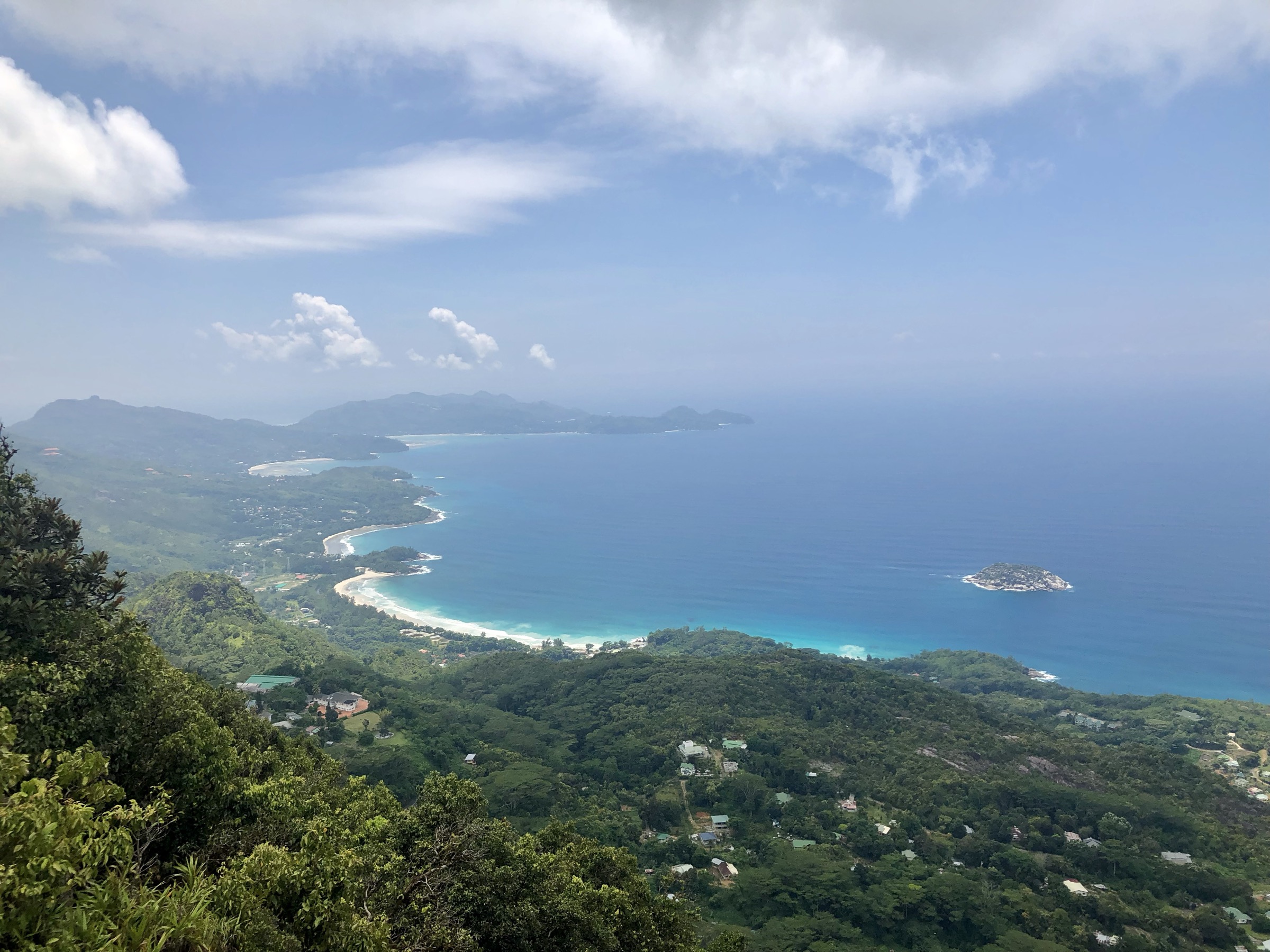
The trail starts above the tea-growing area and climbs steeply through forest into wetter cloud-forest vegetation. Boardwalks, boulders, mossy sections, and the marked Morne Blanc pit lead to a constructed viewpoint over Mahé’s west coast, Port Glaud, Port Launay, Thérèse, Conception, and the southern bays.
Why it is essential
Morne Blanc is the classic west-coast highland lookout and one of the strongest examples of Mahé’s cloud-forest hiking character.
Equipment
Standard to mountain hiking equipment: grippy shoes or boots, water, light rain layer, and sun protection for the exposed viewpoint.
Hazards and notes
Cloud can obscure views, and wet rock, roots, moss, and boardwalks can be slippery. The old SPGA brochure warns against leaving the trail because of hidden hollows and crevices near the upper section.
GPX / KML links
| Source | URL | Format / access | Reuse status |
|---|---|---|---|
| SPGA — Morne Blanc brochure | spga.gov.sc | PDF source map/guide | Official PDF; source-map reference only |
| AllTrails — Morne Blanc | alltrails.com | Web route source | AllTrails terms apply; source-map reference only |
External links
4. Trois Frères Nature Trail

Snapshot
Itinerary
The route starts near the Forestry Office and climbs through a quiet residential area into forest, then opens into lower Cocoplum vegetation and viewpoints above Victoria. A rest shelter and pilgrimage cross area mark the traditional end point for ordinary walkers.
Why it is essential
Trois Frères combines highland views over the capital with cultural history: the route is associated with Good Friday pilgrimage, while the official guide cautions that the true summit is not included for safety.
Equipment
Standard hiking equipment, with grippy footwear and water.
Hazards and notes
The summit itself is not part of the recommended route for safety reasons. Wet rock and open exposed sections require care.
GPX / KML links
| Source | URL | Format / access | Reuse status |
|---|---|---|---|
| SPGA — Trois Frères Nature Trail Guide | spga.gov.sc | PDF source map/guide | Official PDF; source-map reference only |
| AllTrails — Trois Frères Viewpoint | alltrails.com | Web route source | AllTrails terms apply; source-map reference only |
External links
5. Mare aux Cochons

Snapshot
Itinerary
From Le Niol, the track enters Morne Seychellois National Park and climbs through forest and former agricultural terrain toward the upland Mare aux Cochons valley. The route passes old cinnamon-industry ruins, riverside picnic places, and the wetland pond. Options continue to Danzil, Port Glaud, or the Glacis d’Antin viewpoint, while the simplest catalogue variant returns to Le Niol.
Why it is essential
Mare aux Cochons is the best longer forest-and-wetland walk in the Mahé highlands and shows the cultural landscape of former cinnamon production as well as the protected upland marsh.
Equipment
Mountain hiking equipment: sturdy boots, trekking poles recommended, water, food, rain layer, map/GPS, and headtorch for delays.
Hazards and notes
The trail network has multiple branches and can become confusing. River sections, wet forest, ladders/bridges on optional viewpoints, and post-rain conditions can make the route more serious. Confirm the chosen exit before starting.
GPX / KML links
| Source | URL | Format / access | Reuse status |
|---|---|---|---|
| SPGA — Mare aux Cochons brochure | spga.gov.sc | PDF source map/guide | Official PDF; source-map reference only |
| SPGA — Hiking in Seychelles guide | spga.gov.sc | PDF source map/guide | Text/maps/photos rights reserved; source-map reference only |
External links
External links
| Source | URL |
|---|---|
| SPGA — Morne Seychellois Nature Trail Guide (PDF) | spga.gov.sc |
| SPGA — Copolia Nature Trail Guide (PDF) | spga.gov.sc |
| SPGA — Morne Blanc brochure (PDF) | spga.gov.sc |
| SPGA — Trois Frères Nature Trail Guide (PDF) | spga.gov.sc |
| SPGA — Mare aux Cochons brochure (PDF) | spga.gov.sc |
| SPGA — Hiking in Seychelles guide (PDF) | spga.gov.sc |
| SPGA downloads page | spga.gov.sc |
| AllTrails — Morne Seychellois | alltrails.com |
| AllTrails — Copolia Trail | alltrails.com |
| AllTrails — Morne Blanc | alltrails.com |
| AllTrails — Trois Frères Viewpoint | alltrails.com |