


.jpg)
.jpg)
.jpg)
Regional overview
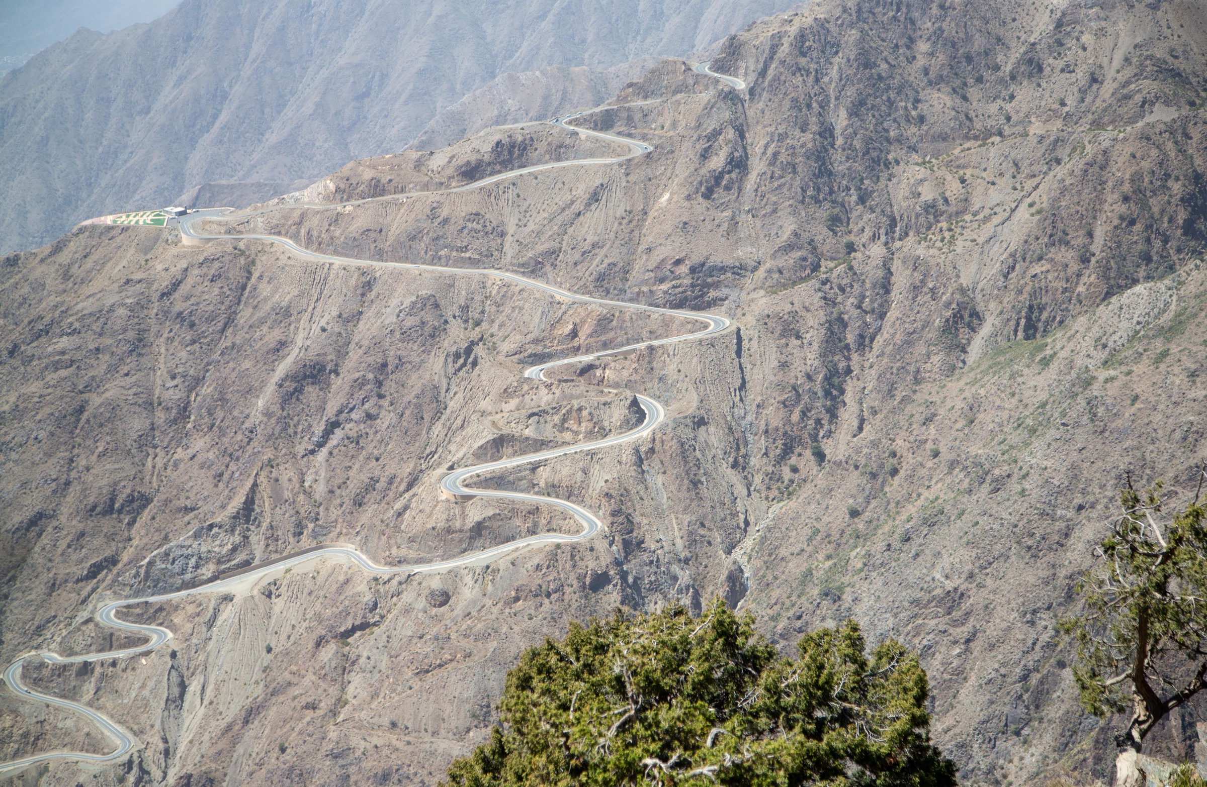
The Asir/Sarawat mountain arc is the high Red Sea escarpment of south-western Arabia, running through Saudi Arabia’s Asir and Jazan highlands and continuing into Yemen’s Haraz-Sarawat uplands. Its walking character is unusual for Arabia: juniper highlands, cliff villages, terraced agriculture, deep wadis, canyon streams, fog-prone ridges, and volcanic high summits.
The Saudi side has the strongest current route data, especially around Al Soudah, Rijal Almaa, Abha, Habala, and Wadi Lajab. The Yemen side has some of the most important mountain landscapes in the region, including Jabal An-Nabi Shu’ayb and Haraz, but current safety and access verification make those entries candidate records rather than practical travel recommendations.
Best hiking conditions are generally in the cooler, drier months, with local variation by elevation. Summer highlands can be cooler than nearby lowlands, but fog, thunderstorms, and flash floods are serious hazards. In wadis, rainfall upstream can make narrow canyon sections dangerous even when the local sky is clear.
This entry is not a current travel recommendation for Yemen. Checked on 11 June 2026, the U.S. State Department advisory for Yemen is Level 4 “Do not travel”, and the UK FCDO page, still current on 11 June 2026, advises against all travel to Yemen.
Selection rationale
The selection combines the best-documented Saudi highland hike, a major Sarawat/Jazan canyon, a culturally important Asir escarpment village walk, Yemen’s highest mountain, and the Haraz terrace-village landscape. Only Jebel Sawda has route statistics strong enough for a normal hiking entry; the other four are retained because they are essential to the region’s identity but need further route, GPX, and access verification.
Summary table
| # | Hike | Country | Route type | Distance | Gain | Max elevation | Difficulty |
|---|---|---|---|---|---|---|---|
| 1 | Jebel Sawda ridge from Rijal Almaa side | Saudi Arabia | Out-and-back | 14.6 km | 1,054 m | 2,982 m on route trace | Hard |
| 2 | Wadi Lajab canyon walk | Saudi Arabia | Out-and-back canyon turn-around | Not resolved; canyon source length c. 11 km | Not resolved | Not resolved | Moderate-hard; water/flash-flood dependent |
| 3 | Habala cliff-village and escarpment walk | Saudi Arabia | Short out-and-back / lift-assisted cultural walk | Short; not measured | Not resolved | Not resolved | Easy-moderate; exposure dependent |
| 4 | Jabal An-Nabi Shu’ayb summit approach | Yemen | Out-and-back / road-track variant unresolved | Not resolved | Not resolved | 3,666 m | Hard / access dependent |
| 5 | Manakhah to Al Hajjarah / Haraz village walk | Yemen | Out-and-back / village-path variant | Not resolved | Not resolved | Not resolved | Moderate; access dependent |
1. Jebel Sawda ridge from Rijal Almaa side

Snapshot
Itinerary
The route climbs from the Rijal Almaa side toward the high ridge of Jebel Sawda / Al Soudah. The AllTrails description records a transition from drier cactus country into mossy forest and then onto the upper ridge. The practical hiking line is the ridge ascent rather than the paved summit-road approach.
The route is long and steep by regional standards. It should be treated as a full mountain day, with an early start and conservative turn-around time if fog or storms build over the escarpment.
Why it is essential
Jebel Sawda is the best-known high mountain of Asir and one of Saudi Arabia’s signature escarpment landscapes. It gives the clearest verified day-hike expression of the Asir highlands: steep relief, forest, ridge views, and the Rijal Almaa/Al Soudah cultural setting.
Equipment
- Mountain hiking equipment: sturdy boots, sun protection, rain/wind layer, warm layer, water, food, offline map/GPS, and headtorch.
- Trekking poles recommended for the long descent.
- Navigation backup is important because fog can cut visibility quickly.
Hazards and notes
- Steep climbs, rocky footing, and long descent.
- Fog, cold wind, thunderstorms, and lightning exposure on the high ridge.
- Flash-flood risk on approach roads and gullies after storms.
- AllTrails user summaries mention wildlife encounters and rocky terrain; current local advice should be checked before publication.
- Jabal Soudah elevation sources disagree; route statistics use the AllTrails route trace, while summit context is listed separately.
GPX / KML links
| Source | URL | Format / access | Reuse status |
|---|---|---|---|
| AllTrails: Jebel Sawda | alltrails.com | Source route page | AllTrails terms apply; GPX download/reuse not confirmed |
External links
- AllTrails — Jebel Sawda
- Wikipedia — Jabal Soudah
- Wikipedia — Asir
- Wikimedia Commons — Al Sawda peak
- Wikimedia Commons — Rijal Almaa during the day
2. Wadi Lajab canyon walk

Snapshot
Itinerary
The candidate walk follows the accessible lower/central part of Wadi Lajab, a narrow canyon in the Jazan highlands with rock walls, running water, vegetation, and constricted passages. A publication-ready route must define the exact legal start, normal safe turn-around point, and whether any water scrambling is unavoidable.
The practical day-hike form should be an out-and-back canyon walk rather than a full canyon traverse.
Why it is essential
Wadi Lajab is one of the most distinctive canyon landscapes in the Sarawat/Jazan highlands and balances the high ridges of Asir with a water-cut escarpment route.
Equipment
- Standard hiking equipment plus grippy footwear suitable for wet rock.
- Dry bag or waterproof protection for electronics.
- Extra water despite the canyon setting; do not rely on untreated stream water.
- Navigation and a local access check.
Hazards and notes
- Flash floods are the primary hazard. Do not enter the canyon during rain, after heavy rain, or when storms are forecast upstream.
- Wet polished rock, pools, unstable boulders, and narrow slots can make retreat difficult.
- Route distance, gain, and normal turn-around point remain unresolved.
- The canyon source length is not the same as a verified walking route length.
GPX / KML links
| Source | URL | Format / access | Reuse status |
|---|---|---|---|
| OpenStreetMap search: Wadi Lajab | openstreetmap.org | Map source | OSM data is ODbL; orientation only |
External links
3. Habala cliff-village and escarpment walk

Snapshot
Itinerary
Habala is a cliff-village and escarpment candidate rather than a fully verified hiking trail. The visitable walking line is likely a short route between the cable-car exit, old village sections, museum/restaurant areas, and escarpment viewpoints where public access is permitted.
Any publication route should avoid implying access to private, closed, or unsafe cliff paths. The old rope-ladder access is historical context, not a modern hiking instruction.
Why it is essential
Habala is one of the defining cultural landscapes of the Asir escarpment, combining cliff settlement, mountain views, and the history of access by rope ladder. It provides the culturally important short-walk counterpart to the longer Sawda ridge hike.
Equipment
- Standard hiking equipment for short mountain walks.
- Sun protection, water, and grippy footwear.
- Warm or wind layer in cool/foggy weather.
Hazards and notes
- Cliff edges, unstable old structures, and access restrictions are the main issues.
- Cable-car operation, opening hours, and public walking areas need current local confirmation.
- Route statistics are not publication-grade.
GPX / KML links
| Source | URL | Format / access | Reuse status |
|---|---|---|---|
| OpenStreetMap search: Habala | openstreetmap.org | Map source | OSM data is ODbL; orientation only |
External links
4. Jabal An-Nabi Shu’ayb summit approach

Snapshot
Itinerary
Jabal An-Nabi Shu’ayb is the country high point of Yemen and the highest mountain in the Arabian Peninsula. The summit is in the Haraz-Sarawat highlands near Sanaa. This pass verified the mountain, elevation, and regional importance, but did not verify a safe, legal, current hiking line.
The eventual catalogue route must establish whether the ascent is a footpath, road walk, restricted service-road approach, or access-controlled summit area before it can be described as a day hike.
Why it is essential
The highest mountain in Yemen and the Arabian Peninsula is topographically essential for any Asir/Sarawat catalogue, even though it is not currently publication-ready as a hiking recommendation.
Equipment
- Future-use only: mountain hiking equipment, windproof and warm layers, sun protection, water, navigation, headtorch, and local permissions/security support.
- Current travel-advisory conditions supersede recreational equipment planning.
Hazards and notes
- Current Yemen security, checkpoints, kidnapping risk, landmines/unexploded ordnance, limited medical care, and lack of consular support are overriding hazards.
- Physical hazards include altitude, cold wind, lightning, rough volcanic terrain, and possible restricted/military infrastructure near the summit.
- Do not infer access from summit elevation alone.
GPX / KML links
| Source | URL | Format / access | Reuse status |
|---|---|---|---|
| OpenStreetMap search: Jabal An-Nabi Shu’ayb | openstreetmap.org | Map source | OSM data is ODbL; orientation only |
| Peakbagger reference | peakbagger.com | Peak reference page | Peakbagger terms; summit reference only, not a GPX route |
External links
- Wikipedia — Jabal An-Nabi Shu’ayb
- Peakbagger — Jabal an Nabi Shu’ayb
- U.S. State Department — Yemen travel advisory
- UK FCDO — Yemen travel advice
- Wikimedia Commons — Al-Qadisiyyah Park (panoramio)
- Wikimedia Commons — Kawkaban wadi view
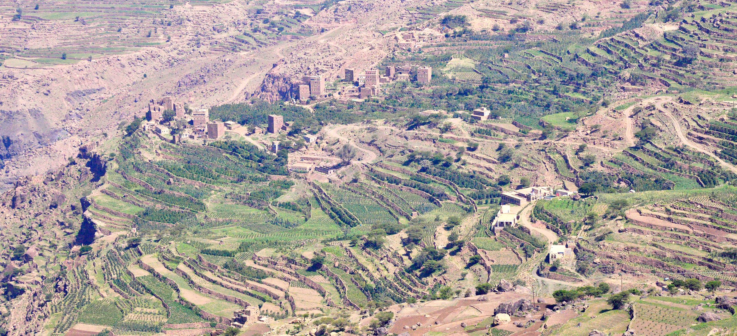
5. Manakhah to Al Hajjarah / Haraz village walk

Snapshot
Itinerary
This Haraz candidate would use old village paths, lanes, and terrace routes linking Manakhah with Al Hajjarah and nearby fortified settlements where access is permitted. Jabal Haraz is noted for fortified villages, terraced fields, and mountain settlements integrated into rocky slopes.
No current safe route line, public access protocol, or legal GPX source was confirmed. This remains a place-based candidate until route geometry and access can be checked locally.
Why it is essential
Haraz is one of the defining cultural mountain landscapes of the Sarawat: terraced slopes, fortified villages, coffee history, and stone architecture. A village-to-village day walk is the most representative hiking form for the area.
Equipment
- Future-use only: sturdy shoes, sun protection, water, modest clothing, local guide/permissions, and emergency communications.
- Current travel-advisory conditions supersede recreational equipment planning.
Hazards and notes
- Current Yemen security conditions are the controlling hazard.
- Physical hazards include cliff/terrace exposure, loose paths, heat, private/community access boundaries, and limited rescue options.
- Route statistics and source-route geometry remain unresolved.
GPX / KML links
| Source | URL | Format / access | Reuse status |
|---|---|---|---|
| OpenStreetMap search: Manakhah Al Hajjarah | openstreetmap.org | Map source | OSM data is ODbL; orientation only |
External links
- Wikipedia — Jabal Haraz
- Wikipedia — Al Hajjarah
- UNESCO tentative list — Jabal Haraz
- U.S. State Department — Yemen travel advisory
- UK FCDO — Yemen travel advice
- Wikimedia Commons — Hajarah, Haraz Mountains
- Wikimedia Commons — Yemen terraces / Haraz-region context
Missing data / follow-up work
- Saudi-side official GPX/KML downloads were not found in this pass.
- Jebel Sawda route statistics come from AllTrails; official route statistics and direct GPX reuse remain unresolved.
- Wadi Lajab needs a defined legal trailhead, safe turn-around point, and measured route distance/gain.
- Habala needs current cable-car/open-area confirmation and measured short-walk geometry.
- Yemen-side entries are candidate-only because current official travel advisories make normal recreational verification impractical and unsafe.
- Jabal An-Nabi Shu’ayb needs legal access, summit-area restrictions, and route geometry checked before publication.
- Haraz village walking needs current local access, route geometry, and community/guide requirements confirmed.
External links
| Source | URL |
|---|---|
| AllTrails — Jebel Sawda | alltrails.com |
| Wikipedia — Jabal Soudah | en.wikipedia.org |
| Wikipedia — Asir | en.wikipedia.org |
| Wikipedia — Habala | en.wikipedia.org |
| Wikipedia — Jazan Province / Wadi Lajab | en.wikipedia.org |
| Wikipedia — Jabal An-Nabi Shu’ayb | en.wikipedia.org |
| Peakbagger — Jabal an Nabi Shu’ayb | peakbagger.com |
| Wikipedia — Jabal Haraz | en.wikipedia.org |
| UNESCO tentative list — Jabal Haraz | whc.unesco.org |
| U.S. State Department — Yemen travel advisory | travel.state.gov |
| UK FCDO — Yemen travel advice | gov.uk |