Regional overview
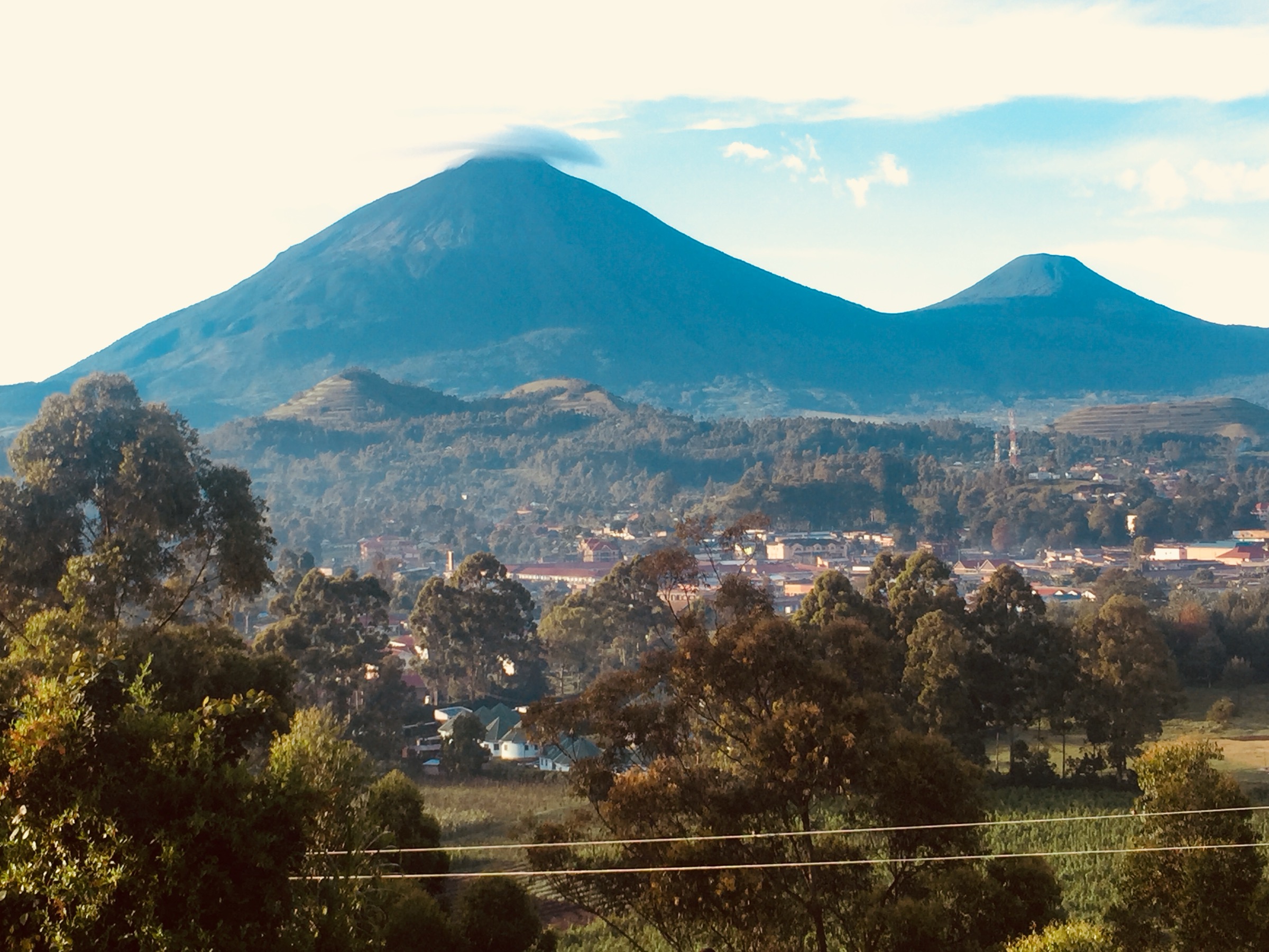
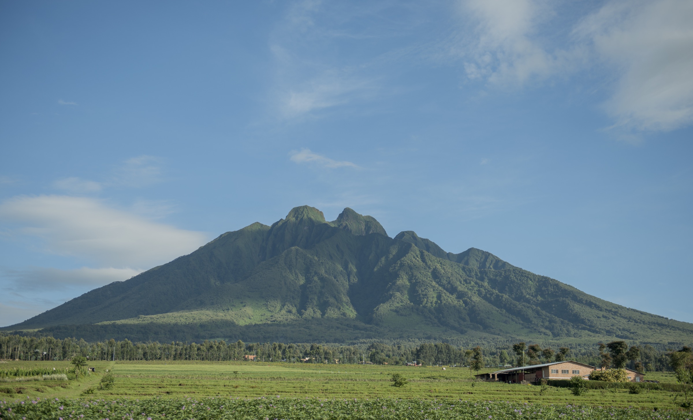
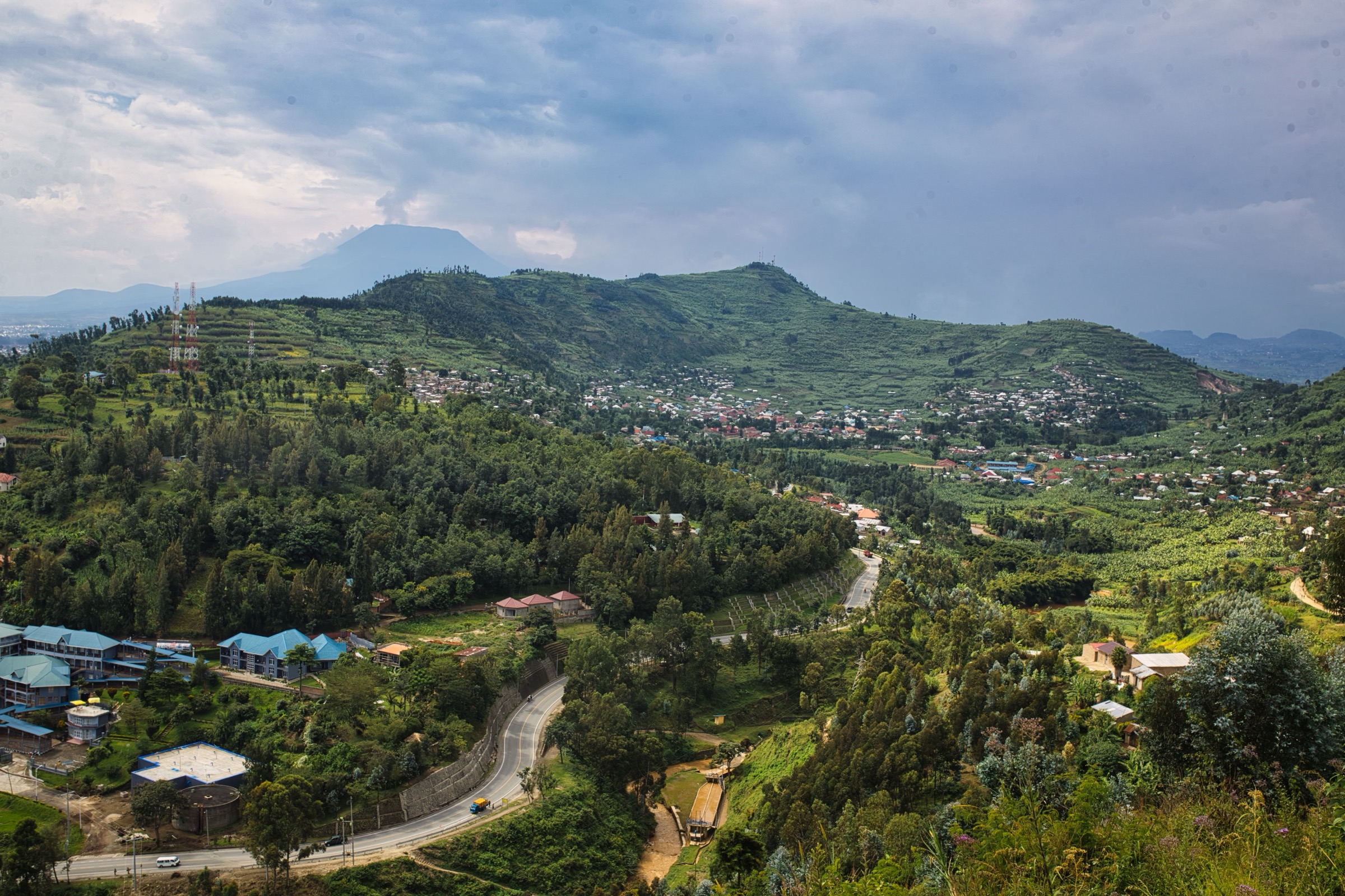
The Virunga Mountains are a chain of eight volcanoes on the western branch of the East African Rift, lying between Lake Kivu and Lake Edward and straddling the borders of Rwanda, Uganda and the Democratic Republic of the Congo. The eight peaks are Karisimbi (4,507 m), Mikeno (4,437 m), Muhabura (4,127 m), Bisoke or Visoke (3,711 m), Sabyinyo (3,669 m), Gahinga (3,474 m), Nyiragongo (3,470 m) and Nyamuragira (3,058 m). Most are dormant stratovolcanoes; Nyiragongo and Nyamuragira on the Congolese side remain active, with Nyiragongo’s last major eruption recorded on 22 May 2021.
Three contiguous protected areas cover the range: Volcanoes National Park in Rwanda, managed by the Rwanda Development Board (RDB); Mgahinga Gorilla National Park in Uganda, managed by the Uganda Wildlife Authority (UWA); and Virunga National Park in the Democratic Republic of the Congo, managed by the Institut Congolais pour la Conservation de la Nature (ICCN). Virunga National Park was inscribed as a UNESCO World Heritage Site in 1979 and has been on the List of World Heritage in Danger since 1994.
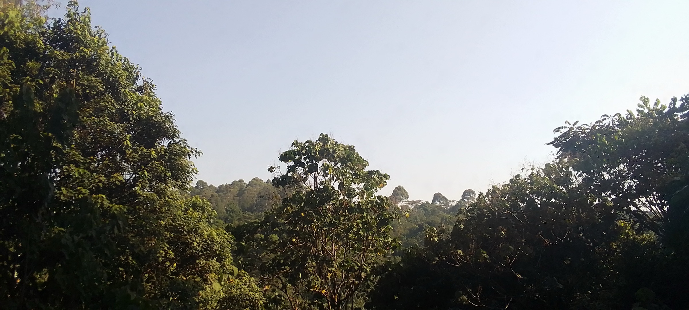
Hiking is the principal non-gorilla visitor activity. The vegetation belts climb from cultivated foothills through bamboo and montane forest to Hagenia-Hypericum and Afro-alpine zones with giant lobelias and senecios near the summits. Trails are normally muddy, steep and weather-exposed; armed park rangers accompany all summit hikes for wildlife protection. The drier hiking windows in Rwanda and Uganda fall in June-September and December-February, although hikes are operated year-round. Mountain gorillas are present across all three parks and golden monkey habitat overlaps with several summit routes.
Access is highly asymmetric. Rwanda’s park headquarters at Kinigi, near Musanze, is the standard base for Bisoke, Karisimbi, the Rwandan side of Sabyinyo and the Dian Fossey grave trail. Uganda’s Mgahinga headquarters at Ntebeko, near Kisoro, is the base for Muhabura, Gahinga and the only feasible Sabyinyo summit route. The DRC side — Nyiragongo, Nyamuragira and Mount Mikeno — is access-restricted. As of mid-2026, following the M23 advance into Goma in January 2025 and prolonged armed conflict in North Kivu, Virunga National Park remains closed to independent tourism. Park status and government travel advisories should always be re-checked before any DRC route is planned.
Selection rationale
The five hikes were chosen to span the range’s most representative day routes across all three countries while respecting the catalogue’s day-hike constraints:
- Mount Bisoke (Rwanda) — the defining day hike of Volcanoes National Park to a crater lake summit, and the route most cited in RDB-affiliated material.
- Mount Sabyinyo (Uganda from Mgahinga) — the only feasible summit route on the Rwanda-Uganda-DRC tripoint, including the famous ladder ridge.
- Mount Muhabura (Uganda from Mgahinga) — the highest stratovolcano feasibly day-hiked in the Virungas, with a small summit crater lake.
- Dian Fossey grave and Karisoke memorial hike (Rwanda) — the range’s defining cultural and conservation-history walk, shorter and lower than the summit routes.
- Mount Nyiragongo (DRC) — the volcano hike of greatest international notoriety because of its summit lava lake, flagged as security-sensitive and currently inaccessible.
Mount Karisimbi is excluded as it is sold by RDB as a two-day trek with an overnight camp at around 3,700 m and does not fit the day-hike definition. Mount Gahinga is documented in the regional overview as an alternative shorter option but was passed over in favour of Sabyinyo and Muhabura, which carry more weight in published literature and tourism material.
Summary table
| # | Hike | Country | Route type | Distance | Gain | Max elevation | Difficulty |
|---|---|---|---|---|---|---|---|
| 1 | Mount Bisoke crater lake | Rwanda | Out-and-back | 9.5-12 km | 1,000-1,200 m | 3,711 m | Hard |
| 2 | Mount Sabyinyo three peaks | Uganda (tripoint summit) | Out-and-back | 13-14 km | 1,400 m | 3,669 m | Hard |
| 3 | Mount Muhabura | Uganda | Out-and-back | 10-12 km | 1,600-1,800 m | 4,127 m | Hard |
| 4 | Dian Fossey grave / Karisoke memorial | Rwanda | Out-and-back | 6 km | 500 m | 3,000 m | Moderate |
| 5 | Mount Nyiragongo (access-restricted) | DRC | Out-and-back | 13 km | 1,600 m | 3,470 m | Hard |
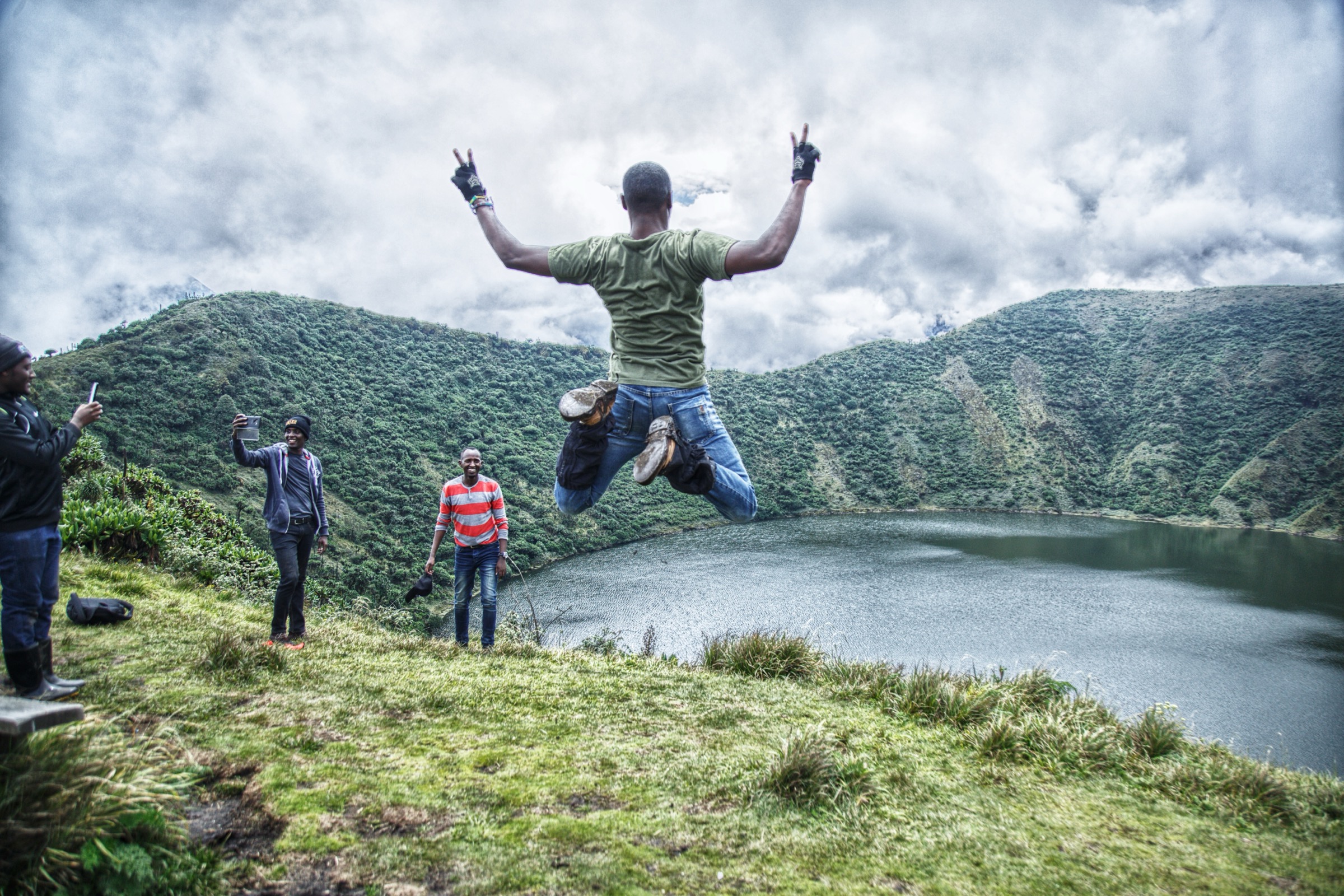
1. Mount Bisoke crater lake
Snapshot
Itinerary
The hike begins with a daily briefing at the Volcanoes National Park headquarters in Kinigi, followed by a short transfer to the Bisoke trailhead at roughly 2,700 m. The route climbs the southern flank of Mount Bisoke through farmland, a buffalo wall, dense bamboo, then Hagenia and Hypericum forest. Lake Ngezi, a smaller crater lake on the saddle below the main summit, is the standard mid-route landmark on combined-route variants. Above about 3,300 m the path steepens substantially through alpine vegetation and soft volcanic ground to the rim of the summit crater lake. The crater holds a roughly circular lake about 400 m across at 3,711 m. Descent is by the same route. Wildlife encounters with mountain gorillas, golden monkeys, forest elephants or buffalo are possible at any time on the lower forested sections.
Why it is essential
Mount Bisoke is the defining day hike of the Virunga Massif. It is the only Virunga summit with a large open crater lake reached on a same-day return, the most cited single-day route in RDB and tourism literature, and it sits inside the protected gorilla habitat that defines the region. Within the day-hike constraints of the catalogue it is the closest to a non-negotiable inclusion.
Equipment
Mountain hiking equipment as a baseline: sturdy waterproof boots, gaiters strongly recommended for deep mud, weatherproof shell, warm layer for the summit, sun protection, gloves and hat for cold rim conditions, headlamp for long days. Trekking poles help on the descent. Porter hire is widely available and standard in tourism guidance. Park-required: an RDB hiking permit (verify the current rate with RDB before travel), an armed park ranger escort, and the mandatory daily briefing at Kinigi.
Hazards and notes
Persistent mud is the dominant hazard and can be ankle-deep over much of the trail. Steep volcanic terrain above the forest line, slippery ground on descent, cold and wet weather at the rim, and high-altitude effects above 3,500 m are the standard difficulties. Wildlife encounters require following ranger guidance. The Rwanda-DRC border crosses the upper mountain and entering DRC territory is prohibited. The summit can be cloud-locked, so the crater lake view is not guaranteed.
GPX / KML links
| Source | URL |
|---|---|
| AllTrails: Mount Bisoke | alltrails.com |
| Wikiloc: Hiking Mount Bisoke | wikiloc.com |
| Visit Rwanda: Volcanoes National Park | visitrwanda.com |
2. Mount Sabyinyo three peaks
Snapshot
Itinerary
The hike starts at Ntebeko at roughly 2,340 m with a UWA ranger briefing. The path crosses farmland and a buffalo wall into the bamboo and montane forest of Mgahinga, climbing steadily before turning onto the southern ridge of Mount Sabyinyo. The route then follows a series of three peaks linked by sharp ridges and wooden ladders. Peak One is reached first at about 3,400 m; the route then drops slightly, climbs by ladder to Peak Two, and finishes with the steepest sustained ladder section to Peak Three, where the Rwanda-Uganda-DRC tripoint is marked. Descent is by the same line. The summit ridge gives panoramic views of Muhabura and Gahinga to the east, Karisimbi and Mikeno to the south-west, and Lake Kivu beyond. The mountain’s name in Kinyarwanda means “old man’s teeth” in reference to its serrated profile.
Why it is essential
Mount Sabyinyo is the only feasible Virunga tripoint summit and is hiked only from the Ugandan side, as the Rwandan and Congolese faces are too steep. The famous ladder ridge is one of the range’s most distinctive hiking experiences. It is the standard counterpoint to the Bisoke crater-lake hike and is repeatedly highlighted by UWA-affiliated material as the signature Mgahinga summit.
Equipment
Mountain hiking equipment with emphasis on gripped boots, gloves for ladders and exposed rock, weatherproof shell, warm layer for the summit ridge, sun protection and trekking poles. A headlamp is sensible for long days. Porter hire is available at Ntebeko. Park-required: a UWA hiking permit (verify the current rate with UWA before travel) and an armed ranger escort.
Hazards and notes
The principal hazard is the ladder and ridge section between Peaks One, Two and Three: exposed, weather-affected, and requiring three-point contact. Mud is severe on the lower forest sections. Altitude effects appear above 3,400 m. Cloud and wind can close the summit ridge; rangers may turn back groups in unsafe conditions. The tripoint summit is on an international border — photography is acceptable but crossing into DRC territory is prohibited.
GPX / KML links
| Source | URL |
|---|---|
| Wikiloc: Mount Sabyinyo 3.645 m | wikiloc.com |
| Hiking Project: Mount Sabyinyo Trail | hikingproject.com |
| Asilia Africa: Mgahinga Gorilla National Park | asiliaafrica.com |
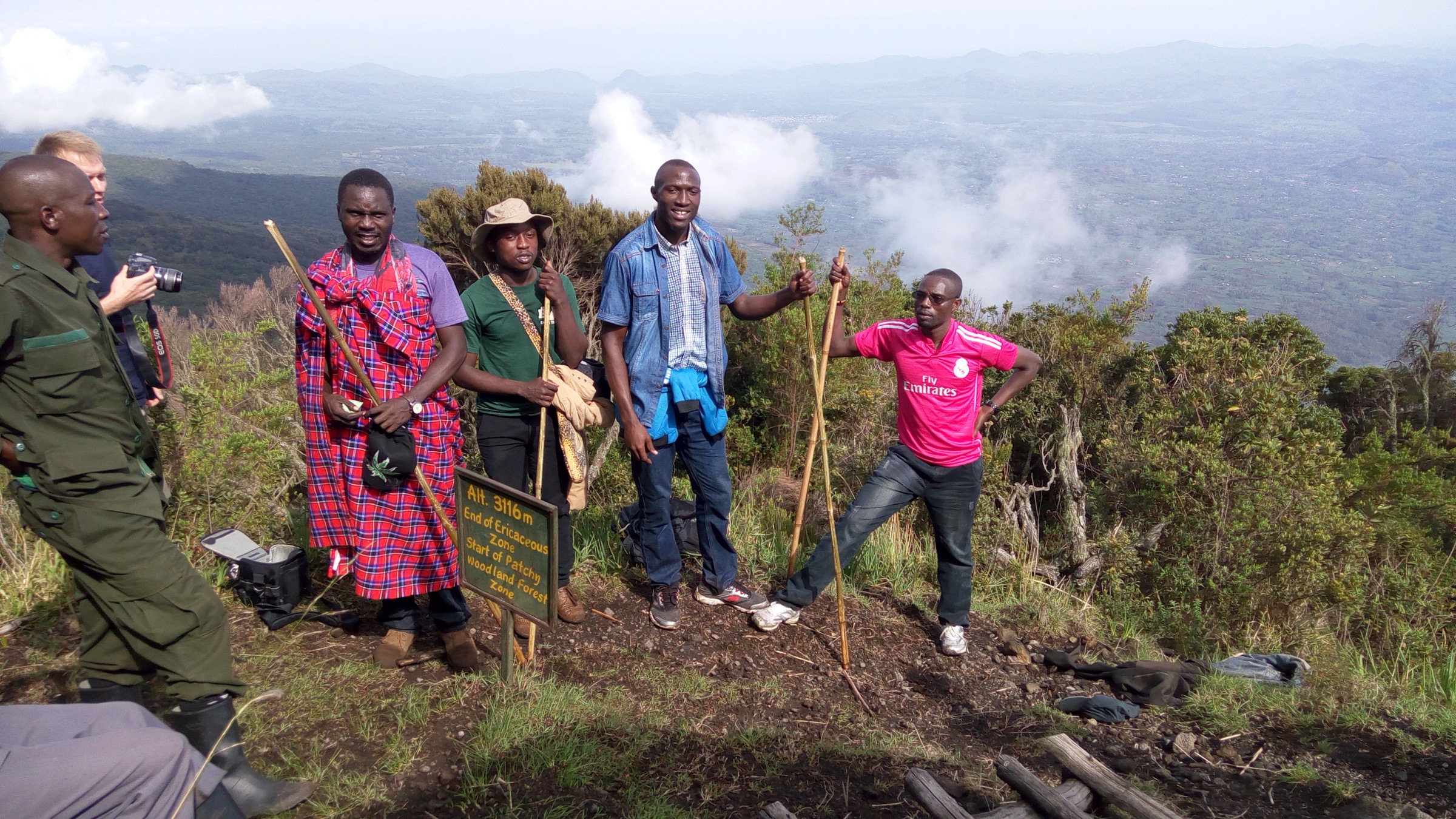
3. Mount Muhabura
Snapshot
Itinerary
The route starts at Ntebeko at roughly 2,340 m. The path skirts farmland and the park boundary buffalo wall before climbing steeply and continuously up the southern flank of Mount Muhabura. Stages follow the vegetation belts: bamboo, montane forest, Hagenia, ericaceous heather, then Afro-alpine grassland with giant lobelias and senecios on the upper cone. The summit is a small crater holding a shallow lake at 4,127 m. The route returns by the same line. On clear days the summit gives wide panoramas of the other Virunga peaks, Lake Bunyonyi to the north-east, and the volcanic field north of Goma.
Why it is essential
Mount Muhabura is the highest Virunga summit feasibly completed in a single day. It sits at the boundary of the catalogue’s “under 1,800 m of ascent” rule but is included on the strength of being a single-day route to a named active rift summit at over 4,100 m, with a summit crater lake. It is the strenuous counterpart to Bisoke in the catalogue and offers the most distinctive Mgahinga summit profile.
Equipment
Mountain hiking equipment as a baseline: sturdy waterproof boots, gaiters for mud, weatherproof shell, warm and windproof summit layers, gloves and hat for the cold upper cone, sun protection, a headlamp for a likely-dark return, and trekking poles. Porter and walking-stick hire are standard at Ntebeko. Park-required: a UWA hiking permit (verify the current rate with UWA before travel) and an armed ranger escort.
Hazards and notes
The route is steep, sustained and high. Altitude effects above 3,500 m can be significant, and acclimatisation is not standard for visitors flying in. The upper cone is open and exposed to cold, wind and rain. Mud is severe on the lower bamboo sections. Wildlife encounters with buffalo or elephant are possible on the lower forest belt. Group pace is set by ranger judgement and turnaround calls in poor weather are common.
GPX / KML links
| Source | URL |
|---|---|
| AllTrails: Nyagahinga / Mount Muhabara | alltrails.com |
| Asilia Africa: Mgahinga Gorilla National Park | asiliaafrica.com |
4. Dian Fossey grave and Karisoke memorial
Snapshot
Itinerary
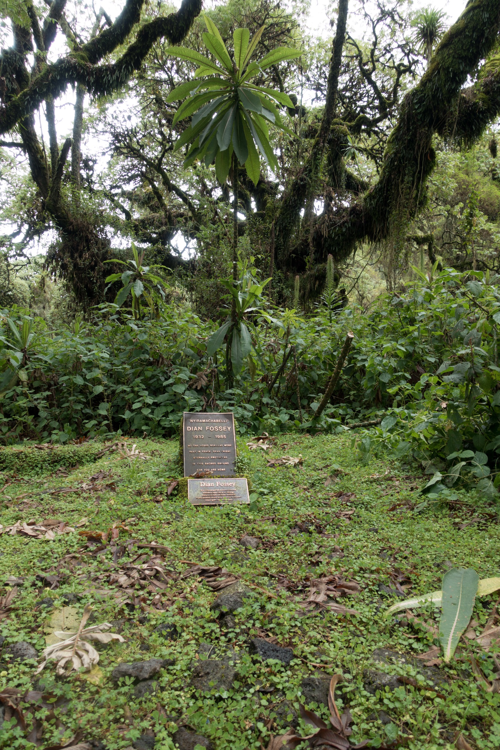
The hike begins with a daily briefing at the Volcanoes National Park headquarters in Kinigi, followed by a short transfer to the Bisoke trailhead. The route shares the initial Bisoke approach through farmland, the buffalo wall and the lower bamboo belt, then turns off onto the saddle path between Mount Bisoke and Mount Karisimbi. The trail climbs through Hagenia and Hypericum forest to the site of the original Karisoke Research Center established by Dian Fossey in 1967. The memorial includes Fossey’s grave and the gorilla graveyard, where she lies buried next to Digit and other named research subjects killed by poachers. Return is by the same route. The hike is widely sold as a four-to-six hour itinerary including time at the memorial.
Why it is essential
The Dian Fossey grave hike is the cultural and conservation-history walk that defines visits to Volcanoes National Park beyond gorilla trekking and the summit routes. It is the only formal day hike that visits the founding site of mountain-gorilla conservation research in the Virungas. Within the catalogue selection it is the regional equivalent of a culturally or historically important route.
Equipment
Standard mountain hiking equipment: waterproof boots, gaiters strongly recommended for mud, weatherproof shell, warm layer, sun protection, gloves. Trekking poles are useful on the muddy descent. Porter hire is available at the trailhead. Park-required: an RDB hiking permit (verify the current rate with RDB before travel) and an armed park ranger escort.
Hazards and notes
Mud is the dominant hazard, as on Bisoke. Altitude effects are mild compared with the summit hikes. Buffalo and elephant signs are frequent on the lower forest sections; ranger guidance must be followed. The memorial site is on the saddle of two active conservation zones and visitor behaviour is governed by park rules; flash photography near gorillas, off-trail walking and collecting plant material are prohibited.
GPX / KML links
| Source | URL |
|---|---|
| Visit Rwanda: Volcanoes National Park | visitrwanda.com |
| Dark-Tourism: Dian Fossey grave at Karisoke | dark-tourism.com |
| Dian Fossey Gorilla Fund: Karisoke anniversary | gorillafund.org |
5. Mount Nyiragongo (currently access-restricted)
Snapshot
Itinerary
When operational, the trek starts at the Kibati Ranger Post north of Goma, with a ranger briefing and group formation. The route follows the 2002 lava trail in five staged sections separated by short breaks. The path crosses dense forest at the base, opens onto pyroclastic and lava terrain on the middle slopes, then ascends sharply through ericaceous and Afro-alpine vegetation to the crater rim. A series of basic rim huts at about 3,470 m hold groups overnight, with the active lava lake visible inside the crater below the rim. Descent is by the same route the following morning. Pure single-day return ascents have been completed by fit walkers but are not the standard format and were not the published Virunga National Park itinerary.
Why it is essential
Mount Nyiragongo holds one of the world’s largest persistent lava lakes inside its summit crater and is the most internationally recognised hike on the Congolese side of the Virungas. Its summit overnight was, until recent closures, the showpiece visitor experience of Virunga National Park. The hike is included in the catalogue as the regional representative of the DRC volcanoes, and is flagged as currently inaccessible and security-sensitive.
Equipment
Mountain hiking equipment with strong emphasis on warm and windproof layers for the cold crater rim, weatherproof shell, sturdy waterproof boots, headlamp (essential at the summit camp), gloves, a gas mask or buff for sulphur dioxide exposure on the rim, a sleeping bag rated for cold high-altitude camps, food and water. Park-required: an ICCN / Virunga National Park trek permit, an armed ranger escort, a valid DRC visa and travel insurance.
Hazards and notes
This hike sits outside normal day-hike risk in three categories. First, it is an active volcano with a persistent lava lake; the eruptive event of May 2021 destroyed homes and infrastructure on the Goma side and killed approximately 32 people. Second, gas exposure at the rim — principally sulphur dioxide — can be acute when wind drives the plume across the camp. Third, the surrounding region of North Kivu is affected by ongoing armed conflict. In January 2025 M23 forces took the city of Goma and Virunga National Park remained closed to independent tourism through subsequent months. As of mid-2026, the most recent reporting confirms that the park is not operating tourism activities and the Nyiragongo trek is not bookable; UK FCDO, US State Department and equivalent advisories continue to warn against travel to North Kivu, and Ebola has historically been reported in the wider eastern DRC. The status must be re-checked against ICCN, Virunga National Park communications and government travel advisories before any trip planning.
GPX / KML links
| Source | URL |
|---|---|
| Wikiloc: Nyiragongo Vulcano hike | wikiloc.com |
| Visit Virunga: Nyiragongo Volcano Trek | visit.virunga.org |
| Virunga National Park | virunga.org |
External links
| Source | URL |
|---|---|
| Wikipedia: Virunga Mountains | en.wikipedia.org |
| Wikipedia: Mount Bisoke | en.wikipedia.org |
| Wikipedia: Mount Sabyinyo | en.wikipedia.org |
| Wikipedia: Mount Muhabura | en.wikipedia.org |
| Wikipedia: Mount Nyiragongo | en.wikipedia.org |
| Wikipedia: 2021 Mount Nyiragongo eruption | en.wikipedia.org |
| Wikipedia: Volcanoes National Park | en.wikipedia.org |
| Wikipedia: Mgahinga Gorilla National Park | en.wikipedia.org |
| Wikipedia: Virunga National Park | en.wikipedia.org |
| Wikipedia: Karisoke Research Center | en.wikipedia.org |
| UNESCO World Heritage Centre: Virunga National Park | whc.unesco.org |
| UNESCO 2025 State of Conservation: Virunga | whc.unesco.org |
| Visit Rwanda: Volcanoes National Park | visitrwanda.com |
| Visit Rwanda: Hiking interests | visitrwanda.com |
| Asilia Africa: Mgahinga Gorilla National Park | asiliaafrica.com |
| Visit Virunga: Nyiragongo Volcano Trek | visit.virunga.org |
| Virunga National Park / ICCN | virunga.org |
| Dian Fossey Gorilla Fund: Karisoke anniversary | gorillafund.org |
| AllTrails: Mount Bisoke | alltrails.com |
| AllTrails: Nyagahinga / Mount Muhabara | alltrails.com |
| Wikiloc: Hiking Mount Bisoke | wikiloc.com |
| Wikiloc: Mount Sabyinyo 3.645 m | wikiloc.com |
| Wikiloc: Nyiragongo Vulcano hike | wikiloc.com |
| Hiking Project: Mount Sabyinyo Trail | hikingproject.com |
| Wikimedia Commons: Virunga Mountains category | commons.wikimedia.org |