.jpg)


Regional overview
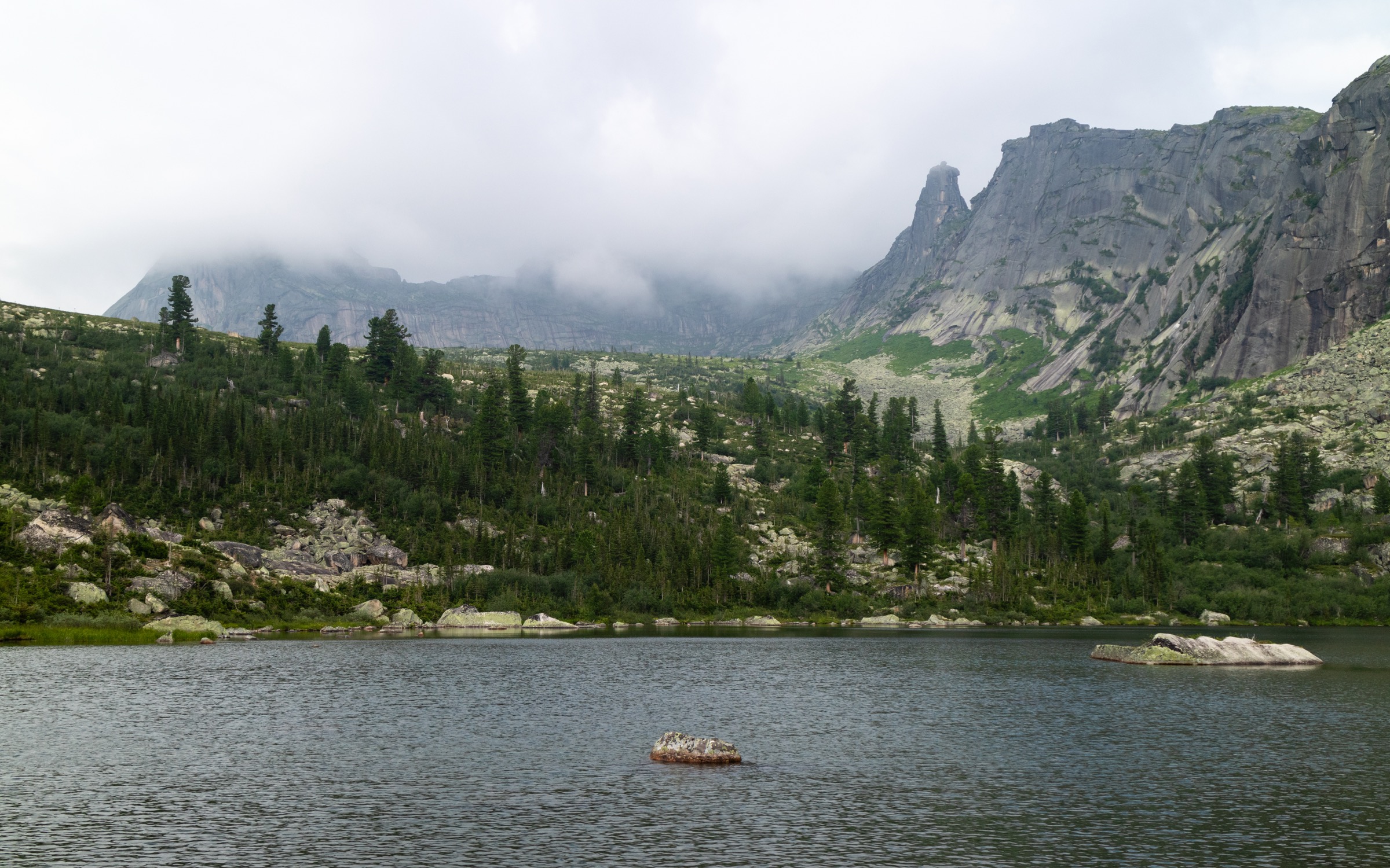
Sakhalin and the Kurils are a wet, maritime mountain-and-volcano region: short but steep forest climbs on Sakhalin, active volcanic craters and solfatara fields in the Kurils, frequent fog, high wind, bear habitat, and weather windows that can close quickly. Public route data is uneven. For this pass I used the local Idilesom route pages where they expose mapped distances, coordinates, season tags, and download endpoints, and I marked longer or ambiguous “one-way” distances explicitly.
Selection rationale
The five routes below balance the most accessible Sakhalin summit hike with four Kuril volcanic objectives. Tyatya is iconic but the available route source describes it as a 2-3 day outing, so it is referenced in the regional context but not selected as an essential day hike.
Summary table
| # | Hike | Island / sub-region | Core reason | Verification status |
|---|---|---|---|---|
| 1 | Peak Chekhov | South Sakhalin, Susunai Range | Classic Yuzhno-Sakhalinsk summit | Verified route source; ascent unresolved |
| 2 | Mendeleev Volcano NW Solfatara Field | Kunashir | Short volcanic fumarole walk | Verified route source; elevation gain unresolved |
| 3 | Ebeko Volcano Crater Route | Paramushir | Active crater above Severo-Kurilsk | Verified route source; active-volcano risk |
| 4 | Upper Yuryev Hot Springs | Paramushir | Geothermal valley west of Ebeko | Verified route source; long-day logistics need local check |
| 5 | Golovnin Caldera Lakes | Kunashir | Southern Kuril caldera, hot lakes | Objective verified; route stats unresolved |
1. Peak Chekhov

Snapshot
Itinerary
From the Yuzhno-Sakhalinsk side, follow the road/trail approach toward the reservoir and then the marked mountain path. The route climbs mixed forest, dwarf birch, kuril bamboo, and cedar elfin thickets before reaching the exposed rocky summit of Peak Chekhov, with views toward the Sea of Okhotsk, Susunai Valley, Aniva Bay, and the Kamyshovy Range in clear weather.
Why it is essential
This is the signature day summit above Yuzhno-Sakhalinsk and one of the most visited natural monuments on Sakhalin, with cultural traces from the Karafuto period and a full cross-section of southern Sakhalin vegetation.
Equipment
Waterproof boots, rain shell, insulating layer, navigation, bear-noise practice, and winter skis or snowshoes when snow-covered.
Hazards and notes
Fog and wet vegetation can obscure the trail. Snow can persist into May. Idilesom notes marked difficult sections; the exact amount of ascent is unresolved.
GPX / KML links
| Source | URL | Format / access | Reuse status |
|---|---|---|---|
| Idilesom route page | idilesom.com | Source route page | Terms not confirmed; use as source route only; re-digitise if needed |
| Idilesom download endpoint | idilesom.com | Route download | Terms not confirmed; legal reuse unresolved |
External links
2. Mendeleev Volcano NW Solfatara Field

Snapshot
Itinerary
The mapped Idilesom route crosses the northwestern solfatara field of Mendeleev Volcano, one of the island’s active geothermal zones. The walk is short, but the terrain is volcanic and the objective is the fumarole/solfatara landscape rather than the summit.
Why it is essential
Mendeleev is one of Kunashir’s defining volcanoes. Its fumarole fields give a compact, feasible day-hike experience of the Kuril volcanic arc.
Equipment
Waterproof boots, rain shell, eye protection in wind-blown gas, map/GPS, and no off-trail shortcuts across crusted hydrothermal ground.
Hazards and notes
Volcanic gas, scalding ground, sudden fog, and fragile crust are the primary hazards. Stay out of gas plumes and avoid low windless hollows.
GPX / KML links
| Source | URL | Format / access | Reuse status |
|---|---|---|---|
| Idilesom route page | idilesom.com | Source route page | Terms not confirmed; use as source route only; re-digitise if needed |
| Idilesom download endpoint | idilesom.com | Route download | Terms not confirmed; legal reuse unresolved |
External links
3. Ebeko Volcano Crater Route

Snapshot
Itinerary
The route leaves the Severo-Kurilsk side of northern Paramushir and climbs toward Ebeko’s summit crater complex. The objective is the crater/fumarole landscape; conditions can change quickly because Ebeko is highly active.
Why it is essential
Ebeko is one of the most active Kuril volcanoes and the most feasible iconic volcano day hike from Severo-Kurilsk.
Equipment
Helmet if ash/rockfall is possible, eye protection, windproof shell, GPS, satellite communicator, and local volcanic-activity check before departure.
Hazards and notes
Do not attempt during ash emission, poor visibility, or official warnings. Acidic crater lakes, gas, ash, snowfields, and wind exposure are all plausible.
GPX / KML links
| Source | URL | Format / access | Reuse status |
|---|---|---|---|
| Idilesom route page | idilesom.com | Source route page | Terms not confirmed; use as source route only; re-digitise if needed |
| Idilesom download endpoint | idilesom.com | Route download | Terms not confirmed; legal reuse unresolved |
External links
4. Upper Yuryev Hot Springs
Snapshot
Itinerary
The route heads from the Severo-Kurilsk side toward the upper Yuryev stream geothermal area west of Ebeko. Idilesom describes multiple hot-water outlets and a geochemically active stream system.
Why it is essential
This is the day-hike counterpoint to the Ebeko crater: instead of the summit, it visits the volcanic hydrothermal system draining the western side of the massif.
Equipment
Long-day kit, river-crossing footwear if needed, GPS, satellite communicator, rain shell, and no bathing or stepping on untested thermal ground.
Hazards and notes
The mapped distance is long if treated as one-way. Treat as a guided/local-logistics route unless transport and return timing are confirmed.
GPX / KML links
| Source | URL | Format / access | Reuse status |
|---|---|---|---|
| Idilesom route page | idilesom.com | Source route page | Terms not confirmed; use as source route only; re-digitise if needed |
| Idilesom download endpoint | idilesom.com | Route download | Terms not confirmed; legal reuse unresolved |
External links
5. Golovnin Caldera Lakes

Snapshot
Itinerary
This candidate day hike targets the Golovnin caldera and its hot/acidic lake landscape in southern Kunashir. Because no legally reusable public GPX/KML or an official day-route stat page was found in this pass, the line should be manually verified before publication.
Why it is essential
Golovnin is the southernmost Kuril volcano and one of Kunashir’s classic volcanic landscapes. It represents the low caldera-lake end of the Kuril hiking spectrum, contrasting with Ebeko and Mendeleev.
Equipment
Waterproof boots, rain shell, navigation, local permit confirmation, and volcanic-gas caution.
Hazards and notes
Route access, exact trailhead, and current protected-area rules are unresolved. Do not use unverified social-media tracks for field navigation without local confirmation.
GPX / KML links
| Source | URL | Format / access | Reuse status |
|---|---|---|---|
| OpenStreetMap search | openstreetmap.org | Map/search | ODbL for OSM database; individual route relation not identified; use only as a manual mapping cross-check |
External links
External links
| Source | URL |
|---|---|
| Idilesom — Peak Chekhov route | idilesom.com |
| Idilesom — Mendeleev NW Solfatara Field | idilesom.com |
| Idilesom — Ebeko Volcano Crater Route | idilesom.com |
| Idilesom — Upper Yuryev Hot Springs | idilesom.com |
| Mendeleyeva — Wikipedia | en.wikipedia.org |
| Ebeko — Wikipedia | en.wikipedia.org |
| Golovnin — Wikipedia | en.wikipedia.org |