Regional overview
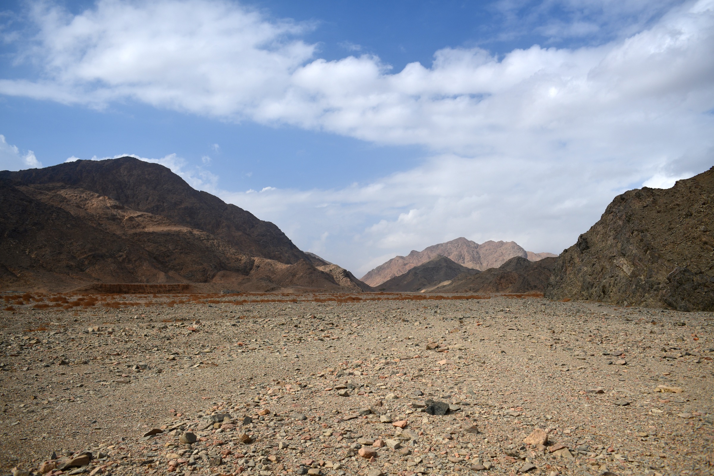
The Red Sea Hills form a long arid mountain belt along the western side of the Red Sea, with rugged granite and volcanic uplands, dry wadis, desert springs, ancient quarrying/mining sites, and isolated highland settlements. The best documented modern hiking network is in Egypt’s Eastern Desert around the Red Sea Mountain Trail near Hurghada. Sudanese and Eritrean Red Sea highlands have significant scenic and cultural value, including Arkawit/Erkowit in Sudan and Filfil/Solomuna in Eritrea, but public day-hike route data is much thinner.
For the Egyptian section, the Red Sea Mountain Trail is the primary source: it describes a 170 km circuit and a wider network of hiking hubs around Jebel Shayib, Um Anab, Abul Hassan, Jebel Gattar, Abu Dukhaan, and Wadi Faalig. The same official source currently states that the trail organisation stopped hikes in November 2024 because permits had become practically unobtainable by late 2024. That closure is a catalogue-level access constraint.
The normal walking season is winter and the cooler shoulder months. Heat, dehydration, scarce water, flash flooding in wadis, rough scrambling, and remote rescue conditions are major issues. Many routes require Bedouin/local guiding, 4x4 approaches, permissions, and current security checks.
Selection rationale
The five entries prioritise the strongest route documentation available in this pass: official Red Sea Mountain Trail day-hike descriptions and Wadi el Gemal/Sikait protected-area context. A Sudanese Arkawit/Erkowit escarpment candidate is retained for regional balance, but it is not publication-ready because no reliable day-hike line or statistics were found.
- Jebel Shayib el Banat summit route — the flagship summit of the northern Red Sea Mountains.
- Abul Hassan to Talla Hamra — a documented canyon-and-wadi traverse on the Red Sea Mountain Trail.
- Jebel Gattar: Um Deesa to El Nagaata — a hard non-summit highland traverse with archaeology and springs.
- Wadi el Gemal / Sikait archaeological walk — a candidate archaeological walk in Wadi el Gemal National Park.
- Arkawit / Erkowit escarpment candidate — a regional Sudanese highland candidate retained for balance.
Summary table
| # | Hike | Country | Route type | Distance | Gain | Max elevation | Difficulty |
|---|---|---|---|---|---|---|---|
| 1 | Jebel Shayib el Banat summit route | Egypt | Out-and-back or scramble circuit, exact line unresolved | 15 km | Over 1,500 m possible by source category; exact line unresolved | 2,187 m | Serious scramble / mountaineering day |
| 2 | Abul Hassan to Talla Hamra | Egypt | Point-to-point / traverse | 17 km | Difficult desert hike with scrambling/water obstacles possible | ||
| 3 | Jebel Gattar: Um Deesa to El Nagaata | Egypt | Traverse | 12 km | ca. 700 m ascent/descent | Hard | |
| 4 | Wadi el Gemal / Sikait archaeological walk | Egypt | Out-and-back or short site walk, exact line unresolved | Candidate only | |||
| 5 | Arkawit / Erkowit escarpment candidate | Sudan | Candidate day walk; route unresolved | Route maximum unresolved; Erkowit ca. 1,100 m | Candidate only |
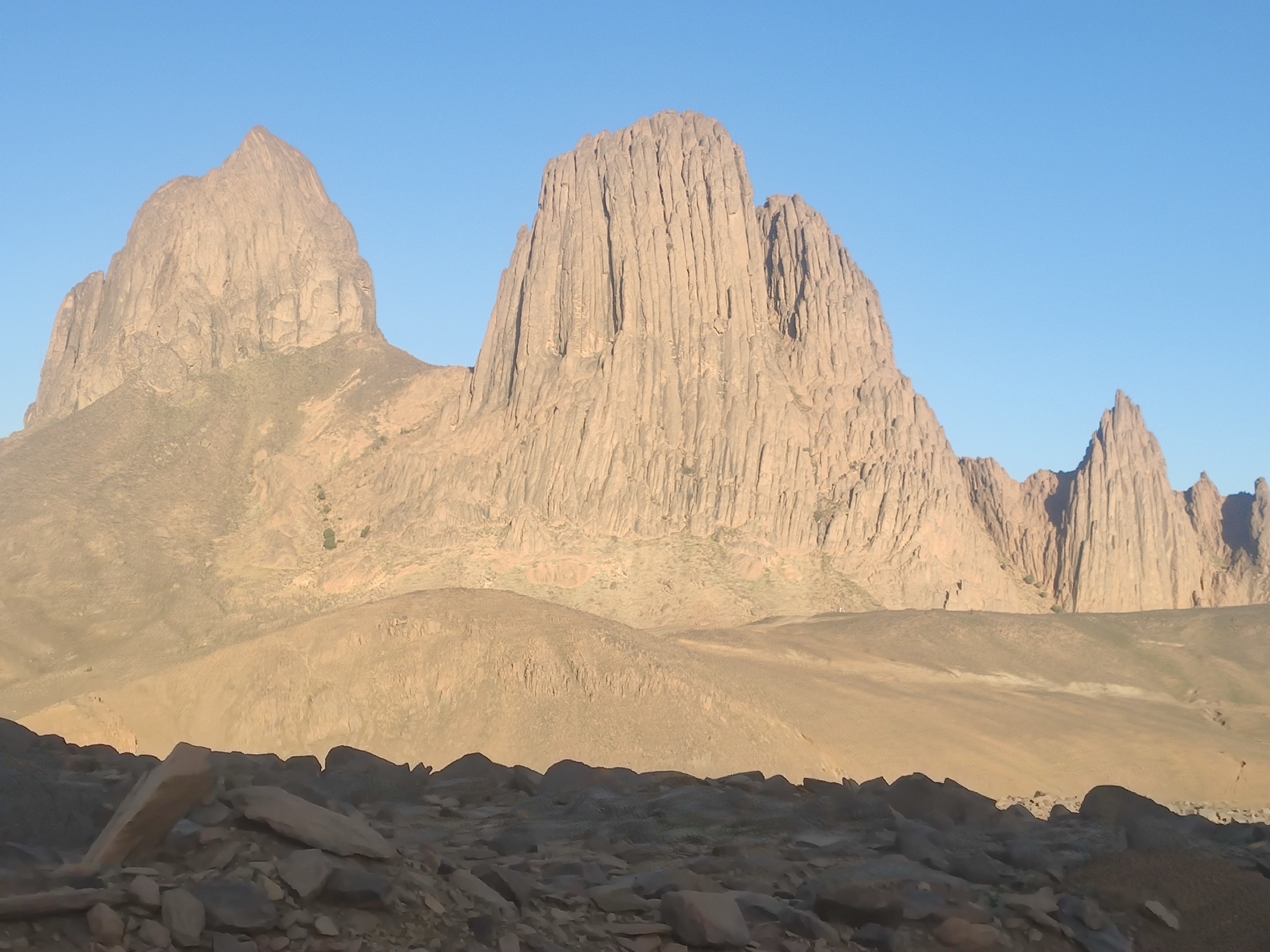
1. Jebel Shayib el Banat summit route
Snapshot
Itinerary
Jebel Shayib el Banat is the highest mountain in mainland Egypt and the flagship summit of the northern Red Sea Mountains. The official RSMT description treats the climb as a serious route with continuous scrambling, steep exposed steps, and a recommendation to wait for overnight clearances rather than force the ascent into a single day.
For catalogue purposes, this entry records the objective but does not publish a walkable itinerary. The exact ascent line, descent, permit status, and current legality of hiking must be confirmed with local authorities and the Red Sea Mountain Trail organisation before any derived route is used.
Why it is essential
Jebel Shayib is the dominant summit of the Egyptian Red Sea Mountains and the natural high-point objective for the region. Its inclusion is essential, but its current access and technical seriousness mean it should not be presented as a normal waymarked day hike.
Hazards and notes
- The Red Sea Mountain Trail states that it is currently closed and stopped hikes in November 2024 after permits became practically unobtainable.
- Continuous scrambling, steep/exposed steps, heat, dehydration, remote rescue, and lack of water.
- Do not publish as a standard day hike until legal access and a specific route line are verified.
GPX / KML links
| Source | URL | Format / access | Reuse status |
|---|---|---|---|
| RSMT: Book a hike / Jebel Shayib listing | redseamountaintrail.org | Official route description | Copyright Red Sea Mountain Trail; route file not provided; description checked, no reusable route file |
| RSMT: Jebel Shayib hub | redseamountaintrail.org | Official area description | Copyright Red Sea Mountain Trail; route file not provided; area context checked, no GPX |
External links
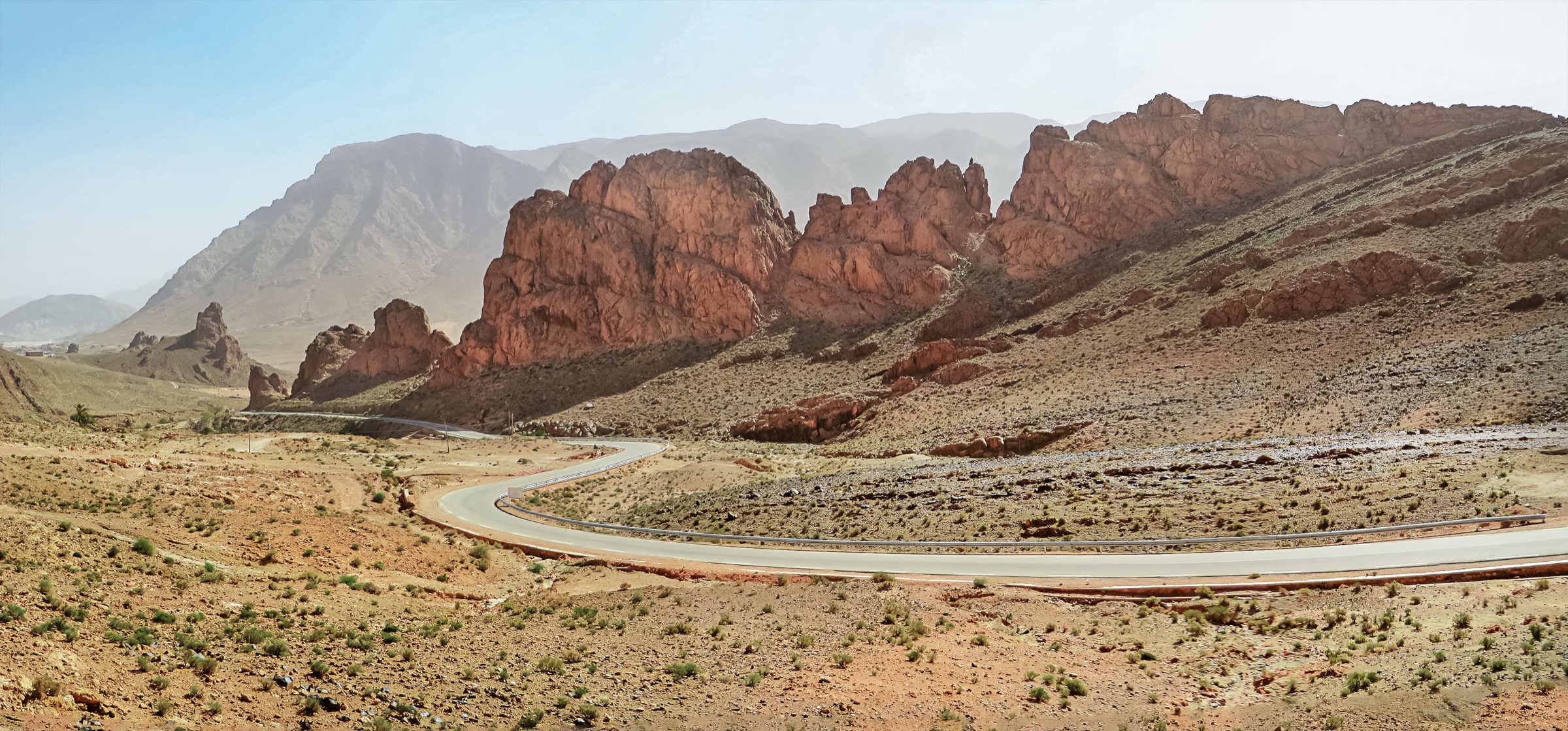
2. Abul Hassan to Talla Hamra
Snapshot
Itinerary
The official RSMT description presents this as a 17 km traverse through the remote Jebel Abul Hassan region, crossing narrow canyons, winding gorges, and rugged passes. Pools and creeks may form after good rain, and the source warns that scrambling and even swimming may be required if water remains in the wadi.
Why it is essential
This is one of the strongest documented one-day routes on the Red Sea Mountain Trail and represents the region’s canyon-and-wadi character better than a summit-only selection.
Hazards and notes
- RSMT closure/access issue applies.
- Remote terrain, broken paths, scrambling, possible wadi swims, flash-flood risk, and very limited rescue options.
- Water in pools can make the route more serious rather than easier.
GPX / KML links
| Source | URL | Format / access | Reuse status |
|---|---|---|---|
| RSMT: Book a hike / Abul Hassan to Talla Hamra | redseamountaintrail.org | Official route description | Copyright Red Sea Mountain Trail; route file not provided; description checked, no reusable route file |
| RSMT: Abul Hassan hub | redseamountaintrail.org | Official area description | Copyright Red Sea Mountain Trail; route file not provided; area context checked, no GPX |
External links
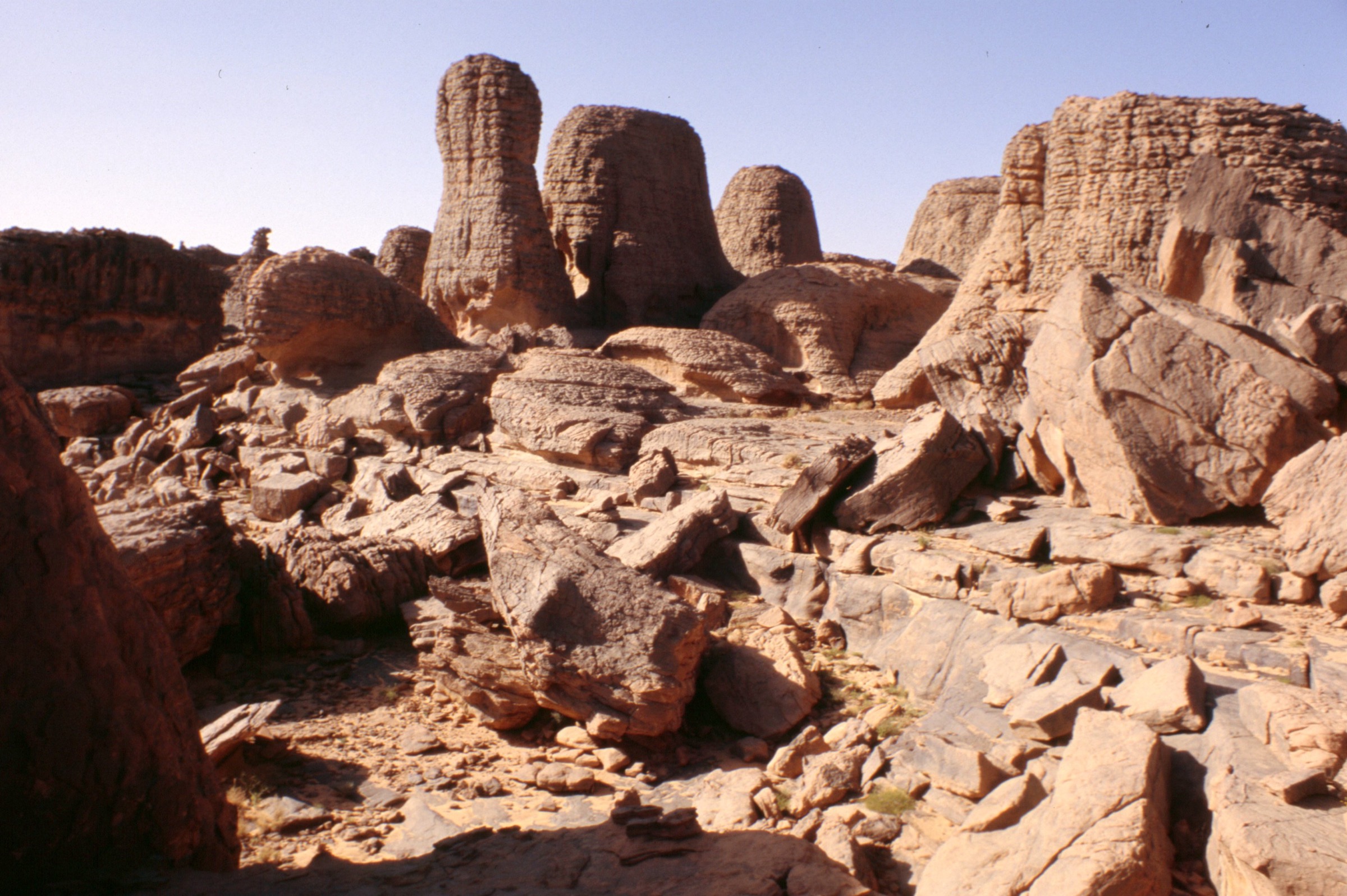
3. Jebel Gattar: Um Deesa to El Nagaata
Snapshot
Itinerary
The route starts near the spring of Um Deesa, traverses the highlands of Jebel Gattar, and finishes at the spring of El Nagaata. RSMT describes rugged wadis, whaleback granite, and early Christian chapels and hermit cells in the area. The route does not require a summit but still has substantial ascent/descent.
Why it is essential
Jebel Gattar gives the catalogue a hard but non-summit desert-highland traverse with archaeology, springs, and granite terrain. The published distance and ascent make it one of the more useful verified RSMT day routes.
Hazards and notes
- RSMT closure/access issue applies.
- Fit, experienced walkers only; heat, dehydration, broken paths, and remote rescue context are major hazards.
- Spring water should not be assumed potable without treatment and local confirmation.
GPX / KML links
| Source | URL | Format / access | Reuse status |
|---|---|---|---|
| RSMT: Book a hike / Jebel Gattar | redseamountaintrail.org | Official route description | Copyright Red Sea Mountain Trail; route file not provided; description checked, no reusable route file |
External links
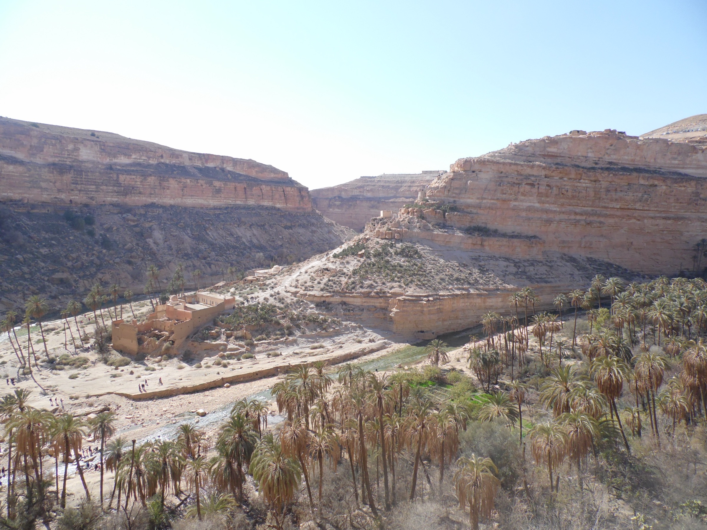
4. Wadi el Gemal / Sikait archaeological walk
Snapshot
Itinerary
Wadi el Gemal National Park includes desert mountains, wadis, and the Sikait/Mons Smaragdus emerald-mining archaeological area. Official/protected-area sources confirm the protected-area context and the presence of historical sites, but a complete day-hike line with distance and ascent was not verified in this pass.
Why it is essential
The Red Sea Hills are not only a summit landscape; they also preserve ancient mining and desert-travel history. Sikait/Mons Smaragdus is the strongest source-backed archaeological walking candidate found for the southern Egyptian Red Sea Hills.
Hazards and notes
- Route geometry, permits, visitor rules, and site protection requirements need confirmation.
- Archaeological remains must not be disturbed.
- Heat, lack of water, and remote-road logistics are major constraints.
GPX / KML links
| Source | URL | Format / access | Reuse status |
|---|---|---|---|
| Wadi el Gemal National Park overview | abughosoun.org | Protected-area overview | Site terms unresolved; confirms area context, no route file |
| Wikimedia Commons Sikait category | commons.wikimedia.org | Media/geographic cross-check | Commons/OSM links; not a route file; useful for waypoint research only |
External links
5. Arkawit / Erkowit escarpment candidate
Snapshot
Itinerary
Arkawit/Erkowit is a highland settlement area in Sudan’s Red Sea Hills. It is retained as a regional candidate because it represents the Sudanese side of the range, but no publication-ready walking line, statistics, route file, or open image was verified in this pass.
Why it is essential
Without a Sudanese entry, the Red Sea Hills selection would over-represent the better documented Egyptian section. Arkawit/Erkowit is the most obvious Sudanese highland candidate, but it requires a separate local-source pass before publication.
Hazards and notes
- Current security and travel restrictions in Sudan may make field access impossible or unsafe.
- Route statistics, trailhead, and legal access are unresolved.
- Candidate only; do not publish as a usable route yet.
GPX / KML links
| Source | URL | Format / access | Reuse status |
|---|---|---|---|
| Discover Sudan: Erkowit | discoversudan.de | Tourism/geographic context | Site terms unresolved; not a route file; confirms highland context and approximate settlement elevation, no route geometry |
| OpenStreetMap search: Arkawit / Erkowit | openstreetmap.org | Map search | OSM data is ODbL; no selected relation; candidate geometry cross-check only |
External links
External links
| Source | URL |
|---|---|
| Red Sea Mountain Trail — Hike the trail | redseamountaintrail.org |
| Red Sea Mountain Trail — Book a hike | redseamountaintrail.org |
| Red Sea Mountain Trail — Jebel Shayib hub | redseamountaintrail.org |
| Red Sea Mountain Trail — Abul Hassan hub | redseamountaintrail.org |
| Red Sea Mountain Trail — El Gattar hub | redseamountaintrail.org |
| Abu Ghosoun — Wadi el Gemal National Park | abughosoun.org |
| Discover Sudan — Erkowit | discoversudan.de |
| NASA/JSC Earth Science and Remote Sensing — Red Sea Hills of Sudan | esrs.jsc.nasa.gov |
| Visit Eritrea — Filfil Solomuna | visiteritrea.net |