Regional overview
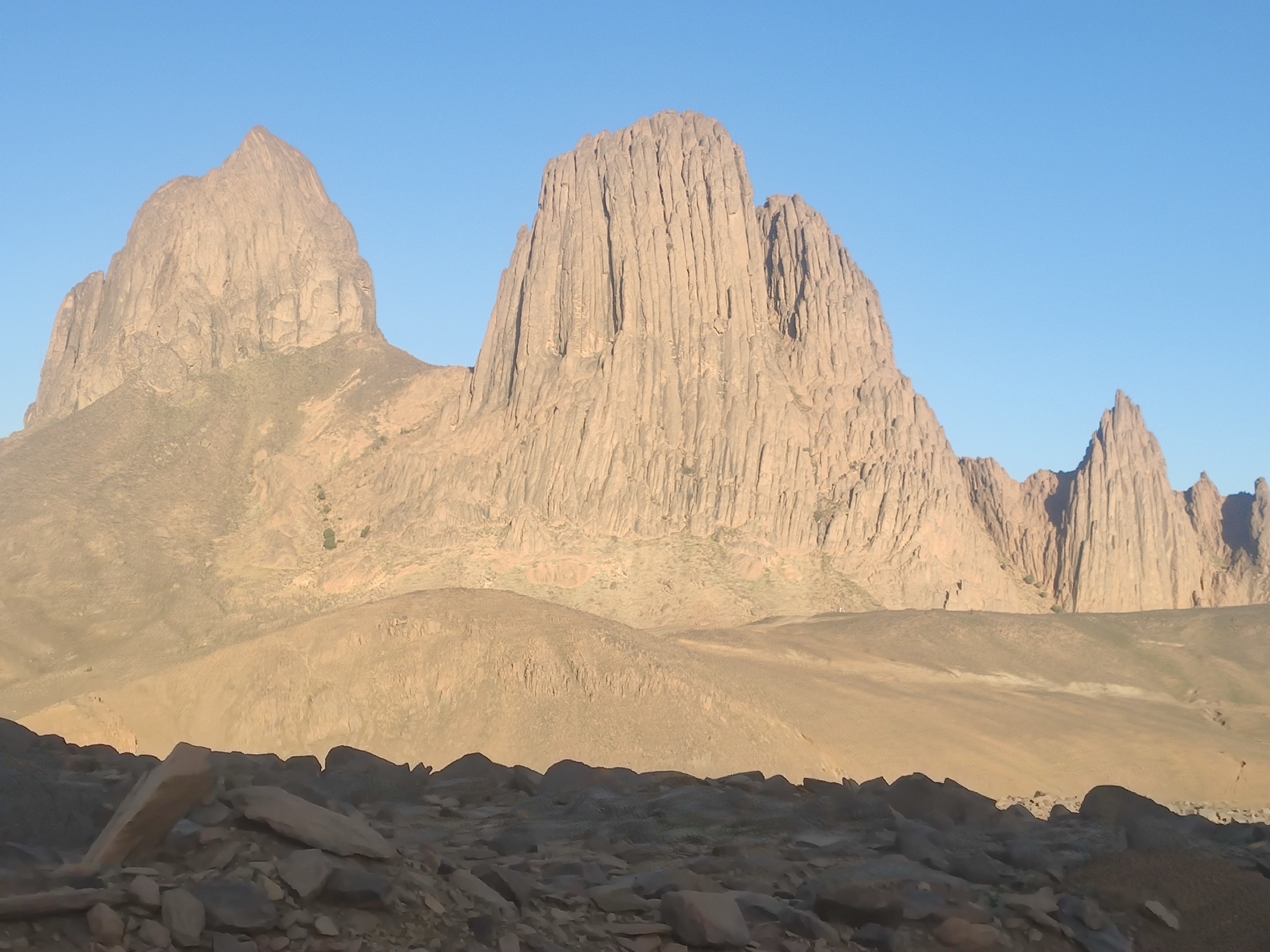
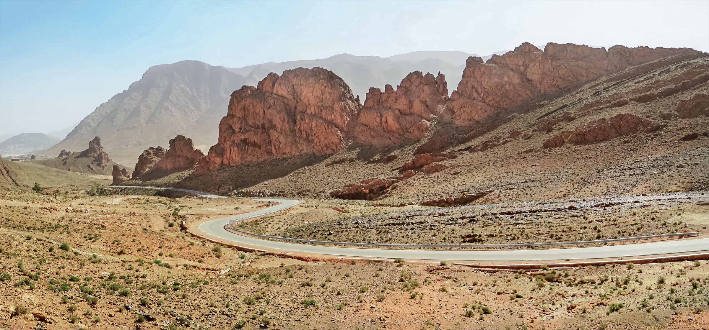
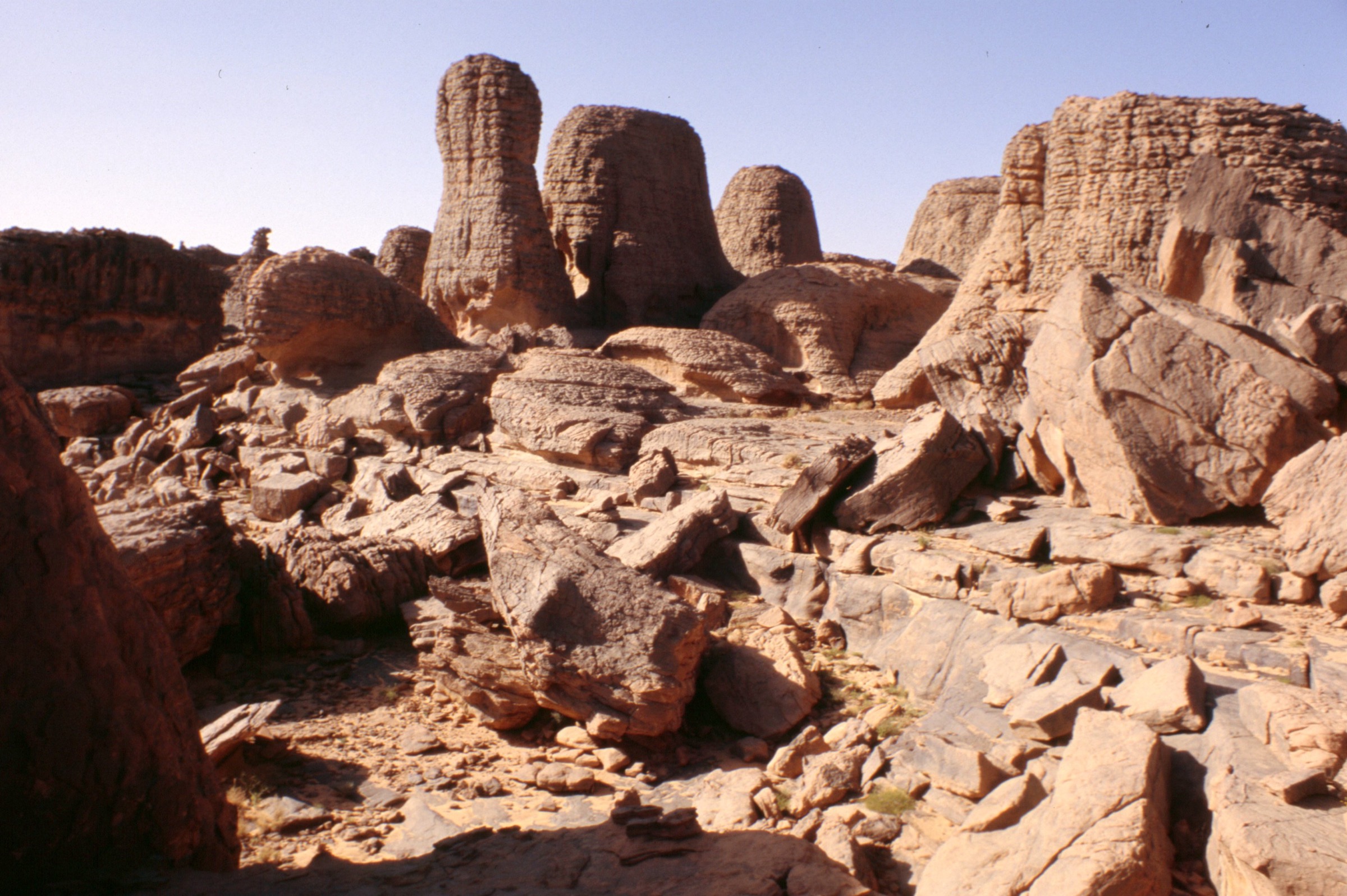
Tassili n’Ajjer is a vast sandstone plateau and cultural landscape in south-eastern Algeria, famous for rock forests, wadis, gueltas, relict vegetation, and one of the world’s most important concentrations of prehistoric rock art. UNESCO describes a 72,000 sq km property with exceptional geological scenery and more than 15,000 drawings and engravings.
Unlike compact waymarked hiking areas, Tassili walking is usually guide-led and expedition-based. UNESCO states that tourism is strictly controlled and that visitor groups are accompanied by an official guide. Public day-hike GPX data is sparse; where only 4WD approach tracks or multi-day treks were found, this entry marks the walking route as candidate-only rather than inventing route statistics.
Selection rationale
The selection balances the major accessible themes: a Jabbaren rock-art approach, a short Erg Admer dune walk near Djanet, a Tim Rass sandstone viewpoint, the Essendilene guelta walking leg, and a Sefar sandstone-city / rock-art day-section candidate. Only the first three have usable public walking-stat fragments; the last two need local/official route confirmation.
- Djanet to Jabbaren rock-art approach — a sourced approach route toward the central Tassili rock-art zone.
- Erg Admer dune walk near Djanet — a short desert-edge dune and viewpoint walk.
- Tim Rass sandstone atalaya walk — a short Adjahil-area sandstone viewpoint walk.
- Essendilene guelta walking leg — a guelta-and-canyon walking leg after a 4WD approach.
- Sefar sandstone-city day-section candidate — a guided day-section of a longer Trek Sefar route.
Summary table
| # | Hike | Route type | Distance | Gain | Max elevation | Difficulty |
|---|---|---|---|---|---|---|
| 1 | Djanet to Jabbaren rock-art approach | Point-to-point / guided day-section | 9.53 km | 651 m | Hard | |
| 2 | Erg Admer dune walk near Djanet | Out-and-back / short dune walk | Just over 3.5 km | Easy–moderate | ||
| 3 | Tim Rass sandstone atalaya walk | Out-and-back / short viewpoint walk | 1.70 km | 44 m | Easy–moderate | |
| 4 | Essendilene guelta walking leg | Out-and-back walking leg after 4WD approach | Candidate only | |||
| 5 | Sefar sandstone-city day-section candidate | Guided day-section of a longer trek | Unresolved for day section; 90.05 km multi-day Trek Sefar source | Unresolved for day section; 1,386 m multi-day source | Candidate only |
Before you go
Required equipment
The Tassili n’Ajjer is desert and sandstone-plateau terrain with very long distances between water points. The same baseline equipment applies across all five walks:
- Desert-capable day-hiking kit: broken-in boots or approach shoes, sun hat, sunglasses, high-SPF sunscreen, and light long sleeves.
- Large water carry. Treat 3–5 litres as a planning floor for moderate days and more for hot, exposed, or remote routes.
- Offline navigation, paper/map backup where available, power bank, headlamp, first-aid kit, and emergency shelter layer.
- Food, electrolyte salts, warm layer for high plateaus, and windproof layer for exposed ridges.
- Local guide or locally verified access plan where protected-area, border, military, or remote-desert rules apply.
Current access and safety notes
- Heat, dehydration, sun exposure, and very long distances between reliable water points.
- Weak or absent waymarking; GPS tracks may describe an individual recording rather than a maintained trail.
- Flash-flood risk in wadis and canyons after storms, even where the surrounding desert is dry.
- Remote rescue context: phone coverage, road access, and local transport options may be poor or absent.
- Current access, guide, permit, and security conditions must be checked locally before publication or field use.
- UNESCO confirms controlled tourism and official guides; visitor groups are accompanied by an official guide.
- Sensitive rock-art context: no touching, chalking, wetting, tracing, or off-guide movement around protected panels.
1. Djanet to Jabbaren rock-art approach
Snapshot
Itinerary
The source listing identifies a hiking route from the Djanet/Tassili area toward the Jabbaren rock-art zone with 9.53 km and 651 m of ascent. This fits the classic Tassili pattern: an approach from oasis/desert edge up toward the sandstone plateau and archaeological landscape.
A publication-ready version must confirm the exact trailhead, protected-site rules, guide permissions, and whether the listed line is a single-day approach or part of a longer guided trek. The route should be written as a cultural-landscape hike rather than a freely accessible marked trail.
Why it is essential
Jabbaren is one of the names most closely associated with Tassili rock art. A sourced approach route gives the catalogue a real walking statistic for the region’s central cultural theme.
Hazards and notes
- Sensitive rock-art context: no touching, chalking, wetting, tracing, or off-guide movement around protected panels.
- Official guide requirement and protected-area rules must be built into the final guide.
GPX / KML links
| Source | URL | Format / access | Reuse status |
|---|---|---|---|
| Wikiloc Djanet listing: Sahara algerino (1) to Jabbaren | wikiloc.com | Trail listing with source route link | Listing statistics checked; exact route-file page still unresolved under Wikiloc terms |
External links
- Wikiloc — Djanet route listings
- UNESCO World Heritage Centre — Tassili n’Ajjer
- UNESCO MAB — Tassili N’Ajjer Biosphere Reserve
2. Erg Admer dune walk near Djanet
Snapshot
Itinerary
A short walk into the low dunes and hard sand flats of Erg Admer near Djanet. The source description describes a comfortable, short walk of just over 3.5 km, including a dune ascent for sunset views.
This is not a mountain summit, but it is an essential Tassili-adjacent day walk because it shows the contact between Djanet, the sandstone plateau world, and the dune systems that extend from the Tassili n’Ajjer region.
Why it is essential
Tassili walking is inseparable from the desert-edge setting. Erg Admer gives the entry an accessible dune-and-viewpoint route with a published descriptive distance, useful where full route stats are scarce.
Hazards and notes
- Soft sand, wind, heat reflection, and disorientation if visibility drops.
- Vehicle pickup point and exact return line must be fixed before field use.
GPX / KML links
| Source | URL | Format / access | Reuse status |
|---|---|---|---|
| Wikiloc: Paseo por Erg de Admer | wikiloc.com | Source route page / GPX via Wikiloc | Descriptive distance checked; complete route stats not captured under Wikiloc terms |
External links
- Wikiloc — Paseo por Erg de Admer
- Wikiloc — Dunas Djanet / Erg de Admer related listing
- UNESCO World Heritage Centre — Tassili n’Ajjer
3. Tim Rass sandstone atalaya walk
Snapshot
Itinerary
A very short sandstone viewpoint walk identified in the Adjahil listings as an atalaya in the Tassili de Tim Rass. The statistics are modest, but the route likely functions as a short exploration of rock forms and desert views.
Because the exact source page was not resolved, the final guide should treat this as a candidate short walk until the GPX line, access, and protected-area status are checked.
Why it is essential
Not every essential Tassili walk is long. Short viewpoint walks are a practical and representative part of guided desert itineraries, especially around sandstone formations near Djanet.
Hazards and notes
- Unresolved exact geometry and protected-area status.
- Short walk still requires sun and navigation caution in open desert terrain.
GPX / KML links
| Source | URL | Format / access | Reuse status |
|---|---|---|---|
| Wikiloc Adjahil listing: Atalaya en el Tassili de Tim Rass | wikiloc.com | Trail listing with source route link | Listing statistics checked; exact route-file page still unresolved under Wikiloc terms |
External links
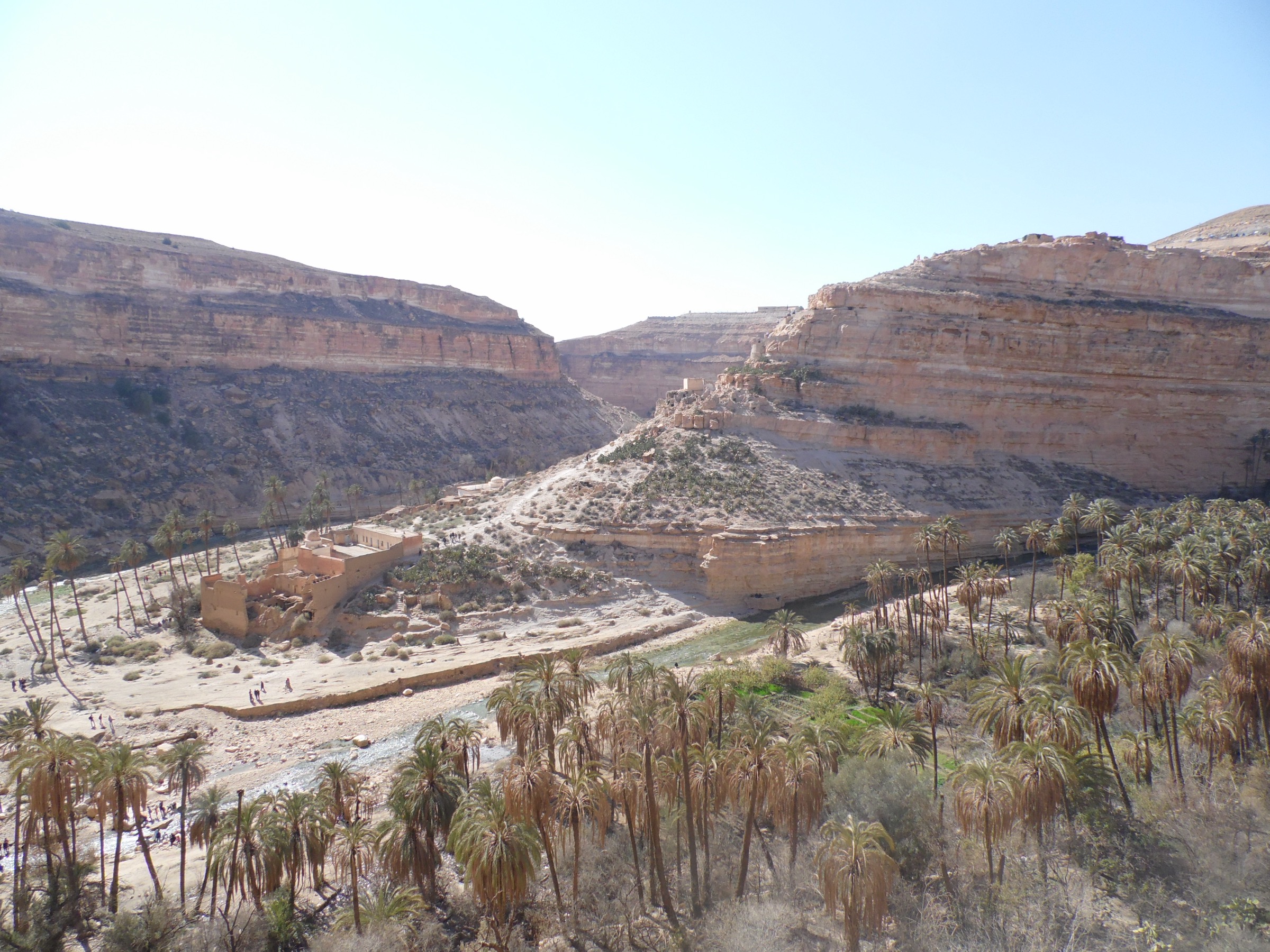
4. Essendilene guelta walking leg
Snapshot
Itinerary
The public source found is a 4WD route to Essendilene, but its description states that after leaving the jeeps, the route continues on foot through a narrow vegetated gorge to small lakes/gueltas for about two hours.
That walking leg is the catalogue-relevant part. It needs a local guide’s exact route, access permissions, and separate foot-track statistics before it can be promoted beyond candidate status.
Why it is essential
Essendilene represents Tassili’s guelta-and-canyon side: rare water, vegetation, and enclosed sandstone walking after the open desert approach.
Hazards and notes
- Canyon flash-flood risk and possible slippery rock near gueltas.
- No public walking GPX was resolved; do not use the vehicle track as a foot-route substitute.
GPX / KML links
| Source | URL | Format / access | Reuse status |
|---|---|---|---|
| Wikiloc Djanet off-road listing: La guelta di Essendilene | wikiloc.com | 4WD listing with walking-leg description | Walking-leg stats unresolved; vehicle source not reusable as hiking GPX |
External links
- Wikiloc — Djanet off-road listings (incl. La guelta di Essendilene)
- UNESCO World Heritage Centre — Tassili n’Ajjer
5. Sefar sandstone-city day-section candidate
Snapshot
Itinerary
Sefar is a major Tassili rock-art and sandstone ‘city’ objective, but the public source resolved in this pass is a long Trek Sefar entry rather than a discrete day-hike route. A final catalogue route should select one guided day-section from that broader trek.
The day-section should be designed around protected-site rules, rock-art sensitivity, and realistic return logistics from a camp or 4WD-supported access point. Until then, this entry is an essential candidate rather than a route-ready hike.
Why it is essential
Sefar is too important to omit from a Tassili catalogue, but the available route data is not yet granular enough for a safe day-hike recommendation.
Hazards and notes
- Sensitive rock-art and archaeological context.
- The only route stats found belong to a multi-day trek, not the proposed day section.
GPX / KML links
| Source | URL | Format / access | Reuse status |
|---|---|---|---|
| Wikiloc Algeria hiking listing: Trek Sefar | wikiloc.com | Multi-day route listing | Not reusable as a day-hike GPX without extracting a verified day section |
External links
- Wikiloc — Algeria hiking listing (incl. Trek Sefar)
- UNESCO World Heritage Centre — Tassili n’Ajjer
- UNESCO MAB — Tassili N’Ajjer Biosphere Reserve
External links
| Source | URL |
|---|---|
| UNESCO World Heritage Centre — Tassili n’Ajjer | whc.unesco.org |
| UNESCO MAB — Tassili N’Ajjer Biosphere Reserve | unesco.org |
| Wikiloc — Djanet route listings | wikiloc.com |
| Wikiloc — Adjahil route listings | wikiloc.com |
| Wikiloc — Paseo por Erg de Admer | wikiloc.com |
| Wikiloc — Djanet off-road listings | wikiloc.com |
| Wikiloc — Algeria hiking listing (incl. Trek Sefar) | wikiloc.com |