Regional overview
The central French Pyrenees combine several of the range’s most recognisable walking landscapes: the limestone amphitheatre of Gavarnie, high border passes around the Mont-Perdu / Taillon massif, the lake-and-granite terrain of Cauterets and the Néouvielle, and the more pastoral, ridge-based hiking of Ariège.
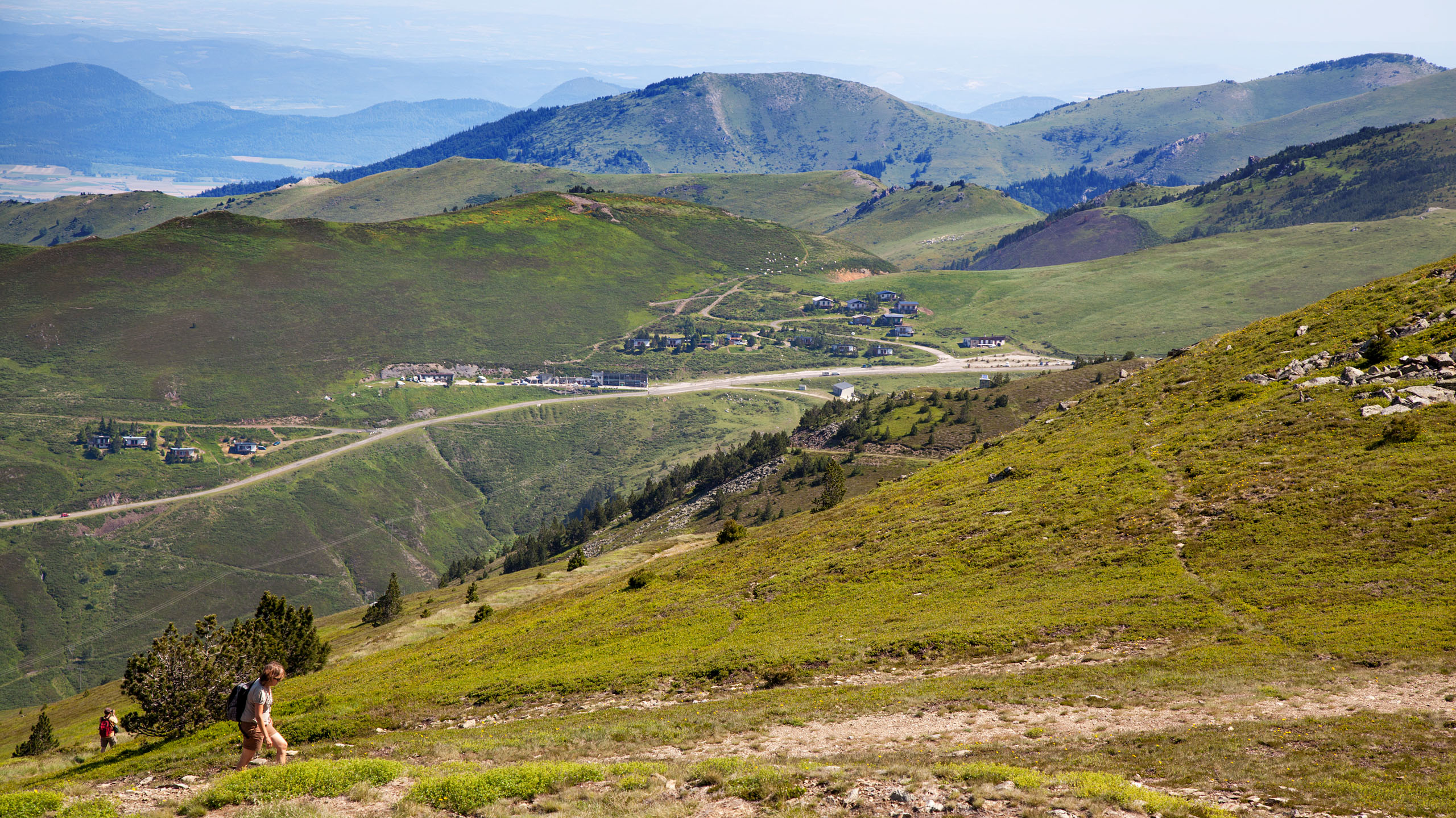
The main hiking centres for this selection are Gavarnie-Gèdre, Cauterets / Pont d’Espagne, Lac d’Orédon in the Néouvielle, and the Col de Pailhères / Ascou area in Ariège. Terrain ranges from easy valley paths to high mountain trails crossing boulderfields, lingering snow patches, cols above 2,500 m, lake basins, and exposed ridges.
The normal hiking season is late spring to autumn for lower valley routes, and mainly July to September for the higher routes. Early-season snow, avalanche terrain, road closures, and national-park restrictions can materially change the seriousness of these walks. Dogs are prohibited in the core of the Parc national des Pyrénées and in the Néouvielle reserve areas covered by several of these routes.
Selection rationale
These five hikes were selected to represent the region rather than concentrate on one valley: one iconic cirque and waterfall route, one famous high-border pass, one Vignemale glacier-view lake route, one classic Néouvielle lake circuit, and one Ariège summit-and-lakes route.
Summary table
| # | Hike | Country | Route type | Distance | Gain | Max elevation | Difficulty |
|---|---|---|---|---|---|---|---|
| 1 | Cirque de Gavarnie and Grande Cascade viewpoint | France | Out-and-back | 7.9 km official; c. 10–11 km with cascade extension | +226 m official; c. +426 m with extension | 1,570 m official; c. 1,800 m with extension | Easy to Hôtellerie; extension more serious |
| 2 | Brèche de Roland from Col des Tentes | France | Out-and-back | 11 km | +584 m | 2,807 m | Difficult |
| 3 | Pont d’Espagne – Lac de Gaube – Refuge des Oulettes de Gaube | France | Out-and-back | 16.5 km | +694 m | 2,148–2,151 m | Medium |
| 4 | Les Lacs du Néouvielle: Orédon, Laquettes, Aubert, Aumar and Col d’Estoudou | France | Loop | 10.7 km | +572 m | 2,247–2,260 m | Difficult |
| 5 | Pic de Tarbésou and Étangs de Rabassoles | France | Loop / official page labels “round trip” | 12 km | +716 m | 2,364 m | Moderate mountain hike |
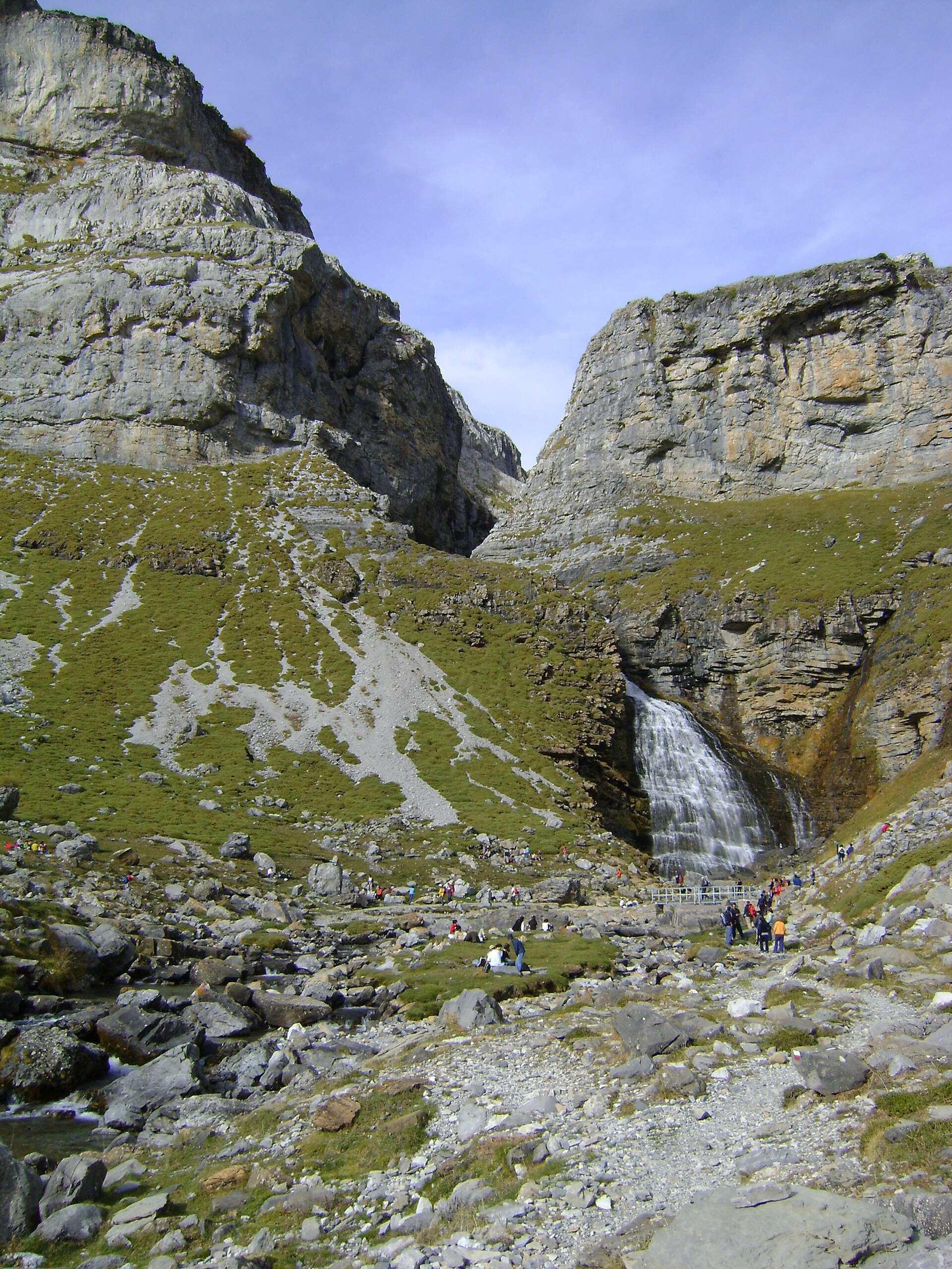
1. Cirque de Gavarnie and Grande Cascade viewpoint
Snapshot
Itinerary
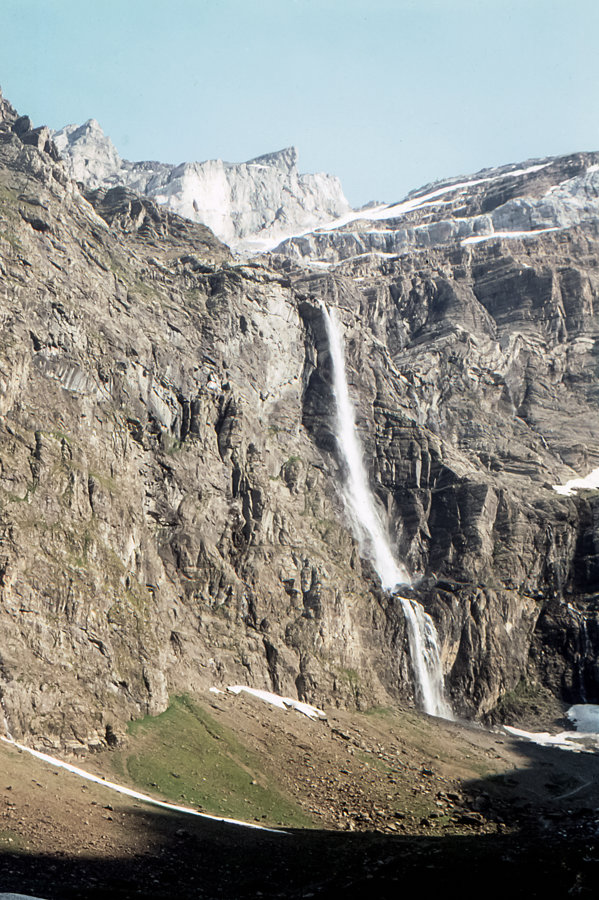
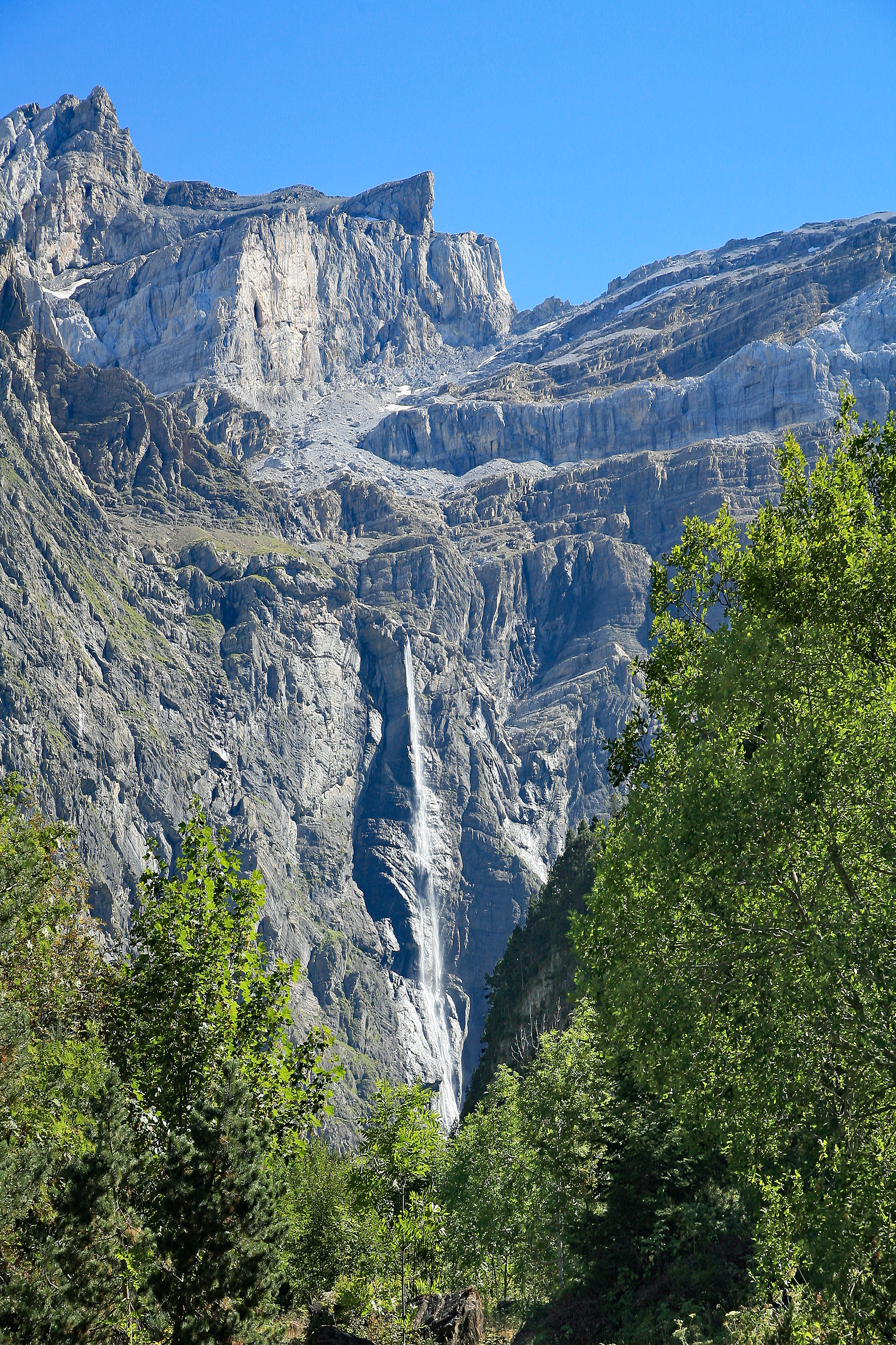
The route leaves Gavarnie village and follows the valley-bottom path south into the Cirque de Gavarnie. It passes La Courade and La Prade before reaching the Hôtellerie du Cirque at about 1,570 m, where the amphitheatre walls and the Grande Cascade are directly ahead. The official itinerary returns by the same route.
A further path continues towards the foot of the Grande Cascade. The official source treats this as an optional extension, adding about 45 minutes on ascent, 35 minutes on descent and roughly 200 m of extra ascent. The extension is steeper, rockier and exposed to rockfall, and is not advised in winter or spring.
Why it is essential
This is the most accessible classic walk into the Gavarnie amphitheatre, a major Pyrenean landmark within the Pyrénées-Mont Perdu UNESCO area.
Equipment
- Sturdy footwear
- Weatherproof layer
- Warm layer
- Water and food
- Map / GPS
- Sun protection
- Mountain hiking equipment if continuing close to the cascade
Hazards and notes
- The base route is popular and easy to follow.
- The optional cascade-foot extension has rockfall exposure.
- Snow bridges, avalanche debris, or wet rock can make the cascade extension unsuitable.
- Dogs are permitted only as far as the Hôtellerie sector; dogs are prohibited between the Hôtellerie and the Grande Cascade.
- High-season crowding and parking pressure are common.
GPX / KML links
| Source | URL | Format | Notes |
|---|---|---|---|
| Rando Vallées de Gavarnie official route page | rando.valleesdegavarnie.com | GPX / KML source page | Official base route; direct raw GPX/KML URL not captured |
| Altituderando secondary cascade-extension description | altituderando.com | Route description / possible route source | Useful for cross-checking the longer Grande Cascade variant |
Further reading
2. Brèche de Roland from Col des Tentes
Snapshot
Itinerary
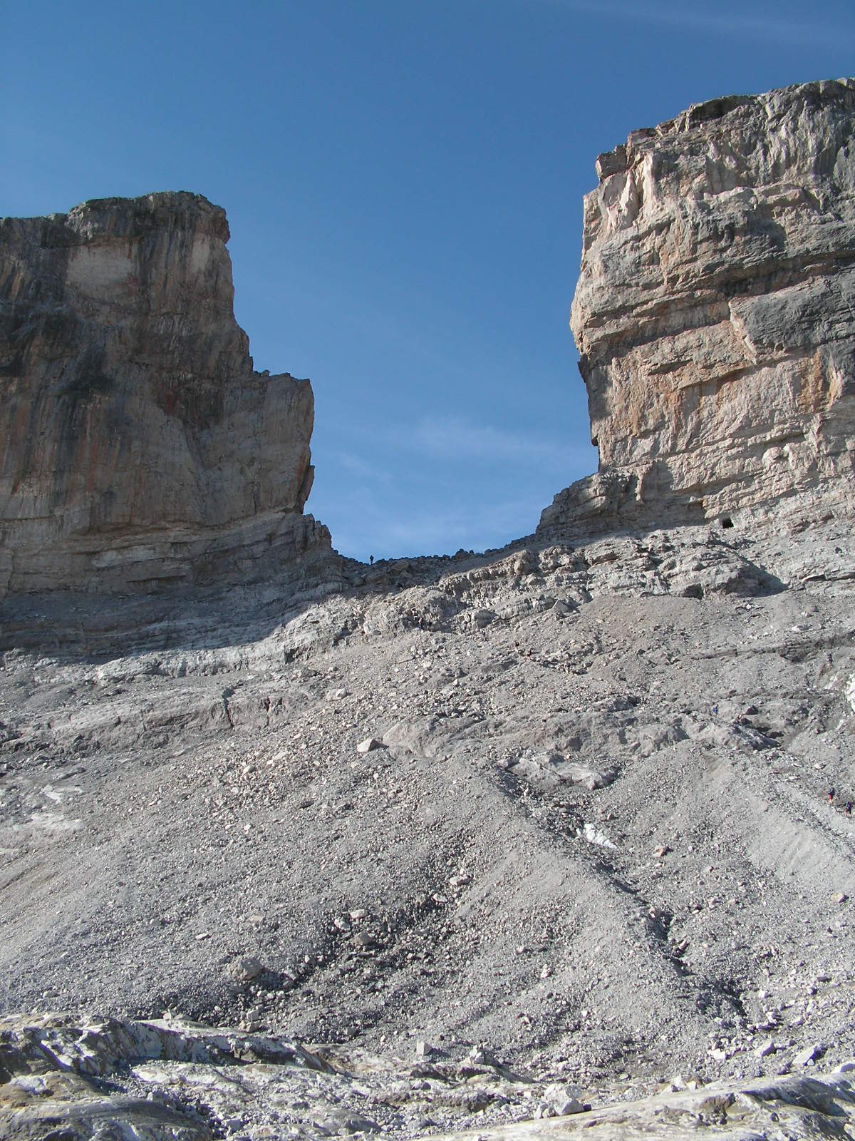
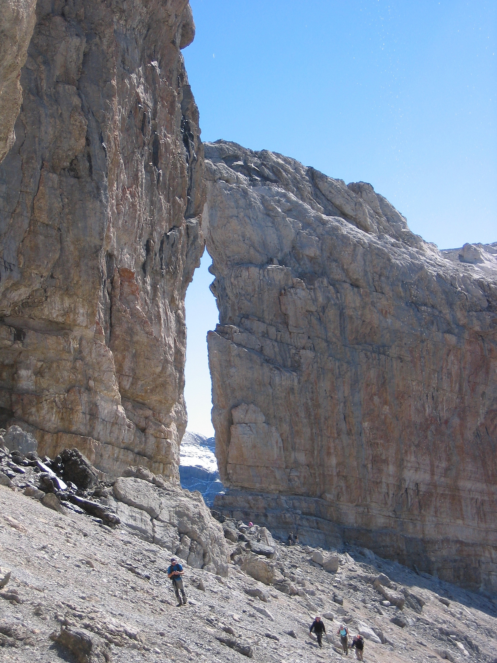
The route starts at Col des Tentes and follows the old road alignment towards Port de Boucharo. It then traverses east beneath the border ridge, climbs towards the Refuge de la Brèche / Sarradets sector, crosses the area affected by the cascade of the Taillon, and ascends the final slope to the Brèche de Roland at 2,807 m. The descent follows the same route.
Why it is essential
The Brèche de Roland is one of the most famous high Pyrenean passes: a natural breach in the frontier ridge between France and Spain, associated with the Roland legend and used historically as a trans-Pyrenean passage.
Equipment
- Sturdy boots
- Warm and waterproof layers
- Sun protection
- Map / GPS
- Navigation backup
- Food and water
- Headtorch for delays
- Crampons or microspikes and ice axe may be needed depending on snow conditions
Hazards and notes
- High mountain route.
- Snow can remain into summer.
- The cascade of the Taillon crossing can be problematic.
- Bad weather makes navigation and exposure more serious.
- The route lies in the Parc national des Pyrénées core area.
- Dogs are prohibited.
- Bivouac is regulated.
- The access road to Col des Tentes is closed in winter and often into late spring.
GPX / KML links
| Source | URL | Format | Notes |
|---|---|---|---|
| Rando Vallées de Gavarnie official route page | rando.valleesdegavarnie.com | GPX / KML source page | Official route; direct raw GPX/KML URL not captured |
| Randozone secondary route page | randozone.com | GPX source page | Secondary verification only |
Further reading
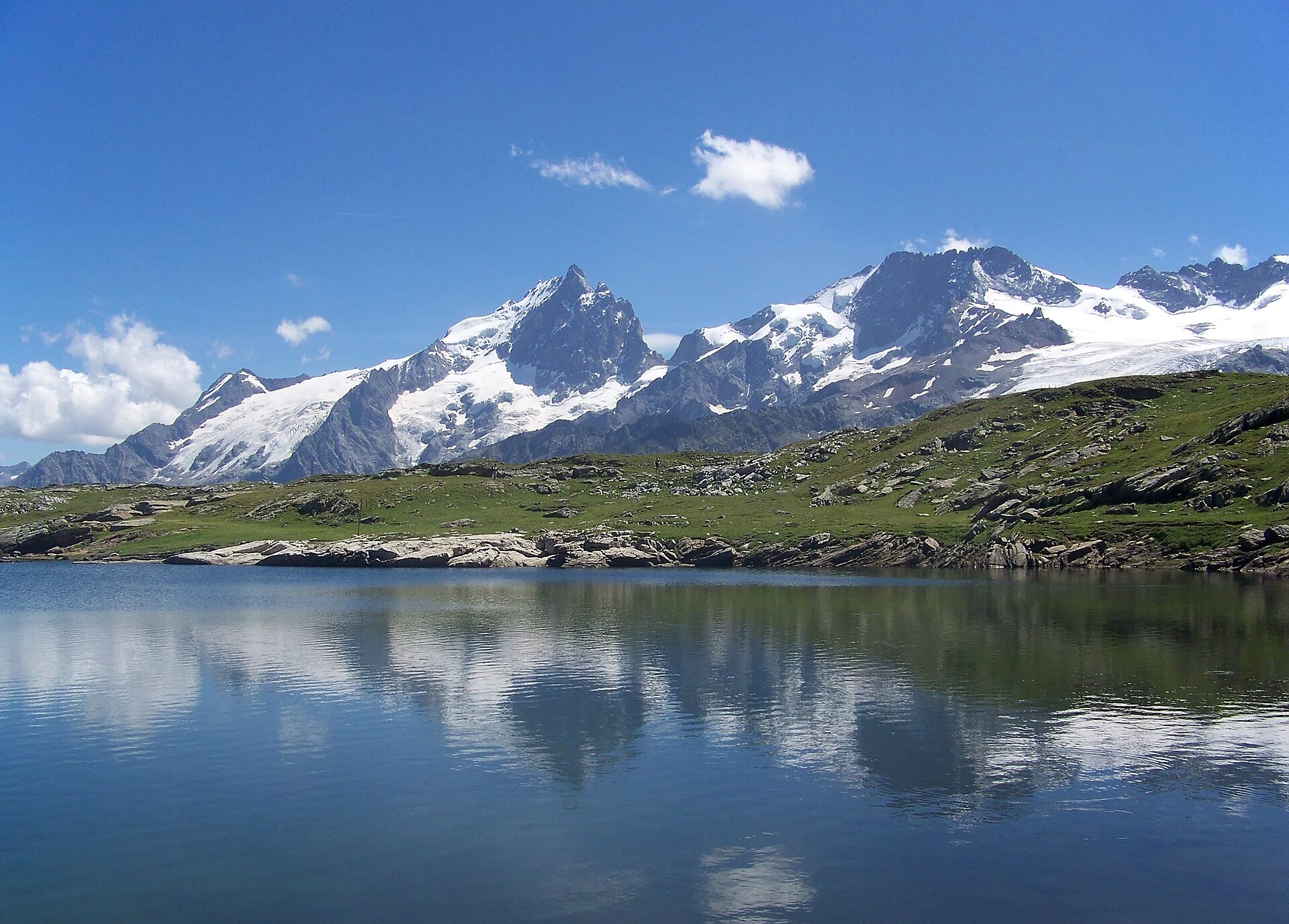
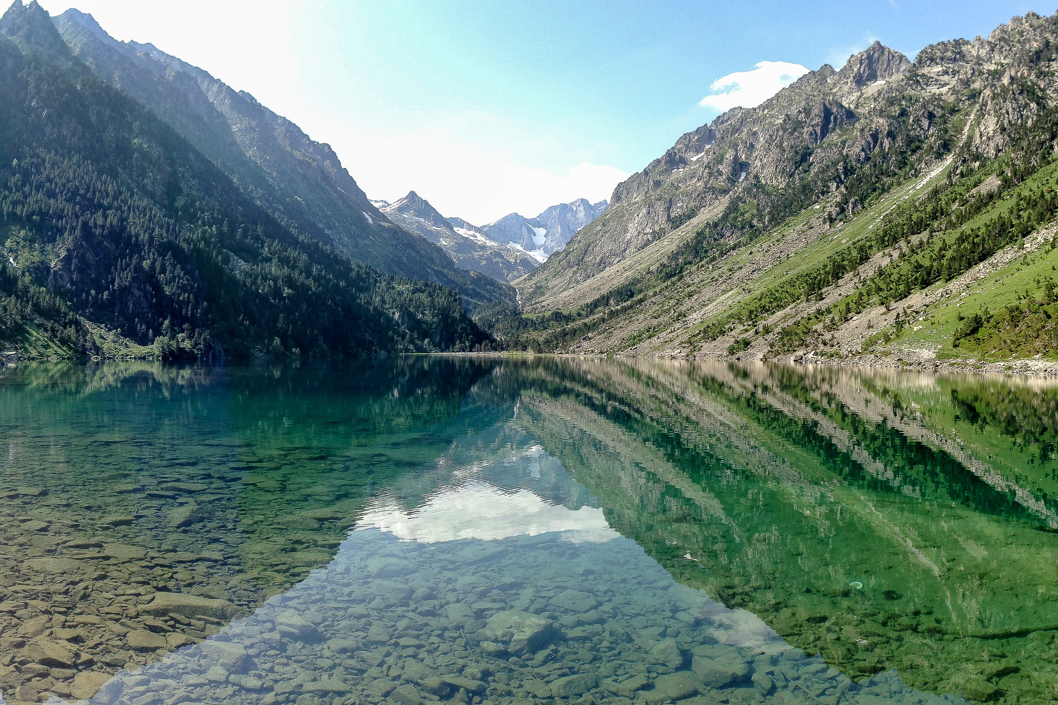
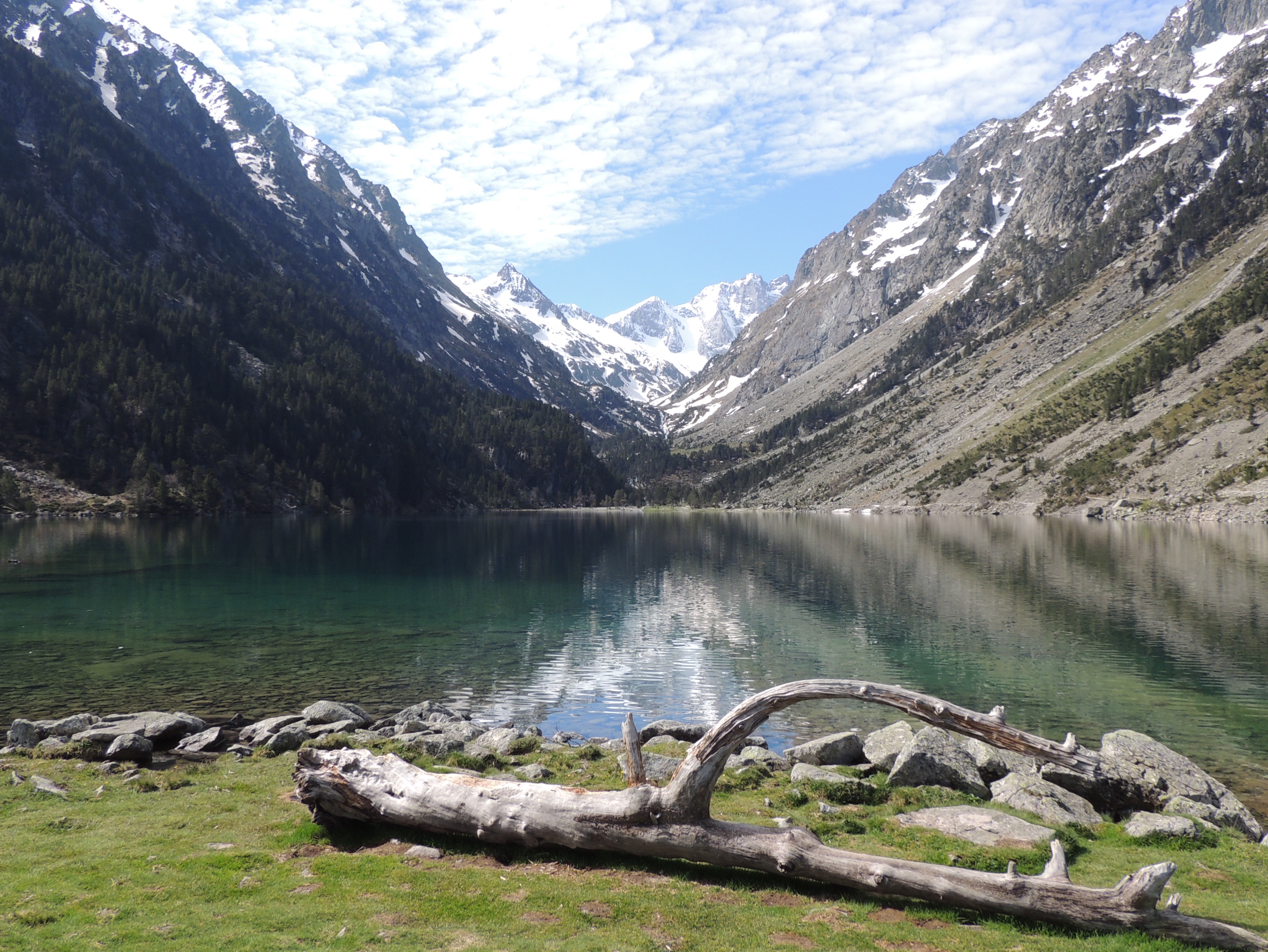
3. Pont d’Espagne – Lac de Gaube – Refuge des Oulettes de Gaube
Snapshot
Itinerary
From the Puntas car park at Pont d’Espagne, the trail climbs towards Lac de Gaube. The route follows the lake shore, then continues up the Gave des Oulettes valley. It passes the Esplumouse cascade area and the upper valley before reaching the Refuge des Oulettes de Gaube beneath the north face of Vignemale. The return follows the same route. Lac de Gaube can be partly accessed by chairlift, which changes the walking statistics.
Why it is essential
This is the classic Cauterets approach to Lac de Gaube and the Oulettes basin, giving one of the French Pyrenees’ best-known views towards Vignemale.
Equipment
- Sturdy boots
- Trekking poles
- Warm layer
- Waterproof layer
- Map / GPS
- Food and water
- Sun protection
- Headtorch for delays
Hazards and notes
- Access in winter and early spring is discouraged because of avalanche risk.
- The route is inside the Parc national des Pyrénées core area.
- Dogs are prohibited.
- Picking is prohibited.
- Bivouac is regulated.
- The Oulettes refuge was marked as closed for works in the retrieved official source; opening status and services must be checked before relying on the hut.
GPX / KML links
| Source | URL | Format | Notes |
|---|---|---|---|
| Official Geotrek booklet / Rando Vallées de Gavarnie | geotrek65admin.openig.org | Source-map / PDF | Official route source verified; raw GPX not confirmed from the official page |
| Trace de Trail route | tracedetrail.fr | GPX / GeoJSON source page | Secondary source-route found; one-way statistics differ from official out-and-back route |
Further reading
- Official Geotrek booklet — Refuge des Oulettes au pied du Vignemale
- Trace de Trail — Pont d’Espagne / Lac de Gaube / Oulettes
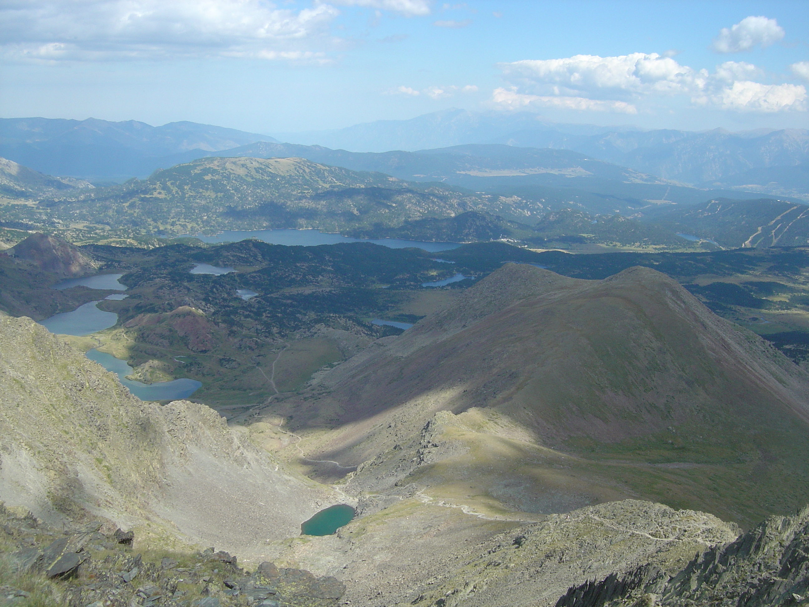
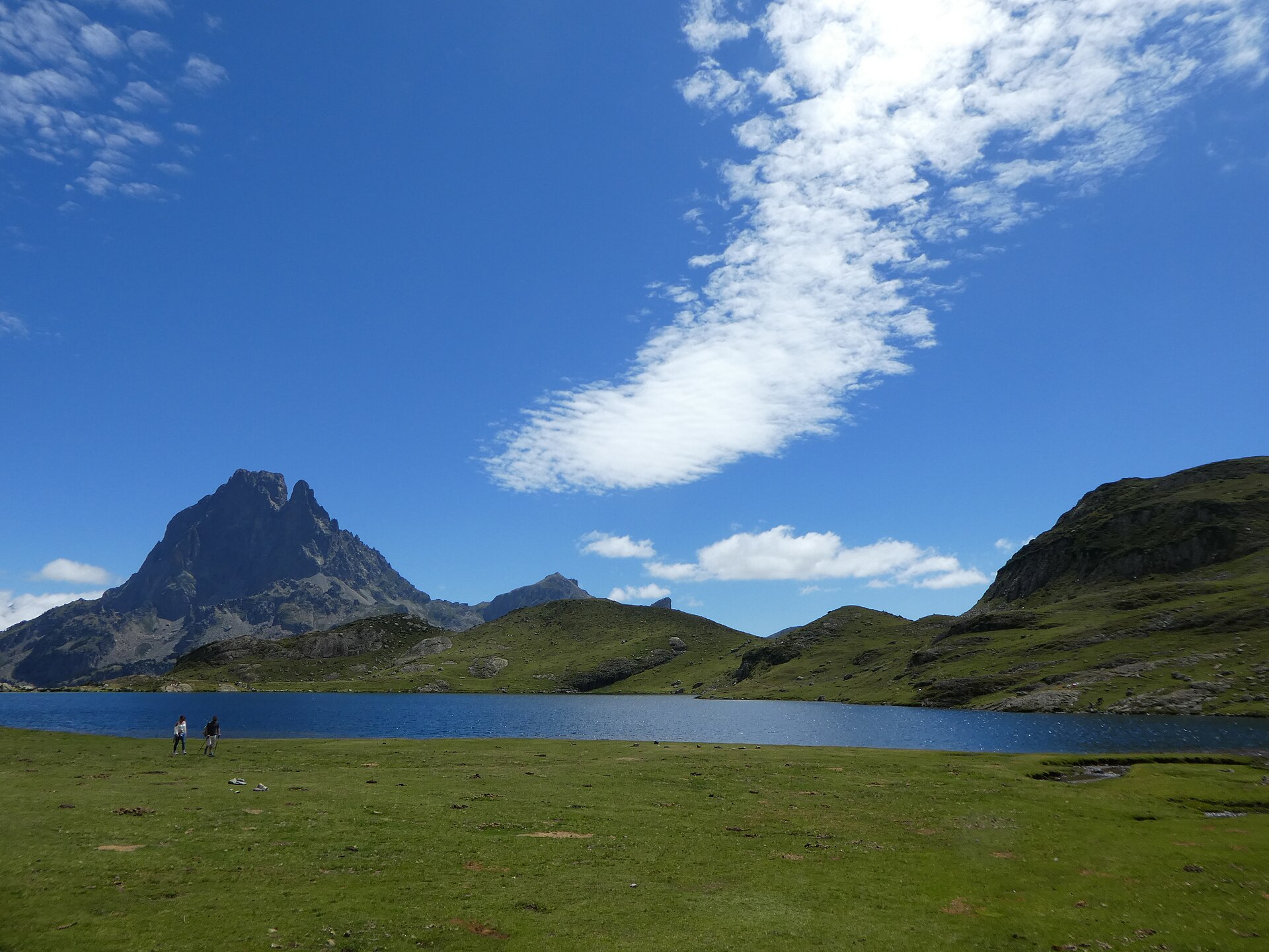
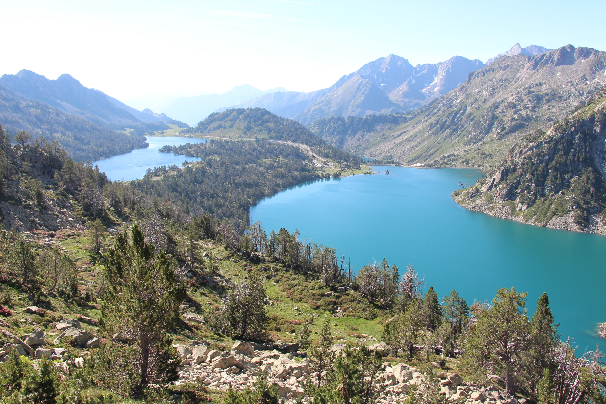
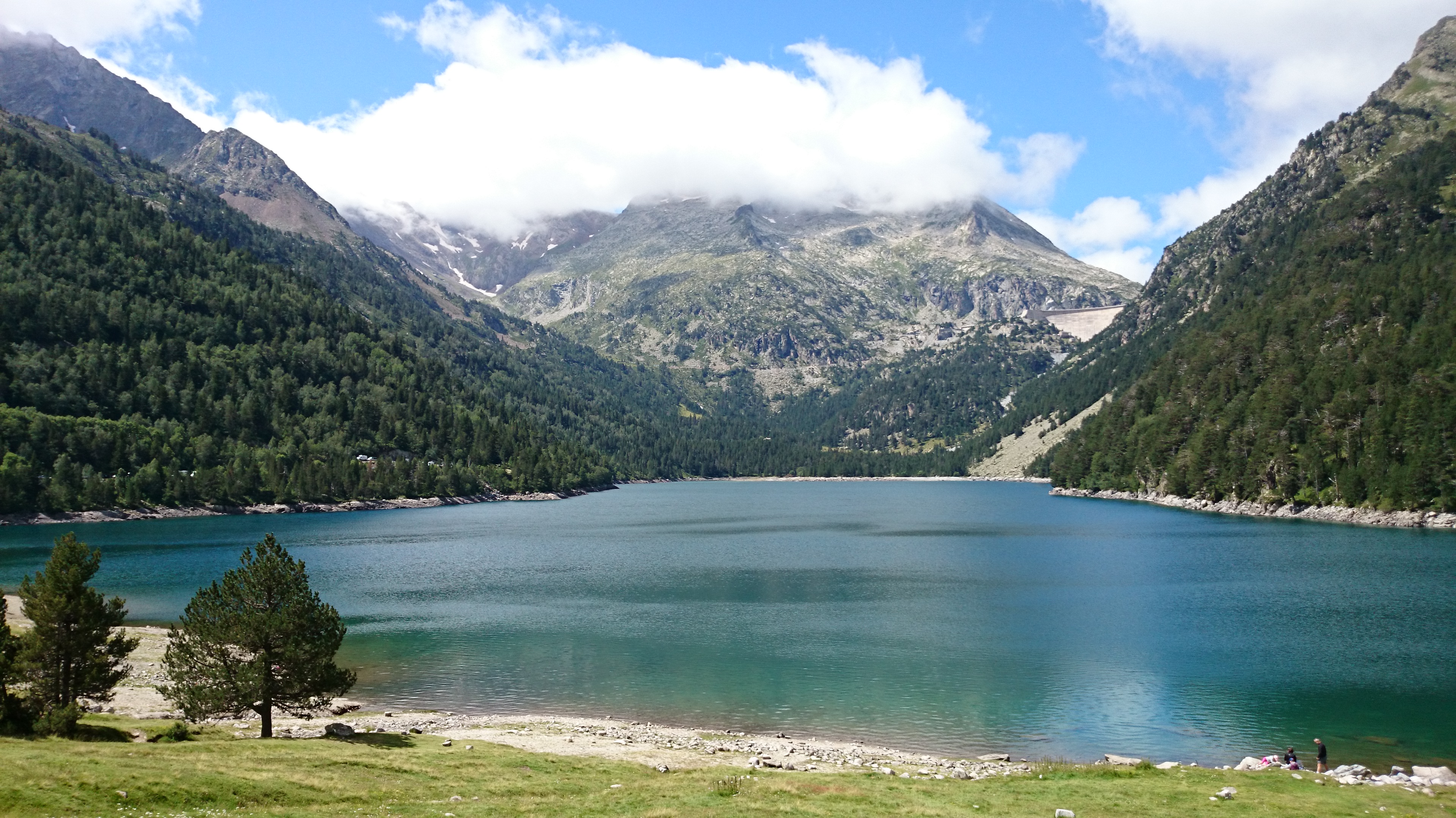
4. Les Lacs du Néouvielle: Orédon, Laquettes, Aubert, Aumar and Col d’Estoudou
Snapshot
Itinerary
From Lac d’Orédon, the route climbs through the lake chain of the Laquettes to Lac d’Aubert and Lac d’Aumar. It then follows the GR10 sector around the Passades d’Aumar before climbing towards Col d’Estoudou. The official description gives the col as 2,260 m and describes a steep 410 m descent back towards Lac d’Orédon.
Why it is essential
This loop gives a compact cross-section of the Néouvielle: pine forest, polished granite, linked high lakes, views towards the Néouvielle massif, and the protected reserve environment.
Equipment
- Sturdy boots
- Trekking poles for the descent
- Warm layer
- Waterproof layer
- Sun protection
- Map / GPS
- Food and water
- Navigation backup
Hazards and notes
- The descent from Col d’Estoudou is steep.
- The route is a summer itinerary outside snow conditions.
- Snow or ice on the upper part changes the route’s difficulty significantly.
- The route lies in a protected area.
- Dogs are prohibited in the reserve.
- Swimming in the lakes is prohibited.
- Picking and bivouac restrictions apply.
GPX / KML links
| Source | URL | Format | Notes |
|---|---|---|---|
| Official Geotrek booklet — Les Lacs du Néouvielle | geotrek65admin.openig.org | Source-map / PDF | Official route source verified; raw GPX/KML not located |
| Visorando secondary shorter lake-route variant | visorando.com | Route page / possible GPX source | Useful only for variant comparison; not the exact official loop |
Further reading
5. Pic de Tarbésou and Étangs de Rabassoles
Snapshot
Itinerary
From the parking area below Col de Pailhères, the route crosses the road and follows a path marked by cairns towards the ridge. It continues south on or near the GR alignment, climbs the Mougnégou ridge, and reaches the Pic de Tarbésou. The descent continues south-south-west along the ridge, passes Sarrat de Gabensa, then drops towards the small lake basin. The route joins the GR 7B sector around the Blue Pond and Black Pond before climbing to Col de la Coumeille de l’Ours and returning north towards the starting area.
Why it is essential
Pic de Tarbésou is an Ariège classic because it combines a high but accessible summit with a chain of mountain lakes below the ridge.
Equipment
- Sturdy boots
- Trekking poles
- Waterproof and warm layers
- Map / GPS
- Navigation backup
- Food and water
- Sun protection
- Headtorch for delays
Hazards and notes
- The route crosses open ridge terrain.
- Wind, thunderstorms and poor visibility can make the ridge sections more serious.
- Snow or verglas outside the main summer season can make the ridges and lake-basin sections more serious.
- The official page indicates that marking information is not available, so navigation should not rely on waymarking alone.
- The official page marks the route as pet-friendly, but dogs should remain under control around livestock and wildlife.
GPX / KML links
| Source | URL | Format | Notes |
|---|---|---|---|
| Ariège Pyrénées Tourism official route page | ariegepyrenees.com | GPX / KML source page | Official route page with GPX and KML download options; direct raw GPX/KML URL not captured |
| VisuGPX secondary route page | visugpx.com | GPX source page | Secondary source only |
| Altituderando secondary route page | altituderando.com | Route description / GPX source page | Secondary route-stat cross-check |
Further reading
- Ariège Pyrénées Tourism — Pic de Tarbésou and Étangs de Rabassoles
- Ariège Pyrénées Tourism — Le Pic de Tarbésou et les étangs de Rabassoles
- VisuGPX — Pic du Tarbésou
- Altituderando — Pic du Tarbésou par le col de Pailhères
Further reading
| Source | URL |
|---|---|
| Rando Vallées de Gavarnie — Cirque de Gavarnie | rando.valleesdegavarnie.com |
| Rando Vallées de Gavarnie — Brèche de Roland | rando.valleesdegavarnie.com |
| Official Geotrek booklet — Refuge des Oulettes au pied du Vignemale | geotrek65admin.openig.org |
| Official Geotrek booklet — Les Lacs du Néouvielle | geotrek65admin.openig.org |
| Ariège Pyrénées Tourism — Pic de Tarbésou and Étangs de Rabassoles | ariegepyrenees.com |
| Trace de Trail — Pont d’Espagne / Lac de Gaube / Oulettes | tracedetrail.fr |
| Randozone — Brèche de Roland | randozone.com |
| VisuGPX — Pic du Tarbésou | visugpx.com |
| Altituderando — Pic du Tarbésou | altituderando.com |
| Altituderando — Cirque de Gavarnie / Grande Cascade | altituderando.com |
| Visorando — Les Lacs du Néouvielle | visorando.com |