Regional overview
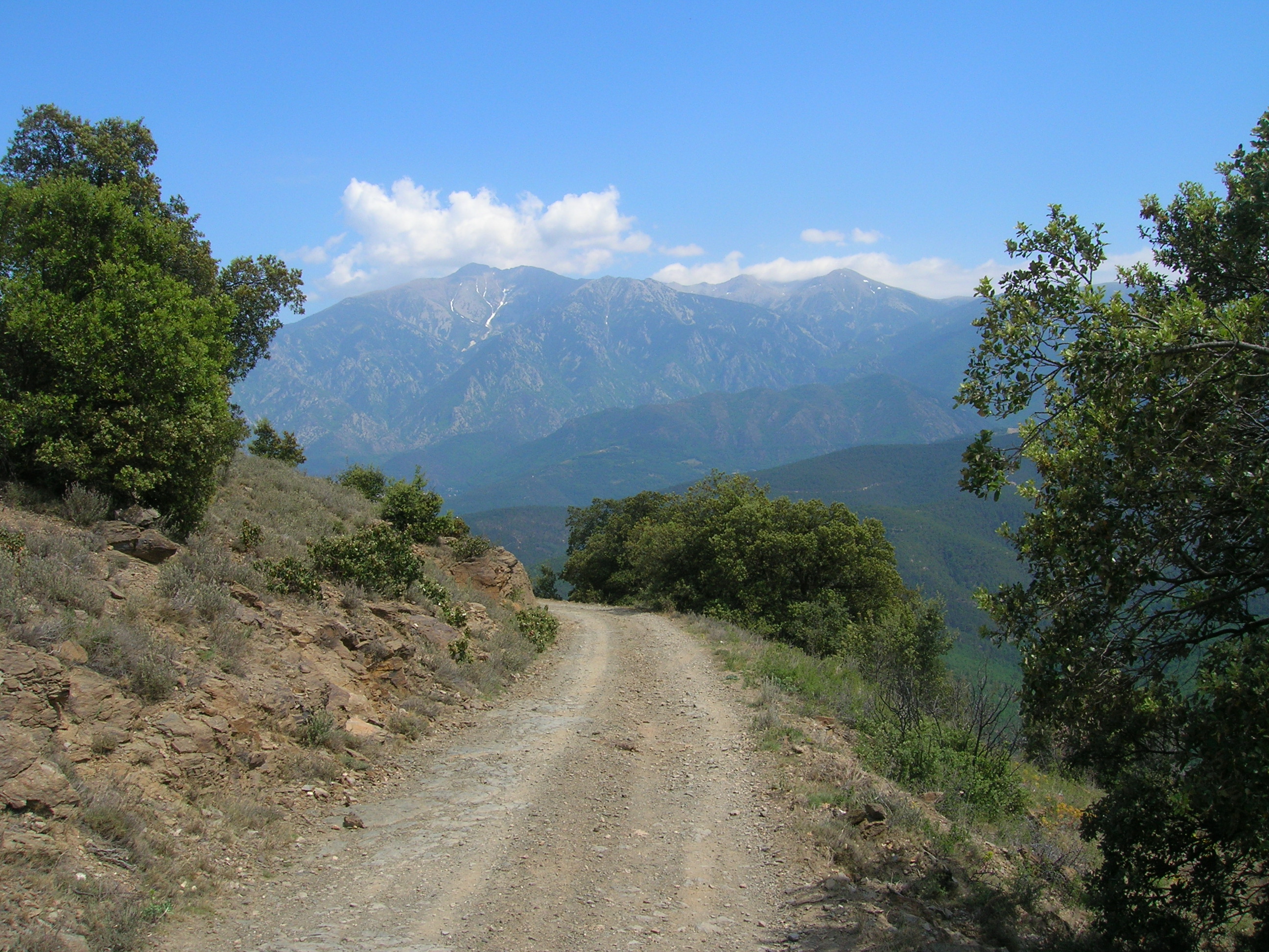
This region covers the lake-and-granite high Pyrenees of Aigüestortes i Estany de Sant Maurici, the open Cerdanya–Capcir plateau around the Bouillouses lakes and Pic Carlit, the Ordino high valleys of Andorra, and the eastern sentinel summit of Canigó. Aigüestortes is Catalonia’s only national park and is defined by high-mountain relief, more than 200 lakes and tarns, streams, waterfalls, and glacial valleys.
The walking character is mainly high-mountain hiking rather than technical alpinism: stony lake circuits, marked national-park paths, summit paths with occasional hand-use, and exposed weather-sensitive terrain above 2,000 m. Summer and early autumn are the main seasons. Snow can remain well into early summer on higher routes such as Carlit, Tristaina, and Canigó.
Access varies strongly by sector. Aigüestortes and Colomèrs often use park taxis or regulated valley access. Tristaina’s upper-road access is restricted in summer, with cable-car access indicated by Visit Andorra. Bouillouses road access is regulated in the June–September season. Canigó from Cortalets is short in distance but depends on reaching a high refuge trailhead by permitted access or on foot.
Selection rationale
The five hikes were selected to represent the main walking identities of the region: the classic Sant Maurici–Amitges lake-and-spire landscape, the Colomèrs glacial lake cirque, an iconic Andorran high-lake circuit, the major summit of Cerdanya–Capcir, and the culturally symbolic Canigó massif. The set avoids concentrating all choices in one valley and keeps to routes normally feasible as day hikes for fit walkers in summer conditions.
Summary table
| # | Hike | Country | Route type | Distance | Gain | Max elevation | Difficulty |
|---|---|---|---|---|---|---|---|
| 1 | Estany de Sant Maurici, Ratera and Amitges Lakes | Spain | Loop | 10 km | +480 m | c. 2,380 m | Moderate |
| 2 | Grand Cirque de Colomèrs / Seven Lakes of Colomèrs | Spain | Loop | 5.7 km upper circuit; c. 14 km with Banhs approach | +360 m upper; c. +490–750 m depending on start | 2,240 m | Moderate to hard |
| 3 | Estanys de Tristaina Circuit | Andorra | Loop | 4.39 km | +210 m | c. 2,330 m | Moderate |
| 4 | Pic Carlit from Lac des Bouillouses | France | Out-and-back / lake-loop return | 14.5 km | +936 m | 2,921 m | Hard mountain hike |
| 5 | Pic du Canigó from Refuge des Cortalets | France | Out-and-back | 8 km | +650 m | 2,784 m | Fairly hard |
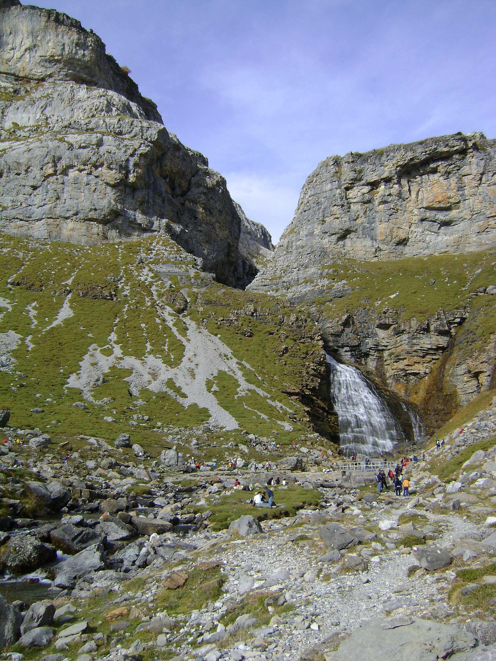
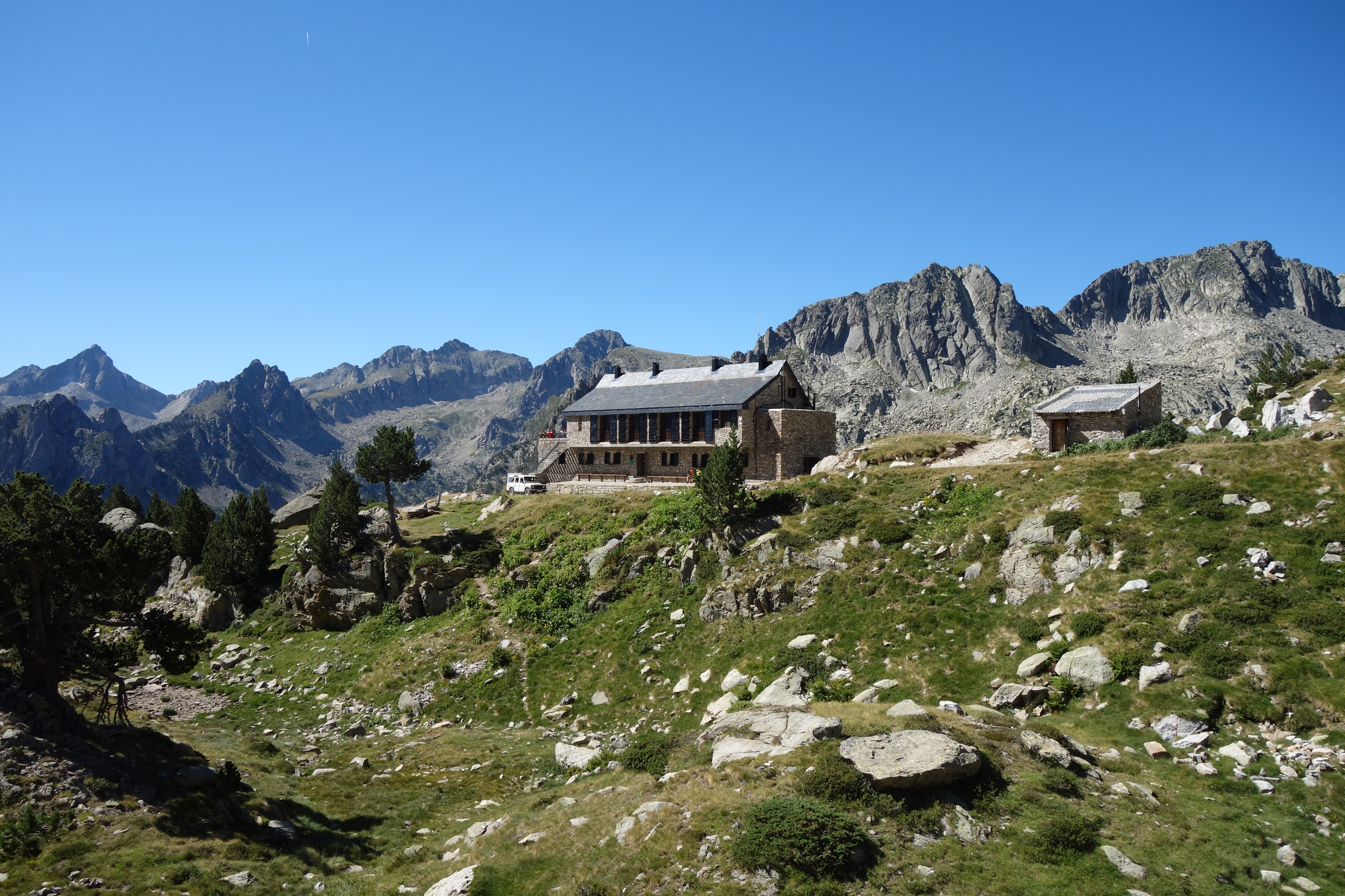
1. Estany de Sant Maurici, Ratera and Amitges Lakes
Snapshot
Itinerary
From Estany de Sant Maurici, the path passes the Encantats viewpoint landscape and climbs towards Cascada de Ratera. It continues to Estany de Ratera and the Obagues de Ratera lake area before reaching the higher Amitges sector, with views of the Agulles d’Amitges. The return descends by the viewpoint route above Estany de Sant Maurici, completing a compact circuit through one of the most recognisable parts of the national park. The official Vall d’Àneu route describes this as a circular walk linking Sant Maurici, Cascada de Ratera, Estany de Ratera, the Amitges lakes and the Sant Maurici viewpoint.
Why it is essential
This is one of the clearest single-day introductions to Aigüestortes: granite needles, glacial lakes, waterfalls, pine forest, and the classic Sant Maurici–Encantats landscape. It gives a concentrated sample of the national park without requiring a hut night.
Equipment
- Sturdy boots
- Weatherproof and warm layers
- Food and water
- Map or GPS
- Sun protection
- Trekking poles recommended
- Microspikes may be useful in early season if lingering snow remains on shaded upper sections
Hazards and notes
- The upper route is weather-sensitive and can hold snow outside the core summer season.
- Mobile-phone coverage in Aigüestortes is limited.
- Camping or bivouacking outside recognised refuges is prohibited.
- Taxi access, refuge opening, and seasonal restrictions should be checked locally before departure.
GPX / KML links
| Source | URL | Format | Notes |
|---|---|---|---|
| Aigüestortes / Vall d’Àneu official route PDF | leaderpirineuoccidental.cat | PDF / source route description | Use as verified source description; no route-file reuse licence found |
| Komoot secondary route source | komoot.com | Online route / possible GPX behind platform terms | Secondary geometry reference |
Further reading
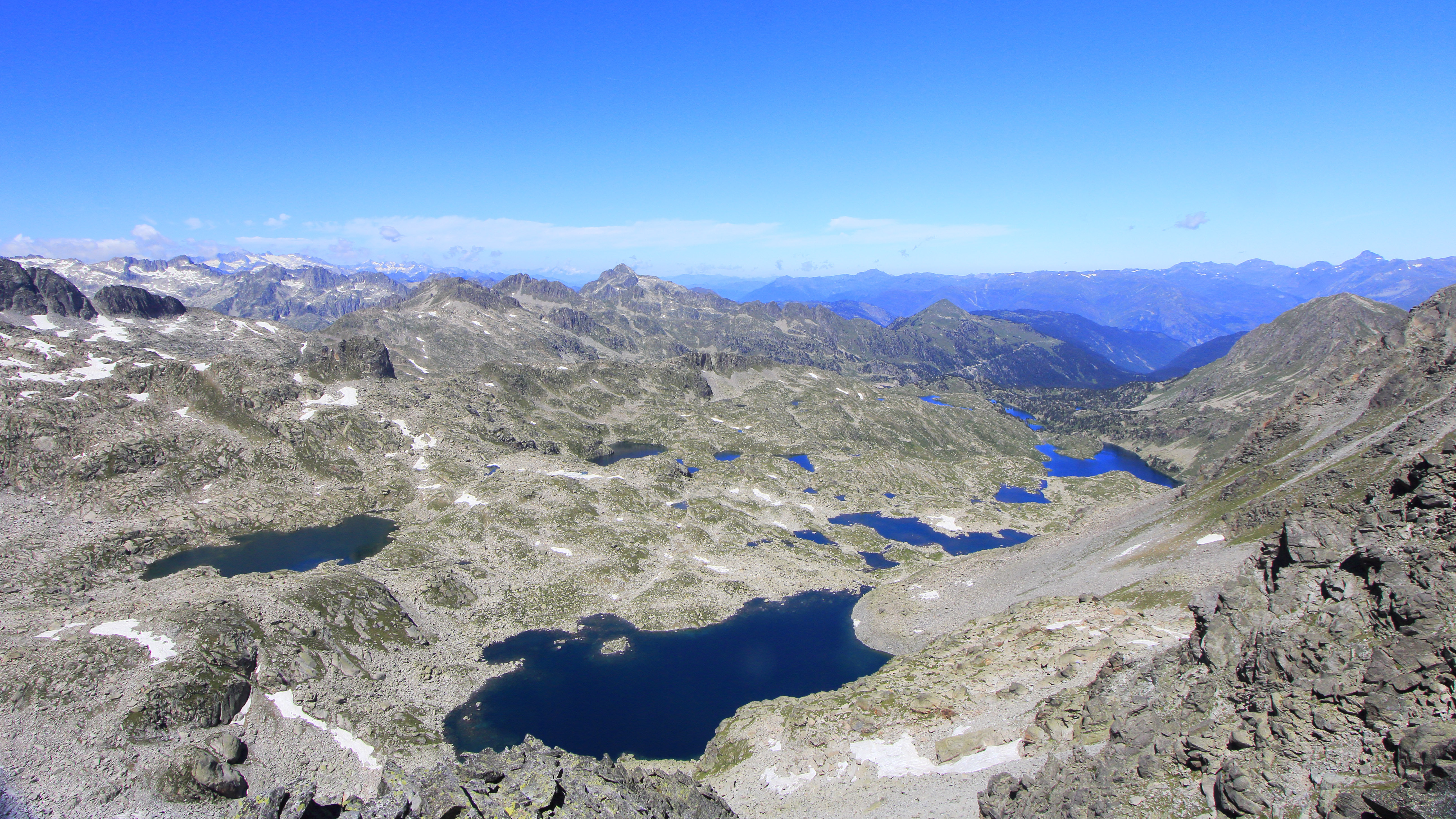
2. Grand Cirque de Colomèrs / Seven Lakes of Colomèrs
Snapshot
Itinerary
From Banhs de Tredòs, the longer park route follows the Aiguamòg valley towards Aigües Tòrtes and Lac Major de Colomèrs, then links Estanh Mòrt, Estanh des Garguilhs, Lac des Cabidornats and returns towards Lac Major before descending. The shorter tourism version begins higher, near the Refugi de Colomèrs access, and concentrates on the Seven Lakes circuit. Both variants explore the largest concentration of lakes in the Aigüestortes area and should not be treated as identical for statistics.
Why it is essential
Colomèrs is the classic glacial-lake cirque of the Val d’Aran side of the park. It represents the eastern Pyrenean high-lake landscape at its most concentrated: granite basins, linked tarns, refuge access, and a natural circular itinerary.
Equipment
- Sturdy boots
- Warm and waterproof layers
- Sun protection
- Water and food
- Map or GPS
- Trekking poles recommended
- Microspikes may be required if snow or hard névé remains on passes or shaded lake basins
Hazards and notes
- Route statistics depend heavily on whether the walk starts at Banhs de Tredòs or at the upper seasonal access point.
- Weather can change quickly above 2,000 m.
- Waymarking should not replace map / GPS navigation.
- Access and shuttle arrangements in the Aiguamòg valley should be confirmed before departure.
GPX / KML links
| Source | URL | Format | Notes |
|---|---|---|---|
| Visit Val d’Aran — Route: The 7 Lakes of Colomèrs | visitvaldaran.com | Route page / GPX indicated on source page | Official tourism GPX appears available, but direct file URL still needs extraction |
| Aigüestortes official park itinerary PDF | parcsnaturals.gencat.cat | PDF / source route description | Use as official route description |
| VisuGPX secondary trace | visugpx.com | GPX-download platform trace | Secondary reference |
Further reading
- Aigüestortes Colomèrs official itinerary PDF
- Visit Val d’Aran — The 7 Lakes of Colomèrs
- VisuGPX trace
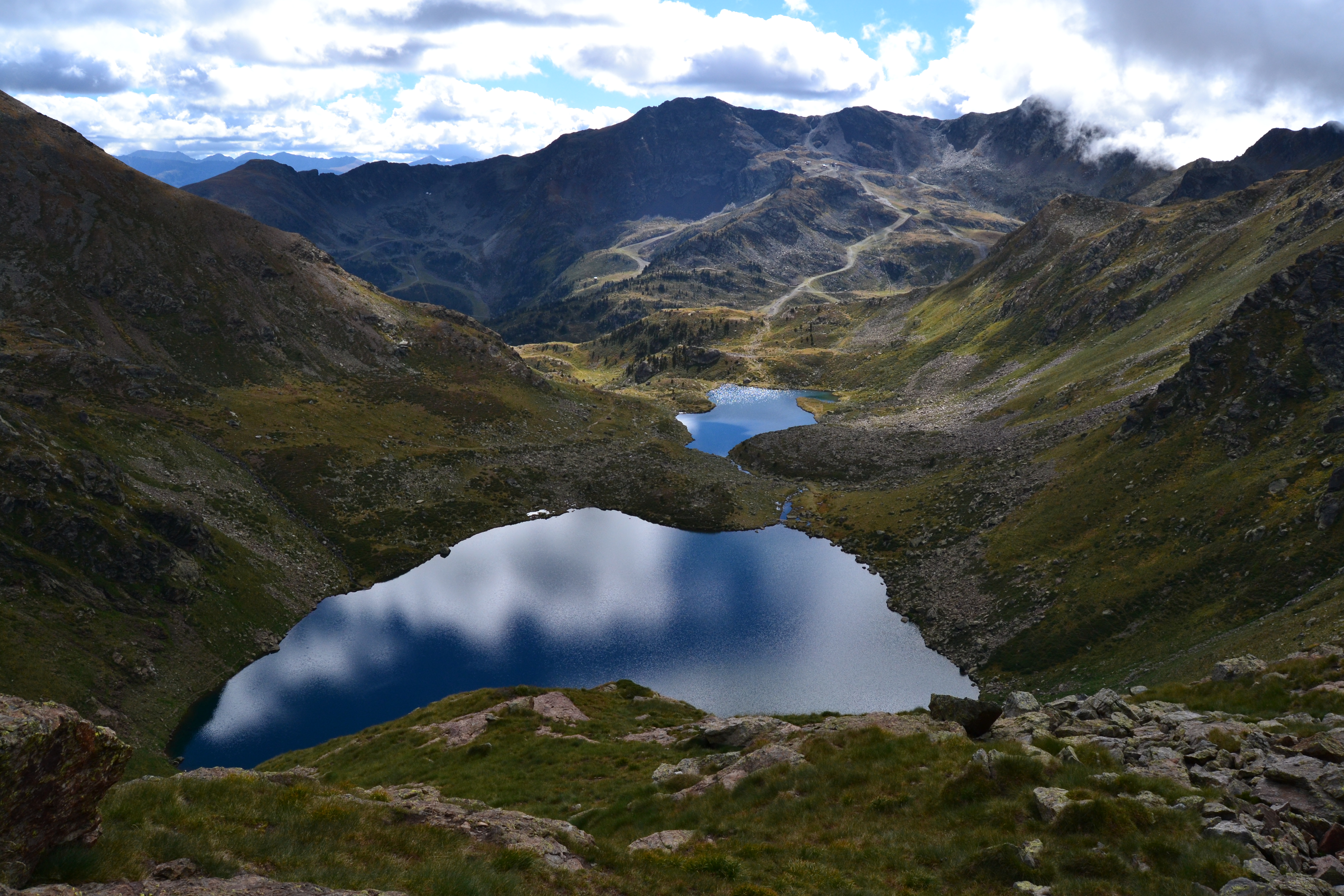
3. Estanys de Tristaina Circuit
Snapshot
Itinerary
The circular route starts at La Coma del Forat and climbs to the Tristaina lake basin. It passes the lower, middle, and upper lakes, using a waymarked high-mountain path below the Tristaina cirque. The official Visit Andorra route identifies the three lakes as Estany Primer, Estany del Mig and Estany de Més Amunt, with the upper lake being the largest and highest.
Why it is essential
Tristaina is one of Andorra’s most accessible and recognisable high-lake circuits. It gives a short but genuinely alpine-feeling route in the Ordino Biosphere Reserve area, with little wasted distance and strong scenery for the effort.
Equipment
- Hiking shoes or boots
- Waterproof layer
- Warm layer
- Water and food
- Sun protection
- Map or GPS
- Trekking poles useful on rocky sections
- Microspikes may be needed if snow lingers
Hazards and notes
- This is a high-altitude route despite its short distance.
- Weather changes can be sudden on high routes.
- Late June to late September is the usual recommended season.
- Summer road restrictions and cable-car operation should be checked before departure.
GPX / KML links
| Source | URL | Format | Notes |
|---|---|---|---|
| Visit Andorra official route page | visitandorra.com | Source map / official route page | Authoritative route source |
| Visit Andorra GPX | visitandorra.com | GPX | Official route-file reference |
| Visit Andorra route PDF | visitandorra.com | Official route sheet |
Further reading
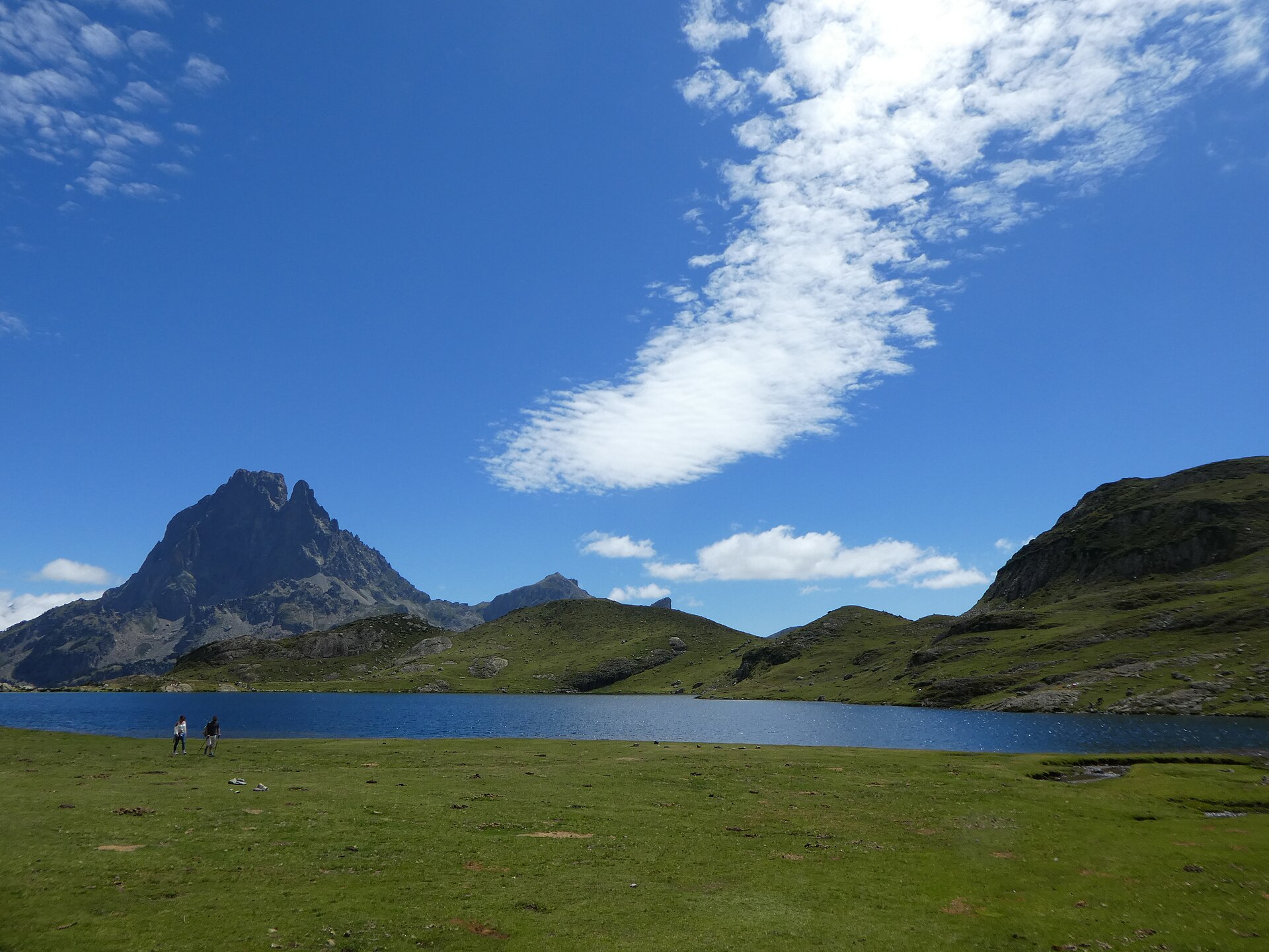
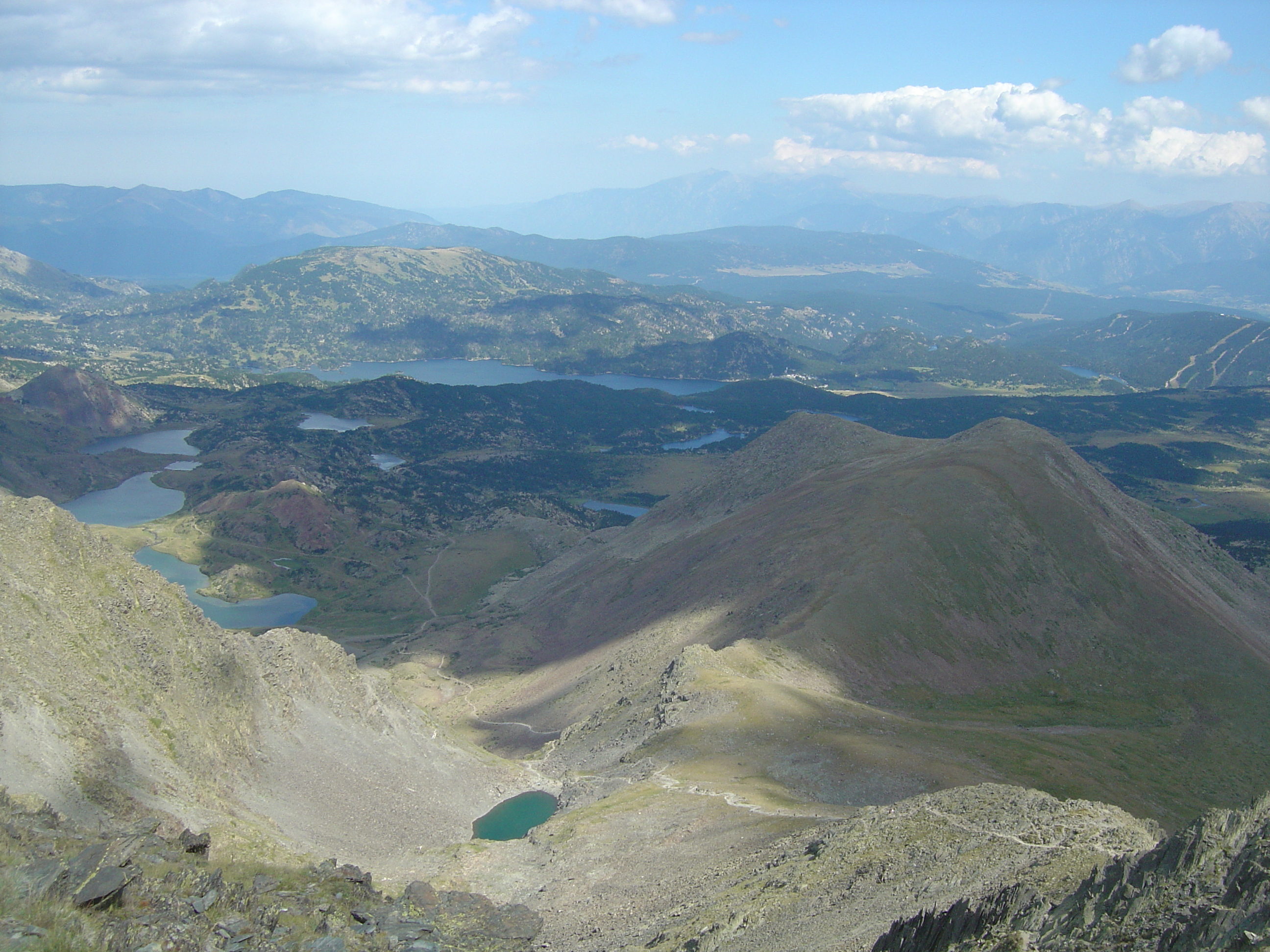
4. Pic Carlit from Lac des Bouillouses
Snapshot
Itinerary
From Lac des Bouillouses, the route follows the classic lakes approach before climbing towards the Carlit summit. The official route describes a succession of lakes, then a steeper final section where the path climbs to the summit ridge. The descent returns by the same summit section, with the lower return using the lake route back to Bouillouses.
Why it is essential
Pic Carlit is the dominant summit of the Bouillouses–Cerdanya walking area and one of the major non-glaciated day summits in the eastern Pyrenees. The approach combines high lakes with a substantial summit objective, making it the key strenuous mountain day in this sector.
Equipment
- Sturdy boots
- Warm and waterproof layers
- Gloves and hat outside settled midsummer
- Food
- At least 1.5–2 litres of water
- Sun protection
- Map or GPS
- Headtorch
- Trekking poles
- Microspikes or crampons may be required in early season depending on snow conditions
Hazards and notes
- This is a long high-mountain day.
- The final section is steep and may require use of the hands.
- The final section may be awkward for people prone to vertigo.
- Snow can remain for much of the year.
- The route requires good mountain equipment and experience.
- The D60 access to Bouillouses is regulated from June to September.
GPX / KML links
| Source | URL | Format | Notes |
|---|---|---|---|
| Pyrénées Cerdagne official route page | pyrenees-cerdagne.com | Source map / route page | Authoritative route source |
| Official GPX | medias.tourism-system.com | GPX | Official route-file reference |
| Official KML | medias.tourism-system.com | KML | Official route-file reference |
Further reading
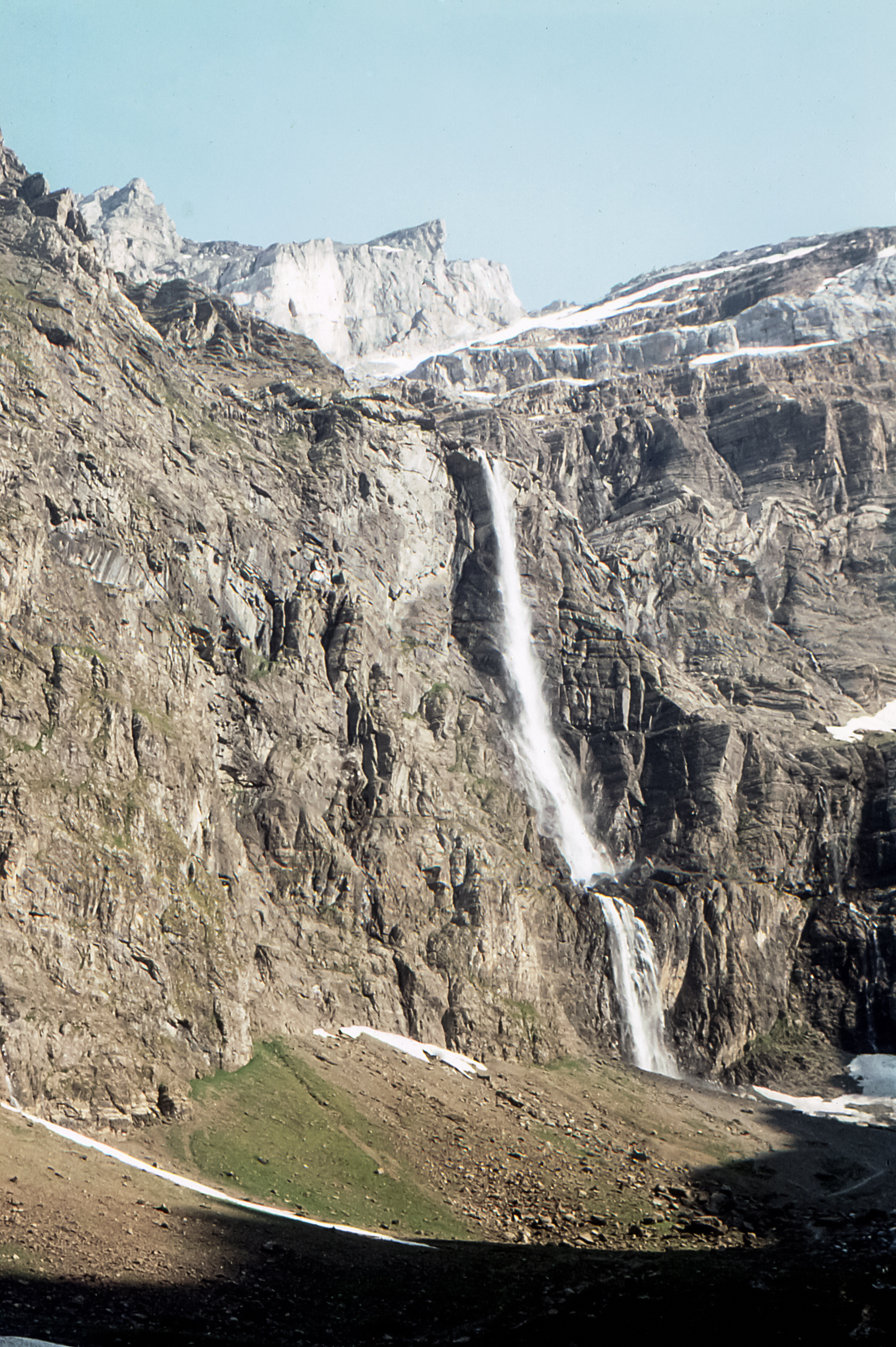
5. Pic du Canigó from Refuge des Cortalets
Snapshot
Itinerary
From Refuge des Cortalets, the path follows GR waymarks towards Pic Joffre and then continues by yellow-marked mountain path. It passes Fontaine de la Perdrix, reaches La Portella, and climbs the rocky upper slopes by zigzags to the summit of Pic du Canigó. The return follows the same route to Cortalets.
Why it is essential
Canigó is the symbolic summit of the eastern Pyrenees and a Grand Site de France. The official route description presents it as the easternmost high summit of the Pyrenees, with views extending towards the Mediterranean in clear weather.
Equipment
- Sturdy boots
- Warm and waterproof layers
- Water and food
- Sun protection
- Map or GPS
- Headtorch
- Trekking poles recommended
- Snow equipment may be necessary in spring or after late snowfalls
Hazards and notes
- The route is short but starts high and reaches 2,784 m.
- The route is exposed to sudden weather changes, cold wind, and poor visibility.
- Snow can create avalanche risk in spring.
- The official route sheet gives basic mountain-safety advice, including checking weather, carrying suitable clothing, water, food, and a charged phone.
- Marked paths and protected-site rules should be respected.
GPX / KML links
| Source | URL | Format | Notes |
|---|---|---|---|
| Pyrénées-Orientales official tourism route page | tourisme-pyreneesorientales.com | Source map / official route page | Official source; GPX button indicated |
| Official route PDF | cdt66.media.tourinsoft.eu | Official route description | |
| VisuGPX secondary trace | visugpx.com | GPX-download platform trace | Secondary reference |
Further reading
Further reading
| Source | Use | URL |
|---|---|---|
| Aigüestortes i Estany de Sant Maurici official park information | Regional character, safety, phone coverage, camping / bivouac restriction | parcsnaturals.gencat.cat |
| Vall d’Àneu / Aigüestortes route PDF | Sant Maurici–Ratera–Amitges route description and statistics | leaderpirineuoccidental.cat |
| Aigüestortes Colomèrs official itinerary PDF | Colomèrs route sequence, timing, elevation range and season | parcsnaturals.gencat.cat |
| Visit Val d’Aran | Seven Lakes of Colomèrs route statistics and GPX indication | visitvaldaran.com |
| Visit Andorra | Tristaina route description, access, statistics and GPX | visitandorra.com |
| Pyrénées Cerdagne | Pic Carlit official route, GPX/KML, access and hazards | pyrenees-cerdagne.com |
| Pyrénées-Orientales Tourisme | Canigó from Cortalets official route and PDF | tourisme-pyreneesorientales.com |