Regional overview
This region covers two of the great high-mountain walking areas of the Spanish Pyrenees: Ordesa y Monte Perdido National Park in Sobrarbe, and Posets-Maladeta Natural Park around Benasque. The walking character is strongly alpine-Pyrenean: deep limestone canyons, hanging ledges, cirques, waterfalls, glacial lakes, granite basins, and views towards 3,000 m summits such as Monte Perdido, Aneto, Maladeta and Posets.
The main hiking centres are Torla-Ordesa for the Ordesa valley, Escalona/Fanlo for Añisclo, and Benasque/Eriste for Posets-Maladeta. Most classic routes are summer mountain walks rather than technical climbs, but snow, storms, rockfall, heat in the canyons, and exposed ledge paths can make conditions serious.
The normal season for these selections is late spring to autumn, with the higher routes best treated as summer-to-early-autumn hikes unless current local conditions confirm otherwise. Ordesa access is seasonally regulated by shuttle bus from Torla; during regulated periods, buses run from Torla to the Pradera and private-car access is restricted.
Selection rationale
The five hikes were chosen to represent the region’s essential walking themes: the classic Ordesa balcony, the Añisclo canyon, the Maladeta–Aneto glacier-view basin, the lake country of Posets-Maladeta, and a classic Posets approach route.
Summit climbs such as Monte Perdido, Aneto and Posets were not selected because they commonly exceed the non-technical day-hike brief or involve snow, glacier, or alpinism considerations.
Summary table
| # | Hike | Route type | Distance | Gain | Max elevation | Difficulty |
|---|---|---|---|---|---|---|
| 1 | Senda de los Cazadores, Faja de Pelay and Cola de Caballo | Loop | 18.5 km | 750–770 m | 2,007 m | Hard mountain walk |
| 2 | Añisclo Canyon to La Ripareta | Out-and-back | 15 km | 500–694 m | 1,423 m | Moderate mountain walk |
| 3 | La Besurta, Aigualluts and Refugio de la Renclusa | Loop | 7 km | 400 m | 2,280 m | Moderate |
| 4 | Valle de Estós, Ibonet de Batisielles and Ibón de Escarpinosa | Out-and-back | 13.2–14 km | 725–750 m | c. 2,036 m | Moderate |
| 5 | Cascada de Espigantosa to Refugio Ángel Orús | Out-and-back | 7 km | c. 590–630 m | c. 2,148 m | Moderate |
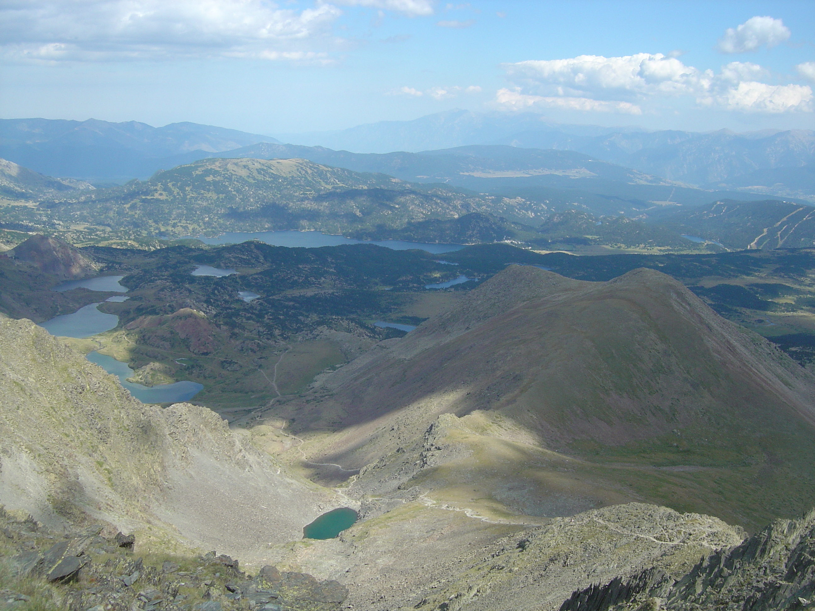
1. Senda de los Cazadores, Faja de Pelay and Cola de Caballo
Snapshot
Itinerary
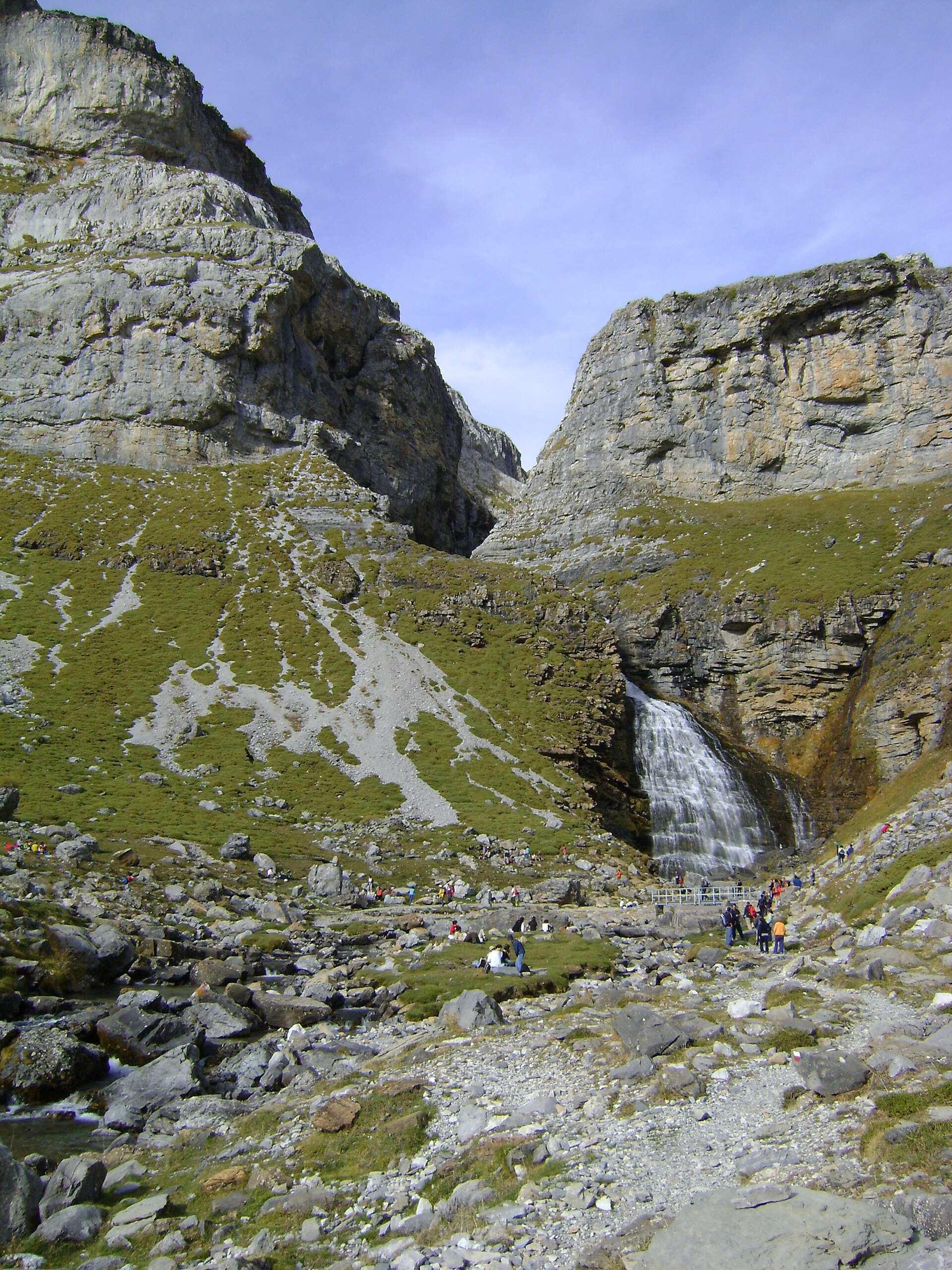
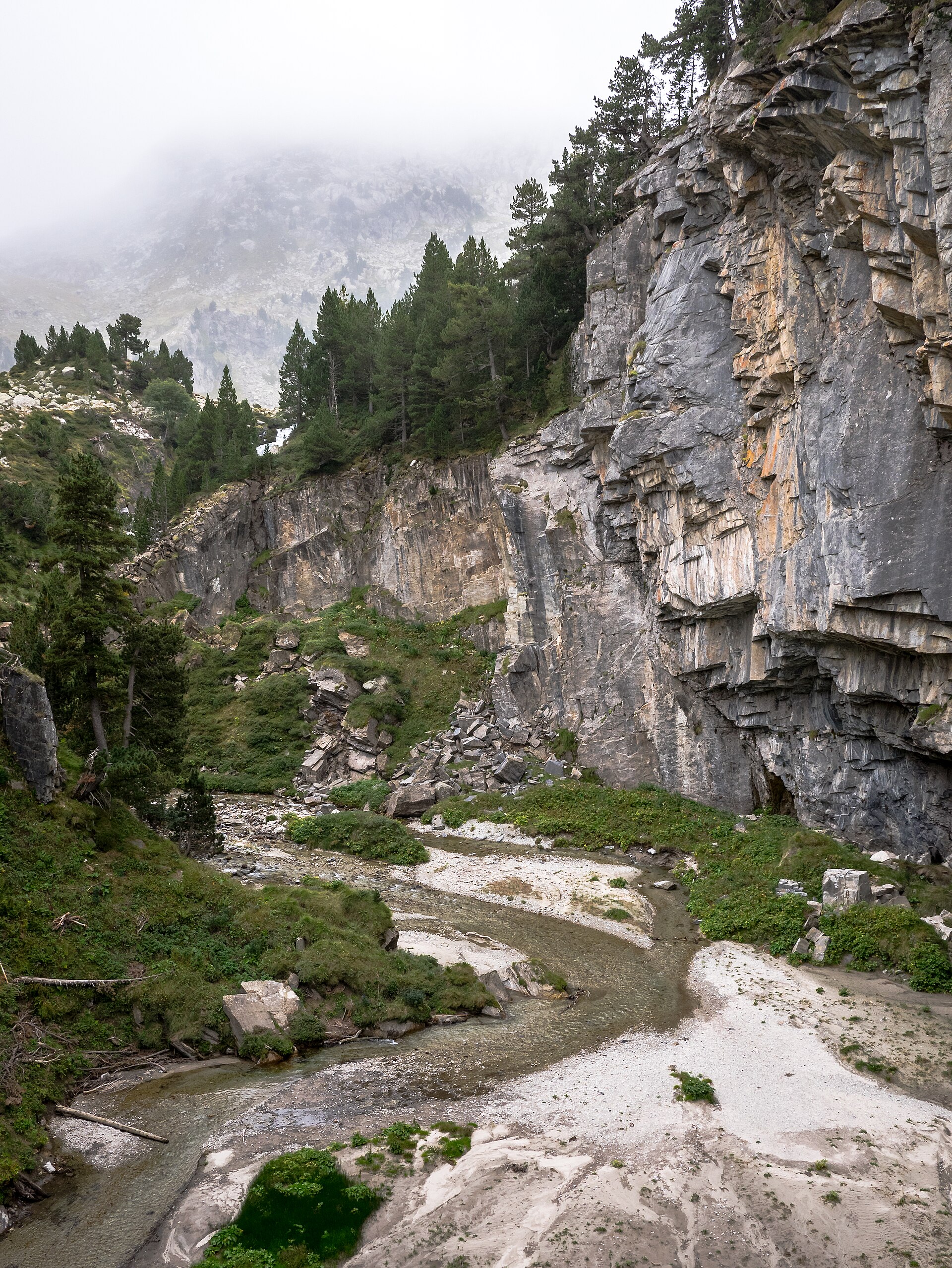
From the Pradera de Ordesa, the route crosses the Arazas river and climbs steeply through woodland on the Senda de los Cazadores. The ascent gains more than 600 m in tight zigzags before reaching the Mirador de Calcilarruego. From there, the Faja de Pelay traverses high above the Ordesa valley with sustained views towards the canyon walls and Monte Perdido sector.
The path continues towards the Circo de Soaso and the Cola de Caballo waterfall, then returns down the valley floor past the Gradas de Soaso and the Arazas waterfalls to the Pradera.
Official and Montaña Segura route notes warn against doing the loop in reverse because descending the Senda de los Cazadores increases accident risk.
Why it is essential
This is the classic high-level Ordesa day hike: a demanding ascent, a long balcony traverse, full views into the glacial valley, and the iconic Cola de Caballo finish. It gives a much broader sense of Ordesa than the easier valley-floor walk.
Equipment
Mountain hiking equipment:
- Sturdy boots
- Weatherproof layer
- Warm layer
- Food
- Water
- Map/GPS
- Sun protection
- Trekking poles recommended
- Microspikes or crampons may be needed outside settled snow-free conditions
Hazards and notes
The initial climb is steep and strenuous. The Faja de Pelay is an exposed mountain ledge route and should not be taken in snow, ice, storms, high wind, or heavy rain. Start early in hot weather. Ordesa access by private vehicle is restricted during peak periods; use the Torla shuttle when in operation.
GPX / KML links
| Source | URL | Format | Notes |
|---|---|---|---|
| Montaña Segura route 160 | montanasegura.com | GPX | Use as source route; replace later with project-owned GPX |
| Montaña Segura route 160 | montanasegura.com | KML | Use as source route; replace later with project-owned KML |
Sources
2. Añisclo Canyon to La Ripareta
Snapshot
Itinerary
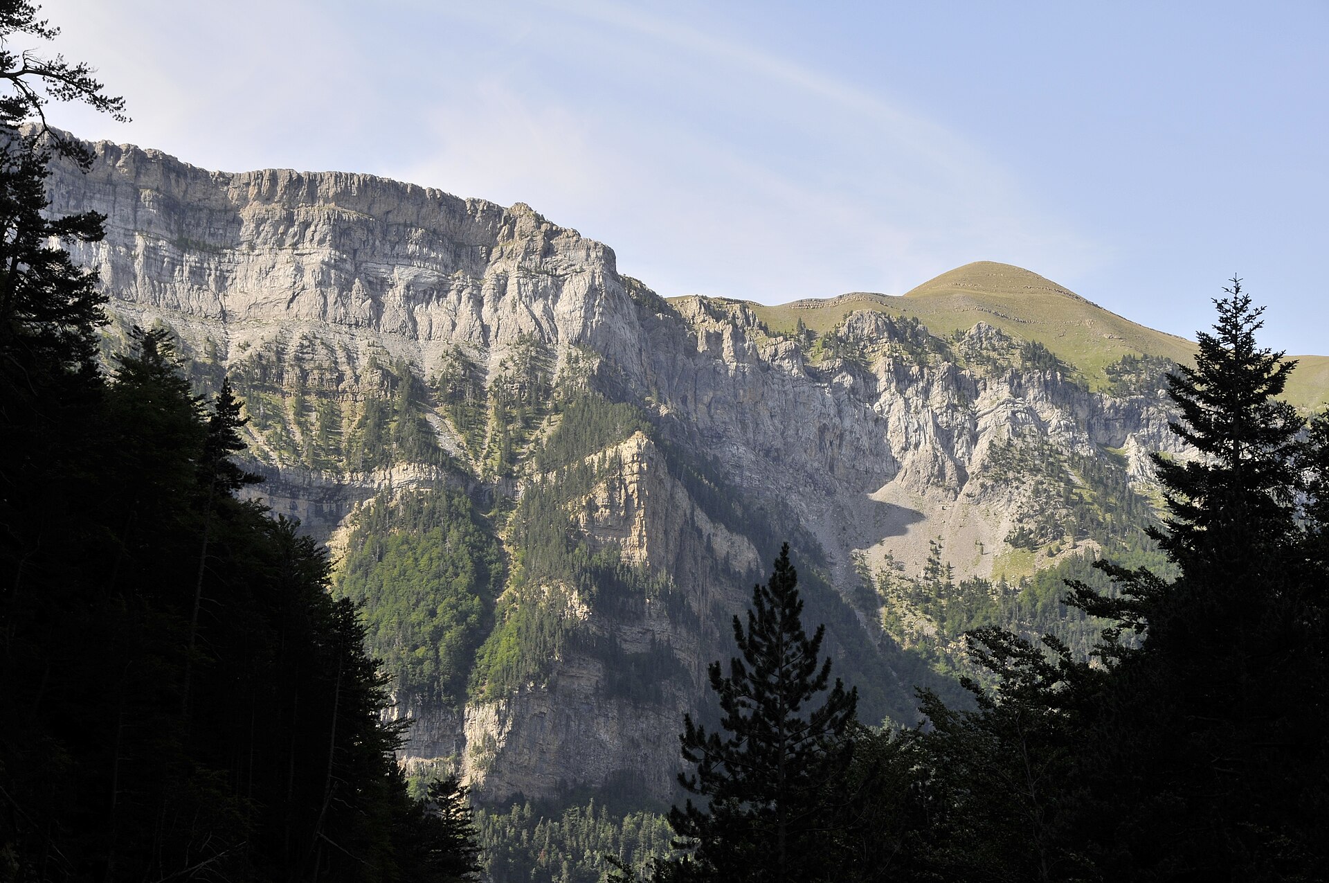
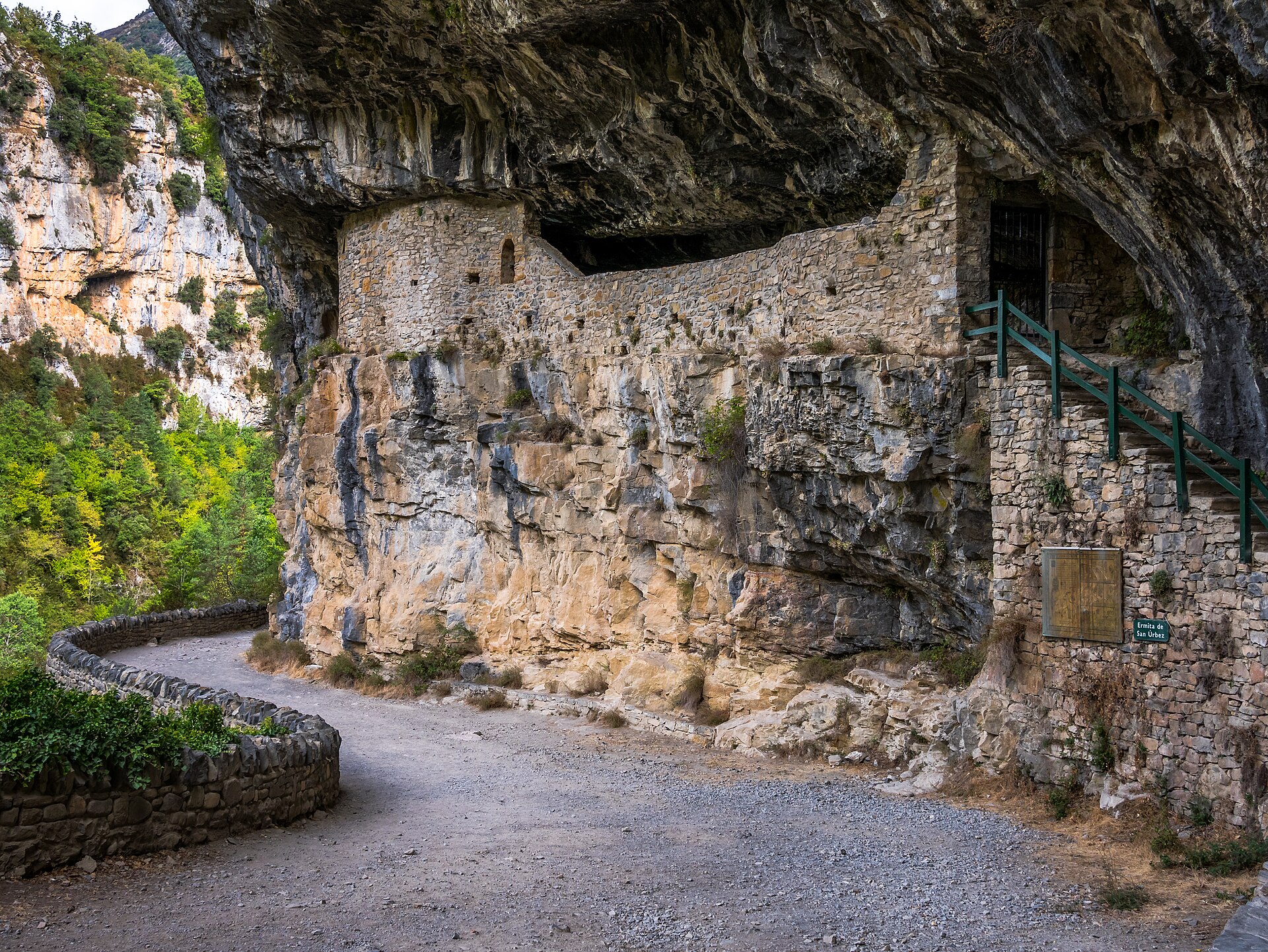
From the Ereta de Biés / San Úrbez parking area, the route follows the signed path into the Añisclo canyon. It passes the San Úrbez area and continues along the Bellós river corridor, using forest tracks and paths beneath the canyon walls.
After the Sangóns bridge, the route becomes more enclosed and climbs gradually towards La Ripareta, where the Pardina and Bellós waters meet. The return follows the same route.
PNOMP warns walkers to take care near river viewpoints and exposed canyon edges.
Why it is essential
Añisclo is the great canyon counterpart to Ordesa: narrower, more enclosed, and defined by limestone walls, river pools, woodland and waterfalls. La Ripareta gives a substantial but still day-hike-length way to experience the canyon.
Equipment
Standard to mountain hiking equipment:
- Boots or sturdy hiking shoes
- Weatherproof layer
- Warm layer outside summer
- Water
- Food
- Map/GPS
- Sun protection
- Trekking poles useful on wet or rough sections
Hazards and notes
The canyon is weather-sensitive. Storms, rockfall, wet limestone and high water can make the route more serious. Montaña Segura notes that bathing is not permitted in the national park and that dogs should not be loose.
GPX / KML links
| Source | URL | Format | Notes |
|---|---|---|---|
| Montaña Segura route 350 | montanasegura.com | GPX | Use as source route; replace later with project-owned GPX |
| Montaña Segura route 350 | montanasegura.com | KML | Use as source route; replace later with project-owned KML |
Sources
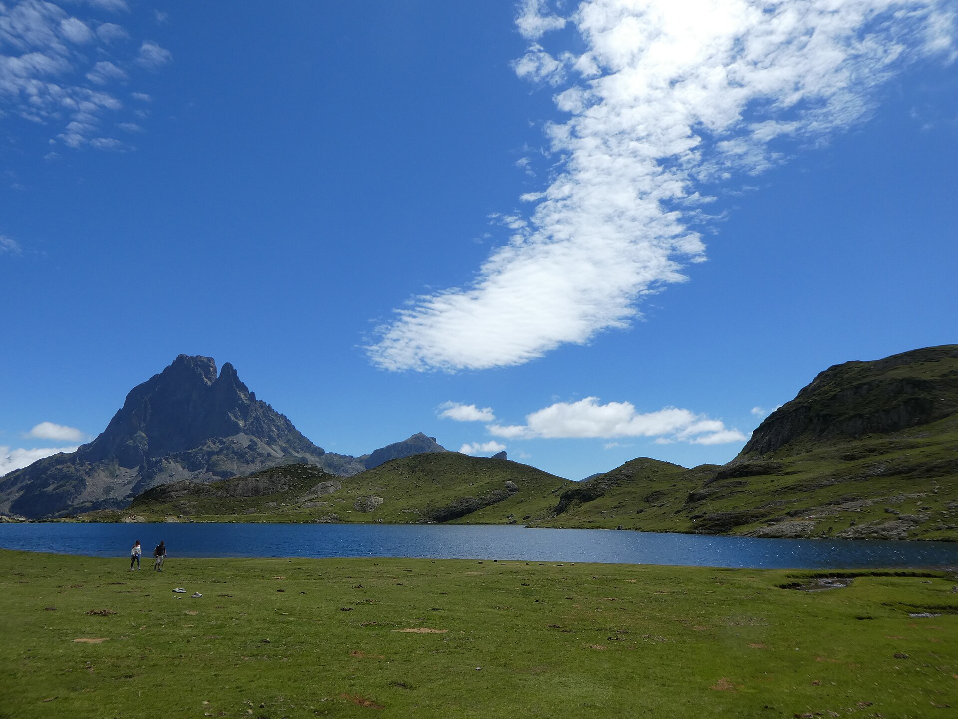
3. La Besurta, Aigualluts and Refugio de la Renclusa
Snapshot
Itinerary
From La Besurta, the route reaches the Pleta de la Renclusa and continues towards the Forau de Aigualluts, a karst sinkhole associated with the waters descending from the Maladeta-Aneto area. The path visits the Aigualluts waterfall and the Plan de Aigualluts, with views towards Aneto and its glacier setting.
The loop then climbs towards the Collado de la Renclusa and descends via the Refugio de la Renclusa and its barranco back to La Besurta.
Rutas Pirineos lists the route as 7 km, 400 m of ascent and 3 hours, while the Benasque official route page gives a longer 13.4 km variant from Vado del Hospital.
Why it is essential
This is the most accessible non-technical hike into the Maladeta-Aneto landscape. It combines waterfalls, high meadows, karst hydrology, glacier views and one of the classic Aneto approach refuges without requiring glacier travel.
Equipment
Mountain hiking equipment:
- Boots
- Warm layer
- Waterproof shell
- Sun protection
- Food
- Water
- Map/GPS
- Outside snow-free conditions, snowshoes or skis may be needed
- Avalanche information should be checked in winter or early spring
Hazards and notes
The route is straightforward in settled summer conditions but becomes a snow route in winter and early spring. Rutas Pirineos recommends checking the avalanche bulletin in snowy conditions.
Summer access to La Besurta is regulated. From late June to early September, access beyond Benasque is by mandatory bus and private cars cannot reach La Besurta in the central summer period.
GPX / KML links
| Source | URL | Format | Notes |
|---|---|---|---|
| Rutas Pirineos | rutaspirineos.org | GPX | Use as source route; replace later with project-owned GPX |
| Rutas Pirineos | rutaspirineos.org | KMZ | Use as source route; replace later with project-owned KML/GPX |
Sources
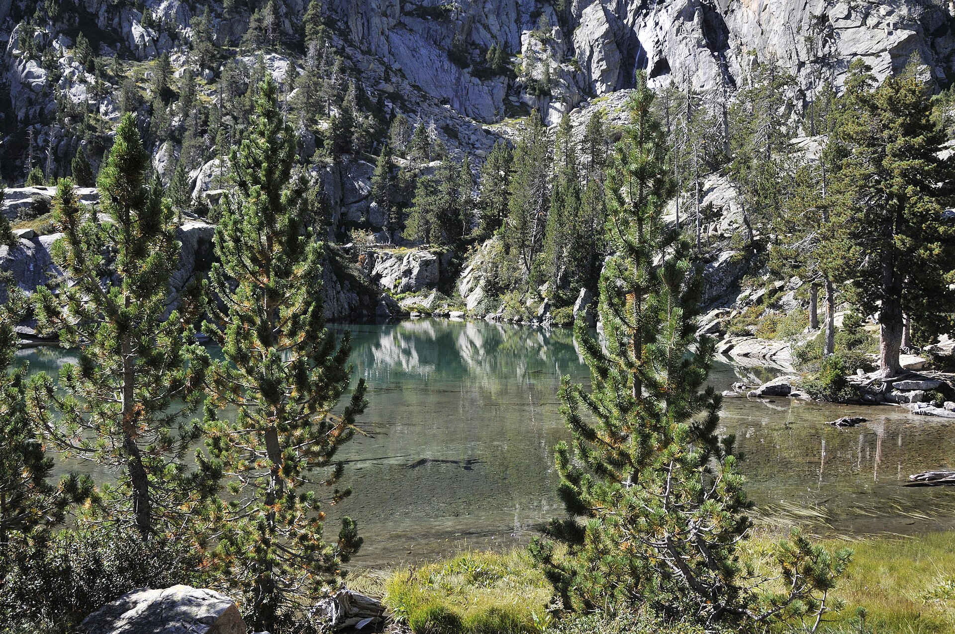
4. Valle de Estós, Ibonet de Batisielles and Ibón de Escarpinosa
Snapshot
Itinerary
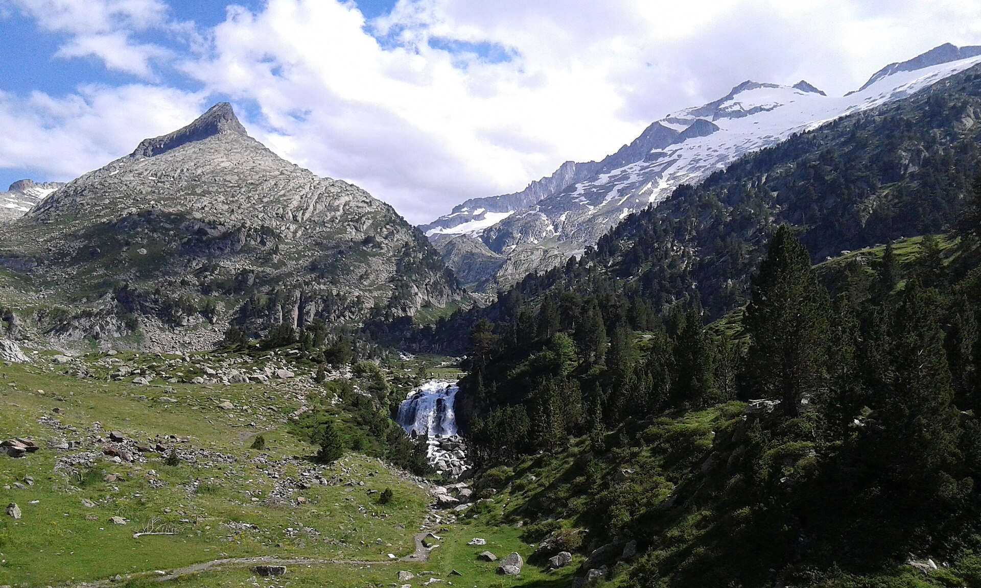
The route starts at the Estós valley parking area and follows the GR 11 into the valley. It passes the Cabaña de Santa Ana area before leaving the main valley track for the Batisielles path.
The route climbs through forest to the Ibonet de Batisielles, then continues on rougher mountain path towards Ibón de Escarpinosa, a glacial lake basin below the Perramó and Batisielles scenery. The return follows the same route.
Benasque’s official route page lists this as one of the essential Posets-Maladeta itineraries and gives 13.2 km, +750/-750 m and about 5 hours.
Why it is essential
This is the classic lake walk of the Benasque side of Posets-Maladeta: forest approach, GR 11 valley walking, glacial lakes and granite scenery, without entering technical summit terrain.
Equipment
Mountain hiking equipment:
- Sturdy boots
- Weatherproof layer
- Warm layer
- Food
- Water
- Map/GPS
- Sun protection
- Trekking poles recommended for the descent
- In early season, lingering snow may require traction
Hazards and notes
The route is non-technical in normal summer conditions, but the lake approach has rougher terrain and can be slippery after rain or snow. Navigation is usually straightforward on signed paths, but mist can complicate the upper lake area. No official route-file download was found.
GPX / KML links
| Source | URL | Format | Notes |
|---|---|---|---|
| Apatita route page | apatita.com | GPX in ZIP | Use as source route; replace later with project-owned GPX |
| Wikiloc route by Santiago González | Source page located via Wikiloc; exact download URL not captured | GPX/source route | Use only as secondary route reference if needed |
Sources
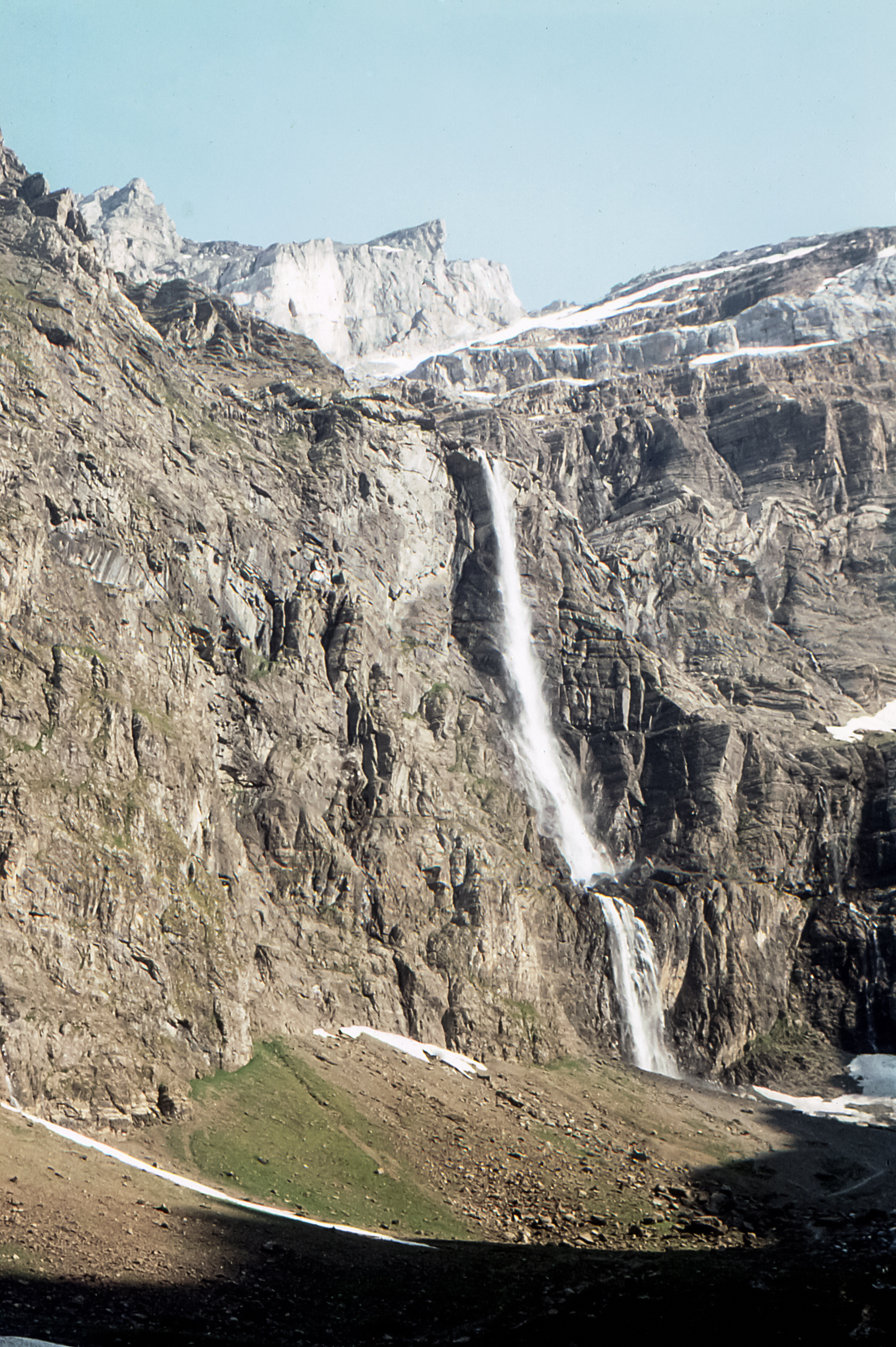
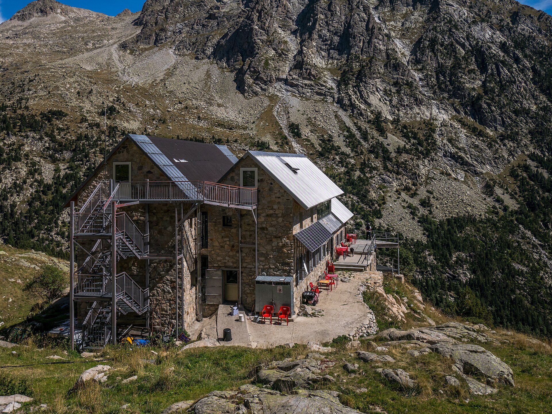
5. Cascada de Espigantosa to Refugio Ángel Orús
Snapshot
Itinerary
From the Espigantosa area, the PR-HU 36 climbs beside the Eriste valley route towards the Refugio Ángel Orús. The path passes the Cascada de Espigantosa, follows forested and rocky sections above the river, and climbs steadily to the Forcau / Ángel Orús refuge, a major access point for the Posets massif.
The official Red Natural de Aragón route describes the route as an out-and-back pedestrian trail of 7 km and about 3 hours. The Benasque route description confirms the PR-HU 36 line and notes the strong ascent after the waterfall sector.
Why it is essential
This is the accessible classic approach into the Posets high-mountain world. It reaches one of the key refuges of the massif and gives a strong day-hike objective without requiring a summit ascent.
Equipment
Mountain hiking equipment:
- Sturdy boots
- Warm layer
- Waterproof shell
- Food
- Water
- Map/GPS
- Sun protection
- Trekking poles useful
- In snowy conditions, winter equipment and avalanche knowledge may be required
Hazards and notes
The Benasque route page warns that the difficulty varies greatly depending on snow and that avalanche risk must be considered. The ascent is sustained and can be hot in summer. Snow, ice, storm activity, or poor visibility can make the route more serious than its summer grade suggests.
GPX / KML links
| Source | URL | Format | Notes |
|---|---|---|---|
| Red Natural de Aragón | rednaturaldearagon.com | GPX, WGS84 | Official GPX; replace later with project-owned GPX |
| Red Natural de Aragón | rednaturaldearagon.com | GPX, ETRS89 | Official GPX; replace later with project-owned GPX |
Sources
Region-level sources
| Source | Use | URL |
|---|---|---|
| Parque Nacional de Ordesa y Monte Perdido official route pages | Ordesa and Añisclo route statistics, itinerary and difficulty verification | pnomp.es |
| PNOMP Añisclo route page | Añisclo canyon route verification | pnomp.es |
| Montaña Segura | Ordesa and Añisclo GPX/KML sources, safety notes and cross-check statistics | montanasegura.com |
| Montaña Segura route 350 | Añisclo GPX/KML and safety notes | montanasegura.com |
| Benasque official tourism route pages | Aigualluts, Escarpinosa and Ángel Orús route descriptions and statistics | benasque.com |
| Rutas Pirineos | Aigualluts–Renclusa loop statistics and GPX/KMZ source | rutaspirineos.org |
| Red Natural de Aragón | Official Ángel Orús route page and GPX links | rednaturaldearagon.com |
| Wikimedia Commons | Licence-compatible image candidates for all five hikes | commons.wikimedia.org |
| OrdesaBus | Current access/shuttle information for Ordesa valley | ordesabus.com |