

.jpg)


Regional overview
The Philippine Cordilleras and volcanic ranges offer humid tropical mountain walking with sharp seasonal contrasts: cool grassland and mossy forest in the Cordillera, lahar canyons and crater lakes around active volcanoes, and dense lowland-to-montane forest on older volcanic massifs. Most routes require registration, guides or local permits, and conditions can be strongly affected by typhoons, monsoon rain, heat, landslides and volcanic advisories.
This entry balances two Cordillera classics with three Luzon volcanic-range hikes. It avoids routes with frequent closure uncertainty such as Taal and Kanlaon, and it avoids multi-day Cordillera traverses.
Selection rationale
The five hikes were selected to cover the region’s most recognisable day-hiking experiences: Luzon’s highest peak by the Ambangeg route, a Benguet ridge eco-trail, Pinatubo’s crater-lake walk, a Central Luzon stratovolcano summit route and Makiling’s rainforest trail to Peak II.
Summary table
| # | Hike | Country | Route type | Distance | Gain | Max elevation | Difficulty |
|---|---|---|---|---|---|---|---|
| 1 | Mount Pulag via Ambangeg Trail | Philippines | Out-and-back | 15.4 km | 840 m | 2,920 m source route / 2,928 m summit | Hard |
| 2 | Mount Ulap Eco-Trail | Philippines | Point-to-point | 8.0 km | 516 m | 1,826 m | Hard |
| 3 | Mount Pinatubo crater lake trek | Philippines | Out-and-back | 11.4 km | 625 m | 1,019 m source route | Hard |
| 4 | Mount Arayat North Peak | Philippines | Out-and-back | 13.0 km | 1,396 m | 1,021 m | Hard |
| 5 | Mount Makiling Peak II via UPLB / Mariang Makiling Trail | Philippines | Out-and-back | 19.0 km | 1,038 m | 1,076 m source route / ca. 1,090 m mountain | Hard |
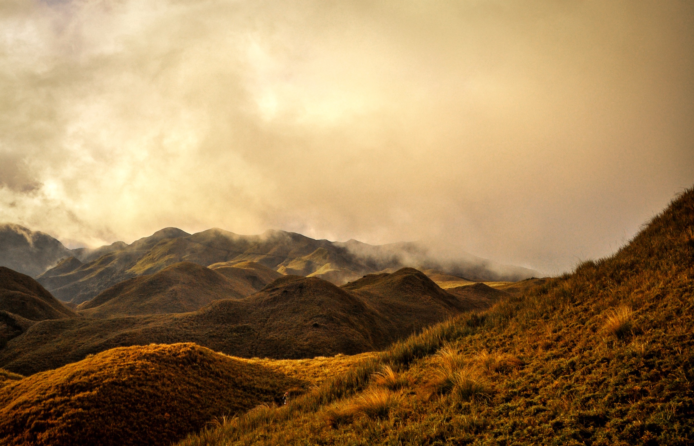
1. Mount Pulag via Ambangeg Trail

Snapshot
Itinerary
The Ambangeg route climbs from the high road-access area through montane forest and grassland toward the broad summit of Mount Pulag. It is the standard non-technical route to Luzon’s highest peak and is often timed for sunrise and sea-of-clouds views.
Why it is essential
Pulag is the Cordillera’s flagship high summit and one of the Philippines’ most famous hikes, combining mossy forest, high grassland, cool conditions and an iconic summit panorama.
Equipment
Warm layers, waterproof shell, gloves/hat, headtorch, hiking shoes, food, water, sun protection and required registration/guide documents.
Hazards and notes
Cold, rain, fog, altitude, crowding and park closures are practical concerns. Confirm current permit, camping/day-hike rules and trail advisories before travel.
GPX / KML links
| Source | URL | Format / access | Reuse status |
|---|---|---|---|
| AllTrails: Ambangeg Trail to Pulag | alltrails.com | Source route page / app map | AllTrails terms apply; route-file reuse not confirmed |
| OpenStreetMap search: Mount Pulag Ambangeg | openstreetmap.org | Map source | OSM data is ODbL; geometry cross-check target |
External links
- AllTrails — Ambangeg Trail to Pulag
- Wikipedia — Mount Pulag
- Wikimedia Commons — Mount Pulag National Park by Say Bernardo
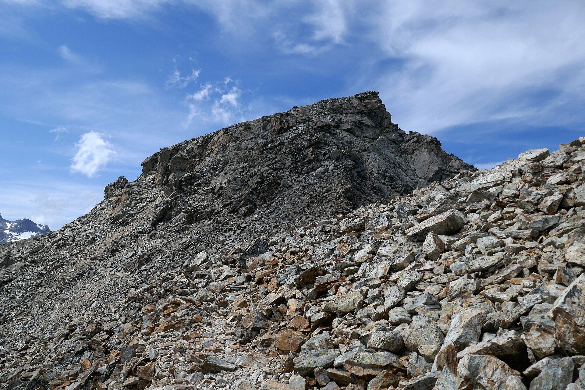
2. Mount Ulap Eco-Trail

Snapshot
Itinerary
The route traverses open pine-and-grassland ridges above Itogon, linking several high points and viewpoints before descending toward the exit side. Local registration and guide rules should be checked before arrival.
Why it is essential
Mount Ulap is a classic Benguet ridge day hike: close to Baguio, scenic, culturally recognisable and visually distinct from Pulag’s high summit grassland.
Equipment
Hiking shoes, rain shell, sun protection, water, food and offline map/GPS.
Hazards and notes
Exposed ridge weather, fog, slippery ground after rain and crowded weekends are the main issues. Follow local guide and registration rules.
GPX / KML links
| Source | URL | Format / access | Reuse status |
|---|---|---|---|
| AllTrails: Mount Ulap | alltrails.com | Source route page / app map | AllTrails terms apply; route-file reuse not confirmed |
| OpenStreetMap search: Mount Ulap | openstreetmap.org | Map source | OSM data is ODbL; geometry cross-check target |
External links
3. Mount Pinatubo crater lake trek

Snapshot
Itinerary
The modern trek uses a 4x4 approach through lahar terrain, then follows a walking route through streambeds and volcanic deposits to the crater lake viewpoint. Return is by the same route and vehicle approach.
Why it is essential
Pinatubo is one of the world’s most famous recent volcanic landscapes. The crater-lake trek turns the 1991 eruption landscape into a feasible day hike.
Equipment
Shoes suitable for wet stream crossings, sun protection, water, snacks, rain shell, hiking poles and dry bag in wet periods.
Hazards and notes
Pinatubo is an active volcano and lahar landscape. Check current PHIVOLCS/official advisories, weather and operator access before travel. Flash floods and heat are major risks.
GPX / KML links
| Source | URL | Format / access | Reuse status |
|---|---|---|---|
| AllTrails: Mount Pinatubo | alltrails.com | Source route page / app map | AllTrails terms apply; route-file reuse not confirmed |
| OpenStreetMap search: Mount Pinatubo crater lake trek | openstreetmap.org | Map source | OSM data is ODbL; geometry cross-check target |
External links
- AllTrails — Mount Pinatubo
- Wikipedia — Mount Pinatubo
- Wikipedia — Capas
- Wikimedia Commons — Pinatubo Crater Lake (052005)
4. Mount Arayat North Peak

Snapshot
Itinerary
The route climbs from the Arayat Bano side through Mount Arayat National Park to the North Peak area, with steep forested sections and summit viewpoints over the Central Luzon plains.
Why it is essential
Arayat is the isolated volcanic landmark of the Pampanga plain and a classic Central Luzon mountain day.
Equipment
Hiking shoes, water, food, sun protection, rain shell, offline map/GPS and headtorch.
Hazards and notes
The ascent is steep and hot at lower elevations. Slippery ground, route-finding and late finishes are concerns. Confirm current protected-area rules and local guide requirements.
GPX / KML links
| Source | URL | Format / access | Reuse status |
|---|---|---|---|
| AllTrails: Mount Arayat North Peak Campsite | alltrails.com | Source route page / app map | AllTrails terms apply; route-file reuse not confirmed |
| OpenStreetMap search: Mount Arayat National Park | openstreetmap.org | Map source | OSM data is ODbL; geometry cross-check target |
External links
- AllTrails — Mount Arayat North Peak Campsite
- Wikipedia — Mount Arayat
- Wikimedia Commons — Mount Arayat Volcano in Philippines
5. Mount Makiling Peak II via UPLB / Mariang Makiling Trail

Snapshot
Itinerary
The UPLB-side route follows the Mariang Makiling Trail through the Mount Makiling Forest Reserve, passing rainforest, creeks, mudspring side areas and numbered stations before reaching Peak II / Station 30. Return is by the same route.
Why it is essential
Makiling is the classic rainforest volcano hike near Manila and an ASEAN Heritage Park landscape, contrasting strongly with the open Cordillera ridges and Pinatubo’s lahar terrain.
Equipment
Hiking shoes with grip, rain shell, water, food, insect/leeches protection, offline map/GPS and headtorch.
Hazards and notes
Mud, leeches, slippery roots/rocks, heat and heavy rain are common issues. Follow MCME/UPLB access rules and avoid restricted areas.
GPX / KML links
| Source | URL | Format / access | Reuse status |
|---|---|---|---|
| AllTrails: Mount Makiling | alltrails.com | Source route page / app map | AllTrails terms apply; route-file reuse not confirmed |
| MCME Mount Makiling maps | makiling.center | Official map page | MCME states maps may be copied/used for research and non-commercial purposes with citation |
| OpenStreetMap search: Mount Makiling Forest Reserve | openstreetmap.org | Map source | OSM data is ODbL; geometry cross-check target |
External links
- AllTrails — Mount Makiling
- Makiling Center for Mountain Ecosystems — Places in Mount Makiling
- MCME — Mount Makiling maps
- MCME — About MCME
- Wikimedia Commons — Mount Makiling
Missing data / follow-up work
- Official current permit/registration pages for Pulag, Ulap, Pinatubo and Arayat were not reliably accessible in this pass; verify locally before publication.
- PHIVOLCS or local government advisories should be checked again immediately before any Pinatubo recommendation goes live.
- AllTrails-derived route pages are source maps only; downloadable route-file reuse is not confirmed.
- Some official government legal pages were blocked by a Cloudflare challenge during shell verification, so protected-area law URLs should be rechecked manually if needed.
External links
| Source | URL |
|---|---|
| AllTrails — Ambangeg Trail to Pulag | alltrails.com |
| AllTrails — Mount Ulap | alltrails.com |
| AllTrails — Mount Pinatubo | alltrails.com |
| AllTrails — Mount Arayat North Peak Campsite | alltrails.com |
| AllTrails — Mount Makiling | alltrails.com |
| Makiling Center for Mountain Ecosystems — Places in Mount Makiling | makiling.center |
| MCME — Mount Makiling maps | makiling.center |
| MCME — About MCME | makiling.center |
| Wikipedia — Mount Pulag | en.wikipedia.org |
| Wikipedia — Itogon | en.wikipedia.org |
| Wikipedia — Mount Pinatubo | en.wikipedia.org |
| Wikipedia — Capas | en.wikipedia.org |
| Wikipedia — Mount Arayat | en.wikipedia.org |