Regional overview
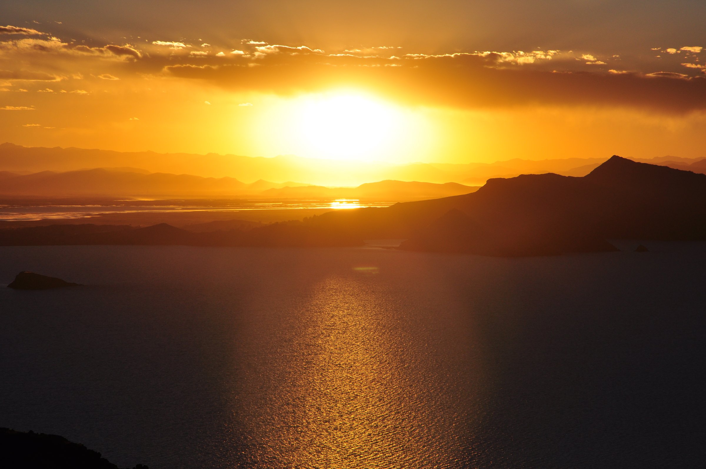
The Puno / Lake Titicaca highlands are an open Altiplano walking region of islands, peninsulas, archaeological headlands, sacred hills and lake-view ridges. Most walking starts around 3,810-3,900 m, so even moderate routes feel harder than their distance suggests. The landscape is less glaciated and more cultural than the Cordillera Blanca: terraces, textile communities, chullpas, Aymara and Quechua pilgrimage sites, totora wetlands and huge lake horizons are the defining features.
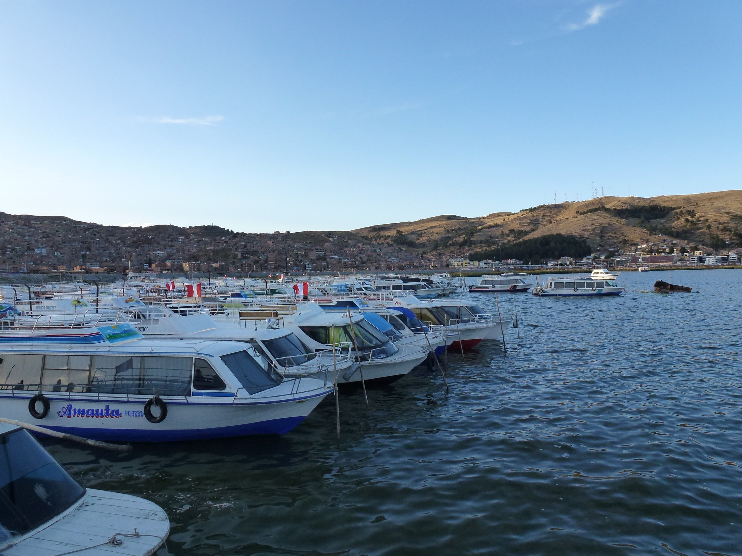
The main access base is Puno, with boats to Taquile and Amantani, road access to Sillustani and Capachica / Llachon, and longer road access toward Yunguyo / Pomata for Cerro Khapia. The Titicaca National Reserve protects parts of the lake and wetland environment; several walks are outside the reserve but still depend on community tourism arrangements, boat schedules and local access rules.
Weather is high-altitude and exposed. Sun, cold wind, afternoon storms, lightning, altitude illness, boat logistics and limited emergency access are the main hazards. The drier May-October period is usually clearest, but island and peninsula walks can be done year-round when lake transport is operating safely.
Selection rationale
The selection covers the five most representative Puno highland day-walk experiences: crossing Taquile, climbing to Amantani’s sacred high point, walking the Sillustani / Lake Umayo archaeological headland, visiting the regional sacred mountain Cerro Khapia, and making a longer Capachica / Llachon peninsula loop. Floating Uros islands are important culturally but are not selected as a mountain day-hike.
Summary table
| # | Hike | Country | Route type | Distance | Gain | Max elevation | Difficulty |
|---|---|---|---|---|---|---|---|
| 1 | Cross Taquile Island | Peru | Point-to-point | 5.5 km | 248 m | 3,959 m | Moderate |
| 2 | Amantani Pachamama Trail | Peru | Out-and-back | 4.5 km | 260 m | 4,132 m | Moderate |
| 3 | Sillustani / Lake Umayo chullpa circuit | Peru | Loop | 3.11 km | 108 m | 3,907 m | Easy-moderate by altitude |
| 4 | Cerro Apu Khapia from Taro Okjo / Acari side | Peru | Out-and-back candidate | 5.8 km return based on official 2.9 km one-way walking access | 4,809-4,960 m source discrepancy | Hard by altitude | |
| 5 | Llachon Peninsula loop | Peru | Loop | 12.7 km | 475 m | 4,094 m | Moderate-hard by altitude |
1. Cross Taquile Island
Snapshot
Itinerary
The route crosses Taquile Island from one boat landing toward the village/central ridge and down to the opposite side. It follows stone paths, terrace margins and community lanes with constant views across Lake Titicaca. On clear days the horizon can extend toward the Bolivian Cordillera Real.
Why it is essential
Taquile is the iconic Lake Titicaca walking island, internationally known for its textile culture and recognised by UNESCO for Taquile textile art. The cross-island route combines lake views, terraces and living cultural landscape in a compact walk.
Equipment
- Comfortable walking shoes
- Sun hat, sunglasses, sunscreen
- Water
- Warm/wind layer
- Rain shell in wet season
- Cash for community/boat arrangements
- Light luggage if walking between landings
Hazards and notes
- Altitude, sun, stone steps, boat delays, wind and sudden storms are the key issues.
- Respect community rules and do not photograph people or textile work without permission.
GPX / KML links
| Source | URL | Format / access | Reuse status |
|---|---|---|---|
| AllTrails: Cross Taquile Island | alltrails.com | Source map / route platform; AllTrails terms apply | Source-map reference only; direct GPX reuse unresolved |
| AllTrails: Isla Taquile | alltrails.com | Longer island route variant; AllTrails terms apply | Variant reference only |
External links
- AllTrails — Cross Taquile Island
- AllTrails — Isla Taquile
- UNESCO Intangible Cultural Heritage — Taquile and its textile art
2. Amantani Pachamama Trail
Snapshot
Itinerary
From the port/community side of Amantani, the trail climbs through terraces and village paths to the Pachamama high point, an ancient ceremonial area near the top of the island. The route is short but reaches above 4,100 m, with open views over Lake Titicaca and nearby islands. Pachatata, the neighbouring sacred hill, may be combined locally, but this entry keeps to the verified Pachamama Trail.
Why it is essential
Amantani is the classic sacred-island hill walk of the Peruvian Titicaca side: a compact climb to one of the island’s two symbolic summits, with cultural and landscape importance.
Equipment
- Walking shoes
- Sun protection
- Water
- Warm/wind layer
- Rain shell
- Headtorch if staying for sunset
- Cash for community arrangements
- Local guide where required or offered by the community
Hazards and notes
- Altitude, stone steps, storms, lightning and boat logistics are the main risks.
- Respect ceremonial areas and follow local guidance on access and behaviour.
GPX / KML links
| Source | URL | Format / access | Reuse status |
|---|---|---|---|
| AllTrails: Pachamama Trail | alltrails.com | Source map / route platform; AllTrails terms apply | Source-map reference only; direct GPX reuse unresolved |
External links
3. Sillustani / Lake Umayo chullpa circuit
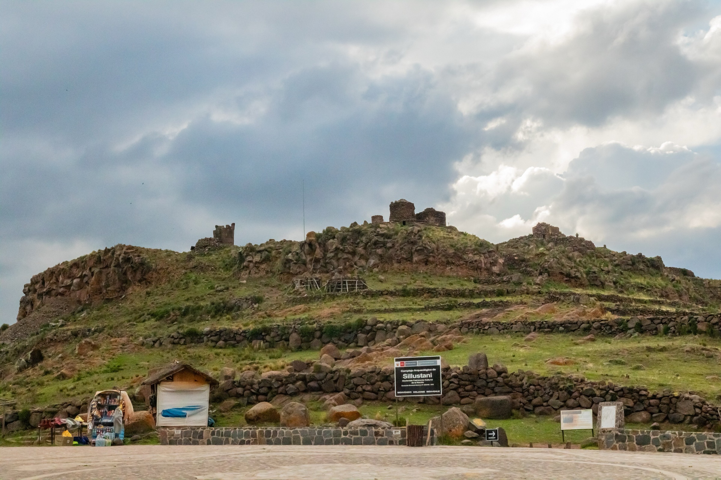
Snapshot
Itinerary
The walking circuit tours the Sillustani funerary complex on the Lake Umayo peninsula, linking chullpas, terraces, ceremonial features and viewpoints over the lake. MINCETUR identifies Sillustani as a major archaeological resource in Atuncolla and lists the final access from the parking area to the complex as a 1.5 km footpath.
Why it is essential
Sillustani is the essential archaeological walk of the Puno highlands: a short but visually powerful route through one of the best-known chullpa landscapes of the Lake Titicaca region.
Equipment
- Comfortable walking shoes
- Sun protection
- Water
- Warm/wind layer
- Camera
- Local guide for archaeological interpretation
Hazards and notes
- The path is easy but high and exposed.
- Respect roped/signposted areas and do not climb on archaeological structures.
- Opening hours, ticket prices and access routes should be checked before travel.
GPX / KML links
| Source | URL | Format / access | Reuse status |
|---|---|---|---|
| Wikiloc: PUNO — Chullpas Sillustani Trek 1D | wikiloc.com | Source route / GPX platform; Wikiloc terms apply | Source-map reference; direct GPX reuse unresolved |
| MINCETUR tourist inventory: Complejo Arqueológico de Sillustani | mincetur.gob.pe | Official access/stat context; government page | Official source for access, altitude, hours and context; no GPX |
External links
4. Cerro Apu Khapia from Taro Okjo / Acari side
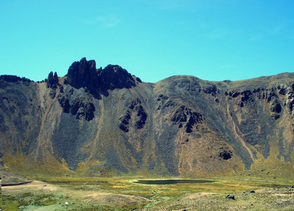
Snapshot
Itinerary
The official MINCETUR inventory identifies Cerro Apu Khapia as the tutelary mountain of Yunguyo and a protected landscape with trekking activity. The catalogue route follows the recorded walking access from the Taro Okjo / Acari side toward the summit/ceremonial high area, then returns by the same line. The exact GPS track, ascent and trailhead elevation were not verified in this pass.
Why it is essential
Cerro Khapia is the sacred high mountain of the southern Titicaca highlands, combining landscape, Aymara ritual importance, volcanic geology and protected-area status.
Equipment
- Boots
- Warm/windproof layers
- Rain shell
- Sun protection
- Water and food
- Headtorch
- Offline map/GPS
- Trekking poles
- Local guide for access, route choice and cultural protocol
Hazards and notes
- Altitude, exposure, fog, storms, lightning, route ambiguity and cultural-site sensitivity are the main concerns.
- The elevation discrepancy in the official inventory should be resolved before final publication.
GPX / KML links
| Source | URL | Format / access | Reuse status |
|---|---|---|---|
| MINCETUR tourist inventory: Cerro Apu Khapia | mincetur.gob.pe | Official access/stat context; government page | Official source for access, altitude and context; no GPX |
| Wikimedia Commons Cerro Khapia category | commons.wikimedia.org | Open media/geographic context; Commons file-specific licences | Not a route file; useful for visual/location context only |
External links
5. Llachon Peninsula loop
Snapshot
Itinerary
The loop crosses the Llachon / Capachica peninsula landscape above Lake Titicaca, climbing from community level to higher viewpoints before returning through cultivated and pastoral terrain. The AllTrails route records a substantial half-day loop with views over terraces, fields, lake channels and nearby islands.
Why it is essential
Llachon represents the quieter peninsula side of Lake Titicaca: longer, less boat-dependent walking through rural highland terrain, with broad lake panoramas rather than a single summit or archaeological site.
Equipment
- Walking shoes or light boots
- Sun protection
- Water and food
- Warm/wind layer
- Rain shell
- Offline map/GPS
- Cash for community services
Hazards and notes
- Altitude, exposure, sun, dogs/livestock, storm risk and unclear path junctions are the likely hazards.
- Respect private/community land and avoid entering fields without permission.
GPX / KML links
| Source | URL | Format / access | Reuse status |
|---|---|---|---|
| AllTrails: Llachon Peninsula | alltrails.com | Source map / route platform; AllTrails terms apply | Source-map reference only; direct GPX reuse unresolved |
| MINCETUR tourist inventory: Península de Capachica | mincetur.gob.pe | Official regional/community context; government page | Context only; no GPX |
External links
- AllTrails — Llachon Peninsula
- MINCETUR — Península de Capachica tourist inventory
- Municipalidad Distrital de Capachica — Llachon
External links
| Source | URL |
|---|---|
| AllTrails — Cross Taquile Island | alltrails.com |
| AllTrails — Isla Taquile | alltrails.com |
| AllTrails — Pachamama Trail | alltrails.com |
| AllTrails — Llachon Peninsula | alltrails.com |
| Wikiloc — PUNO Chullpas Sillustani Trek 1D | wikiloc.com |
| MINCETUR — Complejo Arqueológico de Sillustani | mincetur.gob.pe |
| MINCETUR — Cerro Apu Khapia | mincetur.gob.pe |
| MINCETUR — Península de Capachica | mincetur.gob.pe |
| Municipalidad Distrital de Capachica — Llachon | municapachica.org.pe |
| SERNANP — Titicaca National Reserve visitor page | sernanp.gob.pe |
| UNESCO Intangible Cultural Heritage — Taquile and its textile art | ich.unesco.org |