Regional overview
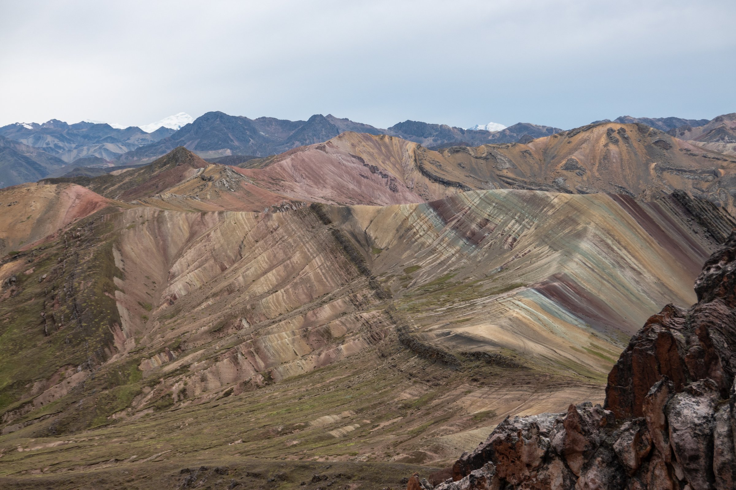
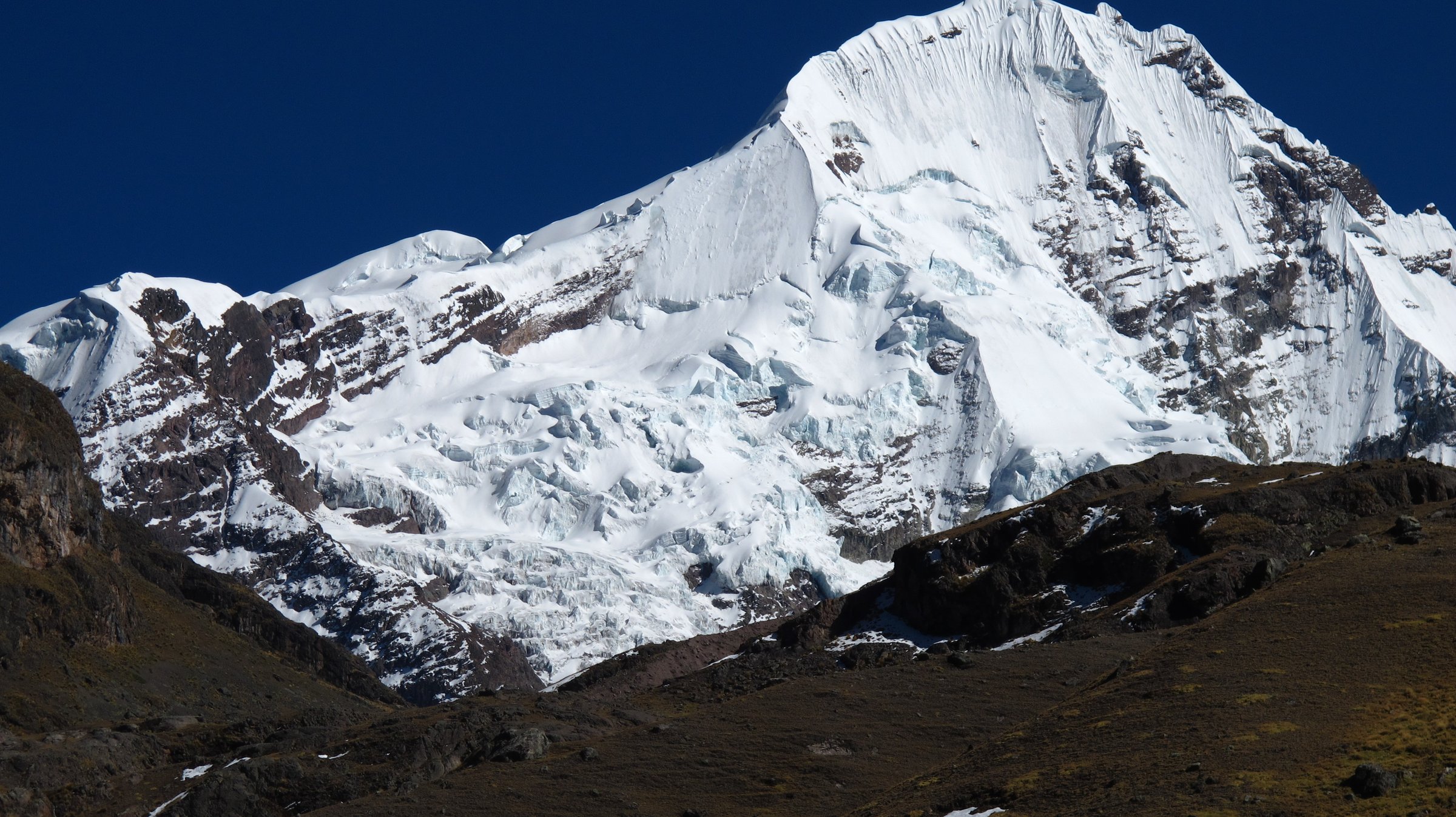
Ausangate and the Cordillera Vilcanota form the high, glaciated mountain heart southeast of Cusco. The range contains Ausangate, major puna plateaus, glacial lakes, alpaca and llama grazing country, hot springs around Pacchanta, and the multicoloured mineral landscapes of Vinicunca and Palccoyo. Unlike the lower Sacred Valley, most day hikes here start above 4,000 m and often reach 4,800-5,000 m.
The main access settlements for day hikes are Cusipata, Pitumarca, Checacupe, Ocongate/Tinki, Pacchanta, Upis and remote communities near Singrenacocha. Many walks are sold as full-day tours from Cusco, but the driving time is long and altitude exposure is immediate. Independent walkers need reliable transport, local community access information and strong acclimatisation.
The normal dry-season window is roughly April to November, with the clearest and firmest conditions usually from May to September. Snow, hail, intense sun, cold wind and altitude illness are the controlling hazards. Wet-season tracks can be muddy or snow-affected, and high passes on Ausangate circuit sections should not be treated as casual tourist paths.
Selection rationale
The selection covers the essential day-hike range of the Vilcanota high country: the iconic Vinicunca/Red Valley route, the shorter Palccoyo rainbow-mountain walk, the Seven Lakes loop from Pacchanta, the less crowded Singrenacocha lake approach, and the Upis-Hatun Pucacocha/Arapa Pass section as a one-day sample of the classic Ausangate circuit.
Summary table
| # | Hike | Country | Route type | Distance | Gain | Max elevation | Difficulty |
|---|---|---|---|---|---|---|---|
| 1 | Vinicunca / Rainbow Mountain and Red Valley viewpoint | Peru | Loop | 7.7 km | 446 m | 5,010 m | Hard |
| 2 | Palccoyo Rainbow Mountain and Stone Forest | Peru | Out-and-back / short loop | 3-4 km approx. | 100-300 m approx. | 4,900-4,950 m | Moderate by altitude |
| 3 | Seven Lakes of Ausangate from Pacchanta | Peru | Loop | 11.6 km | 343 m | 4,633 m | Moderate-hard |
| 4 | Laguna Singrenacocha from Mallma/Yanacancha side | Peru | Out-and-back | Approx. 4-6 km | Not verified | 4,350-4,600 m depending on source | Moderate by distance; hard by altitude/remoteness |
| 5 | Upis - Arapa Pass - Hatun Pucacocha | Peru | Point-to-point / circuit section | 16.1 km | 705 m | 4,750 m | Hard |
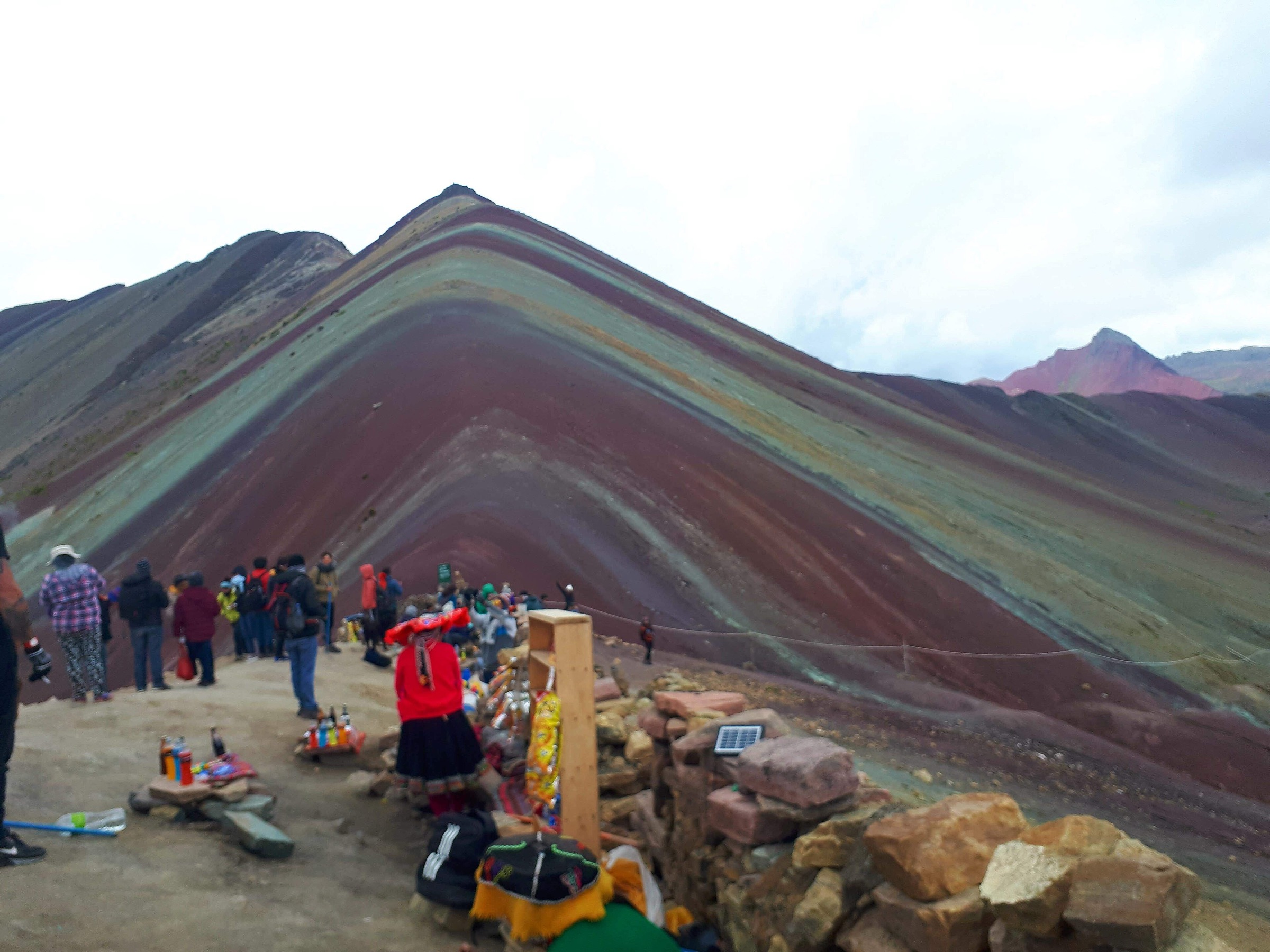
1. Vinicunca / Rainbow Mountain and Red Valley viewpoint
Snapshot
Itinerary
The route climbs from the high road-end/community checkpoint toward Vinicunca, the Rainbow Mountain viewpoint, then continues or loops toward the Red Valley viewpoint depending on the variant. The walking distance is not long, but nearly all of the route is above 4,600 m and the final slopes are slow for poorly acclimatised walkers.
AllTrails records the Red Valley viewpoint loop as 7.7 km with 446 m of ascent and a maximum elevation of 5,010 m. Search results and local guide sources show shorter and longer Vinicunca access variants, so the catalogue figure refers specifically to the Red Valley loop source.
Why it is essential
Vinicunca is the internationally recognised rainbow-mountain objective of the Cusco high Andes and one of the most visited day hikes in the Vilcanota range. The Red Valley extension adds a contrasting mineral landscape and reduces the sense of a single viewpoint out-and-back.
Equipment
- Sturdy footwear
- Windproof/waterproof shell
- Warm layer
- Hat and gloves
- Sun protection
- Water and snacks
- Map/GPS
- Trekking poles for loose or crowded slopes
- Altitude medication only under medical advice
Hazards and notes
- Altitude illness is the main hazard.
- Cold wind, snow, hail, intense sun and rapidly changing visibility are common.
- Horses may be present on some access routes.
- Community fees and route access points can change, so current local arrangements should be confirmed before departure.
GPX / KML links
| Source | URL | Format / access | Reuse status |
|---|---|---|---|
| AllTrails: Rainbow Mountain - Red Valley Viewpoint | alltrails.com | Source map / downloadable route via AllTrails account; AllTrails terms apply | Source-map reference only |
| OpenStreetMap search: Vinicunca | openstreetmap.org | Map geometry cross-check; OSM data is ODbL | Suitable for geometry cross-check with attribution |
External links
- AllTrails — Rainbow Mountain - Red Valley Viewpoint
- Eco Tour Cusco — Rainbow Mountain visitor guide
- Cusco Journeys — Rainbow Mountain Peru
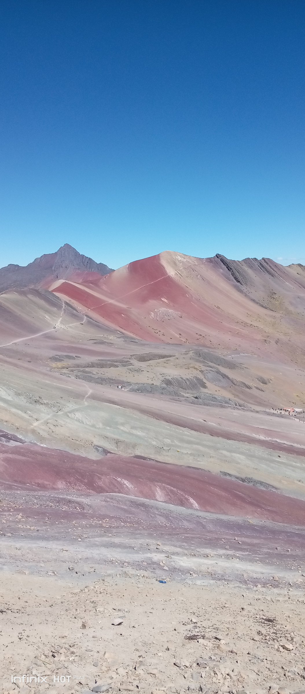
2. Palccoyo Rainbow Mountain and Stone Forest
Snapshot
Itinerary
The Palccoyo walk starts from a high road-end and follows a short path across open puna to multiple rainbow-coloured slopes and viewpoints. The Stone Forest add-on reaches a cluster of rock spires above the main viewpoint area. Compared with Vinicunca, the walking distance and ascent are shorter, but the route still sits close to 4,900 m.
Current guide sources commonly describe the Palccoyo hike as about 3-4 km round trip with roughly 100-300 m of gain. Cuscoperu describes the walking route as short, accessible and around 45 minutes from the starting point, while other current sources give about 4 km round trip and 200-300 m of gain. No official GPX was found in this pass.
Why it is essential
Palccoyo is the most important lower-commitment alternative to Vinicunca in the Vilcanota range. It provides multicoloured mountain scenery, Ausangate views and the Stone Forest with less ascent and usually fewer crowds.
Equipment
- Sturdy shoes
- Windproof/waterproof shell
- Warm layer
- Hat and gloves
- Sun protection
- Water and snacks
- Trekking poles optional but useful in wind or snow patches
Hazards and notes
- Altitude remains serious despite the short distance.
- Cold wind, snow showers, hail and poor visibility can affect the route.
- Community access fees and road conditions should be confirmed locally.
GPX / KML links
| Source | URL | Format / access | Reuse status |
|---|---|---|---|
| Trailforks: Palccoyo Rainbow Mountain Loop | trailforks.com | Source route map; Trailforks terms apply | Source-map reference; route reuse terms unresolved |
| OpenStreetMap search: Palccoyo | openstreetmap.org | Map geometry cross-check; OSM data is ODbL | Suitable for geometry cross-check with attribution |
External links
- Cuscoperu — Palcoyo Mountain
- Eco Tour Cusco — Rainbow Mountain vs Palcoyo notes
- Trailforks — Palccoyo Rainbow Mountain Loop
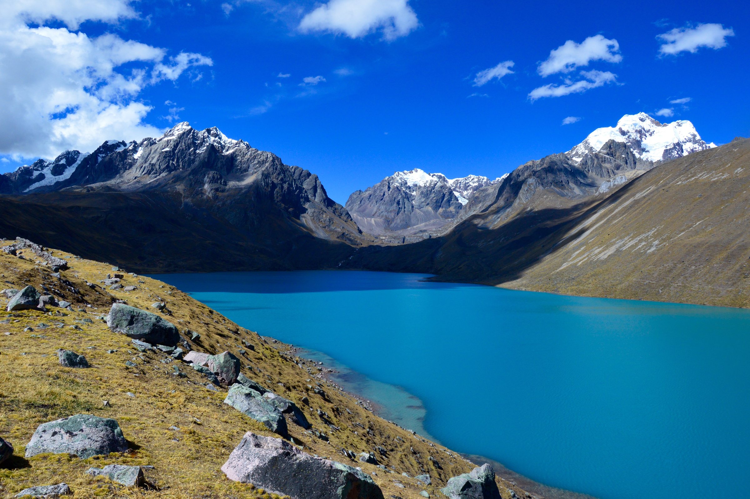
3. Seven Lakes of Ausangate from Pacchanta
Snapshot
Itinerary
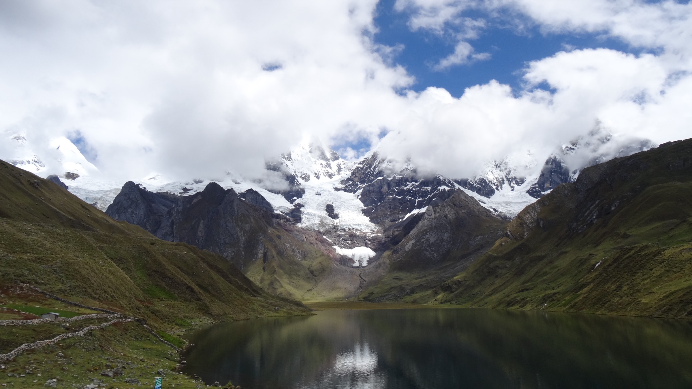
The loop starts in Pacchanta, a high community known for hot springs below Ausangate, and climbs into the lake basin north of the massif. The route visits or passes a chain of glacial lakes such as Azulcocha, Otorongo/Otorongococha and Q’omercocha depending on the exact local line, with views toward Ausangate and surrounding snow peaks.
AllTrails records 11.6 km with 343 m of ascent and a maximum elevation of 4,633 m. Ausangate Peru’s one-day itinerary describes a longer 16 km version reaching up to about 4,800 m, showing that route variants and lake-counting conventions differ.
Why it is essential
The Seven Lakes route is the most accessible day hike into the Ausangate lake-and-glacier landscape. It gives a concentrated version of the scenery associated with the multi-day Ausangate circuit.
Equipment
- Sturdy boots
- Warm and waterproof layers
- Hat/gloves
- Sun protection
- Water and food
- Map/GPS
- Trekking poles
- Swimwear/towel if using Pacchanta hot springs after the walk
Hazards and notes
- Altitude, cold wind, boggy ground, snow patches and storms are the main hazards.
- Weather can change quickly under the massif.
- Community access fees and hot-spring opening arrangements should be confirmed locally.
GPX / KML links
| Source | URL | Format / access | Reuse status |
|---|---|---|---|
| AllTrails: Ausangate Foothill Hike | alltrails.com | Source map / downloadable route via AllTrails account; AllTrails terms apply | Source-map reference only |
| OpenStreetMap search: Pacchanta Ausangate lakes | openstreetmap.org | Map geometry cross-check; OSM data is ODbL | Suitable for geometry cross-check with attribution |
External links
- AllTrails — Ausangate Foothill Hike
- Ausangate Peru — Ausangate 7 Lakes Hike
- Ruta Ausangate — Pacchanta
4. Laguna Singrenacocha from Mallma/Yanacancha side
Snapshot
Itinerary
The Singrenacocha day route uses road access into the eastern/northern Ausangate highlands, then follows a short high-altitude walk from the Mallma/Yanacancha side across wetlands and grazing terrain to Laguna Singrenacocha. The lake lies in the Cordillera Vilcanota and is known for turquoise water, puna surroundings and views toward high snow peaks in the Ausangate/Callangate area.
Tour sources describe the walk as about 1-1.5 hours each way from Mallma and give lake or route elevations from about 4,350 m to more than 4,600 m. No reliable route-file source or exact distance was found in this pass, so the distance shown is an approximate planning range and not publication-grade.
Why it is essential
Singrenacocha represents the quieter lake-and-glacier side of Ausangate away from the most visited Rainbow Mountain and Pacchanta routes. It is an important high-lake objective for a broader Vilcanota catalogue, but it needs better geometry before final publication.
Equipment
- Boots
- Warm and waterproof layers
- Hat/gloves
- Sun protection
- Water and food
- Map/GPS and navigation backup
- A local guide or driver familiar with the approach is strongly recommended
Hazards and notes
- The route is remote, high and exposed.
- Vehicle access, community permissions, wetlands, cold wind, snow and poor visibility are the main practical issues.
- Because exact route statistics were not verified, it should not be promoted as a casual self-guided walk without local confirmation.
GPX / KML links
| Source | URL | Format / access | Reuse status |
|---|---|---|---|
| OpenStreetMap search: Laguna Singrenacocha | openstreetmap.org | Map/location cross-check; OSM data is ODbL | Location cross-check only; no route GPX found |
| Terres des Incas: Laguna Singrenacocha | terresdesincas.com | Source itinerary / map context; site terms not checked | Route description only; no reusable GPX found |
External links
- Terres des Incas — Laguna Singrenacocha - Ausangate
- Terres des Incas — Singrenacocha day trek (English)
- Andean Ways — Singrenacocha Lake Day Trip
5. Upis - Arapa Pass - Hatun Pucacocha
Snapshot
Itinerary
This one-day section follows the north side of the Ausangate circuit from Upis toward Arapa Pass and onward to the Hatun Pucacocha lake/camp area. It crosses open high pasture, pass terrain and lake country with broad views of the Ausangate massif. The route is part of a multi-day circuit, but the section itself is within day-hike distance for acclimatised and logistically supported walkers.
AllTrails records 16.1 km point-to-point, 705 m of ascent and a maximum elevation of 4,750 m. It is not a casual out-and-back from Cusco; transport and pickup logistics are integral to using it as a day hike.
Why it is essential
This route gives the closest day-hike equivalent of the classic Ausangate circuit experience: remote puna, high pass terrain, lakes and glacier views without committing to the full multi-day circuit.
Equipment
- Sturdy boots
- Trekking poles
- Windproof/waterproof shell
- Warm layers
- Hat/gloves
- Sun protection
- Food
- 2 litres or more of water
- Headtorch
- Map/GPS and navigation backup
- Emergency communication recommended because the route is remote
Hazards and notes
- The route crosses remote high-altitude terrain.
- Snow, cold wind, hail, poor visibility and altitude illness can make it serious.
- It should be attempted only by acclimatised walkers with transport logistics, local route knowledge and a conservative weather window.
GPX / KML links
| Source | URL | Format / access | Reuse status |
|---|---|---|---|
| AllTrails: Ausangate Circuit: Upis - Hatun Pucacocha | alltrails.com | Source map / downloadable route via AllTrails account; AllTrails terms apply | Source-map reference only |
| OpenStreetMap search: Arapa Pass Ausangate | openstreetmap.org | Map geometry cross-check; OSM data is ODbL | Suitable for geometry cross-check with attribution |
External links
- AllTrails — Ausangate Circuit: Upis - Hatun Pucacocha
- AllTrails — Ausangate Trek (full circuit for context)
External links
| Source | URL |
|---|---|
| AllTrails — Rainbow Mountain - Red Valley Viewpoint | alltrails.com |
| AllTrails — Ausangate Foothill Hike (Seven Lakes) | alltrails.com |
| AllTrails — Ausangate Circuit: Upis - Hatun Pucacocha | alltrails.com |
| AllTrails — Ausangate Trek (full circuit) | alltrails.com |
| Trailforks — Palccoyo Rainbow Mountain Loop | trailforks.com |
| Cuscoperu — Palcoyo Mountain | cuscoperu.com |
| Eco Tour Cusco — Rainbow Mountain visitor guide | ecotourcusco.com |
| Cusco Journeys — Rainbow Mountain Peru | cuscojourneys.com |
| Ausangate Peru — Seven Lakes Hike | ausangateperu.com |
| Ruta Ausangate — Pacchanta | rutaausangate.com |
| Terres des Incas — Laguna Singrenacocha | terresdesincas.com |
| Terres des Incas — Singrenacocha day trek (English) | terresdesincas.com |
| Andean Ways — Singrenacocha Lake Day Trip | andeanways.com |