Regional overview
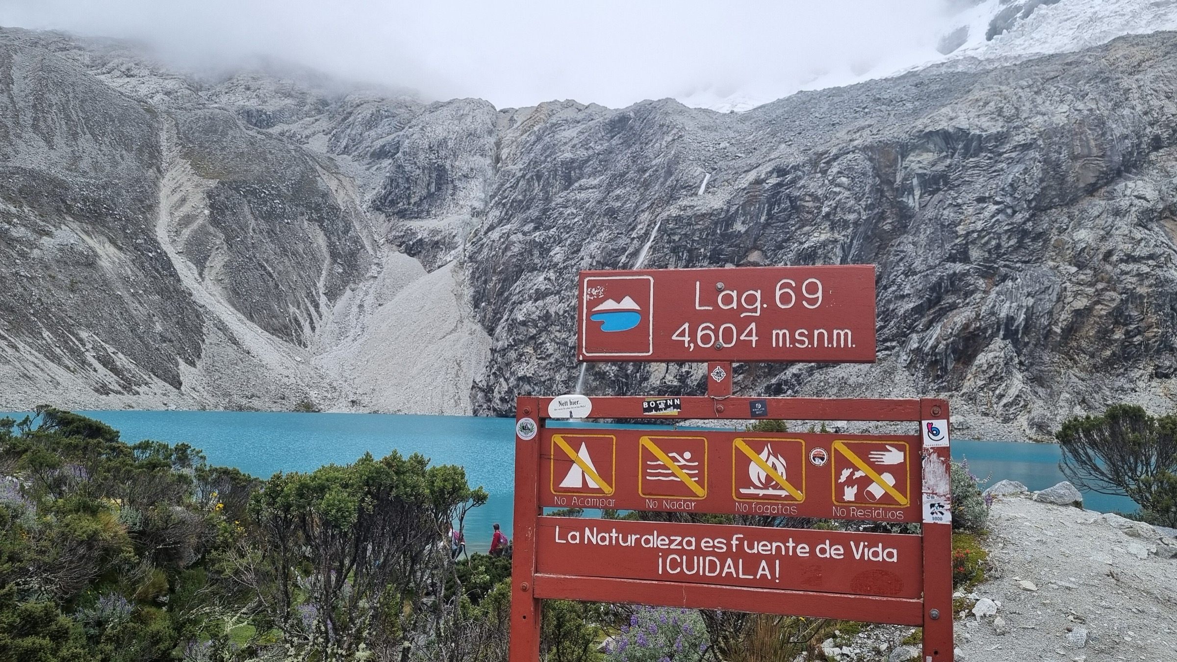
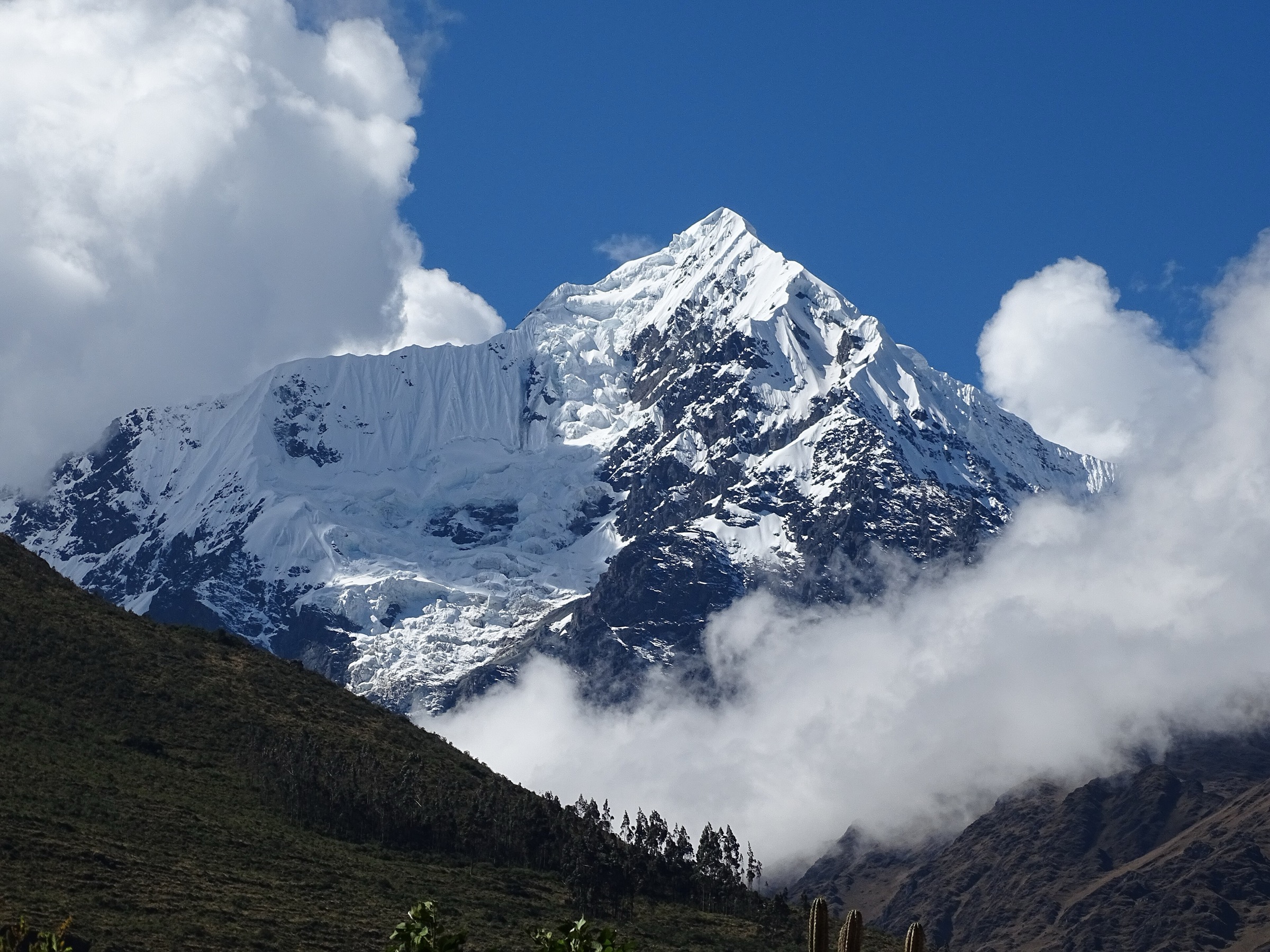
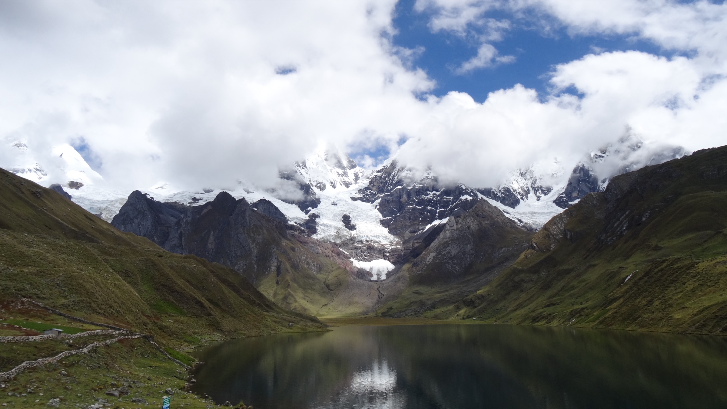
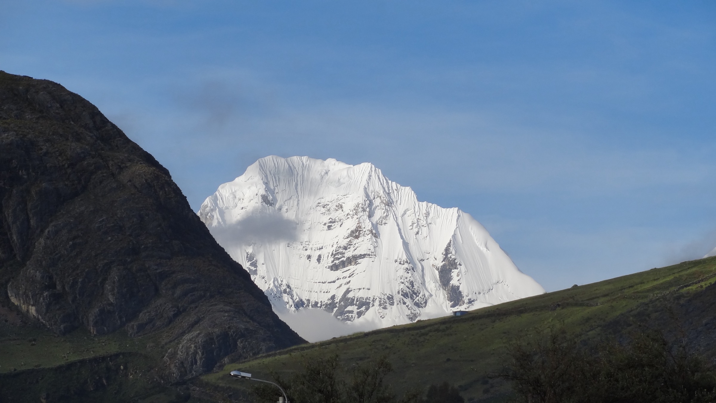
The Cordillera Huayhuash is a compact, high, severe range south of the Cordillera Blanca, protected as the Zona Reservada Cordillera Huayhuash. SERNANP describes it as a high-mountain protected area of 67,589.76 ha, created to conserve the range’s ecosystems and exceptional landscape beauty, with trekking commonly taking place above 4,000 m. Its walking character is remote, high-altitude, pass-to-pass trekking among glaciated 6,000 m peaks, turquoise lakes, community-managed camps, and weather-exposed puna. The essential “day hikes” are best treated as one-day route sections or side hikes inside a supported circuit.
Selection rationale
Huayhuash is remote and trek-oriented. These five entries are essential one-day sections or side hikes within the range, not simple day trips from Huaraz. Together they cover the classic east-side pass and lake basin under Yerupaja, the Tres Lagunas viewpoint day, the high Punta Cuyoc crossing on the southern variant, the historically defining Siula Grande base-camp side hike, and the final Pampa Llamac panorama above Jahuacocha.
Summary table
| # | Hike | Country | Route type | Distance | Gain | Max elevation | Difficulty |
|---|---|---|---|---|---|---|---|
| 1 | Carhuac Pass to Laguna Carhuacocha | Peru | Point-to-point trek section | Approx. 11-12 km | Approx. 450-600 m | Approx. 4,600-4,650 m at Carhuac Pass | Moderate to strenuous |
| 2 | Laguna Carhuacocha to Huayhuash via Siula Pass and Mirador Tres Lagunas | Peru | Point-to-point trek section | Approx. 14 km | Approx. 560 m | Approx. 4,830-4,850 m at Siula Pass | Strenuous |
| 3 | Viconga to Huanacpatay via Punta Cuyoc | Peru | Point-to-point trek section | Approx. 10.5-12 km | Approx. 780 m | Approx. 4,900-5,050 m | Strenuous to very strenuous |
| 4 | Cutatambo to Siula Grande Base Camp / glacier-lake viewpoint | Peru | Out-and-back side hike | Approx. 9-11 km | Approx. 300-500 m (unresolved) | Approx. 4,500-4,700 m (unresolved) | Moderate to strenuous |
| 5 | Jahuacocha to Llamac via Pampa Llamac Pass | Peru | Point-to-point trek section | Approx. 13-15 km | Approx. 250-350 m in exit direction | Approx. 4,300 m at Pampa Llamac Pass | Moderate to strenuous |
1. Carhuac Pass to Laguna Carhuacocha
Snapshot
Itinerary
Cross high puna from the Mitucocha side to Carhuac Pass, then descend toward Laguna Carhuacocha, one of the signature east-side lake basins below Yerupaja, Jirishanca, and Siula Grande. This is a classic early Huayhuash circuit day.
Why it is essential
It is the first major pass-and-lake reveal of the classic circuit and introduces the big east wall of the range.
Equipment
- Broken-in hiking boots
- Trekking poles
- Sun protection
- Waterproof shell
- Warm layers
- Water treatment
- Navigation backup
Hazards and notes
- High altitude, cold wind, limited shelter, remote evacuation.
- Community fee/checkpoint arrangements apply.
- Non-technical in normal dry conditions.
GPX / KML links
| Source | URL | Format / access | Reuse status |
|---|---|---|---|
| AllTrails Huayhuash circuit route/list | alltrails.com | Source list; AllTrails terms apply | Direct GPX reuse unresolved; attribution likely required |
| Huayhuash.com classic circuit | huayhuash.com | Official/local guide-style source; no GPX found | Reuse of text/route data not assumed |
External links
- SERNANP / gob.pe — Zona Reservada Cordillera Huayhuash
- AllTrails — Circuito Huayhuash
- Huayhuash.com — classic circuit
2. Laguna Carhuacocha to Huayhuash via Siula Pass and Mirador Tres Lagunas
Snapshot
Itinerary
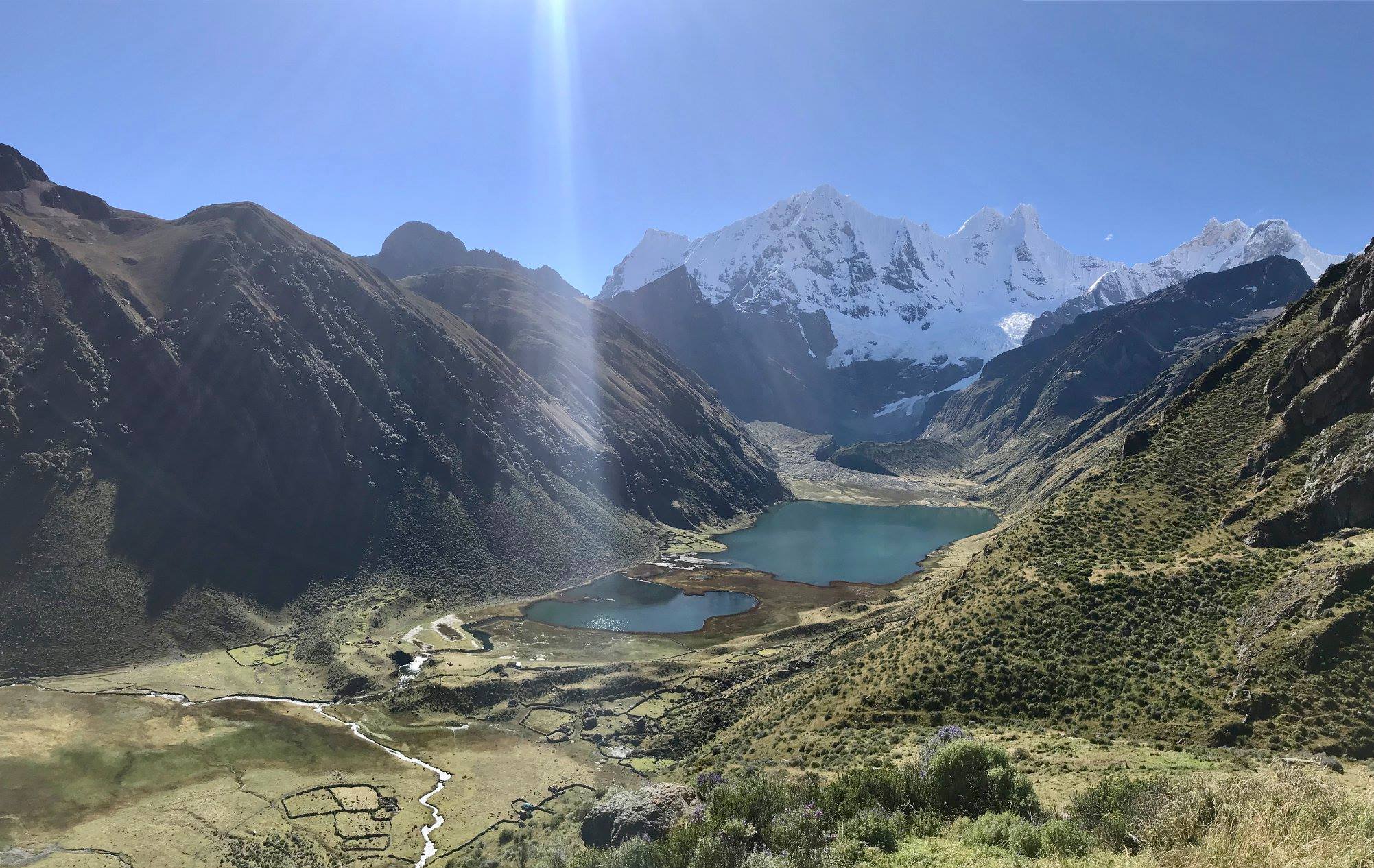
Follow the shore of Laguna Carhuacocha, pass the glacial-lake basin of Gangrajanca, Siulacocha, and Quesillococha, climb to the famous Tres Lagunas viewpoint and continue toward Siula / Siula Punta Pass before descending to Huayhuash.
Why it is essential
This is the iconic Huayhuash lake-view day, with the classic alignment of turquoise lakes under Yerupaja, Siula Grande, and Carnicero.
Equipment
- Full mountain day kit
- Trekking poles
- Warm/rain layers
- Navigation
- Water treatment
Hazards and notes
- Very high altitude, exposed pass, possible snow/hail, steep loose sections.
- Avalanche/icefall views near glaciers but no glacier travel on the standard walking line.
GPX / KML links
| Source | URL | Format / access | Reuse status |
|---|---|---|---|
| Wikiloc: Trekking Huayhuash etapa 3, Laguna Carhuacocha - Paso de Siula - Huayhuash | wikiloc.com | Source map / GPX through Wikiloc interface; Wikiloc terms apply | GPX download/use terms unresolved; attribution required if using user route metadata |
| Huayhuash.com classic circuit | huayhuash.com | Guide-style source; no GPX found | Reuse not assumed |
| Geographica Huayhuash PDF | geographica.es | Secondary stat source for 14 km / +560 m / -770 m | Reuse unresolved |
External links
- Wikiloc — Trekking Huayhuash etapa 3
- Huayhuash.com — classic circuit
- Geographica — Huayhuash trekking PDF
3. Viconga to Huanacpatay via Punta Cuyoc
Snapshot
Itinerary
Leave Viconga, climb steadily to Punta Cuyoc / Cuyoc Pass, then descend into the Huanacpatay valley with views toward Cuyoc, Puscanturpa, and the southern Huayhuash peaks.
Why it is essential
It is one of the highest standard walking passes of the classic/southern Huayhuash variants and gives a very different, more open view of the range.
Equipment
- Full cold-weather mountain day kit
- Trekking poles
- Gloves/hat
- Waterproofs
- Emergency headlamp
- Navigation
Hazards and notes
- Extreme altitude for walkers.
- Possible snow/ice, loose descent, remoteness.
GPX / KML links
| Source | URL | Format / access | Reuse status |
|---|---|---|---|
| Wikiloc: Laguna Viconga - Paso de Cuyoc - Guanacpatay | wikiloc.com | Source map / GPX through Wikiloc interface; Wikiloc terms apply | GPX reuse unresolved; attribution required if using user route metadata |
| AllTrails: Huayhuash Trek, Huayhuash - Huanacpatay | alltrails.com | Source map; AllTrails terms apply | GPX reuse unresolved |
| Peruvian Andes Adventures: Viconga and Cuyoc Pass itinerary | peruvianandes.com | Itinerary source; no GPX found | Reuse not assumed |
External links
- Wikiloc — Laguna Viconga - Paso de Cuyoc - Guanacpatay
- Peruvian Andes Adventures — Viconga and Cuyoc Pass itinerary
- AllTrails — Huayhuash Trek, Huayhuash - Huanacpatay
4. Cutatambo to Siula Grande Base Camp / glacier-lake viewpoint
Snapshot
Itinerary
From Cutatambo, walk up-valley toward the Siula Grande west-face base-camp area and nearby glacier lakes. This is the Huayhuash side hike associated with Joe Simpson and Simon Yates’s 1985 Siula Grande story.
Why it is essential
It is the historically defining Huayhuash side trip and gives close views into the landscape of “Touching the Void”.
Equipment
- Mountain day kit
- Trekking poles
- Waterproofs
- Warm layers
- Navigation
- Do not enter glacier terrain without alpine equipment and experience
Hazards and notes
- Moraine terrain, unstable slopes.
- Glacier/icefall hazard if leaving the walking route.
- Remoteness and altitude.
GPX / KML links
| Source | URL | Format / access | Reuse status |
|---|---|---|---|
| AllTrails: Huayhuash Trek, Cutatambo - Siula Grande Glacier | alltrails.com | Source map; AllTrails terms apply | GPX reuse unresolved |
| Huayhuash.com classic circuit, Day 8 side visit | huayhuash.com | Guide-style source; no GPX found | Confirms side hike and historical context |
| Peruvian Andes Adventures: Siula Base Camp trek | peruvianandes.com | Itinerary source; no GPX found | Confirms route objective |
External links
- AllTrails — Cutatambo - Siula Grande Glacier
- Huayhuash.com — classic circuit, Day 8 side visit
- Peruvian Andes Adventures — Siula Base Camp trek
5. Jahuacocha to Llamac via Pampa Llamac Pass
Snapshot
Itinerary
Climb from Jahuacocha to Pampa Llamac Pass / viewpoint, then descend by the classic Llamac access path to the village.
Why it is essential
It is the classic north-western exit/entry and one of the famous final panoramic views of the Huayhuash wall above Jahuacocha.
Equipment
- Mountain walking kit
- Trekking poles for the descent
- Sun/rain protection
- Water
Hazards and notes
- Long descent, altitude, remoteness until Llamac.
- Community access rules apply.
GPX / KML links
| Source | URL | Format / access | Reuse status |
|---|---|---|---|
| Wikiloc: Jahuacocha - Llamac | wikiloc.com | Source map / GPX through Wikiloc interface; Wikiloc terms apply | GPX reuse unresolved |
| Huayhuash.com classic circuit, final day | huayhuash.com | Guide-style source; no GPX found | Gives Pampa Llamac pass height and stage timing |
External links
External links
| Source | URL |
|---|---|
| SERNANP / gob.pe — Zona Reservada Cordillera Huayhuash | gob.pe |
| AllTrails — Circuito Huayhuash | alltrails.com |
| AllTrails — Huayhuash Trek, Huayhuash - Huanacpatay | alltrails.com |
| AllTrails — Cutatambo - Siula Grande Glacier | alltrails.com |
| Wikiloc — Trekking Huayhuash etapa 3, Carhuacocha - Siula - Huayhuash | wikiloc.com |
| Wikiloc — Laguna Viconga - Paso de Cuyoc - Guanacpatay | wikiloc.com |
| Wikiloc — Jahuacocha - Llamac | wikiloc.com |
| Huayhuash.com — classic circuit | huayhuash.com |
| Geographica — Huayhuash trekking PDF | geographica.es |
| Peruvian Andes Adventures — Viconga and Cuyoc Pass itinerary | peruvianandes.com |
| Peruvian Andes Adventures — Siula Base Camp trek | peruvianandes.com |