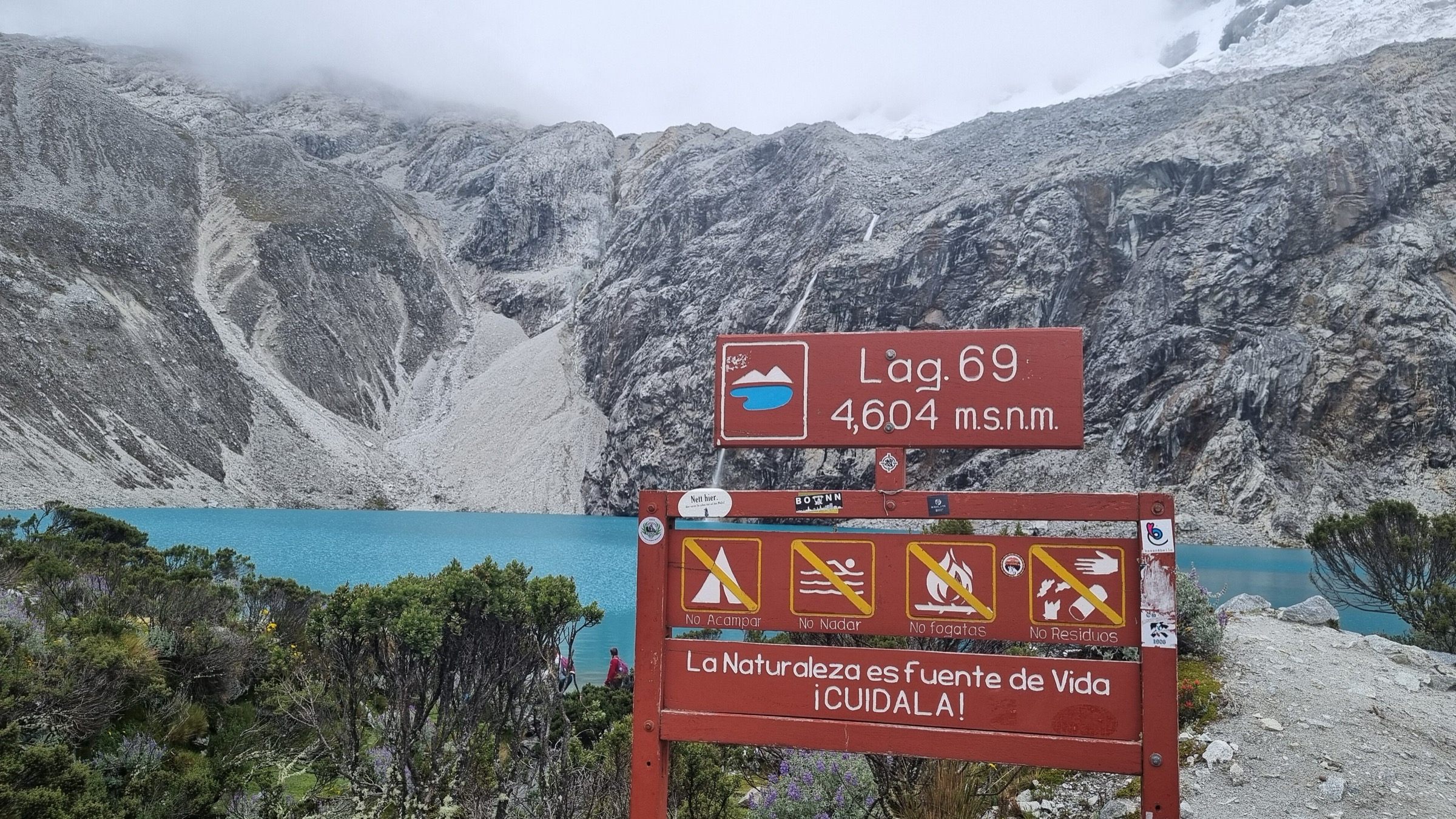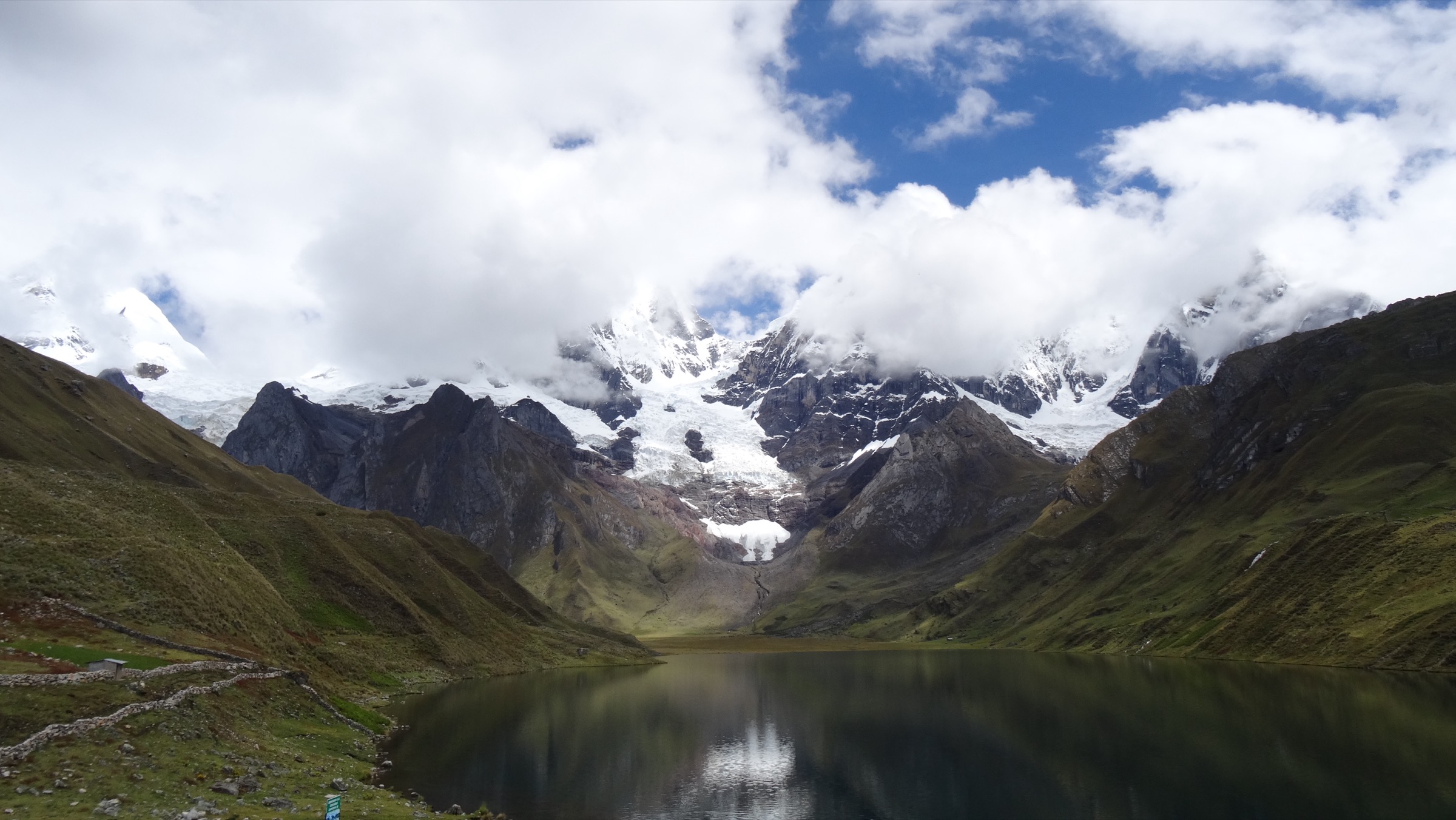
Regional overview
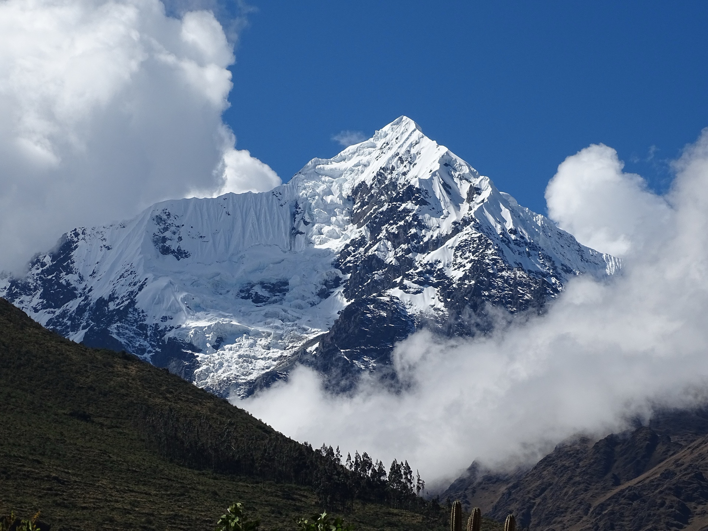
The Cordillera Urubamba rises above the north side of the Sacred Valley and includes steep side valleys, Inca paths, fortress sites, waterfalls, high farming communities and viewpoints toward Wakay Willka/Veronica and other glaciated peaks. Compared with the main Sacred Valley archaeological circuit, these day hikes feel more mountainous and less formalised, with fewer official trailheads and more local-route logistics.
The main bases are Ollantaytambo, Urubamba, Calca, Huaran and nearby Lares/Patacancha-side settlements. Trailheads are often reached by taxi, local road or village track. Several routes begin between 2,800 m and 3,300 m and climb toward 3,800-4,000 m, so the walks are more strenuous than their distances suggest.
The normal dry-season window is April-October, with March-November often possible depending on rain. Wet-season hazards include muddy terraces, slick stone, swollen side streams, poor visibility and transport delays on unpaved roads. Many routes pass through working communities, archaeological areas or private/local-access zones; current entry fees and local permissions should be confirmed before walking.
Selection rationale
The selection represents the Cordillera Urubamba through five complementary day hikes: the high Inti Punku viewpoint above Ollantaytambo, the Pumamarca fortress trail, the Perolniyoc waterfall and Raqaypata ruins, the Pumahuanca side valley, and the long Huaran-Cancha Cancha valley route associated with the Lares trekking corridor.
Summary table
| # | Hike | Country | Route type | Distance | Gain | Max elevation | Difficulty |
|---|---|---|---|---|---|---|---|
| 1 | Inti Punku / Sun Gate above Ollantaytambo | Peru | Out-and-back | 16.7 km | 1,172 m | 3,876 m | Hard |
| 2 | Ollantaytambo - Pumamarca | Peru | Out-and-back | 12.9 km | 564 m | 3,398 m | Hard |
| 3 | Perolniyoc Waterfall and Raqaypata ruins | Peru | Out-and-back | 7.2 km | 494 m | 3,617 m | Hard |
| 4 | Pumahuanca Valley | Peru | Out-and-back | 9.2 km | 644 m | 3,845 m | Hard |
| 5 | Huaran - Cancha Cancha | Peru | Out-and-back | 21.2 km | 1,077 m | 3,952 m | Hard |
1. Inti Punku / Sun Gate above Ollantaytambo
Snapshot
Itinerary
The route climbs from Ollantaytambo or the Cachicata side toward the stone gateway known as Inti Punku/Puerta del Sol. The ascent passes dry slopes, terraces and viewpoints over the Sacred Valley, with wide views toward Wakay Willka/Veronica and the valley corridor. The return normally follows the same line.
AllTrails records 16.7 km out-and-back, 1,172 m of ascent and a maximum elevation of 3,876 m. Other current guide sources describe a shorter 8.5 km ascent figure for one-way or variant measurements, so the catalogue statistic is tied to the AllTrails out-and-back route.
Why it is essential
This is the major high viewpoint hike above Ollantaytambo and one of the strongest day walks for seeing how the Sacred Valley, Inca quarry landscape and Urubamba-range mountains fit together.
Equipment
- Sturdy boots
- Trekking poles
- Windproof/waterproof shell
- Warm layer
- Sun protection
- Water and food
- Map/GPS
- Headtorch
- Early start because the route is long and exposed
Hazards and notes
- The route has substantial ascent, exposed sun, limited water and possible route-finding uncertainty on variants.
- Afternoon storms and wind can make the upper section unpleasant.
- Carry cash if using local access or community services.
GPX / KML links
| Source | URL | Format / access | Reuse status |
|---|---|---|---|
| AllTrails: Inti Punku Puerta del Sol - Ollantaytambo | alltrails.com | Source map / downloadable route via AllTrails account; AllTrails terms apply | Source-map reference only |
| OpenStreetMap search: Inti Punku Ollantaytambo | openstreetmap.org | Map geometry cross-check; OSM data is ODbL | Suitable for geometry cross-check with attribution |
External links
- AllTrails — Inti Punku Puerta del Sol Ollantaytambo
- The Sacred Valley — Inti Punku
- Ticket Machu Picchu — trekking guide to Inti Punku of Ollantaytambo
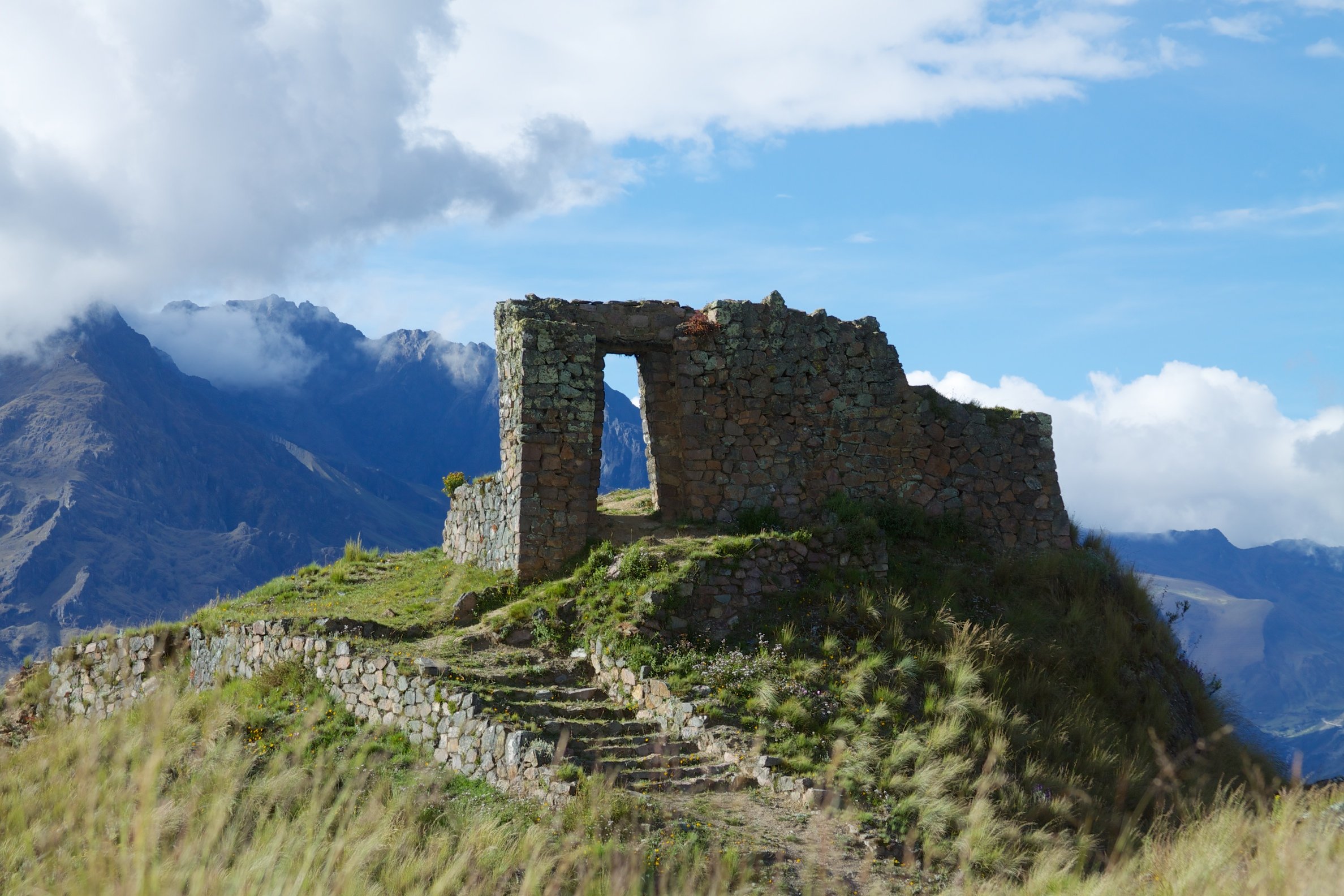
2. Ollantaytambo - Pumamarca
Snapshot
Itinerary
The trail climbs from Ollantaytambo into the side valley toward Pallata and the Pumamarca archaeological site. It passes terraces, local houses, irrigation features and mountain views before reaching the ruins, which sit above the valley as a defensive and settlement site. Shorter versions start higher by road near Pallata and walk only the final approach.
AllTrails records the Ollantaytambo out-and-back route as 12.9 km with 564 m of ascent and a maximum elevation of 3,398 m. Aracari describes a shorter guided access from Pallata of about 2 km to the ruins, which explains the discrepancy between full town-start hikes and short site walks.
Why it is essential
Pumamarca gives a quieter Inca-site hike from Ollantaytambo and shows the side-valley defensive landscape beyond the famous main archaeological park.
Equipment
- Sturdy footwear
- Sun protection
- Water and snacks
- Light rain layer
- Map/GPS
- Trekking poles for descent
Hazards and notes
- Steep descents, sun exposure, dogs near settlements and local entry fees are practical issues noted by recent route users.
- Confirm access and fee arrangements locally; bring cash.
GPX / KML links
| Source | URL | Format / access | Reuse status |
|---|---|---|---|
| AllTrails: Ollantaytambo - Pumamarca | alltrails.com | Source map / downloadable route via AllTrails account; AllTrails terms apply | Source-map reference only |
| Wikiloc: Ollantaytambo to Pumamarca Ruins | wikiloc.com | Source map / GPX through Wikiloc interface | Wikiloc terms apply; route source identified; reuse terms need review |
| OpenStreetMap search: Pumamarca Ollantaytambo | openstreetmap.org | Map geometry cross-check; OSM data is ODbL | Suitable for geometry cross-check with attribution |
External links
- AllTrails — Ollantaytambo to Pumamarca
- Aracari — Pumamarca Ruins
- Wikiloc — Ollantaytambo to Pumamarca Ruins
3. Perolniyoc Waterfall and Raqaypata ruins
Snapshot
Itinerary
The route starts near Socma and climbs toward Perolniyoc waterfall, then continues higher to the Raqaypata archaeological remains above the falls. It combines a natural objective with an Inca-site viewpoint and is commonly visited as a half- to full-day excursion from Ollantaytambo or Cusco.
AllTrails records 7.2 km out-and-back with 494 m of ascent and a maximum elevation of 3,617 m. Current local tour sources confirm the waterfall-and-ruins pairing as a full-day Sacred Valley hike.
Why it is essential
Perolniyoc/Raqaypata is the strongest waterfall-plus-archaeology day hike in the Ollantaytambo side of the Cordillera Urubamba. It adds a different natural feature to a region otherwise dominated by terraces and viewpoints.
Equipment
- Hiking shoes or boots
- Sun protection
- Water and snacks
- Rain layer
- Map/GPS
- Trekking poles for climb and descent
Hazards and notes
- The approach is steep and transport access can be limited.
- Mist and wet rock near the waterfall, mud after rain and route-finding around the ruins require care.
- Confirm local fees and vehicle access before departure.
GPX / KML links
| Source | URL | Format / access | Reuse status |
|---|---|---|---|
| AllTrails: Perolniyoc waterfall and Raqaypata ruins | alltrails.com | Source map / downloadable route via AllTrails account; AllTrails terms apply | Source-map reference only |
| OpenStreetMap search: Perolniyoc Raqaypata | openstreetmap.org | Map/location cross-check; OSM data is ODbL | Suitable for geometry cross-check with attribution |
External links
- AllTrails — Perolniyoc waterfall and Raqaypata ruins
- Cusco Trips — Perolniyoc Waterfall and Raqaypata hike
- Andenes del Inca — Perolniyoc / Raqaypata / Naupa Iglesia overview
4. Pumahuanca Valley
Snapshot
Itinerary
The route begins at Pumahuanca above Urubamba and follows the side valley upstream through forest, river scenery and climbing terrain toward waterfalls and higher viewpoints. It gives a quieter mountain-valley experience close to Urubamba, with less archaeological focus than the Ollantaytambo-area hikes.
AllTrails records 9.2 km out-and-back, 644 m of ascent and a maximum elevation of 3,845 m. A Sol y Luna route sheet found in search results gives 9 km for a Pumahuanca waterfall full-day hike, supporting the route-distance order of magnitude.
Why it is essential
Pumahuanca is the representative Urubamba side-valley hike: forest, water, steep mountain walls and a direct approach into the range above the valley town.
Equipment
- Sturdy footwear
- Waterproof layer
- Warm layer
- Sun protection
- Water and food
- Insect protection in wetter months
- Map/GPS
- Trekking poles for steep or wet ground
Hazards and notes
- Steep sections, rain, insects, muddy ground and streamside terrain are the main issues.
- Water availability is better than on dry-slope hikes, but untreated water should not be assumed safe.
- Confirm trailhead access from Urubamba locally.
GPX / KML links
| Source | URL | Format / access | Reuse status |
|---|---|---|---|
| AllTrails: Pumahuanca Valley | alltrails.com | Source map / downloadable route via AllTrails account; AllTrails terms apply | Source-map reference only |
| OpenStreetMap search: Pumahuanca Valley | openstreetmap.org | Map/location cross-check; OSM data is ODbL | Suitable for geometry cross-check with attribution |
External links
- AllTrails — Pumahuanca Valley
- Native Experience Tours — Pumahuanca overview
- Sol y Luna — Pumahuanca Waterfall full-day hike sheet
5. Huaran - Cancha Cancha
Snapshot
Itinerary
The route follows the Quebrada Cancha Cancha from Huaran into a high side valley associated with the Lares trekking area. It climbs steadily through cultivated land, river scenery and puna approaches toward Cancha Cancha, then returns by the same line. As a day hike, it is long and best suited to acclimatised, fit walkers.
AllTrails records 21.2 km out-and-back with 1,077 m of ascent and a maximum elevation of 3,952 m. The same corridor is also used as part of longer Lares trekking itineraries, so day hikers should avoid being drawn into multi-day logistics without a clear turnaround plan.
Why it is essential
Huaran-Cancha Cancha is the most representative high-valley day hike in this selection. It shows the inhabited mountain valleys and Lares-side terrain of the Cordillera Urubamba rather than only archaeological viewpoints.
Equipment
- Sturdy boots
- Trekking poles
- Waterproof/windproof shell
- Warm layer
- Sun protection
- Water and food
- Map/GPS
- Navigation backup
- Headtorch
- Extra time and food for a long day
Hazards and notes
- Distance, ascent and altitude make this a serious day.
- Weather can change quickly in the upper valley.
- Respect local homes, fields and livestock, and confirm access or community expectations before departure.
GPX / KML links
| Source | URL | Format / access | Reuse status |
|---|---|---|---|
| AllTrails: Huaran - Cancha Cancha | alltrails.com | Source map / downloadable route via AllTrails account; AllTrails terms apply | Source-map reference only |
| OpenStreetMap search: Huaran Cancha Cancha | openstreetmap.org | Map/location cross-check; OSM data is ODbL | Suitable for geometry cross-check with attribution |
External links
External links
| Source | URL |
|---|---|
| AllTrails — Inti Punku Puerta del Sol Ollantaytambo | alltrails.com |
| AllTrails — Ollantaytambo to Pumamarca | alltrails.com |
| AllTrails — Perolniyoc waterfall and Raqaypata ruins | alltrails.com |
| AllTrails — Pumahuanca Valley | alltrails.com |
| AllTrails — Huaran to Cancha Cancha | alltrails.com |
| Wikiloc — Ollantaytambo to Pumamarca Ruins | wikiloc.com |
| The Sacred Valley — Inti Punku | thesacredvalley.com |
| Ticket Machu Picchu — Inti Punku Ollantaytambo guide | ticketmachupicchu.com |
| Aracari — Pumamarca Ruins | aracari.com |
| Cusco Trips — Perolniyoc Waterfall and Raqaypata hike | cuscotrips.com |
| Andenes del Inca — Perolniyoc / Raqaypata / Naupa Iglesia overview | andenesdelinca.com |
| Native Experience Tours — Pumahuanca | nativeexperiencetours.com |
| Sol y Luna — Pumahuanca Waterfall full-day hike sheet | hotelsolyluna.com |