Regional overview
The Ybytyruzú highlands in Guairá/Caazapá contain Paraguay’s highest hills, Atlantic Forest remnants, waterfalls, and the country’s best-developed cluster of upland hiking. Official sources confirm the reserve, Cerro Tres Kandú, Cerro Akatí, and Salto Suizo, while route geometry usually comes from AllTrails/Wikiloc.
Selection rationale
The five hikes cover the Ybytyruzú’s essential walking themes: the national high point at Cerro Tres Kandú, the scenic balcony viewpoint at Cerro Akatí, the signature waterfall trails at Salto Suizo, the compact steep loop at Cerro de la Cruz, and the steep representative summit of Cerro Amor.
Summary table
| # | Hike | Country | Route type | Distance | Gain | Max elevation | Difficulty |
|---|---|---|---|---|---|---|---|
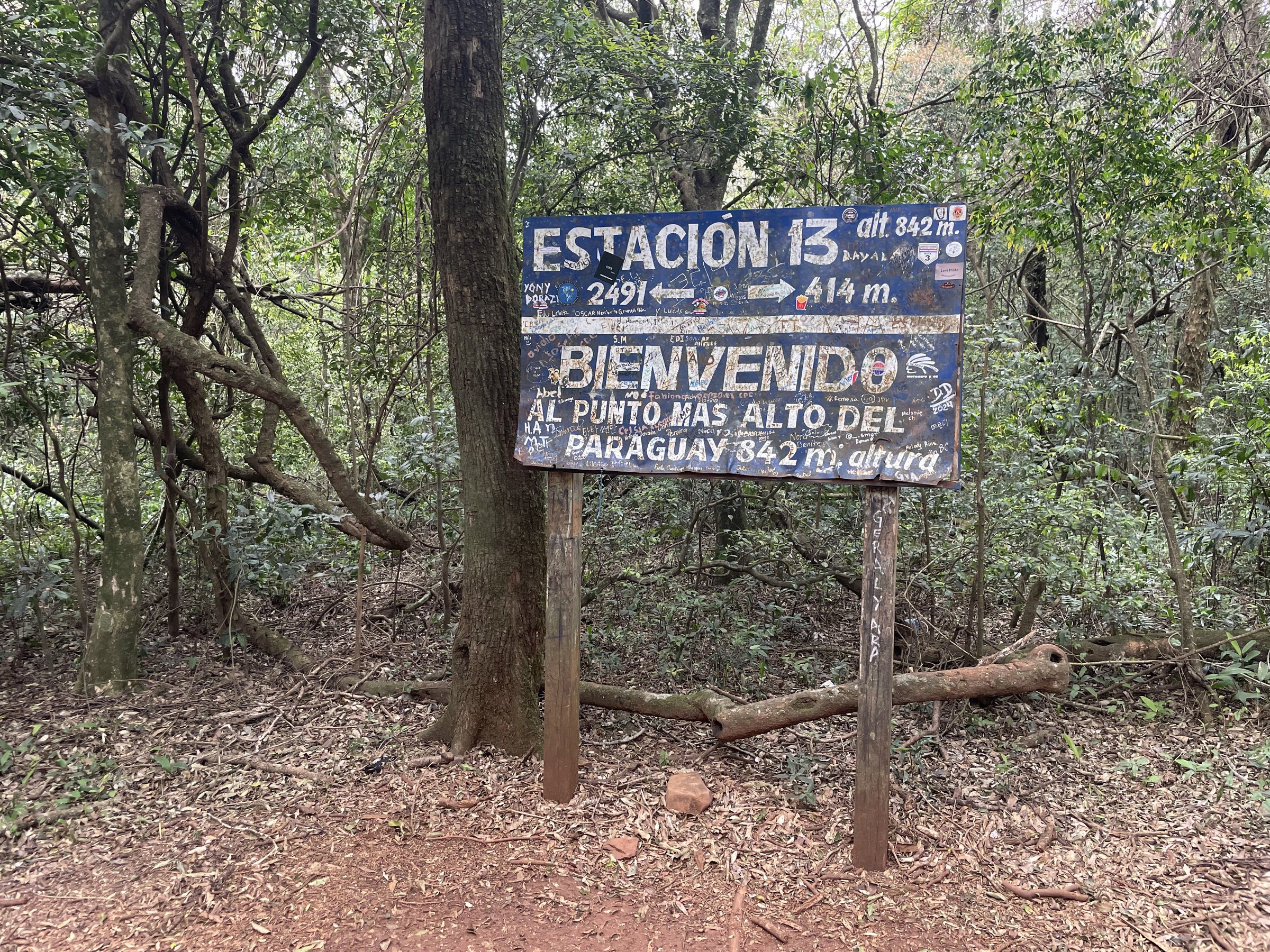
| 1 | Cerro Tres Kandú | Paraguay | Out-and-back summit ascent | 6.1 km | 592 m | 842 m | Hard |
| 2 | Cerro Akatí | Paraguay | Loop or out-and-back | 7.05 km loop | 280 m | 698 m | Moderate |
| 3 | Salto Suizo ecological trails | Paraguay | Waterfall / forest trail (varies by circuit) | 9.3 km one-way (source track) | 224 m / -85 m | 321 m | Moderate |
| 4 | Cerro de la Cruz | Paraguay | Short circular climb | 2.89 km loop | 258 m | 585 m | Hard |
| 5 | Cerro Amor | Paraguay | Steep out-and-back or short loop | 2.70 km | 473 m | Moderate-hard |
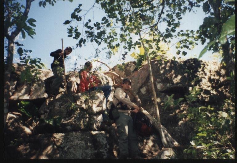
1. Cerro Tres Kandú
Snapshot
Itinerary
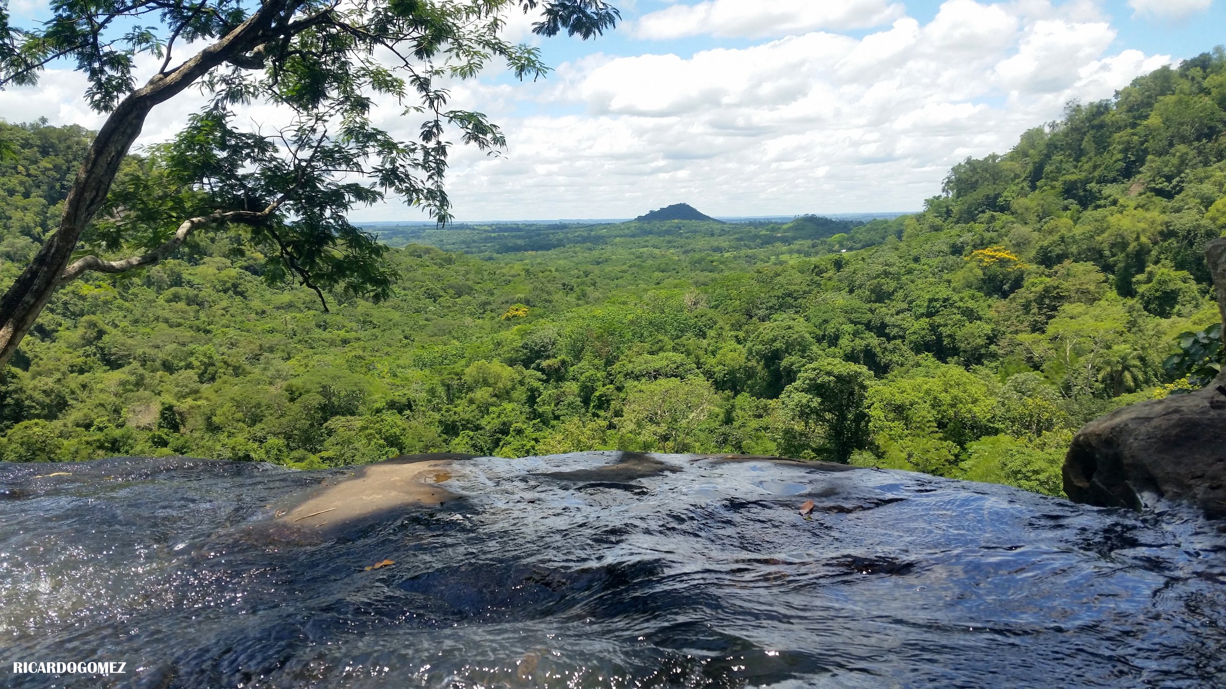
Climb the signed trail from the visitor base through native vegetation to Paraguay’s highest point, with summit views over Guairá and the Ybytyruzú hills.
Why it is essential
The country high point and the defining Ybytyruzú hike.
Equipment
- Hiking shoes
- 2+ litres of water
- Sun protection
- Rain shell in wet season
Hazards and notes
- Steep/rocky parts.
- Heat and thunderstorms.
GPX / KML links
| Source | URL | Format / access | Reuse status |
|---|---|---|---|
| AllTrails: Cerro Tres Kandú | alltrails.com | Recorded track | Route-file download terms not checked |
| Visit Paraguay: Cerro Tres Kandú | visitparaguay.travel | Source page | Site terms apply; no GPX found |
| MADES: Reserva Ybytyruzú | mades.gov.py | Source page | Site terms apply; no GPX found |
External links
- Visit Paraguay — Cerro Tres Kandú
- MADES — Reserva de Recursos Manejados Cordillera del Ybytyruzú
- AllTrails — Cerro Tres Kandú
2. Cerro Akatí
Snapshot
Itinerary
Ascend through defined tracks and open slopes to Cerro Akatí’s natural mirador, with wide views over Independencia and the surrounding highlands.
Why it is essential
The classic Ybytyruzú balcony/viewpoint hike, less severe than Tres Kandú but highly scenic.
Equipment
- Grippy shoes
- Water
Hazards and notes
- Access road can be rough in wet conditions.
GPX / KML links
| Source | URL | Format / access | Reuse status |
|---|---|---|---|
| Wikiloc: Cerro Akatí | es.wikiloc.com | Recorded track | Terms/reuse unresolved |
| Visit Paraguay: Cerro Akatí | visitparaguay.travel | Source page | Site terms apply; no GPX found |
External links
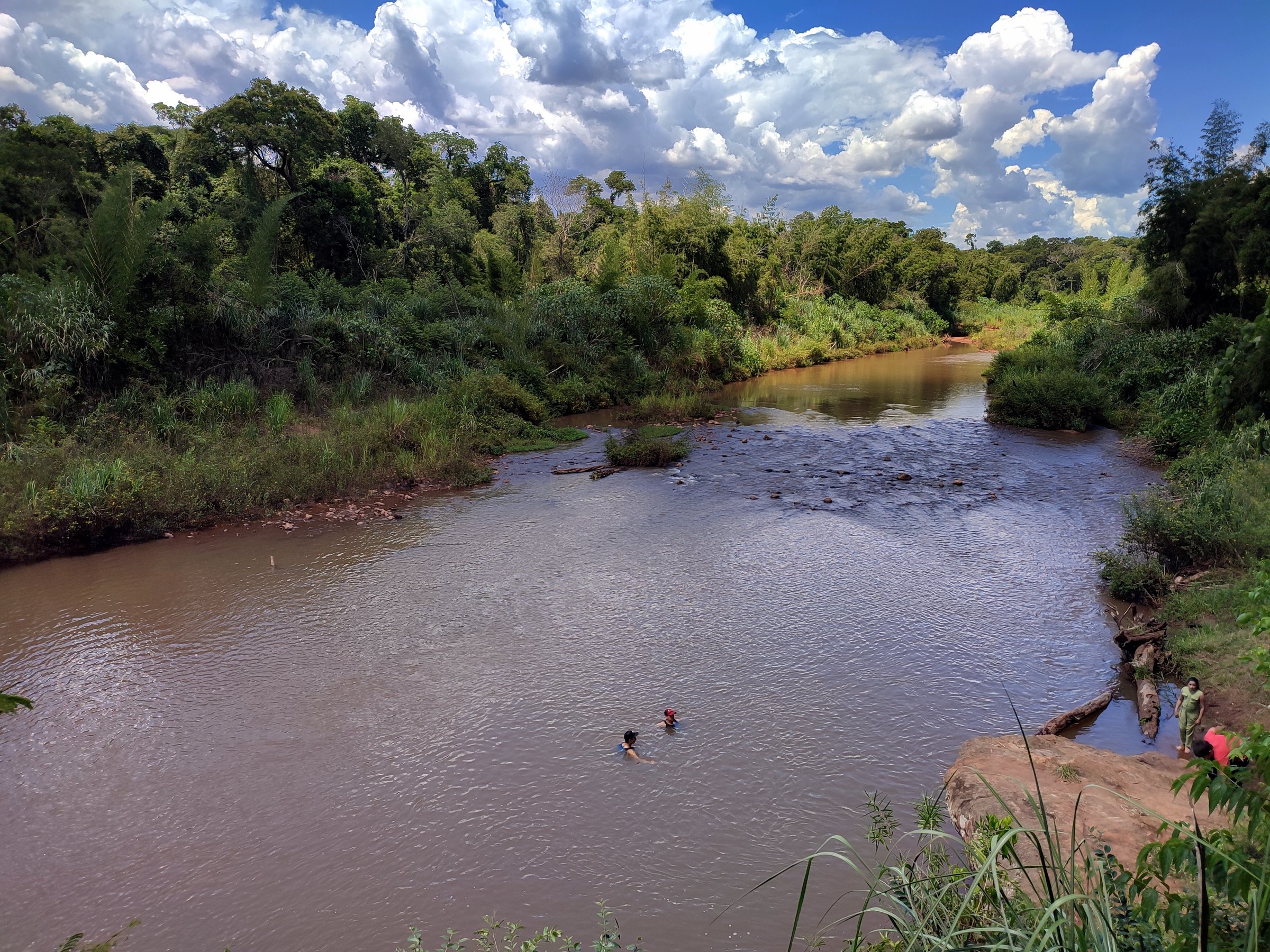
3. Salto Suizo ecological trails

Snapshot
Itinerary
Follow ecological trails through native forest to the Salto Suizo waterfall, viewpoints, rest zones, and adjoining trekking circuits. Official waterfall drop is about 40 m.
Why it is essential
The region’s signature waterfall walk and one of Paraguay’s best-known ecotourism sites.
Equipment
- Shoes with grip
- Water
- Insect protection
Hazards and notes
- Slippery rock and stream/waterfall edges.
- Avoid flood conditions.
GPX / KML links
| Source | URL | Format / access | Reuse status |
|---|---|---|---|
| Wikiloc: Salto Suizo | wikiloc.com | Recorded track | Terms/reuse unresolved |
| Visit Paraguay: Salto Suizo Parque Ecológico | visitparaguay.travel | Source page | Site terms apply; no GPX found |
| Salto Suizo official site | saltosuizo.com.py | Source page | Site terms apply; no GPX found |
External links
4. Cerro de la Cruz
Snapshot
Itinerary
A steep local loop to the Cerro de la Cruz summit/marker, with forest-edge walking and highland views.
Why it is essential
A compact but steep Ybytyruzú summit walk often paired with Salto Suizo/Cerro León viewpoints.
Equipment
- Hiking shoes
- Water
Hazards and notes
- Steep gradient.
- Avoid rain-slick ground.
GPX / KML links
| Source | URL | Format / access | Reuse status |
|---|---|---|---|
| Wikiloc: Cerro de la Cruz | es.wikiloc.com | Recorded track | Terms/reuse unresolved |
| Visit Paraguay: Independencia | visitparaguay.travel | Source page | Lists Cerro de la Cruz among local attractions |
External links
5. Cerro Amor
Snapshot
Itinerary
Climb the short but steep track to Cerro Amor, one of the recognised high summits of the Ybytyruzú system.
Why it is essential
A representative steep Ybytyruzú peak, completing the set beyond Tres Kandú and Akatí.
Equipment
- Hiking shoes
- Water
- Sun protection
Hazards and notes
- Very steep for its length.
- Local guidance recommended.
GPX / KML links
| Source | URL | Format / access | Reuse status |
|---|---|---|---|
| Wikiloc: Cerro Amor — Colonia Independencia | ca.wikiloc.com | Recorded-track listing | Terms/reuse unresolved |
| Ultratrail Guaraní: Cordillera del Ybytyruzú | ultratrailguarani.com | Source page | Site terms apply; no GPX found |
External links
Missing data / follow-up work
- No official GPX/KML files were verified for these Ybytyruzú walks; route geometry depends on Wikiloc and AllTrails recorded tracks whose reuse terms remain unchecked.
- Cerro Akatí licence status for available photography should be rechecked before reuse.
- Salto Suizo park circuits vary; the route stats here reflect one Wikiloc track and not all variants.
- Cerro de la Cruz access permission with local landowners requires confirmation.
- Cerro Amor maximum elevation and current access arrangements are unresolved.
External links
| Source | URL |
|---|---|
| Visit Paraguay — Cerro Tres Kandú | visitparaguay.travel |
| Visit Paraguay — Cerro Akatí | visitparaguay.travel |
| Visit Paraguay — Salto Suizo Parque Ecológico | visitparaguay.travel |
| Visit Paraguay — Independencia | visitparaguay.travel |
| MADES — Reserva de Recursos Manejados Cordillera del Ybytyruzú | mades.gov.py |
| Salto Suizo official site | saltosuizo.com.py |
| Ultratrail Guaraní — Cordillera del Ybytyruzú | ultratrailguarani.com |
| AllTrails — Cerro Tres Kandú | alltrails.com |
| Wikiloc — Cerro Akatí | es.wikiloc.com |
| Wikiloc — Salto Suizo | wikiloc.com |
| Wikiloc — Cerro de la Cruz | es.wikiloc.com |
| Wikiloc — Cerro Amor / Colonia Independencia | ca.wikiloc.com |