Regional overview
The Hunza, Nagar, and Gilgit Karakoram is the most accessible high-mountain corridor in northern Pakistan. The Karakoram Highway links Gilgit, Nagar, Hunza, Gojal, Passu, Sost, and Khunjerab, while side valleys climb rapidly towards glaciers, 7,000 m peaks, forts, irrigated terraces, and old caravan landscapes. The best-known hiking bases are Karimabad, Minapin, Hopper, Passu, Gulmit, and Gilgit.
Walking ranges from short cultural routes along water channels and fort paths to demanding one-day climbs above 3,000 m. Rakaposhi Base Camp, Ultar Meadow, Passu Glacier, and Hoper Glacier are physically serious day objectives for fit, acclimatised walkers; Gilgit’s Kargah water-channel walk gives a lower, culturally important counterpoint.
The normal hiking season is May to October, with June to September most reliable for higher routes. Spring and autumn can be excellent at valley level, but snow, rockfall, landslides, glacier movement, and road closures can affect access. Local guides are recommended for glacier margins, Ultar Valley, Hoper/Hander, and any route without a clearly maintained trail.
Selection rationale
These five hikes represent the region’s main walking identities: a major Nagar glacier-and-base-camp ascent, an iconic Hunza side-valley climb below Ultar, a Passu/Hussaini glacier and suspension-bridge route, a Hopper/Nagar glacier crossing and pasture climb, and a Gilgit water-channel route to the Kargah Buddha. AllTrails provides strong statistics for Rakaposhi and Passu; the official Gilgit-Baltistan tourism brochure verifies several other route concepts and timings, but detailed GPX files remain incomplete.
Summary table
| # | Hike | Route type | Distance | Elevation gain | Max elevation | Difficulty |
|---|---|---|---|---|---|---|
| 1 | Rakaposhi Base Camp Trail from Minapin | Out-and-back | 17.9 km | 1,420 m | 3,477 m | Hard |
| 2 | Ultar Meadow from Karimabad | Out-and-back | Approx. 7 km | Approx. 800–900 m | Approx. 3,270 m | Hard |
| 3 | Hussaini Bridge to Passu Glacier | Point-to-point | 6.8 km | 342 m | 2,615 m | Moderate |
| 4 | Hoper Glacier to Hander / viewpoint | Out-and-back / local traverse | Unresolved (7 h return) | Medium-hard | ||
| 5 | Gilgit Water Channel Walk to Kargah Buddha | One-way / out-and-back variant | Unresolved (2–3 h one-way) | Minor-moderate | Easy-moderate |
1. Rakaposhi Base Camp Trail from Minapin
Snapshot
Itinerary
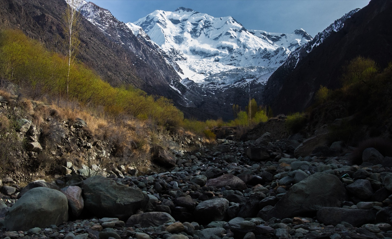
The trail starts in Minapin and climbs steeply through village-edge paths, a narrow gorge, pine and cedar forest, and open alpine meadows. Hapakun is a common intermediate meadow, while the upper objective is the Tagaphari / Rakaposhi Base Camp area below the Minapin Glacier and the immense north-facing wall of Rakaposhi.
The route is a demanding day because the ascent is sustained and the upper section is high enough for weather and altitude to matter. A two-day version is common, but the out-and-back is feasible in one long day for fit walkers with an early start.
Why it is essential
Rakaposhi is one of the signature mountains of the western Karakoram, rising dramatically above the Hunza-Nagar valley. The Minapin route is the classic day-scale way to reach its glacier and base-camp meadows.
Equipment
- Mountain hiking equipment: sturdy boots, trekking poles, waterproof/windproof shell, warm layer, sun protection, food, water treatment, map/GPS, and headtorch
- Carry extra warmth outside midsummer
Hazards and notes
- The main hazards are steep ascent, heat in the lower gorge, altitude, rapidly changing weather, and possible snow or ice in shoulder season
- Water should be treated
- Hiring a local guide or porter is sensible, especially for walkers unfamiliar with the route
GPX / KML links
| Source | URL | Format | Notes |
|---|---|---|---|
| AllTrails: Rakaposhi Basecamp Trail | alltrails.com | Route page / app map | AllTrails terms apply; statistics used, geometry reuse not confirmed |
| OpenStreetMap search: Rakaposhi Base Camp Minapin | openstreetmap.org | Map/search | OSM data is ODbL; geometry cross-check only |
External links
- AllTrails — Rakaposhi Basecamp Trail
- Official Gilgit-Baltistan tourism brochure (PDF)
- The Hiking Life — Rakaposhi trek notes
2. Ultar Meadow from Karimabad
Snapshot
Itinerary
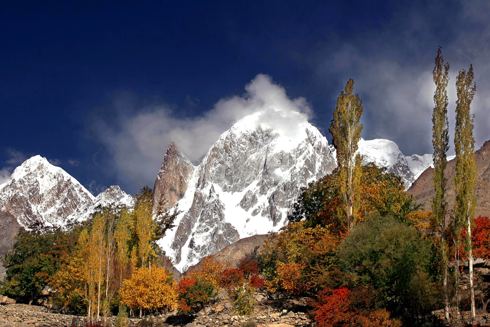
From Karimabad, the route climbs steeply into the Ultar Valley, passing irrigation-channel terrain, rock walls, rough footpaths, and narrowing gorge sections before reaching Ultar Meadow below Ultar Sar, Hunza Peak, and Ladyfinger Peak. SummitPost describes the meadow at about 3,270 m and reachable from Karimabad in around three hours.
The path is short by Karakoram standards but steep, eroded in places, and more serious than a village walk. The route to Hon Pass above the meadow is not included here; that continuation is much harder and significantly higher.
Why it is essential
Ultar Meadow is the classic high walk directly above Karimabad. It gives close views of the dramatic Ultar massif and the granite walls that make central Hunza feel unusually alpine despite its proximity to the Karakoram Highway.
Equipment
- Mountain hiking equipment: boots, trekking poles, warm layer, waterproof/windproof layer, water, food, sun protection, map/GPS, and headtorch
- A local guide is recommended for the eroded upper route
Hazards and notes
- Steep eroded trail, loose rock, heat in the lower valley, snow in shoulder seasons, and navigation into side gullies are the main hazards
- Do not continue onto Hon Pass or glacier terrain without current local advice
GPX / KML links
| Source | URL | Format | Notes |
|---|---|---|---|
| Wikiloc: Ultar BC Trail | wikiloc.com | Route page / possible GPX platform | Wikiloc terms apply; source-map only |
| OpenStreetMap search: Ultar Meadow Karimabad | openstreetmap.org | Map/search | OSM data is ODbL; geometry cross-check only |
External links
- SummitPost — Ultar II route/access notes
- The Hiking Life — Ultar Meadow day hike
- Wikiloc — Ultar BC trail
3. Hussaini Bridge to Passu Glacier
Snapshot
Itinerary
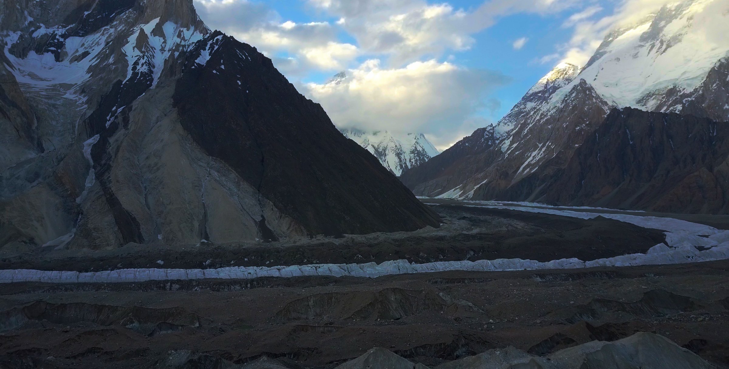
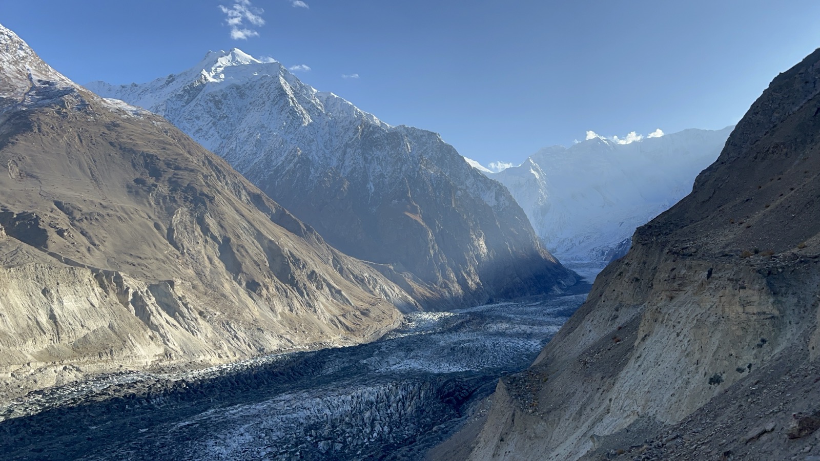
The route starts near the famous Hussaini suspension bridge and follows local paths towards the Passu Glacier area. AllTrails describes a point-to-point hike involving suspension bridges and mountain scenery. The route gives close views of Passu Cones, Passu Glacier, the Hunza River, and the Batura / Passu side of the Karakoram.
The exact finish depends on the route used around the glacier and village access. Local advice should be sought before stepping onto glacier ice or unstable moraine.
Why it is essential
This is the most accessible day hike in Upper Hunza that combines the region’s two most recognisable features: the Hussaini bridge landscape and the Passu Glacier / Passu Cones backdrop.
Equipment
- Standard to mountain hiking equipment: hiking shoes or boots, water, sun protection, wind layer, warm layer, snacks, and map/GPS
- Trekking poles are useful on loose moraine or dry slopes
Hazards and notes
- Suspension bridges are exposed and unsuitable for severe vertigo, high wind, or unsafe conditions
- Glacier margins, loose moraine, and river edges can be dangerous
- Use local guidance and avoid informal shortcuts over unstable ground
GPX / KML links
| Source | URL | Format | Notes |
|---|---|---|---|
| AllTrails: Hussaini Bridge – Passu Glacier | alltrails.com | Route page / app map | AllTrails terms apply; statistics used, geometry reuse not confirmed |
| OpenStreetMap search: Hussaini Bridge Passu Glacier | openstreetmap.org | Map/search | OSM data is ODbL; geometry cross-check only |
External links
4. Hoper Glacier to Hander / viewpoint
Snapshot
Itinerary
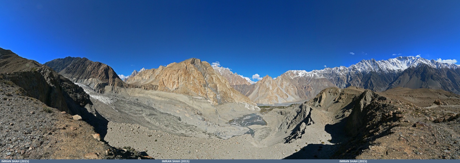
The official Gilgit-Baltistan tourism brochure describes a Hopper Valley hike that crosses Hoper Glacier and climbs to Hander in about 7 hours return. The walk begins from the Hoper village side, descends or traverses towards the debris-covered glacier, then climbs beyond the glacier edge towards a higher viewpoint/pasture area.
This is not a casual glacier stroll. Debris-covered ice can hide holes, streams, and unstable blocks, and the correct line may change. A local guide is recommended.
Why it is essential
Hoper is the most accessible Nagar glacier landscape and a major contrast to the Rakaposhi Base Camp route. It gives the region a day hike focused on glacier travel, village terraces, and the Diran / Miar / Bualtar glacier setting.
Equipment
- Mountain hiking equipment: sturdy boots, trekking poles, warm and waterproof layers, sun protection, water, food, map/GPS, and headtorch
- Gloves are useful if using hands on rough moraine
Hazards and notes
- Glacier margins, loose moraine, hidden ice holes, stream crossings, rockfall, and rapidly changing local route lines are serious hazards
- Guide support and current route advice are strongly recommended
GPX / KML links
| Source | URL | Format | Notes |
|---|---|---|---|
| Official Gilgit-Baltistan tourism brochure | tourism.gov.pk | PDF route listing | Timing and route concept only; no GPX found |
| OpenStreetMap search: Hoper Glacier Hander | openstreetmap.org | Map/search | OSM data is ODbL; geometry cross-check only |
External links
5. Gilgit Water Channel Walk to Kargah Buddha
Snapshot
Itinerary
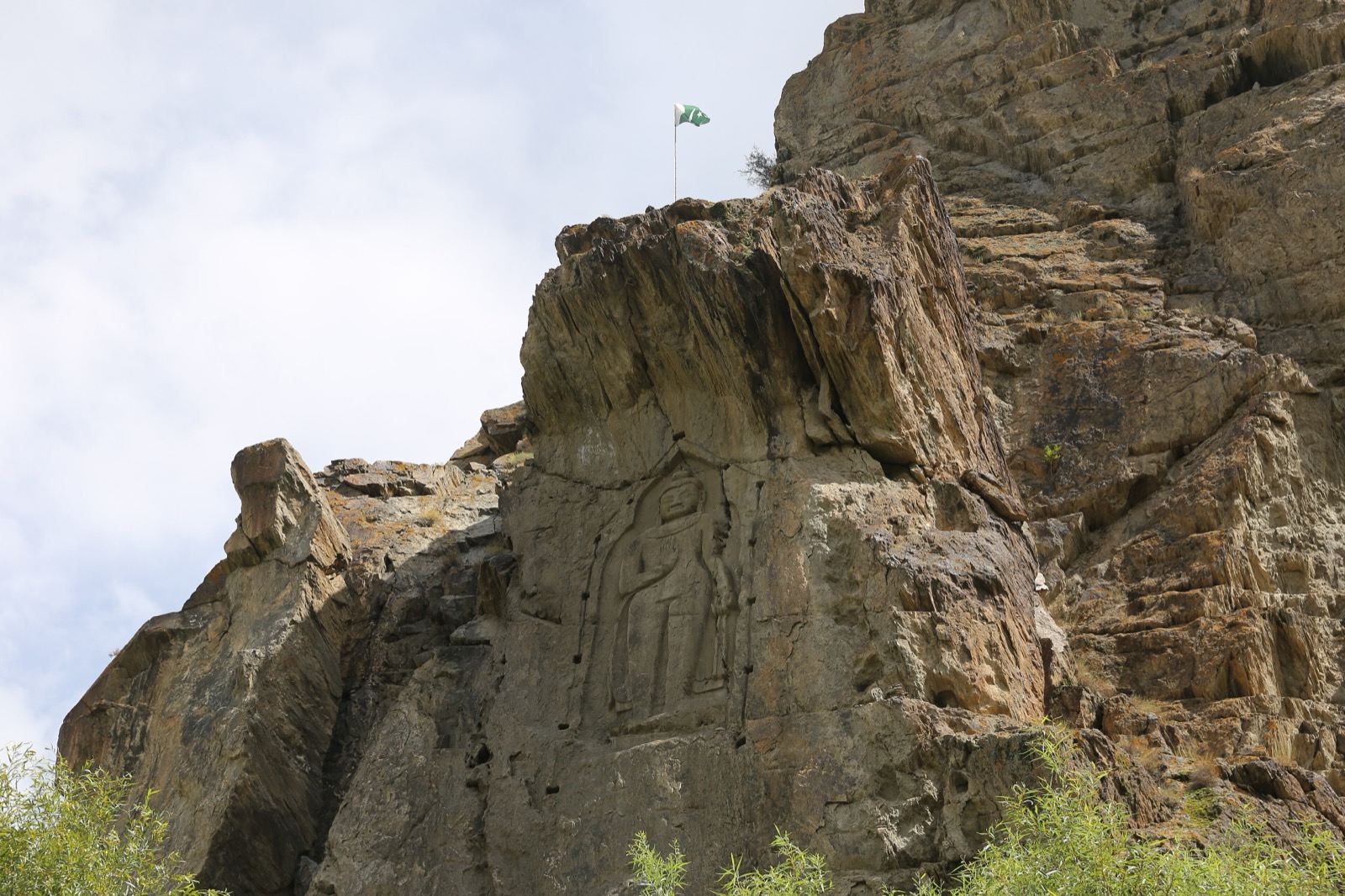
The official Gilgit-Baltistan tourism brochure lists a Gilgit water-channel walk to Kargah Buddha, described as an easy-to-medium one-way walk with views over the Gilgit valley. The route follows traditional irrigation-channel terrain and valley-side paths towards the Kargah Buddha rock carving, one of the most important cultural landmarks near Gilgit.
The precise public start point and maintained walking line need local confirmation. The walk can be treated as a one-way route with vehicle pickup or as a shorter out-and-back from the Kargah side.
Why it is essential
This route represents Gilgit itself: irrigated valley walking, cultural history, and a major Buddhist-era rock carving. It balances the harder glacier and meadow hikes elsewhere in the Hunza-Nagar-Gilgit selection.
Equipment
- Standard hiking equipment: walking shoes, sun protection, water, light layer, snacks, and phone/GPS
- In hot weather, start early and carry extra water
Hazards and notes
- Narrow channel paths, heat, traffic near road sections, dogs near settlements, and private land boundaries are the main issues
- Respect the archaeological site and local access rules
GPX / KML links
| Source | URL | Format | Notes |
|---|---|---|---|
| Official Gilgit-Baltistan tourism brochure | tourism.gov.pk | PDF route listing | Timing and route concept only; no GPX found |
| OpenStreetMap search: Kargah Buddha Gilgit | openstreetmap.org | Map/search | OSM data is ODbL; geometry cross-check only |
External links
- Official Gilgit-Baltistan tourism brochure (PDF)
- Central Karakoram National Park — Exploring Gilgit Area
External links
| Source | URL |
|---|---|
| Official Gilgit-Baltistan tourism brochure (PDF) | tourism.gov.pk |
| Visit Gilgit-Baltistan | visitgilgitbaltistan.gov.pk |
| Central Karakoram National Park | cknp.org |
| Central Karakoram National Park — Exploring Gilgit Area | cknp.org |
| SummitPost — Ultar II route notes | summitpost.org |
| The Hiking Life — Hunza day-hike notes | thehikinglife.com |
| The Hiking Life — Ultar Meadow day hike | thehikinglife.com |
| AllTrails — Rakaposhi Basecamp Trail | alltrails.com |
| AllTrails — Hussaini Bridge to Passu Glacier | alltrails.com |
| Wikiloc — Ultar BC Trail | wikiloc.com |